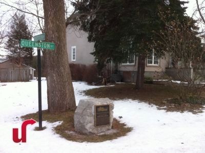
During the War of 1812, the Brock Dead House was owned by Patrick McCabe. The façade was oriented in an easterly direction, facing the Niagara River.
Courtesy Brock University Library,
Special Collections and Archives
Brock Dead House . . . — — Map (db m75882) HM WM
[Text on North Side of Marker]:
Near the spot
Major-General
Sir Isaac Brock, K.C.B.
Provisional Lieutenant
Governor of Upper Canada
fell on 13 - October, 1812
while advancing to repel
the invading enemy.
[Text . . . — — Map (db m49483) HM
Upper Canada has dedicated this monument
to the memory of the late
Major-General Sir Issac Brock K.B.
Provisional Lieut.Governor and commander of the forces
in this province whose remains are deposited in the vault . . . — — Map (db m49926) HM
The monument towering above you is a memorial to Major-General Sir Isaac Brock commander of British forces in Upper Canada at the beginning of the War of 1812. Brock died on the slopes below Queenston Heights on October 13, 1812, during an . . . — — Map (db m52137) HM
[English Text]: Fort Drummond
This small redoubt, or square fortification, and the U-shaped advance battery, named in honour of Sir Gordon Drummond, were built in the late spring of 1814 to defend the main portage road from Chippawa . . . — — Map (db m56658) HM
[Text inscribed on stone monument]:
Home of
Laura Ingersoll
Secord.
[Text on lower plaque]:
This stone marker was placed in 1901 by the Women's Literary Club of St. Catharines
to honour Laura Secord and was re- . . . — — Map (db m51612) HM
Warriors of the Six Nations of Iroquois (Mohawks, Oniedas Onondagos, Cayugas, Senecas, Tuscaroras), mainly from the Grand River, fought as allies of the British in this historic battle with the Americans. Speaking distinctive dialects and with . . . — — Map (db m49168) HM
[Front side of Monument]:
This monument has been
erected by the
Government of Canada
to
Laura Ingersoll Secord
who saved her husband's life
in the battle on these heights,
October 13th, 1812,
and who . . . — — Map (db m75866) HM
Born in Great Barrington, Massachusetts, Laura Ingersoll came to Upper Canada with her father in 1795, and settled in this area. About two years later she married James Secord, a United Empire Loyalist, and within seven years they had moved to this . . . — — Map (db m49160) HM
[English text]:
The celebrated heroine of the war of 1812 is a renowned figure in Canadian History. Determined to warn the British of an impending attack on Beaver Dams, Secord set out from her home on June 22, 1813, on a dangerous . . . — — Map (db m51613) HM
This pioneer historian, author and soldier was born in Queenston. His family moved to Amherstburg about 1802, and at the outbreak of the War of 1812 Richardson joined the British army. Retired on half pay in 1818 in London, England, he published the . . . — — Map (db m54135) HM
This British officer, “the hero of Upper Canada,” led the successful defense of the province early in the War of 1812. Appointed commander of military forces in 1810, he organized the militia and prepared the colony for possible war with . . . — — Map (db m140079) HM
On October 13, 1812, following Isaac Brock's death in a preceding assault, Major-General Sheaffe assumed command and led a successful attack which dislodged an invading American force from Queenston Heights. Born in Boston, Mass., Sheaffe was . . . — — Map (db m49161) HM
[Side of Marker Using English Text]:
When the War of 1812 began, people of African descent in the Niagara peninsular feared an American invasion. They were anxious to preserve their freedom and prove their loyalty to Britain. Many joined . . . — — Map (db m49162) HM
In the early morning of 13 October 1812, American troops under Major-General Stephen Van Rensellaer crossed the Niagara River and took possession of Queenston Heights. Major-General Isaac Brock hurried from Fort George to lead a small force against . . . — — Map (db m48908) HM
The Battle of Queenston Heights
The village below you and the heights on which you are standing were the stage for the famous Battle of Queenston Heights.
It took place during the Anglo-American conflict 1812-1815 known as the . . . — — Map (db m51682) HM
The Niagara escarpment rises above you. The British reinforcements arriving here from Fort George, in battle dress and exhausted from a "double quick march", struggled up this slope some distance to your right. While the Americans controlled . . . — — Map (db m55533) HM
On the plateau before you, the British and Americans met for battle. The British formed a line to your right, the Americans to your left. General Sheaffe formed a British counter-offensive force of nine hundred men in a line shoulder to shoulder. . . . — — Map (db m55028) HM
Following the loss, after the American Revolution of the Niagara River's east bank, a new portage around Niagara Falls was established in the 1780s' with Queenston its northern terminous. Wharves, storehouses and a block-house were built. Robert . . . — — Map (db m51621) HM
"An unguarded trail up this steep cliff was the only route which the Americans had to the heights of Queenston. The trail was to your right but does not exist any longer. Trapped on the river shore by unrelenting gunfire, the Americans contemplated . . . — — Map (db m55030) HM
One of the first Black settlers in this region, Pierpoint was born in Senegal. At the age of about 16 he was imprisoned and shipped to America where he became the slave of a British officer. During the American Revolution he enlisted in the British . . . — — Map (db m75872) HM
has been erected by his grandson William Hamilton Merritt of the City of Toronto, son of William Hamilton Merritt Jr. of St. Catharines, as a tribute to the father of Canadian transportation who through initiatory steps in first waterways and . . . — — Map (db m76186) HM
A pioneer in the field of transportation, Merritt was born in Bedford, New York and settled at Twelve Mile Creek (St. Catharines) with his Loyalist family in 1796. He served with the provincial cavalry during the War of 1812, then operated . . . — — Map (db m76184) HM
Following their repulse at Stoney Creek the Americans sent a force from Fort George to destroy a British advanced post at Beaver Dams. Warned of their approach by an Indian scout and by Laura Secord, a force of Indians from Caughnawaga and the Grand . . . — — Map (db m48909) HM
This house of Captain John DeCou (the name was variously spelled by his relatives and descendants and latterly as DeCew) was the Headquarters of the British outpost under Lieut. James Fitzgibbon to which came Laura Secord through the woods and . . . — — Map (db m56826) HM
Who set out from her home in Queenston early in the morning of June 22, 1813, to walk an arduous nineteen miles to warn the British outpost at DeCew Falls of an impending American attack. The information enabled the local British commander, . . . — — Map (db m53392) HM
By 1809 John and George Ball had constructed a four-storey grist-mill here on Twenty Mile Creek. Equipped with two run of stones, the mill provided flour for British Troops during the War of 1812. It was expanded during the 1840's and by the end of . . . — — Map (db m57064) HM
[English Text]: Battle of Cook's Mills
In October 1814 an American army advanced from Fort Erie toward the British line along the Chippawa River. Lieutenant-General Drummond ordered a reconnaissance towards Cook's Mills on his right . . . — — Map (db m56657) HM
On May 14, 1814, about 800 American regulars and militia under Lieutenant Colonel John Campbell disembarked nearby at the mouth of the Lynn River. The following day, meeting no opposition, they burnt the settlements of Dover and Ryerse’s Mills and . . . — — Map (db m198920) HM
The Capture of Detroit
To counter the American invasion of the Detroit frontier,
Major General Isaac Brock mustered a force of about 50
regulars and 250 militia here at Port Dover. They embarked
on 8 August 1812 and, proceeding . . . — — Map (db m237003) HM
During the War of 1812, Long Point Bay
provided a safe harbour for the vessels
of the British Provincial Marine, and
later the Royal Navy. Port Ryerse,
Turkey Point (Fort Norfolk) and the site
of present-day Port Dover were all
transfer . . . — — Map (db m236332) HM
Major General Isaac Brock with 40 men of His Majesty’s 41st Regiment and 260 of the York, Lincoln, Oxford and Norfolk militia, set out from Port Dover on the 8th August, 1812, to relieve the invaded western frontier. His brilliant capture of . . . — — Map (db m199073) HM
Lieutenant-Governor Simcoe's visit to this locality in 1795 led to a grant to Aaron Culver, one of the districts earliest settlers, on condition of building mills. By 1812, a hamlet had formed near these mills, but they were burnt and adjacent . . . — — Map (db m217600) HM
Thanks to Laura Secord, nearly 500 Americans surrendered at Beaver
Dams in 1813, and a British defeat was averted. She had overheard plans
for a surprise attack and struggled alone tarough miles of dense bush to
warn the commander of . . . — — Map (db m178159) HM
English:
A skillful professional soldier, Salaberry formed the celebrated Voltigeurs canadiens. In 1813, he outwitted and defeated a vastly superior American force at the Battle of Châteauguay, helping to save Lower Canada from invasion. . . . — — Map (db m83313) HM
Fought on land and on water, the War of 1812 helped shape the future of Canada. To defeat the American invasion, people from various walks of life came together - men and women; military personnel and civilians; English, French and . . . — — Map (db m194884) HM WM
War came to Canada in June of 1812 when the United States of America declared war on Great Britain. Local civilians, many of whom were American by birth, felt the brunt of the war. Some militia volunteers fought in battles, while others served in a . . . — — Map (db m242981) HM WM
This area, the present township of Longueuil, was granted in 1674 to François Prévost, Town Major of Québec, and was the first seigneury in what is now Ontario. Known originally as the seigneury of "Pointe à L'Orignac", it was not developed until . . . — — Map (db m103964) HM
John Baker was born into slavery in Lower
Canada (Quebec), in the 1780s to Dorinda,
a Black woman enslaved by Major James
Gray. When the Gray family relocated to
Cornwall, John, Dorinda, and his brother
Simon were brought with them. The . . . — — Map (db m201421) HM WM
The regiment of Glengarry Light Infantry Fencibles was raised in 1811–12 largely from among the Highland settlers of this region, many of whom had served previously in Europe with the Glengarry (British Highland) Fencibles. The Canadian corps . . . — — Map (db m103612) HM
Founded in 1787 by the well known Scot, the Reverend John Bethune, St. John's Presbyterian Church and its people played an important role in the preservation of Canadian land and territorial claim during the war of 1812. Their first church building . . . — — Map (db m103631) HM
In 1793 some forty families, including members of several clans, emigrated from Glenelg, Scotland, under the leadership of Alexander MacLeod and landed at St. John's Island (now Prince Edward Island). The following year they came to Glengarry . . . — — Map (db m76853) HM
English:
Here, on the farm of John Crysler, was fought one of the decisive battles of the War of 1812. On 11 November 1813 Lieutenant-Colonel Joseph Morrison, with 800 British and Canadian regulars, militia and Indians, engaged an . . . — — Map (db m82184) HM
In November, 1813, an American army of some 8000 men, commanded by Major-General James Wilkinson, moved down the St. Lawrence en route to Montreal. Wilkinson was followed and harassed by a British “corp of observation” consisting of . . . — — Map (db m82180) HM
These plaques are found in the British Court of Honour and the Canadian Court of Honour at the Crysler's Farm Battlefield visitors center.
Battlefield
of Chrysler’s Farm
Pro Patria
In Memory of
Captain Thomas Nairne . . . — — Map (db m82182) WM
Top Row — left, small Pres built 1831 purchased by Catholics 1845 present Catholic cen. left 1968 — — old & present Presbyterian 1873 located in Dunbar — — United Church in Williamsburg former Presbyterian 1866 — . . . — — Map (db m150218) HM
Born in Inverness-shire, Scotland, McGillivray joined the North West Company in 1784, became a partner in 1790 and its principal director in 1804. Fort Kaministiquia, the Company's wilderness headquarters, was renamed Fort William in his honour in . . . — — Map (db m106759) HM
This battery saw action during the Battle of York in 1813. It survived the American occupation and became part of the rebuilt fort of 1813-15. Today it reflects its 1816 appearance, when it held two artillery pieces. It was modified to hold five . . . — — Map (db m237599) HM
[English] Fort York constituted the primary defensive position in early York (Toronto). The present bildings, erected between 1813 and 1815 to replace those destroyed during the American occupations of York in 1813, are among the . . . — — Map (db m199282) HM
From 1800 to 1813, 'Government House' stood in the centre of today's Fort York. It was the home and office of Upper Canada's lieutenant-governor, head of the colony's civil government. In stressful times, the office was combined with that of the . . . — — Map (db m237595) HM
English:
Loyal residents of York (Toronto) were encouraged by early British victories in the War of 1812, but in 1813, they experienced first-hand the hardships of war. On the morning of April 27th, an American fleet appeared offshore and . . . — — Map (db m83668) HM
254 entries matched your criteria. Entries 201 through 254 are listed above. ⊲ Previous 100