On this land settled by his father Patrick Calhoun in the 1750s, defended against the Indians in the Cherokee War and the enemies of liberty in the American Revolution, John Caldwell Calhoun, American statesman and champion of the old South, was . . . — — Map (db m10626) HM
The last action of the Revolution in this part of S.C. was at Pratt's Mill, a grist mill on the Little River owned by Joseph Pratt. On October 30, 1781, an outpost of 30 Patriots at the mill, under Capt. John Norwood, was surprised by 30 . . . — — Map (db m20821) HM
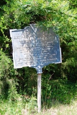
Our fight for Independence
that assured us Freedom of
Speech, Religion, the Press,
Right to Peaceful Assembly
and right to Petition for
Redress of Grievances. We
enjoy our present freedom
because of the willingness
of our . . . — — Map (db m30819) HM
Born 1757 in Virginia, this Indian fighter, who later moved to Edgefield District, attained the rank of Lieutenant Colonel of state troops during the American Revolution. Among the engagements he participated in were: Hanging Rock, Musgrove’s Mill, . . . — — Map (db m9800) HM
In the 1730s, an Indian path from Fort Moore to the Saluda ridge was used by traders going to the Cherokee Nation. Later, a wagon road from Ninety Six to Augusta followed the same route. Named for the Martin family who lived beside it and served . . . — — Map (db m203774) HM
(obverse)
Indian Head
The Indian Head, a series of springs at the head of Goodland Swamp, long served as a landmark and watering place. Travelers along the Middle Road referenced it and it appears on colonial plats. In 1781 . . . — — Map (db m102914) HM
Located 1.09 miles northwest, this cemetery marks the original site of Hopewell Baptist Church which was constituted in 1803. The cemetery contains graves of Revolutionary and Confederate veterans. Some graves are marked by field stones with . . . — — Map (db m10724) HM
Though not engaged in actual warfare since the Revolutionary War, when it was used by both the American and British Army, this old cannon has had much to do with the making of South Carolina history. It came into this section, first in 1814, in . . . — — Map (db m21310) HM
This land, Cherokee territory until 1777, became the final resting place after the American Revolution for early pioneers who settled the area. A number of soldiers of the Revolution are buried here including Robert Pickens, who served in the . . . — — Map (db m9087) HM
(Front text) Woodlands was the country home of William Gilmore Simms (1806-1870), the most prominent and prolific writer of the antebellum South, from 1836 to his death. A novelist, poet, historian, critic, and essayist best known for his . . . — — Map (db m32008) HM
[Front]
Nearby earthworks at Morris Ford, on the Salkehatchie River, built in the spring 1780 by Loyalists under Ben John. In May, soon after Charleston fell to the British, Capt. John Mumford of the South Carolina militia was killed in . . . — — Map (db m8671) HM
(Front text)
The grave of Tarlton Brown (1757 - 1845),
militia officer, state representative, and
state senator, is located here. Brown, a
native of Virginia, moved to S.C. at an
early age and settled in what was then
Orangeburg . . . — — Map (db m8791) HM
[Front text]
By tradition, Healing Springs got its name during the Revolutionary War. In 1781 after a bloody battle at nearby Windy Hill Creek, four wounded Tories sent inland from Charleston by General Banastre (the Butcher) Tarleton . . . — — Map (db m8798) HM
According to tradition the Indians reverenced
the water for its healing properties as a gift
from the great spirit.
They led the British wounded to their secret
waters during the American Revolution and
the wounded were healed.
This . . . — — Map (db m8799) HM
During the Colonial period the Beaufort district grew and prospered. Rice was produced for export on the mainland, indigo in the sea islands, shipbuilding flourished. The Parish System developed as the political basis and Beaufort competed with . . . — — Map (db m5935) HM
(Marker Front):
This Episcopal Parish was established by Act of the Assembly June 7, 1712. The first known rector, William Guy, conducted early worship services in homes of settlers. The parish suffered greatly during the 1715 Yemassee . . . — — Map (db m5827) HM
Phillip Martinangele, born in Italy, immigrated to this country and settled in St. Helena’s Parish. He married Mary Foster in 1743, but had died by 1762 when his widow bought 500 acres
on Daufuskie Island. Their son Phillip, a captain in the . . . — — Map (db m244107) HM
Near the old halfway house, in the
vicinity of Grays Hill, on February
3, 1779, a force of South Carolina
Militia, Continentals, and
volunteers, including men from
Beaufort, under General William
Moultrie, defeated the British in
their . . . — — Map (db m14738) HM
native of Ireland, soldier in the Revolution, planter
on this island, a founder of the Episcopal Church on Hilton Head, the ancestor of the Stoneys of South Carolina. Also of his grandson, John Safford Stoney, eldest son of John and Elizabeth . . . — — Map (db m119649) HM
In December 1781, returning from a patrol with the Patriot Militia, Charles Devant was mortally wounded from ambush near here by Captain Martinangel's Royal Militia from Daufuskie Island. He managed to ride
his horse to his nearby plantation, Two . . . — — Map (db m33789) HM
[Front]:
Born in South Carolina, Pinckney was educated in England and served in the First and Second Provincial Congresses. A commander in the Revolution, he later served in the SC General Assembly, signed the US Constitution, and was . . . — — Map (db m30536) HM
Church of Prince William's Parish
known as
Sheldon
Built Between 1745-1755
Burned By the British Army 1779
Rebuilt 1826
Burned By the Federal Army 1865 — — Map (db m106086) HM
Text from Front Side
Prince William's Parish Church
(Sheldon Church)
These ruins are of Prince William's Parish Church, built ca. 1751-1757 and partially burned during the American Revolution, with its interior and roof rebuilt . . . — — Map (db m106077) HM
Ruins of Old Sheldon Prince William's Parish Church Built 1745-55. Burned 1779 by British. Rebuilt 1826. Burned 1865 by Federal Army. Named for ancestral home of the Bull family in Warwickshire, England. ——— Annual Services . . . — — Map (db m26366) HM
Residence of Rt. Rev. Robert Smith, who was born in Norfolk, England, in 1732. He was consecrated in Philadelphia in 1795, as the first Episcopal Bishop of South Carolina. He died in 1801, and is buried in St. Philip's Churchyard, Charleston, S.C. . . . — — Map (db m23801) HM
Acording to family information, Francis Marion, brigadier general of the S.C. Militia during the American Revolution, was born near here on Goatfield Plantation. He was a member of the First Provincial Congress, fought in the battles of Parker's . . . — — Map (db m22968) HM
Near this spot stood Barnet's Tavern, called the Forty Five Mile House, indicating its distance from Charleston. Here was the muster ground of the Eutaw State Volunteers, a company raised in 1833, to support the Ordinance of Nullification. From this . . . — — Map (db m23200) HM
About 1765-1767 Thomas Sumter, future hero of the American Revolution, kept a country store near this spot where the stream of colonial traffic to the Up Country divided in the fork where the Nelson's Ferry Road branched off from the Road to . . . — — Map (db m22247) HM
At this bridge, on July 17,1781, British forces under Col. Coates, who was retreating from Moncks Corner, encountered pursuing Americans under Gen. Thomas Sumter. After the destruction of the bridge, Col. Coates sought refuge under cover of the . . . — — Map (db m41914) HM
In the summer of 1781, with the British hold on the interior of South Carolina significantly weakened, Continental commander Maj. Gen. Nathaniel Greene sent Brig. Gen. Thomas Sumter, with Brig. Gen. Francis Marion and Lt. Col. Henry “Light . . . — — Map (db m53889) HM
Here, on May 6, 1780, Col. A.M. White was routed by Tarleton with the loss of two officers and thirty-six men killed and wounded and seven officers and sixty dragoons taken; Tarleton lost 2 men. Two boys, Francis Deliesseline and Samuel Dupre, . . . — — Map (db m23249) HM
The Berkeley County Museum and Heritage Center opened its doors in 1992. Built to resemble the Lowcountry architecture of the Colonial period, the museum structure includes details such as flooring taken from a 150-year-old Darlington railroad . . . — — Map (db m206632) HM
After Eutaw Springs, the British retreated to their post at Fair Lawn Plantation. In November 1781, Brig. Gen. Francis Marion sent Col. Hezekiah Maham with 180 horsemen and Col. Isaac Shelby with 200 mountain riflemen to eliminate British foraging . . . — — Map (db m53885) HM
Fairlawn Plantation Fairlawn Barony, sometimes called “Fair-Lawn,” was granted to Peter Colleton, whose father John had been one of the original Lords Proprietors of the Carolina colony. John’s grandson John (1679-1754), known as . . . — — Map (db m53881) HM
First site of Monck's Corner, where the road to the Congarees branched off from this road. Founded by Thomas Monck in 1735. Relocated on the railroad about 1856.
Here about 3:30 A.M. April 13, 1780, Col. Wm. Washington's Light Dragoons were . . . — — Map (db m33664) HM
Fair Lawn Plantation was an enormous property granted to Sir Peter Colleton, oldest son of Sir John Colleton, one of the original eight Lords Proprietors of the Carolina colony. During the Revolutionary War, the British army first occupied the . . . — — Map (db m53883) HM
The Colleton Family
The Colleton family was the only one of all the privince's original proprietors to cast their fortune in South Carolina by establishing a family seat and actual residence here. None of the seven other owners even . . . — — Map (db m206731) HM
Wadboo was a Native American name given to the enormous landholding of James Colleton, a son of Sir John Colleton, who was one of the original eight Lords Proprietors of the Carolina colony. Called a barony according to the Proprietors’ plan . . . — — Map (db m53891) HM
Commander of Fort Sullivan and
the S.C. 2nd Regiment Jun. 17, 1775 to
Sept. 16, 1776. Governor of South
Carolina 1785-1787 and 1792-1794.
Defeated the British ships in 1776
in the invasion of the Charleston
Harbor. The fort's name was . . . — — Map (db m29432) HM
( Front Text ) Francis Marion
Brigadier General of S.C. militia during the American Revolution, Francis Marion, was one of the partisan leaders who kept the war alive during the British occupation of the state. His elusive . . . — — Map (db m22549) HM
(North face) Sacred to the Memory
of
Genl. Francis Marion,
Who departed his life, on the 27th of February, 1795,
in the sixty-third year of his age
Deeply regretted by all his fellow-citizens.
History will record his worth . . . — — Map (db m23902) HM
Burial place of Col. Hezekiah Maham A native of St. Stephen's Parish Berkeley County, South Carolina Born 1739 Died 1789 He was a distinguished soldier and patriot of the American Revolution — — Map (db m54777) HM
Disastrous American defeats during the Revolutionary War at Charleston and Camden in the summer of 1780 led many South Carolinians to give up the fight for independence. But Francis Marion carried on the struggle, waging a guerrilla war in the . . . — — Map (db m53957) HM
For what he did in less than three years during the Revolutionary War, Francis Marion won enduring fame. By the nineteenth century he was remembered as the Swamp Fox, the partisan commander who always eluded the British and their Loyalist allies. . . . — — Map (db m53956) HM
John Adam Treutlen Governor of Georgia, 1777 A stern revolutionary patriot Born at Berchtesgaden, Austria in 1726 Brutally murdered by Tories about 1782 near this spot — — Map (db m51711) HM
In Grateful Appreciation of the Services of the Patriots of Calhoun County 1775 ~ 1781 Gov. John Adams Treutlan; Col. Wm. Thompson; Maj. Lewis Colson; Maj. Jacob Geiger; Capt. Jacob Rumph; Com. Alexander Gillam; Capt. Wm. Heatley, Jr.; Lt. Wm. . . . — — Map (db m51702) HM
Built to defend the port city during the French and Indian War, Charleston's Horn Work was designed in 1757 by Lieutenant Emanuel Hess, a Swiss engineer serving with a British regiment. Hess used a durable oyster-shell cement called tabby to . . . — — Map (db m242354) HM WM
In February 1780, the British army, 12,500 men strong under the command of Sir Henry Clinton, returned to capture the port city. Under the direction of French engineers, Charleston laborers, including many enslaved people, hurriedly erected . . . — — Map (db m242336) HM WM
In the late 18th century, an imposing fortification straddled the "Broad Path" (now King Street) just north of Boundary Street (now Calhoun Street). This "Horn Work,” the generic term for a fortress with a central entrance to control the traffic in . . . — — Map (db m242355) HM WM
Notable for its fine Georgian
paneling, this was home and
office to Dr. David Ramsay,
the distinguished patriot,
Revolutionary Historian and
physician. Dr. Ramsay
introduced the Small Pox
vaccine to Charleston
and helped found the . . . — — Map (db m27447) HM
When war came to the colonies in 1775, soldiers repurposed the neglected Horn Work for Charleston's protection. The completed Horn Work rose 30 feet from the bottom of the moat in front, stretched more than 600 feet across the north side, and . . . — — Map (db m242350) HM WM
The city named this square after Revolutionary War hero Brigadier General Francis Marion in 1882. In 1883, a small portion of the Horn Work's original tabby wall was enclosed by an iron fence on this site, where you see it today. It continues to be . . . — — Map (db m242381) HM WM
In the 1990s, local institutions collaborated to find the footprint of Charleston's historic Horn Work. A limited archaeological study in 1998 revealed that the foundation of the fortress rested approximately one foot below the surface of Marion . . . — — Map (db m242358) HM
Born at Magnolia Plantation in 1713, but
failing to inherit Magnolia, he purchased
an adjoining tract and built Drayton Hall in
1740, but later acquiring Magnolia from his
nephew. In a will hastily drawn the night he
died while fleeing the . . . — — Map (db m14515) HM
The British siege cut off all avenues of escape for the Patriot army trapped in Charleston. After six weeks of heavy bombardment, Generals Benjamin Lincoln and William Moultrie surrendered on May 12, 1780. The formal transfer of command took place . . . — — Map (db m242349) HM WM
In 1780, this square and its surrounding buildings were within the footprint of a massive fortification called the Horn Work. This spot marked the northern perimeter of the City of Charleston, and there was an actual city gate in the center of . . . — — Map (db m242800) HM
Marion Square was once home to an extensive fortress that covered these public grounds and the surrounding area. Called the Horn Work, the name of the structure derived from its shape. Flanking the gateway on King Street were two . . . — — Map (db m242429) HM
An extensive fortress protected Charleston during the Revolutionary War. It was destroyed long ago, but remnants of its formidable tabby walls-cement made with oyster shells- lie just below the surface of these grounds. A fragment is preserved above . . . — — Map (db m242334) HM WM
In memory of
Elizabeth Hutchinson
Jackson
Mother of
Andrew Jackson
President of the U.S. 1829-1837
Who gave her life in the
cause of independence
while nursing Revolutionary
soldiers in Charles Town
and is buried in . . . — — Map (db m27509) HM
Commemorating
Francis Salvador
1747-1776
First Jew in South Carolina to hold public office and to die for American Independence
He came to Charles Town from his native London in 1773 to develop extensive family landholdings in the . . . — — Map (db m27489) HM
George Washington was born in Virginia on February 22, 1732. As a boy, he excelled in field sports, and though
his formal education was limited, he exhibited skill in mathematics and surveying.
In the French and Indian War, though only 23, . . . — — Map (db m47791) HM
In this Churchyard is Buried Josiah Flagg
1763~1816
First native born American to make dentistry his life work and the first to carry to any foreign land evidence of American Dental Progress.
Soldier in the American Revolution, sailor in the War . . . — — Map (db m49764) HM
It is believed that these two 12-pound British naval cannons were transported to Charles Town during the American Revolution (1775-1783). During the 19th century they stood vertically with their muzzles in the ground on Ann Street — near the . . . — — Map (db m70313) HM
Here in the churchyard of
St. Philip's are buried
Charles Pinckney
(1757-1824)
Signer of the United
States Constitution
and author of the famous
"Pinckney Draught"
Governor of South Carolina
U.S. Senator & Congressman . . . — — Map (db m27541) HM
The two cannons displayed in front of the Powder Magazine are Revolutionary-War era pieces that were found in the Charleston area. Referred to as field guns, the weapons would have been mounted on wheeled carriages for greater mobility.
Each . . . — — Map (db m47963) HM
Near this spot is buried,
Elizabeth Jackson,
Mother of President Andrew Jackson,
She gave her life cheerfully for
the independence of her country,
on an unrecorded date in Nov, 1781,
and to her son Andy this advice:
"Andy, never tell . . . — — Map (db m54621) HM
Built about 1765 by Philip Porcher, loyalist. Confiscated during the Revolution, his property afterwards was returned and he was allowed to remain in this country because of his "Universal" good character. — — Map (db m49008) HM
The British capture of Charleston in May 1780 was one of the worst American defeats of the Revolution. On March 30-31 Gen. Henry Clinton’s British, Hessian, and Loyalist force crossed the Ashley River north of Charleston. On April 1 Clinton advanced . . . — — Map (db m39458) HM
This early Charleston single house was built by Huguenot carpenter Esaie Brunet as his residence on the banks of Vanderhorst Creek (now Water Street).
In 1764 it became the family home of Revolutionary War naval hero Captain William Hall, . . . — — Map (db m187610) HM
↑ Fort Moultrie 1776 First complete victory in Revolution ↑ Fort Sumter 1829 Longest Siege in warfare 1863-186 ↑ Fort Johnson 1704 First shot in Civil War ← Castle Pickney 1794 ← Cooper River Formerly Wando . . . — — Map (db m67961) HM
Joseph Verree, a prosperous Charleston master carpenter, constructed this two-and-one-half story Georgian single house circa 1767. It occupies the southernmost part of Town Lot No. 77 of the "Grand Modell of Charles Town," the original plan of the . . . — — Map (db m47613) HM
One of the Founders of the American Republic
Born February 25, 1746, Charleston
Member of Provincial Assembly 1769
District Attorney General for South Carolina 1773
Member of Provincial Congress 1775
Officer of the Continental Army . . . — — Map (db m47718) HM
Peter Bocquet the younger built this house
shortly after the lot was given to him in July,
1770, by his father Peter Bocquet, senior, a
Huguenot immigrant. The younger Bocquet
became a major in the Revolutionary forces,
a member of the . . . — — Map (db m27446) HM
(West Face):
This Monument represents the high esteem in
which all who love freedom hold Charleston's
native son, William Moultrie
Born November 23, 1730, Moultrie served in
the Royal Assembly from 1752 until 1773. He . . . — — Map (db m221024) HM
Noted for its elegant architecture and prominent owners, the house was built in 1772 by Justice William Burrows (1727-1781), distinguished jurist, landholder, and member of St. Michael's Church.
His son, William Ward Burrows (1758-1805), served . . . — — Map (db m187614) HM
[Front of Monument:][Upper Plaque:]
Second
South Carolina
Regiment
Army of the
Revolution
Organized
June 17, 1775
[Lower Plaque:]
“To the
Defenders
Of
Fort Moultrie
June The 28th
1776” . . . — — Map (db m229544) HM
At the time of the Revolution the town-gates stood near this spot across what is now King Street, originally the high way into Charles Town and formerly called the "Broad Path". In 1780 these gates were enclosed in the "Horn-Work", the post of honor . . . — — Map (db m30197) HM
(Front text) Major General Charles Cornwallis established a brigade headquarters not far from this site on or around June 19, 1776. His brigade was part of a British army under the command of Sir Henry Clinton, which had occupied this island . . . — — Map (db m39959) HM
Site of
Fort Johnson
In 1776
Prior to the battle of Sullivan's Island
General William Moultrie here raised
The First Flag of Liberty
This building was a unit of the fort.
(Emblem: D.A.R.)
Placed by Rebecca Motte Chapter . . . — — Map (db m241938) HM
3/4 mile on Live Oak Plantation at
Sandy Hill Plantation, seven miles N.W.,
this Virginian made his home in the
country through which he had led his
American Cavalry. There in 1791 he
entertained his kinsman, George
Washington, President of . . . — — Map (db m26668) HM
Charles Pinckney, like most other members of the plantation elite, was educated and trained for public service. In 1779, at the age of 21, he was elected to represent Christ Church Parish in the General Assembly of South Carolina. Over the next . . . — — Map (db m224187) HM
Marker is on the farmhouse porch at north entrance):
Charles Pinckney National Historic Site honors Charles Pinckney honors Charles Pinckney of South Carolina, one of the drafters and signers of the Constitution of the United States. . . . — — Map (db m30544) HM
(Front): The Moultrie Schools were named in honor of General William Moultrie, the highest ranking S.C. officer during the Revolutionary War and hero of the 1776 Battle of Fort Sullivan, which was renamed Fort Moultrie. He fought in the S.C. . . . — — Map (db m31883) HM
(Front): Haddrell’s Point extended along the waterfront from Shem Creek to Cove Inlet and was named for George Haddrell, an early settler. The land bordering Shem Creek became home to important industries including factories, canneries, and . . . — — Map (db m36686) HM
Gen. William Moultrie and other colonial officers stayed here on parole when the British occupied Charleston 1781 Placed by Rebecca Motte Chapter Daughters of the American Revolution 1936 — — Map (db m67283) HM
(Front): Hibben House A 1777 map shows a house on this property owned by Jacob Motte, Charleston City Treasurer. His 67 acre plantation called Mount Pleasant provided the name for the present town. James Hibben purchased the land in 1803. . . . — — Map (db m36687) HM
In 1770, the South Carolina colonial government authorized construction of a powder magazine near the Wando River plantations and Hobcaw Point shipyards. A four-sided earthen embankment with a brick powder magazine and guardhouse stood near here . . . — — Map (db m36688) HM
Shipyards built on Hobcaw Creek included Pritchard’s Shipyard, the largest in colonial South Carolina.
Notable ships launched there were the 180 ton Heart of Oak (1776) and the 200 ton Magna Carta (1770). The South Carolina Navy built and . . . — — Map (db m36689) HM
(Front): Now called Patriots Point, Hog Island played a crucial role in the defense of the Charleston Harbor. In 1775, Patriot forces were sinking old ships in the deep Hog Island Channel to block British access to the Wando and Cooper . . . — — Map (db m36690) HM
Jasper Green
Jasper Green, a grassy field, became part of Moultrie High School’s campus and was named for Sergeant William Jasper. Jasper Green was home to the Moultrie High School Generals, now the Moultrie Middle School Patriots. The Green . . . — — Map (db m37811) HM
[Side A]
On June 28, 1776, a British and Loyalist force seeking to capture Charleston advanced to Sullivan's Island with 9 ships and 2,500-3,000 infantry. The American defenders, 435 men under Col. William Moultrie of the 2nd S.C. . . . — — Map (db m19122) HM
Here at Breach Inlet in June 1776, Americans commanded by Colonel William “Danger” Thompson repelled a British attempt to capture unfinished Fort Sullivan by land. The British planned a coordinated land and sea assault to establish a . . . — — Map (db m67277) HM
639 entries matched your criteria. The first 100 are listed above. Next 100 ⊳