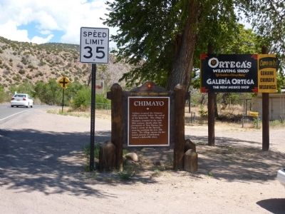
Indians occupied the Chimayo valley centuries before the arrival of the Spaniards. The village of Chimayo, founded in the early 18th century, shortly after the reconquest of New Mexico, has been a center of the Spanish weaving tradition for over 250 . . . — — Map (db m32819) HM
The Jicarilla Apaches, primarily a hunting and gathering group, once occupied vast portions of northeastern New Mexico and southern Colorado. Pressure from Comanche Indians and European settlers eventually pushed them from their homeland. In 1887, . . . — — Map (db m104757) HM
When it was described by Gaspar Castano de Sosa in 1591, the Española Valley contained about ten Tewa-speaking pueblos, several of which are still occupied today. Juan de Oñate established New Mexico’s first colony here in 1598. Long on the northern . . . — — Map (db m45671) HM
Agueda is the matriarch of Hispanic weaving in New Mexico. From a very young age, she was known for her complex designs and natural dyes. She was the subject of the Academy Award-nominated documentary film, “Agueda Martinez: Our People, Our . . . — — Map (db m73393) HM
Esther Martinez served her community as an educator, linguist and storyteller. Her foremost contributions to our state are documenting and preserving the Tewa language and the art of storytelling. Esther was named a National Heritage Fellow in 2006 . . . — — Map (db m32856) HM
[ Panel 1: ]
San Juan Parish's Shrine of Our Lady of Lourdes was conceived as place of pilgrimage for those faithful wishing to honor Our Lady and to be given a glimpse
of her place of apparition to St. Bernadette Soubirou in the . . . — — Map (db m32794) HM
Pablita Velarde was an internationally acclaimed artist whose paintings largely depicted Pueblo life. She was commissioned by the WPA art's program to paint murals at Bandelier National Monument. Selected as one of New Mexico's "Living Treasures", . . . — — Map (db m45663) HM
Founded around the fourteenth century, Santa Clara traces its ancestry to Puye, an abandoned site of cave dwellings on the Pajarito Plateau. Increasing tensions with the Spanish led to its participation in the Pueblo Revolt of 1680. The mission . . . — — Map (db m45664) HM
Fort Lowell was established in 1866 to protect the Tierra Amarilla area settlements from the Southern Utes. Originally named Camp Plummer this post was garrisoned by a detachment of New Mexico Volunteers, some of whose descendants live in the area. . . . — — Map (db m74255) HM
Blackwater Draw consists of several important archaeological sites that have yielded much information about the big-game hunting way of life. Some of the animals that were hunted, like the mammoth, are long extinct. Eastern New Mexico University's . . . — — Map (db m56114) HM
Working from his house and publishing through the American Natural History Museum, Earl Morris intrigued the nation with his findings at Aztec Ruins.
In 1923 the site Morris had known since boyhood was preserved as a national monument . . . — — Map (db m71078) HM
In the early 1100s, travelers on this familiar path could see a sprawling settlement ahead. Across the river, ceremonial kivas and great houses with hundreds of rooms dominated the landscape. Smaller house-style unit pueblos and farming areas spread . . . — — Map (db m184352) HM
Though you may not notice at first, wildlife thrives along the Animas River. These rich, green corridors, or "riparian zones," provide animals with food, water, and shelter. Archeological research tells us that in the centuries since Ancestral . . . — — Map (db m184355) HM
Despite its name, this magnificent site reflects 11th century influence from nearby Chaco Canyon rather than from the later Aztecs of Mexico. The striking masonry pueblos illustrate the classic Chaco architectural style with later Mesa Verde . . . — — Map (db m36466) HM
Despite its name, this magnificent site reflects 11th century influence from nearby Chaco Canyon rather than from the later Aztecs of Mexico. The striking masonry pueblos illustrate the classic Chaco architectural style with later Mesa Verde . . . — — Map (db m36467) HM
Through the collective recognition of the community of nations, expressed within the principles of the convention concerning the protection of the world cultural and natural heritage Aztec Ruins National Monument has been designated an outlier . . . — — Map (db m71077) HM
You are standing among many thousands of years of connecting networks, layered over each other across generations. This is a place of ancient farming, with a river offering dependable water and stable soil for planting. It is a place of gathering, . . . — — Map (db m184351) HM
In the late 11th century, influence from Chaco Canyon, 45 miles south of here, began to be felt at this site and at nearby Aztec Ruins National Monument. The Chacoans abandoned this large and well-built masonry pueblo by 1150, and shortly . . . — — Map (db m36457) HM
Atop Fajada Butte Chacoan skywatchers commemorated the movement of the sun and the seasons. Sunlight passed between three boulder slabs onto a spiral petroglyph to mark the sun's position on the summer solstice, winter solstice, and the equinoxes. . . . — — Map (db m120182) HM
Chaco Culture was designated as a UNESCO World Heritage Site in 1987. Chaco Canyon was a major cultural center between 850 and 1250 CE, and is remarkable both for its monumental architecture and its status as a center of trade, politics, and . . . — — Map (db m120186) HM
Fajada Butte dominates the landscape. Exposed rock layers reveal the regions geologic and human history.
Cliff House Sandstone forms the upper layer with deposits of fossil shells, clams, shark teeth, and marine sand. Menefee Formation forms . . . — — Map (db m120180) HM
This is the only place in the United States marking the common corner of four states – Colorado, New Mexico, Arizona and Utah.
Who established this corner?
The four corners monument was established and perpetuated by U.S. Government . . . — — Map (db m36522) HM
This huge volcanic neck was formed in Pliocene times, over 3,000,000 years ago. It rises 1700 feet above the surrounding plain and is famed in legends of the Navajo as "Sa-bit-tai-e" (the rock with the wings). They hold that it was the great
bird . . . — — Map (db m30013) HM
The monument was first surveyed in 1875 and that remarkable feat of surveying precision and accuracy stands today. The tribal park which was first identified with a concrete pad in 1912, improved in the 60's and graced with its current look in 2010. . . . — — Map (db m184213) HM
Imagine going back in time to when this pueblo was flourishing. You are standing in the center of the pueblo. Towering above you is a five-story structure built of stacked, mortared, and plastered stones. Around you, pueblo life hums. People weave . . . — — Map (db m185319) HM
Architectural records reveal details that may hold a key to the past. The mission church ruins in front of you and pueblo ruins along the trail reveal the culture of the people who once called Pecos Pueblo home. Here at Pecos National Historical . . . — — Map (db m185361) HM
The Spanish returned to New Mexico 12 years after the 1680 Pueblo Revolt. In front of you are the remains of the smaller church they completed in 1717.
Pecos Pueblo had entered a long decline due to disease, famine, and raids. Over time the . . . — — Map (db m185383) HM
Set at a natural crossroads, trade helped make Pecos Pueblo a powerful village of more than 2,000 people. Its strategic location was a natural meeting place for people from near and far. Native Americans traded ceremonial items such as macaw . . . — — Map (db m185317) HM
Pecos was one of the largest and most powerful pueblos in northern New Mexico when the Spanish established a mission here. A few years later, in 1625, the first church was completed. You can see remnants of its foundation in front of you. Arrival of . . . — — Map (db m185381) HM
Front:
Humans have inhabited the Pecos Valley for at least 12,000 years. The fifteenth century Towa-speaking trading pueblo, Cicuyé, had over 2,000 inhabitants. During the sixteenth and seventeenth centuries, Franciscan churches were built . . . — — Map (db m119913) HM
The Pecos people farmed for generations before the Spanish arrived. Through the mission Franciscan friars taught the Puebloans about raising animals and ranching. The friars introduced domesticated livestock including sheep, goats, chicken, horses, . . . — — Map (db m185316) HM
Pecos Pueblo rose to power by capitalizing on the natural environment. The pass between the Glorieta Mesa and Sangre de Cristo Mountains was a well-established trade route - bringing wealth to Pecos. The pueblo sat atop a narrow ridge, elevating it . . . — — Map (db m185320) HM
After years of oppression, and epidemics and droughts that killed many, the people of Pecos rebelled against Spanish authority in 1680. Here they destroyed the mission church, the symbol of Spanish power.
The revolt united pueblos across the . . . — — Map (db m185382) HM
(side one)
According to oral and recorded history, the Santo Domingo people have always made and traded jewelry. From prehistoric times heishi, drilled and ground shell beads, have been strung into necklaces. Generations of Santo . . . — — Map (db m45475) HM
The Keres-speaking pueblo of Santa Ana was established on its present site in 1693, as part of Diego de Vargas' reconquest of New Mexico. The spot, exposed to flooding, was poorly suited for farming, and today the residents live on their farms along . . . — — Map (db m32843) HM
Women of Cochiti are known for reviving the historic figurative tradition now referred to as Storytellers, adult clay figurines surrounded by children. The efforts of these women have bloomed into a vibrant cottage industry, inspiring many potters . . . — — Map (db m73262) HM
Spanish colonization of this region, once the location of many Tiwa Indian pueblos, began in the 17th century. Corrales is named for the extensive corrals built here by Juan González, founder of Alameda. In the 18th century this rich farming . . . — — Map (db m45436) HM
In 1769, Spanish Governor Pedro Fermin de Mendinueta made the San Joaquin del Nacimiento land grant to 35 pioneering families who had settled the headwaters of the Rio Puerco in 1766. The community was later abandoned owing to raids by frontier . . . — — Map (db m73665) HM
Jemez Pueblo. Evelyn M. Vigil, a descendant of the last remaining Pecos residents that moved to Jemez Pueblo in 1838, led a revival of Pecos Pueblo style pottery. She spent time at Pecos National Historic Park studying materials and techniques . . . — — Map (db m73244) HM
Jémez is the sole surviving pueblo of the seven in the “provencia de los Hemes” noted by Spaniards in 1541, and the last at which the Towa language is still spoken. In 1838, the remaining inhabitants of Pecos Pueblo moved here. The . . . — — Map (db m73254) HM
The village of Giusewa was occupied by ancestors of the Jémez Indians before the arrival of the Spanish in 1541. Its ruins lie close to those of the great stone mission church of San José de los Jémez, which was built by the Franciscans around 1622. — — Map (db m73238) HM
More the one hundred prehistoric and historic pueblos and other archeological sites and over 15,000 petroglyphs or rock art sites give ample evidence of the occupation of this valley for at least 12,000 years. Spanish explorers who came into the . . . — — Map (db m73508) HM
Trinidad Gachupin Medina was the most widely known Zia potter of her time. She was recognized for her large polychrome storage jars. Sponsored by trader Wick Miller, she toured the United States from 1930 to 1946, demonstrating pottery making at . . . — — Map (db m32859) HM
The Keresan people of Santo Domingo have occupied the area of the Rio Grande Valley since prehistoric times despite several floods that have forced relocation and reconstruction of the original pueblo. Strategically located along the roads that have . . . — — Map (db m45476) HM
In 1583 Antonio de Espejo recorded this pueblo as one of five in the Province of Punamé. Following the sacking of Zia by Spanish troops in 1689, the pueblo was reestablished, but never attained its former size. The Zia ancient sun symbol is . . . — — Map (db m32858) HM
… where you will experience the tri-cultural story of New Mexico, a history of the Indians, the Spanish, and the Anglos each altering this landscape in their efforts to obtain turquoise, lead, silver, and more.
Indians mined nearby . . . — — Map (db m70565) HM
The name Tesuque is a Spanish variation of the Tewa name Tetsugeh, meaninig "narrow place of cotton wood trees." The small Tewa speaking pueblo of Tesuque was established before 1200, and was first visited by Europeans in 1591. It is one of the most . . . — — Map (db m32852) HM
Spanish explorers found several Tano-speaking pueblos in the Galisteo Basin in 1540. They were among the leaders of the Pueblo Revolt in 1680. 150 Tano families were eventually resettled in Galisteo Pueblo in 1706. Droughts, famine, Comanche raids, . . . — — Map (db m64819) HM
Welcome to Cerrillos (Little Hills)
Cerrillos was once seriously considered as the capitol of New Mexico. Cerrillos mining district is one of the oldest and most marked of the old Spanish mineral developments in the Territory. Ttwenty-one . . . — — Map (db m181833) HM
The St. Francis Women's Club was instrumental in raising funds to rebuild San Francisco de Asís Church, which had been condemned and demolished in about 1960.
Their main fundraiser was the annual Fourth of July Ceremonial, featuring dances of . . . — — Map (db m32833) HM
Feliciana Tapia Viarrial helped establish today's
Pueblo of Pojoaque. Pojoaque, or Posuwageh, water
drinking place, is a Tewa village founded circa A.D.
900. By 1919, the Pojoaque homelands were severely
diminished. Most members left . . . — — Map (db m32835) HM
In the 1500’s, migrants from the Pajarito Plateau joined their Tewa-speaking relatives at San Ildefonso. The pueblo is famous as the home of the late María Martínez and other makers of polished black pottery. The modern church, a replica of that of . . . — — Map (db m45659) HM
1620
The Barrio de Analco and San Miguel Church are both located on the south
side of the Santa Fe River. Analco, from the Nahuatl language of central
Mexico, means "on the other side of the water." Mexican indians who came
to New Mexico . . . — — Map (db m182318) HM
In the seventeenth century New Mexico was plagued by drought, conflicts between civil and church authorities, and extreme demands placed by the Spanish settlers on the native population. The latter situation caused a deterioration so severe that by . . . — — Map (db m76202) HM
1777
Don Juan Bautista de Anza, a native of Sonora, was governor of New Mexico
from 1777 to 1788. Considered one of New Mexico's best governors his
primary challenge was stopping incessant Indian raids that nearly wiped out
some of the . . . — — Map (db m182387) HM
Santa Fe is the oldest capital city in the United States, a successful blend of three cultures and yet a modern city of over 50,000 residents.
The Commemorative Walkway Park, constructed in 1986, provides a historical walk through Santa Fe . . . — — Map (db m76131) HM
From 500 A.D. onward, New Mexico underwent a number of comparatively rapid changes. The people throughout the western two-thirds of the state became increasingly restricted to smaller and smaller areas resulting in the development of many regional . . . — — Map (db m76136) HM
(English) Pueblo Indians farmed this area south of the Santa Fe River as early as the mid-15th century. By the 17th century, acequias (irrigation ditches) laced the landscape for use by Spanish farmers, who grazed livestock and built . . . — — Map (db m184937) HM
This neighborhood was first established in the early 1600s by Tlaxcalan Indian servants for whom the original San Miguel Chapel was built. Razed during the Pueblo revolt in 1680; resettled by families of Spanish soldiers after the De Vargas . . . — — Map (db m184948) HM
First gold placer mining west of the Mississippi began with the discovery of the precious metal in the rugged Ortiz Mountains south of here in 1828, 21 years before the California gold rush. Since then, the district has produced more than 99,000 . . . — — Map (db m45477) HM
Come and Get It!
The ingredients were meager and the menu was basic: biscuits, bacon, and coffee for travelers on the trail in the 19th century.
But with those simple ingredients, supplemented by fresh meat killed on the trail and . . . — — Map (db m185098) HM
Oldest church structure in U.S.A. The adobe walls and altar were built by Tlaxcalan Indians from Mexico under the direction of Franciscan Padres. ca. 1610 — — Map (db m116019) HM
Santa Fe Cathedral Park and Monument A gift to the citizenry of Santa Fe and the State of New Mexico commemorating the first European settlers of New Mexico - the Spanish colonists of 1598.
The year 1998 marked the 400th anniversary of the . . . — — Map (db m181926) HM
Ernest Thompson Seton (1860-1946), naturalist, artist, writer, authority on Indian lore, and first Chief Scout of the Boy Scouts of America, lived here during the last part of his life. The village includes his home, art collection, library, and . . . — — Map (db m55151) HM
This courtyard is dedicated to Catua and Omtua, two messengers from the Pueblo of Tesuque (Taytsugeh Oweengeh) who were captured and executed by Spanish authorities. Their execution led, in part, to the start of the Great Pueblo Revolt which began . . . — — Map (db m182055) HM
(side one)
Three generations of one family worked more than 100 years to preserve the cultural heritage of New Mexico. Eva Fenyes created an artistic and photographic record of missions and adobe buildings, and preserved Spanish . . . — — Map (db m45481) HM
Seated clay figurines known as rain gods or "rain catchers" spring from Tesuque Pueblos's deep-rooted figurative pottery tradition. Popularized in the 1880's, Tesuque women made and sold the figurines in a variety of colors and designs, and earned . . . — — Map (db m32853) HM
Cutting through the southern edge of the Manzano
Mountains, this area has always been an important
trade route. The trail linked Abó and the Salinas
pueblos to the Rio Grande pueblos, fostering trade of
beans, cotton, buffalo meat and salt with . . . — — Map (db m235442) HM
In 1582 and 1583, Antonio de Espejo and his party followed the Rio Grande north to the Bernalillo area. Espejo was trying to learn the fate of two Franciscan friars who stayed with the Pueblo Indians after the Rodriquez – Sanchez/Chamuscado . . . — — Map (db m68057) HM
Named for Magdalena Peak, Magdalena is located in a mineral-rich area which became a center for silver and zinc mining in the 1860's. In 1884, a railroad spur was built from the smelter in Socorro, and Magdalena became an important railhead for . . . — — Map (db m238359) HM
The Piro Indian pueblo Teypana was visited by Juan de Oñate in 1598. The people of the village reportedly supplied corn to Oñate who bestowed the name Socorro ("aid" in Spanish) on the pueblo. In 1626, the mission of Nuestra Señora de Socorro was . . . — — Map (db m38462) HM
Maria Ramita Simbola Martinez, Cora Durand, and Virginia Duran helped to preserve the distinctive micaceous pottery tradition that is important in Picuris and other nearby pueblos. Made with locally mined mica-rich clay, these unusual pots have a . . . — — Map (db m43808) HM
In 1795, twenty-five families were granted land along the Río Grande at Pilar, then known as Cieneguilla. The Battle of Cieneguilla was fought at Embudo Mountain near here in March 1854. A large force of Utes and Apaches inflicted heavy losses on . . . — — Map (db m69869) HM
(side one)
Captive Women and Children of Taos County
In August 1760, around sixty women and children were taken captive in a Comanche raid on Ranchos de Taos. That raid is an example of the danger of living on New Mexico's . . . — — Map (db m45719) HM
When Spaniards arrived at Picuris in 1591, they described the pueblo as consisting of nine-story roomblocks. The church is named for its patron saint, San Lorenzo, and according to oral tradition has been rebuilt five times. The original church was . . . — — Map (db m44283) HM
Design: Juanita Lavadie
Concept & Installation: The Paseo Project
In the fall of 2020, The Paseo Project collaborated with Juanita Lavadie to explore the possible
ways that the historical networks of the Acequia Madre del Río Pueblo could . . . — — Map (db m236390) HM
Welcome visitors and Taosenos! You are invited to explore the diversity of this region through a self-guided tour. The two-hundred- year-old Taos Plaza, including the streets that radiate from it like spokes, forms the National Historic District . . . — — Map (db m66702) HM
Capitan Hernan Alvarado and his conquistadors from the famous Francisco Vasquez de Coronado Expedition arrived here on August 29, 1540. It is estimated that the Tiwa Indians settled in this valley around 1350 A.D. The name Taos is believed to be . . . — — Map (db m66697) HM
Palo Flechado (tree pierced with arrows) Pass was used by natives and newcomers traveling from the eastern plains to Taos by way of the Cimarron River. The name may be attributed to the Flecha de Palo Apache band (first mentioned by Juan de . . . — — Map (db m45738) HM
In 1692, after having been driven from New Mexico by the Pueblo Revolt of 1680, the Spanish began to re-establish their rule. In one of the last battles of the reconquest, in September 1696, Governor Diego de Vargas defeated the Indians of Taos . . . — — Map (db m45737) HM
A Kiva Here? Rock walls and unearthed relics can tell us only so much about what people believed 350 years ago. The mysterious, round structure before you resembles a kiva. In Pueblo tradition, kivas are underground meeting chambers for . . . — — Map (db m235521) HM
Crossroads In the 17th century, an ancient trade route that linked the Rio Grande to the Great Plains shared this fragile mountain valley with a bustling pueblo full of people who spoke Tompiro. When a single Spanish priest walked into town in . . . — — Map (db m235524) HM
New Songs The worn stairs before you endured over 50 years of small Tompiro boys hurrying to join the adults in the choir loft above. Franciscans in Mexico in the 1500s had noted how powerfully music aided their mission efforts. Friars here in . . . — — Map (db m235506) HM
People at Work Ahead and to your right you see a complex maze of rooms: the convento of Mission Abó. Here, two dozen Tompiros tackled many tasks crucial to running a mission – from herding livestock and maintaining church properties to grinding . . . — — Map (db m235501) HM
In English:
Crossroads
In the 17th century, an ancient trade route that linked the Rio Grande to the Great Plains shared this fragile mountain valley with a bustling pueblo full of people who spoke Tompiro. When a single Spanish . . . — — Map (db m62066) HM
Located adjacent to the major east-west trade route through Abó Pass, the Tompiro Pueblo of Abó (ca. 1300s-1670s) was one of the Southwest’s largest Pueblo Indian villages. Extensive Indian house complexes are dominated by the unique buttressed . . . — — Map (db m119761) HM
The Tompiro Indian “Pueblo de las Humanas" (ca. 1300-1670s) had 1,500 to 2,000 inhabitants and was a trading center with Plains Indians. The village evolved for centuries on the fringe of the Mogollon and Anasazi cultures. There are two large . . . — — Map (db m119759) HM
Founded in 1902, Mountainair developed as a major center for pinto bean farming in the early 20th century until the drought of the 1940s. The region had been occupied earlier by Tompiro and eastern Tiwa pueblo Indians from prehistoric times through . . . — — Map (db m75511) HM
Founded in 1902, Mountainair developed as a major center for pinto bean farming in the early 20th century until the drought of the 1940s. The region had been occupied earlier by Tompiro and eastern Tiwa pueblo Indians from prehistoric times through . . . — — Map (db m75512) HM
On the edge of the Plains stands the abandoned Tiwa Pueblo Indian village of Quarai (ca. 1200–1670s), the southernmost of the Tiwa villages, located along the eastern flanks of the Manzano Mountains. The Spanish Franciscan mission church of La . . . — — Map (db m119760) HM
The pueblo-mission of San Miguel de Tajique was established in the 1620s. In the 1670s, famine, disease and Apache raids caused the abandonment of the Jurisdiccion de las Salinas (1598-1678) which included Tajique. Modern occupation of Tajique began . . . — — Map (db m75510) HM
This community traces its beginnings to the hacienda established by Captain Francisco Valencia along this section of the Camino Real by the mid-17th century. Abandoned during the Pueblo Revolt of 1680, the area was resettled in 1740 by Christian . . . — — Map (db m67073) HM
197 entries matched your criteria. Entries 101 through 197 are listed above. ⊲ Previous 100