President Gordon B. Hinckley has spoken of the mission of The Church of Jesus Christ of Latter-day Saints and its members, which is symbolized by Ensign Peak:
"This great pioneering movement of more than a century ago goes forward with . . . — — Map (db m234452) HM
The mansion, completed in 1901, was designed for Alfred W. and Elizabeth McCune by architect S. C. Dallas. Alfred McCune acquired great wealth through railroad, mining, and timber enterprises. In 1920, after the McCune's moved to Los Angeles, they . . . — — Map (db m132485) HM
"And he shall set up an ensign for the nations, and shall assemble the outcasts of Israel, and gather together the dispersed of Judah from the four corners of the earth….Lift ye up a banner upon the high mountain" (Isaiah 11:12; 13:2).
Long . . . — — Map (db m234451) HM
The Assembly Hall, constructed of granite
stone left over from the building of the
temple, was completed in 1880. It is a
place of public worship, in which visitors
are welcome. Although the building is used
mainly for conferences of Latter-day . . . — — Map (db m172067) HM
The Church of Jesus Christ of Latter-day Saints constructed this building between 1914 and 1917 to serve as its headquarters. Prior to its completion, the office of the Church President was located just to the east between Brigham Young’s Lion . . . — — Map (db m35685) HM
Among the wagons that headed west with the Mormon pioneers were those carrying the historical records of The Church of Jesus Christ of Latter-day Saints. After storing in records in various locations around the city in 1855-1856 the Church built a . . . — — Map (db m223420) HM
Eliza R. Snow
Leader of Pioneer Women
January 21, 1804 - December 5, 1887
O My Father
The immortal poem – hymn, “O My Father” was written by the inspired poetess, Eliza R. Snow, sometime in the Spring of 1845 in . . . — — Map (db m35237) HM
July 26, 1847, two days after the Mormon pioneers entered this valley Brigham Young and party climbed to this point and with the aid of field glasses made a careful survey of the mountains, canyons and streams. In the group were Heber C. Kimball, . . . — — Map (db m150534) HM
July 26, 1847, two days after the Mormon pioneers entered this valley Brigham Young and party climbed to this point and with the aid of field glasses made a careful survey of the mountains, canyons and streams. In the group were Heber C. Kimball, . . . — — Map (db m224778) HM
Dedicated July 26, 1996 by President Gordon B. Hinckley
The Church of Jesus Christ of Latter-day Saints
This park is the result of a public-private partnership between Salt Lake City and Ensign Peak Foundation.
About the Plaza . . . — — Map (db m225319) HM
Ensign Peak has been a place for much flag-flying. Shortly after the coming of the Mormons in 1847, an American flag was flown from this summit. Early settlers may have also flown their special "flag of the kingdom" here. This "kingdom flag" was . . . — — Map (db m225193) HM
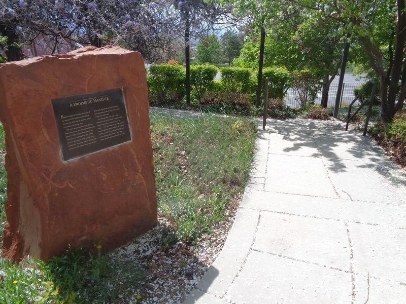
"We believe in the literal gathering of Israel and…that Zion (the New Jerusalem) will be built upon the American continent" (Pearl of Great Price, Articles of Faith 1:10). Joseph Smith's prophetic statement set out the Latter-day Saint view on the . . . — — Map (db m234445) HM
At the founding of Salt Lake City in 1847, this city block was deeded to Heber C. Kimball, a friend of Brigham Young who served with him in the First Presidency of the LDS Church. Kimball was born in Vermont in 1801 and joined the church in New York . . . — — Map (db m155791) HM
Latitude 40°46'04" - Longitude 111°54'00" Altitude (sidewalk) 4327.27 Ft.Fixed by Orson Pratt assisted by Henry G. Sherwood, August 3, 1847, when beginning the original survey of “Great Salt Lake City,” around the . . . — — Map (db m35007) HM
Old Folks Day was inaugurated in Salt Lake City in 1875, by Charles R. Savage, assisted by Edward Hunter, presiding Bishop of the Church of Jesus Christ of Latter-Day Saints, and George Goddard, since which time all persons seventy or more years of . . . — — Map (db m34998) HM
The corner of Main Street and South Temple have long been important in Utah history. Prior to construction of Hotel Utah in 1909-11, the Church of Jesus Christ of Latter-day Saints’ general tithing office, bishop’s storehouse, and the “Deseret . . . — — Map (db m35680) HM
In Honor Of
Brigham Young
and
The Pioneers
[ Second Plaque Mounted on the Monument: ]
The Names of the PIONEERS Who Arrived in this Valley,
July 24, 1847,
* Signifies Those Now Living. The Unmarked Ones Are All . . . — — Map (db m35317) HM
The Hotel Utah was the “Grande Dame” of hotels in the Intermountain West. For most of the 20th century. the hotel hosted Utah’s most distinguished visitors and was a focal point of local social activity. As one historian wrote, . . . — — Map (db m35747) HM
Heber C. Kimball, pioneer of 1847 and first counselor to Brigham Young, was allotted the land adjacent to this monument upon which to build homes for his family, the majority of whom arrived in 1848. He and Newel K. Whitney dedicated a plot of . . . — — Map (db m132484) HM
From 1847 to 1869 approximately 86,000 persons, mainly converts to the Church of Jesus Christ of Latter-day Saints, left their established homes to build anew in the valleys of the Rocky Mountains. About 6,000 were buried along the way. . . . — — Map (db m35212) HM
Constructed 1855-1856 as a residence for Brigham Young and his family, the Lion House takes its name from the recumbent lion carved by William Ward set on top of the front portico. The house was designed by Truman O. Angell and built of stuccoed . . . — — Map (db m173257) HM
The Handcart Pioneer Monument is a tribute to the thousands of hardy Mormon pioneers who, because they could not afford the larger ox-drawn wagons, walked across the rugged plains in the 1850s, pulling and pushing all their belongings possessions in . . . — — Map (db m171183) HM
The Nauvoo Bell originally hung in the temple that Church members built in Nauvoo, Illinois, in the 1840s.The Saints removed the bell in 1846 when they were forced to leave Illinois because of persecution. Following instructions from Brigham Young, . . . — — Map (db m101779) HM
The Primary Association, a children’s organization of The Church of Jesus Christ of Latter-Day Saints, operated a children’s hospital near hear for 30 years, from 1922 to 1952.
· Located at 44 West North Temple Street.
· Founded by Sarah . . . — — Map (db m1363) HM
The temple is used by Church members for marriages and other sacred ordinances designed to strengthen families, both now and for eternity. Begun in 1853, it was completed 40 years later. Granite rock used in its construction was hauled 23 miles by . . . — — Map (db m132227) HM
The 18th Ward of the Church of Jesus Christ of Latter-day Saints, one of the original nineteen ecclesiastical wards of Salt Lake Valley, was organized Feb. 14, 1849. Early congregations consisted of families of Brigham Young, Heber C. Kimball, and . . . — — Map (db m35670) HM
Brigham Young knew when he saw Ensign Peak that this marked the right place for the center of the new Zion. He said, "I want to go there," sensing that at the top he might gain some insight about the future city.
Ascending the hill with other . . . — — Map (db m234453) HM
Built by President Brigham Young and used by him as a residence from about 1855 until his death in 1877. On the lower floor were the dining room and kitchens. On the next floor were the living rooms and large parlor; and on the top floor were the . . . — — Map (db m172050) HM
History
In May and June 1846, the services of the Mormon people--en route to the west--were officially tendered to the United States government, then at war with Mexico.
President James K. Polk authorized Colonel Stephen W. Kearney, . . . — — Map (db m35195) HM
The first settlers in the Salt Lake Valley were members of The Church of Jesus Christ of Latter-day Saints, sometimes called Mormons because of their belief in the Book of Mormon. They had suffered persecution in New York, Ohio, Missouri, and . . . — — Map (db m225316) HM
Before he left Nauvoo, Brigham Young said that Joseph Smith, the deceased prophet, had appeared to him in a vision and had shown him a place where the banner of liberty should wave. When he viewed this peak as he entered the Salt Lake Valley on July . . . — — Map (db m225192) HM
After viewing the valley on July 24, 1847, Brigham Young reportedly declared, "This is the right place." Scouting reports verified that there were enough natural resources to support a city, which was soon laid out with wide streets and ten-acre . . . — — Map (db m225195) HM
When Brigham Young first looked over the valley from the area of the This is the Place Monument, five miles southeast of here, he saw Ensign Peak and knew that it marked the right place for the gathering of the Latter-day Saints.
Before leaving . . . — — Map (db m234446) HM
[panel 1] Following the days of their severest persecutions in the winter of 1846-7, when the Mormon pioneers, driven from their beloved city of Nauvoo, Illinois, by mob violence, were scattered across the frozen plains of Iowa, there came . . . — — Map (db m167225) HM
Early migration to Utah and its settlement by the Mormons were added by stalwart friends. Typical of these was Col. Thomas L. Kane of the U.S. Army. A cultured and courageous man, devoted to truth and justice. In financial, political, and civil . . . — — Map (db m223417) HM
From Ensign Peak the pioneer leaders laid plans for Salt Lake City. They envisioned a prospering community of wide streets, farms, homes, schools, shops, churches, and a temple. George A. Smith reported that before leaving Nauvoo, Illinois, for the . . . — — Map (db m225320) HM
Designed by Philip Meyer, a native of Germany and a nephew of local retail magnate Frederick Auerbach, the B'nai Israel Temple was constructed in 1890-91. Henry Monheim, a local architect, supervised the construction. It is one of the few remaining . . . — — Map (db m35790) HM
This Synagogue was constructed in 1903 at a cost of $9,000, and was one of only 4 synagogues built in Utah during the 19th and early 20th centuries. It was designed by prominent Utah architect Carl Neuhausen. The building's exotic style results from . . . — — Map (db m35833) HM
Begun in 1870-1871, Completed 1882-1902.
Architect Richard Upjohn, founder of A.I.A.
Utah's oldest non-Mormon church
in continuous use. — — Map (db m36041) HM
Hauling granite to build a temple
From 1872-1892, a railroad spur ran up the middle of South Temple Street, greatly accelerating the
construction of the temple. In its first year of operation, it carried more than 4,000 tons of rough cut . . . — — Map (db m245957) HM
Organized during the 1880’s by the Reverend T. Saunders, this congregation has served as a focus of black religious, social, and cultural activity in Utah from territorial days to the present. In 1907 property at this spot was acquired, and a church . . . — — Map (db m35829) HM
As a result of the organization of the original 19 wards of the Church of Jesus Christ of Latter-day Saints “Mormons” in Salt Lake City on February 22, 1849, ward squares or blocks were created on which the public buildings for each ward . . . — — Map (db m35828) HM
In June 1875 in answer to the appeal of the Rev. Lawrence Scanlan, two Sisters of the Holy Cross, Mother M. Augusta and Sister M. Raymond, came to Salt Lake City. In August they were joined by Sisters M. Pauline, Anna, Josepha, Holy Innocents, and . . . — — Map (db m149966) HM
This building has housed the Alta Club for over 100 years. Prominent Utah businessmen founded the exclusive club in 1883. The original members were all non-Mormons and most were involved in the mining industry. The Alta Club's official . . . — — Map (db m146855) HM
Jews have been part of Utah’s religious, economic, social, and political life since the mid-19th century. Congregation B’Nai Israel was organized in 1874. The first service was held in March, 1883. B’Nai Israel merged with Congregation Montefiore in . . . — — Map (db m35792) HM
The Holy Trinity Greek Orthodox Church is evidence of the size and religious devotion of Salt Lake City's Greek immigrant community. In the early 20th century, Greeks were the largest immigrant group in Utah. Salt Lake City's Greek community was . . . — — Map (db m35696) HM
Constructed in the traditional Byzantine style, Holy Trinity held its first service on August 15, 1924. Located in the center of the Salt Lake City immigrant district, the church served Greek miners, railroad and smelter workers and their families. . . . — — Map (db m35285) HM
Replaced the First Greek Church in Utah, consecrated in 1905. Designed in the Byzantine tradition, its construction began in July 1923 and was completed in August 1924. Surrounding the church were once many immigrant neighborhoods dependent on the . . . — — Map (db m35283) HM
This monument marks the site of the "Old Fort" in which the Mormon Pioneers wintered in 1847-48 and in which some of the settlers resided for several years. Brigham Young laid the foundation stones on August 10, 1847, for 4 of the 17 houses . . . — — Map (db m161604) HM
Long, long be my heart with such memories filled; like the vase in which roses have once been distilled.
You may break, you may shatter the vase if you will,
but the scent of the roses will hang ’round it still.Thomas Moore
. . . — — Map (db m35755) HM
This statuary and surrounding gardens have been created in tribute to the Mormon pioneers, who sang joyously "All is Well" amid their trials and rigors of the long trek from Nauvoo, Illionis to Salt Lake Valley.
Their beginnings came on April . . . — — Map (db m245954) HM
Formed in 1856 to accommodate rapid growth in the area, the 20th Ward originally met in a meetinghouse on 2nd Avenue between D and E streets. By 1884 when the need for a larger facility and the desire of the school board to use the location for a . . . — — Map (db m1560) HM
Honored here for his roles as pioneer, colonizer, governor, and religious leader, Brigham Young was best known as simply "Brother Brigham". A beloved leader and wise counselor, he served as President of the Church of Jesus Christ of Latter-day . . . — — Map (db m132637) HM
The Eagle Gate marked the entrance to the homes of Brigham Young. During the early settlement of the valley, Brigham Young was aloted the land lying athwart the mouth of City Creek Canyon. His New England heritage prompted him to desire the privacy . . . — — Map (db m35161) HM
The well-known Mormon hymn, O My Father, has lifted millions of hearts through generations with its sublime message on man's eternal journey. Words to the hymn were written by Eliza R. Snow. Born in Becket, Massachusetts in 1804, she was . . . — — Map (db m234341) HM
Construction of this English Gothic Revival Style Church began in June 1903 and was completed May 1906. Architect was W. E. Ware. Built of local red sandstone. — — Map (db m121760) HM
Born June 1, 1801, at Whitingham, Vermont
Died August 29, 1877, at Salt Lake City, Utah
Brigham Young, second President of the Church of Jesus Christ of Latter-day Saints succeeded Joseph Smith, founder of the Church, who was martyred at . . . — — Map (db m62788) HM
This unusually large house with its ornamental detailing
indicates the upper middle class status achieved by the John
and Sarah Fairbanks family, after years of living in their
covered wagon and log cabin. Located in Payson, Utah,
the upper . . . — — Map (db m173192) HM
Restored through the generosity of
The Reverend Cannon Frederick Quinney Lawson and Janet Quinney Lawson
with additional support from other individuals and faith groups
The historic Fort Douglas Post Chapel was built in 1884 at a cost of . . . — — Map (db m225322) HM
After the first Mormon pioneers came to Utah, thousands more came west each year to join them. Because some pioneers could not afford a covered wagon or oxen, they built simple handcarts to take their belongings in on the long trek to Utah. They . . . — — Map (db m171350) HM
Built of red sandstone from the mountains near Heber City,
this building was used for school and church meetings.
The year 1890 brought about Utah's Free School Law, but
before 1890, teachers received their salary as a result of
students' . . . — — Map (db m172174) HM
This is a replica of a meetinghouse that still stands in
Pine Valley, north of St. George, Utah. It was built by
Scottish immigrant and shipbuilder, Ebenezer Bryce. Using
traditional shipbuilding techniques, Bryce first crafted the
log walls on . . . — — Map (db m172040) HM
The pioneers built a bowery on Temple Square in single
day, three days after their arrival in 1847. Constructed of
native timbers and willows, it provided a gathering place for
the community.
The bowery was rebuilt several times until it was . . . — — Map (db m172014) HM
This is the Place Monument, dedicated July 24, 1947, commemorates the arrival of the Mormon pioneers into the valley of the Great Salt Lake one hundred years before, and also the role of others—Spanish Catholic fathers, trappers and fur traders, . . . — — Map (db m1525) HM
Church Takes Root in Sandy
This monument recalls the early history of the Church of Jesus Christ of Latter-day Saints in the Sandy area, and the three pioneer chapels that were located across the street to the east.
A few Church members . . . — — Map (db m246515) HM
In the 1860's, a town named Granite was located at the mouth of Little Cottonwood Canyon by ore miners of Alta, Silverton, and Tannersville. Its desertion began as the mines closed about 1882. The surrounding country had been settled by Latter-day . . . — — Map (db m37468) HM
Built in 1906, the Sandy Tithing Office is one of 28 well-preserved buildings in Utah that were part of the successful "in kind" tithing system of the Church of Jesus Christ of Latter-day Saints (LDS or Mormon church) during the 1850s-1910s. Tithing . . . — — Map (db m238449) HM
In 1871, Utah Southern Railroad from Salt Lake was finished and station built here. Wasatch & Jordan Valley Line ran east to Granite Quarry to bring to this junction, huge rocks for constructing S.L. Temple. Later, a narrow-gauge, completely covered . . . — — Map (db m222696) HM
The granite used in the construction of the Mormon Temple in Salt Lake City was quarried from a large field of huge boulders covering this area broken by nature's forces from adjacent cliffs.
The quarrying of these boulders was begun about . . . — — Map (db m44176) HM
Stones for the walls of the Salt Lake Temple of the LDS Church came from this area. As construction began on the temple, Church authorities selected the rock in this canyon as the “best material that can be furnished in the mountains of North . . . — — Map (db m44180) HM
The Samuel Elijah Holt Farm, with its buildings dating from 1907 to c. 1930, is one of the last surviving examples of an active homestead built by early settlers of South Jordan. Mr. Holt, born August 30, 1868, purchased this farm from his father, . . . — — Map (db m230411) HM
Samuel Elijah Holt was born on August 30, 1868, five years after his family arrived from England. The family lived in a one-room log cabin on the bank of the Beckstead Ditch (east of the South Jordan cemetery). Samuel's childhood days were spent . . . — — Map (db m230381) HM
In 1859, George A. Smith sold his Mexican Land Grant to Alexander Beckstead, who, with others, settled ½ mile to the south. They dug a five mile ditch from Jordan River, in operation since completed in 1863. Adobe Community House built, 1864. . . . — — Map (db m34679) HM
The Samuel Elijah Holt Farm, with its buildings dating from 1907 to c. 1930, is one of the last surviving examples of an active homestead built by early settlers of South Jordan. Samuel Elijah Holt, born August 30, 1868, purchased this farm from his . . . — — Map (db m230374) HM
Upon the advice of Brigham Young, the first settlers west of the Jordan River built English Fort in 1853 for protection from Indians. Thick walls of rock and adobe with one gate surrounded the two acres of land. Adobe partitions separated the . . . — — Map (db m137520) HM
On this site, 6200 South and Redwood Road, in the year 1905 stood the 64th District School House. It was a red brick building consisting of two large rooms on the west side and a single large room on the east side.
The name of the school was . . . — — Map (db m41348) HM
In 1849 Governor Brigham Young sent Apostle John Taylor on a mission to France to investigate industries that could be successfully established in the New Mountain Empire. There he met Philip De Lamare, a man of exceptional talents and substantial . . . — — Map (db m35548) HM
In 1859, to replace a log church house, Bishop Archibald Gardner chose Elias Morris as architect of this red sandstone and granite church. On May 15, 1861, the cornerstone was laid. Proceeds from a military ball attended by L.D.S. authorities . . . — — Map (db m35952) HM
Homesteaders and settlers came in the 1870's to the area 4700 South to 7200 West, north to the Great Salt Lake, northeast along it's shore and the Davis County line to 4800 West and south to 4700 South. This area became Hunter Precinct in 1880 from . . . — — Map (db m35101) HM
Sketched by Remington Lange 1893 Bluff's log meetinghouse was the center of all public gatherings for the small community on the remote San Juan frontier. The meetinghouse, which was part of the north wall of the Bluff Fort, served as . . . — — Map (db m149540) HM
• Member of San Juan Mission Exploring Party • Driver of one of first wagons through Hole-in-the-Rock • First Superintendent of San Juan Schools • Church Leader and Missionary to Indians — — Map (db m150070) HM
This log church is a replica of the first church in Monticello. The original church, built in 188 for religious worship, also became the core of community activities. It was a school, a refuge for the homeless, a place to dance, a site for public . . . — — Map (db m95126) HM
President Brigham Young, in 1876, gave the Relief Society sisters an assignment to store wheat for a time of need. This historic, oolite limestone building was constructed as a granary in response to this concept. Pioneer women and children followed . . . — — Map (db m74995) HM
In 1861 Joseph Bartholomew, James Mellor and others settled here and diverted the warm creek for irrigation purposes. A branch of the Church of Jesus Christ of Latter-day Saints was organized in 1862 with Branch Young as President. The name of the . . . — — Map (db m74909) HM
The pioneers of Sanpete were committed to fostering their relationship with God and desired to build a temple where they could worship and increase their spiritual understanding of God's principles. Twenty-eight years after the first pioneers . . . — — Map (db m243325) HM
In the 1840s settlers in the west were typically separated by miles of open fields, leaving individuals and families isolated and unprotected. The pioneers, however, did not follow this settlement pattern when they gathered together in Utah. . . . — — Map (db m243332) HM
Bridging the Past, Present, Future
It was late November 1849, when a vanguard of pioneers arrived with their songs of praise, their Bibles and Books of Mormon. Within their hearts was a burning desire to help build Zion near the designated . . . — — Map (db m243386) HM
Mormon pioneer Joseph Taylor’s journal contains an account of a miracle he witnessed while building the temple: Joseph Taylor served as the timekeeper during construction of the Manti Temple. As timekeeper, he would walk the temple grounds, . . . — — Map (db m243324) HM
The Mormon Pioneers had an all-encompassing purpose in leaving their
homelands and gathering to Utah. The pioneers sought a place where they could help build Zion, a community organized and based on religious ideals.
(caption) The . . . — — Map (db m243388) HM
Pioneer Values
Cooperation
Mormons converts migrated to the west seeking a place to gather as a people and find refuge from religious persecution. They faced many challenges as they established settlements in Central Utah.
The . . . — — Map (db m243335) HM
Pioneer Values
Education
The Pioneers were a culturally diverse group, gathered together from many nations. Yankees, Southerners, British, and Scandinavians made up the majority of the people. Though their backgrounds varied, a universal . . . — — Map (db m243323) HM
Pioneer Values
Faith
Leaving from states such as Illinois and Iowa the early pioneers over 1,200 miles to reach their destination in Central Utah. These early settlers abandoned their homes and livelihoods to cross the treacherous and . . . — — Map (db m243390) HM
This mission church and school constructed in 1881 of native oolite limestone in the Greek Revival style was designed by architect Peter Van Houghton of Salt Lake City. The church was constructed under the supervision of Reverend G.W. Martin who . . . — — Map (db m74922) HM
Under direction of Bishop Isaac Morley 224 pioneers arrived in this vicinity Nov. 22, 1849. In response to an invitation from Indian Chief Walker to President Brigham Young. Their first homes were dugouts in the south side of Temple Hill. That . . . — — Map (db m44489) HM
On April 25 1877, the pioneer colonizers of Manti -- the fourth community established in Utah -- began taking form the south side of this hill the oolite stone from which to build their temple. The third of these sacred edifices erected in Utah, it . . . — — Map (db m44485) HM
This location marks the final resting place of hundreds of men, women, and children of diverse backgrounds and life experiences. It is believed that most if not all burials of white settlers in Sanpete Valley between November 1849 and the early . . . — — Map (db m243334) HM
On this spot of ground, in 1873, an adobe building, the first recreation center in Richfield, was erected by Pioneers Austin M., Alonzo L. and Albert Farnsworth. Accepted into the United Order in 1874. Acquired by the LDS Church in 1877 for all . . . — — Map (db m74819) HM
This mission chapel was erected in 1880 as part of the efforts of Reverend Duncan McMillan to evangelize central Utah. Originally located on Main Street, the building was torn down and rebuilt at this location in 1937/38. The church also symbolizes . . . — — Map (db m74818) HM
Erection of the first L.D.S. Church in Salina was commenced in 1864 when rocks were hauled from a quarry two miles away. Soren Neilson, a stonecutter, supervised the work. When the structure was built to the square, the people used it as a fort. . . . — — Map (db m74860) HM