Near County Road 63, 0.3 miles south of County Road 530, on the right when traveling south.
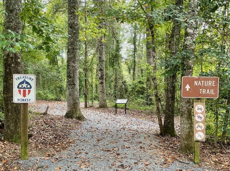
By 1900, America's forests were in a depleted
state. In the 1920's and 30's, conservationist
and lumberman Evan Frank Allison led the
movement to revitalize Alabama's forests and
wildlife. At one time he and his forester
counted less than five . . . — — Map (db m207007) HM
On Bridge Street at Gin Shop Hill Road, on the right when traveling west on Bridge Street.
Daniel Pratt, Prattville’s founding father, constructed an imposing home and garden within a quarter-mile of this site on Autauga Creek, near his industrial complex. The large home was designed and erected by Pratt himself, a noted architect / . . . — — Map (db m27985) HM
On Main Street at Manci Avenue, on the right when traveling south on Main Street.
The City of Daphne was incorporated July 8, 1927 with a population of 500. its history, however, dates to a much earlier period. Research and artifacts show that Tensaw, Alabama, Choctaw, Creeks, and Seminole Indians all lived in the this area prior . . . — — Map (db m100843) HM
On Alabama Route 59 at milepost 56, on the right when traveling north.
William Bartram, America’s first native born artist - naturalist, passed through Baldwin County during the Revolutionary era, making the first scientific notations of its flora, fauna and inhabitants. As the appointed botanist of Britain’s King . . . — — Map (db m81855) HM
On Cotton Avenue at Highland Avenue on Cotton Avenue.
The Tree That Owns Itself
Planned and Dedicated
April 19, 1961
Replacing the Walker Oak
Felled by Wind April 9, 1961
Original Deed Granted by
City of Eufaula
to the
Post Oak Tree
April 8, 1936 . . . — — Map (db m101286) HM
On Sherling Lake Road (County Road 44) 1 mile west of Braggs Road (State Route 263), on the right when traveling west.
Front
William Bartram, America's first great naturalist, passed through northwest Butler County in July 1775. He described the "limestone rocks" and "banks of various kinds of sea shells" left by oceans that covered this area millions of . . . — — Map (db m120937) HM
On East Commerce Street (Alabama Route 10) at Posey Street, on the right when traveling west on East Commerce Street.
The Camellia City
Mr. J. Glenn Stanley, an ardent camellia enthusiast, dreamed of Greenville becoming “The Camellia City” and loyally promoted this slogan as editor of The Greenville Advocate. The city’s first Camellia Show was held at . . . — — Map (db m154579) HM
On County Road 15 at State Route 35, on the right when traveling north on County Road 15.
In February 1937, W.P. Brown & Sons Lumber Co. signed a contract with Alabama Power for an estimated 20,000,000 feet of saw timber. The south end of Brown's property is located 1,000 feet back of this marker and extended northward ¾ mile. Brown . . . — — Map (db m114741) HM
On Main Street Circle west of Main Street South, on the right when traveling west.
Fulton, first known as Wade's Station, developed in the 1880s along the Mobile to Birmingham Railroad. With the railroad came an influx of lumbermen from the North. Marcus Behrman was the first of the lumbermen who came to establish a lumber mill . . . — — Map (db m203704) HM
On Commerce Street (Alabama Route 177) at Magnolia Drive, on the right when traveling west on Commerce Street.
Side 1
First home of Creek and Choctaw Indians, Jackson’s first pioneer settlers arrived about 1800. The little village was first called Republicville, then Pine Level, before its incorporation by an act of the Mississippi Territory . . . — — Map (db m101591) HM
On Rockville Road (County Road 15) at Stimpson Sanctuary Road, on the right when traveling south on Rockville Road.
William Bartram, America’s first native born artist-naturalist, passed through Clarke County during the Revolutionary era, making the first scientific notations of its flora, fauna and inhabitants. As the appointed botanist of Britain’s King George . . . — — Map (db m101568) HM
In 1933 the Civilian Conservation Corps began construction of Cheaha State
Park as parks across the nation were built, President Franklin D. Roosevelt
provided jobs and stability as well as parks for future generations. The 2,799
acre Cheaha . . . — — Map (db m175560) HM
From this viewshed, you are looking over the Talladega
National Forest. The federal government purchased the
land in 1936 as part of an effort to restore clear-cut
timberlands and farmlands no longer capable of
producing crops. The contiguous . . . — — Map (db m175330) HM
Near Natchez Trace Parkway (at milepost 327.3), 2.7 miles east of N Pike (County Route 21), on the left when traveling east.
The Natchez Trace Parkway is designed to encourage leisurely exploration of the history and beauty of Old Southwest. Here are a few pointers to make your trip more enjoyable.
Regulations and Safety
Obey posted speed limits. Be alert for . . . — — Map (db m107254)
On Shaw Road, 0.2 miles 6th Street, on the left when traveling north.
Baldy Shaw purchased this property from the state of Alabama in 1830. In 1844, he constructed this home. Over the years, various property owners made changes and addition to the Shaw Home and its outbuildings. The canning building is directly north . . . — — Map (db m209816) HM
Escape to an Earlier Time The giant trees of Northern Alabama's mature forest have stood throughout generations, witnessing considerable natural, historical, and cultural changes. Some probably witnessed the Civil War while others only date . . . — — Map (db m117058) HM
Plaque A 85-90 Million Years Old
Possibly a Bald Cypress
from the Cretaceous Period
or the Age of Dinosaurs Plaque B
325 Million Years Old
A Member of the Giant Club Mosses
from the early Coal Age — — Map (db m29287) HM
The Moon Tree was grown from seeds that journeyed to the moon and back aboard Apollo 14 during the period of January 31-February 9, 1971.
The seed was germinated by the U.S. Forest Service in Gulfport, Mississippi, and the seedling was presented to . . . — — Map (db m108374) HM
On South Main Street (U.S. 331/84) north of Cummings Avenue (U.S. 331/84), on the left when traveling north.
The Depot In 1900, the L&N Railroad won the right to establish the railroad through this area. The town is named for Henry Opp, who represented L&N in successful legal negotiations. The coming of the railroad consolidated the surrounding areas . . . — — Map (db m39777) HM
Near County Road 67 at U.S. 84, on the right when traveling west.
Side 1
Sanford first came into being as a community post office which was established on May 19, 1879. Around the turn of the century, Sanford had a period of progress that lasted for several years. The L&N Railroad had come through in . . . — — Map (db m94166) HM
On Capitol Avenue at Cahaba Road, on the right when traveling east on Capitol Avenue.
Alabama's Black Belt region derives
its name from a narrow sash of
dark, fertile soil across the state's
midsection. Covering 1000 square
miles, the Black Belt occupies just 2%
of the state's landmass, but its history
and transformations . . . — — Map (db m112800) HM
On Railroad Avenue at Mountain Street, on the right when traveling west on Railroad Avenue.
Here stood
The giant Black Spanish Oak
Under which
Traditionally
Sequoyah
Taught his newly invented
Alphabet
Tree felled by a storm
1934 — — Map (db m28036) HM
Near West Fort Toulouse Road, 0.2 miles south of Jackson Park Road.
William Bartram, the first native-born American artist-naturalist, of Philadelphia, visited this site on Christmas Day, 1776.
This arboretum commerates (sic) the man, his visit to Fort Toulouse, and his travels through the southeastern . . . — — Map (db m83726) HM
On Dixon Center Road, 1.6 miles north of U.S. 29, on the right when traveling north.
Dixon Home Place
Four generations of Dixons, each promoting the management of trees as a renewable resource, made their living in forestry on this ground thereby contributing significantly to Alabama’s economy and forest industry. . . . — — Map (db m130670) HM
On Misella Street at Lamosa Street, on the right when traveling south on Misella Street.
Martin Lindsey bought the Pollard Mill later known as the Lindsey Mill Company. Several hundred employees worked at the Mill during the early 1900s, among them Joe Douglas, head of the woodlands, and Percy Watson, accounting. Mr. Lindsey handled the . . . — — Map (db m84386) HM
On County Road 55 at Cottonwood Road (State Road 53), on the right when traveling south on County Road 55.
In April 1903, the Town of Cottonwood was incorporated, making it the first town established in Houston County. The town's name may have come from either Mr. Wood, an influential land owner, or from the softwood trees growing in the area. General . . . — — Map (db m73381) HM
Near Alabama Route 79, on the right when traveling south.
Nature preserve, recreation area, and wildlife management area.
This tract was protected and made available for public recreation through the efforts of the Alabama forever wild land trust. The Alabama state lands division of the department of . . . — — Map (db m145464)
On City Park Road south of Kentucky Avenue (Alabama Route 17), on the left when traveling south.
Alabama’s Winter Waterfowl
The Tennessee River Valley is the winter home for thousands of waterfowl. These birds migrate from across the northern US and Canada down through the center of the continent to the Tennessee River.
Careful . . . — — Map (db m106298) HM
On Old Springville Road / County Road 30, on the left when traveling north.
On Cahaba Mountain to the NW, springs form a fragile stream that grows as it carves through the steep, rocky terrain of Birmingham suburbs, flowing south on the Gulf Coastal Plain to the Alabama River, at the site of Alabama's first capital, . . . — — Map (db m25110) HM
Near Alabama Route 33, 0.2 miles south of County Route 67, on the left when traveling south.
A Special Place: for People and Birds
The forest of Bankhead have been here for many generations, witnessing considerable natural, historical and cultural changes. This area was home to native Americans for many years. The pioneers who live . . . — — Map (db m107295) HM
Near Alabama Route 33, 0.2 miles south of County Route 67, on the left when traveling south.
Many Kinds of Birds Call North Alabama Home
The northern tier of Alabama has several district landforms including the Tennessee River Valley and the southern Cumberland Plateau. The variety of terrain and the large expanse of forest in the . . . — — Map (db m107297) HM
Near Alabama Route 33, 0.2 miles south of County Route 67, on the left when traveling south.
Discover the Incredible Variety of Habitats and Birds in the Bankhead National Forest
1. Walston Ridge Road
The road along Walston Ridge provides a variety of forest habitats. Prescribed fire maintains the open oak-pine woodlands. . . . — — Map (db m107294) HM
On Murphy Drive, 0.2 miles east of Wrights Mill Road (County Road 33), on the right when traveling east.
Side 1
Under President Franklin D. Roosevelt's New Deal (1933-1942), the Civilian Conservation Corps (CCC) was established to provide work for single young men. The CCC's Company 4448, Camp Alabama SP-12, began work in September 1935 to . . . — — Map (db m85164) HM
Near Garden Drive, 0.1 miles west of South College Street (Alabama Route 15), on the left when traveling west.
This post oak started growth in 1850 and was 6 years old when East Alabama Male College was established. It was 33 years old when the Alabama Agricultural Station was established, 91 when the nation entered World War II, and over 100 when this site . . . — — Map (db m74430) HM
Near Woodfield Drive, 0.1 miles east of South College Street (Alabama Route 15), on the right when traveling east.
The Cullars Rotation
(Established 1911)
The Cullars Rotation is the oldest, continuous soil fertility study in the South and the second oldest cotton study in the world. It was started in 1911 by the Alabama Agricultural . . . — — Map (db m74463) HM
On Lem Morrison Drive, 0.1 miles north of Duncan Drive, on the right when traveling north.
Established in 1896 by Professor J.F. Duggar, the Old Rotation at Auburn University is: (1) the oldest, continuous cotton experiment in the U.S.; and (2) the 3rd oldest continuous field crop experiment in the U.S.; and (3) the 1st experiment to . . . — — Map (db m74429) HM
On Forest Road 949, 0.2 miles north of State Route 186, on the left when traveling north.
William Bartram, America's first native born artist - naturalist, passed through Macon County during the Revolutionary era, making the first scientific notations of its flora, fauna and inhabitants. As the appointed botanist of Britain's King George . . . — — Map (db m99676) HM
Opened in 1934, the third Madison County Courthouse was the home of these majestic limestone columns and for more than 50 years they stood in the square, after which they were carefully disassembled.
Garden volunteers Evelyn Lucas and Seth Mize . . . — — Map (db m144866) HM
The Van Valkenburgh Daylily Garden features a collection of approximately 800 cultivars of daylilies in a spectacular array of colors, sizes, shapes and flower forms. The display garden continues to evolve every year as the latest introductions are . . . — — Map (db m150382)
This American Liberty Elm was named after “The Liberty Tree: Our Country’s first Symbol of Freedom.” On the morning of August 14, 1765, the people of Boston awakened to discover two effigies suspended from an elm tree in protest of . . . — — Map (db m85848) HM WM
On Cadillac Avenue west of Grant Street, on the right when traveling west.
John F. Porter, Jr. Goat Tree Reserve
John F. Porter, Ph.D. served as volunteer Executive Director of Dauphin Island Bird Sanctuaries, Inc. (incorporated as Friends of Dauphin Island Audubon Sanctuary) from its inception in 1992 until his . . . — — Map (db m151634) HM
On Moffett Road (U.S. 98) 0.6 miles south of Snow Road North, on the right when traveling south.
Owen and Vivian Welch Blackwell founded Blackwell Nurseries, Inc.
in 1938, and by the late 1960s the nursery became known as the
largest azalea producer in the nation which helped earn the
reputation of Semmes as the "Nursery Capital of the . . . — — Map (db m226738) HM
Near Bellingrath Gardens Road (County Route 18) 1.4 miles east of Bellingrath Road (County Route 59), on the right when traveling east.
(plaque 1)
The site of the famed gardens was originally a semi-tropical jungle on the Isle-Aux-Coirs River.
In 1917 the property was acquired for a private fishing lodge by Walter and Bessie Morse Bellingrath… The primeval beauty of the . . . — — Map (db m100526)
On Monroe Street east of North Bainbridge Street, on the right when traveling east.
The Alabama Legislature approved a bill sponsored by Rep. T.E. Martin of Montgomery County in 1927 that designated the Goldenrod the official state flower. It became law on Sept. 6, 1927, the same day that the Yellowhammer became the official . . . — — Map (db m86066) HM
Washington took command of the American Army under grandparent of this elm, Cambridge, Mass., July 3, 1775
Raised and given by Maryland D.A.R. and Alice Paret Dorsey as part of 200th anniversary of birth of Washington, . . . — — Map (db m155635) HM
On Wheeler Wildlife Boat Launch north of Alabama Route 67, on the right when traveling north.
1838
Trail of Tears: The discovery of gold in Georgia and thirst for land expansion prompted the U.S. Government and white communities to force the Cherokee nation from their ancestral lands. During the summer and winter of 1838, the first . . . — — Map (db m113290) HM
On Alabama Route 165 north of Creek Trail, on the right when traveling north.
William Bartram, American's first native born artist - naturalist, passed through Russell County during the Revolutionary era, making the first scientific notations of its flora, fauna and inhabitants. As the appointed botanist of Britain's King . . . — — Map (db m164144) HM
On this site over 100 years ago, a 22-foot waterwheel turned, creaked, and groaned to power the Ketchikan Shingle Mill. It was an ingenious creation of pioneer Austin “Ott” Inman.
Inman and his partner, Charles Borch, first used the mill as a . . . — — Map (db m182074) HM
On Seward Street at American Street, on the right when traveling east on Seward Street.
This two-story, wood clapboard and gambrel roofed cottage-style house was constructed during the summer of 1916 by the United States Department of Commerce, Coast and Geodetic Survey. Prior to the purchase of Alaska by the United States from the . . . — — Map (db m181580) HM
On South 4th Street at Toughnut Street, on the right when traveling north on South 4th Street.
In 1934, Robert Ripley
declares the Rose Bush
the World's Largest in the
Newspaper column
"Believe it or Not".
The fire of May 26th, 1882, destroyed the dwellings located here. In 1885, Mrs. Amelia Adamson built the Cochise House . . . — — Map (db m125645) HM
Flagstaff was a name on a map before the area had any significant population. The first permanent settler was Thomas F. McMillan who arrived sometime in 1876. On July 4, 1876, a party of emigrants traveling from Boston to California was camped at . . . — — Map (db m41717) HM
Logging wheels were originally an integral part of the early lumber industry in Northern Arizona. Originally designed in 1870 by Silas Overpack, a Manistee, Michigan wheelwright, the wheels were used by a local farmer to help him clear his land. . . . — — Map (db m33331) HM
On East Santa Fe Avenue (U.S. 89), on the right when traveling east.
Arizona Lumber and Timber Company purchased this Baldwin steam engine in 1917 for lumbering operations in and around Flagstaff, where the engine spent its entire working life. The City of Flagstaff purchased No. 25 in 1995.
Canvas water bags . . . — — Map (db m41720) HM
This house was built in 1917 and was the home of the Sedona District Ranger, Jesse I. Bushnell. It continued to serve as living quarters until 1996, when the structure was converted to office space for the USFS Sedona Ranger District. — — Map (db m94829) HM
On Historic Route 66 east of North 3rd Street, on the left when traveling east.
In 1898 the forested lands around
Williams were set aside as a forest
reserve that supplied timber for
the Saginaw-Manistee lumber mill
and box factory, which operated
from 1893 to 1942. Built by the
Rounseville brothers about 1915,
this . . . — — Map (db m236374) HM
Near West Railroad Avenue west of North Grand Canyon Boulevard.
Welcome to Williams, Arizona, located in the heart of the Kaibab National Forest at an elevation of 6,770 feet.
Founded in 1881, Williams was named for the famous trapper, scout and mountain man, "Old Bill Williams." A statue of "Old Bill" . . . — — Map (db m193233) HM
Near South Green Valley Parkway, 0.5 miles north of Main Street.
Dedicated
to
Firefighters
who made the
Ultimate Sacrifice
to protect our magnificent
Mogollon Rim Country
Date - Fire Name - Victim's Name - Remarks
6/15/61 - Roberts - Chuck Cochane - Pilot TBM Air Tanker
6/21/61 - . . . — — Map (db m67406) HM
The Rim Country Museum complex is the site of the first headquarters for the Payson Ranger District, Tonto National Forest. The original buildings were placed here in 1907. The Ranger's family house is the second one, built in 1933. The ranger . . . — — Map (db m67407) HM
On Fire Control Road or "Control Road" (Route NF 64) 13.8 miles east of Arizona Route 260, on the left when traveling east.
On June 25, 1990 a lightning caused fire entrapped ten members of the Perryville fire crew in this canyon. Resulting in six fatalities. Before the fire was contained it had burned more than 24,000 acres and destroyed over 70 structures.
This . . . — — Map (db m28210) HM
On Myrtle Point Trail, 0 miles north of NF 431, on the left.
These Trees Planted in Memory of the Firefighters Who Died in the Dude Fire June 26, 1990
Sandra J. Bachman • Joseph Chacon • Alex S. Contreras • James L. Denny • James E. Ellis • Curtis E. Springfield — — Map (db m28211) HM
This packing shed, constructed in 1891, is one of the oldest farm buildings on the ranch. It was designed by James M. Creighton, a prominent architect in territoral Arizona.
Exactly how the shed was used is not known, but presumably it was here . . . — — Map (db m40702) HM
The most important crops in the early years of Sahuaro Ranch were fruits and nuts. These commanded high prices, which meant they could profitably be raised here and sold to buyers across the country despite the high cost of shipping from such a . . . — — Map (db m40705) HM
Near North Pipe Spring Road, 0.3 miles north of Arizona Route 389, on the left when traveling north.
Pipe Spring National Monument is establishing a native vegetation plot, reminiscent of the grasslands of the Arizona Strip prior to the 1850s. Over-abundant shrubs (four-wing saltbush and sagebrush) were removed from the area, and native grasses and . . . — — Map (db m149366) HM
On Black Canyon Road, on the right when traveling north.
From 1915 to 1949 the Heber Ranger Station Stood at this site.
The year is 1910 and you decide you'd like to be a Forest Service Ranger. To pass the test you'll need to know the local country, be able to take care of yourself and your . . . — — Map (db m68676) HM
Lemmon Rock Lookout Tower was erected in 1928. It is the oldest lookout still in use on the Forest. This general locale has been used as a fire lookout since the Coronado Forest Reserve was established in 1902. The current lookout structure was . . . — — Map (db m55554) HM
Planted shortly after Fort Lowell was established in 1873. The trees were irrigated by acequias or open ditches with water diverted from Pantano Wash. The beautiful shade trees made Fort Lowell an oasis in an otherwise barren area. After the fort . . . — — Map (db m26197) HM
On Cactus Forest Drive, 1.8 miles north of South Old Spanish Trail, on the left when traveling north.
The view from this hill has changed a lot over the years. In the 1930s, this was the most spectacular cactus forest in Arizona. But no one knew that these aging giants were near the end of their lives. Today we speculate that mild weather in the . . . — — Map (db m85357) HM
The Sonoran Desert can be described as a “desert jungle” because more than 200 species of animals and 600 species of plants live here. Saguaros---with their branching arms and accordion-like pleats—dominate this scene. Intermixed with these cacti . . . — — Map (db m83147) HM
On Cactus Forest Drive, 0.2 miles north of South Old Spanish Trail, on the right when traveling north.
The saguaro cactus before you owes its existence to the foresight of local residents. In the 1920s grazing and development threatened the saguaro's future. Saguaro forests began to disappear as mature cactuses were chopped to make way for new . . . — — Map (db m85355) HM
You can still see part of the cattle tank that was installed in 1938. It sat on a concrete base and was used every summer as a swimming pool before the water was released to irrigate the surrounding gardens.
The Porters had their own well, as did . . . — — Map (db m84176) HM
The Historical Gardens show a gardening style that was popular in Tucson from the 1880s through the 1940s. The landscape choices of those days aimed for a green retreat from the desert and helped keep homes cooler in the decades before . . . — — Map (db m84175) HM
Like many Tucsonans in the 1920s, Bernice Walkley and Rutger Porter were transplanted easterners – she from Connecticut and he from New York. Rutger met Bernice while doing landscape work for her father in Tucson.
In 1929 Rutger bought the . . . — — Map (db m84199) HM
Near U.S. 60 at milepost 223 at Boyce Thompson Road, on the right when traveling east.
Colonel William Boyce Thompson was a mining promoter, financial magnate, and Red Cross officer. He fell in love with the Picketpost Mountain area when he first visited his Magma Copper Mine near Superior and chose this spot for his winter home. . . . — — Map (db m117109) HM
On North Montezuma Castle Highway, 2 miles north of West Highway 260 & South Main Street, on the right when traveling north.
Upper Plaque:
Pecan Lane Rural Historic Landscape
Lower Plaque:
Pecan Lane Rural Historic Landscape was added to the National Register of Historic Places on May 2, 2000.
Pecan Lane played a significant part in the . . . — — Map (db m27855) HM
The International Society of Arboriculture and the National Arborist Association jointly recognize this significant tree in this bicentennial year as having lived here during the American Revolutionary Period. 1776 1976.
[Added brass . . . — — Map (db m18861) HM
On West Gurley Street just west of South Cortez Street, on the left when traveling west.
(Statehood Tree marker) (north side of monument) Statehood Tree Planted Feb. 14, 1912 • • • Monument presented to people of Arizona by Cub Scouts of Prescott, 1960 (Centennial Witness Tree marker) (south side of monument) The . . . — — Map (db m157657) HM
To insure protection during its lifetime, owner Bill Bradford on April 11, 1975, legally willed to itself this tree and all land within a radius of 10 feet from its trunk and donated its use to the city of Bentonville as a mini-park in celebration . . . — — Map (db m50368) HM
On Ivy Circle at McCollum Drive, on the left when traveling west on Ivy Circle.
In 1913, W.T. and Lennie Barnett Ivy moved to what is now the corner of Ivy Place and McCollum Drive. The original home, circa 1900, was destroyed by fire in 1925. The Ivy's rebuilt the existing Prairie-style Craftsman farm house in 1926, . . . — — Map (db m224952) HM
On Jackson Street south of McClure Avenue (County Road 923), on the right when traveling south.
This evaporator dried apples over wooden racks with wood fired furnace heat. After drying, the peeled, sliced apples were sprinkled with powdered sulphur as a preservative. They were shipped out in big barrels by railroad cars. This work was . . . — — Map (db m93259) HM
On McClure Avenue (County Road 923) at Jackson Street, on the right when traveling east on McClure Avenue.
In 1881 J. W. Phillips owned and operated an evaporator (fruit dryer) here. Later it was operated by Mr. Adams.
Hundreds of bushels of apples were peeled, sliced, dried on wooden racks and sprinkled with sulphur as a preservative. Wood-fired . . . — — Map (db m224837) HM
On Jackson Street at Johnson Avenue, on the right when traveling south on Jackson Street.
This 1890's house is one of the oldest homes in Lowell. In 1881, L.P. Davis owned outlot No. 1 and 34 acres used for his plant nursery. An adjoining 40 acres is clearly defined on a 1905 map.
The 1904 photo, above, was given to the museum by . . . — — Map (db m224846) HM
On Spring Street north of Main Street (Arkansas Highway 23), on the left when traveling north.
I stood here growing so many years,
I shared your laughter, I shared your tears.
My life was good, beginning to end,
and this is a wish I'd like to send.
Be happy and kind to all around,
and let not sorrow be ever found.
The spirit of . . . — — Map (db m59971) HM
On Cypress Drive, on the right when traveling north.
The original Delta was a land of enormous stands of oak, gum, cottonwood, hickory, pecan, elm, pine and cypress, some of which had stood for perhaps 500 years. Cypress and tupelo could be found in the bottoms, along with water-tolerant oaks, . . . — — Map (db m234414) HM
Near State Highway 184, 0.6 miles north of U.S. 64, on the left when traveling north.
As northern timberlands were depleted,
timber buyers looked to the dense forests in
the south. In March 1902, S.W. Sterling, a
timber buyer for a firm in Grafton, Ohio,
was buying timber in Missouri when he
heard about the fine timber at . . . — — Map (db m221310) HM
Near State Highway 184, 0.6 miles north of U.S. 64, on the left when traveling north.
Arkansas experienced a number of economic
advances in the first quarter of the 20th
Century. Extensive railroad building in the
late 1800s set the stage for economic growth.
Although the Delta's popular economic image
is King Cotton, . . . — — Map (db m221313) HM
On Central Avenue (Arkansas Route 7) at Fountain Street, on the right when traveling north on Central Avenue.
Setting plays a significant role in the Hot Springs spa experience. The magnolia-lined avenue and landscaped lawns of the bathhouses create a pastoral atmosphere in the midst of the city. Just a few steps behind Bathhouse Row the Grand Promenade . . . — — Map (db m211041) HM
On Grand Promenade Trail, 0.2 miles south of Fountain Street, on the right when traveling south.
The Peak Trail is a short, moderately steep route up Hot Springs Mountain.
The summit has been a traditional site for observation towers. Unlike the 216-foot-high steel structure of today, the earliest wooden tower of the 1870s barely . . . — — Map (db m145684) HM
On Grand Promenade Trail, 0.6 miles south of Fountain Street, on the left when traveling south.
The Tufa Terrace Trail passes historic Ral Spring and follows a fairly level path across the hillside before rejoining the Grand Promenade. From there you can stroll the Grand Promenade or descend past the Thermal Cascade to Arlington Lawn. . . . — — Map (db m145670) HM
The Mississippi River defines Helena
The Mississippi River has for centuries been the backbone of life in Helena; fertilizing its soil, supporting its farms and businesses, connecting people and cultures. Despite this rich history, there . . . — — Map (db m231812) HM
On 6th Street (State Highway 255) south of Rogers Avenue, on the left when traveling south.
This tree was grown from a seed
that journeyed to the Moon and back
aboard Apollo 14 1971
Planted here on Arbor Day March 15
Bicentennial Year 1976 — — Map (db m92358) HM
Mortar Rock takes its name from the many holes worn in these hard lavas by Native American women pounding and grinding acorns and other seeds into meal. This staple food could be stored and later cooked into cakes or porridge.
Native Americans . . . — — Map (db m53850) HM
City of Berkeley Landmark
designated in 1991
Rose Walk was designed by Bernard Maybeck and completed in 1913 with donations from the neighbors. The walkway linked the Euclid Avenue streetcar line with residences higher on the hill.
After . . . — — Map (db m53859) HM
On Russell Street at Piedmont Avenue on Russell Street.
On a once rural site now bordered by Russell Street, College Avenue, and Stuart Street, the Kelsey family planted orchards and grew ornamental plants on land they purchased in 1860. The 24-acre Kelsey Ranch supplied trees and plants for the grounds . . . — — Map (db m54691) HM
3428 entries matched your criteria. The first 100 are listed above. Next 100 ⊳