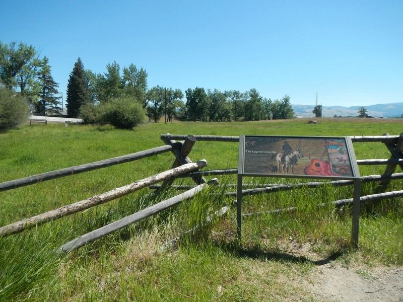
The Homestead Act of 1862 and the Desert Land Act of 1877 allowed private land ownership. Homesteaders had to build fences to keep out the open range cattle. Their work became easier when the 1874 Glidden patent lead to the large-scale production of . . . — — Map (db m210112) HM
Placer Mining
1864- 1875
Early pioneers used placer mining, or gold panning, which relied on water to separate waste rock from the gold (placer ore). Gold is heavier and sinks to the bottom. Placer mining tools generally include the . . . — — Map (db m205897) HM
The Anaconda Co. broke ground for the Berkeley Pit in 1955.
More than a dozen Butte mine yards were dismantled and relocated. Also, the residential communities of East Butte, Meaderville, McQueen, Dublin Gulch, and Finn Town were uprooted. Many . . . — — Map (db m205890) HM
What is in the Water
METALS
The water has very high concentrations of copper, cadmium, cobalt, iron, magnesium, and zinc. All of these metals occur naturally in minerals found in the underground mines and Berkeley Pit. The water also . . . — — Map (db m205898) HM
How Did the Water Get in the Pit?
During the years of underground mining, pumps were used to keep groundwater from filling the underground workings. The main pump station was located on the 3,900 foot level of the Kelley Mine. The pumps . . . — — Map (db m205896) HM
The 100th longitudinal line west of Greenwich was the major goal set by Congress in building the first transcontinental railroad.
Construction of the Union Pacific track reached the Meridian on October 5, 1866.
To celebrate this record-breaking . . . — — Map (db m123869) HM
When Lewis and Clark explored here in 1804, they found the river twisting and turning, changing its course, creating sandbars and islands that were (missing) or seasonal gone the next. Had they visited 100 years later, they could have heard . . . — — Map (db m287508) HM
From Water to Watts
The nearby switchyards, towers, and high voltage power lines deliver electricity from Hoover Dam generators to Southwestern cities.
The Western Area Power Administration (WAPA) operates and maintains the Hoover - . . . — — Map (db m285167) HM
The Bureau of Reclamation welcomes you to Hoover Dam, one of the exceptional engineering achievements of the 20th Century.
Hoover Dam and Lake Mead have provided a reliable supply of water and affordable electricity to the people of the . . . — — Map (db m285528) HM
The Bureau of Reclamation welcomes you to Hoover Dam, one of the exceptional engineering achievements of the 20th Century.
Hoover Dam and Lake Mead have provided a reliable supply of water and affordable electricity to the people of the . . . — — Map (db m292495) HM
Lake Mead began filling in 1935 while Hoover Dam was under construction. It is the largest man-made reservoir in the United States and is approximately 112 miles long with 247 square miles of surface and a depth of approximately 500 feet when at . . . — — Map (db m254445) HM
This was the communications center of Goldfield from 1906 until 1963. From 1904 to 1920, Goldfield boomed as a gold producing center. It was the largest (20,000+) city in Nevada during that period, having four railroads and other modern . . . — — Map (db m114228) HM
Constructed in 1872 by James D. O’Sullivan and Patrick J. Kelly, the historic Sullivan & Kelly Ditch was built to irrigate their ranches located in the northeast Truckee Meadows. Enlarged in 1877, the ditch originally measured three-and-one half . . . — — Map (db m308252) HM
Abel Crawford and son, Ethan Allen Crawford, built the first Crawford House in 1828. It was run by Ethan's brother, Thomas, until sold in 1852. Fires in 1854 and 1859 destroyed the original inn and a replacement. Col. Cyrus Eastman erected the . . . — — Map (db m75236) HM
Settled in 1766 by Jaasiel Harriman whose cabin was near the Great Rock. His nine year old daughter Mercy carried dirt in her apron to the top of this unique rock formation. Here she planted corn, pumpkins and cucumbers, making the first garden . . . — — Map (db m74569) HM
The Curran Suspension Bridge, and its engineer, Kenneth Curran, enjoy a long and rich history in the Town of Littleton, a history that reflects the industrious, self-reliant nature of both town and benefactor.
The Curran Bridge is the . . . — — Map (db m116228) HM
In 1869 a steam pump was
purchased by the cotton mill,
formerly located here.
It was capable of drawing
600 gallons of water per minute
from the river for fire suppression.
The company generously offered
its use to fight town . . . — — Map (db m260864) HM
This dam was built in 1920 replacing a
wooden one constructed in 1883. Its purpose
vas to supply power to the Cotton Mill
downstream owned by Exeter Manufacturing
Company. It is 422 feet long, 21 feet high and
has an ogee spillway of 139 feet. . . . — — Map (db m260909) HM
Carved in ca.1894 by Carroll Farnsworth (1884-1986)
while a student at Ball-Farnsworth District 3 School,
at NW corner of Faxon Hill Rd. and King St.
Latter [sic] Carroll was an instructor. — — Map (db m230415) HM
Primary seacoast lights were located to warn mariners of their proximity to land, the presence of navigational dangers, and to help set their course. By 1852, however, lighthouses and lightships often looked so much alike that it was difficult to . . . — — Map (db m114571) HM
As war clouds gathered in the late 1930s, the Army started building massive fortifications at the entrance to the Delaware River and Bay. Called Fort Miles, the main batteries and headquarters were at Cape Henlopen, Delaware, near the main . . . — — Map (db m39716) HM
This is a replica of the arch that once spanned Pacific Avenue at Cresse Avenue and was donated by the Beautification Committee to the Borough of Wildwood Crest.
Dedicated by the Wildwood Crest Beautification Committee July 11, 2007 — — Map (db m285305) HM
This steel causeway follows two pipelines which supplied water and water power to the old town of Graham where gold and silver ores were milled from nearby mines in the 1890's. The causeway clings to the sides of a sheer box canyon in Saltwater . . . — — Map (db m280099) HM
The Dwelling House or "Bell House" contained a kitchen, large community dining rooms, and retiring rooms (bedrooms). At the height of this community, 100 Shakers lived in the main building and the 'T' shaped wing. On its roof in a cupola, hung a . . . — — Map (db m115659) HM
The Brethren's Shop was used by the men and boys for various crafts including shoe making and tinsmithing. The porches and dormers were added in 1930 and the building is now used by Albany County as offices.
A date stone in the basement is . . . — — Map (db m115662) HM
The Shakers stored milk in the creamery to keep it cool. Milk was brought from the barn in large milk cans, which were then kept cool in troughs filled by water diverted from the creek. Later the building was used as a hen house; now it is used . . . — — Map (db m115688) HM
This brick building was used by the ministry elders. Each member of the ministry had to perform daily manual labor such as shoe making or tailoring. Elder Chauncey Copeley a cabinet maker, worked in a wing added to the building in 1850. . . . — — Map (db m115660) HM
By 1920, automobiles had become both necessary and fashionable. The Shakers never hesitated to adopt new technology that would make life easier and more efficient. They built this concrete garage for their Packard automobilies [sic]. — — Map (db m115671) HM
This Meeting House, or Church, was built in 1848 to replace an earlier (1791) and much smaller Meeting House. It demonstrates many typical characteristics of Shaker architecture; double doors, one for men and one for women; a large meeting room . . . — — Map (db m115663) HM
Shaker Creek provided water for both the canning and laundry operations. The first laundry, done on December 12, 1859, used a steam powered washing machine. Albany County used the building for laundry until the mid 1980s. Today it is a workshop. . . . — — Map (db m115674) HM
Established in 1882, a hill on the site required the removal of 10,000 loads of sand and clay filling a gully on the north side of Elk Street where present houses were built.
Albany 300 - 1686-1986 - Still making History
Erected by Albany . . . — — Map (db m64997) HM
Initiated by William Gorham Rice. Completed in 1927. Restored in 1986 celebrating Albany's Tricentennial of the Dongan Charter through the generous contributions of the citizens of Albany. — — Map (db m64992) HM
In 1835 the City appropriated $1,000 and citizens raised a fund to enclose it within an iron fence. A fountain, the first in the city, dedicated in 1863. — — Map (db m306894) HM
The Lakehouse that appears in these images is very different than the building that stands in front of you. The existing Lakehouse, designed by J. Russell White, was built of brick and terra cotta in 1929. It replaced the original 1875 wood . . . — — Map (db m144255) HM
Attained its present form in the years 1869-1884 Design attributed to the concepts of renowned Landscape Architect Frederick Law Olmsted — — Map (db m138130) HM
The Village's First Freight and passenger train station was built in 1864, only months after the first train passed through Knowersville. In 1896 the old station was moved south along the tracks. In 1897, it was replaced by the . . . — — Map (db m283535) HM
The present day hydroelectric power plant located at this site is owned and operated by the New York
Power Authority. It was constructed in 1908 when the Mohawk River was dammed, the Waterford Flight
of Locks was constructed, and the Erie Canal . . . — — Map (db m138991) HM
This Greek-revival building was one of several weigh stations along the Canal used to levy the tolls for barges carrying merchandise and farm goods.
Until 1850 freight cargoes were measured by the displacement theory, but this hydraulic type . . . — — Map (db m40999) HM
Town Hall
Town of Guilderland
Est. April 4, 1803
First Officers; Supervisor
Nicholas V. Mynderse,
Clerk Peter G. Veeder
Town of Guilderland 1985
— — Map (db m103165) HM
The most obvious music associated with any church is the sweet and dignified tolling of the church bell. Pictured above is George E. Hipwod, President of the Holy Names Society who presented the bell for placement in the new church.
The bell was . . . — — Map (db m70628) HM
Hanging Bog is a man-made pond built by the Civilian Conservation Corps in the 1930's on then federally owned land. In 1962 Hanging Bog was transferred to New York State. The pond is referred to as Hanging Bog because of its unique mat of floating . . . — — Map (db m86561) HM
1933-1942
Allegany State Park - Salamanca, New York
Camp SP-50 - Red House - Company 1250
Camp SP-51 - Red House - Company 249
Camp SP-19 - Red House - Company 2218
Dedicated this 7th day of October 1990 to the memory of those young men . . . — — Map (db m77525) HM
Welcome to Science Lake, a favorite park attraction with an interesting history. Science Lake was built in 1926 as the new location for a science camp popularly called "The School in the Forest." Chauncey J. Hamlin, president of the Buffalo . . . — — Map (db m104901) HM
Sweet Water Spring Legend has it that the Sweet Water Spring gets its name from a Buffalo druggist who was in the area searching for gold with the property owner, N.L. Mr. Kysor. Evidently when the druggist tasted the water, he pronounced it . . . — — Map (db m60092) HM
During the ice ages of the last 2 million years, glaciers sculpted the land surface forming, amongst other features, the many rounded and elongated hills called drumlins that are seen from the Thruway between Rochester and Syracuse. From this . . . — — Map (db m103583) HM
Lock 52 on the Erie Canal was once a busy place. Built in 1851 and lengthened on the berm side in 1887 to accommodate two boats hitched together in tandem, the lock created a popular stopping point for canal boatmen. The 11-foot lift at Lock 52 . . . — — Map (db m103581) HM
The Erie Canal in Port Byron When the original Erie Canal or "Clinton's Ditch" was completed here in 1819, Port Byron was transformed from a frontier settlement to a thriving canal town. Indeed, the local citizens were so hopeful with the new . . . — — Map (db m103580) HM
At the founding of Chautauqua in 1874, John Heyl Vincent assigned to Dr. W.W. Wythe the task of creating Palestine Park, starting with a makeshift temporary wooden model. The park has evolved to its present permanent location and depicts the . . . — — Map (db m117529) HM
First commercial enterprise in southeastern Chautauqua County
Doctor Thomas Ruston Kennedy built first mill October 1805 after purchase of 3000 acres in the area which became the Town of Poland — — Map (db m60146) HM
Newtown Battlefield Preservation has a special place in the history of African Americans' struggle for equality in the United States. When 180 young African-American men of Civilian Conservation Corps (CCC) Company 1251 arrived to work on . . . — — Map (db m90317) HM
Dr. Edwin Eldridge opened
his park in 1879. Called the
beauty spot of the southern
tier for its gardens. Elmira
bought the park in 1889. — — Map (db m77928) HM
The Chenango Land Trust expresses its graditude Maurice and Barbara Ingraham for having the foresight to protect Chenango Canal Lock 99, the best preserved Chenango Canal lock, Lock purchase and preservation made possible by a grant from the Land . . . — — Map (db m93513) HM
Plattsburgh's oldest public
building. Reverend John Henry
Hopkins, who authored the hymn
We Three Kings was the rector
here from 1872-1877.
Le plus ancien batiment publique
de Plattsburgh. Ce fut le Reverend
John Henry Hopkins et . . . — — Map (db m115224) HM
The Harlem Valley derives its name from "The New York and Harlem Railroad," chartered in 1831 and opened in lower Manhattan in 1832 with horse drawn cars. In 1842 the line crossed the Harlem River, and in 1873 joined the New York Central . . . — — Map (db m116811) HM
David Hannum (1822-1891), horse trader and investor in the hoax, "The Cardiff Giant," and on whose life the 1898 novel DAVID HARUM was based, lived in Homer. Portrayed as a horse trader, banker and humanitarian residing in "Homerville," DAVID . . . — — Map (db m141515) HM
Burned rebuilt 1854 3 floor
Seamans Bros owned 1890 to
1920 W F Allen Block burned
1938 built store station
Frost 1985 Antiques 1990 — — Map (db m131028) HM
Dedicated
May 30, 1893,
to the memory
of those who fought
for the preservation
of the Union.
1861 — 1865
Comrades
G.A.R. - F.C. & L. - W.R.C — — Map (db m131032) WM
Presented to
the First Baptist Church
of
Marathon village,
by
Mrs. D. E. Whitmore,
April 23-1901.
————————————
The Carillon of Bells
is dedicated to
the . . . — — Map (db m131022) HM
Made in Marathon, NY by Climax Company,
erected by Sons of Veterans of the Civil War, 1914
Original pole was 110 feet with arrow weather vane.
*Restored and Rededicated September 8, 2007*
Those who unselfishly gave of their time, talent, . . . — — Map (db m131030) HM
The Largest Community in the valley was Cannonsville, a center of commerce and civic life. Presbyterian Baptist and Methodist Churches served both spiritual and temporal needs. The Cannonsville Community House hosted dances, lectures, and . . . — — Map (db m241779) HM
Named for the signal fires lit by Washington's troops atop our mountain during the American Revolution, Beacon is a city with a rich history dating back 400 years to when Henry Hudson's Half Moon anchored here in this beautiful bay. Beacon . . . — — Map (db m124897) HM
Named for the signal fires lit by Washington's troops atop our mountain during the American Revolution, Beacon is a city with a rich history dating back 400 years to when Henry Hudson's Half Moon anchored here in this beautiful bay. Beacon has . . . — — Map (db m144529) HM
Named for the signal fires lit by Washington's troops atop our mountain during the American Revolution, Beacon is a city with a rich history dating back 400 years to when Henry Hudson's Half Moon anchored here in this beautiful bay. Beacon has . . . — — Map (db m144532) HM
People have mined iron in the Taconic region since the late 1700s. The first iron furnace with a steam-powered bellows was built on this site in 1847. Caleb Maltby purchased the mine in 1861 and the Maltby Iron Company produced a high grade of iron . . . — — Map (db m138098) HM
Conceived in the 1860s, the Poughkeepsie-Highland Railroad Bridge created the only Hudson River crossing between New York City and Albany. Political and financial difficulties prevented the project from getting underway for several years. In 1886, . . . — — Map (db m142777) HM
Walkway Loop Trail
Crossing Walkway Over the Hudson and the Mid-Hudson Bridge, this 3.6-mile loop offers thrilling river views and connects attractions on the Poughkeepsie and Highland waterfronts. It provides a link with 25 miles of rail trails in . . . — — Map (db m37878) HM
Walkway Over the Hudson
A place to enjoy the river and a place to appreciate the wonder of an engineering feat unprecedented in its time with a beauty unsurpassed in our generation.
History
• Completed in 1888, the . . . — — Map (db m37871) HM
A Dam on Tonawanda Creek Tonawanda Creek was the only section of the original Erie Canal that was not man-made. The problem was that the creek level ran 4-½ feet too low. The alleviate this, a wooden dam was constructed in 1823 just west . . . — — Map (db m98569) HM
Extending one mile north from Delaware Park Lake, between Elmwood and Delaware Avenues, the Pan-American Exposition was a spectacular sight to over eight million visitors from May 1 to November 2, 1901. Ornate buildings, embellished with . . . — — Map (db m57079) HM
Early History Converting the mouth of the Buffalo River into a safe and easily navigable harbor was a work of great magnitude and cost. The mouth of the Buffalo River frequently became clogged by sands moving north along the beach towards the . . . — — Map (db m85329) HM
The 1,425-foot south pier as it exists today was built by the Army Corps of Engineers, to strengthen an earlier citizen-built pier that was vital to Buffalo's emergence as a city. In 1820 villagers built a 900-foot pier at this site by placing . . . — — Map (db m84953) HM
In 1987, the New York State Department of State designated the Times Beach area as a significant coastal fish and wildlife habitat. This designation is aimed at protecting the state's most important coastal habitats. Times Beach Nature Preserve is . . . — — Map (db m85308) HM
Nowak Pier in honor of Henry J. Nowak Member of Congress "The Billion Dollar Man" for community service (1966-1992) constructed by U.S. Army Corps of Engineers Buffalo District in cooperation with New York State Departmetn of . . . — — Map (db m97958) HM
• Planning for the Strawberry Island Restoration effort had to take into account the sensitivity of the area in order to avoid negative environmental impacts. • Material added to the island's structure had to be natural-looking, yet still serve . . . — — Map (db m101062) HM
Phase I, The Breach Severe autumn storms in 1992 sped up the erosion of Stawberry Island's southwestern shoreline. In December, the waters of the Niagara River broke through the island and penetrated the lagoon interior. By spring, the . . . — — Map (db m101069) HM
Strawberry Island formed near the end of the Wisconsin Ice Age about 12,000 years ago. When meltwaters broke through gracial till and created the present course of the Niagara River, gravel and sand carried downstream by river currents settled out . . . — — Map (db m101061) HM
You are standing on the bed of the Erie Canal, a 363 mile long, 40 ft. wide, 7 ft. deep "ditich" built from 1817 to 1825 that connected Lake Erie waters with the Hudson River and ultimately the Atlantic Ocean. It unleashed a flood of products, . . . — — Map (db m98540) HM
In 1884, the Tonawanda Gas Light Company was incorporated to supply gas to both Tonawanda and North Tonawanda for street and house lighting. The "gas works" was located on property once owned by Mary Long. Between the Canandaigua and Erie . . . — — Map (db m166212) HM
During the 1800s, many Americans and newly arrived immigrants were eager to move west, but this undertaking proved difficult because of the Appalachian Mountains. A natural barrier running from Alabama through Pennsylvania, New York and on into . . . — — Map (db m77385) HM
An Overview
In the spring of 1823, work on the Erie Canal at this end of the state began with the building of a dam. Its purpose was to raise the water level of Tonawanda Creek 4 to 4 1/2 feet so that its ten-mile stretch between Pendleton . . . — — Map (db m77499) HM
The westernmost leg of the Erie Canal completed in 1825 followed a route paralleling the Niagara River between Tonawanda and Buffalo. From where you are standing, the Canal travelled some ten miles through the mostly unsettled Township of Tonawanda . . . — — Map (db m98556) HM
3542 entries matched your criteria. Entries 201 through 300 are listed above. ⊲ Previous 100 — Next 100 ⊳