6840 entries match your criteria. The first 100 are listed. ⊳
Charity & Public Work Topic
By Sandra Hughes, January 17, 2019
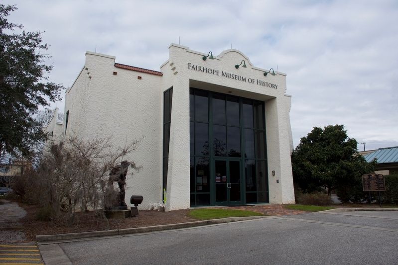
Fairhope Museum of History Marker
| 1 ► Alabama, Baldwin County, Fairhope — Fairhope Museum of History — |
| On 24 N Section Street at Fairhope Avenue, on the right when traveling north on 24 N Section Street. | |||
| 2 ► Alabama, Baldwin County, Foley — Cobb's Light — |
| On Alabama Route 59, on the left when traveling south. | |||
| 3 ► Alabama, Butler County, Greenville — Sherling Lake — Butler County — |
| Near Braggs Road (Alabama Route 263) 0.4 miles north of Sherling Lake Road (County Road 44), on the left when traveling north. | |||
| 4 ► Alabama, Chilton County, Marbury — Memorial Hall — 1904 – 1924 — |
| On County Road 63, 0.7 miles north of State Route 143, on the left when traveling north. | |||
| 5 ► Alabama, Clay County, Delta — CCC Bunker Observation Tower — |
| 6 ► Alabama, Clay County, Delta — Civilian Conservation Corps — |
| 7 ► Alabama, Colbert County, Leighton — William Leigh — Founder of Leighton — |
| On Old Hwy 20 east of Morgan Drive, on the right when traveling east. | |||
| 8 ► Alabama, Colbert County, Muscle Shoals — Building a New Future — |
| Near Reservation Road, 1 mile east of Alabama Route 133, on the left when traveling east. | |||
| 9 ► Alabama, Colbert County, Muscle Shoals — How Does Wilson Dam Work? — |
| On Reservation RD. | |||
| 10 ► Alabama, Colbert County, Muscle Shoals — Natural and Cultural Preservation/Protecting Resources — |
| Near Reservation Road, 1 mile east of Alabama Route 133, on the left when traveling east. | |||
| 11 ► Alabama, Colbert County, Muscle Shoals — TVA Goes to War — |
| Near Reservation road, 1 mile east of Alabama Route 133, on the left when traveling east. | |||
| 12 ► Alabama, Colbert County, Muscle Shoals — TVA: A History of Progress and Innovation / A Valley of Hardships — |
| Near Reservation Road, 1 mile east of Alabama Route 133, on the left when traveling east. | |||
| 13 ► Alabama, Colbert County, Muscle Shoals — TVA: Our Enduring Mission/Powering Prosperity — |
| Near Reservation Road, 1 mile east of Alabama Route 133, on the left when traveling east. | |||
| 14 ► Alabama, Colbert County, Muscle Shoals — Wilson Dam — |
| 15 ► Alabama, Colbert County, Muscle Shoals — Wilson Dam and the TVA System — |
| On Reservation Road. | |||
| 16 ► Alabama, Colbert County, Muscle Shoals — Wilson Dam: Cornerstone of the TVA System — |
| Near Reservation Road, 1 mile east of Alabama Route 133, on the left when traveling east. | |||
| 17 ► Alabama, Colbert County, Muscle Shoals — Wilson Dam: Setting the Stage — |
| Near Reservation Road, 1 mile east of Alabama Route 133, on the left when traveling east. | |||
| 18 ► Alabama, Colbert County, Tuscumbia — Ethel Davis Plaza — In Memory of — Ethel Davis, Artist — |
| On North Water Street, on the right when traveling south. | |||
| 19 ► Alabama, Colbert County, Tuscumbia — Ivy Green — Birthplace of Helen Keller — |
| 20 ► Alabama, Colbert County, Tuscumbia — The Challenge / The Response — |
| On North Jefferson Street. | |||
| 21 ► Alabama, Colbert County, Tuscumbia — Yellow Fever Epidemic 1878 / The 31 Victims of Yellow Fever Who died in Tuscumbia — |
| On North Main Street at North Commons Street, on the left when traveling north on North Main Street. | |||
| 22 ► Alabama, Cullman County, Cullman — Johann Gottfried Cullmann — |
| On 2nd Ave., NE. | |||
| 23 ► Alabama, Dale County, Ozark — Clarence Dowling Barnard — |
| On West Andrews Avenue (Route 249) east of Fairwood Circle, on the right when traveling west. | |||
| 24 ► Alabama, DeKalb County, Fort Payne — Indians, Settlers, and Tourists — Little River Canyon National Preserve — |
| Near Little River Falls Overlook Trail, 0.1 miles west of State Road 35. | |||
| 25 ► Alabama, Etowah County, Gadsden — Sisters Missionary Servants Of The Most Blessed Trinity — |
| On South 1st Street at South 3rd Street, on the right when traveling north on South 1st Street. | |||
| 26 ► Alabama, Franklin County, Red Bay — Red Bay School — |
| On 1st Street Southeast at 4th Avenue South (Alabama Route 24), on the right when traveling north on 1st Street Southeast. | |||
| 27 ► Alabama, Geneva County, Geneva — Emma Knox Kenan Library — Founded 1904 — |
| On South Commerce Street (Alabama Route 27) north of East Church Avenue, on the right when traveling south. | |||
| 28 ► Alabama, Jackson County, Dutton — Town of Dutton — |
| On Main Street at Browntown Road (County Road 47/416), on the left when traveling north on Main Street. | |||
| 29 ► Alabama, Jackson County, Skyline — Skyline Farms — |
| On County Road 25 at County Road 107, on the right when traveling north on County Road 25. | |||
| 30 ► Alabama, Jackson County, Skyline — Skyline School — |
| Near County Road 25 south of Paradise Lane, on the right when traveling south. | |||
| 31 ► Alabama, Jefferson County, Bessemer — Thomas McAdory Owen — (1866-1920) — |
| On Eastern Valley Road south of Elrie Boulevard, on the right when traveling south. | |||
| 32 ► Alabama, Jefferson County, Birmingham — Carrie A. Tuggle — 1858 - 1924 — |
| On 5th Avenue North at 16th Street North, on the left when traveling east on 5th Avenue North. | |||
| 33 ► Alabama, Jefferson County, Birmingham — Donnelly House — |
| On Highland Avenue South, on the right when traveling west. | |||
| 34 ► Alabama, Jefferson County, Birmingham — St. Vincent’s Hospital — Birmingham’s Oldest Hospital — |
| On St. Vincents Drive at University Blvd South, in the median on St. Vincents Drive. | |||
| 35 ► Alabama, Jefferson County, Birmingham — Temple Wilson Tutwiler, II / Tutwiler Hotel — March 22, 1923 - March 1, 1982 — |
| On 20th Street North at 5th Avenue North, on the right when traveling north on 20th Street North. | |||
| 36 ► Alabama, Jefferson County, Birmingham — The Works Progress Administration |
| Near Valley View Drive west of Richard Arrington Jr Boulevard South. Reported unreadable. | |||
| 37 ► Alabama, Jefferson County, Mountain Brook — First Tuberculosis Sanatorium — |
| On Fairway Drive east of Cahaba Road, on the right when traveling east. | |||
| 38 ► Alabama, Lauderdale County, Florence — Charles Caine Anderson — City of Florence Walk of Honor — |
| On Hightower Place. | |||
| 39 ► Alabama, Lauderdale County, Florence — John Wilkinson Taylor — City of Florence Walk of Honor — |
| 40 ► Alabama, Lauderdale County, Florence — Sculpture Relief Books and Learning — 1921 — |
| On N. Wood Ave.. | |||
| 41 ► Alabama, Lauderdale County, Florence — Wilson Dam — |
| Near South Cox Creek Parkway, 0.5 miles east of Veterans Drive (Alabama Route 133), on the right when traveling south. | |||
| 42 ► Alabama, Lauderdale County, Waterloo — Mud Glorious Mud — |
| On Lauderdale County 1 (County Route 1) 0.8 miles north of Lauderdale County 14 (County Route 14), on the left when traveling north. | |||
| 43 ► Alabama, Lawrence County, Hillsboro — Home of Annie Wheeler — |
| On Alternate U.S. 72 at County Road 377 on U.S. 72Alternate . | |||
| 44 ► Alabama, Lawrence County, Town Creek — The TVA System of Multi-purpose Dams — Wheeler Dam — Built for the people of the United States of America — |
| Near Wheeler Dam Rd (State Highway 101) north of County Road 150, on the right when traveling north. | |||
| 45 ► Alabama, Lee County, Auburn — Chewacla State Park — (CCC) — |
| On Murphy Drive, 0.2 miles east of Wrights Mill Road (County Road 33), on the right when traveling east. | |||
| 46 ► Alabama, Lee County, Loachapoka — Dr. Alexander Nunn / Lee County Historical Society — |
| On Stage Road (Alabama Route 14) 0.1 miles east of Waverly Road, on the left when traveling east. | |||
| 47 ► Alabama, Limestone County, Athens — Courthouse and Poor Farm Fence — |
| On South Jefferson Street near West Washington Street, on the right when traveling north. | |||
| 48 ► Alabama, Macon County, Notasulga — Camp Watts — Named for Thomas H. Watts — CSA Attorney General (1862-63) and Alabama Governor (1863-65) — |
| On Union Camp Road, 0.2 miles north of Cooper Lane, on the right when traveling north. | |||
| 49 ► Alabama, Macon County, Tuskegee Institute — Great Philanthropists — Tuskegee Institute National Historic Site — National Park Service, U.S. Department of the Interior — |
| On University Avenue, 0.2 miles east of Booker T. Washington Boulevard, on the right when traveling east. | |||
| 50 ► Alabama, Macon County, Tuskegee Institute — 4 — Julius Rosenwald — The Tuskegee Civil Rights and Historic Trail — |
| On Moton Drive at Booker T. Washington Boulevard on Moton Drive. | |||
| 51 ► Alabama, Madison County, Huntsville — Civilian Conservation Corps — (C. C. C.) Camp — 1935~1940 — |
| On Monte Sano Blvd Southeast at Highland Plaza Southeast, on the right when traveling north on Monte Sano Blvd Southeast. | |||
| 52 ► Alabama, Madison County, Huntsville — Lowell M. Anderson — Father of Monte Sano Club — |
| On Georgetta Drive, 0.2 miles east of Monte Sano Blvd SE, on the right when traveling north. | |||
| 53 ► Alabama, Madison County, Huntsville — 2 — Making the Water Work — Huntsville Water Trail — |
| Near Fountain Circle Southwest near West Side Square. | |||
| 54 ► Alabama, Madison County, Huntsville — 3 — The Spring Runs Its Course — Huntsville Water Trail — |
| Near Fountain Circle Southwest near West Side Square. | |||
| 55 ► Alabama, Madison County, New Market — Madison County Poorhouse Farm Site and Cemetery — New Market, Alabama — 1870-1923 — |
| On Beth Road just west of New Market Road (County Road 100), on the right when traveling east. | |||
| 56 ► Alabama, Madison County, Toney — Toney Rosenwald School — |
| On Toney School Road, 0.2 miles east of Dan Crutcher Road, on the left when traveling east. | |||
| 57 ► Alabama, Marshall County, Guntersville — Section of Core — |
| On Paddle Wheel Drive (U.S. 431) at Taylor Street, on the right when traveling south on Paddle Wheel Drive. | |||
| 58 ► Alabama, Mobile County, Mobile — Memorial Park — |
| On Government Street (U.S. 90) at Old Government Street on Government Street. | |||
| 59 ► Alabama, Mobile County, Mobile — Mobile City Hospital — |
| On St Anthony Street at North Jefferson Street, on the right when traveling west on St Anthony Street. | |||
| 60 ► Alabama, Mobile County, Mobile — St. John's Episcopal Church — |
| Near South Dearborn Street north of Canal Street, on the right when traveling north. | |||
| 61 ► Alabama, Mobile County, Mobile — The Little Colt — Little Colt of Córdoba — (Potro de Córdoba) — |
| Near South Franklin Street south of Government Street (U.S. 90), on the left when traveling north. | |||
| 62 ► Alabama, Mobile County, Mobile — The Salvation Army in Mobile — |
| On St Francis Street at North Conception Street, on the right when traveling east on St Francis Street. | |||
| 63 ► Alabama, Mobile County, Theodore — The Story of Bellingrath Gardens — A Gift to Posterity — |
| Near Bellingrath Gardens Road (County Route 18) 1.4 miles east of Bellingrath Road (County Route 59), on the right when traveling east. | |||
| 64 ► Alabama, Montgomery County, Hope Hull — Tankersley Rosenwald School — Erected in 1923 — |
| On School Spur Road, 0.3 miles south of Pettus Road (County Road 19), on the right when traveling south. | |||
| 65 ► Alabama, Morgan County, Decatur — Beauty and Hope — Restoring the Vision...Preserving The Legacy — |
| On Prospect Drive at 7th Street, on the right when traveling west on Prospect Drive. | |||
| 66 ► Alabama, Morgan County, Decatur — Rising Sun Lodge No. 29 — Ancient Free & Accepted Masons — |
| Near Bank Street Northeast at Church Street Northeast, on the left when traveling north. | |||
| 67 ► Alabama, Morgan County, Falkville — Original Falkville Town Hall Building / Falkville Water Tower — |
| On East Pike Road (County Road 55) at North 1st Avenue, on the right when traveling east on East Pike Road. | |||
| 68 ► Alabama, St. Clair County, Eden — None — Camp Winnataska — |
| On Camp Winnataska Drive, on the right when traveling west. | |||
| 69 ► Alabama, Talladega County, Talladega — Presbyterian Home For Children — Synod Of Alabama — Presbyterian Church In The United States — |
| On Ashland Highway (State Highway 77) east of Chaffee Street, on the right when traveling east. | |||
| 70 ► Alabama, Tuscaloosa County, Tuscaloosa — Margaret M. DuPont — |
| Near 22nd Avenue. | |||
| 71 ► Alabama, Tuscaloosa County, Tuscaloosa — Queen City Park — |
| Near Queen City Avenue east of Jack Warner Parkway, on the right when traveling east. | |||
| 72 ► Alabama, Wilcox County, Camden — Camden Academy Historic District — Wilcox County — |
| On Claiborne Street (Alabama Route 28/41) 0.2 miles west of Firehouse Road, on the right when traveling west. | |||
| 73 ► Alaska, Denali Borough, Denali National Park — Stephen Tyng Mather — July 4, 1867 - Jan. 22, 1930 — |
| On Park Road, 3.4 miles west of Parks Highway (Alaska Route 3), on the left when traveling west. | |||
| 74 ► Alaska, Juneau Borough, Juneau, Downtown Juneau — Calhoun Ave. Overpass — |
| On Calhoun Avenue north of West 4th Street, on the left when traveling north. | |||
| 75 ► Alaska, Ketchikan Gateway Borough, Ketchikan — Trials by Fire — Frontier, flames and fortitude — |
| On Front Street at Spruce Mill Way, on the right when traveling south on Front Street. | |||
| 76 ► Alaska, Sitka Borough, Sitka — Sitka Woman's Club — |
| On Harbor Drive at Maksoutoff Street, on the left when traveling west on Harbor Drive. | |||
| 77 ► Alaska, Sitka Borough, Sitka — Staton's Steakhouse and Cocktail Lounge — 228 Harbor Drive — |
| On Harbor Drive at Maksoutoff Street, on the right when traveling east on Harbor Drive. | |||
| 78 ► Arizona, Cochise County, Bisbee — Bisbee City Fire Hall — |
| On Naco Road east of Ok Street, on the right when traveling west. | |||
| 79 ► Arizona, Coconino County, Grand Canyon National Park — Albright Training Center History — |
| 80 ► Arizona, Coconino County, Grand Canyon National Park — CCC Legacy — |
| 81 ► Arizona, Coconino County, Grand Canyon National Park — Mission 66 — |
| 82 ► Arizona, Coconino County, Grand Canyon Village — Stephen Tyng Mather — July 4, 1867 — Jan. 22, 1930 — |
| Near South Entrance Road at Yavapai Lodge Road. | |||
| 83 ► Arizona, Coconino County, Page — Colorado River Storage Project / Glen Canyon Dam — Reclamation: Managing Water in the West — |
| 84 ► Arizona, Coconino County, Page — Glen Canyon Dam — Colorado River Storage Project — |
| 85 ► Arizona, Coconino County, Page — Rock Bolts / High Scaling — Reclamation: Managing Water in the West — |
| 86 ► Arizona, Coconino County, Page — Turbine Runner — |
| 87 ► Arizona, Coconino County, Sedona — Carl Richards' Garage — |
| Near Alternate Arizona Route 89, 0.1 miles north of Jordan Road. | |||
| 88 ► Arizona, Gila County, Roosevelt — The Bridge — 1987-1990 — Tonto National Forest — |
| On The Apache Trail (Arizona Route 88 at milepost 242) south of Route 188. | |||
| 89 ► Arizona, Gila County, San Carlos — The Coolidge Dam — |
| On Coolidge Dam Road (Route 3) 9 miles south of US 70 (U.S. 70), on the right. | |||
| 90 ► Arizona, Graham County, Fort Thomas — Melvin Jones International Memorial — Historical Site — |
| On U.S. 70 at milepost 306, on the left when traveling east. | |||
| 91 ► Arizona, Graham County, Safford — Odd Fellows Home — 1920 — |
| Near South 8th Avenue south of West 8th Street, on the right when traveling south. | |||
| 92 ► Arizona, Maricopa County, Apache Junction — Roosevelt Dam — 1989 – 1996 — Tonto National Forest — |
| Near The Apache Trail (Arizona Route 88 at milepost 241). | |||
| 93 ► Arizona, Maricopa County, Apache Junction — The People Who Made It Happen — The Building of a Dam — Tonto National Forest — |
| Near The Apache Trail (Arizona Route 88 at milepost 241). | |||
| 94 ► Arizona, Maricopa County, Phoenix, Central City — Rehabilitation of the Carnegie Library — |
| Near West Washington Street near North 11th Avenue, on the left when traveling west. | |||
| 95 ► Arizona, Maricopa County, Phoenix, Globa — The Original Site of the Desert Mission — Beginnings of John C. Lincoln Hospital — |
| On Eva Street at North 5th, on the right when traveling west on Eva Street. | |||
| 96 ► Arizona, Maricopa County, Scottsdale, South Scottsdale — Charles Miller — 1862 - 1923 — |
| On Indian School Road at Miller Road, on the left when traveling east on Indian School Road. | |||
| 97 ► Arizona, Mohave County, Fredonia — A New National Monument — Pipe Spring National Monument — |
| Near North Pipe Spring Road, 0.3 miles north of Arizona Route 389, on the left when traveling north. | |||
| 98 ► Arizona, Mohave County, Fredonia — Stephen Tyng Mather — July 4, 1867 — Jan. 22, 1930 — |
| Near North Pipe Spring Road, 0.3 miles north of Arizona Route 389, on the left when traveling north. | |||
| 99 ► Arizona, Mohave County, Kingman — Charles Metcalfe Park — |
| Near Grandview Avenue near West Beale Street (Business Interstate 40). | |||
| 100 ► Arizona, Mohave County, Kingman — Locomotive Park — Engine 3759 / Caboose No. 999520 — |
| On West Andy Devine Avenue (Old U.S. 66) at North 1st Street, on the right when traveling west on West Andy Devine Avenue. | |||
6840 entries matched your criteria. The first 100 are listed above. Next 100 ⊳