On Main Street (Alabama Route 18) just north of Fenton Street, on the right when traveling north.
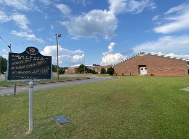
Alabama Christian College of Berry was located on this site from 1912-1922. The College was coeducational and was composed of Primary, Intermediate, Academic, Collegiate, Music Expression and Art Departments. Emphasis was placed on the teaching of . . . — — Map (db m163756) HM
On 1st Street Southeast at 4th Avenue South (Alabama Route 24), on the right when traveling north on 1st Street Southeast.
The first school building was built around 1900 by local citizens. The building was located just across from the Methodist Church. The building was a one-room structure & there were 2 teachers who taught at the school. All pupils walked to school & . . . — — Map (db m83748) HM
On South Commerce Street (Alabama Route 27) north of East Church Avenue, on the right when traveling south.
Mrs. Emma Knox Kenan established the library at the request of school superintendent W.W. Benson in a small cloak room of the Geneva School. The library was financed by subscriptions, book rentals and fund raisers. The property where the library now . . . — — Map (db m131869) HM
On Oak Grove Road, 0.1 miles west of Alabama Route 69, on the right when traveling west.
Tuskegee educator Booker T. Washington and Julius Rosenwald, Sears, Roebuck & Company president, initiated one of the most ambitiuous school building programs for African Americans in the United States. The Oak Grove School is one example of the . . . — — Map (db m83753) HM
On State Street (Alabama Route 69) at Amory Street on State Street.
Merged in 1918 as part of
Birmingham Southern College.
Founded here in 1856
by Methodist Church.
Weathered War and Reconstruction
to prosper in late 1800’s.
Moved to Birmingham in 1918
on merger with Birmingham College,
founded in . . . — — Map (db m83756) HM
On Alabama Route 60 at County Road 59, on the right when traveling east on State Route 60.
One of state's notable academies.
Called “Rugby” of the South.
It prepared exceptional number
of Alabama leaders.
Founded by Dr. Henry Tutwiler,
one of state's foremost educators.
Closed upon his death.
One of first schools to . . . — — Map (db m203636) HM
On County Road 25 at County Road 225, on the right when traveling south on County Road 25.
Founded by Laura L. Ward. Building designed and constructed by Jim McCauley on land given by Glass Maybin. Classes began Sept., 1917. Principals who served school were: J. H. Jackson, W. R. Rosser, Felix Blackwood, Sr., and William B. Ward, Sr. . . . — — Map (db m71809) HM
On North Trawick Street at West College, on the right when traveling south on North Trawick Street.
Side 1
The Southeast Alabama Agricultural School
This school and experiment station was created by Alabama Legislative Act No. 579, February 28, 1889. This was the first school in Alabama to offer free secondary education. SAAS . . . — — Map (db m71808) HM
On County Road 119 at County Road 37, on the right when traveling south on County Road 119.
Lawrenceville
This early cultural, educational and religious center was settled in 1823 and named for Joseph Lawrence, prominent pioneer, farmer, and extensive land owner. A Baptist and a Methodist Church were established here prior to . . . — — Map (db m71825) HM
On North Broad Street (Alabama Route 173) 0.1 miles south of North Railroad Street (County Road 7), on the left when traveling south.
Newville High School
The first known school in Newville was at Center Church in 1881. When Grange Hall was built in 1891, church services and school were held on the first floor. In 1913, Grange Hall was torn down and the wood was used to . . . — — Map (db m71812) HM
On South Main Street south of East Church Street (Alabama Route 52), on the left when traveling south.
After the creation of Houston County in 1903, the old Henry County branch courthouse on the public square in Columbia was converted into the Columbia Elementary School. A bell tower and this bell was added atop the main entrance of the two story . . . — — Map (db m176158) HM
On Jordon Street, on the right when traveling west.
(Front): Cowarts Baptist Church
Cowarts Baptist Church was founded in 1885 when dissension arose in the Congregation of Smyrna. Originally located beside the cemetery, the church was destroyed by fire during the 1890s. It was rebuilt . . . — — Map (db m64865) HM
On West Main Street (U.S. 84) west of Bocage Drive, in the median. Reported damaged.
Near this spot was the boyhood home of Rev. Bob Jones, (1884-1968), D.D., L.L.D., internationally known evangelist and founder of Bob Jones University. The eleventh child of W. Alexander and Georgia Creel Jones, he was three months old when the . . . — — Map (db m191348) HM
On Broad Street (County Road 41) at Bethel Road, on the left when traveling east on Broad Street.
Side 1
Organized in 1882 at nearby Rocky Creek Methodist Church for educational purposes. This school, which occupied approximately seven acres surrounding this marker, was supported by the Methodist Episcopal Church North. This school . . . — — Map (db m73374) HM
On Main Street at Browntown Road (County Road 47/416), on the left when traveling north on Main Street.
The Town of Dutton was incorporated in 1963. The town was named after Marion M. Dutton. The prime reason for incorporating the area was to have an entity in place in order to form the Waterworks Board of Dutton and to be able to borrow government . . . — — Map (db m197512) HM
On County Road 326 at County Road 99, on the right when traveling east on County Road 326.
In 1905. the Methodist Episcopal Church. South. authorized Dr. Frank Gardner and his wife, Annie, to begin Flat Rock School In 1911, Flat Rock High School formally opened. It was the only high school on Sand Mountain north of Albertville. The North . . . — — Map (db m156167) HM
On State Road 65 at County Road 3 on State Road 65.
In 1931, at the height of the Great Depression, Paint Rock Valley citizens raised $2,625 to begin construction of a new school building. Residents gathered native field stones for the façade, which was 18 inches thick when completed. Local sawmills . . . — — Map (db m246852) HM
On South Scott Street at College Avenue, on the right when traveling north on South Scott Street.
College Hill Historic District, located along College Avenue between Scott and Kyle Streets, was nominated to the National Register of Historic Places in 1979. This district was Scottsboro's first subdivision. The area was part of Charlotte Scott . . . — — Map (db m167089) HM
Near County Road 25 south of Paradise Lane, on the right when traveling south.
The Skyline School was built as part of the Skyline Farms Project, a self-help program that the United States government conducted in 1934-1945 for unemployed farmers. Started by the Federal Emergency Relief Administration, the program loaned . . . — — Map (db m167096) HM
On Old Mount Carmel Road (County Route 85) at Ohio Avenue, on the left when traveling west on Old Mount Carmel Road.
During the Reconstruction Period following the Civil War, a freedmen’s community was established in this area called Averyville, named for the Pennsylvania minister and successful businessman Charles Avery, a longtime and faithful champion of Negro . . . — — Map (db m108803) HM
On Eastern Valley Road south of Elrie Boulevard, on the right when traveling south.
Thomas McAdory Owen, son of Dr. William Marmaduke
Owen and Nancy Lucretia McAdory Owen, was born
here on December 15, 1866, at the home of his maternal
grandparents, Thomas and Emily McAdory. A University
of Alabama graduate and lawyer, Owen . . . — — Map (db m215738) HM
On 22nd Street North south of 7th Avenue North, on the right when traveling south.
Southern members of the U.S. Congress in 1956 issued the "Southern Manifesto” that called the U.S. Supreme Court's Brown decision an "abuse of judicial power." By forcing public school integration contrary to social custom,
the high court had . . . — — Map (db m187661) HM
On Reverend Abraham Woods Jr Boulevard at 19th Street North, on the right when traveling east on Reverend Abraham Woods Jr Boulevard.
Shuttlesworth began to dedicate himself to the ministry and enrolled
in Cedar Grove Bible College, a Baptist institution in the Mobile suburb
of Pritchard. He took classes at night while he worked during the day.
The young couple added two more . . . — — Map (db m187628) HM
On 6th Avenue North at 16th Street North, on the left when traveling west on 6th Avenue North.
Built 1992, 520 16th St. N.
The Birmingham Civil Rights Institute contains permanent exhibitions and photo galleries, offering visitors a self-directed
journey through the Civil Rights Movement of the 1950s and
1960s to the human rights . . . — — Map (db m187515) HM
On 5th Avenue North at 16th Street North, on the left when traveling east on 5th Avenue North.
In Tribute to
Carrie A. Tuggle
1858 - 1924
Scholar, Teacher and Christian.
A life of unselfish service
to the troubled and the
homeless black boys and girls.
In 1903, she founded
a school and orphanage,
the Tuggle . . . — — Map (db m27391) HM
On 7th Avenue North at 22nd Street North, on the right when traveling west on 7th Avenue North.
Birmingham's Black schoolchildren played an important role in moving the
city toward ending legal segregation. Under the leadership of SCLC field coordinators, thousands of children left their segregated schools to join the
marches in the downtown . . . — — Map (db m187682) HM
On 7th Avenue North at 23rd Street North, on the right when traveling west on 7th Avenue North.
Many African Americans continued to push for the right to an equal
education that the 1954 Brown decision gave them. Despite angry
threats of violence and intense economic pressure, those first few African American families in Birmingham who chose . . . — — Map (db m187693) HM
On 7th Avenue North west of 23rd Street North, on the right when traveling west.
Community civil rights leaders who helped organize the Movement and embraced the philosophy of nonviolence looked for well-disciplined children with good moral character who would at retaliate if they encountered bullying or violence by White . . . — — Map (db m187690) HM
Near 5th Avenue North at 16th Street North, on the left when traveling east.
Dedicated to
Dr. Ruth J. Jackson
1898-1982
This woman of strength and vision graduated from the Poro School of Cosmetology, the first black registered school in the State of Alabama. At the vanguard of the Civil Rights Movement, she was . . . — — Map (db m27090) HM
On Park Place east of Richard Arrington Jr Boulevard North, on the left when traveling east.
Black leaders debated how best to educate their children to live in a racially segregated society. Former slave Booker T. Washington, founder
of Tuskegee Institute, was America's leading Black spokesman at the
turn of the 20th century and promoted . . . — — Map (db m187636) HM
On 17th Street North, on the right when traveling south.
Emory Overton Jackson was born on September 8, 1908 in Buena Vista, Georgia to Will Burt and Lovie Jones Jackson. E. O. Jackson and his seven siblings were raised in the middle-class Birmingham enclave of Enon Ridge, located on the west side of town . . . — — Map (db m64736) HM
On Center Street, 0.1 miles north of 10th Court West, on the right when traveling north.
September 1963
The increasing number of new African American
families moving onto Dynamite Hill required the
building of a new school. The city's segregation
laws prevented their children from attending
all-White Graymont Elementary, even . . . — — Map (db m189184) HM
On 8th Avenue West at 3rd Street West, on the right when traveling west on 8th Avenue West.
On September 4, 1963, Graymont Elementary
School was the first public school in Birmingham
to be racially integrated. Two brothers, nine and
eleven years old, accompanied by their father,
James Armstrong, along with Reverend Fred . . . — — Map (db m153229) HM
On Old Leeds Road (County Road 64) 0.3 miles south of Mill Springs Road, on the left when traveling south.
Evalina Brown Spencer founded Highlands Day School in 1958, expanding a daycare she operated in her family's backyard. In 1962, Highlands moved from rented space in St. Luke's Episcopal Church to this site, on land donated by Joseph and Virginia . . . — — Map (db m201032) HM
On 7th Avenue North at 23rd Street North, on the right when traveling west on 7th Avenue North.
[Note: a portion of the wording on the first panel of the marker has been torn away.(See photo #1)]Paired marker
September 9, 1957
In 1957, Rev. Fred Shuttlesworth and his followers in
the Alabama Christian Movement for . . . — — Map (db m187702) HM
On Park Place at 22nd Street North, on the left when traveling east on Park Place.
The National Association for the Advancement of Colored People
(NAACP) used its Legal Defense and Educational Fund and its team of
skilled lawyers to attack the "separate but equal” education laws. Beginning in the 1930s, the NAACP filed lawsuits . . . — — Map (db m187658) HM
On 2nd Avenue South, on the right when traveling north.
Founded in 1841 at Marion in Perry County by Alabama Baptists, Howard College was named for British prison reformer John Howard.
The liberal arts college moved to this site in 1887 and relocated to its present campus in Homewood, Alabama in . . . — — Map (db m26693) HM
On 7th Avenue North west of 23rd Street North, on the right when traveling west.
As Birmingham's civil rights leaders pushed to desegregate city schools, radical opponents in Birmingham pushed back, sometimes violently. Responses against school integration included death threats by telephone to parents who dared send their . . . — — Map (db m187686) HM
On 32nd Street North south of 29th Avenue North, on the left when traveling south.
Another goal of the ACMHR was school desegregation. ACMHR members
like barber James Armstrong filed lawsuits to put their children in
better-funded all-White schools after the U.S. Supreme Court's
landmark 1954 decision in Brown v. Board of . . . — — Map (db m189114) HM
On Park Place east of Richard Arrington Jr Boulevard North, on the left when traveling east.
Immediately after the Civil War, Northern church groups funded by
sympathetic Whites rushed to the South to start elementary schools
and colleges to educate freed slaves. Soon afterward, Blacks took the
lead in educating their own children. . . . — — Map (db m187635) HM
On 5th Avenue North at 16th Street North, on the left when traveling east on 5th Avenue North.
In Tribute to
Pauline Bray Fletcher
1878 - 1970
The First Black Registered Nurse of Alabama
Through self-sacrifice, perseverance founded in 1926 Camp Pauline Bray Fletcher.
Renewing the faith and the good health of all black . . . — — Map (db m27393) HM
On 7th Avenue North west of 24th Street North, on the right when traveling west.
Built 1923, 2316 7th Ave N.
Phillips High School was the flagship school in the center of Birmingham. It was named for John Herbert Phillips, the city's highly-esteemed first school superintendent, who served from 1883 until his death in . . . — — Map (db m187704) HM
On 6th Avenue North at 24th Street North, on the left on 6th Avenue North.
Birmingham's first public school was named for Colonel James R. Powell, the city's first elected Mayor. This energetic promoter also served as the first President of the Elyton Land Company (now Birmingham Realty), which founded the city in 1871. . . . — — Map (db m83835) HM
On Roebuck Boulevard, on the left when traveling east.
In 1850 George James Roebuck and his wife Ann Hawkins Roebuck built a log cabin at the mouth of Roebuck Spring. His Influence and leadership led to the area around it to be known as Roebuck. In 1900 Alabama Boys Industrial School was located . . . — — Map (db m26688) HM
On 22nd Street North at 7th Avenue North, on the left when traveling north on 22nd Street North.
Birmingham had the well-earned reputation of being America's deadliest
defender of segregation in the 1950s and 1960s. Civil rights leaders Rev.
Fred Shuttlesworth, head of the local Alabama Christian Movement for
Human Rights (ACMHR) and Dr. . . . — — Map (db m187681) HM
On 7th Avenue South at 19th Street., on the right when traveling south on 7th Avenue South.
Front of Marker:
Opened as Alabama Medical College in 1859 in Mobile by Josiah C. Nott and other physicians as part of the University of Alabama. Closed by the Civil War in 1861 it reopened in 1868. Reorganized in 1897, it became the . . . — — Map (db m83838) HM
On Park Place east of 20th Street North, on the left when traveling east.
Many social scientists of the early 20th century promoted the false
belief that Blacks were intellectually and socially inferior to Whites and
fit only for service jobs. Blacks, therefore, did not deserve to be educated on the same level as . . . — — Map (db m187633) HM
On 7th Avenue North west of 23rd Street North, on the right when traveling west.
In Alabama, White parents used the 1956 Alabama Pupil Placement Act that
let them “choose” which public schools their children would attend. When
Black parents in Birmingham tried to use the same law to send their children
to White schools, . . . — — Map (db m187685) HM
Birmingham’s first library was organized in 1886 and in 1891 became a subscription library for the general public. In 1908 the Birmingham Public Library Association established a free public library, and the City created an independent Library Board . . . — — Map (db m83856) HM
On Park Place east of 20th Street North, on the left when traveling east.
Thirteen years after the American Civil War, the U.S. Supreme Court
began to uphold Jim Crow segregation laws that kept African Ameri-
cans from enjoying their 14th Amendment rights. Its famous Plessy v.
Ferguson decision in 1896 supported a . . . — — Map (db m187632) HM
On 26th Street South at Hatcher Place on 26th Street South.
Built in 1937 by Gen. Louis Verdier Clark from a design by architect William T. Warren as a community playhouse for cultural activities. It was recognized as one of the best of its kind in the nation. Mrs. Vassar Allen - first president, Bernard . . . — — Map (db m27513) HM
On 22nd Street North south of 7th Avenue North, on the right when traveling south.
Southern governors, mayors and elected officials employed every means to
resist public school integration, even famously using armed state guards to
block Black students from entering. For example, Arkansas Gov. Orval Faubus
called the Arkansas . . . — — Map (db m187680) HM
Near 3rd Street Southwest south of Cotton Avenue Southwest, on the right when traveling south.
From 1820 until 1878 this bell hung in the
belfry of the old Elyton courthouse, one-half mile northeast of this spot. In 1861
Jefferson County boys were mustered in
there and the bell tolled them off to war.
John Felix McLaughlin was one of . . . — — Map (db m216063) HM
Near Myron Massey Boulevard north of 55th Street, on the left when traveling north.
Miles College Leaders. Students Active During Civil Rights Era
The Colored Methodist Episcopal Church founded Miles College in
Fairfield in 1898. During the 1960s, President Lucius Pitts
encouraged students, faculty and staff to become . . . — — Map (db m153232) HM
On Main Street north of Mt. Olive Road/Civic Center Drive, on the right when traveling north.
Virgil Allen Howard, who was born in South Carolina in 1859, came to Alabama in 1884 seeking employment with the Alabama Waterworks. He and Ollie Grace Hogan were married on July 15, 1903 and made their first home in Gardendale on property they . . . — — Map (db m39221) HM
On Lakeshore Drive at Sherman Circle, in the median on Lakeshore Drive.
Multiple purpose Christian university founded 1841 as Howard College by Alabama Baptists at Marion.
Moved to East Lake, Birmingham, 1887. Established on this campus 1957.
Acquired Cumberland School of Law, Lebanon, Tennessee 1961. . . . — — Map (db m27296) HM
On 20th Pl South south of Williamsburg Way, on the right when traveling north.
Nationally acclaimed Jefferson County School which originally served students from Homewood, Mountain Brook, Vestavia, Oak Grove, Irondale, Cahaba Heights, Hoover, Rocky Ridge, etc.
Opened Fall 1949, closed 1996, demolished 2000. Designed by . . . — — Map (db m47786) HM
On Hollywood Blvd at Union Hill Drive, on the left when traveling east on Hollywood Blvd.
This cemetery is the final resting place of many of Shades Valley's pioneer residents. A few of the earliest headstones date from the mid-1850s. Descendants of these settlers helped mold the cities of Mountain Brook and Homewood. Located on property . . . — — Map (db m26294) HM
On Park Avenue, on the right when traveling north.
Summit/Hale Sps., a one-room school, opened on the mountain in 1898. It moved to this site and was named Bluff Park Elementary School with 50 students and funded with community support in 1923. From two-rooms, it expanded to 32 classrooms in 1988. . . . — — Map (db m28486) HM
On Patton Chapel Road west of Montgomery Highway (U.S. 31), on the right when traveling west.
Just after the War Between the States Robert Berry Patton gave seven acres of land, logs from his sawmill to build a church, school and cemetery. He served as the first pastor. Fire destroyed the church in 1908 and 1938. The school served the area . . . — — Map (db m83915) HM
On Old Rocky Rodge Road (County Road 115) at Acton Road, on the left when traveling north on Old Rocky Rodge Road.
A subscription school organized in the 1850’s in Rocky Ridge Cumberland Presbyterian Church. Land deeded by church in 1881 to build a log school. In 1912, Professor E. D. Watkins taught all classes to the 30 students. In 1918, his 15 year old . . . — — Map (db m73065) HM
On Shades Crest Road (County Road 97) at Park Avenue, on the right when traveling north on Shades Crest Road.
Indian, Wagon Trail, now Shades Crest Road, led to popular chalybeate springs. Summit, now Bluff Park, was a resort known for its view, cool air and healing mineral water. In 1899 school / church was built. In 1909 Bluff Park Hotel, built on land . . . — — Map (db m27311) HM
On Shades Crest Road east of Mimosa Lane, on the right when traveling east.
Indian, Wagon Trail, now Shades Crest Road, led to popular chalybeate springs. Summit, now Bluff Park, was a resort known for its view, cool air and healing mineral water. In 1899 school / church was built. In 1909 Bluff
Park Hotel, built on land . . . — — Map (db m28517) HM
On Park Avenue at Rockland Drive, on the right when traveling north on Park Avenue.
51 Structures, 70% residential, built early 20th century to post World War II period.
The 1885 sale of Gardner Hale’s land began the housing development. The 33 acre 1924 Independent Presbyterian Church Children’s Fresh Air Farm, 1923 Bluff . . . — — Map (db m28518) HM
On Eastern Valley Road (State Road 119), on the right when traveling east.
Front:
In 1915, the men of the Mt. Hebron Community cleared the land donated by Bess Simmons for a school. Trees donated by Mitch Poole were placed on Rufus Brasher’s wagon and taken to Will Scott’s sawmill. The school opened in the fall . . . — — Map (db m83918) HM
On Church Street, on the right when traveling east.
In 1821 the first settlers came to this area, later called Waddell. Large numbers of people first migrated here in 1863 with the construction of the Irondale Furnace. Destroyed in the Civil War, the furnace was rebuilt and operated from 1867 to . . . — — Map (db m26769) HM
On Mountain Brook Parkway east of Old Mill Lane, on the left when traveling east.
Robert Jemison, Jr. (1878-1974)
The Father of Mountain Brook
A man of great vision, dreams and enthusiasm, Robert Jemison, Jr. was by far the greatest real estate developer of Birmingham’s 20th century. The Post-Herald newspaper . . . — — Map (db m83922) HM
On Alabama Route 207 south of Hammond Street, on the right when traveling south.
(side 1)
Early settlers in Anderson date back to 1818 when James Anderson settled approximately a mile south of here. The earliest permanent settlement was located about one mile north of here on Anderson Creek around 1825 and was known . . . — — Map (db m133189) HM
African Americans, through enslavement and Jim Crow, constructed campus buildings and worked at the University of North Alabama since its beginnings in 1830, yet they were denied admission as students for 133 years. In 1963, Wendell Wilkie Gunn . . . — — Map (db m156930) HM
This school named Burrell Academy, formerly in Selma, Alabama, was given to Florence by the American Missionary Association. In 1903, Burrell Normal School opened and served African ~American students in grades 1-12. In 1937, the Florence City Board . . . — — Map (db m83940) HM
On Veterans Drive east of South Pine Street, on the right when traveling east.
About 1840, African- Americans began holding religious services in a brick cow shed overlooking the town spring near this site. It was purchased in 1857 by the local Methodists for this congregation, with Robin Lightfoot, a slave, as its pastor. In . . . — — Map (db m156921) HM
On Hermitage Drive (County Route 47) at North Walnut Street, on the right when traveling south on Hermitage Drive.
(side 1)
Coffee High School opened at this site in the fall of 1917. Camilla Coffee donated the land in honor of her late husband, Capt. Alexander D. Coffee, son of Gen. John Coffee, a Founding Father of Florence. Because of her generosity, . . . — — Map (db m104643) HM
On East Ervine Avenue at North Court Street, on the right when traveling west on East Ervine Avenue.
George Washington Foster, planter, built this Greek Revival Mansion. An Act of the legislature was required to close Court Street, In fall of 1864 it was headquarters of Nathan B. Forrest, General, CSA. Foster's daughter, Sarah Independence McDonald . . . — — Map (db m28868) HM
This park was donated to the people of Florence by Dr. Kirk R. and Lillian Cook Deibert who initially acquired this property in 1952. The acreage was once a part of a large ante-bellum plantation owned by Judge Sidney Cherry Posey. In 1875 his heirs . . . — — Map (db m33086) HM
Near Hightower Place south of Veterans Drive (Alabama Route 133), on the left when traveling south.
Dr. E. B. Norton was a member of the U.S. Education Mission sent to Japan after World War II to advise Gen. McArthur on the complete reorganization of the Japanese School System, which is still in place today. — — Map (db m219325) HM
Oldest state~supported
teacher college south of Ohio R.
1830 ~ opened as LaGrange College
(Methodist) at nearby Leighton.
First charted college in state.
1855 ~ moved here and re~named
Florence Wesleyan University.
Flourished until . . . — — Map (db m83970) HM
On North Wood Avenue at Tombigbee Street on North Wood Avenue.
Side A The Cypress Land Company reserved this block for educational purposes. In 1847 the Florence Female Academy, consisting of two buildings, was established. The Academy was soon in financial trouble. Despite a $20,000 contribution from . . . — — Map (db m83973) HM
The lion habitat is named in honor of George H. Carroll (1926-1998), a long-standing friend and supporter of the University of North Alabama (UNA). Mr. Carroll was the loving husband of Virginia Sego Carroll and father of Steven, Judy, and George . . . — — Map (db m35658) HM
On Gilbert Circle, on the right when traveling east.
Gilbert School, named in honor of Henry C. Gilbert, school superintendent 1892-1904 and long time member of Board of Education was built in 1920, costing $79,000. The structure was planned by George D. Waller, architect. A relief sculpture . . . — — Map (db m83988) HM
As Deputy Director-General of UNESCO,
Dr. John W. Taylor pioneered international programs
following WWII aimed at ending illiteracy by
promoting education within communities. He
introduced an early version of distance learning
through . . . — — Map (db m219310) HM
Named for Alabama's first United States Supreme Court Justice, John McKinley made his home in Florence, Alabama from about 1821 to 1842. Born May 1, 1780 in Culpepper County, Virginia, he died July 19, 1852 and is buried in Louisville, Kentucky. . . . — — Map (db m28930) HM
On Mars Hill Road, on the right when traveling north.
Built by Theophilus Brown Larimore and his wife, Esther Gresham Larimore, as a home and educational center. Near site of foundry and arsenal of War Between The States, it served as a school, 1871-1887, to train ministers and Christian workers of the . . . — — Map (db m35261) HM
On this site Nicholas Marcellus Hentz conducted a girls' school. Native of Metz, France, Hentz was a painter, entomologist, author, and was once a professor at University of North Alabama. Experimenting with silkworms, he planted groves of mulberry . . . — — Map (db m84029) HM
On North Locust Street at West Mobile Street, on the right when traveling north on North Locust Street.
Part of the city's first residential area, this district contains a variety of architectural styles. Originally the dwellings were log cabins. An early sawmill on Cypress Creek and a nearby brick yard provided lumber and bricks for many of the . . . — — Map (db m156926) HM
Born in Tuscumbia, Lived in Sheffield Daughter of Robert Burns Lindsay, Governor of Alabama 1870.
Teacher of Alabama's first kindergarten - 1898.
Ranks as one of the greatest kindergarten teachers in the world. Author of 14 books for children. . . . — — Map (db m84041) HM
At age 16 in 1982, Maurice Causey won a Ford
Foundation Scholarship to the American School of
Ballet. He has served at Ballet Master for
the Royal Swedish Ballet and the
Netherland Dance Theater.
Inducted 2018 — — Map (db m219179) HM
On Dr. Hicks Boulevard, on the right when traveling west.
First school in Florence Public school system built 1890 on land given by Governor Robert M. Patton. It was occupied in 1891. Designed originally to serve all white elementary school children of Florence. Usually served six grades divided into nine . . . — — Map (db m84042) HM
On Burrell Street at White Street on Burrell Street.
In early 1840s about 14 African-American members from First Methodist formed own congregation “Church Springs” near South Court Street. In 1857, a nearby brick cow shed was converted for its use under Rev. Robin Lightfoot who became a . . . — — Map (db m84050) HM
This sculpture relief was created by James W. Stoves and placed above the entrance to Gilbert Elementary School in 1921. In 1980, following the demolition of Gilbert school, it was moved to Hibbett Middle School. Because of its theme which relates . . . — — Map (db m84048) HM
On North Court Street south of East Irvine Avenue, on the right when traveling south.
Built by John Simpson in 1843, on the site of his earlier home, this residence was occupied at various times by both armies during the Civil War. Purchased in 1867 by George W. Foster, builder of Courtview, for his daughter, Virginia, and her . . . — — Map (db m45808) HM
The Wesleyan Bell was manufactured by the C.S. Bell Company in Hillsboro, Ohio, it is made of alloy steel, has a diameter of 38 inches, and is 24 inches high (not including its yoke). The weight of the bell is 660 pounds. When 350- pounds mountings . . . — — Map (db m28881) HM
Chartered 1856 as Florence Wesleyan University, R.H. Rivers, President. Regarded as North Alabama's most eminent landmark, this Gothic Revival Structure was designed by Adolphus Heiman, Nashville, And built by Zebulon Pike Morrison, Florence, as new . . . — — Map (db m28864) HM
Educator and geographer Dr. William R. ("Bill)" Strong received the National Council for Geographic Education's distinguished Teaching Award (1986).
As Geographer-in-Residence at the National Geographic Society
(1991-1993), he earned its . . . — — Map (db m219338) HM
In 1947, Dr. Willie H. ruff, III was selected for the All-Black 766th Air Force Band, playing at every Air Force Base in the U.S. As Professor of Music at Yale University, 1971-2017, his teaching inspired students from across the globe.
Inducted . . . — — Map (db m219301) HM
As the Head Coach for the football team at the University of North Alabama, Robert Hue ("Bobby") Wallace's team earned three consecutive Division II National Championships (1993-1995),
and he was named Division II Coach of the Year three . . . — — Map (db m219300) HM
On Hermitage Drive at N.Cherry Street, on the left when traveling west on Hermitage Drive.
Coffee High School was located at this site from 1951 to 2004. From 1917 to 1950 it was located three blocks southwest, on the north side of Hermitage Drive at the intersection of North Walnut Street. Growth of the school over the years at that . . . — — Map (db m238220) HM
On Simmons Lane (County Route 243) at Waterloo Road (County Route 14), on the right when traveling west on Simmons Lane.
West End High School
1957-1969
West End High School was located here in the Oakland Community, less than a half-mile east of this location.
It was the first high school for African-Americans in western Lauderdale County, and the second in . . . — — Map (db m232313) HM
On Alabama Route 101 at County Route 71, on the right when traveling south on State Route 101.
Descended from early Lauderdale County pioneers, Andrew Lee Phillips established a general merchandise store here in 1888. Later, he owned and operated a gin, grist mill, and flour rolling mill. In 1917, he was responsible for the city's first bank . . . — — Map (db m176948) HM
On Lovers Lane (County Route 610) west of Lambs Ferry Road, on the right when traveling east.
East End High School was the first school for African-American students in eastern Lauderdale County. Several elementary schools for Africian-American children were established in the area, including the Rogersville School located on the north . . . — — Map (db m215931) HM
15324 entries matched your criteria. Entries 101 through 200 are listed above. ⊲ Previous 100 — Next 100 ⊳