Near Cabrillo Highway (California Route 1), on the right when traveling south.
Drawn to this wild, remote coast
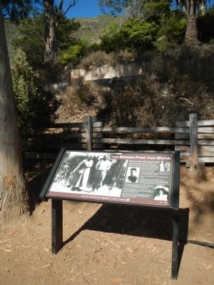
Traveling the difficult route along the coast in October of 1869, Michael and Babara Pfeiffer were forced to winter in Big Sur and decided to stay. Their daughter, Julia, was just 11 months old at the time. . . . — — Map (db m68634) HM
Kalisa Moore, known as "Queen of Cannery Row," was born in Latvia and came to America after WWII. She bridged the eras, opening her gourmet restaurant when most of the canneries had closed.
Over the years "Kalisa's" became a bohemian coffee . . . — — Map (db m81817) HM
This Monument pays tribute to the many diverse characters vital to the evolution of Cannery Row. Perched atop the rocky outcropping sits Nobel Prize winning author John Steinbeck, who immortalized Cannery Row with his novel of the same name. He is . . . — — Map (db m81813) HM
Prior to World War II, only women were allowed to work on cannery lines (top). In some canneries, only “white American women” were allowed to pack fish. Working the lines was considered “women’s work.” Even if there were men . . . — — Map (db m55190) HM
Near Ocean View Boulevard, 0.1 miles north of David Avenue, on the right when traveling north.
You are in the center of what used to be one of the largest Chinese fishing villages on the West Coast. From 1853 to 1906, this was the region's Chinese cultural capital.
The village was unique among Chinese settlements of the time, because it . . . — — Map (db m165547) HM
In her home which occupied this site, Lola’s Social Salon 1853 – 55 attracted men of vision whose investments and technology founded Nevada County’s gold quartz mining industry. She brought culture and refinement to this rude mining camp. A . . . — — Map (db m149201) HM
Built by the Reverend Thomas J. Dalton and dedicated May 2, 1865 by Bishop Eugene O’Connell as Sacred Heart Convent and Holy Angels Orphanage. Under the Sisters of Mercy it served from 1866 to 1932 as the first orphanage of the Northern Mines. It . . . — — Map (db m12898) HM
Near Broad Street west of California Route 20, on the left when traveling west.
To commemorate that ubiquitous segment of society who have been unacknowledged; who, though obscure, made an essential contribution to the settlement of the West. — — Map (db m126628) HM
On Nevada Street north of Broad Street, on the right when traveling north.
Home of Ida Colley and niece, Winifred Mulloy, founders of Laurel Parlor #6 Native Daughters of the Golden West. Now Deer Creek Inn Bed & Breakfast. — — Map (db m229296) HM
Near State Highway 89, 0.6 miles north of Alder Creek Road, on the right when traveling north.
In February, 1847, the first relief party from Sutter's Fort arrived. Two more relief parties came in March. These relief parties took 14 people from here out across the frozen Sierra. Only 11 survived (8 were children). Five people remained at . . . — — Map (db m146235) HM
History
Today each August hundreds of swimmers take to the 65º water of Donner Lake and swim its 2.7 mile long length. Each swimmer has lots of company.
On August 19 (sic, 18), 1935 though, it was a different story. On that day 17 . . . — — Map (db m129739) HM
On Sycamore Street, on the right when traveling east.
This statue is the oldest public works of art project of its type in Orange County. Sponsored by the State Emergency Relief Administration, the Anaheim Rotary Club and the City of Anaheim, it was originally dedicated on September 15, 1935. . . . — — Map (db m51967) HM
This courtyard was dedicated September 17th 1999 in loving memory of Michelle Carew. Her spirited battle against leukemia raised awareness of the National Marrow Donor Program throughout this country. In the process, her legacy has saved countless . . . — — Map (db m311) HM
On Beach Boulevard at 11th Street, on the right when traveling south on Beach Boulevard.
Since its establshment in a newly created Orange County (1889), the Buena Park Woman's Club has influenced the civic life of its community. The club helped establish a volunteer fire department in 1915, a library district in 1919, and the town's . . . — — Map (db m50036) HM
On South Euclid Street, on the right when traveling north.
This two-acre site is dedicated to preserving a visible link to early Garden Grove. Edward G. Ware settled here in 1876 becoming a prominent rancher. His daughter L. Agnes Ware Stanley, was an early school teacher. Deeded in 1970 to the Garden Grove . . . — — Map (db m49992) HM
On Main Street south of Yorktown Avenue, on the left when traveling south.
Established in 1963 by Huntington Beach City Council to honor each Miss Huntington Beach Queen with the planting of a new rose every year. The first Miss Huntington Beach was crowned on July 4th, 1910 to represent the city in the annual Independence . . . — — Map (db m228029) HM
Lewis and Nellie Gail Moulton's daughters, Charlotte and Louise, circa 1918 in a wicker buggy at the Moulton Ranch House. Both the guggy and the Girls' beloved horse "Dicky" were purchased from the Pasadena Rose Parade. The hand-drawn, illustrated . . . — — Map (db m226414) HM
Near Cabot Road south of La Paz Road, on the left when traveling south.
Nellie Gail Moulton with Charlotte in a buggy on Moulton Ranch with Saddleback Mountain in the distance, circa 1915.
A Moulton Ranch Roundup with teams roping and branding cattle near the corral with foreman "SI" Salustiano Sansinena on the . . . — — Map (db m226423) HM
Near Olympiad Road at San Marcos, on the right when traveling north.
Born on December 21, 1959, to Robert Griffith and Florence Deloris Griffith, Florence Delorez Joyner accomplished more in her thirty-eight years on this earth than many people could achieve in one hundred.
Known to millions as Flo-Jo, . . . — — Map (db m189687) HM
Near Olympiad Road at San Marcos, on the right when traveling north.
Florence Joyner Olympiad Park marks the 36th park to be built in the City of Mission Viejo. Dedicated to the memory of Florence Joyner, the 17-acre park reflects her flair for style and her cherished values and ideals, including love of family, . . . — — Map (db m189686) HM
The city of Mission Viejo honors Megan M. McClung who died December 6, 2006 during Operation Iraqi Freedom while serving in the United States Marine Corps, I Marine Expeditionary Forces Headquarters Group. She will be remembered as a hometown hero . . . — — Map (db m215665) HM WM
Near Jeronimo Road east of Via San Fernando, on the right when traveling east.
Artist Marilyn Brame designed the Mountain Wall in 2001, as part of the Terra Native/Celebration of the Native Land Earth Day event.
Constructed or concrete with an overlay of mosaic tiles, the Wall educates the community about the . . . — — Map (db m230933) HM
On Olympiad Road just south of Marguerite Parkway, on the right when traveling south.
The Women's Individual Road Race was the first event of the 1984 Summer Olympics and the first time women's cycling event was included in the Olympic program. The race was held at 9:00 am on Sunday, July 29th 1984. Jeannis Longo-Ciprelli of France . . . — — Map (db m189684) HM
On Center Street south of Chapman Avenue, on the left when traveling south.
Women’s Club of Orange, established 1915.
Old Towne Preservation Association.
This property is within the Old Towne Orange Historic District, placed on the National Register of Historic Places by the United States Department of the . . . — — Map (db m241287) HM
Near Avenida de los Fundadores west of Via Ricardo, on the right when traveling north.
On September 11, 2001 Rancho Santa Margarita resident Lisa Frost was a passenger on the ill fated United Airlines Flight 175. The flight from Boston to L.A. was hijacked and crashed by terrorists into the south tower at the World Trade Center . . . — — Map (db m189861) HM WM
On Westminster Boulevard, on the right when traveling east.
(Circa 1929) Bolsa Avenue and Monroe
Midway City, California
Midway City Women's Club
Organized 1928 - Federated 1935 - Incorporated 1935
Primary purpose: To promote moral, educational, welfare and civic measures.
Donated to Westminster . . . — — Map (db m59907) HM
On East Grass Valley Street, on the right when traveling south.
Depot was 100 yards N.E. of this spot. Built by John Flint Kidder between 1874-76. It ran 22 miles from Colfax to Nevada City via Grass Valley. Rails taken up on 1942. Sarah Kidder, widow of builder , world’s first woman railroad president 1901 . . . — — Map (db m14438) HM
Near West Lake Boulevard north of Tahoe Tavern Road.
Basketmaking is a tradition of the Washoe people of the Great Basin that dates back thousands of years. Different types of baskets were made for holding water and cooking, winnowing seeds and nuts, collecting and storing food, catching fish and . . . — — Map (db m233388) HM
This monument dedicated to the memory of
James P. Beckwourth
Born in Virginia, the son of a Southern planter and a negro slave, Beckwourth was a trapper, scout and mountain man. He explored the west with Jim Bridger, Kit Carson and Peter . . . — — Map (db m56409) HM
Charlotte (Lotta) Mignon Crabtree, born November 7, 1847, New York City. Moved to Grass Valley California in late spring of 1853. In the fall of 1854, the Crabtrees moved to Rabbit Creek (La Porte). Mart Taylor, a saloon owner with a small theater, . . . — — Map (db m56298) HM
On West Hays Street at North 2nd Street, on the right when traveling west on West Hays Street.
Built in 1915, the Banning Woman's Club Clubhouse is a frame building in the classical revival style with a plain entablature, simple doric columns, and palladian windows, as well as providing a meeting place for the woman's club, the socal and . . . — — Map (db m50710) HM
On Indio Boulevard east of Smurr Street, on the right when traveling south.
Dr. June Robertson McCarroll was born June 30, 1867 in the Adirondacks and began her medical career in Chicago. She left a promising practice for Indio in 1904. Becoming the sole practicing physician for the entire Coachella Valley. She traveled by . . . — — Map (db m78540) HM
On Bradley Road south of Newport Road, on the right when traveling south.
Built in 1890 on 1-1/2 acres of land donated by William
Snoddy, the 2-classroom school joined a general store and
blacksmith shop as the hub of the community. It served as
an elementary and high school by day and civic meeting place
at night . . . — — Map (db m176744) HM
On Mission Inn Avenue at Lime Street, on the right when traveling west on Mission Inn Avenue.
Originally constructed for the YWCA on land donated by Frank A. Miller. Designed in a Spanish
Revival style by architect Julia Morgan. Purchased by the Riverside Art Association in 1966. — — Map (db m176365) HM
Near Deer Hollow Way, 0.1 miles north of Pechanga Parkway (County Road 16), on the left when traveling north.
Patricia H. Birdsall (Pat) was known for her genuine love for Temecula, and for her countless hours of volunteer service for the benefit of the entire Temecula Valley.
Prior to the city's incorporation in 1989, Pat served for many years as a . . . — — Map (db m195086) HM
On Warhawk Way, on the right when traveling south.
monument front:
Jacqueline Cochran
(1906-1980)
Woman Pilot, Record Setter, WASP, Ninety-Nine
First Woman to Break the Sound Barrier
Charter Member of the Coachella Valley Chapter of Ninety-Nines
Jackie Cochran . . . — — Map (db m114556) HM
This commemorative bell celebrates a combined century of service by the California Federation of Women’s Clubs and California State Automobile Association including the establishment of bell markers along the historical El Camino Real. — — Map (db m14819) HM
[A tree was planted in the memory of Jean Bell Kellogg. At the foot of the tree lies this marker] Charter member of Sumner Woman’s Relief Corps No.11, Auxiliary to the Grand Army of the Republic, Founded 1885. — — Map (db m15012) HM
This sculpture commemorates the 150th anniversary of the Sisters of Mercy caring for those in need to the greater Sacramento region. Mary Baptist Russell, California Foundress of the Sisters of Mercy, is depicted here as a woman of vision, courage . . . — — Map (db m14840) HM
On K Street at 19th Street, on the right when traveling east on K Street.
A bisexual poet, journalist, and political activist. Among the first generation born free in the South after the Civil War and a daughter of a slave, she was one of the prominent African Americans involved in the artistic flourishing of the Harlem . . . — — Map (db m171821) HM
Near K Street at 19th Street, on the right when traveling east.
Charlotta Bass was an educator, newspaper publisher-editor, and activist. She also
focused on various other issues such as housing rights, voting rights, and labor rights, as
well as police brutality and harassment. In 1952, Bass became the first . . . — — Map (db m171824) HM
Clara Shortridge Foltz was the first American female lawyer on the West Coast and the
pioneer of the idea of the public defender. During a career that spanned 56 years, Foltz
almost single-handedly pushed a great deal of progressive legislation . . . — — Map (db m171852) HM
On 19th Street at K Street, on the right when traveling north on 19th Street.
Dr. Chung advocated for the voting rights of Chinese and American women through her
activism in the Woman's Auxiliary of the Chinese American League of Justice, the Chinese
Protective Association, and the Chinese Women's Reform Club.
Dr. . . . — — Map (db m171553) HM
On 19th Street near K Street, on the right when traveling north.
Inspired by Jewish teachings, Weil stood courageously at the forefront of a wide range
of progressive and often controversial causes, including women's suffrage, labor reform,
and civil rights. She worked tirelessly to extend political, economic, . . . — — Map (db m171468) HM
Rankin organized and lobbied for legislation enfranchising women in several states
including Montana, New York, and North Dakota. She was the first woman to hold
federal office as a member of the U.S. House of Representatives where she . . . — — Map (db m171578) HM
As a teacher, writer, editor, and activist, Idár preserved Mexican culture in South Texas
and encouraged women to pursue an education and push for equal rights. While
working as a journalist, she became the president of the newly-established . . . — — Map (db m171579) HM
On K Street at 19th Street, on the right when traveling east on K Street.
Tribute to Julie SoderlundJulie Soderlund was taken too soon from this world but not without
leaving an indelible mark on the lives of those around her.
Committed to her faith and with a passion for political involvement,
Julie made a . . . — — Map (db m171577) HM
On 19th Street near K Street, on the right when traveling north.
An African American educator and suffragist. Pierce opened the Tennessee Vocational
School for Colored Girls in 1923, and she served as its superintendent until 1939. The
daughter of a slave, Pierce addressed white women at the inaugural . . . — — Map (db m171461) HM
On 19th Street at K Street, on the right when traveling north on 19th Street.
A queer California lawyer, newspaper publisher, and a prominent suffragette. She was
the first woman to run a daily newspaper in the United States and the second female
lawyer admitted to practice in California. Gordon's February 19, 1868 speech . . . — — Map (db m171548) HM
A physician practicing during California's Gold Rush who was also a spiritualist,
businesswoman, and leading Sacramento suffragist. When Sacramento officials denied
her the vote, she sued the city on the grounds that as a taxpaying citizen, she . . . — — Map (db m171896) HM
On K Street at 19th Street, on the right when traveling east on K Street.
The first woman elected to the Sacramento City Council and the first woman to be
elected to the city council of any major city in the United States. She was elected as part of a slate of Progressive candidates, defeating the railroad-aligned . . . — — Map (db m171816) HM
On 19th Street at K Street, on the right when traveling north on 19th Street.
The first woman to receive a PhD. from Columbia University. Even after the passage of
the 19th amendment, Lee was unable to vote because of the Chinese Exclusion Act of
1882 until it was repealed years later. She became a well-known figure in the . . . — — Map (db m171510) HM
The first female Mexican American author to write in English. Who Would Have Thought
It? was the first novel to be written in English by a Mexican living in the United States.
The book was published in 1872 without the author's name on the . . . — — Map (db m171894) HM
On 19th Street near K Street, on the right when traveling north.
A California suffragist and an educator, she campaigned and translated at rallies in
Southern California where suffragists distributed tens of thousands of pamphlets in
Spanish and worked as a translator for the California suffrage movement. She . . . — — Map (db m171533) HM
On 19th Street near K Street, on the right when traveling north.
A Metis Turtle Mountain Band of Chippewa Indians attorney and Native American
rights activist who emphasized the value of traditional Native cultures while asserting
her own place in the modern world as an Indian woman. In 1912, at the age of 49, . . . — — Map (db m171456) HM
On 19th Street near K Street, on the right when traveling north.
An African American suffragist who helped found the National Association of Colored
Women in 1986 and served as its first national president. In addition, she was a
founding member of the National Association of College Women.
In 1950, she . . . — — Map (db m171453) HM
On 19th Street at K Street, on the right when traveling north on 19th Street.
An African American suffragist, civil rights activist, and poet who highlighted the
experience of African American women who were still enslaved by their inability to
vote. She also found that the white women who had organized a children's home . . . — — Map (db m171505) HM
On 19th Street near K Street, on the right when traveling north.
A Californian botanist and botanical artist, Mount Lemmon in Arizona is named
for her, as she was the first white woman to ascend it. She was responsible for
the designation of the golden poppy as the state flower of California, in 1903. . . . — — Map (db m171502) HM
Zitkála-Šá (Lakota: Red Bird), also known as Gertrude Simmons Bonnin was a writer,
editor, translator, musician, educator, and political activist. In 1926 she and her husband
founded the National Council of American Indians, dedicated to the cause . . . — — Map (db m171898) HM
Near K Street at Interstate 5, on the right when traveling east.
The reform movement of the late 19th century brought women into a new sphere of activity. The desire to improve the good of humanity led women to found cultural organizations and women’s clubs. Women became politically active with child labor, . . . — — Map (db m229889) HM
Near K Street at Interstate 5, on the right when traveling east.
Perhaps nowhere was the impact of women in the workforce more keenly experienced than in the Sacramento area canneries during World War I and World War II. Canning facilities operated at the highest level of production possible. Women dominated the . . . — — Map (db m229972) HM
Near Laburnum Avenue south of Junction Avenue, on the left when traveling south.
Till on, sweet sisters from a golden shore; Emma and Anna, sing for us once more; Raise high your voices blending in accord: So shall your fame be widely spread abroad. – M.E.H., Boston Daily News
Anna Madah Hyer Fletcher was one half of . . . — — Map (db m227361) HM
Near Riverside Avenue at Magnolia Avenue, on the left when traveling north.
Jennie Hall worked as a nurse during the Civil War beginning in 1862 at the battle of Shiloh. Four days before the battle started, she arrived with her first husband, Ezra Squires, then got to work nursing sick and wounded soldiers. When wounded . . . — — Map (db m227206) HM
Near Cypress Avenue south of Chapel Square, on the right when traveling south.
Dr. Logan came to California in 1850 in search of gold. When the cholera epidemic broke out in Sacramento in October of that same year, he left the gold fields to lend his services to aid the residents of the city.
Dr. Logan wrote the first . . . — — Map (db m226383) HM
Georgia Fisher died on December 27, 1875. Martin Bergman, Georgia’s fiancée, was one of Sacramento’s earliest premiere potters and sculptures. Shortly after her death, Martin, together with his father and brother, created a beautiful monument on her . . . — — Map (db m14034) HM
Near Broadway east of Muir Way, on the right when traveling east.
Jane Norris 1832-1899 On April 11, 1865, a Sacramento woman hatched a secret plan to celebrate the end of the Civil War. Upon learning of Robert E. Lee's surrender to Northern troops, Jane Norris marched to the state capitol's construction . . . — — Map (db m136563) HM
The donation of her late husband’s art collection to the city in 1885 gave Sacramento the first and finest art gallery west of the Mississippi. Other philanthropic gestures during her lifetime, which included generous support of the Protestant . . . — — Map (db m10769) HM
Memorial Grove
Dedicated to those
women who served in
the World War. Capital
City Women's Post
#389 American Legion
May 30, 1939 — — Map (db m110677) WM
Near Lenwood Road, on the right when traveling east.
On August 29, 2023, this location was dedicated to
Susie De Ridder, TA Citizen Driver. Susie grew up in a trucking
family and would often accompany her Dad on trucking trips as a
young girl. She noticed from a very young age the lack of . . . — — Map (db m240867) HM
On Glen Helen Parkway, on the right when traveling west.
Erected in memory of the pioneer women of the San Bernardino Valley who dared to travel across the country by ox team and covered wagon to help lay the foundation for the building of this state. — — Map (db m72579) HM
On Rim of the World Highway (California Route 18).
"I never thought I would outlive the trees"
A century old herself in 2005, and seeing many of her beloved trees bow to beetle and flame, Pauliena Lafuze had done just that. She has been a Lake Arrowhead Woman's Club member since the . . . — — Map (db m30409) HM
On Euclid Avenue (California Route 83) near C Street, in the median.
This fountain was built by the Women's
Christian Temperance Union and dedicated
to this City of Ontario on July 4th 1908, to
provide the town with "a drinking fountain
where only the pure, sparkling water
can be had at any time by the . . . — — Map (db m37513) HM
Near Utah Trail at National Park Drive, on the right when traveling south.
Minerva Hamilton Hoyt was a Pasadena, California gardener and civic leader who loved desert landscapes.
She saw beauty in the desert where others saw an empty wasteland or an opportunity for profit.
Mrs. Hoyt believed that outstanding desert . . . — — Map (db m116862) HM
On Ghost Town Road, 4 miles north of Interstate 15.
Calico’s most distinguished and long time resident was Lucy Bell Lane (1874-1967). Known at one time as the “Queen of Calico”, Lucy lived at Calico for nearly 67 years. Of her many gifts, she is most remembered for her warm hospitality . . . — — Map (db m78579) HM
On Orange Avenue (California Route 75), on the right when traveling south.
Vice Admiral Stockdale was awarded our nation's highest military award, the Medal of Honor, for his extraordinary heroism, conspicuous gallantry, and unparalleled leadership while serving as senior naval officer in the Prisoner of War camps of North . . . — — Map (db m117116) HM
Near Torrey Pines Park Road, 0.9 miles south of North Torrey Pines Road (County Road S21), on the left when traveling south.
“the heart of a nurse, the courage of an astronaut and a capacity to give both generously and wisely” – Thomas O. Scripps
The philanthropist Ellen Browning Scripps (1836—1932) holds a special and endearing place . . . — — Map (db m142943) HM
On Garnet Avenue at Pico Street, on the right when traveling west on Garnet Avenue.
This plaque commemorates the life and influence of a woman who envisioned San Diego beautiful. On this site she operated a nursery and gained world renown as a horticulturist. She was the first woman to receive the International Meyer Medal in . . . — — Map (db m51098) HM
The Old Mint (1869), San Francisco's second, is
California's only such Federal Greek Revival
structure. Due to unsurpassed productivity, it
became a sub-treasury in 1874. Intact after the
1906 disaster, it served as clearing . . . — — Map (db m241572) HM
(English text:)
"Our worst fear is that our painful history during World War II will be forgotten." - former Comfort Woman
This monument bears witness to the suffering of hundreds of thousands of women and girls, . . . — — Map (db m114752) HM WM
On Market Street, on the right when traveling west.
Audre Lorde
(1934-1992)
American writer, political activist,
and self-described black feminist
lesbian mother warrior poet, whose
work confronted racism, sexism
and homophobia — — Map (db m237817) HM
On Market Street east of Castro Street, on the right when traveling west.
Noted politician and civil rights
leader, widely considered to be
the first openly lesbian
representative elected to the
United States Congress — — Map (db m120172) HM
On Market Street, on the right when traveling west.
Josephine Baker
(1906-1975)
African-American born French
dancer, singer, actress, Resistance
fighter and world-famous entertainer
who refused to perform for
segregated audiences — — Map (db m186406) HM
On Market Street at Noe Street, on the right when traveling west on Market Street.
American physician and political
radical who fought for peace, an
eight-hour workday, women's suffrage
and their right to birth control — — Map (db m187158) HM
On Market Street at Castro Street, on the right when traveling west on Market Street.
Physicist and astronaut, the first
American woman in space, where as a
mission specialist she helped to
launch satellites and conduct
scientific experiments
Sally Ride — — Map (db m120150) HM
On 19th Street west of Castro Street, on the left when traveling west.
American feminist, civil rights
activist and cofounder of the
Daughters of Bilitis, the first
social and political organization
for lesbians in the United States. — — Map (db m186782) HM
Then-owner William Roth selected Ruth Asawa, well known for her abstract, wire-woven sculptures, to design and create the centerpiece fountain for Ghirardelli Square. Although it was unveiled among some controversy in 1968, Asawa's objective was to . . . — — Map (db m90225) HM
On Sutter Street near Buchanan Street, on the left when traveling east.
Life in America was full of unknowns for an Issei (Japanese immigrant) departing Japan in the early l900s. She may have come to America as a laborer or accompanying her husband. More likely, she came as a picture bride through an arranged marriage . . . — — Map (db m86487) HM
Inspired by San Francisco in 1883
Became the first world organizer of women.
Standing here in 1883 she said
"We are one world of tempted humanity" — — Map (db m18462) HM
On Sutter Street, on the right when traveling east.
This Property
has been placed on the
National Register
of Historic Places
by the United States
Department of the Interior
Metropolitan Club
Incorporated in 1915 as the
Woman’s Athletic Club of San Francisco
Bliss & . . . — — Map (db m71912) HM
Near Taylor Road north of Sheridan Avenue, on the right when traveling south.
"The enlisted stratum included the noncommissioned officers [sergeants] and their red-armed wives who were the post’s laundresses, and the broods of unkempt urchins who raced round the big black laundry kettles that bubbled over woodfires in the . . . — — Map (db m176594) HM
On 19th Street at Lexington Street, on the right when traveling west on 19th Street.
Here marks the site of the Lexington Club,
"your friendly neighborhood dyke bar" where "every night is ladies' night",
which cultivated a close knit community
among San Francisco's LGBTQ community
over the course of two decades and touched
many . . . — — Map (db m145200) HM
Juana Briones, born in Hispanic California, was a preeminent woman of her time. In the 1830s and 1840s she transformed an isolated cove in the then Mexican hamlet of Yerba Buena into her rancho. At the site of this park she raised cattle and grew . . . — — Map (db m143437) HM
Originally opened in 1934, Mona's Club moved to 440 Broadway in 1939 and is credited with being San Francisco's first openly lesbian club. The venue featured female entertainers dressed as men, an inverse to the transgender theme of nearby . . . — — Map (db m116012) HM
On Columbus Avenue at Broadway Street, on the right when traveling north on Columbus Avenue.
The birthplace of the world’s first topless & bottomless entertainment.
Topless • June 19, 1964
Bottomless • September 3, 1969
Starring Ms. Carol Doda
San Francisco, California — — Map (db m9238) HM
On Kearny Street north of Columbus Avenue, on the right when traveling south.
Opened in 1976, the Lusty Lady started out as a private-booth theatre showing 16mm adult films. By 1983, the
theater had incorporated live performances into the mix,
a move that would engender a landmark workers' rights
win just thirteen years . . . — — Map (db m152594) HM
On Baker Street near Fulton Street, on the left when traveling north.
The Order of the Native Daughters of the Golden West was founded on September 25, 1886. In 1899, a Home was established providing our members with "...rest, serenity and an abiding place of affection..."
This structure is our fourth Home in . . . — — Map (db m143240) HM
On The Embarcadero North south of Broadway, on the right when traveling north.
Side 1:
I have heard that cry: that once heard can never be forgotten,
“Man overboard!”
I remember men lost from my ship, far out in the mid-ocean,
On dark midnights.
I remember how we used to stand,
Gathered under the mizzen . . . — — Map (db m200533) HM
On Lincoln Boulevard at Funston Avenue, on the right when traveling west on Lincoln Boulevard.
We march along with faith undaunted /
Beside our gallant fighting men /
whenever they are sick or wounded
We nurse them back to health again
As long as healing hands are wanted
You'll find the nurses of the Corps
-- . . . — — Map (db m92064) HM
7180 entries matched your criteria. Entries 301 through 400 are listed above. ⊲ Previous 100 — Next 100 ⊳