On East Third Street west of North Center Avenue, on the right when traveling west.
Mark S. Scott & his wife, Isabelle Balkom Scott, came to Millville in late 1907 from Holmes County and built this home for their young family in 1908. Scott was the brother of Mrs. Eunice Scott Cotton and Mrs. Mary L. Forrester who also moved to . . . — — Map (db m245362) HM
On Cincinnati Avenue at West 13th Street, on the right when traveling north on Cincinnati Avenue.
In 2015, Carmichael C. Caldwell Jr. and Sonya Y. Caldwell purchased this lot at the corner of Cincinnati and 13th overlooking St. Andrews Bay.
(caption) A Partial View of The Oaks, Overlooking the Bay — — Map (db m245630) HM
On West Beach Drive (Business U.S. 98) at Friendship Avenue, on the right when traveling east on West Beach Drive. Reported missing.
Near this site on March 20, 1863, Confederate soldiers commanded by Captain Walter J. Robinson repelled a landing by Union sailors led by Acting Master James Folger of the blockading vessel U.S.S. Roebuck. The 11-man scouting party of Union . . . — — Map (db m8160) HM
On West Beach Drive (U.S. Bus 98) just west of Fairland Avenue, on the right when traveling east. Reported missing.
The U.S. bark Roebuck, commanded by John Sherrill, was sent to St. Andrews Bay to prevent blockade running. On March 20, 1863, an 11-man scouting party landed in this vicinity to secure fresh drinking water. They were attacked by Confederates . . . — — Map (db m129811) HM
On East 2nd Plaza at North Center Avenue, on the right when traveling east on East 2nd Plaza.
This lovely home was built in 1913 by M. C. Stephenson for his large family. After his death in 1916, it became home to the Wilburn F. Turner family when they moved to Millville in 1917. W. F. Turner was an early Mayor of Millville and a wonderful . . . — — Map (db m245378) HM
On West 13th Street at Cincinnati Avenue, on the left when traveling east on West 13th Street.
Site of the Oaks Hotel around 1909. Current home moved to the site by Professor Maurice Swann, Gulf Coast Community College Professor of Science. — — Map (db m245549) HM
On Bayview Avenue at West 11th Street, on the right when traveling north on Bayview Avenue.
The land was purchased during the 1886 "land boom" when the St. Andrews Bay RR Land & Mining Company sold this lot for $9. The home was constructed shortly thereafter and housed the J.R. Thompson Store from 1901 - 1915, Over the years the property . . . — — Map (db m245550) HM
On College Avenue at East 3rd Street, on the left when traveling south on College Avenue.
This one and a half story frame house was built by the St. Andrews Bay Lumber Company in 1922 on the site of the "Old School Property at Millville". The school was operated from 1908 to 1917 by the Board of Public Instruction of Washington and Bay . . . — — Map (db m245457) HM
On College Avenue, 0.1 miles south of East 3rd Street, on the left when traveling south.
This frame house was built in 1922 by the St. Andrews Bay Lumber Company on the site of the original "Old School Property at Millville". The school was operated from 1908 to 1917 until a new brick school was built on East Avenue. The C.M. "Kid" . . . — — Map (db m245455) HM
On Spring Avenue, 0.1 miles south of East 4th Street, on the right when traveling south.
This one-story cottage was built by the Moore Timber Co. at Bay Harbor about 1911 and was the residence of two of Bay County's early physicians, Dr. James C. Jones (1912 - 1919) and Dr. James Montgomery Nixon (1919 - 1925). Both were employed by the . . . — — Map (db m245435) HM
On East Beach Drive, 0.1 miles east of East First Court, on the left when traveling east.
This is the oldest known existing residence in the Cove. It was built about 1867 by Wiliam & Martha Farley who brought their family to the bay from Jackson County shortly after the close of the Civil War. Farley also planted a large grove of orange . . . — — Map (db m245154) HM
On McKenzie Avenue, 0.1 miles south of East 4th Street, on the left when traveling south.
This is the site of the landmark Gideon case, after which the Public Defender system was established in Florida and throughout the nation. In 1961, Clarence Earl Gideon (1910-1972) stood trial in this courthouse for the felony of burglary. Lacking . . . — — Map (db m42115) HM
On West 9th Street at Calhoun Avenue, on the right when traveling east on West 9th Street.
Early St. Andrews pioneers Thomas & Piercy Gwaltney built this house prior to 1876 and raised a family of nine children. The house originally sat one block south of this location at the SW corner of West Beach Drive, and Calhoun Avenue. In 1912 the . . . — — Map (db m245552) HM
On West 9th Street at Foster Avenue, on the left when traveling east on West 9th Street.
This house was built in 1904 by Master Boat Builder Frank E. Haight and his wife Jennie. They had purchased the property from Capt. Lambert Ware Sr. who had purchased several tracts in 1883 and platted the area as "Ware Estates". Frank was employed . . . — — Map (db m245534) HM
On Harrison Avenue, 0.1 miles north of East 4th Street, on the right when traveling north.
On November 16, 1936, Fred Moon of Moon Jewelry moved into this recently constructed building, owned by A.H. Brake at 424 Harrison Avenue. He was reputed in the 1930's to be the only certified watchmaker in town.
In 1943, Cecil M. Williams is . . . — — Map (db m245257) HM
On Oak Avenue south of West 10th Street, on the right when traveling south.
This house was built in 1937 by Clarence Lester Jinks as a gift to his wife Dorothy. The interior finish is all wood, with each piece personally selected by Mr. Jinks. The lumber was cut at the sawmill of Jinks Lumber Company on 11th Street close to . . . — — Map (db m245418) HM
Near West 10th Street (State Road 30) at Beck Avenue (Alternate U.S. 98), on the left when traveling west.
This Heritage Oak Tree
is estimated to be over
250 years old
It was standing during
The War Between the
States as if a Sentry
standing guard over
Old St Andrews Bay — — Map (db m87324) HM
On East 4th Street at Magnolia Avenue, on the right when traveling east on East 4th Street.
In 1937, A. W. Page built this building comprised of 4 storefronts with 15 offices upstairs for $45,000. It was sold to the local Carpenter's Union for $25,000 in 1943. During WWII, over 2100 carpenters worked at Wainright Shipyard in Panama City. . . . — — Map (db m244963) HM
On 2nd Place, 0.1 miles east of East Beach Drive, on the right when traveling west.
Newkirk and Nettie Southerland purchased this property from Henry S. Harmon, the first developer of Panama City's Cove area, and built this frame vernacular cottage by 1911. The original address was 24 Olive Street later renamed E. 2nd Place. . . . — — Map (db m245157) HM
On Bayview Avenue at West 11th Street, on the right when traveling north on Bayview Avenue.
In September 1962, the divers of Southern Skin Divers Supply, Inc. in Birmingham, Alabama (one of the oldest dive stores in the United States) recovered this anchor from the now famous shipwreck, the SS Tarpon. The recovery boat was the . . . — — Map (db m245553) HM
On West Beach Drive (Business U.S. 98) at East Caroline Boulevard, on the right when traveling south on West Beach Drive.
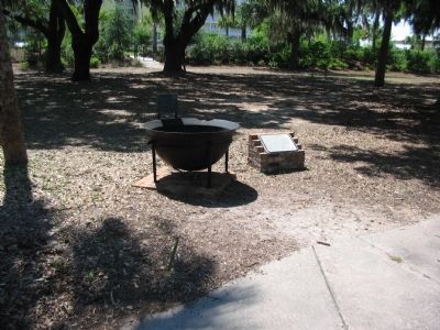
Between 1861 and 1865, the St. Andrew Bay Saltworks, one of the largest producers of salt in the South, contributed to the Confederate cause by providing salt, fish, and cattle for southern troops and citizens. A necessary preservative in those . . . — — Map (db m8158) HM
On Cincinnati Avenue, 0.1 miles West 14th Street, on the right when traveling south.
The home was built by Thomas Freeman, surveyor for The Cincinnati Company, a large landholding concern in the area. After the company declined, eventually to enter bankruptcy, Freeman sold the home in 1894. After a series of owners, the home in 1907 . . . — — Map (db m245628) HM
On Harrison Avenue, 0.2 miles south of East Beach Drive, on the right when traveling south.
In 1936, the Van Kleeck Company, a hardware store, moved into two of the units of his new building, built by Deeb Construction Company. Panama Recreation Parlor opened in the unit at 131 Harrison Avenue. The most newsworthy event that occurred here . . . — — Map (db m245136) HM
On East Third Street west of North Center Avenue, on the right when traveling west.
This house was built in 1908 by Will H. Marshall and new wife Idumea Gray Marshall. Miss Gray was a daughter of Millville pioneer John C. Gray. When the new "Bay County" was created on July 1, 1913 young W.H. Marshall was elected the first Bay . . . — — Map (db m247703) HM
Near East 4th Street at Harrison Avenue, on the right when traveling east.
This building was built in 1926 and named for its original owner, Walter L. Folkes, who introduced electricity to Panama City in 1915. The first floor was originally occupied by Panama Light and Power Company, under the management of Folkes' son, . . . — — Map (db m245238) HM
On North Cove Boulevard at East 4th Street, on the right when traveling north on North Cove Boulevard.
In 1936, real estate developer H. L. Sudduth donated this property at 350 Cove Blvd to the Woman's Club of Panama City for the location of a clubhouse. Architect James Look drew the plans and supervised construction. Cost for the modern brick . . . — — Map (db m245130) HM
On Martin Luther King Jr Blvd (U.S. 98) 0.3 miles south of E 11th Street, on the right when traveling north.
Anderson's Service Station, owned and operated by Willie and Bertha Anderson, and was open six days a week from 1939 to 1985. Truly a family business, the Andersons daughters Peggy, Ruth, Barbara, Dannie and Willie, Jr., all worked at the station. A . . . — — Map (db m245122) HM
On Martin Luther King Junior Boulevard (U.S. 98) 0.3 miles south of E 11th Street, on the right when traveling north.
Time and service have honored the name of Battle Funeral Home since 1933. In Phenix City, Alabama in February of 1933 W. C. Battle, Sr. embarked upon the funeral industry. To this day, Battle & Battle funeral Home continues to service the families . . . — — Map (db m245120) HM
On West 15th Street at Beck Avenue, on the right when traveling east on West 15th Street. Reported missing.
The first school in St. Andrew, a community established ca. 1827, was built in 1850. That building burned down. The second school was a two-story wooden structure with two large rooms on each floor. The school had four teachers and 100 students. In . . . — — Map (db m221882) HM
On Front Beach Road (Florida Route 30) at Argonaut Street, on the right when traveling east on Front Beach Road.
On February 22, 1926, WWI Veteran Harry C. Cailey of St. Andrews filed claim under the Homestead Act for 140.52 acres on this Gulf of Mexico location. His patent deed, signed by President Calvin Coolidge, required he maintain residency for . . . — — Map (db m244869) HM
Near Panama City Beach Parkway (U.S. 98) at Heather Drive, on the left when traveling east.
Divers were limited to time and depth working underwater.
Dr. George Bond theorized that divers could stay underwater longer and dive to greater depths using saturation techniques breathing a controlled mixture of gas. These . . . — — Map (db m245046) HM
On Panama City Beach Parkway (U.S. 98) 0.1 miles east of Coral Drive, on the right when traveling west.
This Decompression Chamber was built in 1965 and is made of steel. The Chamber has skids and lifting eyes to secure it on a deck. The Chamber has all of the necessary pressure gauges, fittings, valves and portholes for adequately decompressing a . . . — — Map (db m245025) HM
On Panama City Beach Parkway east of Coral Drive, on the right when traveling west.
This Deep Dive System (DDS) was built in 1968 to provide a surface habit for Saturation Divers working at great depths. Divers are sealed into the habitat and become compressed to the same depth they will be working.
After their bodies have . . . — — Map (db m245736) HM
On Panama City Beach Parkway (U.S. 98) 0.1 miles east of Coral Drive, on the right when traveling west.
Built as Perry Cubmarine PC3B in 1963. The Tech-diver can operate at a working depth of 600 ft for a 6 hour maximum dive duration. It is designed to carry a pilot and non-diving specialist for first-hand inspection and supervision of construction, . . . — — Map (db m245044) HM
On Panama City Beach Parkway near 17314 Panama City Beach Parkway, on the right when traveling west.
This Treste II Sphere was in active service from 1966 to 1973.
It was used on over 30 occasions varying from
800 to 16,400 feet.
This sphere was also used to obtain photographs of the
USS Thresher (SSN 593) at approximately 8500 feet . . . — — Map (db m245738) HM
On Panama City Beach Parkway (U.S. 98) 0.1 miles east of Coral Drive, on the right when traveling west.
Engineers and Scientists from the
“Navy Mine Defense Laboratory”
researched the problems of living at the bottom of
the sea with safety as paramount
The staff designed for:
• Primary and breathing gases
• Communication with . . . — — Map (db m245024) HM
On Pitts Avenue, 0.1 miles south of Aster Street, on the right when traveling south.
Loftin’s Ferry, on Pitts Avenue, which later became Parker, was an important part of the major land route called the “Military Road” that ran from Apalachicola through St. Joseph to Marianna and beyond. This road, constructed from 1836 . . . — — Map (db m42114) HM
On East Call Street (Florida Route 230) just east of South Walnut Street, on the right when traveling east.
Bradford County Bank Built c. 1914 has been placed on the National Register of Historic Places by the United States Department of the Interior — — Map (db m169900) HM
On East Call Street (Florida Route 230) at South Water Street, on the right when traveling east on East Call Street.
Dedicated to those who served and those who died while serving
Our Heroes
World War I
Herman Crosby • Eurie Douglas • Lanier Droke • Robert H. Green • Nick Johns • Willie J. Jones • Neal Langford • Ervin Minton • Ira McKinney • . . . — — Map (db m207060) HM
On West Call Street (State Road 230) at North Temple Street (U.S. 301) on West Call Street.
On December 6, 1861, Gov. John Milton signed a law changing the name of New River County to Bradford County. The Legislature had passed the law in honor of Captain Richard G. Bradford of Madison who was killed October 9, 1861, in the Battle of Santa . . . — — Map (db m15316) HM
On North Walnut Street, on the right when traveling south.
The Woman’s Club of Starke, formerly known as the Mother’s Club, was founded in the late 19th century and held its meetings in the Bradford County High School. Their purpose was to assist the Bradford County High School. Only mothers were accepted . . . — — Map (db m34517) HM
Near Dave Nisbet Drive, 0.2 miles west of George J. King Boulevard, on the right when traveling west.
Experience the thrill of the Space Coast. Rockets carrying spacecraft lift off from Cape Canaveral Air Force Station, northeast of Port Canaveral. The Port is the best viewing site for launches. Every U.S. manned space mission and hundreds of . . . — — Map (db m164405) HM
Near Museum Circle, 0.2 miles south of Lighthouse Road, on the left when traveling south.
Established by the United States Air Force in 1950 as the Joint Long Range Proving Ground, this area supported the initial development of America’s space program. The era of the Space Age for the U.S. began on this site with the launch of America’s . . . — — Map (db m154077) HM
Near Dave Nisbet Drive, 0.2 miles north of George King Boulevard, on the right when traveling north.
The first missile launched from Cape Canaveral Air Force Station in 1950. Space exploration and missile testing still keep the station active.
The Air Force operates the historic 1868 Cape Canaveral Lighthouse. Tour the Air Force Space and . . . — — Map (db m164444) HM
On Lighthouse Road north of Control Tower Road, on the left when traveling north.
When the Lighthouse was moved to this site in 1894, the Head Keeper's cottage, the First Assistant Keeper's cottage, and one storage building were also moved. Soon after another storage building and a cottage for the Second Assistant Keeper were . . . — — Map (db m217571) HM
On Lighthouse Road near Control Tower Road, on the right when traveling north.
Originally constructed in 1868 overlooking the Cape Canaveral beach. Due to shoreline erosion, the lighthouse was dismantled and moved 1 ½ miles inland in the early 1890s. In July 1894, the light was relit at the new location. — — Map (db m23522) HM
On Lighthouse Road, on the left when traveling north.
On May 21, 1838, Florida territorial delegate Charles Downing requested a lighthouse be built on Cape Canaveral. The first lighthouse completed in Jan. 1848 stood 65-feet tall, had a 55-foot tower and a 10-foot lantern room equipped with 15 lamps on . . . — — Map (db m64798) HM
On Lighthouse Road north of Control Tower Road, on the left when traveling north.
The earliest evidence of human habitation on Cape Canaveral dates back about 6,000 years. Descendants of these first humans, the Ais, inhabited Cape Canaveral along with the nearby islands and the mainland.
There are 95 recorded sites within the . . . — — Map (db m217573) HM
On Center Street at Sevilla Court, in the median on Center Street.
Before modern construction a complex of six burial mounds occupied this location. They were built by the ancestors of the prehistoric Ais tribe, a group who occupied the Cape Canaveral area at the time of European contact. Based on pottery styles . . . — — Map (db m243353) HM
Vc = Ro √(g/Ro+h)
"… one of the most complex tasks ever presented to man in this country -- the achievement of manned flight in orbit around the earth." - John F. Kennedy
Thirty-Fifth President of the United States
This marker . . . — — Map (db m69963) HM
Near Dave Nisbet Drive, 0.2 miles west of George J. King Boulevard, on the right when traveling west.
Port Canaveral is one of the busiest cruise ports in the world. Millions of passengers pass through the terminals every year on their way to relaxation and adventure. Some cruise liners are homeported here. For others, this is a port of call. . . . — — Map (db m164415) HM
On Lighthouse Road north of Control Tower Road, on the left when traveling north.
Beginnings of Settlement
In the 1500s European explorers, slavers and missionaries first came to Cape Canaveral. Here they found a Native American population which had disappeared by 1730. The area remained sparsely populated until a . . . — — Map (db m217567) HM
Near Museum Circle south of Lighthouse Road, on the left when traveling south.
The effort to launch Explorer I was led by the U.S. Army Ballistic Missile Agency (ABMA). Military personnel assigned to the ABMA from 1956 to approximately 1965 wore this patch on the left shoulder of their uniforms. Each color in the patch . . . — — Map (db m217865) HM
Near Museum Circle, 0.2 miles south of Lighthouse Road, on the left when traveling south.
On this date the U.S. Army’s Ballistic Missile Agency launched the United States’ first
space craft—Explorer 1. The Jet Propulsion Laboratory and the State University of Iowa developed the satellite payload which was launched on an Army . . . — — Map (db m154079) HM
Near Dave Nisbet Drive, 0.2 miles west of George J. King Boulevard, on the right when traveling west.
Port Canaveral began as a small oil and fishing port. Today, the first-class, deep-water harbor can serve import, export and other industries. Through the years, generations of fishing families have taken their daily catch to market. Some of the . . . — — Map (db m164411) HM
Near Dave Nisbet Drive, 0.2 miles west of George J. King Boulevard, on the right when traveling west.
Titusville is the oldest community on the Indian River. After the Civil War, Titusville went on to spur the region’s transportation, business and shopping growth.
Buildings in the historic area date from 1895 to 1926, when the Florida Land . . . — — Map (db m164440) HM
On Museum Circle south of Lighthouse Road, on the left when traveling south.
A growing interest in space exploration in the late 1950s fueled the need for launch vehicles able to lift increasingly larger scientific payloads. Juno II was a modified Jupiter Intermediate Range Ballistic Missile (IRBM) with longer propellant . . . — — Map (db m217779) HM
On Museum Circle south of Lighthouse Road, on the left when traveling south.
Designed by the Army Ballistic Missile Agency (ABMA), the Jupiter missile was initially designated SM-78. Even though research and development of the Jupiter was performed by the ABMA, the Army was never able to deploy the missile. In 1955, the . . . — — Map (db m217780) HM
This building served as the control center for the two launch pads that made up Launch Complex 26. Between 1957 and 1963 was used to support the U.S. Army's Redstone, Jupiter, and Juno ballistic missile and launch vehicle programs. Explorer . . . — — Map (db m217582) HM
America's entry into the Space Race occurred on 31 January 1958 with the launch of Explorer I from Pad A of Launch Complex 26 (Pad 26A). It was boosted in orbit atop a Juno rocket as part of America's participation in the International . . . — — Map (db m217591) HM
On Museum Circle south of Lighthouse Road, on the left when traveling south.
One of the original buildings at Launch Complex 26, the Exhibit Hall was built as a pressurized gas storage facility. It was used for that purpose from 1957 through 1963 while the Complex was an active launch facility, supporting numerous . . . — — Map (db m217657) HM
On Museum Circle south of Lighthouse Road, on the left when traveling south.
Just as Kitty Hawk, North Carolina was the proving ground for the Wright Brothers, “the Cape” served the same purpose for America’s space program. Cape Canaveral Air Force Station is the world’s premier gateway to space, and has been the site of . . . — — Map (db m217783) HM
Dedicated to the living memory of the crew of the Apollo 1:
U.S.A.F Lt. Colonel Virgil I. Grissom
U.S.A.F. Lt. Colonel Edward H. White, II
U.S.N. Lt. Commander Roger B. Chaffee
They gave their lives in service to their country in the . . . — — Map (db m72912)
On Museum Circle south of Lighthouse Road, on the left when traveling south.
(side 1)
In 1955. President Dwight Eisenhower approved a plan to orbit a satellite during the International Geophysical Year, a period hailed as an unprecedented international effort involving scientists from 67 countries to advance . . . — — Map (db m217578) HM
Near Dave Nisbet Drive, 0.2 miles west of George J. King Boulevard, on the right when traveling west.
There’s a strong military presence at the port. The Naval Ordnance Test Unit operates the Navy Port and ballistic missile submarines use the Trident Turning Basin for maintenance.
The U.S. Coast Guard, U.S. Air Force and Military Sealift . . . — — Map (db m164399) HM
On Space Port Way at Poseidon Avenue, on the left when traveling east on Space Port Way.
Prime Contractor: North American Aviation
Type: Intercontinental Guided Missile
The Navaho was a rocket-launched, air breathing, long-range intercontinental guided missile. The Navaho was considered to have the range, accuracy, and . . . — — Map (db m164869) HM WM
On Glen Cheek Drive at Dave Nisbet Drive, on the right when traveling west on Glen Cheek Drive.
1964 – First cruise ship visit, S/S Yarmouth
1980 – First Queen Elizabeth II visit
1982 – First Cruises to Nowhere, S/S Scandinavian Seas
1984 – First homeported ship, Premier Cruise Lines S/S . . . — — Map (db m59645) HM
On Glen Cheek Drive, 0.3 miles west of Flounder Street, on the right when traveling west.
1953 – Commercial fishing began
1954 – First oil imported for Central Florida power plants
1955 – First merchant ship, S/S Mormac Spruce arrived
1962 – First bulk cement silos built
1966 – First . . . — — Map (db m59647) HM
On Glen Cheek Drive, 0.2 miles west of Flounder Street, on the right when traveling west.
1961 – Freedom 7, First space capsule recovered through the Port
1989 – Foreign Trade Zone (FTZ) 136 activated
1989 – First quadramodal connection between sea, land, air and space
1992 – SPACEHAB, First FTZ . . . — — Map (db m59648) HM
On Glen Cheek Drive, 0.3 miles west of Flounder Street, on the right when traveling west.
North Side Development
1971 – Courageous, First Coast Guard Cutter, arrived
1974 – First warehouse built
2000 – Container Yard completed
South Side Development
1965 – First refrigerated . . . — — Map (db m59665) HM
On Glen Cheek Drive, 0.4 miles west of Flounder Street, on the right when traveling west.
1968 – Jetty Park Opened
1990 – Central Park (renamed Freddie Patrick Park) opened
1992 – First Florida deepwater port to develop an Inlet Management Plan
1995 – Malcolm E. McLouth Fishing Pier dedicated
1995 . . . — — Map (db m59666) HM
On Glen Cheek Drive at Flounder Street, on the right when traveling west on Glen Cheek Drive.
Port dedicated by U.S. Senator Spessard L. Holland. Serving on the Canaveral Port Authority Board of Commissioners: Colonel Noah Butt, Chairman; David S. Nisbet; L.M. Carpenter; A.A. Dunn and G.W. Laycock. N.M. Argabrite, Secretary. Barbara . . . — — Map (db m59729) HM
On Museum Circle south of Lighthouse Road, on the left when traveling south.
The Redstone missile was developed by a team led by Dr. Werner von Braun, who had been working for the U.S. Army at Fort Bliss, Texas, following World War II. In 1950 the team was transferred to Redstone Arsenal in Huntsville, Alabama, where the . . . — — Map (db m217777) HM
Near Dave Nisbet Drive, 0.2 miles west of George J. King Boulevard, on the right when traveling west.
Florida’s largest lock connects the ocean to the Banana River. Ships, fishing and pleasure boats, barges and even space vehicles use Canaveral Lock to access the Port. Gates on the extra-wide lock open to adjust water levels. This ensures . . . — — Map (db m164418) HM
On Mission Control Road south of Flight Control Road, on the right when traveling south.
Built on this site in 1957, the Mercury Control Center, later renamed Mission Control, was the United States first mission control for unmanned and manned space programs under the leadership of the National Aeronautics and Space Administration. . . . — — Map (db m217564) HM
On Indian River Drive (County Road 515) 0.1 miles south of Briarwood Lane, on the left when traveling north.
Known as City Point, this area was settled shortly after the Civil War by Confederate veterans, citrus grove workers, northern winter residents, and consumptives seeking a healthy climate. By early 1885, a board of trustees was formed consisting of . . . — — Map (db m203571) HM
On Delannoy Avenue north of Church Street, on the right when traveling north.
On October 31, 1916, citrus grower and inventor Edward Postell Porcher and wife Byrnina Peck Porcher, moved into what was the grandest house in Cocoa. The house is a unique example of Neo-Classical Revival Style architecture interpreted in coquina . . . — — Map (db m112182) HM
Near Harrison Street at Riveredge Boulevard, on the left when traveling west.
Born 20 December 1929 at New Smyrna, Florida. Moved to Brevard County March 15, 1936. A 1948 graduate of Cocoa High School. Enlisted in the U.S. Army July 25, 1950. Killed in action June 24, 1951. His grave in Pinecrest Cemetery is properly marked. . . . — — Map (db m145975) HM WM
On West King Street (State Road 520) west of South Cocoa Boulevard (U.S. 1), on the right when traveling west.
One half mile to the west ran the Hernandez Trail used during the Seminole War. It connected forts along the East Coast to Ft. Dallas in Miami and across from Ft. Pierce and Ft. Capron to Ft. Brooke near Tampa. Brig. General Joseph M. Hernandez, . . . — — Map (db m72606) HM
On Derby Street at Brevard Avenue, on the left when traveling west on Derby Street.
Dedicated on July 13, 1924, this structure was built by the Seventh Day Adventist Church, and was heralded by The Cocoa Tribune as “an honor to the City.” In 1955 it was sold to the Church of Christ, Scientist. In 1964 it was sold to the . . . — — Map (db m125640) HM
On Church Street at Riverside Drive, on the left when traveling east on Church Street.
On June 2, 1878, the Right Reverend John Freeman Young, Bishop of Florida, and Dr. William H. Carter of Holy Cross Church of Sanford, Florida, held the first meeting of St. Mark’s Episcopal Church at a nearby Rockledge residence. The mission was . . . — — Map (db m70299) HM
Near Harrison Street at Riveredge Boulevard, on the left when traveling west.
Medal of Honor recipient Melvin Morris was born in Okmulgee, Okla. January 7, 1942. Sergeant First Class Morris (U.S. Army-Retired) and family settled in Brevard County in December 1990. On March 18, 2014, the President of the United States of . . . — — Map (db m146008) HM WM
On Delannoy Avenue at West King Street (Florida Route 520), on the right when traveling north on Delannoy Avenue.
(side one) Founded in 1885, the S.F. Travis Company is the oldest continuously operating business in the city of Cocoa and one of the oldest hardware stores in Florida. Surviving two world wars, numerous hurricanes, and financial busts, the . . . — — Map (db m145953) HM
Near Meade Avenue, 0.1 miles east of Ocean Beach Boulevard, on the right when traveling east.
This anchor was discovered 16 miles off the shore of the Westgate Cocoa Beach Pier in 1984 by the late Keith Siegel, a famous local lobster diver, and his brother Brian.
Standing 10 ft. 5 in. tall and weighing more than 6,000 lbs., this artifact . . . — — Map (db m131824) HM
Dedicated
July 20, 1976
To those men, women and children of Brevard County who through the practice of the American way of life, liberty and the pursuit of happiness, gave sacrificially of their time and money in the commemoration of the . . . — — Map (db m217589) WM
This anchor was discovered 16 miles off the shore of the Westgate Cocoa Beach Pier in 1984 by the late Keith Siegel, a famous local lobster diver, and his brother Brian.
Standing 10 ft, 5 in. tall and weighing more than 6,000 lbs. This artifact . . . — — Map (db m164170) HM
On I Dream of Jeannie Lane at State Road A1A, on the right when traveling north on I Dream of Jeannie Lane.
I Dream of Jeannie was part of Cocoa Beach when a television sitcom ran from 1965 to 1979 starring Barbara Eden as a 2000 year old female genie and Larry Hagman as an astronaut.
The TV series was set in and around Cocoa Beach.
Barbara Eden . . . — — Map (db m158368) HM
6701 entries matched your criteria. Entries 301 through 400 are listed above. ⊲ Previous 100 — Next 100 ⊳