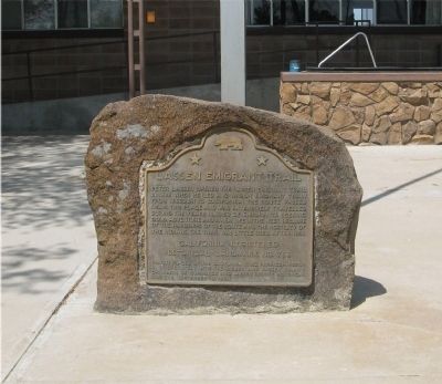
Peter Lassen opened the Lassen Emigrant Trail in 1848 when he led a 12-wagon emigrant train from Missouri to California. The route, which passed near this place, was extensively traveled during the years 1848-53 by emigrants seeking gold, adventure, . . . — — Map (db m10264) HM
On Scott Road 2.3 miles south of California Route 70, on the left when traveling south.
"We descended in to the head of a beautiful valley here we found things requisite for camping ... our road led immediately down the valley from camp ... with a good level road all the way." - John C. Thorniley, Aug 16-17, 1852 — — Map (db m148331) HM
Honey Lake is a remnant of the once huge Lake Lahontan. Fed by melting snow and ice at the end of the most recent ice age, Lake Lahontan covered nearly 8,000 spquare miles of land. The lake reached its highest level about 13,000 years ago when it . . . — — Map (db m308302) HM
American Indians, including the Kammu Tukadu and Wadakhut bands of the Northern Paiute peoples, played a key role in the Euro-American overland migration. Although some of the emigrant trails were new, many mirrored earlier Indian routes . . . — — Map (db m113026) HM
On State Highway 395, on the left when traveling south.
This route was first used in 1852 by emigrants to Northern California seeking to avoid the hardships of the Lassen Trail. It crossed the desert from the Humbolt River in Nevada, passed this point, and proceeded over the mountains to the town of . . . — — Map (db m10269) HM
On Milford Grade Road at Hamlin Drive, on the right when traveling south on Milford Grade Road.
First settled by Robert J. Scott on May 10, 1856, Milford is one of the oldest settlements in the Honey Lake Valley. In 1861 the first important flour mill in northeastern California was built here. In recognition of this, and of a sawmill, the . . . — — Map (db m87776) HM
Near Bridge Creek Springs Road (County Road 112) 1 mile north of Merrill Flat Road.
Nancy Ann Alien was born November 14, 1832, in Gentry County, Missouri. Her parents were Robert and Marian (Crawford) Ready, natives of Kentucky where they were married in 1826. Nancy was the oldest of four children. Her sister Elenor, "Elen", . . . — — Map (db m148180) HM
Near Bridge Creek Springs Road 1 mile Merrill Flat Road, on the left when traveling north.
Many hundreds of Overland Trail emigrants died while crossing the continent during the great westward expansion of the mid-Nineteenth Century. Most of these emigrants were buried in unmarked graves beside the trails, and have been lost to history. . . . — — Map (db m148181) HM
On Highway 299 (California Route 299) near New Cemetery Road (County Route 406), on the left when traveling west.
In memory of
An Unknown Soldier
who was buried here about 1870 on this the Old Military Road which ran from Ft. Bidwell in Modoc Co. to Ft. Crook, Shasta Co. — — Map (db m87821) HM
On Forest Road 32N21 0.5 miles south of Route 44, on the left when traveling south.
"Day pleasant. Road has been excellent ... Has led us through beautiful glades and plains ... Tonight we camped at 'Butte Creek' a fine little stream with abundance." Benjamin Franklin Ruggles, Aug 15, 1859 — — Map (db m148737) HM
Near California Route 44 8.4 miles north of Mooney Road, on the left when traveling north.
"Thence northwest winding westward through some timber into a dry valley, some grass near the west end of the valley ... here we camped some grass wood plenty but no water, having water in our keg." J. D. Randall, Aug 24, 1852 — — Map (db m148185) HM
“Peter Lassen was born on October 31, 1800 in Farum, Denmark. At the time Farum was a small village about 15 miles northwest of Copenhagen. Peter was a son of humble parents. His mother was Johanne Sophie Westergaard and his father was Lars . . . — — Map (db m14179) HM
“In November 1859 – almost half a year after Lassen’s death, another party with Joe Kitts, Antone Storff, and John Tutt, began a new trip back to Black Rock. The men were going to bring the remains of Peter Lassen’s body back to . . . — — Map (db m14233) HM
On Highway 139 (California Route 139 at milepost 10.3), on the left when traveling north.
Named for John "Coyote Jack" Wright who left here in 1869. By 1880, five wagon roads converged here which resulted in various establishments over the years including a stage station, saloon, sawmill, dance hall, logging camp, and agricultural . . . — — Map (db m87820) HM
Lassen County Deputy Sheriff
Larry Griffith
was killed in the line of duty
March 2, 1995
On that date, Deputies Larry Griffith, Henry Mahan, William Freitas and Wayne Aldridge were on duty on the Madeline Plains and were . . . — — Map (db m87781) HM
On South Lassen Street near Court Street, on the right when traveling south.
Lassen County was officially created on April 1, 1864 and three months later Susanville's founder, Isaac Roop donated this city block for the Lassen County Courthouse.
On January 23, 1886 Holden Dick and Mexican Ben were lynched here, marking . . . — — Map (db m295430) HM
On North Weatherlow Street near Nevada Street, on the left when traveling north.
Commemorating the centennial of Lassen Lodge No. 149 F.&A.M., March 21, 1961 and in memory of Isaac N. Roop, ardent Free Mason, founder of Susanville, first Governor of the provisional Territory of Nevada, civic leader and friend of Man, and John S. . . . — — Map (db m87783) HM
“When Lassen returned to Sutter’s Fort he was still haunted by memories of the beautiful scenery in the North Valley. He decided to apply for land and settle there. There were no settlements at all in this region, so there would be room enough for . . . — — Map (db m14226) HM
“We do not know the exact date on which Peter Lassen arrived in America. Let us suppose that he landed in the early spring of 1831. Most reports say that Lassen arrived in Boston, Massachusetts. Also his passport had Boston written as the . . . — — Map (db m31741) HM
Near North Street, on the right when traveling north.
This meadow, now a city park, was a welcome stopping place on the Noble Emigrant Trail, pioneered by William H. Nobles in 1851 and first used in 1852. Here, emigrants en route to the Northern California mines were able to rest, refresh their stocks, . . . — — Map (db m10268) HM
Near California Route 44 4.9 miles north of Route 36 when traveling north.
"10 ms. from the...head (of) Susan Valley you will find an excellent spring 150 yds. south of the road; but little grass here; grass is scarce on this ridge." J. D. Randall, Aug 23, 1852 — — Map (db m148177) HM
Near Bridge Creek Springs Road 1 mile north of Merrill Flat Road.
"This is a fine valley and has the purest and coldest water a man ever drank ... I think this is the most pleasant camping place we have had, fine pine timbers ... Found the grave of Nancy Allen today." Gorham Gates Kimball, Jun 23, 1865 — — Map (db m148179) HM
On Bridge Creek Springs Road 2 miles north of Route 44, on the right when traveling north.
"We have risen to a considerable heighth [sic] today, though our road has been up and down. We are now crossing the Sierra Nevada Mountains by 'Nobles Pass' said to be the easiest pass of three" Benjamin Franklin Ruggles, Aug 13, 1859 — — Map (db m148178) HM
On Eagle Lake Road 0.2 miles north of Route 36, on the right when traveling north.
"We commenced the ascent directly on leaving the city...The greater portion of the company took the road to Marysville while the remaining portion & ourselves included have taken the Red Bluff Road." Mary C. Fish, Sep 12, 1860 — — Map (db m148037) HM
On North Weatherlow Street near Nevada Street, on the right when traveling north.
"This is a village of about 20 houses nearly all of which were built this summer. (It) is situated at the head of the valley... there is a hotel, store, blacksmith shop and... a saw-mill not far away." - Allen J. Tyrrell, Sep 8, 1860 . . . — — Map (db m87785) HM
On South Gay Street at Main Street (Route 36), on the left when traveling south on South Gay Street.
William Vellenoweth, better known to a generation of Susanville youngsters as Dad Popcorn, had his colorful stand at this location from 1918 to 1931.
This building, constructed in 1901 as the Oakes & Philbrook Furniture Store, also housed the . . . — — Map (db m112617) HM
“In Camponit Peter Lassen and his party had been waiting for the winter to be over. Instead of crossing the mountain ranges on their way south, he and six other persons decided to go by ship from Fort Vancouver. A small steamship, . . . — — Map (db m31740) HM
On Main Street near South Gay Street, on the left when traveling west.
A saloon has been on this site since 1862. Originally known as the Humboldt Exchange, in 1863 the name was changed to the Pioneer. This bar is the oldest established business in northeastern California. — — Map (db m87810) HM
Near Wingfield Road near Florence Lane, on the left when traveling south. Reported missing.
Due to "Gold Fever" and named for Richmond, Virginia by Orlando Streshly in 1859, the town of Richmond grew rapidly until 1861 - becoming the most important and populous settlement in the county "... overshadowing Susanville." Sporting hotels, a . . . — — Map (db m87808) HM
Near North Weatherlow Street, on the right when traveling north.
Built in July 1854 by Isaac N. Roop. First called Roop's House, and used as stopping place by emigrant trains. It was the locale of the "sagebrush war" fought in 1863 between Plumas County and Lassen County citizens. — — Map (db m10266) HM
On Main St (California Route 36), on the left when traveling east.
Constructed and dedicated to honor
the Veterans of World War I
and all future Veterans who have served the
United States of America and Lassen County,
Constructed February through August of 1926 and
Dedicated on August 17, 1926
The . . . — — Map (db m113271) HM WM
On Main Street near South Gay Street, on the left when traveling west.
Established in 1909, the Grand was first operated by Kwan Wong. In 1912, the Grand moved to this location and in 1921 Sam Vucanovich and Steve Sargent became the new owners. The original building collapsed in 1934 from construction next door and the . . . — — Map (db m87817) HM
On Birch Street south of 4th Street, on the left when traveling south.
The first boardinghouses were built by Red River Logging in 1915 near the mill in Pine Town. The consisted of wood floors and canvas tents. Nine 2 story units built on Birch Street housed 80 men each while two units south of Birch Street housed . . . — — Map (db m56715) HM
This building was part of the rail station from 1911-1958 of the Southern Pacific Line and was built by the Red River Lumber Company owned by the Walker Family. The Western Union and freight offices were a gathering place for local people. Leaving . . . — — Map (db m56713) HM
Through this draw passed many covered wagons and gold seekers enroute to California over the Lassen Trail during 1848-1851. Approaching this location from the north, the trail passed what is now Bogard Ranger Station. Proceeding southward to Big . . . — — Map (db m22027) HM
On 3rd Street (County Highway A21) east of Birch Street, on the right when traveling east.
Paul Bunyan has been the hero of lumberjack whopper tales that were handed down for generations in the camps of White Pine lumbermen in the north eastern forests of America. In 1913 the Walker family who owned the Red River Mill in Minnesota, moved . . . — — Map (db m56687) HM
On Ash Street (County Highway A21) south of 4th Street, on the right when traveling south.
Built in 1917 by the Red River Lumber Co. as a bakery, it supplied 3 stores and the company cookhouse. It was famed for its biscuits (as in biscuits & gravy) that gave the loggers the fuel needed to build Westwood out of virgin timber. It has also . . . — — Map (db m56712) HM
On California Route 36 at milepost 6.9, on the right when traveling east.
Built in late 1920’s as a Chevron Service Station, it was purchased in 1935 by the Tunisons who added the bar & restaurant with the fireplace. In Dec., 1942 bartender Ray Bollengier was shot and killed by an angry patron. The building burned in 1960 . . . — — Map (db m66081) HM
Near 3rd Street (County Route A21) at Birch Street, on the right when traveling east.
A “Company Town” for 44 years
Est. 1912 by T.B. Walker family,
founders of Red River Lumber Co.
1944-1956 Fruit Growers Supply Co. — — Map (db m56710) HM
On Birch Street near 4th Street, on the left when traveling north.
Built in 1914 by the Red River Lumber Co. as a mens club. The club had a pool room, card room, cafe, tobacco shop and a bar. It burned in 1944 and was rebuilt in 1945. Bought by George & Vera Young in 1957 & was turned into a market. Their son Mike . . . — — Map (db m66083) HM
On 3rd Street (County Route A21) at Birch Street, on the left when traveling east on 3rd Street.
Built in 1913, this building has been the home of the Westwood Fire Department since its beginning. O.L. Lunt was the 1st Chief until 1918. Maurice Hertzig was appointed Chief in 1946 and served for 32 years, he was the last official chief. Once the . . . — — Map (db m56708) HM
On 4th Street near Cedar Street, on the left when traveling west.
This building was built in 1925 by George Peltier and was funded by The Red River Logging Company. The building housed the Free and Accepted Masons and was known as Westwood Lodge #502 F.&A.M. It has been a gathering place of friends and families . . . — — Map (db m66082) HM
Site of pioneer cabin built by Thomas A. Denson in 1871
This Marker is dedicated to the pioneers of Modoc County by Alturas Parlor 159
Native Duaghters of the Golden West
September 21, 1932 — — Map (db m143470) HM
“Striking the river this morning I noticed a cluster of
singular shaped rocks sticking up in spires of a conical
shape 20 to 30 feet high” - Andrew Lopp Murphy, Sep 26, 1849 — — Map (db m113025) HM
On S Main St (U.S. 395), on the left when traveling south.
“We crossed the creek here running between high banks,
and drove a short distance down the north west side
and encamped” — Elijah Preston Howell, Sep 6, 1849 — — Map (db m113037)
On N East Street, on the right when traveling north.
The Nevada-California-Oregon Railway, a three foot narrow gauge, reached the Southern end of Alturas in 1908.
The Reno based contractor, Martin and Diamond, was hired to construct the passenger depot out of native stone.
Construction was completed . . . — — Map (db m284478) HM
Near East 4th Street near North B Street, on the right when traveling east.
Begun 1883
Completed 1910
Designated a National Historic Place by the United States Department of the Interior
in the Pontificate of Pope John Paul II
in the Episcopate of Bishop Francis Quinn
in the Pastorate of Reverend James Streets . . . — — Map (db m87844) HM
On no nearby street, on the left when traveling south.
The first Euro-Americans arrived in 1870 when Presley A. Dorris, Henry Fitzhugh, and several other Dorris family members drove cattle and horses into the area. With land granted under the Homestead Act, the Dorris family established a livestock . . . — — Map (db m113039) HM
“My shoes are giving out and I have no others. Left one of
them and the other is barely on...At our noon camp I made
some moccasins of cloth” — Joseph Stuart, Sep. 28, 1849 — — Map (db m113024) HM
On Centerville Road (County Route 54) at County Route 175, on the left when traveling east on Centerville Road.
"We now call this cr. a river, but we do not know what it is. We begin to hear ... that we are near the Sacramento Valley" - Elijah Preston Howell, Sep 8, 1849 — — Map (db m147426) HM
On Pit River Road (County Route 84) near Turner Creek Road, on the right when traveling west.
"We were obliged to cross the stream quite a number of times, in consequence of the canons of rock which confine it to a narrow bed." - Amos Batchelder, Sep 29, 1849
Guidebook available
Trails West Inc., P.O. Box 12045, Reno, NV 89510 . . . — — Map (db m113659) HM
On County Route 54 at County Route 70, on the left when traveling east on County Route 54.
"A few hundred yards N. W. of our camp, a tall, symetrical [sic] butte, or isolated mountain, rises from the level plain, like a tent." - J. Goldsborough Bruff, Oct 6, 1849 — — Map (db m147884) HM
Near Center Street south of Townsend Street, on the right when traveling south.
The first building erected in Deep Creek settlement, now Cedarville, was built in 1865 as a trading post by James Townsend, who was killed in an indian fight it 1866.
Purchased by William T. Cressler and John H. Bonner in 1867, the building . . . — — Map (db m10245) HM
This is the location of the junction of the original 1846 route of the Applegate Trail and the 1853 realignment of the trail as laid out by road engineers from Siskiyou County. The original route goes due east from this point and its traces are no . . . — — Map (db m152261) HM
On Crowder Flat Rd (Forest Road 73), on the right when traveling south.
The 1846 Applegate Trail, also known as the South Road to Oregon, lies behind this sign and heads westward along the banks of Fletcher Creek. It leaves Fletcher Creek after about two miles and then swings around the southern flank of Blue Mountain. . . . — — Map (db m152283) HM
On Westside Road (County Road 11) at U.S. 395, on the right when traveling east on Westside Road.
... Decent [sic] to the lake ... Night brought us to the end of the lake ... We laid up on a mountain brook where the roads forked ... One branch going to Oregon, the other to California."
Alonzo Delano, August 28, 1849 — — Map (db m147424) HM
On U.S. 395 at milepost 50.6, on the right when traveling south.
"Traveled ... to Goose Lake. The descent ... is sidling and dangers. While we were nooning here 2 wagons of other trains were upset and mashed to atoms" - Simon Doyle, Sep 19 1849
Guidebook available
Trails West Inc., P.O. Box 12045, . . . — — Map (db m87849) HM
On County Route 133C 0.3 miles south of South Willow Ranch Road (County Route 47), on the left when traveling south.
"Four miles to a beautiful little stream of pure cold water coming from the mountains to our left and emptying into Goose Lake ... Camped there ...Found plenty of ripe plums on the neighboring mountain sides." - Andrew Murphy, Sep 23, 1849 — — Map (db m147338) HM
On Westside Road (County Route 48) near U.S. 395, on the left when traveling west.
"We leave the old Lawson Road for the new road to Shasta Valley (Yreka) to day It seems as if the road is one stone pile We have to goe a foot in such places for fear of getting our heads nocked off" Sophroni Helen Stone, Sep 13 1852 . . . — — Map (db m87850) HM
On Fandango Pass Road (County Road 9) 4 miles west of Surprise Valley Road (County Road 1), on the right when traveling east.
This spot marks the convergence of two pioneer trails widely used by emigrants during the years 1846-1850. The Applegate Trail, established in 1846, led from the Humbolt River in Nevada to the Willamette Valley in Oregon. The Lassen Cut-Off, . . . — — Map (db m10174) HM
On Fandango Pass Road (County Route 9) 2.5 miles north of Surprise Valley Road, on the right when traveling north.
"We arrived at the foot of the summit ridge, the top of which lay one mile distant ... Up we ascended, slowly but surely, by the toilsome climbing of the teams and by lifting of the members. ... at the wheels." - William Swain, Oct 11, 1849 — — Map (db m147406) HM
On Fandango Pass Road 3.8 miles north of Surprise Valley Road, on the left when traveling north.
"Passing over the summit, which is a very narrow ridge, a broad,deep valley ... presented itself to our view, far below us ... We immediately descended the mountain, which on this side, is fearfully steep" - Amos Batchelder, Sep 25, 1849 — — Map (db m147407) HM
On Forest Road 30 2 miles south of County Route 133C, on the left when traveling south.
"Trees hundreds of feet high and 4-5-6 feet in diameter ... We can drive anywhere among the trees. Only the ground is covered with cobble stones" - E. W. Brooks, Sep 1, 1849 — — Map (db m147888) HM
On Bridge Street at Mail Street, on the left when traveling west on Bridge Street.
Monument marks site of old Fort Bidwell military post, established in August, 1865, to protect pioneer settlers of this vicinity from marauding bands of Indians. Abandoned as an Army post in 1892. — — Map (db m240313) HM
On Fandango Pass Road, on the left when traveling west.
Southern Route to Oregon
In 1846, Jesse Applegate and fourteen others from near Dallas, Oregon, established a trail south from the Willamette Valley and east to Fort Hall. This route offered emigrants an alternative to the perilous . . . — — Map (db m87845) HM
On Old Alturas Highway (County Route 114) 1.1 miles north of County Route 101, on the left when traveling north.
“Over divide to Tule Lake, on Lost River, passed in sight of Bloody Point where a train of emigrants were cut off last year. This afternoon Geo. W. Ebey killed a brant on the lake. Oh, so good to eat.” —James Henry Bascomb Royal, Oct 19, 1853. — — Map (db m147563) HM
"Camped at a magnificent spring of fresh cold water,
which we called Goff's Spring, in honor of the
newly elected lieutenant of the company."
-Levi Scott, South Road Exploring Party, 1846 — — Map (db m151903) HM
On California Route 139, on the left when traveling north.
Two Warm Springs Indians, acting
as scouts with the U.S. Army were
killed at the Battle of Dry Lake.
That final battle of the Modoc War
was fought about 10 miles S.E. of here,
May 10, 1873. They were brought to
the Peninsula Camp, just . . . — — Map (db m151905) HM
On California Route 139 4.4 miles north of Clear Lake Road, on the right when traveling north.
This trail was blazed by Peter Burnett in 1848 from Oregon City, Oregon Territory to the California gold fields. The route followed the Applegate Trail south and eastward to Tule Lake. It then struck southward probably following an earlier trail . . . — — Map (db m147839) HM
On Old Alturas Highway (County Route 114) 1.1 miles north of County Route 101, on the left when traveling north.
"We followed the Applegate Route to Klamath Lake [Tule Lake], where we left that road and took a southern direction. Thomas McKay, myself, and five others ... Went on in advance of the wagons to discover the best route" - Peter Burnett, Oct 1848 — — Map (db m147564) HM
On Route 46N23 0.1 miles east of Route 139, on the left when traveling east.
"The water [at Copic Bay] being so bad, we drank very little, and left early next morning [over a prairie]." - Peter Burnett, Oct 1848 — — Map (db m147841) HM
On California Route 139, 0.2 miles Glendale Street, on the right when traveling south.
General E.R.S. Canby was murdered here in April, 1873, while holding a peace parley under flag of truce with Captain Jack and Indian Chiefs. Rev. Eleazer Thomas, Peace Commissioner, was likewise treacherously slain. — — Map (db m154348) HM
On State Highway 139, 0.2 miles south of Glendale Street, on the right when traveling south.
From this fortress Captain Jack and his Indian forces successfully resisted capture by U.S. Army troops from December 1, 1872 to April 18, 1873. Other nearby landmarks of the Modoc Indian War are Canby's Cross, No. 110 and Guillam's Graveyard, No. . . . — — Map (db m154347) HM
On County Road 126 (County Route 126), on the left when traveling south.
This steep cliff of nestholes and crevices overlooks the Tule Lake National Wildlife Refuge and Lava Beds National Monument — fruitful hunting ranges for hawks, falcons, owls, and other birds of prey.
A favorable environment here is . . . — — Map (db m151904) HM
On Emigrant Trails Scenic Byway (Route 139) at County Road 176, on the right when traveling north on Emigrant Trails Scenic Byway.
Tule Lake was one of ten American concentration camps established during World War II to incarcerate 110,000 persons of Japanese ancestry, of whom the majority were American citizens. Behind barbed wire and guard towers without charge, trial or . . . — — Map (db m10370) HM
On County Road 176 north of State Highway 139, on the left when traveling east.
World War II Valor in the Pacific National Monument was established in 2008, in part to serve as a reminder of the grave injustices endured by Japanese Americans incarcerated at the Tule Lake Segregation Center. The Tule Lake Unit also preserves a . . . — — Map (db m271963) HM
On California Route 139 near County Route 122, on the left when traveling north.
Two Warm Springs Indians, acting as scouts with the U.S. Army were killed at the Battle of Dry Lake. That final battle of the Modoc War was fought about 10 miles S.E. of here May 10, 1873. They were brought to the Peninsula Camp, just south of here, . . . — — Map (db m87893) HM
Near Clear Lake Road, on the right when traveling west.
Burnett's Road - Hunters skirted the lava fields to the west as they headed southerly. They crossed dry lake, which had only scattered ponds of water, and entered an area of scattered brush and rocky ridges. — — Map (db m147844) HM
On Old Alturas Highway (County Route 140) at Route 139, on the right when traveling north on Old Alturas Highway.
"We passed over ... smooth prairie for some distance. One evening we encamped at what was then called Goose Lake (at Copic Bay). It being late in the season, the water in the lake was very low, muddy, and almost putrid." Peter Burnett, Oct 1848 . . . — — Map (db m87851) HM
On Willow Ranch Road at South Willow Ranch Road on Willow Ranch Road.
This monument was erected in honor of all the people who were part of what once was a thriving community when the Crane Creek and Willow Ranch Lumber Companies were in operation here from 1929 to 1959. The land was given to Modoc County by the . . . — — Map (db m10367) HM
On State Highway 3, on the left when traveling south.
Opened 1867 – Closed 1925
Founded by Stephen Farrington
Forging of tools for the miner and general blacksmithing was carried on in this shop — — Map (db m57895) HM
Near East Callahan Road (County Route 3), on the left when traveling south.
Born March 6, 1835 in Lexington, Missouri, Tacitus, at the age of nineteen, left for California by the southern overland route. The journey took six months to complete. He spent many years mining in Napa and Sonoma Counties, working on a ranch in . . . — — Map (db m70296) HM
On Main Street (U.S. 97) near East 3rd Street, on the right when traveling north.
Killed in Action
V.F.W. Post 5944
Dorris , California
Richard J. Birman • Loren E. Clark • Hudson Moak • Roy N. Taber • Donald F. Taber • James Forthingham • Dalton Yokem • Pete Viscanni • Howard Camp • John S. Branstetter • Clair . . . — — Map (db m87944) WM
On Picard Rd at Cemetery Rd, on the right when traveling west on Picard Rd.
Located east of the Cascade Mountain Range where the old Topsy Grade Stage Road enters Butte Valley, the town of Picard was settled in the early 1880s. Picard's Post Office opened in 1883 and closed in 1907. La Lake School located one mile to the . . . — — Map (db m100220) HM
On Dorris Brownell Road, on the left when traveling west.
(front plaque)
South Road - Forks Of The Yreka Trail
“All in need of provisions were supplied by a government
agent at this camp. Near this point the road forks-one
leading to Jacksonville, in Oregon, and the other to
Yreka, . . . — — Map (db m151605) HM
On Dorris Brownell Road 2 miles west of Sheepy Creek Road, on the left when traveling west.
"Road good ... Still crooking round the inlets of lake, make 8 miles and camp at a fine bold spring but not cold."
Virgil Pringle, Oct 2, 1846 — — Map (db m151579) HM
259 entries matched your criteria. The first 100 are listed above. Next 100 ⊳