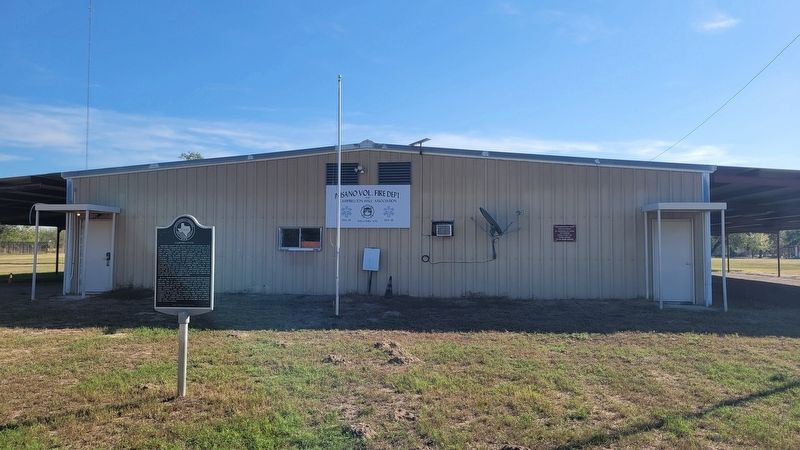
On Saint Francis Avenue north of Campbell Blvd, on the right when traveling north.
Atascosa County was created from Bexar County in 1856 by the Sixth Legislature of Texas. The town was named after John Campbell who came to Texas from Ireland as a boy with his parents. John Campbell first came to Atascosa County around 1857 and . . . — — Map (db m261711) HM
On County Road 315W 0.2 miles east of Farm to Market Road 140, on the right when traveling east.
Early settlers Dario and Manuelita Douglas Tober acquired land here in 1877 and later set aside this site for a family cemetery. The oldest marked grave, that of teenager Nieves Douglas Tober, dates to 1903. The Tober family deeded the original . . . — — Map (db m56664) HM
On Farm to Market Road 140 0.4 miles County Route 334, on the left when traveling south.
Kings Highway Camino Real Old San Antonio Road
Marked by The Daughters of The American Revolution and The State of Texas A.D. 1918 — — Map (db m223167) HM
On County Route 347 1 mile south of County Route 346, on the left when traveling south.
Kings Highway Camino Real Old San Antonio Road
Marked by The Daughters of The American Revolution and The State of Texas A.D. 1918 — — Map (db m223168) HM
On Farm to Market Road 2924 at Farm to Market Road 99, on the right when traveling south on Road 2924.
Near the Old San Patricio Trail, leading from San Antonio to McMullen and McGloin colony, in area of Gulf of Mexico. In this vicinity were stage stops at Belle Branch, Rock Spring, Rountree's, and Tordilla. Land was part of the Butler, Hickok, Tom . . . — — Map (db m56591) HM
On Campbell Avenue at Circle Drive, on the left when traveling north on Campbell Avenue.
As early as 1722 El Camino Real (The King's Highway) from the Rio Grande to San Antonio was well established in this area. The Spanish word "Atascosa," denoting boggy ground that hindered travel, gave region its name. The county was created in . . . — — Map (db m201987) HM
Atascosa County was created from Bexar County in 1856. The first county seat was at Navatasco, on land donated by Jose Antonio Navarro, and the county's first courthouse was a log cabin. The county seat was moved to Pleasanton in 1858, and a frame . . . — — Map (db m56584) HM
On Oak Street (State Highway 97) at Campbell Avenue, on the right when traveling east on Oak Street. Reported missing.
This log cabin is a replica of first courthouse built 1856 near Amphion (Navatasco) 9 miles to the northwest, on site given by Jose Antonio Navarro out of his 1828 grant from Coahuila and Texas. A signer of the Texas Declaration of Independence, . . . — — Map (db m290799) HM
On Zanderson Avenue (State Highway 16) at Peach Street, on the right when traveling north on Zanderson Avenue.
In October 1909, just one month after the founding of Jourdanton, seven residents gathered to organize a Baptist church under the direction of the Rev. W.G. Gilstrap. Members first met in the community schoolhouse for worship services and were led . . . — — Map (db m180811) HM
On State Highway 97, on the right when traveling north.
Jourdan Campbell (1867-1938) and his family moved to Atascosa County by 1870; his father John Campbell founded Campbellton. Jourdan married Alice Louise Marr in 1897 and the couple had eight children. Jourdan became County Commissioner in the 1890s, . . . — — Map (db m130161) HM
On Oak Street (State Highway 97) 0.2 miles east of Jourdanton Avenue, on the right when traveling east.
In 1909, Jourdan Campbell (1867-1938) and Theodore H. Zanderson (1854-1927) established the Jourdanton community, named for Campbell, on the eastern edge of their Toby Ranch property. Jourdan Campbell was born in Atascosa County, and was a merchant . . . — — Map (db m56595) HM
T.H. Zanderson and city namesake Jourdan Campbell bought the 40,000-acre Toby Ranch in 1907 and laid out the town of Jourdanton. The original plat included two blocks designated for use as a cemetery. The Artesian Belt Railroad built through the . . . — — Map (db m56665) HM
On Zanderson Avenue (State Highway 16) at Plum Street, on the left when traveling north on Zanderson Avenue.
From a tiny school to an official, recognized single campus concept, the Jourdanton Independent School District has remained dedicated to education and community. In the early 20th century, county schools such as the Hilburn School northwest of . . . — — Map (db m180815) HM
On Campbell Avenue south of Elm Street, on the right when traveling south.
The Methodist church in Jourdanton formally organized in 1909, the same year that the City of Jourdanton was founded. The church began as the Jourdanton Methodist Episcopal Church, South, and was a member of the Uvalde District in the West Texas . . . — — Map (db m56666) HM
On Texas Route 97 0.5 miles west of Spur 162, on the right when traveling west.
Kings Highway Camino Real Old San Antonio Road
Marked by The Daughters of The American Revolution and The State of Texas A.D. 1918 — — Map (db m223166) HM
On Main Street at Zanderson Avenue ( Highway 16), on the right when traveling east on Main Street.
By the early 20th century the ranching industry that spurred the growth of Atascosa County had begun to wane, with many large ranches split into smaller ranches, farms and town lots. George M. Martin realized the importance of a company to research . . . — — Map (db m56667) HM
On State Highway 97, on the right when traveling north.
As transportation increased through Atascosa County with the creation of major highways, the number of vehicular accidents and fatalities increased. In 1952, thirteen fatalities and many serious injuries were reported as the "bloodiest year" in . . . — — Map (db m130163) HM
County officials rented a small Jourdanton house for a jail in 1911 after the county seat was moved here from Pleasanton in 1910. A proposal to build a new jail with cells from the old Pleasanton structure was rejected and this reinforced-concrete, . . . — — Map (db m56585) HM
On Oak Street (State Highway 97) 0.2 miles east of Jourdanton Avenue, on the right when traveling east.
R. R. "Railroad" Smith (1880-1944) was born in Gonzales County to Alexander Frohock and Mary McGill (Mathews) Smith. Around 1907, Smith moved to Atascosa County where he opened up a law practice and entered into the newspaper business with a cousin. . . . — — Map (db m56668) HM
On Courthouse Circle Drive at Campbell Ave, on the left when traveling north on Courthouse Circle Drive.
This marker commemorates the men and women who achieved
American independence. These Patriots, believing in the
noble cause of liberty, fought valiantly to found a new nation. 1775-1783 — — Map (db m291009) WM
On Oak Street (State Highway 97) 0.3 miles east of Jourdanton Avenue, on the right when traveling east.
St. John Evangelical Lutheran Church has served this area of Atascosa County since 1918. Around that time, the now-dispersed farming settlement of Dobrowolski was growing, and the mostly Lutheran population needed a place of worship. At first, the . . . — — Map (db m56670) HM
On Zanderson Avenue (State Highway 16) at Commerce Street, on the right when traveling west on Zanderson Avenue.
Following the establishment of Jourdanton in 1909, many Catholic families of Hispanic, Irish, Polish, and German descent expressed interest in building a church. Bishop J.W. Shaw traveled from San Antonio to assist in preparing a new church . . . — — Map (db m130160) HM
On Old Applewhite Road at Bruce Road, on the right when traveling south on Old Applewhite Road. Reported missing.
Texas' bloodiest military engagement -- the Battle of Medina -- may have taken place in this general vicinity in 1813. The early 19th century was a time of political upheaval, and in 1812, while the U.S. was at war with England, Spain faced . . . — — Map (db m56597) HM
On Verdi Road 1 mile west of Farm to Market Road 3006, on the right when traveling west.
Brite Cemetery has served citizens of Atascosa County since the 1850s. It was formally set aside when Thomas Ransdele Brite passed away in 1859, though the earliest marked burial is that of his infant son, Dan (d. 1854). Thomas Brite was born in . . . — — Map (db m56588) HM
On Pleasanton Road at Spur Ridge, on the left when traveling south on Pleasanton Road.
Kings Highway Camino Real Old San Antonio Road
Marked by The Daughters of The American Revolution and The State of Texas A.D. 1918 — — Map (db m223159) HM
On Old Pleasanton Road 0.6 miles north of Bruce Road, on the left when traveling south.
Kings Highway Camino Real Old San Antonio Road
Marked by The Daughters of The American Revolution and The State of Texas A.D. 1918 — — Map (db m223163) HM
On Shilo Road 0.5 miles south of Farm to Market Road 1470, on the left when traveling south.
The first burial in this graveyard, that of fourteen-year-old John Uzell, took place in 1857. The land at that time belonged to Isaac H. Cavender, Sr., who was related to Uzell. Cavender allowed other burials on his property and soon the graveyard . . . — — Map (db m56610) HM
Organized by eleven Master Masons in Benton City in 1872 and chartered June 9, 1873, by Grand Lodge of Texas. First hall, erected of stone in 1876, provided space for public school. The lodge, which has furnished social and cultural leadership to . . . — — Map (db m56586) HM
On Farm to Market Road 3175, on the right when traveling west.
First public cemetery in this community, which was famous in early days for its outstanding school, aggressive businesses, and newspaper, the Benton City "Era." Site was given by James M. Jones, farmer-livestock raiser and leading citizen, whose . . . — — Map (db m56587) HM
On North Prarie Street at Farm to Market Road 2790 on North Prarie Street.
Dr. J.V.E. Covey and 16 charter members organized this church in April 1893 and held their first meeting under a stand of oak trees. A small frame building was later built, becoming their first permanent church building. Early baptisms were . . . — — Map (db m56593) HM
On Somerset Road at Mesquite Street, on the right when traveling south on Somerset Road.
According to oral history, the Lytle Methodist Episcopal Church, South, was founded in 1889. W.C. Newton, a local farmer and preacher, became known as "The Father of the Lytle Methodist Church" due to his efforts to establish a permanent place of . . . — — Map (db m56596) HM
On Interstate 35 Access Road 1.5 miles south of Benton City Road, on the right when traveling north.
Edwin Trimble (1808-1869) left a prosperous life in Kentucky and brought his family to Texas in 1854, settling in this area following the Civil War. This site became a burial ground upon his death from a snakebite. Laid to rest with him are his . . . — — Map (db m294028) HM
On North Main Street at Virginia Street, on the left when traveling north on North Main Street.
Peter Tumlinson was 19 years old when his family moved to Texas in 1821. During an 1823 skirmish with Waco Indians, his father, John Jackson Tumlinson, became the first Texas Ranger to die in the line of duty. Peter followed his father into the . . . — — Map (db m260099) HM
On North Main Street at Virginia Street, on the right when traveling south on North Main Street.
Chartered March 27, 1871, on petition of Master Masons of Pleasanton Lodge No. 283, A.F. and A.M., and the surrounding area. Met in upper floor of the Isaac Cooper home until 1891; over Cooper Brothers store until Masonic Hall was built in 1961. . . . — — Map (db m56589) HM
On Coughran Road at Dead Horse Road on Coughran Road. Reported missing.
Established on land purchased in 1901, the town of Coughran was named for founder and early settler W. A. "Abe" Coughran. He persuaded the San Antonio, Uvalde and Gulf Raildroad to build tracks through his property. The town was platted in 1913; by . . . — — Map (db m56590) HM
On State Road 97 at Parsons Road, on the right when traveling south on State Road 97.
Following World War II, the Federal Communications Commission (FCC) lifted its freeze on new radio stations. In 1949 chiropractor, preacher and rancher Ben Parker and his wife, Mona Parker, each veteran broadcasters, helped form the Atascosa . . . — — Map (db m260127) HM
On West College Street at North Reed Street, on the right when traveling west on West College Street.
On December 16, 1866, seven charter members met together to organize the First Baptist Church of Pleasanton. They met for worship in a variety of places, including the county courthouse in 1867, a schoolhouse south of town in 1870, and the Rock . . . — — Map (db m56594) HM
On North Bryant Street north of Sutton Street, on the left when traveling north.
In 1914, Reverend N.H. Doggett, an evangelist for the Western Texas Presbytery, brought his traveling tent to Pleasanton. On March 29, 1914, the Presbyterian Church in Pleasanton was established, the first in the county. Services were held once a . . . — — Map (db m291010) HM
Between 1852 and 1854, George Washington Marion (G.W.M.) Duck (1828-1899), his wife, Evaline White Duck (1829-1891), and their children left Somerset, Kentucky, and settled southwest of San Antonio in an area eventually called Somerset. In 1854, . . . — — Map (db m291011) HM
On Veterans Memorial Road at East Adams Street, on the right when traveling north on Veterans Memorial Road.
World War I
Bautista, Alberto N., INF, Bugler •
Brister, Charles F. INF, CPL •
Casillo, Desidero, INF, PVT •
Jaggy, Frank J., INF, PFC •
Matton, Frank K., INF, PVT •
Padgett, Arthure G., INF, PVT •
Smelley, Allen, INF, PVT
World War . . . — — Map (db m259979) WM
On East Bensdale Street (State Road 242) at 1st Street, on the right when traveling east on East Bensdale Street.
The Crystal City and Uvalde Railroad was built in 1909 with bonus money and land donations. J.E. Franklin, chairman of the railroad, changed the name to San Antonio, Uvalde and Gulf (S.A.U. & G.), and extended the tracks toward Pleasanton. In 1912, . . . — — Map (db m260104) HM
On West College Street at North Smith Street, on the right when traveling west on West College Street.
Constructed of locally quarried red sandstone, the Old Rock Schoolhouse was built in 1874 with funds pledged by citizens of Pleasanton. Once completed, the building was deeded to the county for free public school purposes. In addition to its . . . — — Map (db m56605) HM
On 2nd Street (U.S. 281) at Settlers Xing, on the left when traveling north on 2nd Street.
Although Poteet is well known for growing strawberries, farmers have enjoyed much success with harvesting peanuts as well. The first peanuts were grown in Atascosa County in the early 1900s. Harvesting was a hand-picked operation until the 1930s, . . . — — Map (db m291015) HM
On North Main Street at West Goodwin Street, on the left when traveling south on North Main Street.
Named for early Texas settler John Pleasants, by John Bowen (d.1867), San Antonio's first Anglo-American postmaster. Bowen, assisted financially by associate Henry L. Radaz, in Sept. 1858 founded this town at the juncture of Atascosa River and . . . — — Map (db m56599) HM
On North Main Street at Patrick Ave, on the right when traveling south on North Main Street.
Records show that a Church of Christ congregation has existed in Atascosa County since at least 1858, when a congregation met at the head of Lucas Creek. A group of Pleasanton women, led by Texana (Holder) Brite, began holding Church of Christ . . . — — Map (db m260010) HM
On West Adams Street at North Bryant Street, on the right when traveling west on West Adams Street.
Begun in 1865 as a family burial ground, the Pleasanton City Cemetery is a reflection of the history of the community from its earliest days. The first burial was that of three-year-old Gustave B. Doak, whose parents, Jonathan and Mary Elizabeth . . . — — Map (db m56600) HM
This congregation was organized in 1857, one year before the city of Pleasanton was founded. The church was established largely through the efforts of early Methodist circuit preachers such as John Wesley DeVilbliss and Augustus C. Fairman, who . . . — — Map (db m56601) HM
Pleasanton School District began educating African American children in 1913 with the creation of the Abraham Lincoln School. By 1955, students from the Lincoln School and white students were participating in football workouts together and . . . — — Map (db m56602) HM
On Verdi Road 1 mile west of Farm to Market Road 3006.
Born in Williamson County, Tennessee, in 1827, Robert E. Neill migrated with his family to what is now Caldwell County, Texas, at the age of four. At age nine, while grinding corn meal for the Texas Army, he suffered a crushing injury that crippled . . . — — Map (db m260132) HM
On East Bensdale Street (State Road 242) at 1st Street, on the right when traveling east on East Bensdale Street.
The San Antonio, Uvalde and Gulf Railroad had its beginning as a short line railroad and began in 1909 under the original name of the Crystal City and Uvalde (CC&U) Railroad. With the advent of drilling and discovery of deep artesian water wells in . . . — — Map (db m260106) HM
On East Adams Street at Hollingsworth Street, on the left when traveling east on East Adams Street.
In 1891, a small group of African American residents from the Pleasanton community met to organize a Baptist church. The meeting was attended by Reverend James Ellis, Mrs. Fannie Lamont, Mrs. Lucky Ross and others. The name Saint James Baptist . . . — — Map (db m260002) HM
On Casarez Road 0.3 miles north of Crane Road, on the right when traveling south.
Between 1850 and 1860, Manuel, Enrique, and Francisco Esparza brought their families to settle in what is now Atascosa County. The brothers, along with their sister and mother, were within the walls of the Alamo when it fell to the Mexicans in March . . . — — Map (db m56608) HM
On North Las Gallinas at Farm to Market Road 536, on the right when traveling north on North Las Gallinas.
Settlement along Gallinas Creek began in the early 1850s, before the creation of Atascosa County in 1856. In succeeding years, a group of families, several originating from Upper Silesia, Poland, settled in the area. These included the Kasper . . . — — Map (db m294030) HM
On Verdi Road 1 mile west of Farm to Market Road 3006.
Thomas Ransdell Brite was born in 1824 in Callaway County, Missouri. His family moved to Bastrop County when he was 16. In 1842, when Mexican armies invaded Texas, Thomas volunteered to serve in the Vasquez, Woll and Somervell campaigns in the . . . — — Map (db m260134) HM
On Farm to Market Road 1784 at Verdi Road, on the right when traveling north on Route 1784.
By 1855, settlers primarily from Alabama, Arkansas, Georgia, Mississippi, Missouri and Tennessee, as well as some of Spanish origin, were making their homes in this area and calling themselves Lucas Community because of their proximity to Lucas . . . — — Map (db m56611) HM
On County Road 304 0.5 miles east of Farm to Market Road 2146.
Amphion traces its beginning to the establishment of Atascosa County's first courthouse which is believed to have been constructed near this site at the county seat of Navatasco in 1857. Amphion, thought to have been named after a figure in Greek . . . — — Map (db m56582) HM
On Route 2504 at Brooks Lane, on the left when traveling north on Route 2504.
The family of William and Mary Allen Stiggins emigrated here from Prince Edward Island, Canada, in 1882. Included in the group were their daughter Mary Jane (1855-1935), who had studied medicine, and her fiancé Thomas Whittet (1838-1913), a former . . . — — Map (db m56633) HM
On 4th Street at Avenue D, on the left when traveling south on 4th Street.
Prior to 1856, settlers around Gallinas gathered on Sundays in each others homes to worship the lord, as numbers grew, they met at Shiloh at a log building used for school and church on Borrego Creek. Seminary student William Dycks Johnson . . . — — Map (db m259944) HM
On Avenue H at Broadway, on the right when traveling east on Avenue H.
Francis Marion and Mary Ann Davis Poteet left N.W. Arkansas in 1857 on the Fancher-Baker wagon train bound for the gold field of California.
The caravan was ambushed in southern Utah. 128 related family members perished in what is known as the . . . — — Map (db m259961) HM
On E Gates Valley Road at Mangum Road, on the right when traveling east on E Gates Valley Road.
William Norwood (W.N.) Gates (1818-1903) was born in Madison County, Tennessee, and served in the Army of the Republic of Texas, participating in the Seige of Bexar in 1835. In 1854, he settled in what was then Bexar County, near present-day Poteet . . . — — Map (db m294024) HM
On Avenue H (Farm to Market Road 476) at 10th Street, on the right when traveling east on Avenue H.
Prospect Hill Grocery and Hooge homestead were established in 1917 by Anna Ripps and Petrus "Alphons" Hooge. The couple and their children came to this area to establish a home and cultivate opportunities from their mutual farming heritage. Known . . . — — Map (db m259964) HM
On I Avenue at 4th Street ( Highway 282), on the right when traveling west on I Avenue.
The town of Poteet traces its history to the 1880s, when Francis Marion Poteet (1833-1907) established a mercantile store northeast of this area. A blacksmith and farmer as well as a merchant, Poteet began providing mail service to his customers. . . . — — Map (db m56603) HM
On 6th Street at Ave D, on the right when traveling south on 6th Street.
The Grange, also known as The Order of Patrons of Husbandry, was founded in the 1860s as a nonpartisan national organization comprised of farmers to establish economic independence, socialization and greater educational opportunities for families. . . . — — Map (db m294020) HM
On 4th Street at Avenue G, on the right when traveling south on 4th Street.
In 1910, the Poteet Townsite Company, owned by Methodists Henry T. and Ida Fischer Mumme, donated land at Fourth Street and Avenue G for a church building, and Fourth Street and Avenue D for a parsonage. The Methodists, under the leadership of the . . . — — Map (db m259960) HM
On Farm to Market Road 1333 at Curvier Road, on the left when traveling south on Route 1333.
This land had once been allocated in the 1700s as a ranch for Mission San Jose in San Antonio (20 mi. N), but in the 1820s was left unsettled. In 1828 prominent San Antonio resident Jose Antonio Navarro (1795-1871) beseeched the Governor of the . . . — — Map (db m111187) HM
On Avenue H at 6th Street, on the right when traveling east on Avenue H.
Allen Smelley Co G 38 Inf, KIA July 15, 1918,
in Champagne-Marne Defensive
Arthur G. Padgett In Rec G 1151, Co K 144 Inf,
Died Dec 1, 1917, Ft. Worth Texas — — Map (db m259963) WM
On Farm to Market Road 2504 0.5 miles south of Route 476, on the left when traveling south.
First Scottish community in southwest Texas. Founded 1873 by brothers William F.M. Ross and John C. Ross. Born in north Scotland, they came to Texas in 1867. Here they were awarded a contract to carry U.S. Mail. On the route, they noticed fertile . . . — — Map (db m56606) HM
Near Jenschke Lane 0.9 miles west of Farm to Market Road 476, on the left when traveling west.
Texas statesman Jose Antonio Navarro (1795-1871) transferred land here along the Atascosa River to his eldest son Jose Antonio George Navarro. J.A.G. Navarro (b.1819) then gave 160 acres here to his daughter Maria Antonia Navarro (1845-1922) in . . . — — Map (db m63703) HM
On Farm to Market Road 2504 0.5 miles north of Sandbranch Road, on the left when traveling north.
Organized under a tree near this site on August 27, 1882, the pioneer Sand Branch Baptist Church began with twelve members from the surrounding rural area. Elder C.B. Hukill served as the congregation's first pastor. Early worship services, . . . — — Map (db m56609) HM
On Old Rock Road 0.3 miles south of Roseville Road, on the right when traveling south.
Organized as Medina Baptist Church in April 1857 at Mann's Crossing, near Macdona. Until 1866, when members built an arbor here near Old Somerset, the services were held in homes or in a schoolhouse.
Site for meetinghouse and cemetery (2.5 . . . — — Map (db m56604) HM
Near Old San Antonio Road 0.1 miles north of State Highway 16.
Size: 69 feet long
Weight: 66,000 pounds
Diet: Herbivore
Habitat: Montana, New Mexico, Texas and Utah
Period: 70-65 million years ago (Cretaceous) — — Map (db m189402) HM
On Highway 173 0.5 miles north of Highway 16 when traveling north.
The Bandera Cemetery has served the town of Bandera since the 1850s. The site's oldest burial dates to 1851, before the town's establishment several years later. Many former community leaders of the area are buried in the cemetery. In addition, . . . — — Map (db m155430) HM
On State Highway 16 at Old San Antonio Road, on the right when traveling south on State Highway 16.
A strategic Indian point in early days. Rangers and Comanches struggled here in 1843. In 1854 Elder Lyman Wight settled Mormon colony. In 1855 Poles settled here. From early days a part of Bexar County, created and organized in 1856
Bandera, . . . — — Map (db m117676) HM
On Main Street (State Highway 173) north of Hackberry Street, on the right when traveling north.
First permanent courthouse for county, which was organized in 1856, but used makeshift quarters for offices and courtrooms until this building was erected 1890-91. Style is local version of the Second Renaissance Revival. White limestone for the . . . — — Map (db m111201) HM
On Main Street (State Highway 16) at Hackberry Street, on the right when traveling north on Main Street.
In honor of the Bandera County boys who made the supreme sacrifice during the World War
Leslie Bownds · Sam Clark · Ernest Polvado · Oscar Haby · Eddie Burleson · Roy Hinds · Twigg L. Wood · James Polvado · Blake Davis · Charlie Evans · Wade . . . — — Map (db m162834) WM
On 11th Street at Cedar Street, on the right when traveling east on 11th Street.
The origin of the name of Bandera Pass and its namesake city and county dates back to conflicts between the Spanish Army and native Lipan Apaches in the early 18th century. The history of the townsite began in the early 1840s, when Charles de Montel . . . — — Map (db m130359) HM
On 11th Street at Hackberry Street, on the right when traveling north on 11th Street.
Built 1880 by members under leadership of B.F. Langford, Sr. Gothic architecture. Hand-cut limestone, with oak timbers. Though enlarged and remodeled, retains original charm. Rev. John Devilbiss (who helped found first Protestant church in San . . . — — Map (db m155445) HM
On State Highway 173 1 mile north of Farm to Market Road 2828, on the left when traveling north.
The prominent feature known as Bandera Pass is a notable landmark in the topography and history of the region. The pass is a narrow natural cut through a chain of hills which run roughly east and west and divide the Guadalupe and Medina river . . . — — Map (db m157932) HM
On Hwy 173 10.6 miles north of SR 16, on the left when traveling north.
Celebrated Indian pass known from the earliest days of Spanish settlement · Identified with many a frontier fight and many a hostile inroad · Old ranger trail from the Medina to the Guadalupe River and the United States Army route between frontier . . . — — Map (db m24384) HM
On 11th Street at Cedar Creek, on the right when traveling north on 11th Street.
Walter and Francis (Adamietz) Ruge created the Bandera Water Works to serve businesses and residences. Walter Trenklebach bought the franchise in 1936, extending the water main to the school and promoting modernization. In 1938, Bandera citizens . . . — — Map (db m232896) HM
On Main Street (State Highway 173/16) at Hackberry Street, on the right when traveling south on Main Street.
The tradition of the Texas cowboy originated from northern Mexico with the vaqueros, individuals mounted on horseback who herded livestock, mainly cattle, through the open prairie. These men became legends in Bandera County. The City of Bandera . . . — — Map (db m130352) HM
On Main Street (State Highway 173/16) at Hackberry Street, on the right when traveling south on Main Street.
July 12, 1984 - The State of Texas House of Representatives, House Concurrence Resolution No. 94, signed by Texas Governor Mark White. "Be it additionally resolved that the Texas county of Bandera be declared the international headquarters . . . — — Map (db m130398) HM
On Main Street (State Highway 16) at Hackberry Street, on the left when traveling north on Main Street.
The town of Bandera was named by Indians. In 1870, a young boy, Herman Lehman, was captured by the Apaches and later lived with the Comanches. At the age of 65 he told this story to Bandera historian J. Marvin Hunter: Lehman said the Comanches . . . — — Map (db m175888) HM
On 11th Street at Cedar Street, on the right when traveling east on 11th Street.
Bandera's First Bank. On Texas Republic land grant. Hand-cut native rock. Built about 1860. A school, home, shop. Recorded Texas Historic Landmark - 1965 — — Map (db m130358) HM
On Old Medina Highway 0.1 miles west of Houston Street, on the right when traveling west.
The footprints of Blacks in the sands of Bandera County's history are not easily found...but they can be seen with diligent searching. Carolyn Edwards, Chairperson, Bandera County Historical Commission, 1991
A Community Laid to Rest . . . — — Map (db m299184) HM
On Main Street (State Highway 173) north of Hackberry Street, on the right when traveling north.
(side 1)
Camp Montel C.S.A.
Site 25 mi. West on Hy. 470, 1 mi. South. Established 1862 as part of Red River-Rio Grande defense line. Named for Captain Charles DeMontel, surveyor and colonizer of Bandera, leader of county . . . — — Map (db m111200) HM
On Main Street (State Highway 16) at Pecan Street, on the right when traveling south on Main Street.
A Bandera County Deputy Sheriff, Capt. Jack Phillips, set out alone on Dec. 29, 1876, on an official visit to Sabinal Canyon. Indians attacked him at Seco Canyon Pass, 22 miles southwest of Bandera. Phillips raced for the nearest settlement. When . . . — — Map (db m117712) HM
On Highway 470 1.5 miles west of Highway 16, on the right when traveling west.
Located on the original homestead of Bandera County pioneer Amasa Clark (1825-1927), this small cemetery contains the graves of several generations of the Clark family. The first recorded burial was that of Clark's first wife, Eliza Jane, . . . — — Map (db m155427) HM
Near Old San Antonio Road 0.1 miles north of State Highway 16.
Size: 20 feet long
Weight: 880 pounds
Diet: Carnivore
Habitat: North America and Asia
Period: 154 to 144 million years ago (Jurassic) — — Map (db m189437) HM
Georgia stonemason Henry White is credited with building this structure about 1868. In 1877 a store occupied the first floor and the Masonic Lodge met on the top floor. County commissioners bought the building that year to provide space for county . . . — — Map (db m130355) HM
On 13th Street at Pecan Street, on the right when traveling north on 13th Street.
Built 1933 to house Western collection of J. Marvin Hunter, Sr. (1880-1957), noted historian, journalist, editor and author. Having lived throughout the west, he settled in Bandera as owner of "New Era", 1921-1934. In 1923 he founded . . . — — Map (db m162838) HM
Near Old San Antonio Road 0.1 miles north of State Highway 16.
Size: 6 feet tall
Weight: 385 pounds
Diet: Camivore
Habitat: Western-central Europe and North America
Period: 55-45 million years ago (Ice Age) — — Map (db m189440) HM
Near Old San Antonio Road 0.1 miles north of State Highway 16.
Size: 46 feet long
Weight: 17,000 pounds
Diet: Carnivora
Habitat: Argentina, South America
Period: 95 million years ago (Cretaceous) — — Map (db m189399) HM
On Main Street (State Highway 16) at Hackberry Street, on the left when traveling north on Main Street.
The first herd blazed the trail in 1874, and the last herd made the trip in 1894. Some historians state otherwise, but most agree that the Great Western Cattle Trail started at Bandera, Texas. It was also known simply as the Western Trail, the . . . — — Map (db m175919) HM
1399 entries matched your criteria. The first 100 are listed above. Next 100 ⊳