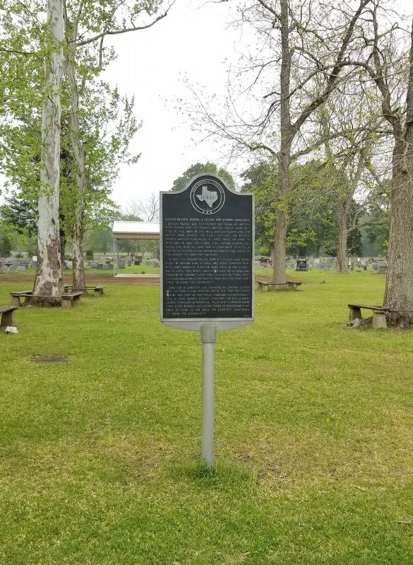
On Batson Prairie Road 0.1 miles south of Guedry Cemetery Road, on the left when traveling south.
Batson Prairie and the present day town of Batson were named for the pioneer Batson family who settled in this area by the 1840s. Matilda Guedry and her family were among the early settlers on Batson Prairie, Matilda purchased a large tract of land . . . — — Map (db m195822) HM
Founded 1859 as first county seat of Hardin County, created in 1858. Prospered until bypassed by Sabine & East Texas Railroad in 1881. A fire of suspicious origin razed the Courthouse here on Aug. 8, 1886. In an 1887 election, Kountze, on the . . . — — Map (db m255344) HM
On State Highway 326, on the right when traveling east.
Hardin County was created in 1858. The official Hardin County building was probably a two-story log building that burned about 1886. Early county records were destroyed in the conflagration.
In 1887, architect Frank Smith of Beaumont designed a . . . — — Map (db m45018) HM
On South Hickory Street, on the left when traveling south.
The Baptist Church of Hardin was organized in 1860 with Pastor D.W. Jordan. When the railroad bypassed Hardin (then the county seat) in 1881, area residents began moving to nearby Kountze. Hardin Baptists are believed to have followed, probably . . . — — Map (db m45134) HM
On U.S. 69 at State Highway 326, on the right when traveling north on U.S. 69.
The town of Kountze developed in the 1880s, after the Texas and New Orleans Railroad was built through this area. The county seat, which had previously been located at the town of Hardin, was moved to Kountze in 1886.
Soon after the town's . . . — — Map (db m45102) HM
On South Maple Street north of West Main Street, on the left when traveling north.
American military leader honored in this county in name of an early town (12 mi. W). Born in North Carolina, Bragg was in Texas in 1840s with army of General Zachary Taylor, to fight in Mexican War.
Made a brigadier general of the . . . — — Map (db m255305) HM
On State Highway 326, on the right when traveling east.
Created January 22, 1858 Organized August 9, 1858 Named in honor of the Hardins of Liberty County, five brothers - Benjamin Watson, Augustine Blackburn, William, Franklin and Milton A. who came to Texas in 1825 County seat, Hardin, 1858-1887 . . . — — Map (db m44982) HM
On Crocker Street, on the right when traveling east.
Established in 1902, the Hooks Abstract Company is thought to be the oldest continuously operating business in Hardin County. Named for its major investor J.B. Hooks, the company initially provided land ownership research for oil and timber . . . — — Map (db m45029) HM
On West Main Street at Redwood Street, on the right when traveling west on West Main Street.
Designed by Frank T. Smith of Beaumont and built in 1902, this was the home of James L. (1844-1922) and Martha Slater (1840-1907) Kirby. James Kirby was superintendent of the Kirby Lumber Company, founded by his brother John Henry Kirby. Most of the . . . — — Map (db m255351) HM
This congregation was established in 1886, one year before Kountze was named Hardin County Seat. First services were held in the Masonic Hall and in the Courthouse. In 1891 a permanent building was constructed on Brown Road on land given by Judge . . . — — Map (db m255348) HM
On West Main Street at South Maple Street, on the right when traveling west on West Main Street.
Organized in September 1886, and chartered in December of that year, the Pine Lodge drew its original thirteen members from all over Hardin County. William B. Pedigo served as the first master of the lodge and would continue his association with it . . . — — Map (db m255349) HM
Conservationist Richard E. Jackson was born August 12, 1880, in Leary, Georgia. In 1886, he came with his parents to Jasper, Texas, where they opened a general mercantile store. As a teenager, he worked for the family store and carried mail from . . . — — Map (db m173798) HM
On North Pine Street (U.S. 69/287), on the right when traveling south.
Kountze Baptist College (also known as Jermany College) served African American students in the area for nearly two decades. In 1910, the Trinity Valley Baptist Association opened the primary and secondary grade level school. Such institutions were . . . — — Map (db m173799) HM
On Farm to Market Road 787 0.2 miles north of Maple Road, on the right when traveling north.
Born in North Carolina. Graduated in 1833 from West Point. In 1845 came to Texas with army of General Zachary Taylor, to fight in Mexican War. In 1850's retired from army to be a planter. Also served as Commissioner of Public Works, State of . . . — — Map (db m255360) HM
On Farm to Market Road 770 at Big Thicket Drive, on the right when traveling west on Road 770.
The Big Thicket National Preserve exists today in large part due to the efforts of a few dedicated individuals who took up the causes of conservation and wildlife preservation against great odds, both political and social. Lance Rosier was one of . . . — — Map (db m173802) HM
A small group of Big Thicket pioneers settled here in the mid-
1800 to work farms and run hogs in the almost limitless
forest. One of the earliest anglo settlers in the area, John
Fletcher Cotten (1819-1907), first tracked his hogs through . . . — — Map (db m255353) HM
On Teel Cemetery Road 2.5 miles south of Farm to Market Road 770.
Alabama native Richard Teel (1833-1918) came to East Texas in the 1850s. He married Nancy A. Hart (1842-1900) in 1858 and they settled here. When the Teels' son, D. J., died in 1893, he was buried here beside the family home. In 1908, after other . . . — — Map (db m255358) HM
Born in the small town of Corrigan in 1909, Aubry Wilson Mullican became famous as a country and western singer and songwriter. His father was a farmer and the African-American farm workers and sharecroppers influenced his music greatly. Mullican . . . — — Map (db m190782) HM
County seat of Jefferson County. Settled in 1825 as Tevis Bluff; incorporated as Beaumont Dec. 16, 1838. Early trading post, riverboat port, lumber, rice and ranching center. Near site of Spindletop gusher, where oil became an industry, ushering . . . — — Map (db m118626) HM
On I-10 Frontage Road 0.2 miles west of Gulf Street, on the right when traveling west.
County seat of Jefferson County. Settled in 1825 as Tevis Bluff; incorporated as Beaumont Dec. 16, 1838. Early trading post, riverboat port, lumber, rice and ranching center. Near site of spindletop gusher, where oil became an industry, ushering in . . . — — Map (db m190794) HM
On I-10 Frontage Road at Forrest Street, on the right when traveling east on I-10 Frontage Road.
Willie Johnson was born near Independence, Texas, in 1897 to Willie and Mary (Fields) Johnson. His family moved to Marlin when Johnson was a young boy, and it was there that he first learned gospel songs at church; his first guitar was said to be . . . — — Map (db m190798) HM
On South Walnut Street at Mulberry Street on South Walnut Street.
This structure was built in 1927 to house the Beaumont fire Department. Organized in 1881. Designed by the architectural firm of Livesay and Wiedemann, the building was constructed on the site of two earlier fire stations. Influences of the Spanish . . . — — Map (db m173329) HM
On College Street (U.S. 90) at Keith Road, on the right when traveling east on College Street.
Named in honor of
Mary Dewleigh Borlace
Warren Beaumont
by her husband Henry Millard
who laid out the town in 1835
on a site known as Tevis's Bluff
Incorporated in 1838 — — Map (db m129555) HM
On Broadway at Forrest Street, on the right when traveling west on Broadway.
The first recorded Jewish worship services in Beaumont were held on Yom Kippur in September 1887. The congregation's first synagogue was built at the corner of Broadway and Willow streets in 1901. In 1923, under the leadership of Rabbi Samuel . . . — — Map (db m172378) HM
On Gladys Street 0.1 miles east of North Martin Luther King Jr Parkway, on the left when traveling east.
Born in British Guiana (Guyana), Charles Frank Luckett Nordman Graham attended college in Alabama, Ohio, and Iowa. He came to Beaumont in 1918 on behalf of the American Missionary Association and founded Graham Congregational Church and the Barnwell . . . — — Map (db m190797) HM
On Main Street at Mulberry Street when traveling north on Main Street.
Near this spot on Nov. 6, 1880, the first Beaumont
Enterprise came off the press. This newspaper,
founded by John W. Leonard, is southeast Texas'
oldest business institution.
The Beaumont Journal, founded in August 1889, by
Robert Emmett . . . — — Map (db m174133) HM
On I-10 Frontage Road 0.2 miles west of Gulf Street, on the right when traveling west.
USAF Century Series Aircraft Flown by Strategic, Tactical and Air Defense Units 1954-1974 Well Known for Nuclear Deterrent Role in NATO Famous for the Reconnaissance Mission in Southeast Asia
In Memory of Walter Mayer, Jr. A . . . — — Map (db m191191) HM WM
On Orleans Street near South Bowie Street, on the right when traveling west.
Founded on April 9, 1889, the First National Bank of Beaumont enjoyed an economic revitalization in the 1930s after the area's second major oil boom. A special meeting of the bank's board of directors was held on January 16, 1935, to discuss plans . . . — — Map (db m172313) HM
On Calder Avenue near Willow Street (Business U.S. 90), on the right when traveling east.
In 1839, Methodist Missionary Samuel A. Williams (1810-66) conducted first religious service in Beaumont, followed in 1840 by another Methodist minister, Henry Stephenson (1772-1841), organizer of first Protestant . . . — — Map (db m173651) HM
On Arbor Lane at French Road, on the left when traveling north on Arbor Lane.
Built 1845 by John J. French (1799-1889), merchant and tanner who came from Connecticut and New York to Texas in 1830s. Served as home and store, with tannery nearby. Early settlers came to “French Town” to trade tallow, hides, corn, and beef for . . . — — Map (db m60304) HM
On Martin Luther King Jr. Parkway Service Road near Neches Street, on the right when traveling north.
Henry Haag "Harry" James was an American musician who became famous as one of the most popular bandleaders during the "Big Band" or "Swing Band" era of the 1930s and 1940s. He was born in 1916 in Albany, Georgia. When Harry was eight his parents . . . — — Map (db m172322) HM
Near Pearl Street, on the right when traveling west.
A native of Saratoga County, New York, Henry Millard moved to Missouri with his family while still a child. As a young man he moved to Natchez, Mississippi, where in 1826 he married Mary Warren Beaumont. While living in Natchez they became the . . . — — Map (db m190760) HM
On Forrest Street near North Street, on the right when traveling north.
A native of Carthage, Texas, Holmes Duke came to Beaumont in the late 19th century and purchased property at this site in 1898. Construction on his home began shortly thereafter. Completed in 1899, the Holmes Duke house features influences of the . . . — — Map (db m172749) HM
Jiles Perry "J.P." Richardson, Jr. was born on October 24, 1930 to Jiles and Elsie Bernice (Stalsby) Richardson in Sabine Pass (26 mi. SE); the family moved to Beaumont when he was six. As a teenager, Richardson began writing songs with country and . . . — — Map (db m190786) HM
On Pennsylvania Avenue at Emmett Street on Pennsylvania Avenue.
Jean Baptiste ("Jonas") Chaison was born in Nova Scotia, of French parents. After imprisonment by the British during the French and Indian War, he and his parents fled in 1763 to France, where he was soon orphaned. He returned to North America, and . . . — — Map (db m292087) HM
Near Pearl Street, on the right when traveling west.
The first county building constructed at this site was a jailhouse completed in 1838, two years after the organization of Jefferson County. Located on land acquired from Nancy Tevis, a pioneer settler of the area, it also housed county offices and . . . — — Map (db m118625) HM
Near Fannin Street west of Pearl Street (U.S. 90), on the left when traveling west.
Built in 1927 by the Jefferson Amusement Company, this theatre quickly became a landmark in downtown Beaumont. Emile Weil, Inc., a New Orleans architectural firm, designed the structure. The interior is a showcase of fine materials and . . . — — Map (db m76253) HM
On Pine Street, on the right when traveling north.
The Magnolia Cemetery Company was granted a charter by the State of Texas on August 3, 1887. The following month the company's five trustees purchased thirteen acres of land on which to locate the graveyard, and burials were soon taking place in the . . . — — Map (db m190759) HM
On Lethia Street at Pine Street, on the right when traveling west on Lethia Street.
This historic congregation began in November 1890 with a group of Christians holding services in a schoolhouse. Worship extended to prayer meetings held in various homes. Eventually the congregation purchased land at the corner of Pine and Prince . . . — — Map (db m191184) HM
At 18, set two world records in the 1932 Los Angeles Olympic games - in 80-meter hurdles and javelin throw. Excelling at all sports, became a professional athlete and won 5 major titles as a championship golfer.
Was nicknamed after famous . . . — — Map (db m190785) HM
On Main Street at Tevis Street, on the right when traveling north on Main Street.
Site of the home of Noah Tevis who came to Texas in 1826 and built his cabin on land not granted until 1835. On a portion of this known as Tevis Bluff, the town of Beaumont was laid out before his death December 6, 1835. Erected by the State of . . . — — Map (db m172382) HM
Began lifetime career as a police officer at age 19. Was chief of detectives for Beaumont Police Department many years; chief of police, 1923 to 1925.
Started police benefit fund, increased staff from 20 to 50, and reorganized department. . . . — — Map (db m190783) HM
On Franklin Street at Main Street, on the left when traveling north on Franklin Street.
The city of Beaumont, 41 miles inland from the Gulf of Mexico, was served from its founding in 1837 by schooners and sternwheelers navigating the Neches River. The three-foot depth of Sabine Lake between the river's mouth and the Gulf limited . . . — — Map (db m118629) HM
On Texecutive Drive 0.1 miles east of Eastex Freeway, on the left when traveling east.
Prater Cemetery is a small family cemetery in what was once known as the Rosedale community of north Jefferson County. Edwin Prater, founder of the cemetery, bought a half acre of land for $10 from his daughter Theodosia and her husband John Jackson . . . — — Map (db m190791) HM
On Jefferson Street south of Forsythe Street, on the right when traveling south.
Traveling priests visited this area as early as the 1850s, conducting Catholic services outdoors, in homes, and later in the town Temperance Hall. The first church building was constructed in 1881 under the leadership of the Rev. V. Quinon. Located . . . — — Map (db m190761) HM
On Pine Street south of Elizabeth Street, on the right when traveling south.
Tennessee-born Robert Washington Sanders (1850-1916), a master wood carver, was drawn to Beaumont in 1878 by the newly-emerging lumber industry. He worked in several local lumber mills until 1902, when he went into business for himself as a . . . — — Map (db m173697) HM
Main crossing on Old Jasper Road and alternate crossing on Opelousas Trail from Liberty through Beaumont to Louisiana.
Used as early as 1750, route followed Indian traces and was highway for explorer-settlers, priests, soldiers, traders from . . . — — Map (db m190729) HM
On Spindletop Road near Ohio Avenue, on the right when traveling north.
Here from 1862 to 1864, camped Colonel A. W. Spaight's Battalion, 2nd Texas Infantry, Confederate States Army, composed of soldiers from Jefferson, Liberty, and Chambers counties. Their presence here served to prevent invasion of this part of . . . — — Map (db m239913) HM
On Highway 69 0.4 miles south of Jerry Ware Drive.
Originally named Jefferson County Airport, this facility has served area residents since the World War II era. Jefferson County commissioners purchased land to build the airport in 1841, and its development, which included three runways, a . . . — — Map (db m304485) HM
On Caswell Road 0.1 miles north of Eastex Freeway, on the left when traveling north.
The land on which this graveyard is located was designated a family cemetery in 1873 by the Marble family. The earliest known burial is that of Martha Marble (d. 1864), whose husband John S. Marble was also buried here in 1873. Their daughter and . . . — — Map (db m190792) HM
On Cartwright Street at San Antonio Street, on the right when traveling west on Cartwright Street.
In 1944, African American physicians and brothers Dr. Edward D.
Sprott, Jr. and Dr. Curtis B. Sprott founded Sprott Hospital in order
to provide quality care for black patients of Beaumont often
denied care in other local hospitals due to Jim . . . — — Map (db m292090) HM
On Pennsylvania Avenue at Emmett Ave on Pennsylvania Avenue.
In the 1920s, the local Col. George Moffett Chapter of the Daughters of the American Revolution (DAR) conceived of a grand memorial to show appreciation for the many Texans who served during World War I. Plans circulated for several years, and in . . . — — Map (db m292089) HM
Beaumont Rice Mill, founded 1892 by J. E. Broussard, was developed after first commercial planting of rice in Texas in 1863. Earlier crops, due to dependence on rain, were dubbed “providence rice.”
Broussard, pioneer grower and irrigator, . . . — — Map (db m201843) HM
On Magnolia Street south of McFadden Street, on the right when traveling south.
Early meetings of the Woman's Reading Club, now the Woman's Club of Beaumont, were conducted in area homes, churches, and public buildings until 1909, when this two-story frame clubhouse was built. Constructed during the presidencies of Mrs. John . . . — — Map (db m173294) HM
Near Jimmy Simmons Boulevard (University Drive) at East Cardinal Drive (Business U.S. 96), on the right when traveling south.
Discovery well of the Spindletop Oil Field and the first important well on the Gulf Coast. It blew in on Jan. 10, 1901, flowing 100,000 barrels of oil a day from a depth of 1020 feet. The oil production which resulted made Beaumont a city and the . . . — — Map (db m64411) HM
On Magnolia Street south of McFadden Street, on the right when traveling south.
On January 18, 1895, Mrs. Hal W. Greer hosted a meeting at her home which resulted in the formation of this club. Present were Mrs. Greer's friends Mrs. E. C. Weiss, Mrs. T. A. Lamb, Miss Mary Lamb, and Miss Harriet Ferrand. Through their guidance, . . . — — Map (db m173296) HM
When Gulf States Utilities Company built this Travis Street substation building in 1929, a new era of progress began in Beaumont and all of southeast Texas. Additional farms, homes, and industries received access to dependable and economic . . . — — Map (db m174023) HM
On Pearl Street (U.S. 90) at Forsythe Street, on the right when traveling west on Pearl Street.
Built in 1903 as the First Baptist Church, this limestone structure replaced a red brick church on the same site. Architect of the Romanesque Revival style edifice was A. N. Dawson and contractor was G. D. Patterson. In 1923, when the Baptist . . . — — Map (db m118628) HM
On I-10 Frontage Road 0.2 miles west of Gulf Street, on the right when traveling west.
Dedicated to those citizens who have sacrificed and given of themselves in the battles fought from 1776 to date for the defense and strength of America — — Map (db m191187) WM
On Bigner Road 0.1 miles north of Maida Road, on the left when traveling north.
During the "Black Church Expansion" between 1875 and 1925, the West Beulah Baptist Church was founded in a shotgun-style house that was common in the south following the Civil War. Rev. Sidney Farrington was the first pastor, and conducted prayer . . . — — Map (db m190793) HM
On North Main Street near Elizabeth Street, on the right when traveling north.
Presbyterian worship services were led in this area by traveling preachers until the Rev. S. F. Tenney and the Rev. W. C. Wallace organized the First Presbyterian Church of Beaumont on February 28, 1880. The Rev. Wallace served as supply preacher . . . — — Map (db m173682) HM
Served in Texas War for Independence at first Siege of the Alamo and San Jacinto.
Supply agent in Civil War.
McFaddin, noted for his hospitality and generosity, founded empire in ranching that survives today. — — Map (db m190784) HM
On Calder Avenue west of Willow Street (Business U.S. 90), on the right when traveling west.
The 1901 Spindletop oil boom brought vice, corruption and inadequate housing problems to Beaumont. H. G. Behrman, a young man who was sleeping in a tent in his friend's backyard, met W. M. Lewis, state secretary of the YMCA. Through their efforts, . . . — — Map (db m173297) HM
On Calder Avenue west of Main Street, on the right when traveling west.
Established in 1911 with ten members, the Beaumont Young Women's Christian Association was officially chartered three years later. Meetings were held in the town Temperance Hall until a separate building was constructed for the members at this . . . — — Map (db m173691) HM
On Pearl Street (U.S. 90) at Bowie Street, on the right when traveling north on Pearl Street.
Born in Berwick Bay, St. Mary’s Parish, Louisiana, to Sidney Hosmore and Mary (O’Brien) Millard, George O’Brien Millard was a pioneer Beaumont civic leader and educator. George moved to Texas with his extended family after his father died in 1854. . . . — — Map (db m292092) HM
On Crockett Street at Archie Street, on the right when traveling east on Crockett Street.
Born in Mahilpur, Punjab, India, on May 18, 1894, Pandit Mehar “P.M.” Chand was an early Asian Beaumont resident and business owner. After moving to Lahore (current day Pakistan) as a child, Chand immigrated to the United States in 1913. He and . . . — — Map (db m292093) HM
On Pearl Street at College Street, on the left when traveling north on Pearl Street.
Music publisher William G. Hall helped start and promote the careers of dozens of musicians. Hall was raised in Beaumont's Multimax Village and graduated from South Park High School and Lamar State College. He was considering a career in law before . . . — — Map (db m239908) HM
On Calder Avenue east of 7th Street, on the right when traveling west.
This home connects two major early Beaumont industries: lumber and
oil. William Hardee Turner (1869-1933) and his wife, Florence (Stovall)
Turner (1877-1936), built the house in 1907. It is highly likely that the pine
lumber used came from the . . . — — Map (db m292268) HM
On McFaddin Avenue at North 14th Street, on the right when traveling west on McFaddin Avenue.
This classical revival mansion was erected on the homestead of William McFaddin (1819-1897), who received land from the Republic of Texas for service at the 1836 Battle of San Jacinto. He later acquired more property and built a ranching empire. . . . — — Map (db m240121) HM
Named for one of several Atakapan-speaking Native American tribes originally connected by this trail, the Opelousas ran from La Bahia (later Goliad) to the Mississippi River in Louisiana. Evidence of cultural interchange between tribes indicates the . . . — — Map (db m190727) HM
On North Broadway 1.5 miles north of U.S. 90, on the left when traveling north.
The reduction of the labor force in the United States during World War II prompted the use of prisoners of war as laborers for various agricultural interests. The responsibility of the Texas Agricultural Extension Service at Texas A&M University, . . . — — Map (db m129554) HM
On Boondocks Road at Patterson Road, on the left when traveling north on Boondocks Road.
The modern Texas rice industry was shaped in part by the Mayumi brothers, who arrived here from Japan in the early twentieth century. Rice had been grown in limited quantities in Jefferson County since the 1840s, but production remained relatively . . . — — Map (db m213859) HM
On East Hamshire Road at Gallier Road, on the left when traveling east on East Hamshire Road.
On land patented to William H. Smith, who died at the Alamo.
Of Louisiana Cypress style is typical of ranches of the time built 1859 by A. Mobray for Emil Broussard. He sold to Eloi and Azema Broussard. Here grew up a son J.E. Broussard who . . . — — Map (db m213854) HM
Near Broussard Cemetery Road 0.3 miles east of Wilber Road.
During the Civil War, Leo Edward Craigen joined the Confederate Army of the Mississippi and was wounded at Shiloh. Following surgery to remove his leg, he served with the cavalry until the end of the war. In 1879 he became a teacher at Taylor's . . . — — Map (db m213857) HM
On Boston Avenue south of North 15th Street, on the right when traveling south.
Settled by Dutch immigrants in 1897; named for their native Netherlands, which in the 1890s suffered overcrowding, worn-out soil, and scant hope for prosperity. Thus when the Port Arthur Land Company (joined by Dutch businessmen) advertised the . . . — — Map (db m291170) HM
On Nederland Avenue north of 20th Street, on the right when traveling north.
This congregation grew out of a revival held by a Baptist minister in the local Dutch Reformed Church. Seven charter members met in March 1907 to organize the First Baptist Church in Nederland, and the Rev. George Montgomery was called to serve as . . . — — Map (db m170868) HM
On Boston Avenue near North 12th Street, on the right when traveling south.
Site of First Mercantile Building As agent for the Port Arthur Land Company, Dutch immigrant G. W. Kilsdonk, Jr., worked to encourage people from his native Holland to settle in this area in the late 1890s. He built a number of . . . — — Map (db m170648) HM
On Boston Avenue east of North 17th Street, on the right when traveling east.
On Dec. 15, 1913 The Eastern Texas Electric Co., now GSU, commenced the rail service between Beaumont and Port Arthur. The deluxe electric trolley cars ran once an hour. The Nederland Station, 50 feet to the west, served as a depot for passengers, . . . — — Map (db m170516) HM
On Boston Avenue south of North 15th Street, on the right when traveling south.
Western singing star Woodward Maurice "Tex" Ritter was born in Panola County Texas. He grew up in Nederland and after attending college, began singing cowboy ballads on a Houston radio station in 1928. He advanced to Broadway where he was nicknamed . . . — — Map (db m170580) HM
Near Gulfway Drive (State Highway 87) at U.S. 73, on the right when traveling east.
The original engineer unit in the "Texas National Guard” originated in Port Arthur in 1916 and was designated
"Company A Texas Engineers.” The Company was first called into service in June 1916 for duty in the Mexican
border . . . — — Map (db m158054) HM
Near Gulfway Drive (State Highway 87) at State Highway 73, on the right when traveling east.
The 143rd stems from the Third Regiment of Infantry which was organized in 1880 from
existing companies of the Texas Volunteer Guard, five of which participated in the Spanish
American War. Company I of the Third Regiment served in the army of . . . — — Map (db m158090) HM
On Proctor Street near Nashville Avenue, on the right when traveling north.
Son of Charles H. and Mary Stilwell, was born on October 21, 1859, in Rochester, New York. Young Arthur was greatly influenced by his grandfather, railroad builder Hamlin Stilwell, and according to family tradition vowed to be a railroad builder . . . — — Map (db m201802) HM
On West Rev. Dr. Ransom Howard Street south of Liberty Avenue, on the left when traveling south.
Birthplace of Babe Didrikson Zaharias (June 26, 1911 - September 27, 1956)One of seven children, Mildred Ella "Babe" Didrikson was the daughter of Norwegian immigrants Hannah Marie (d. 1945) and Ole Didrikson (d. . . . — — Map (db m152242) HM
On Lakeshore Drive near Lake Charles Avenue, on the right when traveling north.
In 1923, twenty-five years after their founding, the Port Arthur Federated Women's Clubs began planning for construction of their own clubhouse. Mrs. C. L. Wignall chaired the planning committee, and her husband, local architect C. L. Wignall, . . . — — Map (db m201890) HM
On Procter Street south of Fourth Svenue, on the right when traveling south.
In 1944, a group of citizens discussed establishment of a retirement home in Port Arthur. Federated Mission Society members from several churches served on the board of directors. Incorporated as the Community Retirement Home on August 28, 1944, . . . — — Map (db m154450) HM
On State Highway 87 1.4 miles south of State Highway 82, on the left when traveling south.
Part of the huge transportation complex that moves petroleum to world markets. Traffic in oil tankers and barges in Texas mushroomed two months after the state's first oil gusher, "Spindletop," roared in. On March 11, 1901, the first boat to . . . — — Map (db m118630) HM
Near Lakeshore Drive south of Bledsoe Place, on the right when traveling south.
Built in 1900 as the winter home of Isaac L. Ellwood (1833-1910), principal developer of barbed wire. Architects G. C. Nimmons and W. K. Fellows, of Chicago, designed the house in a classic revival style with a raised Roman Doric . . . — — Map (db m151243) HM
On Lakeshore Drive north of Lake Charles Avenue, on the right when traveling north.
The Federated Women's Clubs of Port Arthur is a league of sixteen individual clubs which represent a variety of interests and public service projects. Together, through the organization, they combine their efforts for the betterment of the . . . — — Map (db m151292) HM
On Ninth Avenue west of 57th Street, on the right when traveling west.
This congregation traces its history to 1898, when a small group of people began meeting informally for Bible studies. In 1904, under the leadership of B. J. Waugh, First Christian Church was chartered with 72 members. Services were held regularly . . . — — Map (db m151554) HM
On Procter Street south of Shreveport Avenue, on the right when traveling south.
Frank Trost, the photographer of record on the day the Lucas Gusher erupted in the Spindletop Oil Field, came to Port Arthur in 1895 from Kansas City, Missouri, where he had been involved in real estate. He opened a photography studio at this site . . . — — Map (db m150445) HM
John Warne "Bet a Million" Gates (1855-1911), a native of Illinois, was instrumental in the early growth of Port Arthur. A prominent businessman and financier noted for his promotion of barbed wire, he became a leader in the development of the city . . . — — Map (db m150901) HM
Near Stillwell Boulevard near Procter Street, on the right when traveling south.
< John W. Gates (1855-1911), a noted financier and philanthropist, set aside land at this site for a public library. In 1917, through the efforts of his widow Dellora (1855-1918), this classical revival library was completed. It was designed by the . . . — — Map (db m201990) HM
On Ninth Avenue at 25th Street, on the right when traveling west on Ninth Avenue.
Noted musician Harry Henry Choates, whose career was shortened by an early death, was born in Louisiana in 1922. During the 1930s, he moved with his mother to Port Arthur, where as a child he began to develop and shape his gift of music. Known for . . . — — Map (db m151960) HM
Frederick Shepherd, who helped the Rev. Napoleon Harris establish an African Methodist Episcopal (A. M. E.) mission in nearby Sabine in 1902, founded this church at his Port Arthur home in 1903 with the Rev. Harris serving as pastor. The first . . . — — Map (db m171188) HM
On 32nd Street east of West Park Street, on the right when traveling east.
A native of Port Arthur, famed blues and rock and roll singer Janis Joplin lived here with her family. She graduated from Thomas Jefferson High School in 1960 and attended Port Arthur College and Lamar State College of Technology (Lamar University) . . . — — Map (db m158056) HM
On Bledsoe Place 0.2 miles west of Lakeshore Drive.
Illinois native John Warne Gates (1855-1911) arrived in Port Arthur in 1899 at the urging of his business partner and town promoter, Arthur Stilwell. Gates' time here as a financier, entrepreneur and philanthropist left a significant legacy to the . . . — — Map (db m151350) HM
On Procter Street near Nashville Avenue, on the right when traveling east.
The Port Arthur Townsite Company, planning the layout of Port Arthur in 1898, set aside Lakeshore Park along the Sabine Lake shoreline. In 1920 a portion of the park was named Lions Park in honor of the Lions Club members who made numerous . . . — — Map (db m170652) HM
236 entries matched your criteria. The first 100 are listed above. Next 100 ⊳