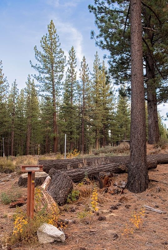
On Luther Pass Road (California Route 89) 4 miles north of Route 88, on the left when traveling north.
"Passed over the summit of the first range and came to [Grass] lake situated nearly on the summit of the mountain....We began our decent [sic] down the mountain over as rough a road as we came up, into Lake Valley" - Luman A. Scott, Sep 8, 1859 — — Map (db m212025) HM
Near Luther Pass Road (California Route 89), on the left when traveling north.
"Then up hill [from Hope Valley] and away, steep and rugged and we at last gain the first summit of the Nevada Mountains [at Luther Pass] and down t'other side more rugged than ever" - John McTurk Gibson, Sep 3 1859... — — Map (db m212003) HM
Near Emerald Bay Road (State Highway 89), on the right when traveling north.
Tahoe’s Only Island
Over the last 100 years, Tahoe’s only island has been known by a number of names. In 1866, a group of young vacationers dreamed up the first name, Coquette, a word referring to a flirtatious or seductive woman. Attracted . . . — — Map (db m275494) HM
Near Emerald Bay Road (State Highway 89), on the right when traveling north.
Imagine what an adventure it must have been for Tahoe’s early motorists. Traveling in open-air Model Ts and Oldsmobiles, vacationers began driving as roads connected the Lake’s recreation spots. Completed in 1913, a rough road around Emerald Bay . . . — — Map (db m275497) HM
Near Emerald Bay Road (State Highway 89), on the right when traveling north.
Captain Richard “Dick” Barter found his way to Lake Tahoe in the 1860s. Barter spent the long winters in Emerald Bay as the sole caretaker of a summer villa owned by Ben Holladay, Jr.
Originally an English sailor, Barter was known to row all . . . — — Map (db m275493) HM
On Lincoln Highway (U.S. 50) west of Apache Avenue, on the left when traveling west.
Send me men to match my mountains.
These are words a great poet said speaking for the brave young nation that needed strong and brave men’s aid.
In memory of
John (Snowshoe) Thompson
who, for twenty successive winters, 1856-1876, . . . — — Map (db m434) HM
On Lincoln Highway (U.S. 50) west of Apache Avenue, on the left when traveling west.
(back) The Hawley Grade from April 3, 1860 to November 17, 1860 was used by the Pony Express. On November 18, 1860 the new toll road down Johnson Pass (Echo Summit), today’s Old Meyers Grade, was opened to horse traffic and was now used by . . . — — Map (db m435) HM
On US Highway 50 (U.S. 50) west of Pioneer Trail, on the left when traveling west.
This was the site of the most eastern remount station of the Central Overland Pony Express in California. Established as a trading post in 1851 by Martin Smith, it became a popular hostelry and stage-stop operated by Ephraim “Yank” Clement on the . . . — — Map (db m433) HM
Before roads were built in the Tahoe area in the 1920s, sailing on a steamer was the only way for visitors to reach the resorts lining the south shore. The Tod Goodwin outdid all the other steamers in size and speed. It could carry 150 . . . — — Map (db m275578) HM
Guests at the Pope estate had the option of staying in one of three unique cabins, each with its own charm.
Many liked the "Log Cabin" best because it was closest to the lake. The cabin across and up the lawn called the "Pachero," was reserved . . . — — Map (db m112980) HM
When Elias J. "Lucky" Baldwin died in 1909, he left his real estate holdings in the Tahoe Basin to his daughter, Anita Baldwin. A few years later, Anita gave her daughter Dextra McGonagle this six-acre lot on the shore of Lake Tahoe.
Dextra had . . . — — Map (db m112981) HM
Possibly two of the oldest structures on the site, these log cabins were probably moved from the nearby Tallac Resort to save them from destruction when the Resort was torn down.
In 1915, Dextra and her mother Anita spent time at the lake, . . . — — Map (db m112982) HM
Near Heritage Way east of Emerald Bay Road ( Highway 89).
In 1920, at age 19, Dextra Balwin ordered construction of her summer house. The architect created a picturesque summer residence that reflected the simple, natural style favored by the wealthy in the 1920s. The house was completed in 1924 and is . . . — — Map (db m275577) HM
Near Emerald Bay Road (State Highway 89), on the right when traveling west.
A Sacred Gathering Place
Many generations of Washoe people spent summers here, living near the shores of Lake Tahoe. Known as da ow a ga by the Washoe, the lake provided a sacred meeting place, where summer gatherings were a focus of . . . — — Map (db m275491) HM
Near Heritage Way east of Emerald Bay Road ( Highway 89).
This site has been a haven for many people over the centuries. The local indigenous group, the Washoe, came here from the valleys of the Eastern Sierras to escape the desert heat, gather food, and enjoy the mountain atmosphere.
In the . . . — — Map (db m275574) HM
Near Emerald Bay Road (California Route 89) west of Cascade Road, on the right when traveling west.
From the vista, you can observe Emerald Bay and learn about its rich and colorful past
Residents & Visitors
For thousands of years, Lake Tahoe's Emerald Bay has drawn people to its shores. The Washoe Indians made their . . . — — Map (db m275495) HM
"Started at 2 P.M. down through [Lake] valley for 6 miles and campt near a small stream here we saw 2 men just commencing to mine gold just found here...Road very good this afternoon" - William Wirt Gilbert, Sep 26, 1853 — — Map (db m212407) HM
On Lakeshore Boulevard south of Stateline AVenue, on the left when traveling north.
Lakeside Park was once the Washoe Indians' favorite location for their "love feasts' or fandangos.
In 1860 a Fish Market and Landing was located where Lakeside Marina is today. The fish were used at Lapham's Stateline Hotel, and most likely sold . . . — — Map (db m227672) HM
On this site, between 1880 and 1909, Elias J. "Lucky" Baldwin created the elaborate Tallac Resort. The luxury complex featured a hotel, a casino, several cottages, a clubhouse, a boathouse, and three piers.
Wealthy society families from San . . . — — Map (db m112975) HM
On South Upper Truckee Road 1 mile west of Route 89, on the left when traveling west.
"After passing over this summit [Luther Pass] we enter Lake Valley [Lake Tahoe Basin]. Here we are camped, grass scarce. We had the roughest road down the mountain I ever saw." - John W. Powell, Sep 3, 1859 — — Map (db m212026) HM
On South Upper Truckee Road 0.3 miles north of Egret Road, on the right when traveling north.
"We now prepared for the ascent of the mountain, we put all the oxen to one wagon, and started....The road is very steep in places, and runs up and along and around the side of the mountain" - J. Robert Brown, Sep 27, 1856 — — Map (db m212028) HM
The Valhalla Boathouse
When Walter Heller purchased this land from George Pope Sr. in 1923, this boathouse was mistakenly sold with the rest of the property.
After the sale, George Pope, Sr. sold the boathouse to Heller for one dollar and . . . — — Map (db m275582) HM
Near Lake Tahoe Blvd (U.S. 50) north of Lyons Avenue.
Oldest Standing Structure at Lake Tahoe
In 1859, silver was discovered in Nevada and the road past Lake Tahoe became a busy highway for treasure seekers and for the goods they needed to survive. To keep roads in repair, stations were set up . . . — — Map (db m113203) HM
Horseback riding was a focus of the Tahoe summer experience. William Tevis Jr. was an ardent lover of horses. He became an internationally known, prize-winning polo player and horseman, and spent many hours riding and "bronco-busting" in rodeos and . . . — — Map (db m112979) HM
The big, beautiful Valhalla main building was built for entertaining. Its grand hall and huge lawn could hold scores of friends and family. The porch along the outside of the building could even be transformed into sleeping porches for extra guests. . . . — — Map (db m275580) HM
On Rufus Allen Blvd at U.S. 50, on the left when traveling north on Rufus Allen Blvd.
To all Veterans of All Wars
this monument is dedicated this
day 31 May 1999, to honor all the
courageous young men and women,
both living and deceased
who served in all wars and conflicts
and did their duty no matter where they
served . . . — — Map (db m113201) WM
The Pope complex is the largest of the Estates, and the main house the most elaborate and least rustic of the three. It is a good example of the fact that construction practices at Tahoe during this period favored the use of lavish effects and often . . . — — Map (db m112977) HM
The Tevis Arboretum & Gazebo
On any beautiful Tahoe summer afternoon, you might find members of the family and their guests enjoying tea here in the luxurious arboretum gardens. Gazebos and "summer homes" like this one were common . . . — — Map (db m275583) HM
Near Lake Tahoe Blvd (U.S. 50) north of Lyons Avenue.
A Tahoe Original
In the 1930s a man named Pomeroy built this little cabin following authentic log cabin styles brought to this country from Sweden. It sat on Star Lake Avenue behind the fire station, only a few blocks from here.
The . . . — — Map (db m113204) HM
This giant Jeffrey pine, the Old Veteran, is 350 to 400 years old. Although this tree still stands, most of the pines of the same age fell to loggers in the late 1800s. This tree is the only one of its kind near the visitor center.
Notice that . . . — — Map (db m212297) HM
Near Heritage Way east of Emerald Bay Road ( Highway 89).
The Pope Estate is the largest of the three estates at the Tallac Historic Site. In 1894, George P. Tallant built a 2,000 square foot rustic-style summer cabin on this site. Five years later, San Francisco businessman William Tevis and his wife . . . — — Map (db m275575) HM
On Lake Tahoe Blvd (U.S. 50) east of Wildwood Avenue, on the right when traveling east.
This memorial is dedicated to all from our community who gave their lives and have served our country from all branches of service. We thank you for your sacrifice and you can rest assured that we will support your families and friends. You have . . . — — Map (db m113200) WM
Because Emerald Bay reminded her of a fjord in Norway, Lora J.M. Knight purchased 200 acres here in 1928 for $250,000. She commissioned her architect nephew to design a summer home that combined the features of Scandinavian castles and churches. . . . — — Map (db m275496) HM
On Wildwood Avenue, on the right when traveling west.
This statue represents and honors the Washoe Tribe of Nevada and California. As the original inhabitants of Lake Tahoe, the Washoe people's life cycles revolved around Lake Tahoe. For thousands of years the Washoe People have been the caretakers . . . — — Map (db m258674) HM
You're standing on the site of the Tallac Resort and Casino, a turn of the century Tahoe destination promoted as "The Grandest Resort in the World." The Resort filled more than 40 acres and offered all the amenities a guest could want.
Elias . . . — — Map (db m112976) HM
Near Lake Parkway, on the left when traveling south.
Henry Van Sickle, 1822-1894
Henry Van Sickle arrived in the Carson Valley in 1852, settling near Genoa. Before Nevada became a state in 1864, and when the area was still part of the Utah Territory, Van Sickle began welcoming weary travelers – . . . — — Map (db m223617) HM
Near Lake Parkway, on the left when traveling south.
In 1988, Jack Van Sickle (1916 – 2003) donated 542 acres of land to the Nevada Division of State Parks to honor his grandfather, Henry Van Sickle. 20 years later, Van Sickle Bi-State Park was born.
”He was a cowboy. That was one of . . . — — Map (db m223616) HM
Lake Tahoe first lured hardy souls who came here to build a life in its wilderness.
Pine Lodge, rises -grandly above the translucent blue waters of Lake Tahoe's west shore.
San Francisco's elite built seasonal retreats like Pine Lodge, . . . — — Map (db m55506) HM
A Plan to Sell Trees
In the latter part of September 1861, Samuel L.
Clemens (Mark Twain) and a friend camped for
three nights on this sandy beach. After hiking
more than 11 miles from Carson City, the two
rowed about three miles across . . . — — Map (db m257004) HM
On River Road (California Route 89) south of Alpine Meadows Road, on the right when traveling south.
A Russian emigrant, surveyor and visionary, Von Schmidt established the present California-Nevada state line between Lake Tahoe and Oregon. He formed the San Fransico and Lake Tahoe Waterworks Company which proposed, during the 1870s, to build a . . . — — Map (db m169743) HM
On Truckee River Bike Trail south of Alpine Meadows Road, on the right when traveling south.
The 16 mile railroad from Lake Tahoe to Truckee was a venture by the Bliss family of the Glenbrook Lumber fame. During the summer of 1898, William Seth Bliss was hired to survey the river canyon between Tahoe and the Central Pacific RR at Truckee. . . . — — Map (db m169783) HM
One thousand competitors from 34 nations came to Squaw Valley to compete in the VIII Olympic Winter Games of 1960. The Games, brought here by Alexander C. Cushing, commemorated a century of sport skiing in America. By 1860 mining towns in the Sierra . . . — — Map (db m23504) HM
Near West Lake Boulevard (State Highway 89) west of State Highway 26.
Business and tourists
Outlet point is the location where the waters of Lake Tahoe find their only release from the lake basin along the Lower Truckee River at Tahoe City
The sheltered inlet of the Truckee River mouth provided safe harbor . . . — — Map (db m34932) HM
Near West Lake Boulevard north of Tahoe Tavern Road.
Basketmaking is a tradition of the Washoe people of the Great Basin that dates back thousands of years. Different types of baskets were made for holding water and cooking, winnowing seeds and nuts, collecting and storing food, catching fish and . . . — — Map (db m233388) HM
Controlling the flow of water through Lake Tahoe's Truckee River outlet
The Donner Lumber and Boom Company built the first dam across the Truckee River outlet in Tahoe City in 1872. Water released through the dam controlled the flow of . . . — — Map (db m112966) HM
In the 1890s, the decline in silver mining on the Comstock in Nevada reduced the demand for lumber from the Lake Tahoe basin. Local businessman Duane L. Bliss, owner of Carson and Tahoe Lumber and Fluming Company, recognized a new business . . . — — Map (db m112973) HM
Near North Lake Boulevard (State Highway 89) west of State Highway 28.
Timber baron and transportation mogul, D.L. Bliss – a one time Nevada banker – was best known for the railroads and steamships that he introduced to the Lake Tahoe Basin. He organized the Carson & Tahoe Lumber & Fluming Co. in 1871 and . . . — — Map (db m34505) HM
Near North Lake Boulevard (State Highway 28) west of Grove Street.
Tahoe City of the 1860s was a very different place than today. The first businesses include hay production, logging and fishing for native Lahontan cutthroat trout. Comstock Lode silver mining created short-lived boomtowns like Knoxville, . . . — — Map (db m34521) HM
On North Lake Boulevard (U.S. 28), on the right when traveling west.
Called the finest establishment between San Francisco and Virginia City, this elegant three and a half story resort signified the start of North Tahoe's tourist industry. Terminal for the Tahoe-Truckee Flyer Stage Line And host To the lake's . . . — — Map (db m100218) HM
Native people first lived along Lake Tahoe's shoreline over 9,000 years ago when retreating glaciers blocked most corridors to the lake.
Lake Tahoe came to be the center of traditional Washoe life. Their legends describe every aspect of the . . . — — Map (db m112969) HM
Near West Lake Boulevard (State Highway 89) west of Highway 28, on the right when traveling east.
The first outlet works were constructed in 1870 by Colonel A.W. Von Schmidt. The stone and timber crib structure soon passed to the Donner Lumber & Boom Co. who continued to regulate, for a fee, the water flow for floatation of logs and, later, . . . — — Map (db m143497) HM
Near North Lake Boulevard (State Highway 26), on the right when traveling east.
News that the 1960 Winter Olympics were coming to tiny Squaw Valley and to Lake Tahoe’s West Shore marked a milestone in Tahoe City development. All at once Lake Tahoe became known world-wide. Many new facilities were built for the Olympics, with . . . — — Map (db m37441) HM
Near North Lake Boulevard (State Highway 26), on the right when traveling east.
Think about the people who made Tahoe City what it is today. They were frontiersman and adventurers, hunters and fishermen, lumberjacks and miners, school teachers, newspapermen, and ladies of the night. They ranged from Washoe Indians, who called . . . — — Map (db m34899) HM
The Placer County Emigrant Road, known today as the Western States Trail, extended from Yankee Jim's on the Foresthill Divide to the Washoe Valley in Nevada. Built in 1852, the road served emigrants before providing a link to the Comstock boom towns . . . — — Map (db m143761) HM
Near North Lake Boulevard (State Highway 26), on the right when traveling east.
A peacetime boom came to Tahoe City. New businesses flourished. Life was changing in ways unimaginable. From the old Tahoe Tavern Winter Sports Grounds, a retired Norwegian sea captain, Kjell “Rusty” Rustad, created a small family-style . . . — — Map (db m34908) HM
On W Lake Blvd, on the right when traveling north.
Trails become roads around Lake Tahoe
Early travel in the Lake Tahoe basin was along Washoe Indian trails and later along American immigrant trails blazed in the 1840s over the rugged Sierra Nevada Mountain passes. The first roads in the . . . — — Map (db m112967) HM
Near North Lake Boulevard (State Highway 26), on the right when traveling east.
In 1925, the Southern Pacific Railroad bought Tahoe Tavern and the railroad from Duane L. Bliss. They changed the narrow-gauge railroad to standard tracks and attempted to clear them of snow during the winter. Their vision was to turn Tahoe City . . . — — Map (db m34905) HM
Near North Lake Boulevard (State Highway 28) west of Grove Street.
The turn of the last century brought sweeping change to Tahoe City. Previously, only wealthy families could afford to travel to Lake Tahoe for an extended summer vacation. By the 1920s middle class families could afford to travel in their . . . — — Map (db m34522) HM
Near North Lake Boulevard (State Highway 26), on the right when traveling east.
Most folks traveling to Tahoe City in the 1800s arrived by stagecoach from Truckee. By 1868, 25 people called Tahoe City home.
Some harvested hay on what is now Tahoe City’s Golf Course, some worked as fishermen on Lake Tahoe. Others found . . . — — Map (db m34864) HM
Near North Lake Boulevard (State Highway 28) west of Grove Street, on the right when traveling east.
For over 125 years a grand pine tree known as the “Big Tree” stood in the centerline of Highway 28 in the heart of Tahoe City.
In 1940 the Federated Women’s Club literally joined hands around the tree when the California Division of Highways’ . . . — — Map (db m34524) HM
Near California 28 Sunnyside south of North Lake Tahoe Boulevard ( Highway 26).
In 1901 Tahoe City needed a constable. There was an influx of workers and summer visitors expected with the completion of a 15-mile railroad line from Truckee and the opening of the 400-room hotel, The Tahoe Tavern. Robert Montgomery Watson, an . . . — — Map (db m55503) HM
Near West Lake Boulevard (State Highway 89) west of State Highway 28.
[First Marker – Located on the left:]
The North Lake Tahoe Historical Society (NLTHS) operates and maintains the Gatekeeper’s Museum, The Marion Steinback Indian Basket Museum, the Watson Cabin Living Museum (located above Commons . . . — — Map (db m34922) HM
Just as you may have come to fish these waters today, so have native people for thousands of years. Natives of the Tahoe Sierra fished the waters from Lake Tahoe and the Truckee River and Pyramid Lake for food. Depending on the season, they pulled . . . — — Map (db m112970) HM
Near West Lake Boulevard (State Highway 89) near State Highway 26.
Lake Tahoe is sacred to the Wa-she-shu or Washoe people.
Each spring family groups gathered at Da-ow-‘ah-ga or Lake Tahoe’s shore and offered blessings. Countless generations of children were taught by each family’s leader that their . . . — — Map (db m35432) HM
Near North Lake Boulevard (State Highway 26), on the right when traveling east.
Positioned on a bluff over looking Tahoe City’s Common Beach is the historic Watson’s Log Cabin. The cabin is listed on the National Register of Historic Places as the oldest log structure remaining in the North Lake Tahoe area.
The two-story . . . — — Map (db m34836) HM
In the years before automobiles and paved highways, local businessman D. L. Bliss needed a way to bring people to his new Tahoe Tavern hotel. He formed the Lake Tahoe Railway and Transportation Company to build and operate a railroad connection . . . — — Map (db m112972) HM
On West Lake Boulevard (State Highway 89) west of North Lake Boulevard (State Highway 28), on the right when traveling north.
This park was named for and dedicated to the memory of William B. Layton by the North Lake Tahoe Historical Society.
North Lake Tahoe will miss the unselfish way the Bill worked for the community. Past General Manager of the Tahoe City Public . . . — — Map (db m143487) HM
On North Carson Street (Lincoln Highway) (Business U.S. 395) north of West Robinson Street, on the left when traveling north.
”Pony” Bob Haslam, considered to be the greatest of all Pony Express riders, rode for the Express from the beginning to the end. His route was through Carson City, one of the relay stations.
Erected by the Nevada Pony Express Centennial . . . — — Map (db m128553) HM
Abraham Curry, the “Father of Carson City”, accomplished more in his 15 year residence than most men hope to in a lifetime. Not only did he purchase the land in 1858 which is now Carson City, but laid out the townsite and built many of its . . . — — Map (db m20874) HM
On Spooner Drive near Windridge Drive, on the right when traveling west.
In 1902 Marion Jefferson Blackwell purchased 360 acres from the State of Nevada, 556 acres of adjoining land from Sweeney’s Hot Springs and a lot with a house. He raised carp and catfish to sell commercially also hay and horses. Neighbors used the . . . — — Map (db m116178) HM
On Elizabeth Street at West Robinson Street, on the left when traveling north on Elizabeth Street.
Built by Duane L. Bliss
Lumber & railroad Magnate
1879
In it's time the most modern & largest home in Nevada.
Entirely constructed of clear lumber & square nails.
First home in Nevada entirely piped for gas lighting. — — Map (db m284410) HM
On South Carson Street (Business U.S. 395), on the right when traveling south.
[Front of Marker:]
Dedicated April 12, 1996
Carson City
Original Station
Apr. 3, 1860 - Nov. 20, 1861
by
Byron L. & Peggy Clark & Family
Bob & Tina McFadden
Mae & Jim Thorpe
The Bike Smith
Betty Young & Erica . . . — — Map (db m23038) HM
Near South Carson Street (U.S. 395/50) near East Musser Street.
Nevada's State Capital, one of the state’s oldest communities, was established in 1851 as Eagle Station, a trading post and ranch on the Carson Branch of the California Immigrant Trail, by Frank and Warren L. Hall, George Follansbee, Joe and . . . — — Map (db m20911) HM
On North Stewart Street, on the left when traveling south.
This is the site of the house and observatory of Nevada’s first weatherman, astronomer, and seismologist, Charles William Friend. Born in Prussia in 1835, Friend immigrated by way of South America to California during the 1849 Gold Rush. In 1867, he . . . — — Map (db m162166) HM
On East 3rd Street just east of South Stewart Street, on the right when traveling west.
This site was part of Carson City's Chinatown, which at one time was one of Nevada's largest Chinese Communities. In the 1880 Census Manuscript of Carson City, of the 789 Chinese, 706 were men and of these, 267 were married, 18 were widowed, 391 . . . — — Map (db m146930) HM
At 4:00 Am September 28, 1926, Fire Broke Out At The Jack Smith Ranch, At The Base Of Clear Creek Canyon.winds, Reversed Itself And Came Down Ings Canyon. It Reversed Itself Again And Raced Up Kings Canyon Once More, Trapping 5 Firefighters Near The . . . — — Map (db m100249) HM
On East Musser Street at North Pratt Avenue, on the right when traveling east on East Musser Street.
On March 17, 1897, at an arena located on this site, Carson City played host to Nevada's first world championship prizefight, a fourteen-round thriller in which the reigning heavyweight titlist, James J. "Gentleman Jim" Corbett, was dethroned by . . . — — Map (db m69690) HM
“Myriads of Stars shine over the graves of our ancestors.” Dat-So-La-Lee had seen some 96 winters, mostly in Carson Valley, when death came in 1925.
She was the last of those Washoe weavers whose ancient art had been practiced by countless . . . — — Map (db m20801) HM
Near North Carson Street (Lincoln Highway) (Business U.S. 395) at East Caroline Street, on the left when traveling north.
This reproduction of the Liberty Bell was presented to the people of Nevada by direction of The Honorable John W. Snyder Secretary of the Treasury
As the inspirational symbol of the United States Savings Bonds Independence . . . — — Map (db m128551) HM
On West Appion Way at Snyder Avenue, on the right when traveling west on West Appion Way.
Centrally located between the first Nevada settlement at Genoa and the precious metal deposits of the Comstock Lode, Eagle Valley, site of present Carson City, was a vital link in land communications.
One of the key California emigrant routes, . . . — — Map (db m20802) HM
On U.S. 50 at Akron Way, on the right when traveling east on U.S. 50.
When the Comstock Lode was discovered in 1859, the problem of reducing the ore from the fabulously rich Virginia City mines had to be solved. Mills were built in Gold Canyon and Six Mile Canyon. In Washoe Valley, at Dayton, and on the Carson . . . — — Map (db m55083) HM
Empire City was a milling town that was established in 1855. As you read this storyboard you are facing east toward Brunswick Canyon. The City of Empire was located to your right about 1/4 - 1/2 mile. At one time Empire City stretched for 3/4 of a . . . — — Map (db m89601) HM
On North Carson Street at East Telegraph Street, on the right when traveling north on North Carson Street.
This imposing public structure, the former United States Post Office and Courthouse, represents the first federal office building constructed in the State of Nevada.
Construction began in late 1888 and was completed in 1891 at a cost of $138, . . . — — Map (db m101827) HM
On South Carson Street (U.S. 395/50), on the right when traveling south.
On this site in the period from 1870 until 1918 stood the ornate two-story home of Mathew Culbertson Gardner, rancher and lumberman. The residence was headquarters for Gardner’s 300 acre ranch in Meadows to the Southward.
Here was located, 1870 . . . — — Map (db m20926) HM
Approximately one-half mile south of this point and west of the present highway lay the immense lumberyard of the Carson-Tahoe Lumber and Fluming Company, the greatest of the Comstock lumbering combines operating in the Lake Tahoe Basin during . . . — — Map (db m20804) HM
On East Musser Street at North Plaza Street on East Musser Street.
This block at the historic core of Carson City was the site of many business enterprises since the city's founding in 1858. The longest standing structure was the Odd Fellows Hall. Here for some 95 years the following lodges met at one time or . . . — — Map (db m89475) HM
On Kings Canyon Road 0.1 miles south of Cooper Springs Court, on the right when traveling south.
Originally a Washoe Indian trail, Kings Canyon served as a gateway to Lake Tahoe following the gold rush to California. Eagle Station was established in 1851 near the mouth of the canyon, Dr. Benjamin King built his ranch the next year, and others . . . — — Map (db m163164) HM
Near Seely Loop near North Saliman Road, on the left.
In March 1868 William Sharon of the Bank of California contracted with Isaac Evan James to construct a railroad from the mines of the Comstock Lode to the stamp mills located on the Carson River. Survey work got underway in December and grading . . . — — Map (db m21338) HM
On Empire Ranch Road at Morgan Mill Road on Empire Ranch Road.
Johnson Cutoff - A New Road
"Strike the river and campt on the bank... near the junction of the roads... The left is the old Carson Road. The right is Johnsons Cut Off a new road... we take the cut off... across the valley to Eagle Ranch 4 . . . — — Map (db m264678) HM
"Continue descending but passing over sandy hills on the south of the road [south of Hwy 50]... Good grass and water 2 miles [to Clear Creek]" - James H. Compton, Sep 20, 1853 — — Map (db m228421) HM
Unveiled June 10, 1989
Artist: Buckeye Blake
It was the winter of 1843-44 when Kit Carson along with the John C. Fremont expedition worked his way south from Pyramid Lake looking for an easy route across the Sierra Nevada. Carson, depicted . . . — — Map (db m20897) HM
On U.S. 395 Alterate (Alternate U.S. 395) at Hobart Road, on the right when traveling south on U.S. 395 Alterate.
As early as 1863, two hotels with appurtenant stables were located here. In 1872, one hotel became a station on the newly-completed Virginia and Truckee Railroad between Carson City and Reno.
Crossing under the highway are three inverted . . . — — Map (db m244508) HM
On North Carson Street (Lincoln Highway) (Business U.S. 395) at West Robinson Street, on the left when traveling north on North Carson Street (Lincoln Highway).
Now:
U.S. 50 • San Francisco to Salt Lake City
U.S. 30 • Salt Lake City to Philadelphia
U.S. 1 • Philadelphia to New York City — — Map (db m128552) HM
Near South Carson Street (Business U.S. 395) at Fairview Drive, on the right when traveling south.
Logging wagon built in 1870 at Bassett Station, Yuba Pass. Used to haul lumber to the Sierra Buttes mines with teams of oxen. Presented to Nevada Day committee in 1950 by Ceasar P. Lombardi. — — Map (db m163897) HM
Dedicated in 1867, this church serves a congregation that was organized in 1859 and is often referred to as the “Cradle of Nevada Methodism”. Like many other buildings in Carson City, the stone used in its construction was quarried at . . . — — Map (db m21240) HM
On North Roop Street 0.2 miles south of East William Street.
On April 15th, 1951 this 52-acre tract, known as Foley's Woods to Carsonites of an earlier day, was presented to the City of Carson by the Mills family, of San Francisco, for use as a city park. The 52-acre tract embraces the eastern extremity of . . . — — Map (db m221712) HM
On North Carson Street (Lincoln Highway) (Business U.S. 395) north of West Robinson Street, on the left when traveling north.
Honour to the Nevada men who were riders in the July 19 to 28, 1960 Centennial Reenactment of the Pony Express
Monument Erected by the
Pony Express Club of Nevada
National Pony Express Centennial Association
Dwight D. . . . — — Map (db m128554) HM
On South Stewart Street at East 7th Street, on the right when traveling south on South Stewart Street.
The Nevada Orphan’s Asylum, a privately funded institution, was opened in Virginia City May 1867 by Sister Frederica McGrath and two other nuns of the Sisters of Charity. By 1870, most of its functions were taken over by the Nevada Orphans’ Home . . . — — Map (db m20806) HM
354 entries matched your criteria. The first 100 are listed above. Next 100 ⊳