752 entries match your criteria. The first 100 are listed. ⊳
Historical Markers and War Memorials on the Sea Islands Region
By Brandon D Cross, August 10, 2019
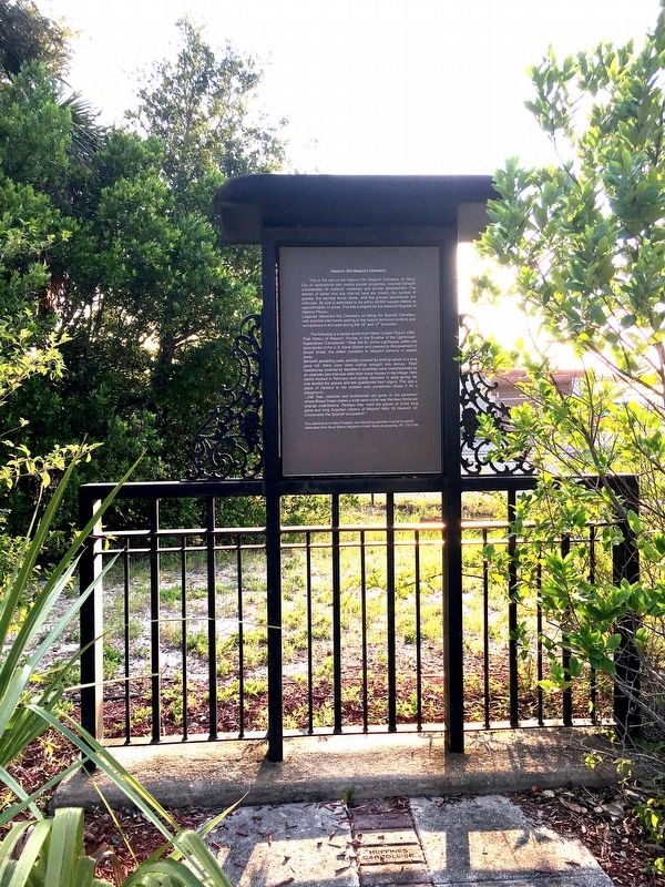
Historic Old Mayport Cemetery Marker
1 ► Florida, Duval County, Atlantic Beach, Mayport — Historic Old Mayport Cemetery —  |
| On Broad Street 0.2 miles east of Ocean Street, on the left when traveling east. | |||
| 2 ► Florida, Duval County, Atlantic Beach, The Beaches — F-917 — Combat Team Camp Atlantic Beach — |
| On Plaza Drive at Seminole Road, on the right when traveling east on Plaza Drive. | |||
| 3 ► Florida, Duval County, Atlantic Beach, The Beaches — F-1253 — Town Marshal Paul M. Patrick — |
| On Ocean Boulevard at Atlantic Boulevard, on the right when traveling north on Ocean Boulevard. | |||
| 4 ► Florida, Duval County, Fort George Island — F-271 — Fort George Island — |
| On Fort George Road, on the right when traveling north. | |||
| 5 ► Florida, Duval County, Fort George Island — Ribault Club Inn — |
| On Fort George Road, on the right when traveling north. | |||
| 6 ► Florida, Duval County, Fort George Island — F-211 — Site of the Mission of San Juan del Puerto — |
| On Ft. George Road, on the left when traveling north. | |||
| 7 ► Florida, Duval County, Fort George Island — F-544 — St. George Episcopal Church — |
| On Fort George Road, on the left when traveling north. | |||
| 8 ► Florida, Duval County, Jacksonville, Fort George Island — A Very Comfortable Habitation — |
| On Palmetto Avenue 2.1 miles north of Fort George Road, on the left when traveling north. | |||
| 9 ► Florida, Duval County, Jacksonville, Fort George Island — African Identity — African Identity and Archaeology at Kingsley Plantation — African Identity in the Archival Record — |
| Near Palmetto Avenue 2.1 miles north of Fort George Road, on the left when traveling north. | |||
| 10 ► Florida, Duval County, Jacksonville, Fort George Island — African Identity — African Identity and Archaeology at Kingsley Plantation — African Identity Discovered Through Archaeology — |
| On Palmetto Avenue 2.1 miles Fort George Road, on the left when traveling north. | |||
| 11 ► Florida, Duval County, Jacksonville, Fort George Island — Choices — A New Era of Choices — |
| Near Palmetto Avenue 2.1 miles north of Fort George Road when traveling north. | |||
| 12 ► Florida, Duval County, Jacksonville, Fort George Island — Fort George Island — The Plantation Era in Florida — |
| Near Palmetto Avenue 2.1 miles north of Fort George Road when traveling north. | |||
| 13 ► Florida, Duval County, Jacksonville, Fort George Island — Jean Ribaut — |
| On Heckscher Drive (State Road 1A) south of Fort George Road, on the right when traveling south. | |||
| 14 ► Florida, Duval County, Jacksonville, Fort George Island — Kingsley Plantation — Fort George Island — |
| On Palmetto Avenue 2.1 miles north of Fort George Road, on the right when traveling north. | |||
| 15 ► Florida, Duval County, Jacksonville, Fort George Island — Kingsley Plantation — Freedom and Slavery — |
| Near Palmetto Avenue 2.1 miles north of Fort George Road, on the right when traveling north. | |||
| 16 ► Florida, Duval County, Jacksonville, Fort George Island — Kingsley Plantation — Plantation Era Florida — |
| Near Palmetto Avenue 2.1 miles north of Fort George Road. | |||
| 17 ► Florida, Duval County, Jacksonville, Fort George Island — Looking Back — |
| On Palmetto Avenue 2.1 miles north of Fort George Road, on the left when traveling north. | |||
| 18 ► Florida, Duval County, Jacksonville, Fort George Island — Looking Back — |
| On Palmetto Avenue 2.1 miles north of Fort George Road. | |||
| 19 ► Florida, Duval County, Jacksonville, Fort George Island — F-819 — Pilot Town/Napoleon Bonaparte Broward — |
| On Heckscher Drive (State Road A1A) south of Fort George Road, on the left when traveling south. | |||
| 20 ► Florida, Duval County, Jacksonville, Fort George Island — Plantation Crops — Grown for Profit and Sustenance — |
| Near Palmetto Avenue 2.1 miles north of Fort George Road. | |||
| 21 ► Florida, Duval County, Jacksonville, Fort George Island — Plantation House — History of a House — |
| Near Palmetto Avenue 2.1 miles north of Fort George Road when traveling north. | |||
| 22 ► Florida, Duval County, Jacksonville, Fort George Island — Plantation Slavery — The Many Faces of Slavery — |
| On Palmetto Avenue 2.1 miles north of Fort George Road, on the left when traveling north. | |||
| 23 ► Florida, Duval County, Jacksonville, Fort George Island — Slave Cabins — The Lost Art of Tabby — |
| On Palmetto Avenue north of Fort George Road, on the right when traveling north. | |||
| 24 ► Florida, Duval County, Jacksonville, Fort George Island — Slave Cabins — Resistance — |
| On Palmetto Avenue 2.1 miles north of Fort George Road, on the right when traveling north. | |||
| 25 ► Florida, Duval County, Jacksonville, Fort George Island — Slave Cabins — Strength to Survive — |
| On Palmetto Avenue 2.1 miles north of Fort George Road, on the right when traveling north. | |||
| 26 ► Florida, Duval County, Jacksonville, Fort George Island — Slave Cabins — Looking Back — |
| On Palmetto Avenue 2.1 miles north of Fort George Road, on the left when traveling north. | |||
| 27 ► Florida, Duval County, Jacksonville, Fort George Island — Slave Cabins — Voices From the Past — |
| On Palmetto Avenue 2.1 miles north of Fort George Road, on the right when traveling north. | |||
| 28 ► Florida, Duval County, Jacksonville, Fort George Island — Slave Cabins — Growing Up a Slave — |
| On Palmetto Avenue 2.1 miles north of Fort George Road, on the right when traveling north. | |||
| 29 ► Florida, Duval County, Jacksonville, Fort George Island — Slave Trade / La Traite d'Esclaves — The Port of Nantes / Le Port de Nantes — |
| Near Palmetto Avenue 2.2 miles north of Fort George Road when traveling north. | |||
| 30 ► Florida, Duval County, Jacksonville, Fort George Island — Slave Trade / La Traite d'Esclaves — A Valuable Commodity / Une marchandise de grande valeur — |
| Near Palmetto Avenue 2.2 miles north of Fort George Road when traveling north. | |||
| 31 ► Florida, Duval County, Jacksonville, Fort George Island — Slaves Cabins — At the Edge between Two Worlds — |
| On Palmetto Avenue 2.1 miles north of Fort George Road, on the right when traveling north. | |||
| 32 ► Florida, Duval County, Jacksonville, Fort George Island — Task System — Managing Labor — |
| On Palmetto Avenue 2.1 miles north of Fort George Road, on the left when traveling north. | |||
| 33 ► Florida, Duval County, Jacksonville, Fort George Island — Waterways — A Link to the World — |
| Near Palmetto Avenue 2.1 miles north of Fort George Road when traveling north. | |||
| 34 ► Florida, Duval County, Jacksonville, North Beach — F-1099 — Historic Manhattan Beach, Florida — |
| Near Seminole Road 0.1 miles east of Campground Road. | |||
| 35 ► Florida, Duval County, Jacksonville, Northside — F-842 — Sawpit Bluff Plantation — |
| On Sawpit Road 0.1 miles north of Flounder Road, on the left when traveling north. | |||
| 36 ► Florida, Duval County, Jacksonville, Northside — F-138 — The Huguenot Memorial Site — |
| On Huguenot Memorial Park Road 0.2 miles east of Heckscher Drive (State Road A1A), on the right when traveling east. | |||
| 37 ► Florida, Duval County, Jacksonville, Northside — Yellow Bluff Fort — Dedicated to the memory of the Confederate soldiers who defended Jacksonville, 1861-1865. — |
| On New Berlin Road at Olympia Avenue, on the right when traveling east on New Berlin Road. | |||
| 38 ► Florida, Duval County, Jacksonville Beach, The Beaches — F-758 — American Red Cross Volunteer Life Saving Corps and Station — |
| On Beach Boulevard east of 1st Street South, on the left when traveling east. | |||
| 39 ► Florida, Duval County, Jacksonville Beach, The Beaches — Beaches Museum Chapel — In Honor of Frances Deyampert McCondichie — |
| Near Beach Boulevard (U.S. 90). | |||
| 40 ► Florida, Duval County, Jacksonville Beach, The Beaches — Beaches Museum Chapel — |
| On Beach Boulevard at 4th Street South, on the right when traveling east on Beach Boulevard. | |||
| 41 ► Florida, Duval County, Jacksonville Beach, The Beaches — Coastal Weather — |
| Near 1st Street South (Ocean Front Street) just south of 5th Avenue South, on the right when traveling north. | |||
| 42 ► Florida, Duval County, Jacksonville Beach, The Beaches — F-293 — Doolittle's 1922 Record Flight — |
| On Beach Boulevard (U.S. 90) near N 5th Street, on the right when traveling west. | |||
| 43 ► Florida, Duval County, Jacksonville Beach, The Beaches — F-305 — First Settlers At Ruby, Florida — |
| On Beach Boulevard (U.S. 90) near N 4th Street, on the right when traveling west. | |||
| 44 ► Florida, Duval County, Jacksonville Beach, The Beaches — Florida East Coast Foreman’s House — |
| On Beach Boulevard at 4th Street South, on the right when traveling west on Beach Boulevard. | |||
| 45 ► Florida, Duval County, Jacksonville Beach, The Beaches — Florida East Coast Railway Depot — |
| On Pablo Avenue at 4th Street South, on the right when traveling east on Pablo Avenue. | |||
| 46 ► Florida, Duval County, Jacksonville Beach, The Beaches — Mayport Depot |
| Near Beach Boulevard (U.S. 90) at 4th Street North, on the right when traveling west. Reported permanently removed. | |||
| 47 ► Florida, Duval County, Jacksonville Beach, The Beaches — Oesterreicher-McCormick Cabin — Beaches Museum History Park — |
| On Pablo Avenue at Street South, on the right when traveling east on Pablo Avenue. | |||
| 48 ► Florida, Duval County, Jacksonville Beach, The Beaches — Oesterreicher-McCormick Homestead — In Honor of Vic & Mary Lenoble |
| On Pablo Avenue (U.S. 90) at North 5th Street, on the left when traveling west on Pablo Avenue. Reported permanently removed. | |||
| 49 ► Florida, Duval County, Jacksonville Beach, The Beaches — Pablo Beach FEC Foreman's House |
| Near Beach Boulevard (U.S. 90) at 4th Street North, on the right when traveling west. Reported permanently removed. | |||
| 50 ► Florida, Duval County, Jacksonville Beach, The Beaches — Pablo Beach Post Office — |
| Near 4th Street North (U.S. 90). | |||
| 51 ► Florida, Duval County, Jacksonville Beach, The Beaches — Porter Wood Burning Locomotive — |
| On Beach Boulevard (U.S. 90), on the left when traveling east. | |||
| 52 ► Florida, Duval County, Jacksonville Beach, The Beaches — SS Gulfamerica — |
| Near 1st Street South north of 5th Avenue South, on the right when traveling north. | |||
| 53 ► Florida, Duval County, Jacksonville Beach, The Beaches — F-541 — SS Gulfamerica — |
| On 4th Avenue N near Ocean Front N, on the right when traveling north. | |||
| 54 ► Florida, Duval County, Jacksonville Beach, The Beaches — Steam Locomotive No.7 — Beaches Museum — |
| Near Beach Boulevard (U.S. 90) at 4th Street North, on the left when traveling east. | |||
| 55 ► Florida, Duval County, Jacksonville Beach, The Beaches — The 1911 Train Engine — |
| On Beach Boulevard at 4th Street South, on the right when traveling west on Beach Boulevard. | |||
| 56 ► Florida, Duval County, Jacksonville Beach, The Beaches — World War II Veterans Memorial — Jacksonville Beach — |
| Near 1st Street South 0.1 miles north of 5th Avenue South. | |||
| 57 ► Florida, Duval County, Mayport — French Huguenots in North America — |
| On Ocean Street (State Road A1A) just east of Broad Street, on the left when traveling east. | |||
| 58 ► Florida, Duval County, Mayport — U.S. Merchant Marine — American Export Lines • United Fruit Company — |
| On Ocean Street (Florida Route A1A) at Broad Street, on the right when traveling north on Ocean Street. | |||
| 59 ► Florida, Duval County, Neptune Beach, The Beaches — F-1084 — Girl Scouts Beaches Little House — |
| On Florida Boulevard 0.1 miles west of 3rd Street ( Route A1A), on the right when traveling west. | |||
| 60 ► Florida, Nassau County, American Beach — F-660 — A Dune System Called "NaNa" — |
| On Ocean Blvd, on the right when traveling south. | |||
| 61 ► Florida, Nassau County, American Beach — American Beach at the Crossroads — |
| On Ocean Blvd near Lewis Street, on the right when traveling south. | |||
| 62 ► Florida, Nassau County, American Beach — F-1147 — Burney Park — |
| Near Gregg Street at Ocean Boulevard. | |||
| 63 ► Florida, Nassau County, American Beach — F-1079 — Evans' Rendezvous — |
| On Gregg Street just south of Lewis Street, on the left when traveling south. | |||
| 64 ► Florida, Nassau County, American Beach — F-737 — Franklintown Chapel — |
| On Lewis Street near 1st Coastal Highway (State Road A1A), on the right when traveling west. | |||
| 65 ► Florida, Nassau County, American Beach — F417 — Historic American Beach — |
| On Lewis Street at Waldron Street, on the right when traveling east on Lewis Street. | |||
| 66 ► Florida, Nassau County, American Beach — F-626 — Martha's Hideaway — |
| On Ervin Street, on the right when traveling north. | |||
| 67 ► Florida, Nassau County, American Beach — F-1129 — The Guzman House — Jessie Parkhurst Guzman - Ignacio L. Guzman — |
| On Waldron Stret at Julia Street, on the left when traveling north on Waldron Stret. | |||
| 68 ► Florida, Nassau County, American Beach — F-1146 — The Stewart House — |
| On Waldron Street at Julia Street, on the left when traveling north on Waldron Street. | |||
| 69 ► Florida, Nassau County, Fernandina Beach — 6-Pound Cannon — Fernandina Plaza Historic State Park — |
| On Estrada Street at White Street, on the right when traveling south on Estrada Street. | |||
| 70 ► Florida, Nassau County, Fernandina Beach — Amelia Island Lighthouse — |
| Near Lighthouse Circle north of O'Hagan Lane. | |||
| 71 ► Florida, Nassau County, Fernandina Beach — Civilian Conservation Corps Company 1420 — Fort Clinch State Park — |
| On Fort Clinch Street Park Drive 0.1 miles south of Fort Clinch State Park Museum, on the left when traveling north. | |||
| 72 ► Florida, Nassau County, Fernandina Beach — David L. Yulee — |
| On Alachua Street east of North 3rd Street, on the right when traveling west. | |||
| 73 ► Florida, Nassau County, Fernandina Beach — Egmont Plantation — A Casualty of the Revolutionary War — |
| On Atlantic Avenue (State Road A1A) at North Wolff Street, on the right when traveling west on Atlantic Avenue. | |||
| 74 ► Florida, Nassau County, Fernandina Beach — F-956 — Ervin’s Rest — |
| On Gregg Street at Julia Street, on the right when traveling north on Gregg Street. | |||
| 75 ► Florida, Nassau County, Fernandina Beach — Evans’ Rendezvous — American Beach Historic District — A Project of the Trust for Public Land — |
| On Gregg Street at Lewis Street, on the left when traveling south on Gregg Street. | |||
| 76 ► Florida, Nassau County, Fernandina Beach — Fairbanks Home — |
| On S 7th Street near Cedar Street, on the right when traveling south. | |||
| 77 ► Florida, Nassau County, Fernandina Beach — F-198 — Fernandez Grant — |
| On North 4th Street south of Calhoun Street. | |||
| 78 ► Florida, Nassau County, Fernandina Beach — F-880 — First Home on American Beach — |
| On Gregg Street just north of Lewis Street, on the right when traveling north. | |||
| 79 ► Florida, Nassau County, Fernandina Beach — F-1027 — First Missionary Baptist Church of Fernandina — |
| On South 9th Sreet just south of Atlantic Avenue ( Route A1A), on the right when traveling north. | |||
| 80 ► Florida, Nassau County, Fernandina Beach — 279 — First Presbyterian Church — American Presbyterian and Reformed Historical Site — |
| On North 6th Street near Alachua Street, on the left when traveling north. | |||
| 81 ► Florida, Nassau County, Fernandina Beach — Florida House — José Martí — 1853-1895 — |
| On South 3rd Street south of Centre Street, on the left when traveling south. | |||
| 82 ► Florida, Nassau County, Fernandina Beach — F-28 — Florida's First Atlantic to Gulf Railroad — |
| On Center Avenue east of Front Street, on the left when traveling west. | |||
| 83 ► Florida, Nassau County, Fernandina Beach — Fort Clinch — |
| On Fort Clinch Road 3.1 miles north of Atlantic Avenue, on the right when traveling west. | |||
| 84 ► Florida, Nassau County, Fernandina Beach — Fort Clinch Military Road — |
| On Fort Clinch Road 3.1 miles north of Atlantic Avenue, on the right when traveling east. | |||
| 85 ► Florida, Nassau County, Fernandina Beach — Fort Clinch Military Road — Fernandina Plaza Historic State Park — |
| On Estrada Street at White Street, on the right when traveling south on Estrada Street. | |||
| 86 ► Florida, Nassau County, Fernandina Beach — F-250 — Fort San Carlos — |
| On Estrada Street at White Street, on the right when traveling south on Estrada Street. | |||
| 87 ► Florida, Nassau County, Fernandina Beach — Home of Fort Clinch — Greetings from Amelia Island — America250FL Road Trip — |
| On Fort Clinch Road 0.2 miles north of Atlantic Avenue ( Route 200), on the right when traveling north. | |||
| 88 ► Florida, Nassau County, Fernandina Beach — F-1210 — Macedonia African Methodist Episcopal Church of Fernandina — |
| On South 9th Street at Beech Street, on the right when traveling north on South 9th Street. | |||
| 89 ► Florida, Nassau County, Fernandina Beach — McClure's Hill — |
| On North 14th Street south of Leon Street. | |||
| 90 ► Florida, Nassau County, Fernandina Beach — F-371 — Memorial United Methodist Church — United Methodist Church Registered Historic Site No. 303 — |
| On Sixth Street near Centre Street (State Road 1A / 20), on the right when traveling north. | |||
| 91 ► Florida, Nassau County, Fernandina Beach — Mount Olive Baptist Church — |
| On Old Nassauville Road (County Road 107) just south of Dirt Road, on the left when traveling south. | |||
| 92 ► Florida, Nassau County, Fernandina Beach — Nassau County American Revolutionary War Memorial — |
| On South 11th Street at Atlantic Avenue (State Road A1A/200), on the right when traveling north on South 11th Street. | |||
| 93 ► Florida, Nassau County, Fernandina Beach — F-686 — Nassau County Historic Courthouse — |
| On Centre Street near S 5th Street, on the right when traveling east. | |||
| 94 ► Florida, Nassau County, Fernandina Beach — F-443 — New Zion Baptist Church — |
| On South Street near Atlantic Avenue (State Route 200) (State Road A1A), on the left when traveling south. | |||
| 95 ► Florida, Nassau County, Fernandina Beach — Old Town — |
| On White Street at North 14th Streeet, on the right when traveling west on White Street. | |||
| 96 ► Florida, Nassau County, Fernandina Beach — F-873 — Peck High School — |
| On South 10th Street at Fir Street, on the right when traveling north on South 10th Street. | |||
| 97 ► Florida, Nassau County, Fernandina Beach — F-419 — Phelan-Verot House Built Prior to 1866 — |
| On N 4th Street near Alachua Street, on the right when traveling north. | |||
| 98 ► Florida, Nassau County, Fernandina Beach — F-249 — Plaza San Carlos — |
| On Estrada Street at Someruelus Street, on the right when traveling south on Estrada Street. | |||
| 99 ► Florida, Nassau County, Fernandina Beach — Post Office Lamp Posts — |
| On Centre Street at North 4th Street, on the right when traveling west on Centre Street. | |||
| 100 ► Florida, Nassau County, Fernandina Beach — Representative George A. Crady — Floridian, Friend, Citizen, Legislator, and Fisherman — |
| Near 1st Coast Hwy (Florida Route A1A) 0.9 miles south of Sanctuary Lane, on the right when traveling south. | |||
752 entries matched your criteria. The first 100 are listed above. Next 100 ⊳