355 entries match your criteria. The first 100 are listed. ⊳
Historical Markers and War Memorials
in the Lake Tahoe Basin Region
By Alvis Hendley, October 21, 2022
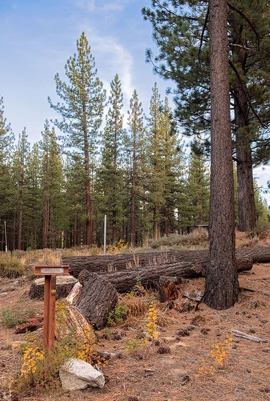
Luther Pass Trail Marker 3 of 5
1 ► California, Alpine County, Meyers — LP-3 — Luther Pass Trail - Came to Grass Lake —  |
| On Luther Pass Road (California Route 89) 4 miles north of Route 88, on the left when traveling north. | |||
| 2 ► California, Alpine County, Meyers — LP-2 — Luther Pass Trail - Luther Pass — |
| Near Luther Pass Road (California Route 89), on the left when traveling north. | |||
| 3 ► California, El Dorado County, Emerald Bay — Fannette Island — |
| Near Emerald Bay Road (State Highway 89), on the right when traveling north. | |||
| 4 ► California, El Dorado County, Emerald Bay — Tahoe By Car — Automotive Adventures — |
| Near Emerald Bay Road (State Highway 89), on the right when traveling north. | |||
| 5 ► California, El Dorado County, Emerald Bay — The Hermit of Emerald Bay — An Eccentric Caretaker — |
| Near Emerald Bay Road (State Highway 89), on the right when traveling north. | |||
| 6 ► California, El Dorado County, Meyers — John (Snowshoe) Thompson — |
| On Lincoln Highway (U.S. 50) west of Apache Avenue, on the left when traveling west. | |||
| 7 ► California, El Dorado County, Meyers — Yank’s Added Station — |
| On Lincoln Highway (U.S. 50) west of Apache Avenue, on the left when traveling west. | |||
| 8 ► California, El Dorado County, Meyers — 708 — Yank’s Station — |
| On US Highway 50 (U.S. 50) west of Pioneer Trail, on the left when traveling west. | |||
| 9 ► California, El Dorado County, South Lake Tahoe — "The Only Way to See Lake Tahoe" — |
| Near Heritage Way. | |||
| 10 ► California, El Dorado County, South Lake Tahoe — A Room with a View — |
| Near Heritage Way. | |||
| 11 ► California, El Dorado County, South Lake Tahoe — A Rustic Retreat: The Baldwin Estate — |
| Near Heritage Way. | |||
| 12 ► California, El Dorado County, South Lake Tahoe — Anita Gibson & Dextra Cabins — Guest Quarters — |
| Near Heritage Way. | |||
| 13 ► California, El Dorado County, South Lake Tahoe — Baldwin House & Tallac Museum — Rustic Gem — |
| Near Heritage Way east of Emerald Bay Road ( Highway 89). | |||
| 14 ► California, El Dorado County, South Lake Tahoe — Da ow a ga – Lake Tahoe — |
| Near Emerald Bay Road (State Highway 89), on the right when traveling west. | |||
| 15 ► California, El Dorado County, South Lake Tahoe — Discover the Tallac Historic Site — |
| Near Heritage Way east of Emerald Bay Road ( Highway 89). | |||
| 16 ► California, El Dorado County, South Lake Tahoe — Enjoy the View from Inspiration Point — |
| Near Emerald Bay Road (California Route 89) west of Cascade Road, on the right when traveling west. | |||
| 17 ► California, El Dorado County, South Lake Tahoe — JC-9 — Johnson Cutoff - Trout Creek — |
| On Golden Bear Trail. | |||
| 18 ► California, El Dorado County, South Lake Tahoe — Lakeside Beach History — Historic Lakeside Beach & Marina — |
| On Lakeshore Boulevard south of Stateline AVenue, on the left when traveling north. | |||
| 19 ► California, El Dorado County, South Lake Tahoe — Lucky's Legacy — |
| Near Heritage Way. | |||
| 20 ► California, El Dorado County, South Lake Tahoe — LP-4 — Luther Pass Trail - Enter Lake Valley — |
| On South Upper Truckee Road 1 mile west of Route 89, on the left when traveling west. | |||
| 21 ► California, El Dorado County, South Lake Tahoe — LP-5 — Luther Pass Trail - Prepared for the Ascent — |
| On South Upper Truckee Road 0.3 miles north of Egret Road, on the right when traveling north. | |||
| 22 ► California, El Dorado County, South Lake Tahoe — New Life for an Old Building — |
| Near Valhalla Road north of Emerald Bay Road. | |||
| 23 ► California, El Dorado County, South Lake Tahoe — Osgood's Toll House — |
| Near Lake Tahoe Blvd (U.S. 50) north of Lyons Avenue. | |||
| 24 ► California, El Dorado County, South Lake Tahoe — Riding into the Winner's Circle — Equestrians at the Tevis/Pope Estate — |
| Near Heritage Way. | |||
| 25 ► California, El Dorado County, South Lake Tahoe — Room for Friends — Entertaining at Valhalla — |
| Near Valhalla Road north of Emerald Bay Road. | |||
| 26 ► California, El Dorado County, South Lake Tahoe — South Lake Tahoe Library Veterans Memorial — |
| On Rufus Allen Blvd at U.S. 50, on the left when traveling north on Rufus Allen Blvd. | |||
| 27 ► California, El Dorado County, South Lake Tahoe — Supporting a Life of Ease — |
| Near Heritage Way. | |||
| 28 ► California, El Dorado County, South Lake Tahoe — Tea Time at the Gazebo — |
| Near Museum Road. | |||
| 29 ► California, El Dorado County, South Lake Tahoe — The Log Cabin — |
| Near Lake Tahoe Blvd (U.S. 50) north of Lyons Avenue. | |||
| 30 ► California, El Dorado County, South Lake Tahoe — The Old Veteran — |
| Near California Route 89. | |||
| 31 ► California, El Dorado County, South Lake Tahoe — The Pope Estate — From Cabin to Lodge — |
| Near Heritage Way east of Emerald Bay Road ( Highway 89). | |||
| 32 ► California, El Dorado County, South Lake Tahoe — Valhalla Grand Hall at the Heller Estate — |
| Near Valhalla Road. | |||
| 33 ► California, El Dorado County, South Lake Tahoe — Veterans Memorial — |
| On Lake Tahoe Blvd (U.S. 50) east of Wildwood Avenue, on the right when traveling east. | |||
| 34 ► California, El Dorado County, South Lake Tahoe — Vikingsholm – A Scandinavian Castle — |
| Near Emerald Bay Road (State Highway 89). | |||
| 35 ► California, El Dorado County, South Lake Tahoe — Washoe Woman — |
| On Wildwood Avenue, on the right when traveling west. | |||
| 36 ► California, El Dorado County, South Lake Tahoe — Welcome to the Historic Tallac Resort — |
| Near Heritage Way. | |||
| 37 ► California, El Dorado County, South Lake Tahoe, Van Sickle Bi-State Park — Henry Van Sickle — |
| Near Lake Parkway, on the left when traveling south. | |||
| 38 ► California, El Dorado County, South Lake Tahoe, Van Sickle Bi-State Park — Jack’s Ranch — |
| Near Lake Parkway, on the left when traveling south. | |||
| 39 ► California, El Dorado County, Tahoma — Pine Lodge-Erhman Mansion — |
| On California State Park Road. | |||
| 40 ► California, Placer County, Brockway - Lake Tahoe — Mark Twain at Lake Tahoe - Two Men Stake a Timber Claim — Mark Twain Timber Claim Adventure Trail — |
| Near Lake Street south of Harbor Avenue. | |||
| 41 ► California, Placer County, Olympic Valley — Allexey W Von Schmidt — 1821 - 1906 — |
| On River Road (California Route 89) south of Alpine Meadows Road, on the right when traveling south. | |||
| 42 ► California, Placer County, Olympic Valley — Lake Tahoe Railway and Transportation Co. — |
| On Truckee River Bike Trail south of Alpine Meadows Road, on the right when traveling south. | |||
| 43 ► California, Placer County, Olympic Valley — 724 — Pioneer Ski Area of America — Squaw Valley, California — |
| On Squaw Valley Road 3 miles west of Route 89. | |||
| 44 ► California, Placer County, Tahoe City — A Safe Harbor — |
| Near West Lake Boulevard (State Highway 89) west of State Highway 26. | |||
| 45 ► California, Placer County, Tahoe City — A Tradition of Basketmaking — Art For the Market — |
| Near West Lake Boulevard north of Tahoe Tavern Road. | |||
| 46 ► California, Placer County, Tahoe City — Conflict Over Water — |
| Near North Lake Boulevard. | |||
| 47 ► California, Placer County, Tahoe City — Development & Conflict — |
| Near North Lake Boulevard. | |||
| 48 ► California, Placer County, Tahoe City — Duane Leroy Bliss — 1833 – 1907 — |
| Near North Lake Boulevard (State Highway 89) west of State Highway 28. | |||
| 49 ► California, Placer County, Tahoe City — Early Tahoe City — |
| Near North Lake Boulevard (State Highway 28) west of Grove Street. | |||
| 50 ► California, Placer County, Tahoe City — Grand Central Hotel — |
| On North Lake Boulevard (U.S. 28), on the right when traveling west. | |||
| 51 ► California, Placer County, Tahoe City — Lake Tahoe — Tahoe Summer Home — |
| Near West Lake Boulevard. | |||
| 52 ► California, Placer County, Tahoe City — 797 — Lake Tahoe Outlet Works and Gatekeepers Cabin — |
| Near West Lake Boulevard (State Highway 89) west of Highway 28, on the right when traveling east. | |||
| 53 ► California, Placer County, Tahoe City — Olympic Silver, 1956 to 1971 — The Olympics Are Coming! — |
| Near North Lake Boulevard (State Highway 26), on the right when traveling east. | |||
| 54 ► California, Placer County, Tahoe City — Pioneer Tourism, 1896 to 1926 — Tourists Come to Lake Tahoe — |
| Near North Lake Boulevard (State Highway 26), on the right when traveling east. | |||
| 55 ► California, Placer County, Tahoe City — Placer County Emigrant Road — |
| Near no nearby street. | |||
| 56 ► California, Placer County, Tahoe City — Post War, 1946 to 1955 — Peacetime Changes Tahoe City — |
| Near North Lake Boulevard (State Highway 26), on the right when traveling east. | |||
| 57 ► California, Placer County, Tahoe City — Roads and Bridges — |
| On W Lake Blvd, on the right when traveling north. | |||
| 58 ► California, Placer County, Tahoe City — Southern Pacific, 1926 to 1945 — Visions for a Two-Season Resort — |
| Near North Lake Boulevard (State Highway 26), on the right when traveling east. | |||
| 59 ► California, Placer County, Tahoe City — Tahoe City — |
| Near North Lake Boulevard (State Highway 28) west of Grove Street. | |||
| 60 ► California, Placer County, Tahoe City — Tahoe City Begins, 1860 to 1895 — A Town of 25 Takes Shape — |
| Near North Lake Boulevard (State Highway 26), on the right when traveling east. | |||
| 61 ► California, Placer County, Tahoe City — Tahoe City’s “Big Tree” — |
| Near North Lake Boulevard (State Highway 28) west of Grove Street, on the right when traveling east. | |||
| 62 ► California, Placer County, Tahoe City — Tahoe City's Constables — |
| Near California 28 Sunnyside south of North Lake Tahoe Boulevard ( Highway 26). | |||
| 63 ► California, Placer County, Tahoe City — The Gatekeeper’s Cabin and Museum — |
| Near West Lake Boulevard (State Highway 89) west of State Highway 28. | |||
| 64 ► California, Placer County, Tahoe City — The Plentiful Lake — |
| Near West Lake Blvd north of Tahoe Tavern Road. | |||
| 65 ► California, Placer County, Tahoe City — The Sacred Lake — |
| Near West Lake Boulevard (State Highway 89) near State Highway 26. | |||
| 66 ► California, Placer County, Tahoe City — The Watson Cabin — |
| Near North Lake Boulevard (State Highway 26), on the right when traveling east. | |||
| 67 ► California, Placer County, Tahoe City — Trains and Tourists — |
| Near North Lake Boulevard south of Grove Street. | |||
| 68 ► California, Placer County, Tahoe City — 797 — William B. Layton Park — |
| On West Lake Boulevard (State Highway 89) west of North Lake Boulevard (State Highway 28), on the right when traveling north. | |||
| 69 ► Nevada, Carson City — "Pony" Bob Haslam — |
| On North Carson Street (Lincoln Highway) (Business U.S. 395) north of West Robinson Street, on the left when traveling north. | |||
| 70 ► Nevada, Carson City — Abraham Van Santvoord Curry — 1815 – 1873 — “A Man with a Vision” — |
| Near South Carson Street (U.S. 395/50). | |||
| 71 ► Nevada, Carson City — Blackwell Ponds — |
| On Spooner Drive near Windridge Drive, on the right when traveling west. | |||
| 72 ► Nevada, Carson City — 70 — Bliss Mansion — |
| On Elizabeth Street at West Robinson Street, on the left when traveling north on Elizabeth Street. | |||
| 73 ► Nevada, Carson City — Carson City — Original Station — Apr. 3, 1860 - Nov. 20, 1861 — |
| On South Carson Street (Business U.S. 395), on the right when traveling south. | |||
| 74 ► Nevada, Carson City — 44 — Carson City — |
| Near South Carson Street (U.S. 395/50) near East Musser Street. | |||
| 75 ► Nevada, Carson City — 258 — Charles W. Friend House, Observatory, and Weather Station — |
| On North Stewart Street, on the left when traveling south. | |||
| 76 ► Nevada, Carson City — Chinatown — |
| On East 3rd Street just east of South Stewart Street, on the right when traveling west. | |||
| 77 ► Nevada, Carson City — Clear Creek-Kings Canyon Fire — |
| On Lincoln Highway (U.S. 50). | |||
| 78 ► Nevada, Carson City — 243 — Corbett-Fitzsimmons Fight — |
| On East Musser Street at North Pratt Avenue, on the right when traveling east on East Musser Street. | |||
| 79 ► Nevada, Carson City — 77 — Dat-So-La-Lee — |
| Near Bigelow Drive near Snyder Avenue. | |||
| 80 ► Nevada, Carson City — Dedicated to You, A Free Citizen in a Free Land — Nevada's Liberty Bell Replica — |
| Near North Carson Street (Lincoln Highway) (Business U.S. 395) at East Caroline Street, on the left when traveling north. | |||
| 81 ► Nevada, Carson City — 76 — Eagle Valley — |
| On West Appion Way at Snyder Avenue, on the right when traveling west on West Appion Way. | |||
| 82 ► Nevada, Carson City — 1 — Empire and the Carson River Mills — 1864 - 1964 — |
| On U.S. 50 at Akron Way, on the right when traveling east on U.S. 50. | |||
| 83 ► Nevada, Carson City — Empire Cemetery — |
| Near Brick Road near Morgan Mill Road. | |||
| 84 ► Nevada, Carson City — 75 — Federal Government Building (1888-1970) — |
| On North Carson Street at East Telegraph Street, on the right when traveling north on North Carson Street. | |||
| 85 ► Nevada, Carson City — 10 — Felice Cohn — Road to the 19th Amendment — National Votes for Women Trail — |
| On South Carson Street (Business U.S. 395) just south of West 2nd Street, on the right when traveling south. | |||
| 86 ► Nevada, Carson City — 194 — Gardner’s Ranch — |
| On South Carson Street (U.S. 395/50), on the right when traveling south. | |||
| 87 ► Nevada, Carson City — 193 — Historic Flume and Lumberyard — |
| Near South Carson Street (U.S. 395/50). | |||
| 88 ► Nevada, Carson City — Historic Fraternal Site of Carson City — |
| On East Musser Street at North Plaza Street on East Musser Street. | |||
| 89 ► Nevada, Carson City — History of the Borda Ranch — |
| On Kings Canyon Road 0.1 miles south of Cooper Springs Court, on the right when traveling south. | |||
| 90 ► Nevada, Carson City — Isaac Evan James — January 6, 1830 – January 1, 1887 — |
| Near Seely Loop near North Saliman Road, on the left. | |||
| 91 ► Nevada, Carson City — JC-1/CR-29 — Johnson Cutoff - A New Road / Carson Trail - To Skin the Poor Emigrant — |
| On Empire Ranch Road at Morgan Mill Road on Empire Ranch Road. | |||
| 92 ► Nevada, Carson City — JC-4 — Johnson Cutoff - Sand Hills — |
| Near U.S. 50, on the right when traveling west. | |||
| 93 ► Nevada, Carson City — Kit Carson 1843 – 44 — |
| Near South Carson Street (U.S. 395/50). | |||
| 94 ► Nevada, Carson City — 213 — Lakeview — |
| On U.S. 395 Alterate (Alternate U.S. 395) at Hobart Road, on the right when traveling south on U.S. 395 Alterate. | |||
| 95 ► Nevada, Carson City — Lincoln Highway — First Marked Coast to Coast Federal Highway — |
| On North Carson Street (Lincoln Highway) (Business U.S. 395) at West Robinson Street, on the left when traveling north on North Carson Street (Lincoln Highway). | |||
| 96 ► Nevada, Carson City — Logging Wagon — |
| Near South Carson Street (Business U.S. 395) at Fairview Drive, on the right when traveling south. | |||
| 97 ► Nevada, Carson City — 71 — Methodist Church of Carson City — |
| On North Division Street. | |||
| 98 ► Nevada, Carson City — Mills Park — Carson City, Nevada Historical Marker — |
| On North Roop Street 0.2 miles south of East William Street. | |||
| 99 ► Nevada, Carson City — Nevada Pony Express Centennial Reenactment Riders Monument — |
| On North Carson Street (Lincoln Highway) (Business U.S. 395) north of West Robinson Street, on the left when traveling north. | |||
| 100 ► Nevada, Carson City — 72 — Nevada State Children’s Home — |
| On South Stewart Street at East 7th Street, on the right when traveling south on South Stewart Street. | |||
355 entries matched your criteria. The first 100 are listed above. Next 100 ⊳