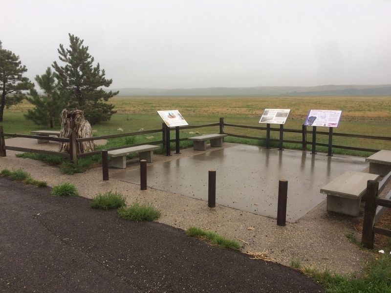
By Ruth VanSteenwyk, August 15, 2017
Custer and Hiddenwood Cliff Marker
| On U.S. 12 0.5 miles north of 40th Ave SE. |
| On U.S. 12 0.5 miles north of 40th Ave SE. |
| On U.S. 12 0.5 miles west of 40th Ave SE, on the right when traveling east. |
| On 14th Street Southeast at 115th Avenue Southeast, on the right when traveling west on 14th Street Southeast. |
| On 51st Street Southeast near 120th Avenue Southeast, on the right when traveling east. |
| On 1st Avenue (County Road 21) west of 4th Street, on the left when traveling east. |
| On 51st Street Southeast 0.3 miles west of 120th Avenue SE, on the left when traveling west. |
| On 120th Avenue Southeast south of 51st Street Southeast, on the right when traveling south. |
| On 51st Street Southeast (County Road 21) near 120th Avenue Southeast, on the left when traveling east. |
| On 48th Street east of County Route 21. |
| On 48th Street east of County Road 21, on the left when traveling east. |
| Near Interstate 94 at milepost 304 near 127th Avenue Southeast. |
| Near Interstate 94 at milepost 304 near 127th Avenue Southeast. |
| Near West Main Street (Business U.S. 10/52) 0.1 miles west of Central Avenue North (County Highway 21), on the right when traveling west. |
| Near West Main Street (Business U.S. 10/52) 0.1 miles west of Central Avenue North (County Highway 21), on the right when traveling west. |
| Near West Main Street (Business U.S. 10/52) 0.1 miles west of Central Avenue North (County Highway 21), on the right when traveling west. |
| Near River Road 1.5 miles north of 117 Avenue Southeast (County Highway 21), on the left when traveling north. |
| Near 4th Street Southwest at 5th Avenue Southwest, on the right when traveling west. |
| Near 4th Avenue Southwest at Central Avenue South, on the right when traveling east. |
| On 3rd Avenue Southeast at College Street Southeast, on the left when traveling south on 3rd Avenue Southeast. |
| Near West Main Street (Business U.S. 10/52) 0.1 miles west of Central Avenue North (County Highway 21), on the right when traveling west. |
| Near West Main Street (Business U.S. 10/52) 0.1 miles west of Central Avenue North (County Highway 21), on the right when traveling west. |
| Near 12th Street Northeast 0.2 miles east of 6th Avenue Northeast (Chautauqua Boulevard), on the left when traveling east. |
| On West Main Street (Business U.S. 10/52) 0.1 miles west of Central Avenue South, on the left when traveling west. |
| On Valley City Memorial Park, on the right when traveling north. |
| Near 12th Street Northeast 0.2 miles east of 6th Avenue Northeast (Chautauqua Boulevard), on the left when traveling east. |
| Near 4th Street Southwest at 5th Avenue Southwest, on the right when traveling west. |
| On Kathryn Road south of 39th Street Southeast, on the left when traveling south. |
| Near 12th Street Northeast 0.2 miles east of 6th Avenue Northeast (Chautauqua Boulevard), on the left when traveling east. |
| On 6th Street Northeast at 8th Avenue Northeast, on the right when traveling east on 6th Street Northeast. |
| Near West Main Street (Business U.S. 10/50) 0.1 miles west of Central Avenue North (County Highway 21), on the right when traveling west. |
| On Main Street East (Business U.S. 10/52) at 8th Avenue Southeast, on the right when traveling east on Main Street East. |
| Near West Main Street (Business U.S. 10/52) 0.1 miles west of Central Avenue North (County Highway 21), on the right when traveling west. |
| On 36th Street Southeast 0.2 miles east of 118th Avenue Southeast, on the right when traveling east. |
| Near 4th Street Southwest at 5th Avenue Southwest, on the right when traveling west. |
| Near West Main Street (Business U.S. 10/52) 0.1 miles west of Central Avenue North (County Highway 21), on the right when traveling west. |
| Near 4th Street Southwest at 5th Avenue Southwest, on the right when traveling west. |
| Near West Main Street (Business U.S. 10/52) 0.1 miles west of Central Avenue North (County Highway 21), on the right when traveling west. |
| On 4th Street Northwest at 3rd Avenue Northwest, on the right when traveling west on 4th Street Northwest. |
| Near West Main Street (Business U.S. 10/52) 0.1 miles west of Central Avenue North (County Highway 21), on the right when traveling west. |
| On 118th Avenue Southeast (County Road 21) at 26th Street Southeast, on the left when traveling north on 118th Avenue Southeast. |
| On Main Street East (U.S. 10) at 2nd Avenue Northeast, on the right when traveling west on Main Street East. |
| On Main Street East (Business U.S. 10) at 2nd Avenue Northeast, on the right when traveling west on Main Street East. |
| On Main Street East (Business U.S. 10) west of 2nd Avenue Northeast, on the right when traveling west. |
| On Central Avenue North north of 4th Street Northeast, on the right when traveling north. |
| On Railway Street at 4th Avenue North, on the left when traveling east on Railway Street. |
| On Railway Street at 4th Avenue North, on the left when traveling east on Railway Street. |
| Near Calvary Circle just north of Calvary Road (1st Avenue). |
| On Theodore Roosevelt Expressway (U.S. 85), on the right when traveling north. |
| On Forest Road 7054 near West River Road (Forest Road 754). |
| On Pacific Avenue at 4th Street, on the right when traveling west on Pacific Avenue. |
| On Pacific Avenue, on the right when traveling west. |
| On E River Road, on the left when traveling north. |
| On 3rd Street north of Pacific Avenue, on the right when traveling north. |
| On E River Road, on the right when traveling north. |
| On Pacific Avenue at 4th Street, on the right when traveling west on Pacific Avenue. |
| On Pacific Avenue, on the right when traveling west. |
| On 3rd Avenue, on the left when traveling west. |
| On 3rd Avenue at Main Street, on the right when traveling east on 3rd Avenue. |
| On Pacific Avenue at 3rd Street, on the left when traveling west on Pacific Avenue. |
| On Main Street at 3rd Avenue, on the right when traveling north on Main Street. |
| On Pacific Avenue, on the right when traveling west. |
| On Pacific Avenue, on the right when traveling west. |
| On Pacific Avenue, on the right when traveling west. |
| On 3rd Avenue at Main Street, on the right when traveling west on 3rd Avenue. |
| On East River Road, on the left when traveling north. Reported permanently removed. |
| On East River Road, on the left when traveling north. |
| On Main Street at Pacific Avenue, on the right when traveling north on Main Street. |
| On Pacific Avenue at 3rd Street, on the right when traveling east on Pacific Avenue. |
| On Easy River Road, on the left when traveling north. |
| On Main Street north of 3rd Avenue, on the right when traveling north. |
| On 3rd Street north of Pacific Avenue, on the right when traveling north. |
| On Pacific Avenue, on the right when traveling west. |
| On Pacific Avenue, on the right when traveling west. |
| On Pacific Avenue, on the right when traveling west. |
| On Broadway at 3rd Street, on the right when traveling east on Broadway. |
| On 3rd Avenue, on the right when traveling west. |
| On Pacific Avenue, on the right when traveling west. |
| On Pacific Avenue at 3rd Street, on the right when traveling east on Pacific Avenue. |
| On Broadway at 3rd Street, on the right when traveling east on Broadway. |
| On 3rd Avenue, on the right when traveling west. |
| On Main Street at Pacific Avenue, on the right when traveling north on Main Street. |
| On Broadway at 3rd Street, on the right when traveling west on Broadway. |
| On Scenic Loop Drive, on the right when traveling east. |
| On East River Road 0.5 miles north of Pacific Avenue, on the left when traveling north. |
| On Main Street at 3rd Avenue, on the left when traveling north on Main Street. |
| On E River Road, on the left when traveling north. Reported missing. |
| On Broadway at 3rd Street, on the right when traveling west on Broadway. |
| On 3rd Avenue near 3rd Street, on the right when traveling west. |
| On 3rd Avenue at 4th Street, on the right when traveling east on 3rd Avenue. |
| On East River Road, on the left when traveling north. |
| On Main Street at Pacific Avenue, on the right when traveling north on Main Street. |
| On Main Street at 3rd Avenue, on the left when traveling north on Main Street. |
| On Broadway at 3rd Street, on the right when traveling west on Broadway. |
| On Pacific Avenue 0.1 miles east of Interstate 94, on the right when traveling west. |
| On Forest Road 750-1 near West River Road (Forest Road 750). |
| On Forest Road 7054 near West River Road (Forest Road 745/750), on the left when traveling north. |
| On Main Street at 3rd Avenue, on the right when traveling north on Main Street. |
| On Broadway at 5th Street, on the right when traveling west on Broadway. |
| On Pacific Avenue at 4th Street, on the right when traveling west on Pacific Avenue. |
811 entries matched your criteria. The first 100 are listed above.
Next 100 ⊳
