2572 entries match your criteria. Entries 301 through 400 are listed.⊲ Previous 100 — Next 100 ⊳
Historical Markers and War Memorials in Kansas
By William Fischer, Jr., August 28, 2010
Baxter Springs Massacre Marker
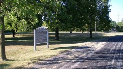
| 301 ► Kansas, Cherokee County, Baxter Springs — 49 — Baxter Springs Massacre — |
| On U.S. 69/400, 0.2 miles south of SE Varck Road, on the right when traveling south. | |||
| 302 ► Kansas, Cherokee County, Baxter Springs — 6 — Baxter Springs Massacre — Civil War Tour — |
| On Military Avenue (U.S. 69), on the right when traveling south. | |||
| 303 ► Kansas, Cherokee County, Baxter Springs — Baxter Springs Massacre 1863 — |
| On Military Avenue (U.S. 69). | |||
| 304 ► Kansas, Cherokee County, Baxter Springs — 9 — Baxter Springs Massacre Burial Site — Civil War Tour — |
| On 6th Street near Military Avenue (U.S. 69), on the left when traveling east. | |||
| 305 ► Kansas, Cherokee County, Baxter Springs — Baxter Springs Soldiers' Lot — |
| Near West Avenue (U.S. 166) west of West 5th Street. | |||
| 306 ► Kansas, Cherokee County, Baxter Springs — Baxter Springs, Kansas — |
| On Military Avenue (U.S. 69), on the right when traveling south. | |||
| 307 ► Kansas, Cherokee County, Baxter Springs — Baxter Springs: from Fort to Town — Bawdy days and mineral springs — |
| On West 2nd Street at Willow Avenue (Old U.S. 66), on the right when traveling east on West 2nd Street. | |||
| 308 ► Kansas, Cherokee County, Baxter Springs — Bischosberger Hotel — Baxter Springs Historic Walking Tour — |
| On Military Avenue (U.S. 69) at 10th Street, on the left when traveling south on Military Avenue. | |||
| 309 ► Kansas, Cherokee County, Baxter Springs — Black Dog Trail — Commemorating — |
| On East Avenue at 7th Street, on the left when traveling south on East Avenue. | |||
| 310 ► Kansas, Cherokee County, Baxter Springs — Café on the Route, Baxter Springs, Kansas — Route 66 Roadside Attraction — |
| On Military Avenue (U.S. 69) at 11th Street, on the right when traveling south on Military Avenue. | |||
| 311 ► Kansas, Cherokee County, Baxter Springs — 12 — Camp Logan — Civil War Tour — |
| On Oak Crest at Fairview Avenue, on the right when traveling east on Oak Crest. | |||
| 312 ► Kansas, Cherokee County, Baxter Springs — Chicago Drug Store — Baxter Springs Historic Walking Tour — |
| On Military Avenue (U.S. 69) near 11th Avenue, on the right when traveling south. | |||
| 313 ► Kansas, Cherokee County, Baxter Springs — 11 — Civil War Tour — |
| Near West Avenue (U.S. 166). | |||
| 314 ► Kansas, Cherokee County, Baxter Springs — 8 — Civil War Tour — |
| On North Willow Avenue north of West A Street, on the right when traveling north. | |||
| 315 ► Kansas, Cherokee County, Baxter Springs — Crowell Bank — Baxter Springs Historic Walking Tour — |
| On Military Avenue (U.S. 69) at 11th Street, on the right when traveling south on Military Avenue. | |||
| 316 ► Kansas, Cherokee County, Baxter Springs — Drovers' and Farmers' Bank — Baxter Springs Historic Walking Tour — |
| On Military Avenue (U.S. 69), on the right when traveling south. | |||
| 317 ► Kansas, Cherokee County, Baxter Springs — First School in Baxter Springs — |
| On Military Avenue (U.S. 69) at 7th Street, on the right when traveling north on Military Avenue. | |||
| 318 ► Kansas, Cherokee County, Baxter Springs — 4 — Fort Blair — Civil War Tour — |
| On East Avenue near 6th Street, on the right when traveling south. | |||
| 319 ► Kansas, Cherokee County, Baxter Springs — Fort Blair Blockhouse — |
| On 6th Street near Military Avenue (U.S. 69), on the right when traveling east. | |||
| 320 ► Kansas, Cherokee County, Baxter Springs — Fort Blair Breastworks — |
| On 6th Street near Military Avenue (U.S. 69), on the right when traveling east. | |||
| 321 ► Kansas, Cherokee County, Baxter Springs — Fort Blair West Breastworks — |
| Near 6th Street near Military Avenue (U.S. 69). | |||
| 322 ► Kansas, Cherokee County, Baxter Springs — Illinois Cash Store — Baxter National Bank — |
| On Military Avenue at 11th Street on Military Avenue. | |||
| 323 ► Kansas, Cherokee County, Baxter Springs — Indiana House — Baxter Springs Historic Walking Tour — |
| On Military Avenue (U.S. 69) at 11th Street, on the left when traveling south on Military Avenue. | |||
| 324 ► Kansas, Cherokee County, Baxter Springs — John Baxter — |
| On 6th Street near Military Avenue (U.S. 69), on the right when traveling east. | |||
| 325 ► Kansas, Cherokee County, Baxter Springs — Johnston Public Library — |
| On 10th Street west of Park Avenue, on the right when traveling west. | |||
| 326 ► Kansas, Cherokee County, Baxter Springs — Last Pratt Pony Truss Bridge in Cherokee County — |
| On 7th Street at East Avenue, on the right when traveling east on 7th Street. | |||
| 327 ► Kansas, Cherokee County, Baxter Springs — Log Cabin — |
| 328 ► Kansas, Cherokee County, Baxter Springs — Murder of C. M. Taylor — Baxter Springs Historic Walking Tour — |
| On Military Avenue (U.S. 69), on the right when traveling north. | |||
| 329 ► Kansas, Cherokee County, Baxter Springs — Ohlen's Restaurant and Bakery — Baxter Springs Historic Walking Tour — |
| On Military Avenue (U.S. 69) near 10th Street, on the right when traveling south. | |||
| 330 ► Kansas, Cherokee County, Baxter Springs — Opperman Harness and Saddle Shop — Baxter Springs Historic Walking Tour — |
| On Military Avenue (U.S. 69) near 11th Street, on the left when traveling south. | |||
| 331 ► Kansas, Cherokee County, Baxter Springs — Phillips 66 Petroleum Company Gas Station — |
| On Military Avenue at 10th Street, on the right when traveling north on Military Avenue. | |||
| 332 ► Kansas, Cherokee County, Baxter Springs — Polster Dry Goods Store — Baxter Springs Historic Walking Tour — |
| On Military Avenue (U.S. 69) near 10th Street, on the right when traveling south. | |||
| 333 ► Kansas, Cherokee County, Baxter Springs — 1 — Quantrill's Raiders Ford Spring River — Civil War Tour — |
| On 12th Street (U.S. 166), on the right when traveling west. | |||
| 334 ► Kansas, Cherokee County, Baxter Springs — 3 — Quantrill's Raiders Kill Johnny Fry — Civil War Tour — |
| On Washington Avenue at 10th Street, on the left when traveling north on Washington Avenue. | |||
| 335 ► Kansas, Cherokee County, Baxter Springs — 2 — Quantrill's Raiders Prepare to Attack Fort Blair — Civil War Tour — |
| On 10th Street, on the left when traveling east. | |||
| 336 ► Kansas, Cherokee County, Baxter Springs — Tbe Economic Engines — Baxter Springs' economy flourishes with cows and miners — |
| On West 2nd Street at Willow Avenue (Old U.S. 66), on the right when traveling east on West 2nd Street. | |||
| 337 ► Kansas, Cherokee County, Baxter Springs — The Battle For Fort Blair — |
| On 6th Street near Military Avenue (U.S. 69), on the right when traveling east. | |||
| 338 ► Kansas, Cherokee County, Baxter Springs — The Big Spring — |
| On 7th Street east of Military Avenue (U.S. 69), on the right when traveling east. | |||
| 339 ► Kansas, Cherokee County, Baxter Springs — The Earliest Residents — Native Americans find healthy spring waters — |
| On West 2nd Street near Willow Avenue (Old U.S. 66), on the right when traveling east. | |||
| 340 ► Kansas, Cherokee County, Baxter Springs — The Hanging Tree — |
| On 7th Street east of Military Avenue (U.S. 69), on the left when traveling east. | |||
| 341 ► Kansas, Cherokee County, Baxter Springs — The Zellekin Brewery — |
| 342 ► Kansas, Cherokee County, Baxter Springs — Veterans Memorial — |
| On 13th Street at Park Avenue, on the right when traveling west on 13th Street. | |||
| 343 ► Kansas, Cherokee County, Baxter Springs — Veterans Memorial — |
| On East Avenue south of 7th Street, on the left when traveling south. | |||
| 344 ► Kansas, Cherokee County, Baxter Springs — Wiggins House — |
| On Military Avenue (U.S. 69) at 9th Street, on the left when traveling north on Military Avenue. | |||
| 345 ► Kansas, Cherokee County, Carona — 1932 Plymouth 0-6-0 Switch Engine — |
| 346 ► Kansas, Cherokee County, Carona — Missouri Pacific Wooden Frame Depot — |
| Near 6769 NW 20th Street. | |||
| 347 ► Kansas, Cherokee County, Carona — Southern Pacific Bay Window Caboose — |
| 348 ► Kansas, Cherokee County, Columbus — Cherokee County WWI Veterans Memorial Clock Tower — "Dedicated to Veterans of All Wars" — |
| On Maple Street at Pennsylvania Avenue, on the left when traveling west on Maple Street. | |||
| 349 ► Kansas, Cherokee County, Columbus — Columbus State Bank 100th Anniversary — |
| On Maple Street near Kansas Avenue, on the left when traveling west. | |||
| 350 ► Kansas, Cherokee County, Columbus — Robert Alexander Long — 1875 — |
| On Kansas Avenue at Walnut Street, on the right when traveling north on Kansas Avenue. | |||
| 351 ► Kansas, Cherokee County, Columbus — The History of Columbus — |
| On U.S. 69/160 at North East Avenue (U.S. 69), on the right when traveling east on U.S. 69/160. | |||
| 352 ► Kansas, Cherokee County, Columbus — Three-Way Interlocking Crossing — |
| On South Tennessee Avenue. | |||
| 353 ► Kansas, Cherokee County, Galena — Galena Chamber of Commerce, Galena, Kansas — Route 66 Roadside Attraction — |
| On Main Street (Historic US Route 66) near 5th Street, on the right when traveling south. | |||
| 354 ► Kansas, Cherokee County, Galena — Galena Growth And Change — From Mining Trucks To Classic Cars Along Route 66 — |
| On South Main Street just south of West 5th Street, on the right when traveling south. | |||
| 355 ► Kansas, Cherokee County, Galena — Galena, Kansas — Founded in 1877 — Will Rogers Highway - US Route 66 — |
| On Main Street at 5th Street, on the right when traveling south on Main Street. | |||
| 356 ► Kansas, Cherokee County, Galena — Mining And Its Impacts — Creating Healthy Environments For The Future — |
| On South Main Street just south of West 5th Street, on the right when traveling south. | |||
| 357 ► Kansas, Cherokee County, Galena — Route 66 Howard 'Pappy' Litch Park — Welcome To Galena Kansas — |
| On South Main Street at West 5th Street, on the right when traveling south on South Main Street. | |||
| 358 ► Kansas, Cherokee County, Galena — The Kansas Ozarks — |
| 359 ► Kansas, Cherokee County, Galena — The Kansas Route 66 Historic District, East of Galena — |
| On Front Street (Old U.S. 66) 0.3 miles east of Joplin Street, on the right when traveling west. | |||
| 360 ► Kansas, Cherokee County, Galena — War Memorial — |
| On 7th Street (State Highway 26/66) west of Wall Street, on the right when traveling west. | |||
| 361 ► Kansas, Cherokee County, Galena — Welcome To Galena — Cars, Parks, And Nature Ensure You Get Your Kicks In Galena — |
| On South Main Street just south of West 5th Street, on the right when traveling south. | |||
| 362 ► Kansas, Cherokee County, Riverton — Baxter Springs Massacre and Today — A battle spread across the Plains — |
| On U.S. 400 near State Highway 66, on the right when traveling south. | |||
| 363 ► Kansas, Cherokee County, Riverton — Boom Towns — Kansas Historic Route 66 Byway — |
| On U.S. 400 at State Highway 66, on the right when traveling south on U.S. 400. | |||
| 364 ► Kansas, Cherokee County, Riverton — Bridging the American Divide — Kansas Historic Route 66 Byway — |
| On U.S. 400 at State Highway 66, on the right when traveling south on U.S. 400. | |||
| 365 ► Kansas, Cherokee County, Riverton — Cosmopolitan Corner — Kansas Historic Route 66 Byway — |
| On U.S. 400 at State Highway 66, on the right when traveling south on U.S. 400. | |||
| 366 ► Kansas, Cherokee County, Riverton — Crossroads of Kansas — Kansas Historic Route 66 Byway — |
| On U.S. 400 at State Highway 66, on the right when traveling south on U.S. 400. | |||
| 367 ► Kansas, Cherokee County, Riverton — Fort Blair — Repelling Quantrill's Raiders — |
| On U.S. 400 at State Highway 66, on the right when traveling south on U.S. 400. | |||
| 368 ► Kansas, Cherokee County, Riverton — Land's Legacy — Kansas Historic Route 66 Byway — |
| On U.S. 400 at State Highway 66, on the right when traveling south on U.S. 400. | |||
| 369 ► Kansas, Cherokee County, Riverton — Marsh Rainbow Arch Bridge — |
| On South East Beasley Road, on the right when traveling west. | |||
| 370 ► Kansas, Cherokee County, Riverton — Where Two Roads Converge — Military roads to cruising roadsters — |
| On U.S. 400 at State Highway 66, on the right when traveling south on U.S. 400. | |||
| 371 ► Kansas, Cherokee County, Treece — Treece, Kansas Historical Marker — Dedicated to the Former Residents — |
| On U.S. 69, on the left when traveling north. | |||
| 372 ► Kansas, Cherokee County, Weir — Veterans Memorial — |
| On Main Street (State Highway 103) west of Washington Street, on the right when traveling west. | |||
| 373 ► Kansas, Cherokee County, Weir — War Memorial — |
| On Washington Street north of Main Street (Kansas Highway 103), on the left when traveling north. | |||
| 374 ► Kansas, Cherokee County, West Mineral — 40 Cubic Yard Dipper — |
| 375 ► Kansas, Cherokee County, West Mineral — Fire Bell — |
| 376 ► Kansas, Cherokee County, West Mineral — Miner's Memorial — Pittsburg, Kansas — |
| 377 ► Kansas, Cherokee County, West Mineral — Star Cemetery / Borland Cemetery Veterans Memorial — |
| 378 ► Kansas, Cherokee County, West Mineral — West Mineral War Memorial — |
| On McClung Street at Lyle Street, on the right when traveling east on McClung Street. | |||
| 379 ► Kansas, Cheyenne County, St. Francis — Cherry Creek Encampment, 1864-65 — Last Buffalo — |
| On State Highway 27 near U.S. 36, on the left when traveling north. | |||
| 380 ► Kansas, Clark County, Ashland — 77 — Big Basin — |
| On U.S. 160 at milepost 138, on the left when traveling south. | |||
| 381 ► Kansas, Clark County, Englewood — Big Basin Prairie Preserve — |
| On U.S. 283, 3 miles south of U.S. 160, on the right when traveling north. | |||
| 382 ► Kansas, Clay County, Clay Center — Better Homes & Gardens' Highest Community Honor — |
| 383 ► Kansas, Clay County, Clay Center — Civil War Memorial — |
| On Lincoln Avenue at 5th Street, on the left when traveling east on Lincoln Avenue. | |||
| 384 ► Kansas, Clay County, Clay Center — Clay Center Municipal Band Shell — |
| On Grant Avenue at 6th Street (Kansas Highway 15), on the right when traveling east on Grant Avenue. | |||
| 385 ► Kansas, Clay County, Clay Center — Clay County Veterans Memorial — All Gave Some, Some Gave All — |
| On 5th Street at Lincoln Avenue, on the right when traveling north on 5th Street. | |||
| 386 ► Kansas, Clay County, Clay Center — M60 Tank — |
| On 6th Street (State Highway 15) at Grant Avenue, on the right when traveling north on 6th Street. | |||
| 387 ► Kansas, Clay County, Morganville — Swedesburg Swedish Evangelical First Lutheran Church Cemetery — |
| On Meadowlark Road, 1.8 miles north of 24th Road (Kansas Highway 80), on the left when traveling north. | |||
| 388 ► Kansas, Clay County, Wakefield — Founders of St. John's Parish in 1874 — To The Glory of God and In Memory of ... — |
| On 7th Road (State Highway 82) at 839th Road, on the left when traveling west on 7th Road. | |||
| 389 ► Kansas, Clay County, Wakefield — St. John's Episcopal Church — The Little Church on the Prairie — |
| On 839th Road south of 7th Road (Kansas Highway 82), on the right when traveling south. | |||
| 390 ► Kansas, Cloud County, Concordia — Agent Anna Laura Hill — November 17, 1878 - August 17, 1963 — Children's Aid Society Placing Agent — |
| On East 6th Street (Kansas Route 9) at Lincoln Street (U.S. 81), on the right when traveling east on East 6th Street. | |||
| 391 ► Kansas, Cloud County, Concordia — Alberta Cole / Roberta Work Miller Slifer — October 17, 1921 - October 14, 2014 — Train to McPherson, Kansas in 1925 — |
| Near West 11th Street just east of Cedar Street, on the right when traveling east. | |||
| 392 ► Kansas, Cloud County, Concordia — Alfred Ulshoefer / Alfred Pierce — February 13, 1903 - May 1, 1975 — Train to Hopkinton, Iowa in 1906 — |
| On East 7th Street at Cloud Street, on the right when traveling east on East 7th Street. | |||
| 393 ► Kansas, Cloud County, Concordia — Anna Katherine Fuchs — December 6, 1913 - November 15, 2006 — Rider to McPherson, Kansas 1924 — |
| On West 6th Street just east of State Street, on the left when traveling east. | |||
| 394 ► Kansas, Cloud County, Concordia — Anna Louise Doherty / Louise Simpson — October 21, 1900 - October 9, 1988 — |
| On East 6th Street (Kansas Route 9) at Lincoln Street (U.S. 81), on the right when traveling east on East 6th Street. | |||
| 395 ► Kansas, Cloud County, Concordia — Brown Grand Theatre — |
| On 6th Street near State Street, on the left when traveling west. | |||
| 396 ► Kansas, Cloud County, Concordia — Camp Concordia — WWII P.O.W. Camp — July 1943 - Nov. 1945 — |
| On Union Road / Fort Kearney Road, 1 mile east of 145th Road (U.S. 81), on the left when traveling east. | |||
| 397 ► Kansas, Cloud County, Concordia — Charles Ferdon — Ferdon Charles Ekstrom — 1904-1985 — Rider to Lindsborg, Kansas in 1912 — |
| Near North 153rd Road, 0.1 miles north of Union Road (Fort Kearney Road), on the right when traveling north. | |||
| 398 ► Kansas, Cloud County, Concordia — Civil War Soldiers and Sailors Memorial — |
| 399 ► Kansas, Cloud County, Concordia — Clara Reed Duckett Morgan — August 20, 1901 - May 27, 2004 — Rider to Belleville, Kansas 1909 — |
| Near Washington Street just south of West 3rd Street, on the right when traveling south. | |||
| 400 ► Kansas, Cloud County, Concordia — Cloud County War Memorial — |
| On Washington Street near 12th Street, on the right when traveling south. | |||
2572 entries matched your criteria. Entries 301 through 400 are listed above. ⊲ Previous 100 — Next 100 ⊳