218 entries match your criteria. The first 100 are listed. ⊳
Pony Express National Historic Trail Historical Markers
These are markers about the Pony Express found along the trail that ran from Sacramento, California to St. Joseph, Missouri.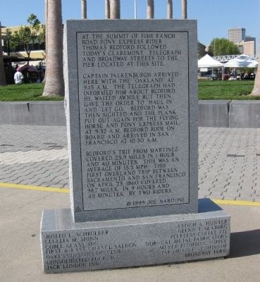
By Andrew Ruppenstein, May 10, 2009
Reverse Side of Pony Express Ferry "Oakland" Marker
1 ► California, Alameda County, Oakland, Produce and Waterfront — Pony Express Ferry “Oakland” — Jack London Square —  |
| Near Water Street at Broadway Street. | |||
| 2 ► California, Alpine County, Woodfords — 805 — The Pony Express - Woodfords — |
| On Old Pony Express Way (California Route 88) east of Route 89, on the right when traveling east. | |||
| 3 ► California, Alpine County, Woodfords — 805 — Woodfords Station — |
| On Old Pony Express Way (California Route 88) east of Route 89, on the left when traveling east. | |||
| 4 ► California, Contra Costa County, Lafayette — Dedicated to the Pony Express — |
| Near Moraga Road at Mout Diablo Boulevard. | |||
| 5 ► California, Contra Costa County, Lafayette — Lafayette House — |
| On Mt. Diablo Boulevard at Morago Road, on the right when traveling east on Mt. Diablo Boulevard. | |||
| 6 ► California, Contra Costa County, Martinez — Martinez-Benicia Ferry — "Gateway to the Gold Fields" — |
| On Joe DiMaggio Jr., Drive at Ferry Street, on the left when traveling east on Joe DiMaggio Jr., Drive. | |||
| 7 ► California, Contra Costa County, Martinez — Morgan House — |
| On Main Street at Ferry Street, on the right when traveling east on Main Street. | |||
| 8 ► California, Contra Costa County, Orinda — Pony Express — 1860-1861 — |
| Near Camino Pablo west of Brookwood Road, on the right when traveling north. | |||
| 9 ► California, Contra Costa County, Orinda — The Pony Express — |
| Near Camino Pablo at Brookwood Road. | |||
| 10 ► California, El Dorado County, Diamond Springs — 487 — Diamond Springs — |
| On Pleasant Valley Road (State Highway 49), on the right when traveling west. | |||
| 11 ► California, El Dorado County, El Dorado — 700 — El Dorado (Mud Springs) — |
| On Pleasant Valley Road, on the right when traveling east. | |||
| 12 ► California, El Dorado County, El Dorado Hills — 699 — Mormon Tavern — Overland Pony Express Route - California — |
| On PG&E-Clarksville Sub-Station Road, on the right when traveling west. | |||
| 13 ► California, El Dorado County, Kyburz — 705 — Moore’s (Riverton) |
| On U.S. 50 near Ice House Road, on the right when traveling west. Reported missing. | |||
| 14 ► California, El Dorado County, Kyburz — 706 — Webster’s — (Sugar Loaf House) — |
| On Interstate 50, on the left when traveling east. | |||
| 15 ► California, El Dorado County, Meyers — John (Snowshoe) Thompson — |
| On Lincoln Highway (U.S. 50) west of Apache Avenue, on the left when traveling west. | |||
| 16 ► California, El Dorado County, Meyers — Yank’s Added Station — |
| On Lincoln Highway (U.S. 50) west of Apache Avenue, on the left when traveling west. | |||
| 17 ► California, El Dorado County, Meyers — 708 — Yank’s Station — |
| On US Highway 50 (U.S. 50) west of Pioneer Trail, on the left when traveling west. | |||
| 18 ► California, El Dorado County, Placerville — 701 — Placerville Pony Express — Station and Terminus — |
| On Main Street at Sacramento Street, on the right when traveling east on Main Street. | |||
| 19 ► California, El Dorado County, Pollack Pines — The Pony Express - Sportsman’s Hall — |
| On Pony Express Trail east of Exit 57 (U.S. 50), on the right when traveling east. | |||
| 20 ► California, El Dorado County, Pollock Pines — 704 — Sportsman’s Hall — |
| On Pony Express Trail east of Exit 57 (U.S. 50), on the right when traveling east. | |||
| 21 ► California, El Dorado County, Shingle Springs — Du Roc House — In Search of the Pony Express — Historical Marker — |
| On Durock Road south of U.S. 50, on the right when traveling west. | |||
| 22 ► California, El Dorado County, Skinners — 703 — Pleasant Grove House — |
| On Green Valley Road, on the left when traveling east. | |||
| 23 ► California, El Dorado County, Strawberry — 707 — Strawberry Valley House — |
| On Highway 50 (U.S. 50) west of Strawberry Lane, on the right when traveling west. | |||
| 24 ► California, Sacramento County, Folsom — 702 — Folsom Pony Express Terminus — |
| On Sutter Street at Wool Street, on the right when traveling east on Sutter Street. | |||
| 25 ► California, Sacramento County, Rancho Cordova — American River Grange #172 — |
| On Kilgore Road, on the left when traveling north. | |||
| 26 ► California, Sacramento County, Rancho Cordova — 698 — Fifteen Mile House — |
| On White Rock Road at Gold Valley Drive, on the right when traveling east on White Rock Road. | |||
| 27 ► California, Sacramento County, Rancho Cordova — The Pony Express — "Connecting the Country" — |
| Near Mills Station Road west of Mather Field Road, on the right when traveling west. | |||
| 28 ► California, Sacramento County, Sacramento, Central Business District — St. George Hotel — |
| On J Street at 4th Street, on the right when traveling east on J Street. | |||
| 29 ► California, Sacramento County, Sacramento, Csus — 697 — Five Mile Station — |
| Near State University Drive East. | |||
| 30 ► California, Sacramento County, Sacramento, Old Sacramento — 606 — B.F. Hastings Bank Building — Western Terminus of the Pony Express — |
| On 2nd Street south of I Street, on the left when traveling south. | |||
| 31 ► California, Sacramento County, Sacramento, Old Sacramento — 812 — Old Sacramento — |
| On 2nd Street, on the left when traveling south. | |||
| 32 ► California, Sacramento County, Sacramento, Old Sacramento — Pony Express River Steamer “Antelope” — |
| Near Front Street. | |||
| 33 ► California, Sacramento County, Sacramento, Old Sacramento — The Pony Express — |
| On 2nd Street at J Street, on the left when traveling south on 2nd Street. | |||
| 34 ► California, Sacramento County, Sacramento, Old Sacramento — The Pony Express — Russell, Majors, Waddell — Founders, Owners, Operators — |
| On 2nd Street, on the left when traveling south. | |||
| 35 ► California, Sacramento County, Sacramento, Southside Park — 526 — California’s First Passenger Railroad — |
| On R Street at 3rd Street, on the left when traveling west on R Street. | |||
| 36 ► California, San Francisco City and County, San Francisco, Chinatown — Pony Express — |
| On Clay Street at Montgomery Street on Clay Street. | |||
| 37 ► California, San Francisco City and County, San Francisco, Chinatown — 696 — Western Headquarters of Russell, Majors, and Waddell — |
| On Montgomery Street at Merchant Street, on the right when traveling south on Montgomery Street. | |||
| 38 ► California, San Francisco City and County, San Francisco, Financial District — 80 — The Montgomery Block — |
| Near Montgomery Street near Washington Street, on the left when traveling north. | |||
| 39 ► California, San Francisco City and County, San Francisco, Northern Waterfront — Pony Express Wharf — |
| On The Embarcadero at Broadway Street, on the right when traveling south on The Embarcadero. | |||
| 40 ► California, Santa Clara County, San Jose, South San Jose — Montgomery Maze — Born in New York City 1836 -- Died June 19, 1875 — Aged 39 yrs — |
| Near Curtner Avenue near Monterey Highway ( Route 82), on the right when traveling north. | |||
| 41 ► California, Solano County, Benicia — Dedicated to the Memory of Pony Express Riders — 1860 The Knights of the Saddle 1861 — |
| On First Street, on the right when traveling south. | |||
| 42 ► California, Solano County, Benicia — Pony Express Ferry “Carquinez” — |
| On First Street, on the right when traveling south. | |||
| 43 ► California, Solano County, Benicia — Solano Hotel — In Search of the Pony Express - Station Marker — |
| On First Street at West E Street, on the right when traveling south on First Street. | |||
| 44 ► California, Solano County, Dixon — Halfway House — In Search of the Pony Express - Station Marker — |
| On Silveyville Road at Schroeder Road, on the left when traveling west on Silveyville Road. | |||
| 45 ► California, Solano County, Fairfield — Rockville Station — In Search of the Pony Express - Station Marker — |
| On Suisun Valley Road at Rockville Road on Suisun Valley Road. | |||
| 46 ► California, Solano County, Fairfield — Vezér Family Vineyard — |
| On Mankas Corner Road at Clayton Road on Mankas Corner Road. | |||
| 47 ► California, Solano County, Rio Vista — Pony Express River Steamer “New World” — |
| On Main Street near North Front Street. | |||
| 48 ► California, Solano County, Vacaville — Gillespie’s Store — |
| On Merchant Street at Main Street, on the right when traveling north on Merchant Street. | |||
| 49 ► California, Yolo County, Davis — Solano House — |
| Near Old Davis Road. | |||
| 50 ► California, Yolo County, West Sacramento — Pony Express Bridge — |
| Near 2nd Street. | |||
| 51 ► Colorado, Sedgwick County, Julesburg — Julesburg, Colorado — The Pony Express — |
| On First Street (U.S. 385) at Pine Street, on the right when traveling east on First Street. | |||
| 52 ► Colorado, Sedgwick County, Julesburg — Oregon Trail — |
| On West 1st Street (Route 138/385) near Cedar Street, on the right when traveling east. | |||
| 53 ► Colorado, Sedgwick County, Julesburg — Overland City (Julesburg) Pony Express Riders — |
| Near County Road 28 0.2 miles west of U.S. 385, on the left when traveling west. | |||
| 54 ► Colorado, Sedgwick County, Julesburg — The Pony Express Trail — 1860 -1861 — |
| On Interstate 76 at U.S. 385 on Interstate 76. | |||
| 55 ► Colorado, Sedgwick County, Ovid — Ovid, Colorado — |
| On Saunders Avenue (U.S. 138) at Main Street, on the left when traveling west on Saunders Avenue. | |||
| 56 ► Kansas, Atchison County, Atchison — 5 — Massasoit House — Company and Division Headquarters, Added Station — Sep. 14, 1861 - Nov. 20, 1861 — |
| On Main Street at 3rd Street, on the left when traveling east on Main Street. | |||
| 57 ► Kansas, Doniphan County, Troy — The Pony Express — America's early express mail delivery rides through the Glacial Hills — Glacial Hills Scenic Byway — |
| Near Last Chance Road (Kansas Route 136) south of Doniphan Street, on the right when traveling south. | |||
| 58 ► Kansas, Doniphan County, Troy — Troy — Added Station — Jul. 1, 1861 - Sep. 13, 1861 — |
| On U.S. 36 near Ottumwa Road, on the left when traveling west. | |||
| 59 ► Kansas, Leavenworth County, Leavenworth — Russell, Majors & Waddell — Historic Wayside Tour #6 — |
| On Delaware Street at 4th Street, on the left when traveling east on Delaware Street. | |||
| 60 ► Kansas, Leavenworth County, Leavenworth — Site of Offices of Russell, Majors, and Waddell — A Famous Freighting Firm — |
| On 4th Street (U.S. 73) at Delaware Street, on the left when traveling north on 4th Street. | |||
| 61 ► Kansas, Marshall County, Axtell — David Smith's Pony Express and Stage Station Overland Trail — 1861 — |
| On 30th Road south of Granite Road, on the right when traveling north. | |||
| 62 ► Kansas, Marshall County, Beattie — Saddle Up at Guittard — Pony Express Trail — |
| On 21st Road 0.8 miles north of Granite Road, on the right when traveling north. | |||
| 63 ► Kansas, Marshall County, Marysville — 28 — Hollenberg Ranch and the Pony Express — |
| On State Highway 148 near U.S. 36. | |||
| 64 ► Kansas, Marshall County, Marysville — Marysville — Original Station — Apr. 3, 1860 - Nov. 20, 1861 — |
| On Broadway at 8th Street, on the right when traveling east on Broadway. | |||
| 65 ► Kansas, Marshall County, Marysville — Marysville, Kan. — A Home Station — 1860 - 1861 — |
| On Broadway near 13th Street, on the right when traveling east. | |||
| 66 ► Kansas, Marshall County, Marysville — Pony Express Home Station No. 1 — 1859 — |
| On 8th Street near Elm Street, on the left when traveling south. | |||
| 67 ► Kansas, Marshall County, Marysville — Pony Express Trail — |
| On South 10th Street, on the right when traveling north. | |||
| 68 ► Kansas, Nemaha County, Seneca — Pony Express Home Station — |
| On Main Street at 4th Street, on the left when traveling west on Main Street. | |||
| 69 ► Kansas, Nemaha County, Seneca — The Smith Hotel — |
| On Main Street at 4th Street, on the left when traveling west on Main Street. | |||
| 70 ► Kansas, Nemaha County, Wetmore — Don Clarence Rising — Born December 1, 1844 • Died September 30, 1909 — |
| Near Nebraska Street. | |||
| 71 ► Kansas, Washington County, Bremen — Wagons Merge on the Prairie — |
| On 1st Road, on the right when traveling east. | |||
| 72 ► Kansas, Washington County, Hanover — Hollenberg Pony Express Station — The Pony Express — 1860∙1861 ∙ 1960∙1961 — |
| Near 23rd Road (Highway 243) west of Big Bear Road, on the right when traveling west. | |||
| 73 ► Kansas, Washington County, Hanover — 119 — Hollenberg Ranch Pony Express Station — |
| On 23rd Road (State Highway 243) near Big Bear Road, on the left when traveling east. | |||
| 74 ► Kansas, Washington County, Hanover — Hollenberg Station and Transportation — |
| Near Big Bear Road. | |||
| 75 ► Kansas, Washington County, Hanover — Points of Interest — |
| Near Big Bear Road. | |||
| 76 ► Kansas, Washington County, Hanover — Transportation — |
| Near Big Bear Road. | |||
| 77 ► Missouri, Buchanan County, St. Joseph — Donnell Court Building — Neo-Classical — 1902 — |
| On Francis Street at 5th Strret, on the left when traveling east on Francis Street. | |||
| 78 ► Missouri, Buchanan County, St. Joseph — Patee House — Company & Division Headquarters, Original Home Station — Apr. 3 1860 - Sep. 13, 1861 — |
| On Penn Street at 12th Street, on the right when traveling east on Penn Street. | |||
| 79 ► Missouri, Buchanan County, St. Joseph — Patee House - 1858 — The Pony Express — |
| On Penn Street at 12th Street, on the right when traveling east on Penn Street. | |||
| 80 ► Missouri, Buchanan County, St. Joseph — Pony Express — "Saddle and Mochila" — |
| On 3rd Street at Felix Street, on the right when traveling south on 3rd Street. | |||
| 81 ► Missouri, Buchanan County, St. Joseph — Pony Express Stable — |
| On Penn Street west of South 10th Street, on the left when traveling west. | |||
| 82 ► Missouri, Buchanan County, St. Joseph — Saint Joseph — |
| On Penn Street, on the left when traveling east. | |||
| 83 ► Missouri, Buchanan County, St. Joseph — The Civil War in St. Joseph — A State Divided: The Civil War in Missouri — |
| On Penn Street, on the left when traveling east. | |||
| 84 ► Missouri, Buchanan County, St. Joseph — The First Pony Express — |
| On Penn Street near South 10th Street, on the right when traveling west. | |||
| 85 ► Missouri, Buchanan County, St. Joseph — The Pony Express — by — Albert Fales — |
| On Penn Street near 12th Street, on the right when traveling east. | |||
| 86 ► Missouri, Buchanan County, St. Joseph, Washington Township — Pony Express — 1860 - 1861 — |
| Near Felix Street. | |||
| 87 ► Missouri, Buchanan County, St. Joseph, Washington Township — The Pony Express — St. Joseph, Missouri — |
| Near Frederick Avenue. | |||
| 88 ► Missouri, Jackson County, Kansas City, Downtown Kansas City — Alexander Majors — October 4, 1814 - - - January 14, 1900 — Honour To — |
| Near East 28 Terrace. | |||
| 89 ► Missouri, Lafayette County, Lexington — Original Site of Russell, Majors and Waddell Home Office — The Pony Express — |
| On Main Street at 10th Street, on the right when traveling east on Main Street. | |||
| 90 ► Missouri, Platte County, Kansas City — A1 — The Pony Express — |
| Near Amman Drive. | |||
| 91 ► Nebraska, Adams County, Hastings — Oregon Trail & Pony Express Trail — |
| On American Legion Memorial Highway (U.S. 281) at West Saddlehorn Road, on the right when traveling south on American Legion Memorial Highway. | |||
| 92 ► Nebraska, Adams County, Juniata — Pony Express — |
| On Grand Army of the Republic Highway (U.S. 34) 0.3 miles west of South Roseland Avenue, on the right when traveling west. | |||
| 93 ► Nebraska, Dawson County, Gothenburg — Original Pony Express Station — 1854 — |
| On 16th Street, on the left when traveling east. | |||
| 94 ► Nebraska, Dawson County, Gothenburg — The Pony Express — |
| On 15th Street, on the left when traveling east. | |||
| 95 ► Nebraska, Deuel County, Big Springs — South Platte Station — |
| On State Highway 138. | |||
| 96 ► Nebraska, Deuel County, Big Springs — The Pony Express — |
| On Pine Street at West Second Street on Pine Street. | |||
| 97 ► Nebraska, Deuel County, Chappell — 316 — Historic Lodgepole Creek Valley — |
| On State Highway 25A at County Route 165, on the right when traveling north on State Highway 25A. | |||
| 98 ► Nebraska, Deuel County, Chappell — 9 — Hughes’ Ranch Pony Express Station — In Search of the Pony Express Stations — |
| On Gold Rush Byway (U.S. 385), on the left when traveling north. | |||
| 99 ► Nebraska, Deuel County, Chappell — The Pony Express — Hughes' Ranch Station — |
| On County Route 25A near Airport Road, on the left when traveling south. | |||
| 100 ► Nebraska, Jefferson County, Fairbury — Jefferson County Pony Express Stations — The Pony Express — 1860:1861 • 1960:1961 — |
| Near 5th Street just west of E Street (568th Avenue), on the left when traveling west. | |||
218 entries matched your criteria. The first 100 are listed above. Next 100 ⊳