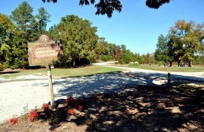
About 1786, John Bush built a brush arbor as a community center for camp meeting at what was then called “Crackers Neck.” From this grew Liberty Chapel, “Cradle of Methodism” for this section. In 1797, Rev. James Jenkins, . . . — — Map (db m23083) HM
White Plains Baptist Church was organized in 1806, with all four sanctuaries located here. The current sanctuary was constructed in 1887. Welcoming its first African-American member in 1812, both races worshipped together until 1869. In the late . . . — — Map (db m23997) HM
1784 First white settlers arrive
1793 Fort Clark built
1810 Georgia's first paper mill
1845 Fire destroyed mills, rebuilt 1847
1861-65 No damages here in Civil War
1887 Flood covered town, removed bridge
1897 Mills sold, town . . . — — Map (db m197804) HM
Clinton Female Seminary was incorporated on Dec. 15, 1821 by Act of Legislature signed by Gov. John Clark. Trustees were James Smith, Gustavus Hendrick, Samuel Lowther, Henry G. Lamar and Charles J. McDonald. This successful school under Rev. Thomas . . . — — Map (db m25209) HM
Brig. Gen. Alfred Iverson, C.S.A., son of Senator Alfred Iverson, also a Brig. Gen., and Caroline Goode Holt, was born here Feb. 14, 1829. He served with the U. S. Cavalry in the Mexican War and Mormon campaign and fought the Comanches and Kiowas. . . . — — Map (db m24994) HM
Side 1:
Known as Clinton’s oldest house, the Macarthy-Pope house is believed to have been built between 1809 and 1810. Benjamin and William Trapp owned the dwelling between 1818 and 1832. During the latter two years of their . . . — — Map (db m57495) HM
Founded in 1808 Clinton was a commercial and educational center and the early seat of Jones County. It was planned with streets in a New England styled gridiron pattern and a central square. In 1820 Clinton was the fourth -largest town in Georgia. . . . — — Map (db m103208) HM
The first iron foundry in Georgia was established here by Samuel Griswold who came from Connecticut, settling in Clinton in 1820. He also manufactured about 1,000 cotton gins a year and ran a steam sawmill and grist mill. Moving to Griswoldville in . . . — — Map (db m25201) HM
On the night of Nov. 19, 1864, Kilpatrick’s cavalry division [US], which was covering the advance of the Right Wing (15th and 17th Corps) of General Sherman’s army on its destructive March to the Sea, camped at Clinton. At noon on the 20th, the . . . — — Map (db m25204) HM
In July, 1864, Maj. Gen. W. T. Sherman’s army [US] closed in on Atlanta. Finding its fortifications “too strong to assault and too extensive to invest,” he sought to force its fall by sending Maj. Gen. George Stoneman, with three cavalry . . . — — Map (db m25207) HM
On Nov. 22, 1864, the Right Wing (15th and 17th Corps) of Gen. Sherman’s army [US] moved SE from Clinton (near Gray) toward Gordon and Irwinton on its destructive March to the Sea. Walcutt’s brigade, with two guns of Arndt’s Michigan Battery, was . . . — — Map (db m41549) HM
About 1:30 P.M. Nov. 22, 1864, after halting in Griswoldville to reform his column and report his progress, Brig. Gen. P.J. Phillips began moving his command (1st Division, Georgia Militia and attached units) east to clear the town, intending to . . . — — Map (db m25302) HM
On Nov. 18, 1864, Blair’s 17th Corps of the Right Wing of Gen. Sherman’s army [US], which had left Atlanta on Nov. 15th on its destructive March to the Sea, crossed the Ocmulgee River at Seven Islands (12 mi. NW of Hillsboro) and marched via . . . — — Map (db m24766) HM
Near here was Blountsville, an early stagecoach station and post office until after the War Between the States. It suffered severely during the War and the town disappeared. The home of many prominent families, Blountsville was the site of . . . — — Map (db m24764) HM
This is the first Methodist church and the second church established in Jones County. Land was appropriated in 1810 and July 14, 1821 a deed to the Clinton Methodists was made effective. The church was "a frame house of good dimensions with . . . — — Map (db m560) HM
Named in Honor of Jimmy Roberts for his meritorious service to the citizens of Gray as Mayor from May 1972 until Dec. 1993. The son of Corbin and Sara Greene Roberts. He was born and educated in Jones Co. He attended Middle GA. College and the Univ. . . . — — Map (db m26249) HM
Gray, Georgia, was named for James Madison Gray, regarded as Jones County's most outstanding citizen. He clothed the Gray Infantry, Company F, 45th Georgia Regiment, C.S.A. and during the Civil War fed soldiers and homeless families from his own . . . — — Map (db m81542) HM
This County, created by Act of the Legislature Dec. 10, 1807, is named for James Jones of Savannah, a legislator at 23 and member of the State Constitutional Convention in 1798 in which year he was elected to Congress. The first County Site was at . . . — — Map (db m26024) HM
The Farmer’s Academy (later Planter’s Academy) was incorporated Dec. 19, 1822 by Act of Legislature signed by Gov. John Clark. Trustees included Bailey Bell, Adam Carson, Kinchen P. Thweatt, James Lockett, Cyrus Cotton, Samuel Barron and William . . . — — Map (db m24770) HM
On the night of Nov. 21, 1864, Murray’s brigade of Kilpatrick’s cavalry [US], which during the day had burned buildings and destroyed railways facilities in Griswoldville, camped on the E fork of Little Sandy Creek, ½ miles NE. At dawn, . . . — — Map (db m25305) HM
On Nov. 15, 1864, after destroying Atlanta and cutting his communications with the North, Maj. Gen. W. T. Sherman, USA, began his destructive campaign for Savannah — the March to the Sea. He divided his army [US] into two wings. The Left Wing . . . — — Map (db m41449) HM
In July, 1864, Maj. Gen. W. T. Sherman’s army [US] closed in on Atlanta. Finding its fortifications “too strong to assault and too extensive to invest,” he sought to force its fall by sending Maj. Gen. George Stoneman, with three cavalry . . . — — Map (db m25645) HM
This building was dedicated on November 29, 1936 and educated students in grades 1 through 11 until the 12th grade was added in 1950, and it served as a school until 1991. This was one of the most modern school buildings in the state at the time. . . . — — Map (db m81545) HM
On Nov. 22 1864, the Right Wing (15th and 17th Corps) of Gen. Sherman’s army [US] marched southeast from the vicinity of Gray toward Gordon and Irwinton on its destructive March to the Sea. To protect the right against Wheeler’s cavalry [CS], Brig. . . . — — Map (db m98659) HM
On Nov. 22, 1864, the 1st Division, Georgia Militia (less the 1st Brigade), with the 1st and 2nd Regiments, Georgia State Line, and Anderson’s Georgia Battery attached, Brig. Gen. Pleasant J. Phillips commanding, marched from East Macon about 8:00 . . . — — Map (db m65517) HM
In 1862, to meet the pressing need of the Confederate States Army for revolvers of the Colt pattern, the Griswold Cotton Gin Company’s plant, on this site, was converted to a pistol factory. In March, the production of cotton gin machinery was . . . — — Map (db m98660) HM
This town is named for Samuel Griswold who moved his iron foundries and cotton gin factories here from Clinton to be on the railroad. A disastrous unrecorded battle was fought here in 1864 when a force of old men and youths under Gen. Phillips, . . . — — Map (db m25194) HM
Griswoldville is among the most severe examples of destruction during the March to the Sea. Nothing remains today of the industrial town that once occupied this crossroads. Named for Samuel Griswold (1790-1867), a Connecticut industrialist, . . . — — Map (db m127156) HM
On Nov. 22, 1864, the Right Wing (15th and 17th Corps) of Gen. Sherman’s army [US] moved SE from Clinton (near Gray) toward Gordon and Irwinton on its destructive March to the Sea. Walcutt brigade, with two guns of Arndt’s Michigan Battery, was . . . — — Map (db m41550) HM
On Nov. 22, 1864, the Right Wing (15th and 17th Corps) of Gen. Sherman’s army [US] moved SE from Clinton (near Gray) towards Gordon and Irwinton on its destructive March to the Sea. Walcutt’s brigade, with two guns of Arndt’s Michigan Battery, was . . . — — Map (db m25240) HM
This road was built about 1800 by the State as a military road for the movement of troops between Milledgeville and Fort Hawkins (Macon) during the Indian Wars. It was strongly garrisoned to afford protection on this side of the Ocmulgee River, and . . . — — Map (db m57868) HM
The first record of Pitts Chapel dates back to October 13, 1860 when three and three-fourths acres of land was purchased from James Wells for $130 for the purpose of erecting a Methodist Episcopal Church. Upon this land was erected the largest and . . . — — Map (db m41560) HM
On the night of Nov. 21, 1864, the headquarters and one division (Hazen’s) of the 15th Corps [US] of General Sherman’s army, which had left Atlanta on Nov. 15th on its destructive March to the Sea, camped here at the crossing of the . . . — — Map (db m41446) HM
As part of a two-pronged Cavalry raid, on Wednesday, July 27 1864, Union Major General George Stoneman with over 2,100 troopers left the main Federal army then located near Atlanta. Stoneman's orders from Major General William T. Sherman, were to . . . — — Map (db m103205) HM
Sunshine Church II, built in 1880 and dedicated in 1883 by Rev. Sam Jones, replaced old Sunshine Church, two miles south of here, which General Sherman’s troops burned in 1864. A wounded northern prisoner, B.F. Morris, Shelby, Ohio, cared for by . . . — — Map (db m8897) HM
On the occasion of its Bicentennial, Morgan County places this Marker here to commemorate the community of Apalachee The name Apalachee is derived from the Indian Tribe that was part of the Creek Confederation, though there is no evidence that . . . — — Map (db m13418) HM
On the occasion of its Bicentennial, Morgan County placed this marker here to commemorate the community of
Bostwick
Named in honor of the family who contributed substantially to the economic success of the community, Bostwick was . . . — — Map (db m16220) HM
On the occasion of its Bicentennial, Morgan County placed this marker here to commemorate the community of
Mallory
The early tax records of Morgan County identify the family of "Malry" in the Harris Militia District as early as . . . — — Map (db m20459) HM
In Memory of Matthew Talbot B. Nov. 27, 1729 Virginia, and his son William Talbot D. 1831 in Walton Co., GA. William bought this land in 1807 and built his home here. Both men served in the Revolutionary War. Burial sites unknown. — — Map (db m107512) HM
On the occasion of its Bicentennial, Morgan County placed this marker here to commemorate the community of
Buckhead
One of the earliest settlements in Morgan County, the area around Buckhead was still in close proximity to Native . . . — — Map (db m16136) HM
On Saturday, November 19, 1864, Federal troops under Gen. Geary, Sherman’s 20th Army Corps, drove a small detachment of Confederate soldiers out of Buckhead, ate dinner and then destroyed the water tank, all railroad buildings and a large supply of . . . — — Map (db m16144) HM
This house, built in early 1800 and used as a stagecoach stop, was located on Seven Islands Road which ran from Philadelphia to New Orleans. On Nov. 20, 1864, Federal raiders under Gen. Geary destroyed the nearby mill and ferry. At the request of . . . — — Map (db m17265) HM
On the occasion of its Bicentennial, Morgan County placed this marker here to commemorate the community of
Park’s Mill
The construction of Park’s Mill is thought to be contemporary with the creation of Morgan County by act of the Georgia . . . — — Map (db m17274) HM
On the occasion of its Bicentennial, Morgan County placed this marker here to commemorate the community of
Swords
Named in honor of the family who contributed substantially to the economic success of the community, Swords has its roots . . . — — Map (db m16236) HM
On Nov. 15, 1864, after destroying Atlanta and cutting his communications with the North, Maj. Gen. W.T. Sherman, USA, began his destructive campaign for Savannah -- the March to the Sea. He divided his army [US] into two wings. The Right Wing . . . — — Map (db m16210) HM
Just below where the Apalachee River joins the Oconee River the Georgia Railroad constructed a massive bridge in the early 1840s, eventually connecting Augusta by rail to the newly-established town of Marthasville (now named Atlanta). It was "a . . . — — Map (db m113289) HM
On the occasion of its Bicentennial, Morgan County placed this marker here to commemorate the
WW II B-25C Airplane Crash
In the early afternoon of January 10, 1945, residents of the south-western portion of Morgan County were . . . — — Map (db m20192) HM
Religious denominations organized Georgia’s first colleges for women. Madison flourished as an educational center following the 1850 incorporation of both the Georgia Female College (Baptist), initially chartered as Madison Collegiate Institute, and . . . — — Map (db m47528) HM
As the county gained more plantations, Madison attracted nearby planters desiring to shop, socialize, learn, and worship. Some planters also built in-town homes. Antebellum architecture reflected the shift from the early yeoman farmer society to a . . . — — Map (db m45734) HM
Three miles from here in a grove of oaks Antioch Baptist Church was established in a primitive log cabin, Sept. 18, 1809. Soon a building 40 x 60 was erected on 4-1/2 acres of land including the original site.
In Sept. 1827, 4,000 people . . . — — Map (db m16156) HM
Prior to the development of the modern financial institutions, many enterprises and ventures were funded through the sale of subscriptions or shares (e.g. railroad, newspapers). Bank startups also followed this pattern and, by 1870, Madison had at . . . — — Map (db m47810) HM
On the occasion of its Bicentennial, Morgan County placed this marker here to commemorate the community of
Bethany
The community of Bethany, anchored by the Bethany Baptist Church, appears on maps after 1915. A church congregation was . . . — — Map (db m19872) HM
On the occasion of its Bicentennial, Morgan County placed this marker here to commemorate the community of
Brownwood-Centennial
Located close to one another on the Old Sandtown Road, the communities of Brownwood and Centennial may have . . . — — Map (db m20483) HM
The Town of Madison Board of Commissioners selected one of their body each year to serve as President until an 1876 charter amendment incorporated the “City” of Madison and vested leadership in a Mayor and Board of Aldermen (later the Mayor and . . . — — Map (db m297475) HM
Establishment of Madison was part of a larger movement to settle the Georgia frontier and the westward population shift. The first division of town land created 48 original lots, each measuring 100 by 200 feet. Lots were sold on February 23, 1809, . . . — — Map (db m47477) HM
Here are buried 51 unknown and one known Confederate soldier and one Negro hospital attendant. These men died of wounds or disease in the Confederate hospitals located nearby, the Stout, Blackie, Asylum, Turnbull, and some temporary ones. These . . . — — Map (db m19767) HM
(north face)
"Lord of Hosts, be with us yet, lest we forget, lest we forget."
"No nation rose so white and fair, none fell so pure of crime."
(west face)
"Their heroism abides in our hearts. Their unchallenged devotion . . . — — Map (db m207202) WM
On the occasion of its Bicentennial, Morgan County placed this marker here to commemorate the community of
Dorsey As early as 1839, historic maps identify a community called Palestine in proximity to the community that became known as Dorsey. . . . — — Map (db m21914) HM
Early academies were private, state chartered institutions. Only a year after the town founding in 1809, commissioners were appointed to organize Morgan County's first academy, officially incorporated as the Madison Academy in 1815. Both male and . . . — — Map (db m109714) HM
Common among the counties during the settlement period, Morgan County (1807) first transacted public business at a private residence - Fields Kennedy's home. After Madison was designated as the county seat in 1808 until the construction of a formal . . . — — Map (db m109716) HM
The earliest religious gatherings were held in private homes, schools, or public buildings until the individual congregations organized and constructed structures. Congregations formed quickly: the Methodists in 1807, the Presbyterians in 1821, and . . . — — Map (db m47965) HM
On the occasion of its Bicentennial, Morgan County placed this marker here to commemorate the community of Fairview
Located south of Madison between Highway 441 South, Pierce Dairy Road and Seven Islands Road, the Fairview community grew up . . . — — Map (db m19944) HM
On the occasion of its Bicentennial, Morgan County placed this marker here to commemorate the community of
Flat Rock
Identified with the Flat Rock Church and School that existed in the early 20th century, Flat Rock has African . . . — — Map (db m186542) HM
Like Madison's high-style architecture, its formal landscapes were Southern translations of both prevalent trends and earlier traditions. Boxwood gardens were an antebellum landscape feature gracing many Madison homes. Parterres were a garden form . . . — — Map (db m49601) HM
Empowered in 1894 to establish public schools, the City of Madison initiated construction of two graded schools, a contrast to one-room schoolhouses typical of rural areas. Nicholas Ittner of Atlanta built the brick graded school for white students . . . — — Map (db m48879) HM
In 1865, the Bureau of Refugees, Freedmen, and Abandoned Lands began assistance to former slaves. While efforts at educating freed slaves were strongest in Georgia's larger cities and towns, State Superintendent of Freedmen's Schools G.L. Eberhardt . . . — — Map (db m25574) HM
With freedom from slavery came freedom of assembly – particularly to worship, evidenced by the early establishment of the first independent black congregation in 1865. African-American churches, such as Calvary Baptist (1883), were the primary . . . — — Map (db m49131) HM
On the occasion of its Bicentennial, Morgan County placed this marker here to commemorate the community of
Godfrey
The town of Godfrey was incorporated by the Georgia Legislature on July 25, 1906. However, this community has much older . . . — — Map (db m16176) HM
Erected by
Henry Walton Chapter
Daughters of the America Revolution
In memory of
The Boys From Morgan County, Georgia
Who fought in the World War
April 6, 1917 – November 11, 1918 — — Map (db m60788) WM
The siting of the railroad, while first controversial, created a new industrial corridor through the community. Just south of downtown, the Madison Steam Factory opened as a textile mill. In town, brokerage and warehouses built near the depots to . . . — — Map (db m49614) HM
Joshua Hill, noted Georgian of the Civil War and Reconstruction, was born in 1812 in the Abbeville District, S.C. He studied law and come to Ga. to practice, settling in Madison after living in Monticello for a time. Having strong Whig and Unionist . . . — — Map (db m9127) HM
With the arrival of the railroad, the traditional inn or tavern along former stagecoach routes gave way to boarding houses and hotels. In Madison, lodging sprang up along Jefferson Street to the square, providing rooms as well as sites for public . . . — — Map (db m49634) HM
On the occasion of its Bicentennial, Morgan County placed this marker here to commemorate the community of
Madison
Named in honor of U.S. President James Madison, the town of Madison was established as the permanent seat of Morgan County . . . — — Map (db m16233) HM
This property has been
placed on the
National Register
of Historic Places
by the United States
Department of the Interior
Madison City Hall & Fire Station
1887 — — Map (db m286971) HM
The municipal burial ground is a composite of four cemeteries reflecting the stages of community development. Early Madisonians first established a collective cemetery at the edge of town rather than sectarian burials in churchyards. The nineteenth . . . — — Map (db m186545) HM
The original foundation and some of the brick walls of the Madison Depot burned by Federal troops on Saturday, November 19, 1864, are still evident in the existing structure. It was one of the first brick depots on the Georgia Rail Road from . . . — — Map (db m103332) HM
Georgia Railroad chartered in 1833 reached Madison from Augusta in 1841. This, the first brick station in Georgia, was built by John B. Walker on land deeded by Adam B. Saffold. It was partially burned by federal troops Dec. 3, 1864. The first . . . — — Map (db m103174) HM
Born Enslaved
December 25, 1803
Greene County, Georgia
Elected in 1868
from Morgan County to the
Georgia House of Representatives
Died December 5, 1878
Madison, Georgia
Additional marker
Georgia House of . . . — — Map (db m264111) HM
Morgan County was created by Act of Dec. 10, 1807 from Baldwin County. It was named for Gen. Daniel Morgan (1736-1802), a native of N.J. “Exactly fitted for the toils and pomp of war,” he served with distinction on Benedict Arnold’s . . . — — Map (db m34449) HM
The names on the walk are veterans from Morgan County who have served their county making it safe and secure for all citizens.
USA-Army •
USAF-Air Force •
USN-Navy •
USMC-Marine Corp •
USCG-Coast Guard — — Map (db m264123) WM
Oliver Norvell Hardy, of the comedy team Laurel and Hardy, lived in the Turnell-Butler Hotel which once stood on this corner. He was born in Harlem, Georgia, on January 18, 1892. The family was in Madison by that February, and may have moved here . . . — — Map (db m15372) HM
On the occasion of its Bicentennial, Morgan County placed this marker here to commemorate the community of
Pennington
The Pennington Community was named for the Pennington family who first acquired land from ceded Native American . . . — — Map (db m16246) HM
The 1906 Perry Act established college-prep boarding schools for rural youth in each of Georgia’s12 congressional districts. Morgan, Putnam, and Wilkes counties submitted proposals for the 8th District Agricultural & Mechanical School campus, . . . — — Map (db m109712) HM
Early town development focused upon the town square, but that changed when cotton and railroads grew in importance. In 1837, Georgia Rail Road construction was announced, and rail service arrived four years later in Madison -- the end point until . . . — — Map (db m49670) HM
Georgia's General Assembly of 1865-1866 passed important property rights laws for its black population, most of whom had recently been emancipated. Blacks could legally buy, sell, inherit, and lease both land and personal property. The experience of . . . — — Map (db m20833) HM
Historic burial traditions parallel both the societal structure and economic status of the period. Old Cemetery reveals racially distinct sections reflected in the notable absence of family plots and headstones on the hill’s slope, where a memorial . . . — — Map (db m125858) HM
The Seven Islands - Alabama Road - was an important emigrant route to the west. Travelers from northeast Georgia and the upper Carolinas followed this trace to the Mississippi Territory, Louisiana, and later Texas.
Originally an important link . . . — — Map (db m16223) HM
On the occasion of its Bicentennial, Morgan County placed this marker here to commemorate the community of
Springfield
Identified with the Springfield Baptist Church and School that existed in the late nineteenth century. Springfield . . . — — Map (db m17397) HM
On Nov. 15, 1864, after destroying Atlanta and cutting his communications with the North, Maj. Gen. W. T. Sherman, USA, began his destructive campaign for Savannah -- the March to the Sea. He divided his army [US] into two wings. The Right Wing . . . — — Map (db m16162) HM
Closing in on Atlanta in July 1864, Maj. Gen. W.T. Sherman, USA, found its vast fortifications “too strong to assault and too extensive to invest.” To force an evacuation, he sent Maj. Gen. George Stoneman’s cavalry [US] (2112 men and 2 . . . — — Map (db m16165) HM
The Georgia Legislature initially designated 100 acres (Parts of Land Lots No.36, No.35, & No.23) for Madison’s establishment. The Justices of the Inferior Court subdivided the land to create a “publick” square as well as lots for sale . . . — — Map (db m49234) HM
Town Park reflects the foresight, leadership and hard work of so many -- a true public-private partnership. Revitalization plans and Bicentennial celebration efforts converged in 2000 upon the idea of reestablishing a downtown greenspace.
By . . . — — Map (db m49738) HM
Civil Engineer R.B. Tufts noted on the 1897 Morgan County map that "The Public Spring . . . which for all these years has been sending forth a bold, steady stream of pure, cold water, was the cause of establishing the Court House and the public . . . — — Map (db m20844) HM
Reserved for public use in the original 1809 town plan, the public square was also used to establish the early town limits, first drawn as a half-mile radius (1822) and then as a mile radius (1849). This method formed circular town boundaries; a . . . — — Map (db m186597) HM
Madison first expanded northwest between the Madison Female Academy and the town spring, one branch of Tanyard Branch-so named for the tanning of animal hides on this site. The branch descends from the Main Street ridgeline and is paralleled by W. . . . — — Map (db m47982) HM
Tanneries, dirty and smelly, were always erected on a water source on the outskirts of town. Such is likely the origin of the Richter Cottage, built c1830 along Tanyard Branch, which still flows about 200 feet behind the cottage.
It's about . . . — — Map (db m284168) HM