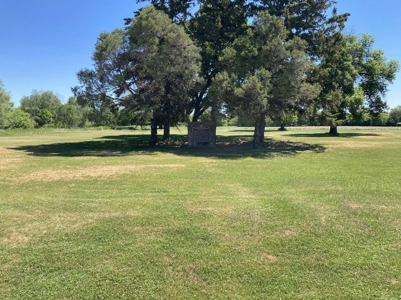
The Maple Creek crossing at old Watson was probably used as early as 1825 by Selkirk colonists moving from Pembina area to Fort Snelling. They were followed in 1843 by the fur brigades of Kittson and Rolette. Major Woods crossed here in 1849, en . . . — — Map (db m175424) HM
Pioneers first settled in the area that later became Kathryn, North Dakota as early as 1876. As the Northern Pacific Railroad constructed the Casselton-Marion spur line, a man named John Runck joined a civil engineer to plat land he purchased from . . . — — Map (db m279296) HM
Jews have been part of North Dakota's social, economic, agricultural and political life since territorial days. Between the 1880's and the 1920's, aided by the Jewish Agricultural and Industrial Society, primarily Russian and Romanian Jews came to . . . — — Map (db m134335) HM
This tablet marks the site where Generals Grant and Sheridan stopped September 4th 1883, with a party enroute west to drive the Golden Spike which completed the Northern Pacific Railroad. — — Map (db m209097) HM
Drugstores offered their communities much more than prescriptions and other medical
products. The display features original furnishings from Norwegian immigrant Lars P. Bjerklie's drugstore from Gilby, North Dakota that he operated from 1889 to . . . — — Map (db m278933) HM
Elbert Heale "Jappe" Trenaman, born in Canada in 1874, came to Page, North Dakota with his mother in the 1880s. He and an
associate named Shinn opened the Brass Rail, a spot that residents remembered as one of the best-known places for meals. . . . — — Map (db m278925) HM
One of the last remaining circular town bandstands that stood in the Buffalo park. This one from Buffalo, ND is now restored and stands proudly at Bonanzaville, USA. — — Map (db m278818) HM
Fargo's current county courthouse is the third courthouse constructed for the town.
The first opened in 1877 and later served as a YMCA building and boarding house. The
second replaced the first in the mid-1880s and burned down during renovations . . . — — Map (db m278870) HM
1906
Cass County District Court
Restoration made possible by a grant from the Alex Stern Family Foundation, given in memory of Alex Stern, Bertha Stern, William Stern, Sam Stern, Helen Stern and Edward A. Stern, A. M. Eriksmoen, . . . — — Map (db m278823) HM
The Cass-Clay Creamery was built on site at Bonanzaville in 1984 and designed to resemble a former 1930s creamery from Kenmare, North Dakota. Much of its interior and equipment comes from the Cass-Clay Cooperative Creamery headquartered in Fargo. . . . — — Map (db m278927) HM
A bonanza farm home from Mapleton Township. Home of Mary Dodge Woodward. She kept a diary here accurately recording pioneer life. From this, her granddaughter wrote the book "The Checkered Years". — — Map (db m278820) HM
The cook car, or "cooker," was a mobile kitchen used to provide onsite meals for workers. They were transported out into fields during harvest season or to active construction sites where cook car staff would prepare and serve hot meals. Cook cars . . . — — Map (db m278931) HM
One-room schoolhouses were common features on the Great Plains during the late-
nineteenth and early-twentieth centuries. Settlers constructed many of the first schools and they used readily available materials like sod or wooden logs. The . . . — — Map (db m278819) HM
The Embden Depot was built in 1900. The town of Embden moved from its original location near the farm of Enos Gray,
the postmaster of Embden, to a spot along a new spur line of the Northern Pacific Railroad. The new line through Embden
was called . . . — — Map (db m278707) HM
Land claims in Fargo, North Dakota were filed soon after it was determined the
railroad would cross at that point. Homesteader A. H. (Harry) Moore entered the Red River Valley area in 1869 and filed one of the earliest claims. Moore built an oak . . . — — Map (db m278744) HM
Christian Furnberg was a young boy when he and his mother moved to Dakota Territory
in 1871. As a boy, Christian would peddle goods to people in the area, shortly after getting married, Christian borrowed $50.00 from his sister-in-law to open a . . . — — Map (db m278748) HM
Martin Habberstad came to Houston County, Minnesota from Eidsvoll, Norway in 1869 and his wife Mary (Tosterud) Habberstad followed in 1871. Martin entered Cass County, North Dakota searching for farmland in early 1875. He chose a spot
near Kindred . . . — — Map (db m278776) HM
Martin Hendrickson Hagen emigrated from Norway with his parents and they first settled in Springfield, Minnesota. Martin
moved to a homestead southwest of Horace with his wife Helene Larsen in 1887. The Hagens built a home there in 1897 where they . . . — — Map (db m278822) HM
Addison, North Dakota was a Great Northern Railroad station first named Williams when established in 1880 for nearby bonanza farmer H. M. Williams. Pioneer Addison Leech, Sr. later bought Williams' farmland and the township was renamed Addison in . . . — — Map (db m278935) HM
David Henderson Houston was born in Glasgow, Scotland on June 14, 1841 and came with his farming parents to Cambria, Wisconsin. David entered the Dakota Territory in 1879 searching for farmland and chose a homestead and timber claim south of Hunter, . . . — — Map (db m278875) HM
Hunter's first newspaper, The Hunter Hawk, began in 1883 and was published by local surgeon Dr. Charles McKay. Following Dr. McKay, Henry and Charles Stone took over and published The Eye from 1885 until 1891 when they started a new newspaper in . . . — — Map (db m278727) HM
In early spring 1882, homesteaders Francis Rogers and Henry McCarten formed a party of settlers that entered Brown County, North Dakota to file land claims. Members of this party were the first settlers of Sargent Township. The township was platted . . . — — Map (db m278768) HM
This is a replica of a Cogswell, ND building.
With the Homestead Act of 1862, hopeful new land seekers were required to register their applications for new plots with the land office. The land office would then provide titles to their property . . . — — Map (db m278773) HM
An Elm Tree in Boston became known as The Liberty Tree. This tree became a rallying point for the growing resistance to the rule of Britain over the American Colonies. In 1765, Patriots in Boston staged the first act of defiance against the British . . . — — Map (db m278879) HM
German homesteaders John and Dora Maier left Odessa, Russia and entered Eureka, South Dakota in the late 1880s. They first farmed near fellow Germans from Russia before moving to Moorhead, Minnesota. The Maier's built a house on their new homestead . . . — — Map (db m278723) HM
The Martinson Cabin was originally a barn built in 1913 on the shore of Pelican Lake. It was built by either Laura A. Schave or Carl Torstenson as both owned the plat of land during that time. Older residents recalled it served as a lodge for local . . . — — Map (db m278887) HM
Named after Donald Moum, the Ag Building was erected in 1996. It contains a collection of agricultural technology that was used and developed in our region. In addition to threshing machines, plows, and seeders, the beginnings of agricultural . . . — — Map (db m278920) HM
This garden is a living tribute to all of America's veterans and their families. In silence and respect, this is a place to remember why millions of Americans have fought and died for our liberty and our freedom.
Here we renew our promise to . . . — — Map (db m278877) WM
Since Fargo, North Dakota has had a formal government, there has been some form of fire protection for the city. The first Mayor, George Egbert, appointed Barney Griffin and L. B. Cornwall as the first two fire wardens on April 12, 1875. Early . . . — — Map (db m278922) HM
St. John's Lutheran Church was located northwest of Horace, North Dakota. It played a very important role in the spiritual and social lives of the people of Horace and the surrounding areas. St John's was originally part of the Sheyenne . . . — — Map (db m278777) HM
This marker commemorates the men and women who achieved American independence. These Patriots, believing in the noble cause of liberty, fought valiantly to found a new nation. 1775-1783
Presented by
North Dakota State Society . . . — — Map (db m278878) WM
In 1870, permanent settlers first established homes near the Wild Rice River in what later became the Eagle Township. More homesteads were filed along the tracks of the Fargo & Southern Railroad, which later became the Chicago, Milwaukee, St. Paul . . . — — Map (db m278817) HM
Peder Borderud, Simon Hanson, Simon's nephew John Rustad, and Ole Svengaard
visited the Red River Valley from Mitchell County, Iowa to examine homestead
possibilities in 1870. They returned to Iowa and came back to the Red River Valley
with more . . . — — Map (db m278881) HM
The Trangsruds were an early pioneering family in Cass County. Hans and Berte
Trangsrud immigrated from Oslo, Norway to America with their children: Amund,
Bernard, Axel, and Bertia in 1870. The family first settled in Mitchell County, Iowa and . . . — — Map (db m278880) HM
Built around 1900, this barber shop was originally located in Buffalo, ND. W.J. Frederick first operated it as the "City Tonsorial Parlor." From 1909-1964, Lewis Easton owned and operated it as the "U-R Next Barber Shop." Easton was also a law . . . — — Map (db m278721) HM
The U-R Next Barbershop first operated in 1900 as W. J. Frederick's "City Tonsorial Parlor" in Buffalo, North Dakota. It was located on a corner lot where the R. Stiles Hotel once stood in 1879 for settlers who came to file land claims. In 1909, . . . — — Map (db m278718) HM
Cass County Board of Commissioners
H. Eklund - Chairman
I. Sandbeck - L. Younker
L. Sutton - W. Bailey
County Engineer - A. Cousins
Built By
Jardine Bridge Co., Inc. Fargo, North Dakota
Historic Bridge
The above plaque was taken . . . — — Map (db m91441) HM
1887 Patrick McHugh 1888 Joseph B. Boyd • Established retail store at this site 1925 John J. & Richard Boyd • Golden Rule Store 1936 Kathren Boyd 1974 Richard S. Johnson • JC Penny Store 1992 Jon Brosseau 2000 Wm. Bodelson, Hans & Diane . . . — — Map (db m206400) HM
When Cavalier County was being settled in the 1880s, spring wheat and durum were the primary crops. Other crops produced were barley, flax, and oats. Major changes in farming operations took place in the 1910s. On-farm grain storage became . . . — — Map (db m214097) HM
Alsen/Storlie (est. 1905) This Soo Line Railroad townsite was named for local settlers who came from Alsen Island off the coast of Denmark. Alsen reached a peak population of 358 in 1930. Ambro (1891-1901) This small Bohemian settlement . . . — — Map (db m214096) HM
1738 • The first known white, non-native men to have set foot in Cavalier County were those in the Verendrye expedition. Through researching journals, it is believed that the expedition passed through Cavalier County in November of 1738 and . . . — — Map (db m214094) HM
One of a kind While original plans called for twelve sites, on May 26, 1972, an interim agreement that came out of the Strategic Arms Limitations Talks I (SALT 1) was signed. The Anti-ballistic Missile (ABM) Treaty limited strategic missile . . . — — Map (db m214102) HM
On this day we honor the memory of those who lost their lives in the Cyclone of May 29, 1909 Mrs. J.B. (Gertrude) Boyd Mrs. F.W. (Rebecca) Bleakley Donalda Sheehan Agnes Bain Joseph Power, Jr. and give thanks for those who persevered to rebuild . . . — — Map (db m206431) HM
Not much is known of the very early history of Cavalier County. The Sioux are believed to have been the earliest residents. The first known white men to have set foot in Cavalier County were those in the Verendrye expedition, which camped in the . . . — — Map (db m214095) HM
In a 1974 North Dakota State University interview-poll of long-time residents, newcomers, and local officials, four out of five respondents indicated that the overall effect of the Safeguard project had been beneficial in terms of the . . . — — Map (db m214104) HM
Located along the northeastern edge of North Dakota, just south of the US-Canadian border, Cavalier County is a vibrant, thriving place to live, work, and visit. As of 2020, population was estimated at 3,800. Agriculture drives the local economy . . . — — Map (db m214098) HM
Ballistic Missile Development WWII spurred a huge leap in missile technology. During the last months of WWII, the Germans introduced the V2, which is considered the first ballistic missile. At the conclusion of WWII, German V1 and V2 rockets . . . — — Map (db m214099) HM
1 • The Perimeter Acquisition Radar (PAR) performed long-range surveillance detection and tracking of ICBMs for interception. The PAR scanned an area of more than 1,000 miles for incoming missiles over the North Pole. Identified . . . — — Map (db m214103) HM
This commemorative plaque is placed in honor of the work performed by Company's 2770, 4737, and 764 of the Civilian Conservation Corp (CCC) between 1934 and 1941 under the direction of the Nat'l Park Service. While the main project of these crews . . . — — Map (db m183703) HM
The Red River Valley is well known for long, harsh winters, But the winter of 1996-97 was unlike any before. Eight blizzards battered the area during a seemingly endless winter. The blizzards, which the Grand Forks Herald named, started with . . . — — Map (db m169712) HM
The flood showed how powerless man is against nature. It also reaffirmed the sheer strength of the human spirit.
Even before the water receded, material goods and money flowed in, gifts from across the land to the people of a small community . . . — — Map (db m169725) HM
In 2002, Mayor Michael R. Brown accepted the gracious donation by Xcel Energy of plaques chronicling the events of the Great Flood of 1997. They were originally dedicated, on the fifth anniversary of the flood, as a permanent gift to the . . . — — Map (db m169727) HM
Considered the Founder of Grand Forks, Alexander Griggs filed the first land plat in the Original Townsite in 1875. Steamboat captain and builder, Griggs was an integral part of the steamboat era. He learned his navigational skills on the . . . — — Map (db m162628) HM
On April 4, "Hannah" swept in, bringing a thick coat of ice that covered everything, followed by seven inches of wet, heavy snow, 70 mile per hour winds, and subzero temperatures.
The flood fight halted. Sandbags froze. Powerlines fell as . . . — — Map (db m169713) HM
First built as a township hall in 1917, this building became Grand Forks County's Blooming 46 school house in 1930. At a time when most Americans lived in rural areas, these one room school houses served as the primary source for education of . . . — — Map (db m183700) HM
Thomas and Almira Campbell emigrated from Perth, Ontario in 1875. They started their farm on this site with eighty acres of land and a sod shanty. In 1879, they built the log cabin that is the original part of the Campbell House. An addition was . . . — — Map (db m183663) HM
The Clifford Annex was constructed by Dinnie Brothers Construction Company during the last surge of 19th century commercial building, which replaced most of the original wood frame buildings in downtown Grand Forks. The architecture has been . . . — — Map (db m213947) HM
The rising water brought crisis. It left behand devastation.
As residents returned to their homes, they found what no television or newspaper could fully capture. Water and mud had seeped onto everything. Garbage was everywhere. The smells . . . — — Map (db m169726) HM
The Dinnie Block was constructed by Dinnie Brothers Construction Company, a firm that played a significant role in the look of the Grand Forks business district in the early 20th century. The three-story building featured locally manufactured . . . — — Map (db m169722) HM
This building was considered one of the best examples of pre-World War I commercial architecture in Grand Forks. The two story structure was built of dark red Hebron brick accented by stone. It remained largely unchanged throughout its life. . . . — — Map (db m213966) HM
Flood predictions from the National Weather Service continued to rise, and a community struggled to keep up. As residents battled the Red River, city officials fought to keep people safe. New and strange sounds engulfed the cities; civil defense . . . — — Map (db m169717) HM
Fannie Mahood was born in Wykoff, MN and moved to Dakota Territory in 1880. She married Frank Heath in 1881. On a 160 acre tree claim west of Grand Forks, they struggled with alkaline soil and drying winds of the treeless prairie. By 1920 their . . . — — Map (db m183665) HM
The battle lost. The cities evacuated. By Saturday, April 19, the community was devastated. Shock turned to disbelief when, at 4:15 p.m. a fire was reported in the downtown Grand Forks Security Building, which stood at this site.
Amid . . . — — Map (db m169724) HM
Nicholas Hoffman and August Loon built this log cabin in 1868 on a site that is now the 500 block of Reeves Drive. In 1870 the cabin became Grand Forks' first post office, with Sanford Cady as postmaster. In the 1880s the cabin was moved in . . . — — Map (db m183667) HM
On this date, ten years after the Flood of 1997, the City of Grand Forks proudly marks the completion of its flood protection project. As the nation watched, the people and property of Grand Forks were devastated by the Flood of 1997. The . . . — — Map (db m169729) HM
The Grand Forks flood of 1997 affected every neighborhood in the city but few knew the degree of devastation experienced by the Lincoln Drive neighborhood.
The waters of the Red River proved to be overwhelming in the spring 1997. . . . — — Map (db m169784) HM
Swedish born engineer Carl Strandlund invented the Lustron Home to ease the housing shortage that followed World War II. Strandlund conceived an all-steel prefabricated home that could be mass produced and marketed across the nation. Manufacturing . . . — — Map (db m183701) HM
Designed by a renowned Grand Forks architect, Joseph Bell DeRemer, this three-story colonial red Harvard brick structure was trimmed with Bedford stone. It was built by the Dinnie Brothers Construction Company and connected to the Security . . . — — Map (db m169721) HM
The streets of this neighborhood in Grand Forks are the first concrete pavements constructed in North Dakota. They were built of portland cement concrete in 1910 and ushered in the era of modern roads and streets in the state. A distinctive feature . . . — — Map (db m183671) HM
From the 1820s to the 1860s, oxcarts were used to carry trade goods between St. Paul and Fort Garry (present-day Winnipeg). The goods were carried from St. Paul, northwest through Minnesota then north through the Red River Valley to Fort Garry.
. . . — — Map (db m183512) HM
Step by difficult step, the people of Grand Forks and East Grand Forks began to rebuild. The priority was to make the cities safe, sanitized, and secure. Water treatment, electrical services, and communications were the first to be restored.
. . . — — Map (db m169728) HM
When residents left their homes, few expected to be gone long. Yet six weeks passed before the last neighborhoods reopened and every resident could assess the extent of the damage. In the meantime, news media told a grim story and painful reality . . . — — Map (db m169723) HM
Built in the Richardsonian Romanesque style, the building was constructed by the Security Improvement Company. The Security Building exemplified the well-designed commercial buildings of the 1800s' Great Dakota Boom. Five stories tall, . . . — — Map (db m169719) HM
Remembering the record flood of 1979, when the Red River crested at 48.8 feet - more than 20 feet above its 28 foot flood stage - Grand Forks and East Grand Forks started raising the levees on both sides of the river.
By March, thousands . . . — — Map (db m169714) HM
The Flood of 1997 is often associated with downtown Grand Forks and the neighborhoods near the Red River. Those areas were indeed devastated, but the 1997 flood affected all of Grand Forks. This site in University Park, which is over a mile and . . . — — Map (db m169791) HM
On the morning of Friday, April 18, the river found a path into Lincoln Park. Water rushed down Lincoln Drive and swamped the levee from behind, and by late afternoon only the rooftops peeked out above the murky, swirling water. Floodwaters . . . — — Map (db m169716) HM
You are standing at the site of the former Security Building, the first structure consumed by the devastating fire that broke out at the height of the 1997 flood of the Red River of the North. This combination of fire and flood - or "Hell and . . . — — Map (db m169711) HM
Dedicated to the men of the 321st Bombardment Group, 57th Bombardment Wing, who flew and fought in the Mediterranean Theater of Operations in World War II. This aircraft is representative of the one flown by 1st Lt John H. O'Keefe of Grand . . . — — Map (db m169802) WM
This vehicle is a Missile Transporter Erector (TE). It was built in cooperation with the GMC and Cessna Corporations and commissioned in 1981 at a cost of $1.3 Million. He TE was used to transport, remove and emplace the Minuteman . . . — — Map (db m169800) WM
Larimore City Hall
Built in 1890
Has Been Placed on the
National Register
Of Historic Places
By the United States
Department of the Interior — — Map (db m183711) HM
Over this trail the Indians carried freight and mail for the U.S. Govt. from Fisher’s Landing to Fort Totten in the years 1879 to 1882. — — Map (db m155662) HM
Named for Captain Charles B. Atchison, assistant commissary and acting ordnance officer, on the staff of General H. H. Sibley. This camp was used as a base for Sibley's Operations to the Missouri River in pursuit of the Sioux Indians and was . . . — — Map (db m200660) WM
Lake Jessie was named for Jessie Benton, daughter of Senator Benton of St. Louis. This lady later became the wife of Lt. John C. Fremont, who with the J. N. Nicollet exploring party camped a half mile northeast of here on the bluff, on July 25, 26. . . . — — Map (db m200661) HM
This was the location of a stop-over shelter for the U.S. Army wagoneers who hauled mail, medicine & supplies from Fort Abercrombie to Fort Toten. It was in use from 1867 to 1872. — — Map (db m176687) HM
In 1886, Erick and Marlene Watne and son Edwin moved to Dakota Territory from Wisconsin. They made their home in this abandoned dugout. Marlene died in 1891. Erick married Hannah Hystad in 1893, they continued to live there until toward the end of . . . — — Map (db m176690) HM
The November-33 Launch Facility (LF), which held a nuclear missile from 1966 to 1997, was unstaffed for nearly all of its history. Rather than securing the LFs (like November-33) of the 321st Strategic Missile Wing with continually on-site, armed . . . — — Map (db m169341) HM
In front of you is a 107½-ton, 4½-foot-thick, wedge-shaped launcher closure door. Between 1966 and 1997, a few feet below this door was a nuclear-tipped Minuteman missile. The most important mission of the launcher closure door was to . . . — — Map (db m169340) HM
The Minuteman missile system depended upon knowledgeable and skilled maintainers to ensure its reliability. Missile maintenance was divided into a number of specialized fields. Air Force enlisted personnel were placed on one of the specialized . . . — — Map (db m169342) HM
Transporting missiles and their nuclear warheads was not an easy task. However, it was critical that it be done smoothly and efficiently. The Minuteman missile system relied on a process of remove, repair and replace - it was essential that all . . . — — Map (db m169339) HM
308 entries matched your criteria. Entries 101 through 200 are listed above. ⊲ Previous 100 — Next 100 ⊳