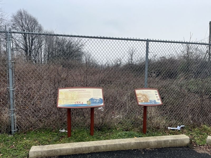
Recreational boating has been a popular pastime on the Delaware since the early 1900s. People still take to the river in watercraft ranging from canoes and rowboats to motorboats, sailboats and yachts. Boating groups—some of which formed nearly a . . . — — Map (db m240204) HM
In the years prior to WW II, many of the local citizens were watermen and made their living from the river. If a boat crew was in distress and needed assistance, other boat owners from town would navigate their craft to make the needed rescue. . . . — — Map (db m189888) HM
John A. Roebling’s legacy is based on his use of suspension cables to hold up bridges and aqueducts. He devised the techniques of air spinning, which is still used today to build much larger spans. This former aqueduct is the nation’s oldest . . . — — Map (db m20597) HM
The first of the dreadnoughts of the United States Navy, the USS Delaware was laid down on November 11, 1907 at Newport News Shipbuilding & Drydock Company, and was the first battleship to have forced lubrication system for engines.
. . . — — Map (db m190725) HM
Delaware boundaries are made up of three distinct lines.
* The 12-mile radius, surveyed 1701.
** The Transpeninsular Line, surveyed 1751.
*** The Mason-Dixon Line, surveyed 1763.
All the lines were completed even before Delaware became a . . . — — Map (db m153857) HM
Delaware boundaries are made up of three distinct lines.
* The 12-mile radius, surveyed 1701.
** The Transpeninsular Line, surveyed 1751.
*** The Mason-Dixon Line, surveyed 1763.
All the lines were completed even before Delaware became a . . . — — Map (db m156796) HM
This monument sheds light on the facts that citizens here felt so strongly during the Civil War that they left their state, farms, businesses and families to head south to enlist. Delaware men served in units from Virginia to Texas. The journey . . . — — Map (db m258114) HM
The open spandrel design pushed reinforced concrete arches beyond the known limit when built. An engineering feat, the railroad alignment rises and falls 11 feet over 28.45 miles. — — Map (db m103910) HM
Alexander Hand - QM USN - Civil War 1862
Charles B. Tanner - 2nd LT INF USA - Civil War 1862
James Parke Postles - CPT INF USA - Civil War 1863
John B. Maberry - PVT INF USA - Civil War 1863
Bernard McCarren - CPL INF USA - Civil War 1863 . . . — — Map (db m240256) WM
It took nearly three years (spring of 1826 to fall of 1828) to build the Delaware & Hudson Canal primarily with German, Scotch, and Irish immigrant labor with the help of horses, hand tools and unpredictable black powder. Dynamite and matches . . . — — Map (db m122221) HM
In Memory of Vietnam War Dead
Dedicated to those from Delaware and New Jersey who made the Supreme Sacrifice in the Service of their Country — — Map (db m68262) WM
Francis Irénée du Pont (1873-1942) began developing this site as an experimental laboratory for his newly-created Delaware Chemical Engineering Company in 1915. Du Pont used the lab to continue his research with smokeless gunpowder and other . . . — — Map (db m140577) HM
The Delaware State Hospital opened in 1889. In its early decades, the hospital cared for people with mental illness, developmental disabilities, brain injuries, seizure disorders, dementia, substance use disorders, and other conditions. Burials in . . . — — Map (db m260249) HM
In 1963, the Cathell family purchased land near Delmar where they built a quarter-mile drag strip known as the US 13 Dragway. As interest in racing grew, they added a dirt speedway to the west of the drag strip and towed grandstands on wheels . . . — — Map (db m245583) HM
On March 16, 1920, Sussex County's members of the Delaware General Assembly held a conference in Georgetown to hear opinions for and against women's suffrage. Suffragists and anti-suffragists organized similar gatherings throughout the state that . . . — — Map (db m190431) HM
Many of the European immigrants who came to this country at the end of the nineteenth century brought with them a variety of epidemic diseases including cholera, typhus, smallpox and bubonic plague. This posed a serious threat to urban areas such as . . . — — Map (db m39387) HM
In the colonial and early Federal periods, Lamberton was an important node in the regional trade network and a limited participant in overseas trade. Positioned at the head of navigation this small port developed as a key point of collection and . . . — — Map (db m166127) HM
In Honored Memory of Our Heroes Who Gave Their Lives
Dedicated to the men and women of Delaware County who served their country in World War II 1941 - 1945 — — Map (db m18244) WM
Beginning in 1892 with the establishment of the Bear Creek Refining
Company in Marcus Hook, the refining industry has long been a major influence
on the Delaware River and the riverfront communities. The area's access to road,
rail, and deep . . . — — Map (db m225277) HM
In the vicinity of this marker, a Flat Outline Map of the State
would be exactly balanced.
In 1989, a curious seventh grader from the Caesar Rodney School District asked where the center of Delaware was located. . . . — — Map (db m39607) HM
This bridge is named for local heroine Michelle Newton Smith, an Emergency Medical Technician with the Delaware City Fire Co. Smith, who dedicated her life to helping others, was aiding an injured motorcyclist along U.S. 13 when she was struck by an . . . — — Map (db m263577) HM
Delaware's only known foreign-born governor, John McKinly emigrated from Northern Ireland to Wilmington in 1742, began a medical practice and became actively involved in Delaware politics. McKinly served as a member of the Colonial Assembly, . . . — — Map (db m39575) HM
1951 — 1968
South Span — Dedicated August 16, 1951
North Span — Dedicated September 12, 1968
Vice President Hubert H. Humphrey dedicated these bridges on September 12, 1968 to the men and women of the State of Delaware and . . . — — Map (db m25561) HM
The reconstructed stockade, blockhouses, log cabins, blacksmith shop, shed, armory, and herb garden are representative of forts constructed by Connecticut settlers in the 1750’s. Revolutionary War Heritage Trail — — Map (db m23635) HM
A Bicentennial gift to the people of the United States from Citizens of the Bedford Indiana area and the Indiana Limestone Industry July 5, 1976. — — Map (db m7277) HM
This coal wagon is a full sized replica of the wagon used on the D&H Gravity Railroad to transport anthracite coal from Carbondale to Honesdale from 1828 until 1898. The loaded wagons traveled a distance of 15.5 miles. The empty wagons travelled a . . . — — Map (db m101629) HM
Noted as interpreters and messengers of peace, the Delawares were chiefly instrumental in bringing other tribes to the General Treaty at Bird's Fort (in the present county of Tarrant) in 1843. — — Map (db m121258) HM
This monument sheds light on the facts that citizens here felt so strongly during the Civil War that they left their state, farms, businesses and families to head south to enlist. Delaware men served in units from Virginia to Texas. The journey . . . — — Map (db m199250) HM
Originally part of the farm property of Sarah Briggs in 1848. The site was laid out by Joseph Fox and purchased by the Delaware County Commissioners in 1849 for the erection of a courthouse. The structure, whose construction plans cost $50, was . . . — — Map (db m83369) HM
Dedicated to all Delaware County
Veterans for all wars
A patriotic sacrifice forever
The memories will live forever
We will remember them
— — Map (db m141705) WM
The building and operation of the 108-mile Delaware & Hudson Canal provided a multitude of jobs not only for Dutch and English settlers but for Irish and German immigrants. The area hummed with activity. Laborers dug the canal with picks and . . . — — Map (db m20590) HM
Imagine boats traveling above the river here. After 1848, 50-ton canal boats crossed over the Delaware River at this site. Chief canal engineer Russel F. Lord and civil engineer John A. Roebling designed and built this suspension aqueduct . . . — — Map (db m121303) HM
Left Side of Marker
U.S. Submarine Veterans
World War II
52 United States Submarines
On Eternal Patrol
U.S. Navy Submarines Paid Heavily for their success in World War II.
374 Officers and 3131 Men are on board these . . . — — Map (db m146109) WM
Walk the Boards
The first Rehoboth Beach boardwalk was 1,000 yards long and consisted of 8-foot-wide oak planks laid on the sand. Built in 1873, it was replaced in 1884 with a new boardwalk 8 feet wide and 1.25 miles long. . . . — — Map (db m198889) HM
Erected by the people of
Delaware County
In grateful remembrance of those
Who served their Country in the Civil War
And who have defended
The American Flag
(List of Battles)
Gettysburg
Antietam
Wilderness
Cold Harbor . . . — — Map (db m137663) WM
In 1888, David Schenck, searching for battlefield artifacts, found the upturned bones of three unidentified soldiers on a farm north of the park. From buttons found in the grave, supposedly marked “USA,” Schenck concluded that the deceased were . . . — — Map (db m221874) HM
The Light Infantry Company of Dover, a part of the 1st Battalion of Kent County, mustered in on 2 April 1776. Each militia volunteer was uniformly armed, equipped, and wore a standard military coat of green faced with red lapels, cuffs, and . . . — — Map (db m39576) HM
This section of the Delaware and Raritan Canal State Park Trail is located on the former right-of-way of the Belvidere Delaware Railroad, which was completed between Trenton and Phillipsburg in 1854. The original station building was initially . . . — — Map (db m37763) HM
Delaware County: Anti-Slavery Stronghold
A unique combintation of strong-principled religous communities, free black settlements, and tightly knit extended families fostered a wide-spread attitude of willful defiance that made Delaware one of . . . — — Map (db m12829) HM
In 1890, local families founded a Church of Christ that met in the Lively School on present-day Britain Rd. Taking the name South Delaware Church of Christ, the congregation built a sanctuary at the southeast corner of S. Delaware and First Streets . . . — — Map (db m263354) HM
Battles around New York City and Environs, 1776-1779
1. Long Island, August 27, 1776
2. Throg's Neck, October 12-18, 1776
3. Mamaroneck Raid, October 22, 1776
4. White Plains, October 28, 1776
5. Retreat across New Jersey, . . . — — Map (db m39713) HM
Desert Shield • Desert Storm
A tribute to all members of the United States Armed Forces who gallantly and courageously performed their duties during the Desert Shield Operation and the Desert Storm War Action in Kuwait-Iraq and Saudi . . . — — Map (db m146110) WM
A black man named Anthony was among the first permanent settlers of New Sweden. He came to the colony from the West Indies in 1639 aboard the Swedish ship Vogel Grip. Records indicate that Black Anthony became a free man named Antoni Swart, an . . . — — Map (db m228037) HM
Centre Bridge
The Center Bridge Company was incorporated to construct a toll bridge across the Delaware River here in 1812, completely reconstructed in 1830, and substantially repaired in 1841 after a damaging flood. The bridge, a covered . . . — — Map (db m16655) HM
Delaware and Raritan Canal State Park
The 66 mile long Delaware and Raritan Canal was dug by hand from 1830 until 1834. It was built to provide a safe, fast inland passage between New York City and Philadelphia. The main channel . . . — — Map (db m208082) HM
The 330-mile Delaware River is the longest free-flowing river east of the Mississippi River is the longest free-flowing river east of the Mississippi River. Its watershed drains an area of 14,119 square miles in four states. This nationally . . . — — Map (db m160163) HM
The Delaware estuary is the second largest freshwater port in the United States. It hosts the country's second largest concentration of petrochemical facilities. Shipping of petrochemicals and other products has revitalized ports along the . . . — — Map (db m191845) HM
Just east of this marker, at a point where an old Indian trail led to the water's edge, Moses Grinter established the first ferry on the Kansas River. The year was 1831, and Grinter became the earliest permanent white settler in the area. His ferry . . . — — Map (db m46329) HM
Since the 1600s, Burlingtonians have enjoyed a close relationship with the Delaware River and surrounding creeks, streams, and ponds. As much as for travel and shipping, the Delaware River presented locals and visitors ample opportunity for . . . — — Map (db m160098) HM
Welcome to Delaware Water Gap National Recreation Area. This unit of the National Park system stretches along both sides of the middle Delaware River for 40 miles from Milford in the north to the scenic Water Gap in the south. The park has places to . . . — — Map (db m87137) HM
Welcome to Delaware Water Gap National Recreation Area. This unit of the National Park system stretches along both sides of the middle Delaware River for 40 miles from Milford in the north to the scenic Water Gap in the south. The park has places to . . . — — Map (db m87136) HM
Welcome to Delaware Water Gap National Recreation Area. This unit of the National Park system stretches along both sides of the middle Delaware River for 40 miles from Milford in the north to the scenic Water Gap in the south. The park has places to . . . — — Map (db m87113) HM
Welcome to Delaware Water Gap National Recreation Area. This unit of the National Park system stretches along both sides of the middle Delaware River for 40 miles from Milford in the north to the scenic Water Gap in the south. The park has places to . . . — — Map (db m87108) HM
Legislative Hall was dedicated as the state's new capitol building in 1933, replacing The Old State House on The Green. The Senate and the House of Representatives of Delaware's General Assembly meets here. The building also houses the offices of . . . — — Map (db m194645) HM
The federal government recognized the need for a militia. It is mentioned in the Constitution and the Bill of Rights. The 2nd Amendment states “A well-regulated Militia, being necessary to the security of a free State, the right of the people to . . . — — Map (db m140181) WM
What is a Hundred?
A hundred is an old English subdivision of a county. Although the origin is somewhat shrouded in mystery, basically it was a tract of land large enough to provide a hundred men to serve the king’s wars. In American . . . — — Map (db m156915) HM
The Delaware River, a mighty highway of commerce, has also been a formidable barrier to travel. Ferries operated sporadically from New Castle from very early days. Modern ferry service didn't begin until 1925 to meet the increasing needs of . . . — — Map (db m191495) HM
In this house lived Ryves Holt
Chief Justice
of “Three Lower Counties On Delaware,”
1745 to 1763
Member of Assembly
of “Three Lower Counties On Delaware,”
1734-1737, 1742-1744, 1746-1755,
And Speaker of Assembly . . . — — Map (db m221639) HM
Listed on the State & National Registers of Historical Places 2004
John I. Blair founded Delaware Village in the 1850's as a station on the newly built Warren Railroad in a rural neighborhood first settled circa 1740. While the station was . . . — — Map (db m26115) HM
Marine pilots know the shoals, lumps, and ledges of the Delaware intimately. They know the bends of the dredged channel, the characteristics of every lighthouse and range light, and the location of wrecks. They understand tides and currents and . . . — — Map (db m39379) HM
A migration of Indians throughout Ohio began due to unstable conditions created by the American Revolution. The massacre of Christian Indians at the Moravian mission of Gnadenhutten in 1782 and Colonel William Crawford’s expedition against . . . — — Map (db m168811) HM
On December 9, 1775, the Continental Congress resolved that a body of troops be raised in Delaware "for the defense of American liberty." Commanded by Colonel John Haslet, the Delaware Regiment consisted of more than 500 battle-ready troops when . . . — — Map (db m67456) HM WM
The federal government recognized the need for a militia. It is mentioned in the Constitution and the Bill of Rights. The 2nd Amendment states “A well-regulated Militia, being necessary to the security of a free State, the right of the people to . . . — — Map (db m140138) HM
The Indian Removal Act of 1830 forced certain eastern tribes westward into Kansas. In recognition of past acts of friendship by the Wyandots, the Delaware agreed to sell them 36 sections of their holdings. The Delaware also graciously donated 3 . . . — — Map (db m69400) HM
In memory of the soldiers and sailors of Delaware County, Ohio, who served in the War of 1861 to 1865 “Their heroic valor ensured our lasting peace” — — Map (db m18227) HM
Delaware Canal has been designated a National Historic Landmark. This site possesses national significance in commemorating the history of the United States of America. — — Map (db m86114) HM
This bronze sculpture replicates the famous painting, Washington Crossing the Delaware by Emanuel Leutze. It depicts Gen. George Washington leading the Continental Army on a dangerous nighttime crossing of the Delaware River on December 25, . . . — — Map (db m106149) HM
A watershed is an area of land that drains into a body of water such as a creek or stream. Small creeks and streams come together to create larger streams and small rivers, which then empty into major rivers like the Delaware River. . . . — — Map (db m240163) HM
Welcome to Delaware Water Gap National Recreation Area. This unit of the National Park system stretches along both sides of the middle Delaware River for 40 miles from Milford in the north to the scenic Water Gap in the south.
The park has places . . . — — Map (db m87106) HM
One of the thirteen original colonies.
Capital-Dover
Delaware was explored by Henry Hudson for the Dutch in 1609, but was named for Lord De la Warr, an early English governor of Virginia. In 1638 Peter Minuit established the first successful . . . — — Map (db m97831) HM
Fairfax Delaware, conceived & built by Alfred J. Vilone. One man's vision becomes security & happiness for thousands.
Dedicated in appreciation & esteem by members of his organization, December 18, 1951. — — Map (db m192438) HM
Canallers You became a captain as young as sixteen by showing “The Company” what you could do. You demonstrate how to “snub” (slow down and brake for lock operations), keep accurate cargo records (pay based on number of miles hauled and coal . . . — — Map (db m86113) HM
Dedicated to All Delaware Veterans
Delaware Military Academy
By CMCPO Joshua Loper, First DMA Eagle Scout
Military Science Course Project
Unique 1861 Iron Cannon
Last Survivor from Lobdell Foundry
Union Field Cannon
Used by . . . — — Map (db m66921) HM WM
The lands adjoining the Falls of the Delaware River were a natural location for early European settlement, just as they had been a focus of native American occupation. The Falls were little more than a stretch of fast-running shallow water between . . . — — Map (db m4233) HM
In the mid-1600s this site was the focal point of a three-nation struggle for control of the Delaware River. Dutch military leaders recognized the strategic importance of this place in controlling river traffic in 1651 and established a fort here. . . . — — Map (db m130462) HM
Delaware Canal
Here is Lock No. 12 in a series of 23 lift locks, numbered from Bristol to Easton. Just above here is one of the nine aquaducts by which the canal and its traffic crossed courses of small streams.
Pennsylvania Canal
A . . . — — Map (db m17586) HM
The Delaware Indians were Algonquins. Their name, Lenni-Lenape meant "real men" or "native men". They loved the rich land along the river and the men hunted the forests, the women tilled the fertile soil and the children played along the banks of . . . — — Map (db m82173) HM
Shellfish call the muddy bottom their home
Among the many species of bottom-dwelling invertebrates
the most commercially important are oysters and blue
crabs. The estuary has been famous for high-quality
oysters for over a century. After . . . — — Map (db m191859) HM
Locations of Interest
🄰 Armory
12 East State Street
Former site of the Pennsylvania National Guard, currently houses the Pennsylvania Veterans Museum.
🄱 Central Business District
From Gayley to . . . — — Map (db m205512) HM
Locations of Interest
🄰 Armory
12 East State Street
Former site of the Pennsylvania National Guard, currently houses the Pennsylvania Veterans Museum.
🄱 Central Business District
From Gayley to . . . — — Map (db m205581) HM
Locations of Interest
🄰 Armory
12 East State Street
Former site of the Pennsylvania National Guard, currently houses the Pennsylvania Veterans Museum.
🄱 Central Business District
From Gayley to . . . — — Map (db m205576) HM
Locations of Interest
🄰 Armory
12 East State Street
Former site of the Pennsylvania National Guard, currently houses the Pennsylvania Veterans Museum.
🄱 Central Business District
From Gayley to . . . — — Map (db m205560) HM
The first commercial crossing of the Delaware River at Easton was a ferry enfranchised to David Martin in 1739.
Located near the present site of Scott Park at the junction of the Lehigh and Delaware Rivers, it operated until the beginning of . . . — — Map (db m114653) HM
When the Revolution began, Congress ordered construction of river defense systems to protect Philadelphia against a sea attack. A system of cheveaux-de-fries, a series of underwater obstructions, was developed. These consisted of large coffers . . . — — Map (db m13438) HM
Honoring women throughout our history who have served in defense of our state and our nation.
In Tribute to the women of the first state who have come forward to protect and defend our state and our nation in the military and supporting . . . — — Map (db m194642) WM
On 3 September 1777 an American light infantry corps under the command of Brigadier General William Maxwell engaged British and Hessian forces here in the Battle of Cooch's Bridge. Maxwell's Corps was composed of soldiers from New Jersey, North . . . — — Map (db m156785) HM
Dedicated by Governor Jack A. Markell and the Military Order of the Purple Heart
Department of Delaware
July 27, 2011
The National Purple Heart Trail memorializes those heroic soldiers, sailors, airmen and marines who have had the . . . — — Map (db m186858) WM
Begun in 1832, canal follows Delaware River to Trenton then New Brunswick. Built by Irish immigrants, canal fell into disuse with advent of railroads in 1850. — — Map (db m16658) HM
3612 entries matched your criteria. Entries 101 through 200 are listed above. ⊲ Previous 100 — Next 100 ⊳
Thin black lines indicate changes in relevance. Between each pair of lines entries are ordered geographically but all have the same relevance.
* Inflectional forms of words are their plurals, singulars, and possessives as well as gramatical tenses and similar variations.