677 entries match your criteria. Entries 101 through 200 are listed.⊲ Previous 100 — Next 100 ⊳
Quakerism Historical Markers
This series is on the history of Quakers (The Religious Society of Friends), including notable Meeting Houses, burial grounds, individuals, settlements and schools. This series is not about things named after Quakers but are not related to Quakerism, such as Quaker State Oil or Quaker Oats.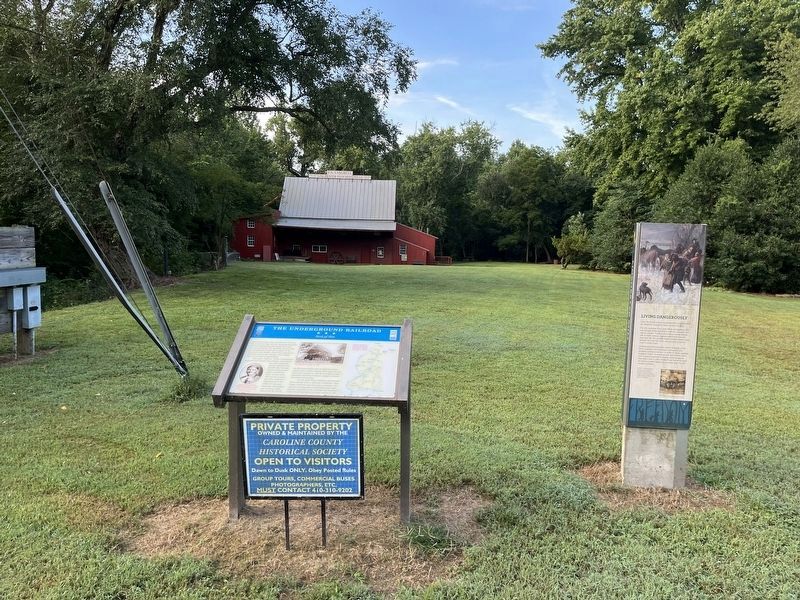
By Devry Becker Jones (CC0), September 3, 2022
The Underground Railroad Marker
101 ► Maryland, Caroline County, Preston — The Underground Railroad — Seed of War —  |
| On Linchester Road 0.1 miles north of Maryland Route 331, on the right when traveling south. | |||
| 102 ► Maryland, Carroll County, Union Bridge — “Pipe Creek Meeting” — |
| On Quaker Hill Road 0.2 miles south of Ladiesburg Road, on the left when traveling south. | |||
| 103 ► Maryland, Cecil County, Calvert — Calvert Village — |
| On Telegraph Road (Maryland Route 273) at Rosebank Road, on the right when traveling east on Telegraph Road. | |||
| 104 ► Maryland, Dorchester County, Cambridge — Agents on the Underground Railroad — |
| On Washington Street (Maryland Route 343) at Ocean Gateway (U.S. 50), on the right when traveling west on Washington Street. | |||
| 105 ► Maryland, Harford County, Kingsville — Jerusalem Mills — |
| On Jerusalem Road 0.2 miles west of Jericho Road, on the left when traveling west. | |||
| 106 ► Maryland, Howard County, Ellicott City — Friends Meeting House and Graveyard — |
| On Old Columbia Pike 0.2 miles south of Main Street, on the left when traveling south. | |||
| 107 ► Maryland, Howard County, Lisbon — New Lisbon — Servicing Travelers on the National Pike — The Historic National Road - The Road That Built The Nation |
| On Historic National Road (Maryland Route 144), on the left when traveling west. Reported permanently removed. | |||
| 108 ► Maryland, Howard County, Lisbon — New Lisbon — Servicing Travelers on the National Pike — The Road That Built The Nation — |
| On Church Alley at Frederick Road ( Route 144), on the right when traveling north on Church Alley. | |||
| 109 ► Maryland, Montgomery County, Brookeville — Briggs House — War of 1812 Bicentennial — United States Capital for a Day — |
| On Market Street east of South Street, on the right when traveling east. | |||
| 110 ► Maryland, Montgomery County, Brookeville — The Rachel Carson Greenway — |
| Near Zion Road south of Sundown Road, on the right when traveling north. | |||
| 111 ► Maryland, Montgomery County, Brookeville — Thomas House Site — War of 1812 Bicentennial — United States Capital for a Day — |
| On Market Street east of South Street, on the right when traveling east. | |||
| 112 ► Maryland, Montgomery County, Olney — Olney — |
| On Olney-Sandy Spring Road (Maryland Route 108) at Georgia Avenue ( Route 97), on the right when traveling east on Olney-Sandy Spring Road. | |||
| 113 ► Maryland, Montgomery County, Sandy Spring — Countee Cullen / The Odd Fellows Lodge — Sandy Spring African American Heritage Trail — [Sandy Spring Slave Museum & African Art Gallery] — |
| On Brooke Road 0.1 miles west of Chandlee Mill Road, on the right when traveling west. | |||
| 114 ► Maryland, Montgomery County, Sandy Spring — Hallowed Ground — |
| Near Brooke Road 0.1 miles north of Hickory Knoll Road, on the right when traveling north. | |||
| 115 ► Maryland, Montgomery County, Sandy Spring — Harridays and Carrolls / Carolyn Snowden — Sandy Spring African American Heritage Trail — [Sandy Spring Slave Museum & African Art Gallery] — |
| On Brooke Road 0.1 miles west of Chandlee Mill Road, on the right when traveling west. | |||
| 116 ► Maryland, Montgomery County, Sandy Spring — Historic Sites Allegedly Connected to the Underground Railroad / Mamma Annie Matthews — Sandy Spring African American Heritage Trail — [Sandy Spring Slave Museum & African Art Gallery] — |
| On Brooke Road 0.1 miles west of Chandlee Mill Road, on the right when traveling west. | |||
| 117 ► Maryland, Montgomery County, Sandy Spring — History of the Sandy Spring Friends Meeting House — |
| On Meeting House Road, on the left when traveling south. | |||
| 118 ► Maryland, Montgomery County, Sandy Spring — Martha Howard and John H. Murphy Alliance / Mutual Memorial Cemetery — Sandy Spring African American Heritage Trail — [Sandy Spring Slave Museum & African Art Gallery] — |
| On Brooke Road 0.1 miles west of Chandlee Mill Road, on the right when traveling west. | |||
| 119 ► Maryland, Montgomery County, Sandy Spring — Olive Branch Community Church / The Awkards and Smith Families — Sandy Spring African American Heritage Trail — [Sandy Spring Slave Museum & African Art Gallery] — |
| On Brooke Road 0.1 miles west of Chandlee Mill Road, on the right when traveling west. | |||
| 120 ► Maryland, Montgomery County, Sandy Spring — Quakers Practicing their Faith in Montgomery County — 1861-1865 — |
| Near Norwood Road. | |||
| 121 ► Maryland, Montgomery County, Sandy Spring — Salute to the Quakers — [Sandy Spring Slave Museum & African Art Gallery] — |
| On Brooke Road 0.1 miles west of Chandlee Mill Road, on the right when traveling west. | |||
| 122 ► Maryland, Montgomery County, Sandy Spring — Sandy Spring Friends Meeting Site — |
| On Meeting House Road, on the left when traveling south. | |||
| 123 ► Maryland, Montgomery County, Sandy Spring — Sandy Spring Museum / The Evan Snowden Dynasty: Born Free at the Manor — Sandy Spring African American Heritage Trail — [Sandy Spring Slave Museum & African Art Gallery] — |
| On Brooke Road 0.1 miles west of Chandlee Mill Road, on the right when traveling west. | |||
| 124 ► Maryland, Montgomery County, Sandy Spring — The Powell-Matthews-Cook and Brooks Families in Sandy Spring / Spencerville — Sandy Spring African American Heritage Trail — [Sandy Spring Slave Museum & African Art Gallery] — |
| On Brooke Road 0.1 miles west of Chandlee Mill Road, on the right when traveling west. | |||
| 125 ► Maryland, Montgomery County, Sandy Spring — The Rachel Carson Greenway — |
| Near Norwood Road (Maryland Route 182) 0.1 miles north of Ednor Road, on the right when traveling north. | |||
| 126 ► Maryland, Montgomery County, Sandy Spring — The Sandy Spring — |
| On Meeting House Road when traveling south. | |||
| 127 ► Maryland, Montgomery County, Sandy Spring — Tribute to Robert H. "Bob" Hill / Sharp Street United Methodist Church — Sandy Spring African American Heritage Trail — [Sandy Spring Slave Museum & African Art Gallery] — |
| On Brooke Road 0.1 miles west of Chandlee Mill Road, on the right when traveling west. | |||
| 128 ► Maryland, Montgomery County, Sandy Spring — Welcome to the Woodlawn Stone Barn Visitor Center — |
| Near Norwood Road (Maryland Route 182) 0.1 miles north of Ednor Road, on the right when traveling north. | |||
| 129 ► Maryland, Montgomery County, Sandy Spring, Norwood — African Americans and Quakers in Sandy Spring — |
| On Park Police Drive near Ednor Road, on the left when traveling east. | |||
| 130 ► Maryland, Montgomery County, Sandy Spring — Woodlawn — |
| On Park Police / Woodlawn Drive, on the right when traveling north. | |||
| 131 ► Maryland, Montgomery County, Silver Spring, Norwood — Children Growing Up in Montgomery County — 1861 - 1865 — |
| On Layhill Road (Maryland Route 182) at Norwood Road ( Route 182), on the right when traveling west on Layhill Road. | |||
| 132 ► Maryland, Montgomery County, Silver Spring, Wheaton — Kemp Mill — |
| On Randolph Road east of Kemp Mill Road, on the right when traveling east. | |||
| 133 ► Maryland, Montgomery County, Silver Spring, White Oak — The Rachel Carson Greenway — |
| Near Colesville Road (U.S. 29) south of Hillwood Drive, on the left when traveling north. | |||
| 134 ► Maryland, Prince George's County, Beltsville — Iron Production: Maryland's Industrial Past / The Iron Making Process |
| Near Old Muirkirk Road. Reported permanently removed. | |||
| 135 ► Maryland, Prince George's County, Beltsville — Iron Production: Maryland's Industrial Past / The Ironmaking Process — |
| On Old Muirkirk Road 0.2 miles north of Muirkirk Road, on the right when traveling north. | |||
| 136 ► Maryland, St. Mary's County, Lexington Park — Defining Freedom and Building Community — from chaos to a new order — 1865 - 1900 — |
| On Rennell Avenue West 0.2 miles east of Willows Road, on the left when traveling east. | |||
| 137 ► Maryland, St. Mary's County, St. Mary's City — An Experiment with Liberty of Conscience — |
| Near Point Lookout Road (Maryland Route 5) 0.4 miles west of Rosecroft Road, on the left when traveling west. | |||
| 138 ► Maryland, Talbot County, Easton — Betty’s Cove Meetinghouse — |
| On St. Michaels Road (Maryland Route 33) at Unionville Road ( Route 370), on the right when traveling west on St. Michaels Road. | |||
| 139 ► Maryland, Talbot County, Easton — Third Haven — Meeting House of the Society of Friends — 1682 - 1684 — |
| On South Washington Street (Maryland Route 565) south of West Earle Avenue, on the right when traveling south. | |||
| 140 ► Maryland, Talbot County, Easton — William Penn — |
| On Easton Parkway (Maryland Route 322) 0.1 miles south of Bay Street ( Route 33), on the right when traveling north. | |||
| 141 ► Maryland, Talbot County, Oxford — 1668-1710: Oxford's Beginnings — The Oxford Museum — A Special Place; A Special Heritage — |
| Near South Morris Street at Market Street, on the right when traveling north. | |||
| 142 ► Massachusetts, Barnstable County, Sandwich, East Sandwich — Sandwich Meeting of Friends — |
| Near Quaker Road 0.1 miles north of Spring Hill Rd. | |||
| 143 ► Massachusetts, Berkshire County, Adams — East Hoosuck Society of Friends Revolutionary War Patriots — |
| Near Maple Street. | |||
| 144 ► Massachusetts, Berkshire County, Adams — Friends Meeting House — |
| Near Valley Street. | |||
| 145 ► Massachusetts, Berkshire County, Adams — Maple Street Cemetery — Welcome — |
| On Maple Street west of Forest Park Avenue, on the right when traveling west. | |||
| 146 ► Massachusetts, Essex County, Amesbury — Macy-Colby House — 1630 - 1930 — |
| On Main Street, on the right. | |||
| 147 ► Massachusetts, Essex County, Salem — Friends Cemetery — Established 1718 — |
| On Essex Street just east of North Pine Street, on the right when traveling west. | |||
| 148 ► Massachusetts, Essex County, West Newbury — Site of the Quaker Meetinghouse — |
| On Turkey Hill Road at Rogers Street, on the right when traveling south on Turkey Hill Road. | |||
| 149 ► Massachusetts, Suffolk County, Boston, Beacon Hill — Mary Dyer — Quaker — |
| On Beacon Street west of Bowdoin Street. | |||
| 150 ► Massachusetts, Suffolk County, Boston, Downtown — Life and Death in Colonial Boston — |
| On Tremont Street, on the right when traveling north. | |||
| 151 ► Massachusetts, Suffolk County, Boston, North End — Gravestone Art: Skulls, Wings, and Other Symbols — |
| Near Hull Street, on the left when traveling east. | |||
| 152 ► Massachusetts, Suffolk County, Boston, North End — Seventeenth Century Copp’s Hill — |
| Near Hull Street, on the left when traveling east. | |||
| 153 ► Michigan, Cass County, Cassopolis — L1352 — Chain Lake Baptist Church and Cemetery — |
| On Chain Lake Street 0.6 miles east of Carver Road, on the right when traveling east. | |||
| 154 ► Michigan, Cass County, Cassopolis — 30 — Freedom Road — Michigan Legal Milestone — |
| On State St. (Road M-60) at Broadway Ave. (Road M-62), on the right when traveling west on State St.. | |||
| 155 ► Michigan, Cass County, Vandalia — Birch Lake Meeting House — |
| On James Street 0.1 miles north of Brownsville Road, on the right when traveling north. | |||
| 156 ► Michigan, Cass County, Vandalia — S137 — The Underground Railroad — |
| On State Street (State Highway 60) at Water Street, on the right when traveling east on State Street. | |||
| 157 ► Michigan, Lenawee County, Adrian — L1844 — Adrian Monthly Meetinghouse / Raisin Valley Friends Church — |
| On North Adrian Highway (State Highway 52) at West Valley Road, on the left when traveling north on North Adrian Highway. | |||
| 158 ► Michigan, Lenawee County, Adrian — Laura Haviland — 1808 - 1898 — |
| On East Church Street (State Highway 52) at South Main Street (State Highway 52), on the right when traveling east on East Church Street. | |||
| 159 ► Michigan, Oakland County, Farmington — City of Farmington — Original Historic District (designated by broken line) Settled 1824 — |
| On Grand River Avenue at Oakland Street, on the left when traveling west on Grand River Avenue. | |||
| 160 ► Michigan, Oakland County, Farmington — 266 — First Quaker Meeting — |
| On Grand River Avenue at Liberty Street, on the right when traveling east on Grand River Avenue. | |||
| 161 ► Michigan, Oakland County, Farmington — Quaker Burial Ground — |
| On Gill Road at Cortland Street, on the left when traveling south on Gill Road. | |||
| 162 ► Michigan, Oakland County, Farmington — The Village Center — |
| On Shiawassee Road at Farmington Road, on the right when traveling west on Shiawassee Road. | |||
| 163 ► Michigan, Oakland County, Farmington Hills — L955 — Lemuel Botsford House — |
| On Farmington Road at Glenn Valley Drive, on the right when traveling north on Farmington Road. | |||
| 164 ► New Hampshire, Rockingham County, Seabrook — 103 — Shapley Line — |
| On Lafayette Road (U.S. 1) at Rocks Road, on the right when traveling north on Lafayette Road. | |||
| 165 ► New Jersey, Atlantic County, Linwood — Friends Meeting House and Burying Ground — |
| On Shore Road just south of Central Avenue. | |||
| 166 ► New Jersey, Burlington County, Bordentown — Friends Meeting House — |
| On Farnsworth Avenue (County Road 545) just south of Walnut Street, on the right when traveling south. | |||
| 167 ► New Jersey, Burlington County, Bordentown — 6 — The "Wye" and the Lower Bordentown Station — |
| Near West Park Street west of Prince Street, on the right when traveling west. | |||
| 168 ► New Jersey, Burlington County, Burlington — Office of the Council of Proprietors and the Surveyor General — Western Division of New Jersey — |
| On West Broad Street 0.1 miles west of High Street, on the right when traveling west. | |||
| 169 ► New Jersey, Burlington County, Burlington — 4 — Pre-Revolutionary History of Burlington City — |
| On West Broad Street east of Locust Avenue, in the median. | |||
| 170 ► New Jersey, Burlington County, Chesterfield Township, Crosswicks — Chesterfield Township — |
| On Ward Avenue 0.1 miles west of Church Street, on the right when traveling west. | |||
| 171 ► New Jersey, Burlington County, Crosswicks — Crosswicks Quaker Meeting — Religious Society of Friends — |
| Near Front Street at Church Street. | |||
| 172 ► New Jersey, Burlington County, Crosswicks — Friends Meeting — |
| On Church Street at Front Street on Church Street. | |||
| 173 ► New Jersey, Burlington County, Marlton — Cropwell Friends Meeting — |
| On South Cropwell Road at Old Marlton Pike N on South Cropwell Road. | |||
| 174 ► New Jersey, Burlington County, Medford — Friends Graveyard — |
| On Union Street. | |||
| 175 ► New Jersey, Burlington County, Medford — 8 — Friends Meeting — |
| On Union Street east of Cherry Street, on the right when traveling east. | |||
| 176 ► New Jersey, Burlington County, Medford — 33 — The Maurice Haines House — |
| On N Main Street (County Route 541) south of Marlton Pike (New Jersey Route 70), on the right when traveling north. | |||
| 177 ► New Jersey, Burlington County, Medford — 40 — The Owen Stratton House — |
| On S Main Street (County Route 541) at South Street, on the right when traveling south on S Main Street. | |||
| 178 ► New Jersey, Burlington County, Moorestown — First Moorestown, New Jersey Friends Meeting House — |
| On East Main Street at Chester Avenue on East Main Street. | |||
| 179 ► New Jersey, Burlington County, Moorestown — Morgan Hollinshead Clock Shop Site — |
| On East Main Street at Chester Avenue on East Main Street. | |||
| 180 ► New Jersey, Burlington County, Mount Holly — John Woolman’s Tailor Shop & 2nd Friends Meeting House — |
| On Mill Street, on the right when traveling west. | |||
| 181 ► New Jersey, Burlington County, Mount Laurel — Evesham Friends Meeting House — |
| On Moorestown - Mount Laurel Road at Hainesport Road, on the left when traveling east on Moorestown - Mount Laurel Road. | |||
| 182 ► New Jersey, Burlington County, Riverton — Caleb Clothier House — |
| On Bank Avenue just east of Main Street, on the right when traveling east. | |||
| 183 ► New Jersey, Burlington County, Riverton — Riverton Public School — |
| On 5th Street just east of Howard Street, on the right when traveling west. | |||
| 184 ► New Jersey, Burlington County, Riverton — Robert and Anna Miller Biddle — |
| On Bank Avenue west of Penn Street, on the left when traveling west. | |||
| 185 ► New Jersey, Burlington County, Riverton — Wharton-Fitler House — |
| On Bank Avenue just west of Main Street, on the left when traveling west. | |||
| 186 ► New Jersey, Burlington County, Springfield, Springfield Township — Upper Springfield Meeting House and Cemetery — Historical Site — 1727 — |
| On Highland Road at Springfield Meeting House Road, on the left when traveling north on Highland Road. | |||
| 187 ► New Jersey, Camden County, Camden, Cooper Grant — Cooper Street: the Gateway of Southern New Jersey — |
| On Cooper Street at North 3rd Street, on the right when traveling west on Cooper Street. | |||
| 188 ► New Jersey, Camden County, Camden, Cooper Grant — 2 — The Cooper Family — |
| On Cooper Street. | |||
| 189 ► New Jersey, Camden County, Camden, Downtown — Newton Friends Meetinghouse — |
| On Cooper Street at Haddon Avenue (County Road 561), on the right when traveling east on Cooper Street. | |||
| 190 ► New Jersey, Camden County, Haddon Township, Westmont — Saddler’s Woods — |
| On MacArthur Blvd.. | |||
| 191 ► New Jersey, Camden County, Lawnside — Peter Mott House Underground Railroad Museum — |
| On Kings Court west of Moore Avenue, on the left when traveling west. | |||
| 192 ► New Jersey, Cape May County, Upper Township, Ocean View — Seaville Friends Meeting House — |
| On Shore Road (Route 9) 0.1 miles south of Argoe Drive, on the right when traveling south. | |||
| 193 ► New Jersey, Gloucester County, National Park — James and Ann Whitall House — |
| On Hessian Road, on the left when traveling west. | |||
| 194 ► New Jersey, Hunterdon County, Flemington, Franklin Township — Nixon Graveyard — |
| On Croton Road (County Road 579) south of Nixon Farm Road, on the right when traveling north. | |||
| 195 ► New Jersey, Hunterdon County, Quakertown — Quaker Meeting House — |
| On County Route 579, on the right when traveling west. | |||
| 196 ► New Jersey, Mercer County, Princeton — Stony Brook Meeting House — |
| Near Quaker Road (County Route 533) at Mercer Road, on the right when traveling north. | |||
| 197 ► New Jersey, Mercer County, Trenton, Chambersburg — 9 — "Trenton Makes, the World Takes" — |
| On Hamilton Avenue at New Jersey Route 129, on the right when traveling east on Hamilton Avenue. | |||
| 198 ► New Jersey, Mercer County, Trenton, Downtown — Friends Meeting House — 1739 — |
| On North Warren Street (U.S. 206) at West Hanover Street, on the right when traveling south on North Warren Street. | |||
| 199 ► New Jersey, Mercer County, Trenton, Downtown — Historic Downtown Trenton — Start Your Tour Here! — |
| On S Broad Street at E Front Street, on the right when traveling north on S Broad Street. | |||
| 200 ► New Jersey, Mercer County, Trenton, Downtown — 6 — The Trenton Steel Works — The Colonial Art of Making Steel — |
| On West State Street. | |||
677 entries matched your criteria. Entries 101 through 200 are listed above. ⊲ Previous 100 — Next 100 ⊳