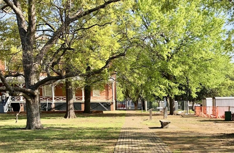
On East 7th Street west of Sherman Street, on the left when traveling west.
The Johnson House was built about 1827 as the residence of Robert W. Johnson and his son and daughter-in-law, Mr. and Mrs. Benjamin S. Johnson. Robert W. Johnson had returned to Little Rock in 1876 after a long and distinguished career which . . . — — Map (db m211347) HM
In Memory Of The Men And Women
Who Served With Honor With The Naval
And Marine Forces Of The United States
Of America During The World War
1917 — 1919 — — Map (db m117236) WM
On Rock Street at East 6th Street, on the right when traveling north on Rock Street.
This property
Nash House
has been placed on the
National Register
of Historic Places
by the United States
Department of the Interior — — Map (db m211350) HM
On October 25, 1905, Theodore Roosevelt became only the second sitting president to visit our state. His visit was a key stop on a southern tour following the election of 1904 in which he was elected easily but failed to win any states of the . . . — — Map (db m266965) HM
The Civil War could have begun at this U.S. Arsenal. As other states seceded, rumors that reinforcements were heading for the Arsenal led around 1,000 militia from south and east Arkansas to demand the surrender of the garrison. On Feb. 12, 1861, . . . — — Map (db m116214) HM
On March 23, 1864, Gen. Frederick Steele led a Union army south from Little Rock to join another army in Louisiana and invade Texas. After fighting at Elkins' Ferry and Prairie D'Ane, Steele's hungry army occupied Camden. Disastrous defeats at . . . — — Map (db m116237) HM
On McMath Avenue at East 11th Street, on the right when traveling south on McMath Avenue.
Front
The first human dissection in Arkansas was made on this spot in November 1874 by James H. Lenow M.D. Little Rock and Richard S. Vickery M.D. U.S. Army
Rear
Erected by the Arkansas Medical Society to perpetuate the . . . — — Map (db m116362) HM
A line of precise reference surveying markers known as the “Mehlburger Markers” was established in memory of the man who pioneered efforts to license land surveyors in the State of Arkansas and was awarded Land Surveyor Certificate No. . . . — — Map (db m117228) HM
On East 9th Street at Commerce Street, on the right when traveling east on East 9th Street. Reported missing.
This stone marks the Quapaw Line, west boundary of lands in Territorial Arkansas, ceded the Quapaw Indians by the United States according to the Treaty of 1818 — — Map (db m241513) HM
Near East 9th Street, on the right when traveling south.
U.S. Colored Troops in Arkansas in the Civil War.
The U.S. Army began recruiting Black soldiers in 1863, and 5,526 men served in eight infantry regiments and two artillery batteries raised in the state. These were the 1st, 2nd, 3rd, 4th, . . . — — Map (db m266962) HM WM
How the Locks Work
When a boat enters the lock
the gates close and the water
level inside the lock is raised to
the upstream level or lowered
to the downstream level,
depending on which way the
boat is moving. The locks are
filled . . . — — Map (db m208844) HM
John Jackson and his wife Anna Jackson came to Little Rock in the 1880s, along with
their employers. They farmed land, some now under water, on the banks of the
Arkansas River in the vicinity of this ramp. In July, 1913 they sold a small parcel . . . — — Map (db m208843) HM
Many people have asked about the 'monoliths' of concrete that are a feature of the plazas on the north
and south side of the Big Dam Bridge. These 'monoliths' are a part of the story of the Big Dam Bridge.
The Bridge is not only unique in . . . — — Map (db m208842) HM
On Cumberland Street at East Daisy L Gatson Bates Drive, on the right when traveling south on Cumberland Street.
This property
The Chisum House
has been placed on the
National Register
of Historic Places
by the United States
Department of the Interior
1894 — — Map (db m211463) HM
On President Clinton Avenue west of Sherman Street, on the left when traveling east.
At about this site stood the law office
of
Augustus Hill Garland
Member of House and Senate of the
Confederate Congress
He prepared and won the case of ex parte Garland in
the U.S. Supreme Court, thus effecting the readmission . . . — — Map (db m102759) HM
On President Clinton Avenue, on the right when traveling east.
From 1882 to 1887, an ornate two-story space on the second floor of this building served as the social hall for the Concordia Association – an organization established in 1864 to help Jewish immigrant families adapt to their new lives in . . . — — Map (db m78014) HM
On President Clinton Avenue just west of S. Rock Street, on the right when traveling east.
In 1904, John E. Geyer and his business partner John D. Adams moved their wholesale grocery business into a building located on this site. The partners replaced that building with this structure, designed by Charles Thompson, in 1914. The Geyer and . . . — — Map (db m102091) HM
On President Clinton Avenue just west of River Market Avenue, on the left when traveling west.
Max Hilb and William Probst built this structure, designed by Joseph Willis, in 1882 for Probst & Hilb Liquor Company. The upper floor contained a two-story space that housed Concordia Hall, a Jewish social club. F. M. Fletcher and T.J. McCarthy . . . — — Map (db m102056) HM
On Marshall Street at West 19th Street, on the right when traveling south on Marshall Street.
This property has been
placed on the
National Register
of Historic Places
by the United States
Department of the Interior
Built in 1900 — — Map (db m211526) HM
On John Harden Drive 0 miles north of Vandenberg Drive when traveling west.
This C-130E was manufactured by Lockheed Aircraft, Marietta Georgia
in May 1963. It was delivered to the 1608th Air Transport Wing, located at
Charleston AFB, SC. It was transferred to the 316th Tactical Airlift Wing
in March 1967, located at . . . — — Map (db m224385) HM
On Lily Drive at Waterside Drive, on the right when traveling west on Lily Drive.
In January 1811 a group of families left Alabama for what was to become the Arkansas territory. They traveled by boat down the Tennessee, Ohio, and Mississippi rivers to Arkansas Post, a settlement at the mouth of the Arkansas River. This group was . . . — — Map (db m282878) HM
Near Riverfront Drive east of Riverfront Place when traveling south.
The elegant steamboat Lizzie Simmons was built in 1859 and ran between Memphis and New Orleans until the Confederate Navy bought her in 1861 and converted her into a gunboat, the C.S.S. Pontchartrain. The vessel fought on the . . . — — Map (db m116257) HM
On North Magnolia Street south of West F Avenue, on the right when traveling south.
Fearing a Union attack on Little Rock, Confederate Gen. Sterling Price ordered his men to fortify the high ground on the north side of the Arkansas River in the summer of 1863. A strong network of earthen works soon developed, including some in what . . . — — Map (db m116251) HM
On Curtis Sykes Drive, on the left when traveling east.
African Americans began settling in the Dark Hollow neighborhood of the Iron Mountain Addition in the early 1900s, near the railroad and jobs. Named for an ancient swamp, Dark Hollow developed further after the Arkansas Legislature authorized an . . . — — Map (db m224244) HM
On Cook's Landing Road, on the left when traveling east.
Four major bridges connect the various elements of the Arkansas River
Trail, allowing visitors to easily cross the river and explore different areas.
Big Dam Bridge
Dedicated on September 20, 2006, the Big Dam
Bridge is the longest . . . — — Map (db m208848) HM
Near Riverfront Drive east of Riverfront Place when traveling south.
Arkansas's sole Civil War rail line, the Memphis and Little Rock Railroad, ran from DeValls Bluff to what is now North Little Rock. After U.S. troops occupied the capital in 1863, the Union army built warehouses, shops, and other railroad facilities . . . — — Map (db m116260) HM
•The Arkansas River begins in Colorado, meanders
through Kansas and Oklahoma, and travels 1,450 miles
to the Mississippi River
•Earliest navigation on the Arkansas involved floating
downstream by raft
•Steamboats first arrived in Little . . . — — Map (db m208845) HM
The Arkansas River was one of the main routes
used to move Indians from the southeastern
United States to the Indian Territory (modern-day
Oklahoma) during the forced removals of the late
1830s. Hundreds of men, women and children
would have . . . — — Map (db m208846) HM
On West 6th Street at Main Street, on the right when traveling west on West 6th Street.
Lynching in America
Following the Civil War, violent resistance to equal rights for Black people and an
ideology of white supremacy led to racial terrorism not only in the South, but across the United States. Lynching emerged as the most . . . — — Map (db m243303) HM
On England Road (U.S. 165) east of East Washington Avenue, on the right when traveling east.
As Union forces advanced to capture Little Rock during the Civil War, the
last duel in Arkansas was fought near this spot in an open grove of heavy
timber between Confederate Generals John Sappington Marmaduke and
Lucius Marshall Walker at . . . — — Map (db m116382) HM
This plaque is dedicated in memorial to these ladies and gentlemen who, over 50 years ago, kept this community together through their concern, time, and hard work. We congratulate each of them for their effort in spite of trying circumstances.
. . . — — Map (db m224246) HM
On Cook's Landing Road, on the left when traveling east.
The idea for the Arkansas River Trail began as early as 1913, with a City of Little Rock plan calling for a series of parks on the banks of the Arkansas River. The trail has been built in pieces, year after year, decade upon decade by committed . . . — — Map (db m208847) HM
Dedicated August 6, 1933, as Pugh's Memorial Park, the Old Mill is a replica of an abandoned water-powered grist mill that would have been used by Arkansas pioneers in the 1800s. Although the Old Mill never actually operated as a mill, the iron . . . — — Map (db m53181) HM
Launched August 15, 1942 at the Portsmouth, New Hampshire Naval Shipyard.
Snook fought well during her first eight war patrols
before her loss on her ninth.
Her Score:
17 Ships Confirmed Sunk
7 Ships Damaged
2 Small Ships Sunk . . . — — Map (db m179396) HM WM
On Toltec Mounds Road, on the right when traveling south.
Plants affect every aspect of our lives. Without them, life would not be possible.
Crews working for the University of Arkansas Museum recovered this bag in the 1930s from a bluff shelter in Benton County, Arkansas.
Filled to the . . . — — Map (db m213906) HM
On Alexander Road west of Walkers Corner Road (State Route 161), on the right when traveling west.
You are standing in the vicinity of where Confederate forces camped on Monday, September 7, 1863, when Union forces under Major General Frederick Steele advancing from Brownsville engaged the brigade of Colonel Robert C. Newton, C.S.A., driving his . . . — — Map (db m116519) HM
On Benton Street 0.2 miles south of Arkansas Route 183, on the left when traveling west.
Bauxite ore from this region was crucial to the United States’ success in the Second World War. The demand for bauxite, the raw material that yields aluminum, spiked when the U.S. entered the war in 1941 and began rapidly manufacturing large . . . — — Map (db m288429) HM WM
On Benton Street at School Street, on the right when traveling east on Benton Street.
Following the discovery of extensive bauxite ore deposits in 1887, an ore drying plant was located here by The Pittsburg Reduction Co. In 1903 a small village was laid out to house the workers. This village which included a bank, hospital, theater . . . — — Map (db m96634) HM
On Dogwood 0.1 miles east of Arkansas Highway 5, on the right when traveling east.
The 11th Arkansas Infantry organized at Benton in July 1861 and Saline County men served in 6 of its 10 companies. The 11th was captured in the Island No. 10 campaign in April 1862 and spent 5 months in Union prisons, later serving in Louisiana and . . . — — Map (db m96586) HM
On West Conway Street just west of North Main Street, on the left when traveling west.
"Scouting will deliver to a nation a great gift, a new generation of prepared, young citizens-physically strong, mentally awake, and morally straight-young people who are growing through their scouting experience, learning the lessons of responsible . . . — — Map (db m247819) HM
On Military Road at Old Congo Road, on the right when traveling north on Military Road.
George M. Holt
George M. Holt was born in Tennessee July 4, 1831, and moved to Arkansas before 1859. A doctor, he rose to brigadier general in the pre-war militia and led the 2nd Brigade, 1st Division. The Arkansas Military Board ordered . . . — — Map (db m170454) HM
This property has been placed on the National Register of Historic Places by the United States Department of the Interior Arkansas Historic Preservation Program Department of Arkansas Heritage — — Map (db m220449) HM
On River Steet at South Market Street on River Steet.
The Southwest Trail, which passed this point, was one of the first permanent roads across Arkansas. It ran from Missouri through northeastern Arkansas to Little Rock and on through Washington to Fulton on Red River. Thousands of settlers followed . . . — — Map (db m104050) HM
On N. Main Street at W. South Street, on the right when traveling south on N. Main Street.
The Indian parties followed an ancient trail that became known as the Southwest Trail. The primitive trail took the tribal groups by where you are standing. William S. Lockhart was the first permanent settler in the area, arriving in 1815, at a . . . — — Map (db m96596) HM
On N. Main Street at W. Conway Street, on the right when traveling south on N. Main Street.
Saline County held 6,640 people in 1860, including 749 slaves. Jabez M. Smith, the county’s secession convention delegate, voted to leave the Union. The Saline Guards formed in 1861 and became Co. E, 1st Arkansas Infantry (C.S.). Their captain, . . . — — Map (db m96592) HM
On W. Sevier Street at N. Main Street, on the right when traveling west on W. Sevier Street.
As Gen. Frederick Steele’s Union army marched toward Little Rock in the summer of 1863, Saline County officials feared their records would be seized or destroyed. They met Aug. 31, 1863, and saying the Union “function is to cut up, mutilate, . . . — — Map (db m96593) HM
On W. Sevier Street at N. Main Street, on the right when traveling west on W. Sevier Street.
In honor of two Revolutionary War soldiers who chose Saline County, Arkansas as their home. After enlisting in the spring of 1777, they served through the winter at Valley Forge and to the end of the war in 1783.
ASHER BAGLEY, Private . . . — — Map (db m96595) WM
On N. Main Street at W. Sevier Street, on the right when traveling south on N. Main Street.
Saline County’s Everlasting Tribute
Here we enshrine forever the glorious memory of the living and the dead who through their valiant efforts and bitter sacrifice kept us a free people
Theirs Not to Reason Why, Theirs But to Do . . . — — Map (db m96594) WM
Founded in 1876 by W.A. Webber as The Saline County Digest, this was the first newspaper and is the oldest continuously operated business in Saline County. The name was changed to The Review in 1882 and to The Courier in 1883. The original office . . . — — Map (db m104055) HM
On S. Market Street north of W. Smith Street, on the right when traveling north.
Built in 1893, the office of Dr. Dewell Gann, Sr. is the only known bauxite building in existence. The building was constructed by patients who could not afford to pay for services he had rendered them. The soft stone was dug from a farm nearby, . . . — — Map (db m96597) HM
Founded in 1910 by C. D. "Bullet" Hyten, a master potter, the Niloak Pottery operated in Benton for 37 years. The unique multicolored spiral pieces were hand turned using natural colored clays dug from nearby "Pottery Hill." Niloak, kaolin spelled . . . — — Map (db m104026) HM
In the early days of Saline County's history the settlers would gather here after the crops had been "laid by" for rest, relaxation, and to give thanks to The Lord. The early meetings were held under brush arbors lighted bu pine knots and included . . . — — Map (db m104059) HM
On Southwest 2nd Street 0.1 miles north of Short Street, on the left when traveling north.
PARKS BUILD COMMUNITY
Open space has been essential to community life
throughout time. In Colonial America, and for centuries
across Europe they have been called "village greens" or
"commons." These open spaces belonged to everyone . . . — — Map (db m231900) HM
On Southwest 3rd Street near S. Pine Street, on the right when traveling south.
The first settlers came to the Bryant area in 1828.
The railroad built a depot in 1873 and the Bryant
Township was created 1878. In October of 1892
a group of 20 citizens petitioned the county
judge to incorporate the City of Bryant. . . . — — Map (db m231576) HM
On S. Reynolds Road (State Highway 183) 0.1 miles south of Griffis Road, on the right when traveling south.
After the fall of Little Rock to Union forces in September, 1863, the area immediately south of the Arkansas River became a No Man’s Land. On the morning of October 23, 1864, a Federal detachment of the 7th Army Corps, returning to Little Rock after . . . — — Map (db m96635) HM
On Old Stage Coach Road (State Highway 5) 0.2 miles west of Hilldale Road, on the right when traveling west.
The
Geographical
Center of Arkansas
is a few steps
north of this highway
Erected by
The Arkansas Society
Daughters of American Colonists
Arkansas Centennial
1936 — — Map (db m96637)
275 entries matched your criteria. Entries 201 through 275 are listed above. ⊲ Previous 100