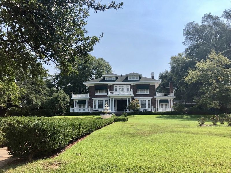
Built 1911 for Dr George W. Robinson, a physician, planter, and real estate developer. Fifth Street was renamed Robinson Place by him in 1910 and the stone columns at Fairfield and Robinson Pl. were erected then. Later and for many years the home of . . . — — Map (db m138835) HM
Built 1899 by John A. Sewall, Jr., grandson of Gen. Charles Albert Sewall, Army engineer who helped Shreve clear Red River log jam. Sewall's brother, John O. Sewall, was Shreveport's first mayor. — — Map (db m141304) HM
Built 1925. Designed by local architect Clarence King. The Shreveport Little Theatre is the oldest continuously operating community theatre in the United States. — — Map (db m141658) HM
Designed as his own residence by John Y. Snyder in 1902. Snyder was a prominent area architect and a geologist of national importance. This house, which once had a wide front porch, is the last remaining residence on Fairfield north of Olive. — — Map (db m143008) HM
Designed by J.P. Annan. Built 1934. Named as a memorial to the St. George Church in New Ephesus, Greece, which was destroyed by the Turks 1917. Congregation founded 1917. — — Map (db m142432) HM
This grand Mediterranean-style mansion was built in the early 1900's as the home of James Alston Thigpen and his wife Mary Colvin Thigpen. Judge Thigpen was a respected lawyer and Caddo Parish judge, as well as a prominent landowner and oil . . . — — Map (db m143020) HM
This Marks the Site
of
Battery 1
One of the eighteen batteries
and four forts which formed
the Confederate defenses
of Shreveport
1864 – 1865 — — Map (db m105334) HM
This Marks the Site
of
Battery 3
One of the eighteen batteries
and four forts which formed
the Confederate defenses
of Shreveport
1864 – 1865 — — Map (db m138788) HM
This Marks the Site
of
Battery 4
One of the eighteen batteries
and four forts which formed
the Confederate defenses
of Shreveport
1864 – 1865 — — Map (db m138787) HM
This Marks the Site
of
Battery 5
One of the eighteen batteries
and four forts which formed
the Confederate defenses
of Shreveport
1864 – 1865 — — Map (db m138780) HM
Built circa 1856 by Aaron B. Levisee for wife Persia Willis. Named for her family home in Alabama. Surrounding estate was subdivided in 1874 giving name to neighborhood and street. Later home to Foster and Harvey families. Builder Levisee was a . . . — — Map (db m138821) HM
Designed for banker William L. Trimble and wife Bessie by noted Shreveport architect Edward F. Neild. Completed 1929. Residence of the Trimble family until 1960. A pristine example of Georgian Revival Style. — — Map (db m138879) HM
Built 1923 by prominent attorney Henry Clay Walker, Jr. Later residence of Coca Cola bottler Zehntner Biedenharn. Housed State Missionary Headquarters of Church of Jesus Christ of Latter Day Saints 1961-1975. Architects: Maritz & Young of St. Louis, . . . — — Map (db m138863) HM
Established on this site September 16, 1922, Shriners Hospitals for Children in Shreveport became the world's first Shriners Hospital. In 1986, the original building was replaced with a new facility. From its beginnings in Shreveport, Shriners . . . — — Map (db m139582) HM
Gas was first discovered in Caddo Parish in 1870 in a water well drilled for an ice plant located between Market and Edwards Streets in Shreveport. First leasing activity for oil was begun in 1904 by Judge S.C. Fullilove, D.C. Richardson and I.G. . . . — — Map (db m109738) HM
Built 1937. Designed by Neild and Somdal architectural firm, of Shreveport. Frescoes over main entrance are by Conrad Albizio. Painted in 1938, they are believed to be the first outdoor frescoes in United States. Listed in National Register of . . . — — Map (db m143755) HM
The Louisiana State Exhibit Museum opened in 1939 under President Franklin D. Roosevelt's Public Works Program, "New Deal". It houses the largest topographical relief map in the state measuring 14 feet in circumference, and it also houses 22 . . . — — Map (db m143794) HM
Opened 1882 as city's Catholic Cemetery. Several priests who died in 1873 yellow fever epidemic rest here, including Father Jean Pierre, founding pastor of Holy Trinity Church. Also many pioneer members of Shreveport's French and Italian Societies . . . — — Map (db m143742) HM
Opened in 1883. City's first Black Cemetery established by and for Black citizens. Many prominent early African-American Shreveporters are buried here. From 1868 to 1874 this site was the campus of Shreveport University, a Baptist College. Entrance . . . — — Map (db m143748) HM
Centerpieces of this center are Caspiana House, built at Caspiana, La., in 1856, and the Thrasher Cabin, a rural Caddo Parish "dogtrot" log cabin, built c. 1835. Caspiana house was listed in the National Register of Historic Places in 1981, the . . . — — Map (db m140326) HM
Cotton was the major crop when the area was first settled. Most of the bigger farms had their own cotton gins.
Hoke Duncan has been working at the Cotton Gin in Gilliam for over 50 years. He is the descendant of some of the first African . . . — — Map (db m170455) HM
It happened again in 1906. The discovery of oil and gas in northwest Louisiana set the stage for yet another upsurge in the fortunes, and the population, of north Caddo Parish.
Logging in the 1880s and railroads in the 1890s had already . . . — — Map (db m170323) HM
The railroad was instrumental in bringing industry, mail delivery and goods like groceries to the small towns it passed through.
Funding and construction of the first railroad, that today passes through Vivian, Oil City and other towns in the . . . — — Map (db m170451) HM
A celebrated singer-songwriter, poet, author, playwright, sculptor, painter, historian & Native American activist… Born Robert Durham in Columbia, LA., Bobby was part of the early music scene in Austin, TX. His highly acclaimed epic trilogy "A . . . — — Map (db m291342) HM
West Side
World War I
World War II
Korean War
Vietnam War
Service
Iraqi Freedom
In remembrance of those who fought
Those who fell
162 American Legion 577
East Side . . . — — Map (db m120210) WM
• At this site a natural river crossing was used by Native American who traversed the Ouachita River valley before the time of Christ
(Indian mounds upriver at Watson Brake date 3500 BC.)
• The Ouachita tribe of the Caddo nation was prominent in . . . — — Map (db m244308) HM
Methodists have worshipped in
a building on this site since
before 1840. Circuit riders
served congregation until 1847,
when first pastor appointed.
Present building completed in
1911 from plans brought from
Europe by a church member. — — Map (db m120260) HM
Columbia Louisiana - Established 1827. Only settlement between Monroe and Black River towns noted for its port and steamboat captains. Available List of captains on the Ouachita River before the Civil War Available List of captains on the . . . — — Map (db m120875) HM
The Wade Landing site has a single platform mound. Indian pottery and soil studies suggest that the site is about 1000 years old. The mound was built in two stages and is 9 feet high and 130 by 165 feet at the base. Historic graves in the summit . . . — — Map (db m120507) HM
The Landerneau Mounds site is an
Indian village with two
dome-shaped mounds. People
lived here around AD 500. The
largest mound, with the cemetery
on top, is 442 feet tall and 130
feet in diameter. The other
mound is 3 feet tall and . . . — — Map (db m193796) HM
Donated by Joshua Willis to J. W. Nicholson who organized a private school 1867-1869. Was one of the leading academies in the state. Became public school 1910. Nicholson later president of L. S. U. School. Т.Н. Harris a noted graduate. — — Map (db m138579) HM
Site of parish site of Claiborne Parish from soon after the parish's creation in 1828 until 1836. First parish jail and courthouse constructed 350 yards east of marker. Named for Samuel Russell who donated the land. — — Map (db m180155) HM
Cane Ridge
Washington B. Nicholson and Martha Wafer Nicholson arrived in Claiborne Parish in late 1844, and settled at "Parker's Creek," a now-unknown location. In the summer of 1846, they moved to this location, calling it "Cane Ridge." . . . — — Map (db m274255) HM
Haynesville Colored School was built in 1927 on twelve acres of land donated by Verge White. From 1933-1959, the school was named Haynesville Colored High School. The name was changed in 1960 to Carter G. Woodson High School with the class of . . . — — Map (db m180167) HM
Near this site the Haynesville Hospital was built in 1925. It moved in 1968 and the old building was torn down. Mr. A. D. Williams designed and Mr. Rayford Ray supervised the construction of this monument as a reminder to all future generations that . . . — — Map (db m263394) HM
AKA pot liquor. Broth made from boiling greens and pork fat. Fed South's hungry by early 1850s. In 1935, Senator Huey Long praised its value. — — Map (db m220563) HM
Originally known as Lebanon Primitive Baptist Church. Organized May 21, 1854, with 13 charter members. Present building built on this location in 1877. One of the oldest church buildings in Claiborne Parish. Church reconstituted by ancestors of . . . — — Map (db m296225) HM
Built in 1860, this ante-bellum building was the point of departure for Confederate troops during the War Between the States. It is one of the finest examples of Southern expression of Greek Architectural style. — — Map (db m180237) HM
In Honor of
the Brave Men and Women
of Clairborne Parish
who served in
World War I
World War II
Korean Conflict
Vietnam War
Desert Storm Gulf War — — Map (db m180238) WM
Homer College (CME)
On December 15, 1879, a committee appointed by Bishop J.E. Bebee of the Colored Methodist Episcopal Church of America purchased 80 acres surrounding this marker for the construction of a "colored institution of learning." . . . — — Map (db m246516) HM
Hotel Claiborne
The Maritzky Building for the Arts, 1890-1984
Home of Herbert S. Ford Memorial Museum
Placed by the Louisiana Society Colonial Dames
XVII Century — — Map (db m248555) HM
Built before 1861, this antebellum building was a point of departure for Confederate troops. It was the site of one or more gun fights during the famous "White Lightning Feud" following the War Between the States. — — Map (db m223760) HM
Patrick Floyd Jarvis Garrett, the legendary lawman credited with killing "Billy the Kid," was born in Chambers County, Alabama on June 5, 1850. His family immigrated to Claiborne Parish in 1853 and established a large plantation on lands . . . — — Map (db m274251) HM
On this site in 1916, the St. John community donated land and logs to construct a Rosenwald school building for the negro children of the community. Earlier schools were established at St. John Missionary Baptist and later a small one room . . . — — Map (db m180161) HM
Thomas H. Harris served as State Superintendent of Education from 1908 to 1940. His tenure was the longest and, arguably, the most successful in the history of Louisiana education. Under his leadership, Louisiana's public school system . . . — — Map (db m274250) HM
Nickname for this infamous winding road. The site of numerous illegal stills and moonshining before, during, and even after prohibition. — — Map (db m180148) HM
Prior to 1850 met in log school house at Forest Grove, soon building a church which was moved to Arizona in 1866. Present building replaced it by 1882. Symbol of the faith of our forefathers who carved their homes from the wilderness. — — Map (db m299121) HM
From 1965-1937, the Friendship CME Church served as the house of worship in Claiborne Parish where the Claiborne Parish Civic League (CLPL), a local activist organization, met and organized plans to bring fair and just changes throughout the parish . . . — — Map (db m180149) HM
Scottsville. In 1847, Benjamin Scott acquired a forty-acre tract of land located here on the east bank of Corney Bayou. It was the era of steamboat travel and this location, previously known as "Corni Bluff," was the northern-most point of . . . — — Map (db m274254) HM
Alabama Methodist Church has been placed on the National Register of Historic Places in 1995 by the United States Department of the Interior — — Map (db m209818) HM
On this site stood a female
college. Founded by Perry J.
Backus of Good Hope (Keachi)
Baptist Church on land
donated by T.M. Gatlin. Became
male & female institution in
1879. Served as hospital after
Battle of Mansfield in 1864. — — Map (db m297574) HM
Incorporated in 1858, the town of Keachi was
named after an Indian group related to the
Caddo tribes. The spelling of the town's name
has been changed many times and there are still
several spellings in use: Keatchie, Kechi, Keachie,
etc. . . . — — Map (db m297670) HM
Within this enclosure are the remains of over 100 Confederate soldiers. Following the Battle of Mansfield, many were infirmed at old Keachie College, where a morgue was established on the second floor of the main building. — — Map (db m188236) HM
Original granite block 10' long 9" square marked the United States - Republic of Texas boundary. Dated 1840. Set on April 23, 1841. Only marker of international boundary known to exist within continental U.S. — — Map (db m221074) HM
Maj. Gen Walker, with Waul's and Surry's brigades, passed here parallel to the road during a charge that turned the Federal left flank and gained a position on the road in rear of Federal line. — — Map (db m105303) HM
Here the Federal line extending from the South turned East along a rail fence forming a V. General Mouton's Division charged this line in the bloodiest part of battle. In this, the first Confederate charge, General Mouton was killed and the gallant . . . — — Map (db m105307) HM
From this point the line extended about 400 yards Northeast, thence East about a mile. It extended about a half mile South from here. — — Map (db m105293) HM
Randal's Brigade of Walker's Texas Infantry Div. charged across this area traveling parallel to the road, supporting Mouton's Division which made the first charge on Randal's left. — — Map (db m105305) HM
In Memory of Capt. Elijah Parsons Petty C.S.A. age 34.
Enlisted May 13, 1862 at Bastrop, Texas, for the war.
Mustered in same day as Capt.. Co. F., 17th Regt. Texas Volunteer Infantry.
Fought in Battle of Mansfield, killed at Pleasant Hill, La. . . . — — Map (db m178236) WM
(Front)
Captain Seth Robert Field
Fell at Battle of Mansfield, April 8, 1864
Aged 29
Member Crescent Regiment of N.O.
(Rear)
Greater Love Hath No Man Than This.
That a Man Lay Down His Life for his Friends - Or His Flag.
A Gentleman . . . — — Map (db m177690) HM WM
Built on this site in 1856 for
the Bayou Pierre community
by Fr. Jean Pierre, a native of
Lanloup, France, who died a
martyr to his charity in the
1873 Yellow Fever Epidemic
in Shreveport. — — Map (db m273895) HM
The Dolet Hills or "Double Churches" community was organized by homestead settlers in the 1850's on a late 1700's Spanish Land Grant to Pierre Dolet. The Lord, Griffith and Pace families were among the earliest arrivals. There were many family . . . — — Map (db m105342) HM
(Front)
General Alfred Mouton
1829-1864
(Back)
Prince C. J. de Polignac
Lt. Colonel July 1861
Col. 5th Tenn. Inft. Aug 1862
Brigadier General Feb 1863
Major General Apr 1864
Twice promoted for gallantry on the fields of Richmond, . . . — — Map (db m177857) HM WM
To commemorate the victories of General Dick Taylor and his gallant soldiers at the Battles of Mansfield and Pleasant Hill, April 1864 — — Map (db m177856) HM WM
Seminole War
William Matthews
Civil War
George W. Berry
Joel A. Carrell
Moses W. Collins
Devereaux J. Ferguson
John F Ferguson
Marshall D. Fleniken
Edward J. Griffith
Thomas E. Hart
William J. Horn
Stephen D. Lord . . . — — Map (db m177946) WM
Lieut. Colonel Clack Died April 24. 1864 from wounds received while leading the charge of the Crescent Regiment - Battle of Mansfield, April 8, 1864. — — Map (db m177937) WM
(Front)
In memory of James H. Beard
Col. of the Crescent Regiment
Fell at the Battle of Mansfield
April 8, 1864
Age 31 Years
Beard
(Back)
First Captain of the Shreveport Greys
(Side)
First to raise the flag when Color Bearer . . . — — Map (db m177851) HM WM
Historic Site
1795
Las Ormigas Spanish Land Grant
Ceded by the Spanish Crown to Jaciento Mora
Six leagues square (207,360 acres)
Mora Sold this Grant to
Samuel Davenport
Luther Smith
William Barr
Edward Murphy . . . — — Map (db m105336) HM
(front)
On April 8, 1864 Maj. Gen. Richard Taylor rode in front of the Louisiana Brigade of Brig. Gen. Alfred Mouton's division to prepare them for the impending battle. Taylor would later write that he had told them...
"As they were . . . — — Map (db m177553) WM
In loving memory of the brave Confederate Soldiers who fought in this battle and to the courageous women who so nobly did their part. — — Map (db m177911) WM
Front
Texas
Remembers her sons by whose valor and
devotion the federal enemy was defeated
at Mansfield, April 8, 1864 and
thereafter in several bloody
engagements driven from the Red River
valley. . . . — — Map (db m105467) WM
The progenitor of the Laffitte family in northwest Louisiana was born in Pouyroquelaure, Gascony, France on March 4, 1746 to Francois Jean Boüet and Marie de Laffitte. He immigrated to Louisiana in 1764 and eventually settled here in the Bayou . . . — — Map (db m105228) HM
Front
Account of
the Battle of Pleasant Hill
The Battlefield After the Fight
On Sunday morning at daybreak I took occasion to visit the scene of Saturday's bloody conflict and a more ghastly spectacle I have not . . . — — Map (db m105410) HM
Front
In memory of the thousands
of Confederate
and Union soldiers buried in
unmarked
graves on this battlefield
Rear
At Pleasant Hill
On the Battle-field at Pleasant Hill, the night . . . — — Map (db m105415) WM
Front
This house is the only remaining structure of the original village of Pleasant Hill. It was occupied by the J.W. Elam family after the Civil War. J.W. Elam was wounded in the eastern theater, was home on recuperation leave, and . . . — — Map (db m105365) HM
The Battle of Pleasant Hill Harper's Weekly May 7, 1864 Pleasant Hill, LA.
(Reverse)
A Tribute to Our Parents
Dr. C.E. "Gene" Poimboeuf established the Pleasant Hill Battlepark in 1994 to preserve the memory of . . . — — Map (db m178395) HM WM
Pierce and Payne College building used for a Federal hospital to care for soldiers wounded in the Battle of Pleasant Hill was near here. — — Map (db m105663) HM
Front
Headquarters Department of the Gulf
(U.S.A)
Alexandria, LA., April 2, 1864
Maj. Gen. H.W. Halleck
Headquarters of the Army
Washington, D.C.
General: — Our troops now occupy . . . — — Map (db m105981) HM
By 1850 Old Pleasant Hill was a thriving community settled by the Blackshear, Jordan, Chapman, Childers and Elam families. Significant structures included the Methodist Church, Pierce-Payne College, Childers Mansion and the Elam House. When the . . . — — Map (db m105386) HM
On this site, then the town of Pleasant Hill, on April 9th, 1864 Gen. Richard Taylor with 12,000 Confederates attacked the town, occupied behind log breastworks by Gen. Banks and 25,000 Federal troops. Through the afternoon the battle raged. That . . . — — Map (db m105402) HM
Pleasant Hill was occupied by
Union armies on April 7, 1864
beginning 3 days of fighting which
culminated in the largest battle
of the Civil War west of the
Mississippi River being fought in and
around the village on April 9, . . . — — Map (db m105983) HM
Front
On this 4 square miles in around the village of Pleasant Hill, approx. 15,000 Confederates under Maj. Gen. Richard Taylor attacked approx. 25,000 Union troops under Maj. Gen. N. P. Banks on April 9, 1864. That was the 3rd day of . . . — — Map (db m105670) HM
Both Gen. Taylor's and Gen Banks' troops obtained drinking water from this cistern while each army occupied Pleasant Hill during the Red River Campaign in April 1864. The stage coach station stood a few feet north of here. — — Map (db m105387) HM
Front
The Village of Pleasant Hill was founded at this location just inside the DeSoto Parish in 1846. Pleasant Hill was a major road intersection with roads radiating to Mansfield, Natchitoches, Grand Ecore, Ft. Jessup, Many, Red River . . . — — Map (db m105673) HM
After the Battle of Pleasant Hill the Confederate army, who had control of the battlefield, began burying the dead soldiers. One of the sites chosen was on the Childers Family property, a part of the battlefield. Here some of the soldiers killed in . . . — — Map (db m178081) HM
Front
Battle for Shreveport
The Confederate capital of Louisiana had been moved to Shreveport, also the headquarters of the Confederate Trans-Mississippi Department (All of the Confederacy west of the Mississippi River). The Red . . . — — Map (db m105977) HM
Front
You are standing on the corner of Main and 1st Streets downtown. The stores and shops were mostly to your left and behind you along Main Street. Some were along 1st Street. About 150 feet to your left was 2nd Street etc. Houses . . . — — Map (db m105979) HM
Front
Brig. Gen. Andrew J. Smith
Third Division Sixteen Army Corps
Second Brigade
14th Iowa - Lieut. Col. Joseph Newbold
27th Iowa - Col. James I. Gilbert
32nd Iowa - Col. John Scott
24th Missouri - Maj. Robert W. Fyan . . . — — Map (db m105357) HM WM
Dedicated to the memory of the Soldiers of the Confederate States Army
1861 * 1865
"Lord God of hosts, be with us yet; lest we forget - lest we forget." — — Map (db m214330) WM
A short distance west of here facing the road, the home of William Robertson was used for the care of Federal Soldiers wounded in a skirmish near by. A mill behind the residence was used to grind grain for soldiers of both armies. — — Map (db m105348) HM
545 entries matched your criteria. Entries 201 through 300 are listed above. ⊲ Previous 100 — Next 100 ⊳