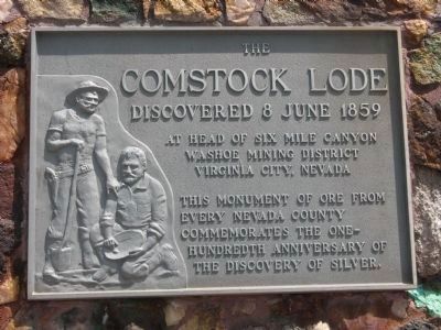
[Located in the center of town is a monument on which there is mounted six markers commemorating historical events and people of Virginia City]West Side - Front of Monument:
In June of 1859 in Gold Canyon, a second group of . . . — — Map (db m21565) HM
At this location on October 18 1861 stood the telegraph pole, shown on above plaque, on which telegraph wires were joined which spanned a continent and united two oceans.
On that date the first two telegrams transmitted were as follows: . . . — — Map (db m35085) HM
Brigham Young sent the Utah Militia, also known as the Nauvoo Legion, to harass the Federal troops and delay their approach. In the early hours of October 4th, Major Lot Smith of the Utah Militia and 40 men captured and burned two supply trains, . . . — — Map (db m67040) HM
One of only three significant engagements of the Utah War, the incident at Simpson's Hollow played a key role in the conflict. The Utah War (1857-1858) was the result of a lack of communication between the U.S. Government and the Utah Territory . . . — — Map (db m67038) HM
Here on Oct. 6, 1857, U.S. Army supply wagons led by a Capt. Simpson were burned by Major Lot Smith and 43 Utah Militia men. They were under orders from Brigham Young, Utah Territorial Governor, to delay the army's advance on Utah. This delay of the . . . — — Map (db m67039) HM
A Legacy of Distrust
In 1857, the Buchanan Administration faced a series of national challenges. Civil war loomed on the horizon, the New York stock market was in trouble, Federal troops were sent to quash unrest in Kansas and Washington . . . — — Map (db m67041) HM
The goal of the Pony Express was to provide speedy and dependable mail service between Missouri and California. Before the first ride, an important task was to develop a shorter route especially across the wild open spaces between Utah and . . . — — Map (db m249518) HM
By 1899, this house stood at the head of Magnolia Avenue, or “Silk Stocking Row,” where the elite of Granite lived. The first floor housed the living quarters for the Superintendent of the Granite Mountain Mining Co. The second floor may . . . — — Map (db m49545) HM
This popular resort and stopping place for stages and teams of the Comstock, established by Swift and Watson in 1856, became a remount station of the Central Overland Pony Express on April 4, 1860. Here on that date division superintendent Bolivar . . . — — Map (db m436) HM
Dedicated April 23, 1999
SOLANO HOUSE
Added Station
Apr. 23, 1860 - Sept. 8 1861
By
First Northern Bank
William & Linda Bernheim
The Rotary Clubs of Davis
UC Davis - Cal Aggie Alumni Association
Davis Enterprise - McNaughton . . . — — Map (db m24606) HM
Seal of the National Pony Express Centennial Association
Chimney Rock Station on the route of the Pony Express, was located near here between Chimney Rock and the North Platte River. This was an important Pony Express stop between . . . — — Map (db m79423) HM
The first teams of Pony Express riders amazed the nation by accomplishing their east and westbound deliveries within the projected 10-day schedule. The speed of the riders even had a role in swaying a divided California to stay with the Union . . . — — Map (db m249761) HM
Strategically placed relay stations across the western frontier proved to be a major contributing factor to the early success of the Pony Express mail service. "Station keepers" assigned to these outposts readied swift horses, fresh and rested, . . . — — Map (db m249757) HM
In 1855, U.S. Senator William Gwin of California urged Congress to fund a faster, overland express mail system. Gwin had envisioned a system of horses and riders
which, supported by periodic livery and supply stations, could bridge the
gap . . . — — Map (db m249627) HM
Near this site, Quantrill's men attacked and killed several men from the fort engaged in target practice. Among them were Johnny Fry, an Army scout who had earlier won fame as the first Pony Express rider, and Lt. Ralph Cook, officer in charge of . . . — — Map (db m80331) HM
(back) The Pony Express Started on April 3, 1860. The original route from Johnson Pass (Echo Summit) to Genoa went through Hope Valley to Woodfords Station.
On May 14, 1860 the new toll road over Daggett Pass opened to foot and horse . . . — — Map (db m432) HM
American Indians inhabited lands along the Pony Express Trail for thousands of years before the Pony began its historic run. From the 1840s through the 1860s, they watched swarms of white settlers cross their homelands-impacting traditional . . . — — Map (db m249489) HM
Front:
Added Station
Jul. 1, 1861 – Nov. 20, 1861
By:
Midvale City
James Stretesky •
Gene I. Glover Family •
Richard Grant Thayne •
Utah Westerners Foundation •
Carl Gustaze “Gus” Carlson Family
Pony Express Trail . . . — — Map (db m199490) HM
A few miles below Marysville was the famous ford on the Oregon Trail known as the Independence, Mormon or California crossing. There thousands of covered wagons with settlers bound for Oregon, Mormons for Utah and gold seekers for California . . . — — Map (db m152715) HM
Here is the valley of Lodgepole Creek through which passed historic trails, telegraph lines, and railroads. The famed Pony Express followed the valley in 1860-61. "Nine Mile" Pony Express station was located just southeast of present Chappell; "Pole . . . — — Map (db m223445) HM
Scotts Bluff, the dramatic series of clay and sandstone highlands surrounding you, is known chiefly as a landmark on the old Oregon Trail. Emigrants heading west encountered the bluffs after a six to eight-week trek across the monotonously flat . . . — — Map (db m174254) HM
[Front of Marker]
ST.GEORGE HOTEL
Dedicated March 19, 2005
SACRAMENTO
By
James Streetsky
First Northern Bank
The Firehouse Restaurant
Rotary Club of Sacramento
Burnett & Sons Planing Mill
and Lumber Co. – Since . . . — — Map (db m14810) HM
In 1845, it took six months to get a message from the East Coast of the United States to California. By the late 1850s, a half million people had migrated west and were demanding up-to-date news from home. Something had to be done to deliver mail . . . — — Map (db m249623) HM
Historic Woodfords Station, the Eastern Sierra gateway to the goldfields of California, way station of the famed Pony Express, and entrance to Carson Pass on the Emigrant Trail to the Sacramento Valley. Beginning in 1849 with the building of the . . . — — Map (db m195369) HM
The Pony Express Museum is housed in the restored Felt Block built in 1880 by Seneca resident Andrew Felt, who later became Lt. Governor of Kansas. The design is an urbane Italianate style using cast iron fronts with applied columns and window . . . — — Map (db m63800) HM
The Pony Express mail service between St. Joseph, Missouri and Sacramento, California only lasted a short time in 1860-61, but its romantic image continues to captivate the hearts of the American public. In only 19 months, its riders covered over . . . — — Map (db m47347) HM
In Memory of J. Clifton Toney
Publisher of the Folsom Telegraph
1962 – 1976
His vision resulted in the
Development of the Sutter Street Mall — — Map (db m14378) HM
Cold Springs was a popular camping ground on the Overland Trail to California, Oregon, Utah and other points in the far west. It was a stage station along the Overland Stage Route 1854 - 1862 and also a Pony Express relay stop 1860 - 1861. . . . — — Map (db m79702) HM
In 1845, it took six months to get a message from the East Coast of the United States to California. By the late 1850s, a half million people had migrated west and were demanding up-to-date news from home. Something had to be done to deliver mail . . . — — Map (db m249488) HM
Descriptions of the variety and number of horses used by the Pony Express became distorted during the course of its history since November 1861. In general, the type of horse used for carrying the rider and mail depended greatly on the region. The . . . — — Map (db m249619) HM
In 1827 “Bible Totin” Jed Smith camped here in. In 1850 these diggings became known as Negro Bar, then named Granite City after the rocks, and in 1855 Joseph Folsom lent his name to this fair city.
Also in 1855 Folsom hired Theodore . . . — — Map (db m57985) HM
[English] Rapid Changes After two decades of trail use, changes arrived in the 1860s. The Pony Express with its riders delivered mail to and from California. They rode through local stations near Chimney Rock and . . . — — Map (db m311088) HM
This was the site of a change station of the Pioneer Stage Company in the 1850’s and 1860’s. During 1860-1861, the Central Overland Pony Express maintained here the first pony remount station east of Sportsman’s Hall. — — Map (db m57977) HM
John Patee came to St. Joseph in 1845 and opened the city's first drugstore at the corner of of Main and Francis Streets. He purchased 320 acres, platted what was known as "Patee Town" and began selling building lots in 1849. He later built the . . . — — Map (db m22072) HM
Dedicated April 23, 2000
Morgan House
Pony Express Route
Apr. 23, 1860 - Sep. 8, 1861
Home Station
Apr. 16, 1869 - Sep.8, 1861
By
James Stretesky
Supervisor Gayle B. Uilkema
Martinez Area Chamber of Commerce
Pony Express Trail . . . — — Map (db m24369) HM
Send me men to match my mountains.
These are words a great poet said speaking for the brave young nation that needed strong and brave men’s aid.
In memory of
John (Snowshoe) Thompson
who, for twenty successive winters, 1856-1876, . . . — — Map (db m434) HM
The Pony Express was an ultra-fast but short-lived mail service that ran between the East and West from 1860 to 1861. The roughly 1,900-mile route began in Missouri and passed through Wyoming and Utah before crossing the Sierra Nevada mountain . . . — — Map (db m76323) HM
Original building was erected by James Bascom in 1878. The first trading post west of Fort Hall. Station for Pony Express and Ben Halliday (sic, Holladay) Stage Line. The largest artery of wagon travel in United States passed here on old Oregon . . . — — Map (db m125408) HM
When Alexander Majors completed this house and its accompanying, but now demolished barns and pens, it formed a trading terminus for the firm of Russell, Majors and Waddell. By 1858 the firm was responsible for a force of 3,500 wagons carrying . . . — — Map (db m84746) HM
In memory of Miss Louisa P. Johnston, great-granddaughter of Alexander Majors, whose steadfast determination led to the preservation of this house to honor him and the historic transportation firm of Russell, Majors and Waddell
and in recognition . . . — — Map (db m84744) HM
Born April 30, 1827 at Upper Tinns, Telemark District of Norway, John A. “Snowshoe” Thompson’s parents Tosten Olsen and Gro Johnsdotter baptized him as John Tostensen. At an early age he learned to “snow skate” (snow ski). In . . . — — Map (db m20712) HM
These fort buildings were reconstructed on the original site in 1936 by the Works Progress Administration. The WPA was a government program created during the Great Depression to provide jobs for the unemployed.
Prior to his death on July 26, . . . — — Map (db m91702) HM
Long before the Oregon/California westward migration, animals instinctively stopped at the Big Sandy River during their migration process. With South Pass just 35 miles east, the river was also a natural East-West pathway for man. The pathway, in . . . — — Map (db m47136) HM
Dayton (known as Chinatown 1857-1861) Dayton is the site of Nevada's first gold discovery (1849) and the state's first permanent Euro-American settlement, founded after miners created a tent town at the mouth of Gold Cañon in 1851. Initially . . . — — Map (db m160799) HM
The eighteenth century saw competition for control of North America among Spain, France, England, and the fledgling United States. Following a forty-year period of wars, treaties, territorial purchases, and establishment of trading posts, the future . . . — — Map (db m91947) HM
This site was originally constructed in 1860 as the Suisun Valley General Mercantile & original Pony Express station.
The Vezer Family provides this facility for the enjoyment of the families of this wonderful valley and gives special . . . — — Map (db m25058) HM
While a few people question Sacramento’s role in the transcontinental railroad, the larger story of Sacramento’s place in transportation history revolves around numerous transportation events such as national stagecoach lines, steamship companies, . . . — — Map (db m229917) HM
Middlegate was named in 1850 by James Simson as he mapped the route for the Overland Stage Company. In his journal he writes that he thought the cuts in the mountains looked like 'gates' so he named each cut Westgate, Middlegate, and Eastgate to . . . — — Map (db m89452) HM
In early June, 1850, a party of Mormons led by Abner and Thomas Blackburn, Hampton S. Beatie and Joseph Dumont, established a trading post about a mile to the north of this site. In September, as they returned to Salt Lake City, a party of . . . — — Map (db m20698) HM
Colonel P. Edward Connor was ordered to build and command this post in 1862. The fort was built midway between Salt Lake City, Utah and Carson City, Nevada to protect the Overland Mail Route (Pony Express) and emigrant travelers from Indian raiders. . . . — — Map (db m74710) HM
The Central Overland Pony Express passed this site many times. Green Valley Road was the gateway to the gold region, and was the center of activities in the 1850’s & 60’s, where many early California Inns were located. In the late 1800’s a . . . — — Map (db m11311) HM
John Patee came to St. Joseph in 1845 and opened the city's first drugstore at the corner of of Main and Francis Streets. He purchased 320 acres, platted what was known as "Patee Town" and began selling building lots in 1849. He later built the . . . — — Map (db m288287) HM
Under the Leadership of Brigham Young
the "Mormon" Pioneers
Exploring Their Way to the Valley of
The Great Salt Lake
Passed here July 15 to 20, 1847. Orson Pratt's advance company reached here July 15, others following at . . . — — Map (db m150075) HM
Thar’s gold in them thar hills! The Black Hills Gold Rush 1874: Two scientists attached to the Custer Expedition uncover gold in sacred Sioux land in South Dakota—and the Black Hills Gold Rush is on. During the Allison . . . — — Map (db m257339) HM
The Carson and Colorado Railroad (C&C) The Carson and Colorado Railroad (C&C), completed in 1881, operated on a 3-foot narrow-gauge track. Nicknamed the "Slim Princess," it provided transportation from Mound House, Nevada to Keeler, California . . . — — Map (db m160798) HM
The trail over South Pass is a transportation corridor which served many purposes. In addition to being the route to Oregon and California, it was used by Mormon pioneers and by the Pony Express.
A great exodus to the Salt Lake Valley in 1847 . . . — — Map (db m67019) HM
In Memoriam
Colonel William Frederick Cody
"Buffalo Bill"
Noted scout and Indian fighter
Born February 26, 1846 Scott County, Iowa
Died January 10, 1917 Denver, Colorado
William F. Cody . . . — — Map (db m152718) HM
The first post office in Deer Lodge was established on May 21, 1866. It was one of the earliest post offices in Montana. Mail service to the early settlers of the Deer Lodge Valley was very expensive and very slow. Letters and parcels were either . . . — — Map (db m128356) HM
In 1893 the Crystal Ice Company dammed a portion of the Little Blue River 1¼ miles north of Ayr, creating “Crystal Lake” for harvesting and selling ice. A huge storage and loading facility was built on the nearby Republican Valley branch of the . . . — — Map (db m287696) HM
Sioux Lookout, the highest point in Lincoln County, was a prominent landmark on the overland trails.
From its lofty summit the development of the West unfolded before the eyes of the Sioux and other Indians.
Trappers and traders came by here . . . — — Map (db m107393) HM
Mud Springs, so-named for its seeps of water, was an oasis on the dry plateau between Lodgepole Creek and the North Platte River. Overland travelers began using the springs in the late 1850s when a cutoff was laid out from Old Julesburg to . . . — — Map (db m274409) HM
Sand Mountain, dominating the Salt Wells Basin, is a prominent landmark in Nevada's early history. The Northern Piute know it as Kwazi, the name of the snake that inhabits the dune, its backbone forming the crest of the mountain. Captain James . . . — — Map (db m69653) HM
Built in 1910, few buildings in Minden have experienced a more diverse life. Its many uses include a saloon/bar, card parlor, soda fountain, grocery store, and several restaurants. — — Map (db m23361) HM
The first known explorer of Diamond Valley was Colonel John C. Fremont, who mapped the area to aid western migration in 1845. Before Fremont, tribes of Shoshone and Paiute Indians long had gathered nature's bounty here.
Colonel J.H. Simpson . . . — — Map (db m69606) HM
Rockwell Station
The Pony Express operated from April 1860 through October 1861 and delivered mail between Missouri and California within a record 10 days. Orrin Porter Rockwell owned and operated a hotel and stable
along the Pony Express . . . — — Map (db m249481) HM
The Muddy Creek Camp, which was northwest of this marker and on the west side of the Muddy Creek was used by Brigham Young's first group of Mormon pioneers who arrived here on July 9, 1847. Thomas Bullock reported that the brethren sang . . . — — Map (db m36573) HM
This is the Platte River Valley, America's great road west. It provided a natural pathway for westward expansion across the continent during the nineteenth century. Here passed the Oregon Trail, following the South Platte River along much the same . . . — — Map (db m227920) HM
Split Rock was a relay station during the turbulent 18 month life of the Pony Express. The Express operated at a gallop, speeding mail across the West in only 10 days. However, because of the "talking wire," its days were numbered. The telegraph . . . — — Map (db m69603) HM
Our historic farmhouse was built in 1878 and it is the oldest wooden structure in San Juan Capistrano. It used to belong to Pony Express Rider, Joel Congdon, who grew Orange County's first walnut grove. Surviving more than 130 years of social, . . . — — Map (db m197236) HM
One of the last living Pony Express riders. His route of 104 miles ran from Cottonwood Springs to Box Elder near Fort Kearny in the Nebraska Territory. In 1883 he moved to Escalon where he became a community leader. — — Map (db m220288) HM
In the 1880's, a fourth Julesburg developed at the junction of the Transcontinental Railroad and the Denver Branch of the Union Pacific. Originally known as Denver Junction, the town was soon renamed Julesburg, presumably the last of Jules Beni's . . . — — Map (db m47367) HM
For 19 months, until the telegraph replaced it, the Pony Express provides the fastest mail service to California. Fry rides the first leg in and out of St. Joseph, Missouri. The mail reaches Sacramento in 10 days. — — Map (db m112747) HM
Born near here were two famous men. Jim Bowie invented the Bowie knife. He died at the battle of the Alamo in Texas. Alexander Majors was co-founder of the Pony Express and hauled freight all over the West for the U.S. Cavalry. — — Map (db m83905) HM
Cofounder of the Pony Express, he was born near this site on Oct. 4, 1814. Five years later, his family moved to Mo. Territory. In 1849, he formed a freighting business from
Mo. to Santa Fe. In 1854, became partners with Wm. Russell and Wm. . . . — — Map (db m159143) HM
Robert Washington Donnell, one of the first settlers of the Platte Purchase, was instrumental in organizing the Bank of the State of Missouri and securing St. Joseph's position as the eastern terminus of the Pony Express. — — Map (db m66385) HM
Byway 136 was designated the Heritage Highway in part because of the many historic trails that are now part of it. You are standing on the historic De Roin Trail. The De Roin Trail began at the Missouri River port town of Brownville on the eastern . . . — — Map (db m47623) HM
From Independence and Westport (Kansas City) Missouri to the Columbia River. Route of the first Oregon Colonists, the trail of trappers and traders as early as 1830. A main road to the gold fields and western military posts. The path of the Pony . . . — — Map (db m206998) HM
Middlegate station closed in the early 1900s. It was an overland stage stop, Pony Express station and freight station. The building was stripped of useful material for mines, shacks, until only the foundation of zeolite blocks remained.
In . . . — — Map (db m261679) HM
William G. Fargo, co-founder with Henry Wells, of American Express Co. in 1850, Wells Fargo & Co. - Pony Express in 1851 and mayor of Buffalo during the Civil War (1862-1866) built his French Mansard-style mansion on a site bounded by Jersey, West, . . . — — Map (db m80419) HM
An early stage stand named in honor of Major Ben Ficklin, 1820 - 1870. A noted frontiersman, mail and stage contractor, who assisted in establishing the Pony Express. He carried the first message from the first governor of California to the governor . . . — — Map (db m116101) HM
Known worldwide for his hit T.V. series "F Troop", Forrest Tucker often shot many of his feature films in Kanab. "Tuck", as he was called, made "The Big Cat" here in 1949, "Oh! Susannah" in 1951, "Bugles In The Afternoon" in 1952, "Ride The Man . . . — — Map (db m130689) HM
Foundation in this area mark the site of a CCC Camp Which was operated by United State Government from 1939 to 1942. This camp included a number of buildings: a dozen large barracks, officers quarters, mess hall, recreation hall, swimming pool and . . . — — Map (db m249653) HM
Alvin Anderson used stone from the abandoned Pony Express station when he built this cabin in 1893. It was intended for his wife, who died in childbirth before she could live in it. — — Map (db m249637) HM
Gateway to Central Utah and California; formed by wave action on leeward arm of ancient Lake Bonneville. Route of first settlers in Central and Southern Utah 1848 to 1854; of government mail line to San Diego 1854 to 1857; of Overland Mail and . . . — — Map (db m249482) HM
A famous natural landmark used by Indians, trappers, and emigrants on the Oregon Trail. Site of Split Rock Pony Express 1860-1861, stage and telegraph station is on the south side of the Sweetwater. Split Rock can be seen as a cleft on the . . . — — Map (db m67007) HM
In 1889, five Mormon families pioneered Jackson Hole making the trip of 28 miles in 14 days over Teton Pass. Their leader was Elijah N. Wilson, known among the people as "Uncle Nick" - famous Indian scout and Pony Express rider. They found 18 single . . . — — Map (db m90977) HM
Dedicated April 23, 1998
Lafayette House
Added Station
By
Diablo Foods
Better Homes Realty - Lafayette
Diamond K. Supply, Ltd.
Lafayette Chamber of Commerce
Lafayette Historical Society
Pony Express Trail Association
{reverse . . . — — Map (db m24916) HM
Three panels are located at the Register Cliff State Historic Site kiosk.
Register Cliff State Historic Site
West of Register Cliff the landscape changes, presenting new challenges for the emigrants. Limited water and rugged . . . — — Map (db m79836) HM
The western spirit of adventure is captured in a moment of connection between two Pony Express riders. A legendary American tradition established in 1860 was revived in 1958 by Arizona's Hashknife Pony Express-who have continued to deliver the U.S. . . . — — Map (db m49937) HM
At this site stood the cabin of Christian Iverson the first european settler of record. Built in the 1860’s, the cabin was constructed of hand split redwood and had two rooms. It stood until the Loma Prieta Earthquake of 1989.
Iverson made his . . . — — Map (db m220075) HM
1. Cabela's Fishing Lure
Richard Dick Cabela started selling
fishing flies, became Cabela's.
2. Aaron Gunn Pyle
Local farmer and painter
Called "Painter of Nebraska"
3. Pony Express Commemorative Stamp
Rode through from April 3, . . . — — Map (db m274425) HM
Glen Hampton, a Forest Service employee and avid backcountry hiker had a dream – an environmentally sensitive trail encircling Lake Tahoe on the ridgetops, offering a challenging hike with breathtaking views of endless mountaintops, lakes, and . . . — — Map (db m229314) HM
Deer Creek Station, which once stood on the site of present- day Glenrock near the confluence of Deer Creek and the North Platte River, became a familiar landmark along the Oregon-California-Mormon Trail between 1857 and 1866.
The station . . . — — Map (db m92081) HM
Shoshone, Arapaho, Crow and Sioux Indians occupied this pleasant valley long before the Oregon Trail, which changed their cultures and life styles forever. This led to tragic warfare and the eventual loss of country they had called their own.
. . . — — Map (db m69602) HM
Founded by Dr. Robert Semple in 1847, the Martinez-Benicia ferry was the first established and longest operating ferry service in the S.F. Bay Area. In 1850 Oliver Coffin took over the operation and with his brothers purchased a new ferryboat, the . . . — — Map (db m27645) HM
Hollenberg Station and Transportation
By the time Hollenberg Station was begun in 1857 or 1858, Gerat Hollenberg
already had years of experience in operating at road ranch on the Oregon-California Trail. A native of Germany, he had been drawn . . . — — Map (db m253085) HM
About 1800 feet due west
prominent on the overland stage and
Pony Express route 1858 to 1868.
Kept by Orrin Porter Rockwell.
This monument was constructed of the stone from the old station. — — Map (db m150035) HM
526 entries matched your criteria. Entries 201 through 300 are listed above. ⊲ Previous 100 — Next 100 ⊳
Thin black lines indicate changes in relevance. Between each pair of lines entries are ordered geographically but all have the same relevance.
* Inflectional forms of words are their plurals, singulars, and possessives as well as gramatical tenses and similar variations.