948 entries match your criteria. Entries 201 through 300 are listed.⊲ Previous 100 — Next 100 ⊳
Mississippi State Historical Marker Program Historical Markers
Markers of the Mississippi state historical marker program administered by the Mississippi Department of Archives and History. It includes state markers installed by previous state departments and agencies. This series does not include markers of the Mississippi Freedom Trail, Mississippi Blues Trail, Mississippi Country Music Trail, and Mississippi Mound Trail, which have their own series categories.
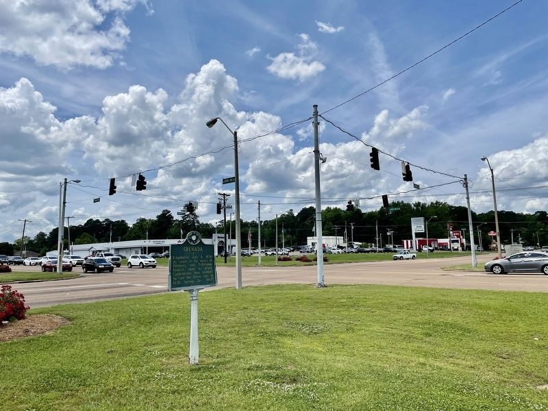
On Dr Martin Luther King Jr Boulevard at Sunset Drive (State Route 8), on the right when traveling north on Dr Martin Luther King Jr Boulevard.
Established July 4, 1836
by union of the towns of
Pittsburg and Tullahoma.
Federal plans to attack
Confederates here stopped
by Gen. Van Dorn's raid on
Holly Springs, Dec., 1862. — — Map (db m173958) HM
Near L D Boone Airport Road 0.7 miles north of Old Highway 7 (State Route 332), on the left when traveling north.
The Grenada Army Air Field was built
with civilian labor in 1942. It served
the 443rd Air Support Command, 63rd
Troop Carrier Group, 877th Airborne
Engineering Battalion, 10th Troop
Carrier Group, and 809th Air Force Unit.
Following the war, . . . — — Map (db m173915) HM
On Scenic Mississippi Route 333 0.1 miles north of Grenada Lake Visitor's Center, on the right when traveling north.
The Great Mississippi River Flood of 1927
affected an area of 27,000 square miles.
More than 130,000 homes were lost
and 700,000 people were displaced.
Congress took action, passing the Flood
Control Act of 1936. The U.S. Army
Corp of . . . — — Map (db m219775) HM
On Springhill Road 0.2 miles east of Sunset Drive (State Route 8), on the right when traveling east.
In 1862 the Confederate army built
forts throughout Grenada in response to
General Ulysses S. Grant's Mississippi
Central Railroad Campaign to capture
Vicksburg. This small fort was placed
to guard the approach to Grenada from
the south, along . . . — — Map (db m173975) HM
On 1st Street at South Main Street, on the right when traveling west on 1st Street.
J. Augustine Signaigo, born in 1835 in Italy, founded the Grenada Sentinel in 1854. A poet, he wrote the libretto of a hit Civil War operetta, "The Vivandiere." He served as president of the Mississippi Press Association in 1869. He died in . . . — — Map (db m89888) HM
J. Augustine Signaigo, born in 1835 in Italy, founded the Grenada Sentinel in 1854. A poet, he wrote the libretto of a hit Civil War operetta, "The Vivandiere." He served as president of the Mississippi Press Association in 1869. He died in 1876 and . . . — — Map (db m89891) HM
On Cemetery Street west of Dr Martin Luther King Jr Boulevard, on the right when traveling west.
Established circa 1840. this is
Grenada's oldest cemetery. Buried
here are many prominent, early
citizens, including Rev. Abraham
Lucas, who performed the "marriage
of Pittsburg & Tullahoma" on
July 4, 1836, forming Grenada.
Also buried here . . . — — Map (db m173957) HM
On Dubard Road (Mississippi Route 35) at Blanch Road, on the right when traveling south on Dubard Road.
Organized here in 1818 by
the Rev. Cyrus Kingsbury.
The 1st in a series of 13
missions for the education
of the Choctaws into western
culture, it was closed in 1832
due to removal of many
Choctaws to Oklahoma. — — Map (db m173979) HM
On Blaize Avenue at Sycamore Street, on the right when traveling south on Blaize Avenue.
The studio of Carter Church (1943-2018), best
known for his elaborate Mardi Gras costumes,
was located here. In addition to creating
costumes for Mardi Gras royal courts, Church
and his husband, artist Yancy Pogue, played
prominent roles in the . . . — — Map (db m243136) HM
On North Beach Road at North 2nd Street, on the left when traveling west on North Beach Road.
Located in the northern part of Bay St. Louis, the area known as Cedar Point developed in the late 1880s when G.W. Dunbar and Sons built a seafood cannery near the end of Dunbar Avenue. In 1909, the Peerless Oyster Co. opened at the present-day site . . . — — Map (db m187779) HM
On North Beach Boulevard north of Boardman Avenue, on the left when traveling north.
Located here was a two-story, French Creole house, with two-tiered galleries. Although construction may have begun prior to the War of 1812, the house was not completed until 1828. Situated on a large plantation, with Sea Island cotton its . . . — — Map (db m108380) HM
On Sycamore Street at Blaize Avenue, on the right when traveling east on Sycamore Street.
First Missionary Baptist Church, organized in
the home of Alexander Fox in 1877, was the
first Baptist congregation in Bay St. Louis.
The original church building was located
on Keller Street. After purchasing land
on Sycamore Street, the . . . — — Map (db m243137) HM
On South Beach Boulevard at Main Street, on the right when traveling south on South Beach Boulevard.
Hancock County Bank opened on October 9, 1899. Weeks later the bank's board of directors purchased this property at the corner of Main Street and South Beach as the site of a new headquarters. Bay St. Louis's first two-story brick building, the . . . — — Map (db m108455) HM
On North Beach Boulevard at Ulman Avenue, on the right when traveling north on North Beach Boulevard. Reported permanently removed.
On Dec. 14, 1814, five U.S. gunboats fired on a British fleet entering Lake Borgne. Their action was the last naval defense of the U.S. before the victory of General Andrew Jackson at New Orleans. — — Map (db m78939) HM
On South 2nd Street north of City Park Avenue, on the left when traveling north.
Shieldsborough, now Bay St. Louis,
was founded in 1699 as a French
settlement. The area was claimed
by Spain in 1763 and then by the
British in 1780. Named for Thomas
Shields, who was an early settler,
Shieldsborough was incorporated
on . . . — — Map (db m243133) HM
On this site stood the "Spanish Customs House," perhaps the oldest structure in Bay St. Louis. The house is believed to have been built by French colonist Hyacinth Caron in 1787. The date of construction is based on an inscription in the . . . — — Map (db m108576) HM
On South Beach Boulevard near Union Street, on the right when traveling south.
Established 1847 by Bishop J.J. Chanche, S.S., first Bishop of Natchez. Mother church of Hancock County, third oldest Catholic parish on the Gulf Coast and fifth oldest in Mississippi. — — Map (db m108548) HM
On North Beach Boulevard north of Nicholson Drive, on the right when traveling south.
The summer home of George and Eliza Jane Poitevent Nicholson, locally known as "Fort" Nicholson, was located here. Better known as "Pearl Rivers." Eliza Nicholson (1849-1896) was a poet, writer, and published of the New Orleans . . . — — Map (db m108581) HM
On Main Street at Gex Street, on the right on Main Street.
Born in Maine, 1793, Hancock Co. judge. Served in Miss. House of Representatives, 1827 - 29. Pres. of St. Const. Conven., 1832. Elected judge of High Court of Errors and Appeals, 1837. Died 1840. — — Map (db m80400) HM
On U.S. 90 at Seminary Drive, on the right when traveling east on U.S. 90.
Founded 1920 in Greenville, Miss., by Divine Word Missionaries. Moved to Bay St. Louis, 1923. Oldest existing Catholic seminary in Miss. for training of young men as missionary brothers & priests. — — Map (db m81044) HM
On South Beach Boulevard east of Union Street, on the right when traveling east.
Founded 1854, by Brothers of the Sacred Heart. Oldest institution of learning on the Mississippi Gulf Coast. On Beach Boulevard, facing the Gulf, the school became college preparatory in 1923. — — Map (db m108379) HM
On Interstate 10 at milepost 2, 1 mile west of 607 ( Highway 607), on the right when traveling east.
In 1860, John Deason, a Mexican War Veteran, organized a militia company here. The "Gainesville Volunteers" entered Confederate service in 1861 as Co. G. of the Third Mississippi Infantry. During the Civil War the unit served in the Gulf Coast . . . — — Map (db m8755) HM
On Shuttle Parkway (State Highway 607) near Old Highway 43, on the left when traveling north.
In 1961 President John F. Kennedy announced plans to send humans to the moon. NASA selected this site for an engine testing facility for the Apollo Moon program. During its construction in 1963, nearly 6,100 workers began building three . . . — — Map (db m107881) HM
On Logtown/Possum Walk Trail 1.5 miles west of State Highway 604, on the right when traveling west.
Founded here in 1848, Logtown was home to the Weston Lumber Company, founded in 1889, which became one of the largest lumber milling operations in the United States during the 1920s. By 1961 the last 250 residents were removed to make way for the . . . — — Map (db m107866) HM
On Napoleon Boat Launch Road 0.7 miles west of Old Napoleon-Westonia Road, on the left when traveling west.
The town of Napoleon was first
settled here in 1767 as a 640-acre
British land grant to John Claudius
Favre. In 1861 it was sold to Simon
Favre, who built his home and
businesses here. Residents were
relocated in 1961 to make way for . . . — — Map (db m197250) HM
On U.S. 90 0.1 miles east of Baltic Street, on the right when traveling east.
Located at this site, Brown's Vineyard, established 1874, was a popular resort during the late 19th and early 20th centuries. The wine, produced on site from scuppernong grapes, was marketed and sold across the United States. The vineyard, which . . . — — Map (db m49061) HM
On South Beach Boulevard south of Brown Road, on the right when traveling south.
Originally called the Gulfside Chatauqua and Camp Meeting Ground, Gulfside was founded in 1923 by Robert E. Jones, the first black Methodist Bishop. At the time, it was the only resort in the Gulf Region open to black Methodists. In 1980, Gulfside . . . — — Map (db m108598) HM
The home of Andrew Jackson, Jr., a nephew and the adopted son of President Jackson, was located here. Jackson and his wife Sarah, who named the plantation, lived here just before the Civil War. The Jacksons sold the property in 1861. The house, . . . — — Map (db m108577) HM
On North Beach Boulevard 0.2 miles south of Whispering Pines Drive, on the right when traveling south.
According to local tradition, the "Pirate House," located here, was built as early as 1802 and was frequented by famed pirate Jean Lafitte and his associates. Later remodeled as a Greek Revival structure, the house is believed to have a secret . . . — — Map (db m108459) HM
Near Beach Boulevard 0.2 miles west of Brady Drive, on the right when traveling west.
Built 1852-4. Last home of Jefferson Davis, U.S. Senator, Congressman, Secretary of War, and only President of Confederacy. Beauvoir served as a Confederate Veterans' home from 1903 until 1956. — — Map (db m280493) HM
On U.S. 90 near Main Street, on the right when traveling east.
Founded by the French as "New Biloxi." Capital of French colony of Louisiana, 1721-1722, prior to French removal to New Orleans. Incorporated as a town in 1850 by the Mississippi Legislature. — — Map (db m68449) HM
On Beach Boulevard (U.S. 90) at Porter Avenue on Beach Boulevard.
Since its construction in 1848, this cast iron lighthouse has been the landmark for which Biloxi-bound vessels sail. Tended by the Younghans family, father, mother and daughter, from late 1866 until 1929. — — Map (db m22778) HM
On Keller Avenue at Jenkins Lane, on the right when traveling north on Keller Avenue.
Barq's root beer was created by Edward C. Barq, Sr. in 1898 and produced on this site until 1936, when the operation moved to Lameuse Street. A Mississippi Gulf Coast favorite, the number of franchise bottlers grew to over two hundred by 1950. . . . — — Map (db m68425) HM
On Main Street at Beach Boulevard (Route 90), on the right when traveling south on Main Street.
This house was built in 1895 for Mrs. Henry Graves and soon sold to her brother, Paul W. Brielmaier. A skilled carpenter who was superintendent and later owner of a local millwork company. Brielmaier may have constructed the house as a showcase for . . . — — Map (db m91144) HM
On Howard Avenue, on the right when traveling west on Howard Avenue.
Parent Catholic Parish on the Mississippi Gulf Coast, continuing missions dating back to French Colonial era. First church on this site dedicated 1844. Rebuilt after fire in 1900. Dedicated Cathedral for Diocese of Biloxi 1977. Restored in 1989 . . . — — Map (db m22980) HM
On Beach Boulevard (U.S. 90) at Bellman Street, on the right when traveling west on Beach Boulevard.
The Carpenter Gothic style Episcopal Church of the Redeemer, built 1873-74 was located here. Among the church's parishioners was former Confederate President Jefferson Davis. In 1892, a new church, designed by architect Thomas Sully, was constructed . . . — — Map (db m102182) HM
On U.S. 90 at Porter Avenue, on the right when traveling east on U.S. 90.
On May 14, 1959, April 24, 1960, and June 23, 1963, the Biloxi beach front was the site of planned civil rights wade-ins demanding equal access to the public beach. On April 24, 1960, several citizens, both black and white, were injured and . . . — — Map (db m68460) HM
On Cadet Street at East 1st Street on Cadet Street.
Built here in 1934 as part of a U.S. Coast Guard base, the barracks was an E-shaped, Spanish Colonial Revival style building made of reinforced concrete. Arcaded porches lined the building's
wings and central pavilion, which had an octagonal . . . — — Map (db m102175) HM
On Beach Boulevard (U.S. 90) at Bellman Street, on the right when traveling west on Beach Boulevard.
The Greek Revival mansion once located here was a "raised cottage" (meaning it was composed of a frame upper story set upon an above-ground brick basement to
protect the wooden portion from moisture and insects.) Probably built ca. 1850 for Peter . . . — — Map (db m68423) HM
On Beach Boulevard (U.S. 90) at Caldwell Avenue, on the right when traveling west on Beach Boulevard.
Known as the Father Ryan House, the Greek Revival house once located here was built ca. 1840 by Judge W.C. Wade of Natchez. Among the area's first vacation villas, it was sold to New Orleans architect T.W. Carter in 1885, and was altered. It may be . . . — — Map (db m115365) HM
On Morrison Avenue north of Beach Boulevard (U.S. 90), on the left when traveling north.
Built ca. 1855 for Charles A. Labuzan, the
raised-cottage Labuzan-Stirling House
originally stood on a beachfront site.
Labuzan (1807-1869) fought in the Mexican War,
was a brigadier general of Louisiana state
troops, and served in the Civil . . . — — Map (db m243070) HM
On Porter Avenue at Beach Boulevard (Highway 90), on the right when traveling north on Porter Avenue.
Located here was a French Colonial cemetery, now known as the Moran Site. Based on archaeological investigations, the cemetery dates to the founding of "New Biloxy" between 1717 and 1722, and includes at least thirty burials, primarily male . . . — — Map (db m68448) HM
On Bayview Avenue 0.5 miles Interstate 110, on the right when traveling west.
Site granted by Spanish to Jean Baptiste Carquote in 1790. Residence in Civil War of Mayor John L. Henley, who led defense against Union fleet, Sept., 1861. Restoration by Biloxi Garden Clubs. — — Map (db m42855) HM
On Division Street at Elmer Street, on the right when traveling east on Division Street.
Originally located at 306 Elmer St., the
Pleasant Reed House was completed ca.
1887 by prominent African American
carpenter and community leader Pleasant
Reed. The earliest portion was a
one-story, three-room, frame “shotgun"
type . . . — — Map (db m122360) HM
On Beach Boulevard (Highway 90) at Porter Avenue, on the right when traveling west on Beach Boulevard.
Originally a raised-cottage Greek Revival mansion similar to Beauvoir, the house located here was built ca. 1849 by J.G. Robinson, a wealthy English cotton
planter. It was the center of an estate that included a ten-pin bowling alley, billiard . . . — — Map (db m68456) HM
Near Rue Magnolia at Water Street, on the left when traveling south.
Built by John Hohn in 1847. Its operation for a century attests to the Gulf Coast as a resort area. In 1972 structure moved to present location 100 yds. north of original site & restored by City of Biloxi. — — Map (db m68447) HM
On East Beach Boulevard (U.S. 90) at Kuhn Street, on the right when traveling west on East Beach Boulevard.
A six-story, blonde-brick structure with an arcaded gallery that wrapped its first story, the Italian Renaissance Revival-style Tivoli Hotel was one of Biloxi's early 20th century resorts, built in 1926-27 to designs by local architect Carl E. . . . — — Map (db m68464) HM
On East Beach Boulevard west of Oak Street, on the right when traveling west.
One of the most substantial of the vacation houses on the Gulf Coast, the Tullis Toledano House was built in 1856 for New Orleans native Christoval Sebastian Toledano (1789-1869) and his wife, Matilda Pradat Toledano. The estate, composed of a . . . — — Map (db m102171) HM
On Beach Boulevard (U.S. 90) at Bellman Street, on the right when traveling west on Beach Boulevard.
Built in the 1830s, the French Creole house once located here incorporated Federal and Greek Revival decorative influences in its design. The gallery completely encircled the house, and its
slender, colonnettes supported a broad hipped roof with . . . — — Map (db m102173) HM
On Beach Boulevard (U.S. 90) at White Avenue, on the right when traveling west on Beach Boulevard.
Established as the White House Inn in
1895, this hotel was first operated as a
boarding house by Cora White. By 1910 the
White House had grown in popularity and
become a tourist destination. The campus
encompassed seven residential . . . — — Map (db m102179) HM
Near Beach Boulevard (U.S. 90) at Main Street, on the right when traveling east.
William Bartram, noted naturalist and journalist, traveled down the Mississippi and along the Gulf Coast in 1777. His observations of plant life, geography and inhabitants were published in 1791. — — Map (db m79087) HM
On Woolmarket Road at Old Highway 67 (Old Highway 67), on the right when traveling east on Woolmarket Road.
S. 3 mi. Once center of wool industry. Here on July 16, 1910, three rural schools formed Woolmarket Vocational High School, considered to be the first consolidated high school in the state. — — Map (db m20010) HM
On Jones Park Drive 0.2 miles east of 25th Avenue, on the right when traveling east.
The Louisiana Native Guards, composed largely of former slaves and free men of color from Louisiana, were organized by Union Maj. Gen. Benjamin Butler in 1862. On April 9, 1863, 180 men from companies B and G of the 2nd Regiment, landed at . . . — — Map (db m102161) HM
On an unnamed entrance road north of East Beach Boulevard (U.S. 90), in the median.
In 1917, this site was designated for the
state's centennial celebration. Known as
the “Mississippi Centennial Exposition,”
the celebration never occurred due to the
onset of World War I. The property was
converted to a naval training station . . . — — Map (db m243086) HM
On 38th Avenue at 19th Street, on the right when traveling south on 38th Avenue.
An African American physician, lived and practiced medicine here fron 1953 until 2002. His work to register African American voters provoked repeated death threats and fire bombing of his clinic. He was president of the Gulfport Branch NAACP and . . . — — Map (db m102169) HM
On a frontage road on north side of East Beach Blvd 0.2 miles west of 20th Avenue, on the right when traveling west.
Organized in 1896 by Bertha Amis and her
half-sister Ruby Thornton, First Baptist Church
first met in a rail car in downtown Gulfport. In
1899, a church was built at the corner of 14th
Street and 23rd Avenue. The congregation then
moved to this . . . — — Map (db m243112) HM
On East Beach Boulevard (U.S. 90) 0.1 miles west of Roberts Avenue, on the right when traveling west.
A two-story, wood-frame Greek Revival
house with peripteral galleries, “Grass
Lawn” was built as a vacation residence
for Dr. Hiram Alexander Roberts, a
surgeon and planter from Port Gibson.
From 1904 to 1950, it was the home of
Gulfport . . . — — Map (db m243092) HM
On Cowan Road (State Highway 605) 0.1 miles north of East Pass Road, on the right when traveling north.
Once located in the Handsboro Community, Gulf Coast College was founded in 1865 by Henry Leinhard as a private coeducational boarding school here on this site. In the early 1890's the college was converted into a public school. After the original . . . — — Map (db m81008) HM
On Beach Drive at Anniston Avenue, on the right when traveling west on Beach Drive.
This preparatory school for boys was founded in 1912. The senior division campus, closed in 1951, is now the site of the Armed Forces Retirement Home-Gulfport, formerly known as the United States Naval Home. The junior division campus, closed in . . . — — Map (db m68452) HM
On East Beach Boulevard (U.S. 90) at Pratt Avenue, on the right when traveling east on East Beach Boulevard.
Near this spot on April 17 and April 24, 1960, Gulfport NAACP president Dr. Felix Dunn and his family joined in peaceful "wade-in" demonstrations to challenge the laws denying African Americans use of the beach. Gulfport police officers removed the . . . — — Map (db m68450) HM
On East Pass Road at Monet Street, on the right when traveling east on East Pass Road. Reported damaged.
N. 1 mi. Founded c. 1800. Famed, 1840-1900, for foundries, sawmills & shipyard; Coast's first newspaper, "Democrat" (1846); and many fine academies. Here Jeff. Davis attended Polar Star Lodge, founded in 1852. — — Map (db m81006) HM
On 32nd ½ Street 0.1 miles east of F Avenue, on the right when traveling east.
Established before the founding
of Mississippi City, the earliest
burials here date to the 1840s.
In 1884, the cemetery was sold to
Harrison County for $1, provided
no graves would be disturbed.
Buried here are veterans of
the Civil War, . . . — — Map (db m243084) HM
On Live Oak Avenue at Silver Lane, on the right when traveling north on Live Oak Avenue.
The Mississippi City Colored School was
built here in 1914 without utilities. Funding
came from the Rosenwald Foundation, the
county, and private donations. Students
completed the eighth grade here, and most
went on to graduate from high school . . . — — Map (db m243082) HM
On Courthouse Road at 16th Street, on the right when traveling south on Courthouse Road.
Constructed in 1893 as part of the Harrison County Circuit Clerk's office, the "Old Courthouse," located here, was a two-story, red brick edifice. It was the last remaining structure associated with a complex of courthouse buildings in Mississippi . . . — — Map (db m81011) HM
On 15th Street at 20th Avenue, on the right when traveling west on 15th Street.
The Gulfport High School, built in 1923 by architect N. W. Overstreet, replaced two earlier schools built in 1899 and 1905, both of which burned. Opened in 1924 at a new location on 15th Street, the school was converted to a junior high in 1977 due . . . — — Map (db m102167) HM
On Church Street west of Watkins Avenue, on the left when traveling west.
Riley Chapel, located in the Handsboro
community, was founded in 1869 as
the Methodist Episcopal Church
(Colored). In 1907. a wood-framed
church was built with a bell, wooden
pews, and stained-glass windows.
The property also included a . . . — — Map (db m243083) HM
On East Beach Boulevard (U.S. 90) at Church Avenue, on the right when traveling west on East Beach Boulevard.
St. Mark's Episcopal Church, once located here, was organized as a mission parish in 1846. Originally a simple rectangular frame building with twin front doors. The church was altered and enlarged over the years and was moved from its original . . . — — Map (db m81009) HM
On 36th Avenue at 19th Street, on the right when traveling north on 36th Avenue.
The St. Therese Parish Hall was built in 1941 by
Rev. Joseph Hennessey, SSJ, across from the
St. Therese of Lisieux Catholic Church. Used by
the parish for a variety of purposes, it was also a
United States Service Organization (USO) center
for . . . — — Map (db m243115) HM
On 13th Street at 25th Avenue (U.S. 49), in the median on 13th Street.
On April 20, 1925, the Magnolia Route opened with a forty-hour, 1,000 mile endurance drive from Gulfport to Chicago. This route was designed to bring more commerce and tourism to Mississippi. — — Map (db m80995) HM
On Rippy Road at Creosote Road, on the right when traveling east on Rippy Road.
In 1866, emancipated African American
settlers established this community
along Turkey Creek, building homes, a
church, and a school. Many residents
are descendants of the original settlers.
Designated in 2001 by Mississippi
Heritage Trust as . . . — — Map (db m243138) HM
On Three Rivers Road at Rippy Road, on the right when traveling north on Three Rivers Road. Reported missing.
In 1866, emancipated African American
settlers established this community
along Turkey Creek, building homes, a
church, and a school. Many residents
are descendants of the original settlers.
Designated in 2001 by Mississippi
Heritage Trust as . . . — — Map (db m243140) HM
On Beach Boulevard East (U.S. 90) 0.1 miles west of East Azalea Drive, on the right when traveling west.
In 1788, Nicholas and Marianne Ladner became the first Europeans to settle in this area. Their log house, know as "The Chimneys", was used as a navigation point for boats traveling from Mobile to New Orleans. After Nicholas's death, the Spanish . . . — — Map (db m81001) HM
On Beach Boulevard East (U.S. 90) at Gulf View Avenue, on the right when traveling east on Beach Boulevard East.
In 1788, Nicholas and Marianne Ladner became the first Europeans to settle in this area. Their log house, know as "The Chimneys," was used as a navigation point for boats traveling from Mobile to New Orleans. After Nicholas's death, the Spanish . . . — — Map (db m81002) HM
On East Scenic Drive at Lang Avenue, on the right when traveling west on East Scenic Drive.
Built by John Backe of New Orleans in 1851. Here in 1913 Pres. Woodrow Wilson and family spent winter vacation as guests of the owner, Miss Alice Herndon. — — Map (db m80997) HM
On Clarke Avenue north of West Railroad Street, on the left when traveling north.
Built in 1928, this school for African American students in Pass Christian was funded by public and private money, including the Rosenwald Foundation. First known as the Harrison County Training School, the name was changed to honor a former . . . — — Map (db m243128) HM
On West Second Street east of Church Avenue, on the left when traveling east.
Built in 1936, the Old Pass Christian High School was located here. Designed by the local architectural firm of Shaw and Woleben, the main school building was a one-story, U-shaped brick building with a columned Federalesque entrance portico and a . . . — — Map (db m243131) HM
On Saucier Avenue at East Railroad Avenue, on the left when traveling north on Saucier Avenue.
Dedicated on March 5, 1911, Our Mother of
Mercy Catholic Church began as a mission for
Pass Christian's African American community.
who had attended St. Paul's Catholic Church
since 1844. First known as St. Philomena, the
church was established . . . — — Map (db m243126) HM
On East Scenic Drive 0.1 miles west of Davis Avenue, on the right when traveling west.
Built ca. 1855 by Pierre Saucier, whose son was later mayor of Pass Christian, the two-story Greek Revival House located here had a central temple-like portico and square-columned galleries spanning its facade, and an octagonal Gothic Revival . . . — — Map (db m81033) HM
On East Scenic Drive at St Paul Avenue, on the right when traveling west on East Scenic Drive.
Due to the large number of 19th and early 20th century mansions once located here, Pass Christian's Scenic Drive was heralded as "The Newport of the South." Composed of architecturally significant vacation villas set among live oaks, this National . . . — — Map (db m81042) HM
On Bolton-Raymond Road at East Madison Street (Old U.S. 80), on the left when traveling south on Bolton-Raymond Road.
Located 4.4 mi. S.W., is site of crucial battle in the Vicksburg defense, May 16, 1863. Grant, cutting off Johnston's relief, drove Pemberton from this hill across Big Black River. — — Map (db m89736) HM
On Old Port Gibson Road (Mississippi Route 462) at Cayuga Road, on the right when traveling north on Old Port Gibson Road.
Grant established his headquarters here on May 10, remaining two days. On May 11, Tuttle's and Steele's divisions of the XV Corps passed through Cayuga and the XIII Corps camps at Fivemile Creek to Auburn, three and a half miles northeast. Lacking . . . — — Map (db m103887) HM
Pioneer Baptist minister who, in 1824, settled in Hinds Co. and organ. Union Church in the Society Ridge Com. A founder of the Miss. Bapt. Conv. in 1836, he influenced that body to acquire Miss. Coll. in 1850. — — Map (db m89733) HM
On Clinton Parkway at East Main Street, on the right when traveling north on Clinton Parkway.
Governor Walter Leake built his
home, Mount Salus, in 1825. The
Mount Salus post office was authorized
that year and renamed Clinton in 1828
to honor Governor Dewitt Clinton of New
York. In 1828-30 the state legislature
considered . . . — — Map (db m115383) HM
On East College Street 0.2 miles west of Fairmont Street, on the left when traveling west.
Established ca. 1800, the Clinton Cemetery is one of the oldest in central Mississippi. Buried here are families of pioneer settlers, ten college presidents, and sixty-three Confederate soldiers. — — Map (db m69598) HM
On U.S. 80 at Mount Salus Drive, on the right when traveling east on U.S. 80.
Founded in 1831, Clinton Methodist Church is
the oldest church in Clinton and the oldest
Methodist church in Hinds County. Henry Goodloe
Johnston, the son-in-law of Governor Walter
Leake and the first known Methodist in Clinton,
inherited . . . — — Map (db m219743) HM
On East College Street at Clinton Parkway, on the right when traveling north on East College Street.
Composed largely of residential
structures built ca. 1870-1940,
this district includes E.
College, E. Main, Landrum and
New Prospect Streets. Parts of
the district were included in
the 1829 town plan. Listed in
the National Register . . . — — Map (db m115386) HM
On East Main Street west of Heights Drive, on the right when traveling west.
Composed largely of residential structures built ca. 1870-1940, this district includes E. College, E. Main, Landrum and New Prospect Streets. Parts of the district were included in the 1829 town plan. Listed in the National Register of Historic . . . — — Map (db m115389) HM
On East Leake Street east of East Street, on the right when traveling east.
Following the closure of the female department at Mississippi College in 1851, the Central Baptist Association founded the Central Female Institute on this site in 1853. The institute provided primary and secondary education, as well as a two-year . . . — — Map (db m103743) HM
On Northside Drive at Old Vicksburg Road, on the right when traveling east on Northside Drive.
Operated at junction of Natchez Trace & Old Vicksburg Rd. by Robert H. Bell (1783-1835) & his "yellow man Vincent," freed by Bell's will in 1835. Bell-Vincent Scholarship, Millsaps College, endowed with funds from the sale of this land, memorializes . . . — — Map (db m50873) HM
On West College Street at Jefferson Street, on the right when traveling east on West College Street.
Founded 1826, is oldest of Mississippi senior colleges. Under Baptist control. Was first coeducational college to grant degree to a woman. Famed for producing many a leader in church and state. — — Map (db m89732) HM
On Jefferson Street at West Main Street, on the right when traveling south on Jefferson Street.
Tanglewood was originally built ca. 1845 on Norrell Road, then just south of Clinton, by Andrew and Nancy Thomas for their daughter Mary Jane and her husband, James A. Criddle. By 1876 Tanglewood had come into the ownership of Captain William Lewis . . . — — Map (db m89730) HM
On East College Street east of Landrum Street, on the left when traveling east.
Built ca. 1835, this Greek Revival house is one of the oldest in Hinds Co. U.S. Grant passed by enroute to Civil War siege of V'burg, 1863. This structure is listed on the National Register of Historic Places. — — Map (db m115290) HM
On Clinton Raymond Road 0.2 miles south of Interstate 20, on the right when traveling south.
On January 12, 1836, Isaac Caldwell, a former law partner of Senator George Poindexter, fought a duel with Samuel Gwin, a protégé of Andrew Jackson. The duel was the result of a lengthy political quarrel that began in 1830, when the senator blocked . . . — — Map (db m119217) HM
On September 4, 1875, Charles Caldwell, a former slave and Republican state senator, organized a political rally at “Moses Hill." Firing erupted during the rally, attended by more than 1,500 blacks and about 75 whites, including some white . . . — — Map (db m115338) HM
On Old U.S. 80 0.5 miles west of Smith Station Road, on the right when traveling east. Reported missing.
After the defeat at Champion Hill, Confederate forces retreated to the Big Black River on the night of May 16, 1863. Here, Generals John Bowen and John Vaughn defended the east bank of the river and the bridge. On May 17, Federal forces under Gen. . . . — — Map (db m80679) HM
On Askew Landing Road 0.5 miles north of Askew Ferry Road when traveling north.
On May 17, 1863, Pemberton's 4th
Brigade, commanded by Col.
Reynolds, and portions of Grant's
15th Corps, commanded by Gen.
Sherman, fought here as Confederate
forces retreated from Champion Hill.
Subsequent skirmishing took place near
here . . . — — Map (db m244398) HM
On Old Port Gibson Road 0.2 miles west of Mt. Moriah Road, on the right when traveling east.
On May 12, 1863, Grant made his headquarters here at Dillon's Farm with Sherman's XV Corps. At Raymond, five and a half miles east along Fourteenmile Creek, McPherson's XVII Corps, with 12,000 men, defeated 3,000 Confederates under John Gregg. Grant . . . — — Map (db m80242) HM
On Old Port Gibson Road 0.2 miles north of Learned Road, on the right when traveling north.
On the morning of May 12, 1863, Grant and
Sherman arrived here with two divisions
of the XV Corps and found the bridge
across Fourteenmile Creek ablaze. A brisk
firefight ensued between a detachment
of Wirt Adams' Mississippi cavalry,
posted . . . — — Map (db m178365) HM
On Mount Moriah Road at Smith Station Road on Mount Moriah Road.
Located 3.5 miles south of Edwards,
Mt. Moriah crossroads was occupied by
Union Gen. John McClernand's XIII Corps
on May 12, 1863. McClernand's object
was to move north and cut the Mississippi
Southern R.R. However. Confederate Lt.
Gen. John . . . — — Map (db m244404) HM
On Old Port Gibson Road at Middle Road, on the right when traveling north on Old Port Gibson Road.
On May 12, 1863, after Grant and two divisions of the XV Corps marched past, three divisions of the XIII Corps turned here onto the Telegraph Road. Four miles north, they met a portion of the 1st Missouri (Dismounted) Cavalry at Whitaker's Ford. . . . — — Map (db m80290) HM
948 entries matched your criteria. Entries 201 through 300 are listed above. ⊲ Previous 100 — Next 100 ⊳