By Duane and Tracy Marsteller, March 31, 2023
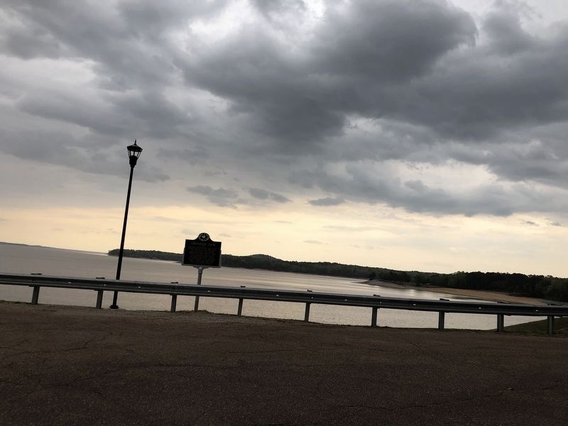
Grenada Dam Marker
GEOGRAPHIC SORT Title Sort Marker Number Sort Marker Number Sort N Marker Number Sort T Publication Order Sort Publication Order Sort A Erected Year Sort Most Viewed Sort Most Recent-Interest Sort Most Recently Changed Sort SEE FAQ #33 FOR DESCRIPTIONS
On Scenic Mississippi Route 333, 0.1 miles north of Grenada Lake Visitor's Center, on the right when traveling north.
On Springhill Road, 0.2 miles east of Sunset Drive (State Route 8), on the right when traveling east.
On 1st Street at South Main Street, on the right when traveling west on 1st Street.
Near Wood Street at 2nd Street Extension.
On Cemetery Street west of Dr Martin Luther King Jr Boulevard, on the right when traveling west.
On Dubard Road (Mississippi Route 35) at Blanch Road, on the right when traveling south on Dubard Road.
On Blaize Avenue at Sycamore Street, on the right when traveling south on Blaize Avenue.
On North Beach Road at North 2nd Street, on the left when traveling west on North Beach Road.
On North Beach Boulevard north of Boardman Avenue, on the left when traveling north.
On Sycamore Street at Blaize Avenue, on the right when traveling east on Sycamore Street.
On South Beach Boulevard at Main Street, on the right when traveling south on South Beach Boulevard.
On North Beach Boulevard at Ulman Avenue, on the right when traveling north on North Beach Boulevard.
On South 2nd Street north of City Park Avenue, on the left when traveling north.
On South Beach Boulevard south of Citizen Street.
On South Beach Boulevard near Union Street, on the right when traveling south.
Paid Advertisement
On North Beach Boulevard north of Nicholson Drive, on the right when traveling south.
On Main Street at Gex Street, on the right on Main Street.
On U.S. 90 at Seminary Drive, on the right when traveling east on U.S. 90.
On South Beach Boulevard east of Union Street, on the right when traveling east.
On Interstate 10 at milepost 2,, 1 mile west of 607 (Mississippi Highway 607), on the right when traveling east.
On Shuttle Parkway (State Highway 607) near Old Highway 43, on the left when traveling north.
On Logtown/Possum Walk Trail, 1.5 miles west of State Highway 604, on the right when traveling west.
On Napoleon Boat Launch Road, 0.7 miles west of Old Napoleon-Westonia Road, on the left when traveling west.
On U.S. 90, 0.1 miles east of Baltic Street, on the right when traveling east.
On South Beach Boulevard south of Brown Road, on the right when traveling south.
On South Beach Boulevard south of Brown Road.
On North Beach Boulevard, 0.2 miles south of Whispering Pines Drive, on the right when traveling south.
Near Beach Boulevard, 0.2 miles west of Brady Drive, on the right when traveling west.
On U.S. 90 near Main Street, on the right when traveling east.
On Beach Boulevard (U.S. 90) at Porter Avenue on Beach Boulevard.
On Keller Avenue at Jenkins Lane, on the right when traveling north on Keller Avenue.
Paid Advertisement
On Main Street at Beach Boulevard (Route 90), on the right when traveling south on Main Street.
On Howard Avenue, on the right when traveling west on Howard Avenue.
On Beach Boulevard (U.S. 90) at Bellman Street, on the right when traveling west on Beach Boulevard.
On U.S. 90 at Porter Avenue, on the right when traveling east on U.S. 90.
On Cadet Street at East 1st Street on Cadet Street.
On Beach Boulevard (U.S. 90) at Bellman Street, on the right when traveling west on Beach Boulevard.
On Beach Boulevard (U.S. 90) at Caldwell Avenue, on the right when traveling west on Beach Boulevard.
On Morrison Avenue north of Beach Boulevard (U.S. 90), on the left when traveling north.
On Porter Avenue at Beach Boulevard (Highway 90), on the right when traveling north on Porter Avenue.
On Bayview Avenue, 0.5 miles Interstate 110, on the right when traveling west.
On Division Street at Elmer Street, on the right when traveling east on Division Street.
On Beach Boulevard (Highway 90) at Porter Avenue, on the right when traveling west on Beach Boulevard.
Near Rue Magnolia at Water Street, on the left when traveling south.
On East Beach Boulevard (U.S. 90) at Kuhn Street, on the right when traveling west on East Beach Boulevard.
On East Beach Boulevard west of Oak Street, on the right when traveling west.
On Beach Boulevard (U.S. 90) at Bellman Street, on the right when traveling west on Beach Boulevard.
Paid Advertisement
On Beach Boulevard (U.S. 90) at White Avenue, on the right when traveling west on Beach Boulevard.
Near Beach Boulevard (U.S. 90) at Main Street, on the right when traveling east.
On Woolmarket Road at Old Highway 67 (Old Mississippi Highway 67), on the right when traveling east on Woolmarket Road.
On Jones Park Drive, 0.2 miles east of 25th Avenue, on the right when traveling east.
On an unnamed entrance road north of East Beach Boulevard (U.S. 90), in the median.
On 38th Avenue at 19th Street, on the right when traveling south on 38th Avenue.
On a frontage road on north side of East Beach Blvd, 0.2 miles west of 20th Avenue, on the right when traveling west.
On East Beach Boulevard (U.S. 90) 0.1 miles west of Roberts Avenue, on the right when traveling west.
On Cowan Road (State Highway 605) 0.1 miles north of East Pass Road, on the right when traveling north.
On Beach Drive at Anniston Avenue, on the right when traveling west on Beach Drive.
On East Beach Boulevard (U.S. 90) at Pratt Avenue, on the right when traveling east on East Beach Boulevard.
On East Pass Road at Monet Street, on the right when traveling east on East Pass Road. Reported damaged.
On 32nd ½ Street, 0.1 miles east of F Avenue, on the right when traveling east.
On Live Oak Avenue at Silver Lane, on the right when traveling north on Live Oak Avenue.
On Courthouse Road at 16th Street, on the right when traveling south on Courthouse Road.
On 15th Street at 20th Avenue, on the right when traveling west on 15th Street.
Paid Advertisement
On Church Street west of Watkins Avenue, on the left when traveling west.
On East Beach Boulevard (U.S. 90) at Church Avenue, on the right when traveling west on East Beach Boulevard.
On 36th Avenue at 19th Street, on the right when traveling north on 36th Avenue.
On 13th Street at 25th Avenue (U.S. 49), in the median on 13th Street.
On Rippy Road at Creosote Road, on the right when traveling east on Rippy Road.
On Three Rivers Road at Rippy Road, on the right when traveling north on Three Rivers Road. Reported missing.
On Beach Boulevard East (U.S. 90) 0.1 miles west of East Azalea Drive, on the right when traveling west.
On Beach Boulevard East (U.S. 90) at Gulf View Avenue, on the right when traveling east on Beach Boulevard East.
On East Scenic Drive at Lang Avenue, on the right when traveling west on East Scenic Drive.
On Clarke Avenue north of West Railroad Street, on the left when traveling north.
On West Second Street east of Church Avenue, on the left when traveling east.
On Saucier Avenue at East Railroad Avenue, on the left when traveling north on Saucier Avenue.
On East Scenic Drive, 0.1 miles west of Davis Avenue, on the right when traveling west.
On East Scenic Drive at St Paul Avenue, on the right when traveling west on East Scenic Drive.
On Bolton-Raymond Road at East Madison Street (Old U.S. 80), on the left when traveling south on Bolton-Raymond Road.
On Old Port Gibson Road (Mississippi Route 462) at Cayuga Road, on the right when traveling north on Old Port Gibson Road.
Paid Advertisement
Near West College Street at Jefferson Street.
On Clinton Parkway at East Main Street, on the right when traveling north on Clinton Parkway.
On East College Street, 0.2 miles west of Fairmont Street, on the left when traveling west.
On U.S. 80 at Mount Salus Drive, on the right when traveling east on U.S. 80.
On East College Street at Clinton Parkway, on the right when traveling north on East College Street.
On East Main Street west of Heights Drive, on the right when traveling west.
On East Leake Street east of East Street, on the right when traveling east.
On Northside Drive at Old Vicksburg Road, on the right when traveling east on Northside Drive.
On West College Street at Jefferson Street, on the right when traveling east on West College Street.
On Jefferson Street at West Main Street, on the right when traveling south on Jefferson Street.
On East College Street east of Landrum Street, on the left when traveling east.
On Clinton Raymond Road, 0.2 miles south of Interstate 20, on the right when traveling south.
Near Belmont Street at Vernon Road.
On Old U.S. 80, 0.5 miles west of Smith Station Road, on the right when traveling east. Reported missing.
On Askew Landing Road, 0.5 miles north of Askew Ferry Road when traveling north.
On Old Port Gibson Road, 0.2 miles west of Mt. Moriah Road, on the right when traveling east.
Paid Advertisement
On Old Port Gibson Road, 0.2 miles north of Learned Road, on the right when traveling north.
On Mount Moriah Road at Smith Station Road on Mount Moriah Road.
On Old Port Gibson Road at Middle Road, on the right when traveling north on Old Port Gibson Road.
On Rose Street south of Dr. Robert Smith Sr Parkway, on the right when traveling south.
On Parkway Avenue south of Utah Street, on the left when traveling south.
917 entries matched your criteria. Entries 201 through 300 are listed above.
⊲ Previous 100 —
Next 100 ⊳