620 entries match your criteria. Entries 201 through 300 are listed.⊲ Previous 100 — Next 100 ⊳
Delaware Public Archives Historical Markers
The Delaware Historical Marker Program began in 1931 and the Delaware Public Archives (DPA) has administered the program since 1990. The State of Delaware has erected more that 680 historical markers which represent Delawareans’ shared history.
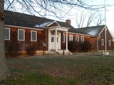
In 1919 a school was established in the Buttonwood Methodist Church to serve the needs of “colored” students in the growing neighborhood. The first teacher was James Matthew Coulbourne. In 1926 a new one room school housing grades 1-8 was built here . . . — — Map (db m92291) HM
Built in 1667, Crane Hook Church was located one mile east of here on what is now Pigeon Point Road. The Church took its name from the land located between here and the Delaware River. Under Dutch leadership, this area was colonized by the Swedes . . . — — Map (db m67354) HM
Built about 1760. Home of Gunning Bedford, eleventh governor of Delaware, born 1742. Lieut-Col. in Haslet's Delaware Regiment. Wounded in Battle of White Plains 1776. Presidential Elector 1788. Also home of Caleb P. Bennett, twenty-ninth governor of . . . — — Map (db m25558) HM
Rear of house built in seventeenth century. Main building built after 1738 by Dr. John Finney. Home of Nicholas Van Dyke, seventh Governor of Delaware. The marriage of Ann Van Dyke to Kensey Johns, Sr. took place here April 24, 1784. George . . . — — Map (db m152614) HM
Site of home of George Read. Born September 18, 1733. Died September 21, 1798. Member of The Congress of the Revolution. The convention that framed The Constitution of The United States, and of the first senate under it. Judge of Admiralty, . . . — — Map (db m25560) HM
Former owners of the Read House, their home for fifty-five years. They were longtime benefactors of New Castle doing much to encourage and promote the preservation and architectural beauty of this colonial town. — — Map (db m54697) HM
Near here October 27, 1682, William Penn first stepped on American soil. He proceeded to the fort and performed Livery of Seisin. “He took the key, thereof,…we did deliver unto him 1 turf with a twig upon it, a porringer with river water and soil, . . . — — Map (db m156292) HM
In 1854, a Methodist Society was organized in the African American community in New Castle. Not long after the society's inception, the group adopted the name Mount Salem Methodist Church and purchased land on which to build a church. Mount Salem's . . . — — Map (db m94193) HM
Built 1832. One of first railroads in country. Extended from this point to Frenchtown on the Elk River. Important connecting link between the North and South. Absorbed by Delaware Railroad 1856. — — Map (db m3549) HM
This land is part of a tract of one thousand acres set apart by William Penn in 1701 for the inhabitants of the town of New Castle. Trustees were appointed and incorporated by Penn’s heirs in 1764, whose successors still hold and manage the land. — — Map (db m3212) HM
The origin of Methodism in this community can be traced to the years prior to the American Revolution, when pioneering clergymen such as Thomas Webb and Francis Asbury visited here to spread the message of their faith. Due to the predominance of . . . — — Map (db m54700) HM
Packet boats from Philadelphia met stage coaches here for Frenchtown, Maryland, chief line of communication from North to Baltimore and South. Andrew Jackson, David Crockett, Daniel Webster, Henry Clay, Lord Ashburton, Sam Houston, Louis Napoleon, . . . — — Map (db m25559) HM
The 112-acre Penn Farm is the last surviving farm of the 1,068-acre New Castle Common. William Penn, Proprietor and Governor of Pennsylvania, made his warrant in writing under his hand and seal in October 1701, granting the New Castle Common “to lye . . . — — Map (db m128897) HM
Founded as a Dutch Reformed Church, 1657. The first building was on the Strand end of the church lot. This church was one of 7 which organized the first Presbytery in America in 1706. Present brick meeting house was built 1707. — — Map (db m122259) HM
An airfield, aircraft plant, and service hangar were built here in 1928 by Giuseppe Mario Bellanca and Henry B. duPont. An aviation pioneer, Bellanca immigrated from Italy in 1912. His plane Columbia was Charles Lindbergh's choice for a . . . — — Map (db m14133) HM
One hundred feet to the East of this point is the site of Fort Casimir. Erected by Dutch in 1651. Taken by Swedes 1654, called Fort Trafaldigheets or Trinity, retaken by Dutch under Petrus Stuyvesant in person September 11, 1655. — — Map (db m130334) HM
First chartered by the Grand Lodge of Pennsylvania as Lodge No. 33 on April 3, 1781. Early meetings were held alternately at Christiana Bridge and New Castle. This was one of four Lodges whose representatives gathered in Wilmington on June 6 and 7, . . . — — Map (db m156139) HM
On February 24, 1959 George, Lucille, and Geraldine Rayfield, an African American family, moved into their new home at 107 Bellanca Lane. As they moved in 300 protesters gathered out front, angered over the news that the Rayfields had moved into the . . . — — Map (db m130574) HM
The Federal Housing Act of 1949 established a goal of “a decent home and a suitable living environment for every American family.” However, a segregated housing market put this goal beyond the reach of African American veterans. In that year, . . . — — Map (db m92289) HM
Laid out by Petrus Stuyvesant, Dutch Governor, 1655. On this green stood the old jail and gallows. Here were held the great fairs and weekly markets from early times. — — Map (db m3423) HM
Portion of the early cart road laid out by Augustine Herrman, Lord of Bohemia Manor to connect his Maryland estate with Appoquinimink Creek and the Town of New Castle. Known as the “The Old Man’s Road”, this was one of the earliest links between the . . . — — Map (db m152613) HM
Built about 1820 by Senator Nicholas Van Dyke. The marriage of Dorcas Van Dyke to Charles I. DuPont took place here Oct. 6, 1824. At this wedding the Marquis de LaFayette was a guest, and gave the bride in marriage. — — Map (db m57131) HM
This is the site of the Eastburn-Jeanes farms and mining industry. Marble from the Cockeysville Formation, found in three quarries in the area, was heated in kilns to produce quick lime for fertilizer and mortar. The lime was transported over . . . — — Map (db m92273) HM
The first meetings of this congregation were held in the homes of its members. In 1824 a stone church building was erected at this location. The growth of the congregation resulted in the replacement of the original building by a one-story frame . . . — — Map (db m155020) HM
This estate, now owned and operated by Delaware State Parks, was once known as Chestnut Hill and contains a manor house and approximately 500 acres of land. John Barclay acquired the property after the American Revolution and in 1792 built the main . . . — — Map (db m154031) HM
In the late 18th century a paper mill was established by Thomas Meeteer on the banks of nearby White Clay Creek. In later years Thomas was succeeded in business by his sons Samuel and William. the property on which this house stands was purchased by . . . — — Map (db m154972) HM
White Clay Creek Church existed prior to 1718, meeting in a small log cabin at this site. The area became known as Meeting House Hill. In 1721, White Clay Meeting formally became the White Clay Creek Congregation. Rev. Thomas Craighead purchased 402 . . . — — Map (db m200791) HM
On September 3, 1777, an American Light Infantry Corps composed of Continental soldiers from New Jersey, North Carolina, Pennsylvania, and Virginia, with militia from Pennsylvania and Delaware, was stationed west of Christina Creek between Aikentown . . . — — Map (db m156783) HM
American light infantry and cavalry under General William Maxwell encountered advance guard of British and Hessian troops under Generals Howe, Cornwallis and Knyphausen in this vicinity September 3, 1777. American troops were expert marksmen drafted . . . — — Map (db m147686) HM
On the morning of September 3, 1777, soldiers of the Hessian Field Jaeger Corps encountered American light infantry positioned in the woods and fields along this road, which led from Aikentown (Glasgow) to Cooch's Bridge. The Americans attacked the . . . — — Map (db m57931) HM
The Iron Hill area was a community of African American farming and mining families. Constructed in 1923, Iron Hill School #112-C was one of over 80 schools built with funding from Pierre S. duPont, who sought to replace rundown public schools with . . . — — Map (db m94286) HM
Designed by architect and engineer S.T. Fuller, the Newark Passenger Railroad Station was built in 1877 at a cost of over $9,000.00 by the Philadelphia, Wilmington and Baltimore Railroad (P. W. & B) to replace an earlier frame building. An . . . — — Map (db m244170) HM
In August 1777, British forces under the command of General William Howe landed at the Head of Maryland's Elk River. Their goal was the capture of Philadelphia, the capital of the young republic. On September 3, advancing troops were engaged by an . . . — — Map (db m156810) HM
Generals Washington, Greene and Lafayette came to Iron Hill, August 26, 1777 in hope of viewing British army then landing along Elk River. Only a few tents could be seen. A heavy storm coming up, they spent the night in a nearby farm house. — — Map (db m9778) HM
Since the mid-18th century an establishment for public hospitality has existed here. The first building, of wood construction, was known as St. Patrick's Inn. Famous visitors included surveyors Mason and Dixon. The property was purchased by James S. . . . — — Map (db m154817) HM
George Washington's "General Staff Headquarters" on September 6, 1777. Here Generals Washington, Lafayette, Wayne, Maxwell, Sullivan, and Greene planned defense of Wilmington. House built circa 1750 by Samuel Hale. Owner 1776 — Daniel Byrnes — a . . . — — Map (db m13555) HM
The first Presbyterian services in this area were conducted by Rev. John Wilson in 1706. Then pastor of New Castle Presbyterian Church, Rev. Wilson came every other Sunday to minister to the many residents of this area who had immigrated from . . . — — Map (db m9979) HM
By the 1780's members of the Masonic fraternity were organized and meeting locally. On December 6, 1802, a charter was issued by the Grand Lodge of Pennsylvania for Lodge No. 96 in Newark. This was one of four Lodges whose representatives gathered . . . — — Map (db m154656) HM
Mt. Zion Union UAME was founded in 1868 in an abandoned blacksmith shop near Boogle Run at the corner of New London Rd and Ray St. Congregants walked three miles to St. Daniels UAME in Iron Hill before the establishment of Mt. Zion. In 1869 the . . . — — Map (db m154881) HM
In 1893 a group of Newark women established a literary and social organization known as the Tuesday Club. Later renamed the New Century Club, the organization became part of the General Federation of Women's Clubs. Committed to matters of civic . . . — — Map (db m154776) HM
The first documented public school for African-American youth in the Newark community was established in 1867 by the Bureau of Refugees, Freedmen and Abandoned Lands. This was one of several schools established in Delaware during the post-Civil War . . . — — Map (db m154662) HM
The African American New London Road community can be traced back to 1786 when free black families began settling in the area. The community clustered around New London Road and was bounded by Cleveland Avenue to the south and Corbit and Ray Streets . . . — — Map (db m154318) HM
Founded at New London, Pennsylvania, in 1741 by Rev. Dr. Francis Alison, removed in 1752 to Cecil County, Md., and in 1767 to Newark. Chartered by Thomas and Richard Penn 1769. Closed from 1777 to 1780 on account of Revolutionary War. Merged with . . . — — Map (db m9781) HM
By 1799 a small group of Methodists was organized and meeting in the homes of its members in the Newark area. Desiring a permanent place of worship, the congregation built the town's first church building on land that was provided by Isaac Tyson at . . . — — Map (db m9897) HM
This building contained a chapel (called the Oratory) class, dormitory, dining, administrative, and student society rooms. Newark College chartered February 5, 1833, opened its doors for instruction May 8, 1834. Name changed to Delaware College . . . — — Map (db m154610) HM
The origins of the Independent Order of Odd Fellows can be traced to the creation of beneficial trade societies in England. Composed of craftsmen who practiced a variety of different or "odd" occupations, the purpose of these organizations was to . . . — — Map (db m9898) HM
The Improved Benevolent Protective Order of Elks of the World was formally organized in 1898. Designed to promote civic improvements, the IBPOEW is one of the largest fraternal organizations of its type in the world. Responding to the request of a . . . — — Map (db m9974) HM
Completed in 1886, this was the home and place of business of Theodore F. Armstrong, a prominent local merchant and civic leader. Reflecting the growing prosperity of the community and its residents, this hybrid of Queen Anne and Gothic architecture . . . — — Map (db m130149) HM
The origin of Methodism in this part of Delaware can be traced to the early 1770's when a Methodist Society was organized and began meeting in the home of Isaac Hersey, a prominent farmer and miller. Through the efforts of Hersey's step-son William . . . — — Map (db m94281) HM
This congregation was organized circa 1848. Early meetings were held in a log cabin at this location on land that was conveyed to trustees of the "Protestant Methodist Church" in 1850. In 1866 the members of the First Colored Methodist Protestant . . . — — Map (db m9968) HM
In 1868, the original Old Village Presbyterian Church, which stood on this location, was purchased by Charles A. Murphey. The property was donated to the Catholic Diocese of Wilmington, and the church was named St. Patrick's. It became a mission of . . . — — Map (db m176291) HM
The wedge-shape tract, west of the Maryland and Delaware curve, consists of approximately 800 acres of land. For more than a century, the property was claimed by Pennsylvania but governed by Delaware. In 1889, a joint committee appointed from both . . . — — Map (db m9961) HM
Created from the difficulty in surveying the twelve-mile circle tangent point and the Tangent Line defined by Charles Mason and Jeremiah Dixon, this land between the State of Maryland and the Delaware curve is a wedge-shaped tract that was claimed . . . — — Map (db m291388) HM
Created from the difficulty in surveying the twelve-mile circle tangent point and the Tangent Line defined by Charles Mason and Jeremiah Dixon, this land between the State of Maryland and the Delaware curve is a wedge-shaped tract that was claimed . . . — — Map (db m243121) HM
Victor Gazaway Willis was born April 12, 1876 and spent his youth and much of his life in Newark, Delaware. He attended and played baseball for Delaware College (now the University of Delaware) in 1897. The Delaware Peach," as he was known, became . . . — — Map (db m92141) HM
In 1867 on land rented and later purchased by the Trustees of the First United African Wesleyan Society, the first school was built with the help of the Freedmen's Bureau. In 1923, with funding provided by the Delaware School Auxiliary . . . — — Map (db m261918) HM
Ashton Richardson built Ashley Mansion in 1804 on land he inherited from his father. A prominent Quaker, Ashton Richardson owned several milling operations and was considered one of the most eligible bachelors in the area. After marrying in 1807, . . . — — Map (db m196413) HM
In 1919, the Industrial School for Colored Girls was founded by the Federation of Colored Women's Club of Delaware for the care and education of African American girls unable to attend the all-white Woodshaven School in Claymont. With donations . . . — — Map (db m258828) HM
Born in Newport, Delaware, September 13, 1755, son of Charles and Ann Stalcop Evans. Invented automatic machinery for flour mills; first high-pressure steam engine adapted to commercial use in America; and first American land vehicle to move . . . — — Map (db m168199) HM
Tradition states that a young Irish immigrant moved to the local area in 1786 and sought out a Methodist minister from Wilmington to preach in Newport. By the early nineteenth century, a permanent Methodist Society had been established in the area. . . . — — Map (db m92147) HM
In 1975 William Julius "Judy" Johnson became the first Delawarean elected to the National Baseball Hall of Fame. During his career, 1921 through 1936, Johnson was considered the best third baseman in the Negro Leagues. In 1935, Johnson served as . . . — — Map (db m269352) HM
From September 4-9, 1777, approximately 11,000 men under the command of George Washington encamped on the grounds of what later became Delcastle Technical High School. The American army occupied a strong defensive position on the east side of Red . . . — — Map (db m240841) HM
First established May, 1861. The Fourth Regiment Delaware Volunteer Infantry camped here June to October 1862, whence they moved to a camp of the same name near Kennett Pike. The remustered First Delaware Regiment camped here in early February 1864, . . . — — Map (db m145423) HM
Constructed in 1749, the area is home to one of the earliest mill sites on the Red Clay Creek. A three-story flour mill once served as the center of activity on the site, and was the location of Oliver Evans’ first automated flour mill operation. In . . . — — Map (db m145422) HM
By 1767, Solomon Hersey was operating a merchant grist mill in this area along Red Clay Creek. The mill was purchased in 1835 by John Marshall. In the following year he expanded the operation to rolling mills and the settlement that came to be . . . — — Map (db m43405) HM
Delaware clock-maker of great distinction and silversmith lived and labored here for about thirty years until his death in 1797. Was a prominent member of Old Drawyers Presbyterian Church. Made contract with State of Delaware in 1776 for manufacture . . . — — Map (db m236871) HM
Believed to be one of the smallest Quaker Meeting Houses in the nation, the Appoquinimink Friends Meeting House was built in 1785 by David Wilson and presented to the Friends as a gift. Local tradition identifies this structure as a stop on the . . . — — Map (db m269792) HM
Indian Village Appoquinimi. Part of large grant to Alexander D'Hinoyessa, vice-director of New Amstel. Edmund Cantwell second owner of tract, 1673. Village named Cantwell's Bridge, 1731. Once important grain shipping center. Named Odessa 1855, after . . . — — Map (db m10307) HM
The history of this congregation may be traced to the 1670s, when Dutch and Swedish members of the "Reformed Church" were gathering locally for worship. By the first decade of the 18th century the settlement of persons largely of Scottish descent . . . — — Map (db m10538) HM
In 1831, a Methodist Society was organized in this community. The congregation was incorporated as Cantwell's Bridge Methodist Episcopal Church in 1832. A small meeting house known as "Brickbat Church" was subsequently constructed on land provided . . . — — Map (db m10539) HM
In 1875, Congress approved funding to build several lighthouses along this segment of the Delaware River. This site was purchased in April 1876, and by December the Port Penn Front Range Light was completed. Constructed under the direction of the . . . — — Map (db m10536) HM
Port Penn’s name is attributed to a visit that William Penn made to the area in 1682. Dr. David Stewart founded Port Penn in the 1760s and laid out the town in a grid pattern. A protected deep water harbor and access to an active peach and grain . . . — — Map (db m140576) HM
This congregation was organized in 1812. For a number of years services were conducted by Methodist “circuit riders” in members’ homes and local schools. On March 7, 1834, Thomas and Hannah Aldred donated land at this location on which to build a . . . — — Map (db m175220) HM
The site of the Rockland Mill Village is one of the earliest and longest-functioning mill seats on the Brandywine. Grist milling commenced c.1724 and was replaced by a fulling and cotton mill c.1735. Paper was the primary product of the mill . . . — — Map (db m128082) HM
Built in the mid-eighteenth century by Captain David Clark, Clearfield Farm was the home of his grandson John Clark (1761 -1821), Governor of Delaware from 1817 -1820. John Clark served as Colonel in the Delaware Militia and as Justice of the Peace . . . — — Map (db m69112) HM
Originally embraced all lands south of Duck Creek and north of Leipsic Creek from Delaware River to Maryland line. In 1869 western half of hundred was detached and joined to western half of Little Creek Hundred to form Kenton Hundred. — — Map (db m243081) HM
A log church was built here in 1789 on land donated by Joseph Dickinson. The church was named "Dickinson's Chapel" in his honor. Francis Asbury and many other pioneers of American Methodism conducted services here. Levi Scott, a native of this area . . . — — Map (db m10608) HM
William Lloyd Nelson was born near Dover, Delaware, on February 22, 1918. He was the son of J. Clarence and Carrie Phillips Nelson. Following his family's move to a farm near Middletown, he was educated in the public schools of the community. He . . . — — Map (db m245058) HM
A community of free African Americans, known as Charley Town, was located here by the mid-19th century. Between 1845 and 1855 brothers Samuel and John Townsend purchased several large tracts of farmland in the vicinity. The Delaware Railroad arrived . . . — — Map (db m141455) HM
The passage of the Public School Law of 1829 brought free public education to Delaware and divided the state into many small districts overseen by county superintendents. Blackbird District No. 60 was first noted in the record of an Annual Meeting . . . — — Map (db m94186) HM
Scott Church and its congregation grew from a Sunday school that was started in Blackbird in 1886. By 1898, the church was incorporated and a site for the church was purchased. Construction began in 1899 and the church was dedicated on Sunday, . . . — — Map (db m290635) HM
On April 5, 1923 a frame schoolhouse located nearby was destroyed by a storm. Within two weeks the General Assembly appropriated $5,000 to construct a new school. Although the amount proved to be inadequate, P.S. duPont, through the Delaware . . . — — Map (db m264102) HM
Abraham Doras Shadd (1801-1882) was the grandson
of Hans and Elizabeth Schad, a Hessian soldier and
free Black woman who settled in Delaware in the
1770s. Abraham was a shoemaker and a well-known
abolitionist in Wilmington who aided freedom . . . — — Map (db m191564) HM
Organized about the year 1769. Early meetings held in academy woods, Gilpin’s Wharf and Thelwell’s School. Church Built in 1789.
Dedicated to Bishop Francis Asbury. Here is buried Allen McLane, Lieutenant in Caesar Rodney’s Regiment 1779; . . . — — Map (db m92275) HM
Delaware remained a racially segregated society until the mid-twentieth century. Though the segregation of public schools was supported by the “separate but equal” doctrine that had been upheld by the nation’s highest court, the facilities and . . . — — Map (db m165893) HM
In August 1958, Wilmington City Councilman and Civil Rights activist William “Dutch” Burton worked with the NAACP to expose the racially discriminatory practices of the Eagle Coffee Shoppe. The restaurant was located on this site in a . . . — — Map (db m140547) HM
Born on October 30, 1930 in Wilmington, Delaware, Clifford Brown was one of the most influential jazz musicians of the mid-20th century. He began to play the trumpet as a teenager while attending Howard High School. By 1948 he was playing in . . . — — Map (db m130221) HM
This building, once known as the Morrow Building, symbolizes the founding of an organized Jewish community in Delaware. Jews have been present in Delaware since the 1650's. Until the late 19th Century, the Jewish community was too small to maintain . . . — — Map (db m166679) HM
In 1805 a group of African-Americans, desiring greater freedom of worship, withdrew from Asbury Methodist Episcopal Church to form a separate congregation. Led by Peter Spencer and William Anderson, they established what was then known as the . . . — — Map (db m14757) HM
Organized Freemasonry in Delaware can be traced to the mid-18th century. For many years Lodges were chartered by other states. On June 6, 1806, representatives of Masonic Lodges located in Wilmington, New Castle, Newark, and Laurel, met at this . . . — — Map (db m92276) HM
In 1875 the Delaware General Assembly enacted legislation requiring the racial segregation of public places such as train stations, hotels, and restaurants. For most of the next century this practice was strictly enforced. Established at this . . . — — Map (db m10920) HM
On June 10, 1848, Congressman Abraham Lincoln traveled to Wilmington, Delaware, for the purpose of addressing a meeting of members of the Whig political party. He was accompanied by Delaware Representative John W. Houston and two other members of . . . — — Map (db m94199) HM
Established in 1813 by free African American Peter Spencer, the Union Church of Africans was the first independent African American religious denomination in the United States. After leaving Asbury Methodist Episcopal Church to start Ezion . . . — — Map (db m94195) HM
On February 4, 1807, the General Assembly of the State of Delaware passed an act modeled after the charter of the Bank of the United States “to establish a Bank…under the name of the Farmers’ Bank of the State of Delaware.” On January . . . — — Map (db m160728) HM
The construction of Town Hall began in 1798. Completed the following year, this was the first structure in Wilmington built for government use. It was designed by a building committee which followed the Borough Council’s request that the structure . . . — — Map (db m165578) HM
The cradle of African-American Catholicism in Delaware, St. Joseph Church was organized in 1889 by Father John A. DeRuyter of the Josephites. Services were first held in the basement of St. Mary’s Church on 6th and Pine Streets. Incorporated as St. . . . — — Map (db m10919) HM
Zion Church in New York City, organized in 1796, was the catalyst by which the African Methodist Episcopal Zion denomination was established in 1821. By the 1870’s a number of Wilmington residents had affiliated themselves with this growing . . . — — Map (db m11011) HM
In 1876, a group of African American men seeking opportunities for political involvement, socio-economic freedom, and cultural enrichment in Wilmington formed The Monday Club. The club incorporated in 1893 and was named for members' only day off . . . — — Map (db m188451) HM
Walnut Street YMCA (Young Men's Christian Association) was designed by Wilmington architect G. Morris Whitehead II as a community center for the city's African American population. Construction began on the three-story structure in 1939 and the . . . — — Map (db m285288) HM
The roots of this congregation can be traced to the efforts of Methodist pioneer Thomas Webb, who visited this area to spread the message of his faith in the years prior to the American Revolution. Influenced by his sincerity and eloquence, a local . . . — — Map (db m128089) HM
620 entries matched your criteria. Entries 201 through 300 are listed above. ⊲ Previous 100 — Next 100 ⊳