917 entries match your criteria. Entries 301 through 400 are listed.⊲ Previous 100 — Next 100 ⊳
Mississippi State Historical Marker Program Historical Markers
Markers of the Mississippi state historical marker program administered by the Mississippi Department of Archives and History. It includes state markers installed by previous state departments and agencies. This series does not include markers of the Mississippi Freedom Trail, Mississippi Blues Trail, Mississippi Country Music Trail, and Mississippi Mound Trail, which have their own series categories.
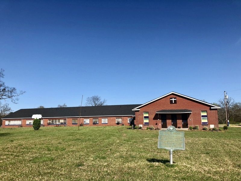
Est. 1897 as Christ's Holiness School; moved to this site in 1907. Chartered as Christ Missionary & Industrial College in 1908. Teaches religious, academic, and vocational curriculum for grades 1-12+. — — Map (db m115292) HM
Established in 1849 by Carl J. Von Seutter as the Carl J. Von Seutter Jewelry and Art Emporium, this business was once located in the Majestic Arcade Building on Capitol Street. In 1918, one of Von Seutter's employees, John C. Carter, purchased the . . . — — Map (db m51181) HM
Organized by five Jacksonians in 1837. Under the leadership of Rev. L.D. Halsey, a church building was constructed herein 1845-46 on land purchased from the state. Utilized for Christian worship until 1951. — — Map (db m107069) HM
This typical family farmstead was in operation from 1860 to 1960. The buildings were moved from Jefferson Davis Co. in 1981 and restored through the generosity of the family, friends and county supervisors. — — Map (db m69944) HM
To assist returning veterans of
WWII, the Mississippi Legislature
set aside 153 acres for low-cost
house sites. Then known as the
"Old Asylum Land," the parcels
were sold by lottery in September,
1948. Streets in the subdivision
bear . . . — — Map (db m115370) HM
This edifice ~ a memorial to Bishop Charles Betts Galloway ~ houses descendants of Jackson's first Christian congregation, worshipping on this site since 1839. — — Map (db m105560) HM
Built in 1927 by the New Orleans Great
Northern Railroad, this freight depot
served various railroads, including the
Gulf, Mobile & Ohio, until 1972, when rail
operations ceased. The Merchants
Company, a wholesale grocer, leased the
building . . . — — Map (db m219750) HM
Originally constructed in 1936 by the WPA
and designed by the Jackson firm of Hull and
Drummond, the Hawkins Field Terminal was
enlarged in 1941 and expanded again in the
mid-1950s. Hawkins Field was created as the
Jackson Municipal Airport in . . . — — Map (db m178424) HM
Named in honor of Grand Master
Thomas W. Stringer, founder of Prince
Hall Masonry in Mississippi, who served
as Grand Master from 1867 to 1893.
Dedicated on May 30, 1955, with an
address given by civil rights activist
and future Supreme . . . — — Map (db m115332) HM
Served 1839-1903 as the state capitol: restored 1959-1961 as the State Historical Museum, a division of the Miss. Department of Archives and History. — — Map (db m95483) HM
As the state capitol (1839-1903), this building was the site of the 1861 Secession Convention and 1868 and 1890 Constitutional Conventions. Andrew Jackson, Henry Clay, and Jefferson Davis spoke here. After housing state offices 1917-1959, the Old . . . — — Map (db m71069) HM
On this site was the house of Andrew J. and Susie Davis Noel, built 1924. Active in the NAACP, the Noels hosted Freedom Riders here in 1960. In 1948, Gladys Noel Bates filed the first lawsuit in the state seeking equal pay for black public school . . . — — Map (db m51173) HM
Begun in 1833. Here Henry Clay, Andrew Jackson, and Jefferson Davis spoke. Was scene of 1861 Secession Convention, Black and Tan Convention of 1868, & 1890 Constitutional Convention. — — Map (db m71070) HM
Built and used between A.D 1000 and 1300, this platform mound and a nearby burial mound mark the ceremonial and political seat of a regional chiefdom of the Plaquemine culture. A thatched, clay-plastered ritual temple or chief's lodging stood atop . . . — — Map (db m77266) HM
Jackson's only surviving "public square" from Peter Vandorn's original city plan of 1822. Named for James Smith, Scottish manufacturer, Confederate benefactor, and Jackson resident, 1834-1855, who donated funds for a fence around the park in 1884. . . . — — Map (db m105562) HM
Jackson's Jewish congregation was organized in 1861. While not the first congregation in Mississippi, Beth Israel was the first to build a temple. In 1867-1868 a wood frame structure was built on this site. Used as both a school and a house of . . . — — Map (db m134332) HM
Two of Jackson’s historic hotels once stood at this site. The Eagle Hotel, originally a tavern, was built in 1823. Andrew Jackson was a guest here in 1840. Alexander McClung, editor and Mexican War hero, committed suicide at the hotel in 1855. The . . . — — Map (db m51178) HM
The Belhaven neighborhood developed north of the city as Jackson's first suburb. Composed of more than 1,300 historic structures dating from as early as 1904, Belhaven is Mississippi's largest historic district. The neighborhood includes a wide . . . — — Map (db m119596) HM
Belhaven College for Young Ladies was founded in 1883 at the estate of Senator Jones S. Hamilton and named for his Scottish home, “Bel Haven," translated "Beautiful Home." Fire destroyed the College in 1894 and again in 1910 before it was . . . — — Map (db m133851) HM
Built ca. 1853 for James H. Boyd, Mayor of Jackson, 1842, 1844, 1850, and 1858. One of the few homes to survive the Civil War, the Greek Revival house is listed on National Register of Historic Places. — — Map (db m115286) HM
During the Civil War siege of Jackson, on
July 11, 1863, Union soldiers in the 2nd
Michigan Infantry staged an impromptu
assault on the city's fortifications.
Advancing south through what is today
eastern Belhaven, they overran a campsite . . . — — Map (db m115337) HM
Over 450 Confederate soldiers who died in and around Jackson during the Civil War are buried here. Their names are known but not the exact site of each grave, as some were reburied here from graves where they fell. As Jackson awaited the final . . . — — Map (db m105596) HM
Eudora Welty (1909-2001), one of the most acclaimed writers of the twentieth century, lived in this house for seventy six years. This house was built by Welty's parents, Christian and Chestina Welty, in 1925. Eudora Welty wrote all of her major . . . — — Map (db m91895) HM
Built ca. 1908 as a private residence for
Cyrus C. Warren, vice president of the
Warren-Godwin Lumber Company, this
Colonial Revival mansion was designed
by the Chicago architectural firm of
Spencer & Powers. Known as the Warren-
Gunter . . . — — Map (db m115367) HM
Fortification Street is situated along a section
line from the 1820 Choctaw Cession that became
Jackson's northern city limit by act of
Mississippi's General Assembly in 1821. The area
was surveyed by U.S. General Thomas Hinds and
Judge Peter . . . — — Map (db m178435) HM
In 1850, Captain William M. Gillespie
(1823-1893) moved to Jackson and
purchased forty acres on the “Canton
Dirt Road” (modern-day North State
Street) for $840. Gillespie's country
estate was bounded by present-day
Arlington Street, Hazel . . . — — Map (db m178430) HM
Greenwood Cemetery is the oldest landmark in Jackson. Authorized by the Mississippi Legislature on January 1, 1823, it was later expanded from six to twenty-two acres and given its present name. Among those buried here are numerous governors, public . . . — — Map (db m51179) HM
The Jitney Jungle grocery store chain was
founded in 1919 by the McCarty and Holman
families. In 1933, Jitney No. 14 held its
grand opening in this Tudor Revival
building designed by Emmett Hull. The
building, called "The English Village," . . . — — Map (db m115335) HM
A gift of R.V. Powers in 1917 enabled the Mississippi Children's Home Society, est. 1912, to build on this site "The Kate McWillie Powers Memorial", a home for children in the care of the Society. In 1997, the Society dedicated this campus as a . . . — — Map (db m115284) HM
Robert Estes Kennington was one of
Jackson's wealthiest merchants in the
early 1900s. In 1912, he chose this hill
north of the city to build "Kenwood," a
grand brick mansion on extensive grounds
including a tennis court, lake, formal . . . — — Map (db m115336) HM
This Georgian Revival home was designed by architect Bem Price and built by Isaac C. Garber in 1913, for Mary D. (Terrell) and Thad B. Lampton, prominent businessman and banker who served as the state treasurer under Governor Longino. The estate . . . — — Map (db m133854) HM
Built in 1857 by Charles Henry Manship,
the Manship House is an excellent example
of a Gothic Revival “cottage villa" inspired
by A.J. Downing's The Architecture of
Country Houses. Manship (1812-1895) was
the mayor of Jackson during the Civil . . . — — Map (db m178427) HM
Chartered Feb. 21, 1890 by Miss. Methodists. Named for & largely endowed by Maj. R.W. Millsaps. Bishop C.B. Galloway first president of Board; Bishop W.B. Murrah first president of college. — — Map (db m51205) HM
Exploring this Belhaven creek in the
1850s, state geologist Eugene Hilgard
identified a fossil-rich stratum at the
base of the Yazoo Clay, known today
as the Moody's Branch Formation, and
the first evidence of volcanic doming at
Jackson. . . . — — Map (db m178432) HM
On January 8, 1868, Thomas E. and Mary Helm, prominent members of First Presbyterian Church, donated this plot of land to African-Americans who had worshipped in the basement of First Baptist Church from 1835 to 1867. Mount Helm was built here in . . . — — Map (db m105597) HM
This building was once Belhaven's own full service gas station and general store, nicknamed by residents the "Shady Nook." It was originally built as a one-room structure ca. 1928 and then expanded in 1936 by architect A. Hays Town using . . . — — Map (db m133852) HM
Front
In 1928, Jackson developer Lucius L. Mayes converted six acres of rugged terrain into a residential development of fully furnished, up-to-date homes with similar color schemes but in a variety of architectural styles. A grand . . . — — Map (db m133850) HM
During the Siege of Jackson, July 10-17, 1863, Confederate Gen. William W. Loring's division held defensive positions extending east of the Canton Road to the Pearl River. A number of artillery batteries were posted on this line, the most prominent . . . — — Map (db m107070) HM
In the Late Cretaceous Period, shallow seas covered central Mississippi. About 75 million years ago, a volcano erupted through the seafloor creating an island surrounded by a reef. Today, these structures are located 2,900 feet beneath the city. . . . — — Map (db m133847) HM
Born in Jackson in 1934, Willie Morris was an
acclaimed novelist, essayist, and editor noted
for his portrayal of Mississippi and the South.
Although his boyhood home was Yazoo City,
Morris frequently visited his grandparents,
Mamie and Percy . . . — — Map (db m219753) HM
Originally built by Our Redeemer Lutheran
Evangelical Church, this Colonial Revival-
style chapel was constructed in 1932
and was the first church located in one of
Jackson's earliest subdivisions. In the
1960s, a new church was built adjacent . . . — — Map (db m178423) HM
Formed in 1835, the congregation of Mt. Helm is the oldest black religious body in the city. The church bears the name of the Helm family who donated this land on which the church originally stood. — — Map (db m115363) HM
Built in 1894 as Jackson's first public school for black students. Commonly known as the "Mother School," it was named for Smith Robertson, a respected community leader, and Jackson's first black city alderman. Among the school's graduates is author . . . — — Map (db m94959) HM
The Mississippi Federation of Women’s Clubs, organized in 1898 in Kosciusko, moved into this headquarters building in 1936. Designed by architect Robert Naef and built by the Works Projects Administration, the structure is of the Georgian-Revival . . . — — Map (db m72679) HM
Following the surrender of Vicksburg on July 4, 1863, Union forces under William T. Sherman pursued Joseph E. Johnston's Confederate army to Jackson and laid siege to the city. North of Jackson, Parke's IX Corps moved astride the Canton Road and . . . — — Map (db m71101) HM WM
This church, organized in 1883, began as a Sunday School mission to blacks under the episcopate of Bishop Hugh M. Thompson. The first instructor was a Mr. Williams, an African American. The Rev. Richard T. Middleton became the first priest in 1904. . . . — — Map (db m51176) HM
Founded in 1961, COFO combined the Civil
Rights efforts of the Congress of Racial
Equality. NAACP, Southern Christian
Leadership Conference, Student Nonviolent
Coordinating Committee, and local groups
under one umbrella. COFO's grassroots . . . — — Map (db m115333) HM
The Gowdy community was first settled prior to 1903. Named for Mr. W.B. Gowdy, former president of the Delta Cotton Oil and Fertilizer Plant. This African American community was awarded its own U.S. postal stop in 1915. The Gowdy community is . . . — — Map (db m71366) HM
The Southeastern Conference, established in
1932, housed its first corporate office on the
13th floor of the Standard Life building. The
league's first commissioner was former Mississippi
governor Mike S. Conner. The office was in
Jackson from . . . — — Map (db m178426) HM
May 12, 1863, on Fourteen Mile Creek, 2,500 Confederate troops under Gen. John Gregg attacked a 10,000 man corps under Gen. James B. McPherson. Outnumbered, Gregg was forced to withdraw to Jackson. — — Map (db m26145) HM
The Confederate Cemetery in Raymond contains the graves of 140 Confederate soldiers who were killed during the battle of Raymond on May 12, 1863, or who died as a result of their wounds. Most of the men were from Tennessee and Texas; many died in . . . — — Map (db m85108) HM
Built, 1857-9, by the famous Weldon brothers with skilled slave labor crew. After the Battle of Raymond, fought 1 ¼ m. S.W. of here, May 12, 1863, this building served as a Confederate hospital. — — Map (db m85140) HM
Organized in 1842 by Rev. Silas Hazard of the
Clinton Presbytery with six charter members.
The present worship hall was built in 1871 with
front rooms added in 1926. Evangelist Rev. Daniel
Baker preached here in 1844. - Ruling elders . . . — — Map (db m178369) HM
St. Mark’s was organized in 1837 by Rev. James McGregor Dale and construction of the sanctuary was completed in 1855. Following the battle of Raymond on May 12, 1863, the church was used as a hospital for Federal soldiers. The interior of the church . . . — — Map (db m115932) HM
On May 12, 1863, two divisions of the XVII Corps marched from the Roach Farm on the Utica Road and defeated Gregg’s Confederate brigade at Raymond. The next day, McPherson’s men moved to Clinton and cut the railroad. Meanwhile, two divisions of the . . . — — Map (db m85109) HM
On May 9, two divisions of McPherson's XVII Corps marched to Reganton, then known as Crossroads and moved southeast toward Utica, camping at Meyer's Farm three miles southeast. On May 10, the XIII Corps marched through here from Big Sand Creek . . . — — Map (db m103873) HM
Three divisions of the XIII Corps camped here May 7-9, 1863, while a reserve division was at Little Sand Creek, two miles southwest. On May 8, Grant reviewed the troops here. On May 9, the XVII Corps marched through Reganton and turned toward Utica. . . . — — Map (db m103867) HM
On May 11, 1863, two division of the XV Corps camped here. Water was scarce, and Sherman reported to Grant that he was "short of provisions and ammunition" while captured mail indicated "many million rations in Vicksburg." The next morning, Grant . . . — — Map (db m103891) HM
On May 8, 1863, as the Union XV Corps left Grand Gulf, two divisions of the XVII Corps rested at Hankinson's Ferry and Rocky Springs to wait for rations. Three divisions of the XIII Corps camped at Big Sand Creek, one and a half miles northeast, . . . — — Map (db m103861) HM
Incorporated March 5, 1880, and named for the native city of Ozias Osborn, an early settler from New York. Utica is noted for the great number of its citizens who have become educators of the deaf. — — Map (db m80234) HM
W. 3 mi. Mineral springs created popular health spa prior to Civil War. Girls boarding school organized, 1854. In 1862, wounded from Shiloh treated here. Now Y. M.C.A. state camp. — — Map (db m140831) HM
Founded, 1858. Named for Louis Durant, a nearby Choctaw chief. Lockhart's Store, 4 mi. W., was first Holmes County post office, dating from 1849. Town later merged with Durant. — — Map (db m140836) HM
Born in 1928 in Holmes County, Robert G.
Clark Jr. was the first African American
elected to the Mississippi Legislature in
the 20th century. Elected in 1967, Clark
became chair of the House Education
Committee in 1977 and played a key role . . . — — Map (db m244497) HM
During Brig. Gen. Benjamin Grierson's raid in the late winter of 1864-1865, a small Confederate brigade under the command of Gen. Wirt Adams attacked the rear guard of one of Grierson's columns at Franklin Church on January 2, 1865. Among the . . . — — Map (db m140860) HM
Built in 1921 with assistance from the
Rosenwald Fund and known locally as the
Goodman School for Negroes, the Goodman School
served African American students in the first
through eighth grades in the Goodman-Pickens
area. Local Black citizens . . . — — Map (db m219758) HM
Charles Harrison Mason (1864-1961) began his ministry in 1893 in Preston, Arkansas. Shunned by the African American Baptist community in Jackson during the 1890s due to his teachings on holiness, Mason brought his revival to Lexington in 1897. He . . . — — Map (db m140839) HM
Dr. Arenia Mallory (1904-1977), a native
of Jacksonville, Illinois, was a graduate
of Jackson State University and the
University of Illinois and was awarded a
Ph.D. from Bethune-Cookman College. In
1926, Mallory came to Lexington, where . . . — — Map (db m219761) HM
Hazel Brannon Smith (1914-1994), a journalist and
publisher, was the owner and editor of four weekly
newspapers, including the Lexington Advertiser. An
advocate for racial justice, Smith condemned the
state's Sovereignty Commission and . . . — — Map (db m219759) HM
Began in 1820s as trading post. Incorporated in 1836. County seat of Holmes County since 1834. In 1907 the first Corn Club in the United States was organized here by W.H. (Corn Club) Smith. — — Map (db m140843) HM
Milton Lee Olive III, a native of Chicago, moved to Holmes County and attended school in Lexington. During the Vietnam War, Olive served in Co. B, 2nd Bttn. (Airborne), 503rd Infantry. Near Phu Cong, on October 22, 1965, Olive saved the lives of . . . — — Map (db m140856) HM
St. Mary's is the successor to Calvary Parish,
organized in 1851 at “Wannalaw,” the home of
William Eggleston. Built in 1852-53 and
consecrated by Bishop William Mercer Green in
1855, the Calvary property was sold in 1878 to
build St. Mary's. . . . — — Map (db m219762) HM
St. Paul Church of God in Christ (COGIC) was organized in 1897 by Bishop Charles Harrison Mason, the founder of the COGIC denomination. St. Paul has served as "Mother Church for the COGIC since its construction here in 1906. Saints Academy. formerly . . . — — Map (db m140853) HM
Born in 1835 in Alabama, Edmund Scarborough
became a successful farmer in Pickens. He
served in the Mississippi Legislature in 1870-1871
and organized what would become Union
Memorial UMC. John B. Scott, born near Pickens
in 1853, attended . . . — — Map (db m219757) HM
Here in 1849, Robert Morris, Mason, schoolmaster, began movement that resulted in creation of the Order of the Eastern Star. Schoolhouse has also housed Masons and Co. C 15th Miss. Inf. C.S.A. — — Map (db m140863) HM
Settled by Charles Land, 1826. Early settlers came by Rockport Road, built by Indians from Tchula Lake to Natchez Trace. Town was trade & shipping center for planters of this area. — — Map (db m121048) HM
On March 13, 1863, near this site, the NATCHEZ burned and sank in the Yazoo. Converted into a Confederate gunboat and armored with cotton bales, the vessel had been taken into the Yazoo to avoid capture. — — Map (db m121107) HM
A significant archaeological site initially settled by people of the Poverty Point culture ca. 1000 BC and continuously occupied through all subsequent archaeological periods of the Lower Miss. Valley. — — Map (db m121110) HM
This home was built of hand-hewn, heart-of-pine lumber ca. 1836, and purchased in 1844 by John Tannehill. An 1887 remodeling added a second floor and a kitchen on the back connected by a breezeway. Also known as the Orr House, it is one of Fulton's . . . — — Map (db m102620) HM
In 1838 the Methodist Episcopal Church established the Bull Mountain Mission Circuit, which added the newly formed town of Fulton to its charge. Circuit riders began holding services in a log structure just northwest of this site. The first church . . . — — Map (db m102621) HM
In the early 1800s the area known as Fulton was first settled near the banks of the Tombigbee River. In 1836 after Itawamba County was formed, Kenneth Clarke, John D. Miller, and Robert A. Miller gave fifty acres of land to the Board of Police, and . . . — — Map (db m98609) HM
Established after the incorporation of the town in 1837, the Fulton Cemetery was formally deeded to D.N. Cayce, president of the Fulton Male Academy by William P. Harrison in 1850. Originally situated on four acres adjacent to the school, the . . . — — Map (db m205426) HM
The Fulton Grammar School was designed by architect J.B. Lawson and built with Work Projects Administration assistance in 1939. This one-story brick building of nineteen rooms included a library, music room, kindergarten, office, and a 550-seat . . . — — Map (db m102622) HM
In 1941 the Itawamba Agricultural High School board of trustees voted to expand the school's curriculum to include college-level courses. In 1948 the Itawamba Junior College opened its doors with an enrollment of 114 students from Itawamba, Lee, and . . . — — Map (db m102623) HM
Also known as the Cates-Gaither House, this one-story Greek Revival-style planters cottage was built in ca. 1859 by ship builder and merchant Pleasant Cates. The heavy framing includes original pegged joints. Named for the cedar trees on the . . . — — Map (db m96773) HM
Non-extant town est. on the Tombigbee River in 1838 by Winfield Walker. Named for President Martin Van Buren. Flourished briefly in the 1840's. Declined between 1850-60 when the railroad was built W. of the town. — — Map (db m205432) HM
Vernon Presley, the father of Elvis Presley, was born on April 10, 1916, in a house that once sat on this site. In 1933, Vernon married Gladys Smith, and in 1935 Elvis Aron Presley was born. Vernon moved his family to Memphis, Tennessee, in 1948 in . . . — — Map (db m205423) HM
Established in 1909, the Fawn Grove School served the Fawn Grove community. After a new school house was constructed here in 1926, the Fawn Grove School recorded its highest enrollment, 162 students, in 1931. The Fawn Grove School closed its doors . . . — — Map (db m102975) HM
The Bankhead Highway, established in 1916, was the first all-weather, transcontinental highway in the United States. It spanned some 3,600 miles. In Mississippi, the northern route roughly follows Highway 178 and the southern route, US Highway 278. . . . — — Map (db m123260) HM
W. 1 mi. Here, 1887~1904, G.A. & J. T. Holley bridged gap between rural schools and colleges for many who distinguished themselves in law, education, & business. — — Map (db m117204) HM
The territory of the Chickasaw Nation
once included north Mississippi, west
Tennessee, northwest Alabama, and western
Kentucky. Until removal from Mississippi,
the Chickasaw people defended their
homeland from native invaders and
Europeans, . . . — — Map (db m169990) HM
The West Pascagoula Creosote Works, at this site, was the first continuously operated creosote treatment plant in the nation. Established in 1874 to protect railroad bridge timbers against rot and the toredo worm, the plant was open until 1978. . . . — — Map (db m16726) HM
This sawmill operated on this site from 1867 till 1906, employing more than twenty local citizens and producing more than 30,000 board feet of lumber per day at its peak. The sawmill was well situated with easy access to the river, railroad, . . . — — Map (db m16754) HM
Built in 1940, the Gautier School replaced the Lyon School, built in 1918 and located 3 miles west at Hilda. The Lyon School consolidated other schools in the area, including the "Little Red Schoolhouse," built in 1890 by Walter Gautier. The "Little . . . — — Map (db m20045) HM
In 1718 this area was settled by Jean-Baptiste Baudreau dit Graveline, born 1671 in Montreal. Arrived with d'Iberville at Fort Maurepas aboard the Renommée Jan 8, 1700. Prominent colonist~adventurer~merchant. — — Map (db m81089) HM
The nearby earthen mound was built by prehistoric Indians during the Late Woodland Period between 400 and 700 A. D. The mound's flat summit was used for ceremonial purposes. Listed on the National Register of Historic Places, it is one of the few . . . — — Map (db m129007) HM
Originally a burial site for the Gautier family, this cemetery contains the graves of Fernando Gautier and Henry Gautier (builder of Twelve Oaks). Members of the Clifford, Fayard, Fuller, LeBatard, Pelham, Peterson, Quinn, Saucier, Vaughan, and . . . — — Map (db m43651) HM
Built ca. 1907 of long leaf
yellow pine by Eugenie Orrell
(1850-1932), daughter of Alfred
and Ann Lewis, owners of Oldfields
Plantation. The old Louisville and
Nashville Railroad depot was moved
to this site in 1968 as a guest
house. The . . . — — Map (db m197352) HM
Built ca. 1899 by S.W. and Elizabeth Henderson Labrot. Labrot was superintendent of the L&N Railroad Creosote Plant. In 1902, the Labrots sold the house to the Louisville and Nashville Railroad Company. The style of construction, using vertical . . . — — Map (db m243013) HM
Arriving in 1827, the McRaes were
among the earliest settlers of
this area and owned extensive
property along the Mississippi
Sound. This cemetery is the burial
place of family patriarch John
McRae, who died in l835. His sons
Colin, John J., . . . — — Map (db m197403) HM
917 entries matched your criteria. Entries 301 through 400 are listed above. ⊲ Previous 100 — Next 100 ⊳