By Mark Hilton, March 22, 2018
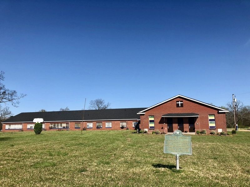
The C.M. and I. College & marker.
GEOGRAPHIC SORT Title Sort Marker Number Sort Marker Number Sort N Marker Number Sort T Publication Order Sort Publication Order Sort A Erected Year Sort Most Viewed Sort Most Recent-Interest Sort Most Recently Changed Sort SEE FAQ #33 FOR DESCRIPTIONS
On Main Street north of Avenue F, on the right when traveling north.
On High Street at North Street, on the right when traveling east on High Street.
On North State Street (U.S. 51) north of Yazzo Street, on the left when traveling north.
Near Lakeland Drive (State Highway 25) at Interstate 55 when traveling north.
On Robinhood Road at North State Street (U.S. 51), on the right when traveling east on Robinhood Road.
On North Congress Street north of Yazoo Street, on the left when traveling north.
On Commerce Street, 0.1 miles north of Tombigbee Street, on the right when traveling north.
On Lavernet Road at Sam Jones Jr Drive, on the right when traveling west on Lavernet Road.
On John R. Lynch Street west of Short Street, on the right when traveling west.
On South State Street (U.S. 51) at East Capitol Street, on the right when traveling north on South State Street. Reported missing.
On South State Street (U.S. 51) at East Capitol Street, on the right when traveling north on South State Street.
On West Pearl Street, on the right when traveling east.
Near North State Street (U.S. 51) at East Capitol Street, on the right when traveling north.
Near U.S. 49, 8.8 miles north of Interstate 220, in the median.
On North Congress Street north of East Amite Street, on the left when traveling north.
Paid Advertisement
On South State Street at South Street, on the right when traveling north on South State Street.
On North Street at East Amite Street, on the right when traveling south on North Street.
On Riverside Drive at Peachtree Street, on the left when traveling east on Riverside Drive.
On Pinehurst Street at Peachtree Street, on the right when traveling west on Pinehurst Street.
On North Jefferson Street, 0.1 miles south of Boyd Street, on the right when traveling south.
On Greymont Avenue at Poplar Boulevard, on the right when traveling south on Greymont Avenue.
On North West Street, 0.2 miles north of George Street, on the left when traveling north.
On Fairview Street, 0.1 miles east of North State Street (U.S. 51), on the left when traveling east.
On Graymont Street at East Fortification Street, on the right when traveling north on Graymont Street.
On Gillespie Street at North Jefferson Street, on the left when traveling west on Gillespie Street.
On George Street at North West Street, on the right when traveling west on George Street.
Near East Fortification Street at North Jefferson Street.
On North West Street at Wesley Avenue, on the right when traveling south on North West Street.
On Carlisle Street east of Kenwood Street, on the left when traveling east.
On North State Street (U.S. 51) north of Arlington Street, on the left when traveling north.
Paid Advertisement
On Fortification Street at North West Street, on the right when traveling west on Fortification Street.
On North West Street at McTyere Street, on the right when traveling south on North West Street.
On Monroe Street at Manship Street, on the right when traveling south on Monroe Street.
On North Lamar Street at East Church Street, on the left when traveling north on North Lamar Street.
On Poplar Boulevard at Hazel Street, on the right when traveling west on Poplar Boulevard.
On St Mary Street at Pinehurst Street, on the right when traveling north on St Mary Street.
On Manship Street east of North State Street (U.S. 51), on the right when traveling west.
On Poplar Boulevard at Kenwood Place, on the left when traveling east on Poplar Boulevard.
On North Jefferson Street north of East Fortification Street, on the right when traveling north.
On Broad Street north of Robinson Road, on the right when traveling south.
On East Church Street east of Dreyfus Street, on the left when traveling east.
Near Bloom Street at Dr. Jessie Mosley Street.
On North State Street (U.S. 51) at East Woodrow Wilson Avenue, on the right when traveling south on North State Street.
Near North State Street (U.S. 51) 0.2 miles south of Lakeland Drive (County Route 25), on the right when traveling north.
On West Pearl Street, on the right when traveling east.
On John R. Lynch Street at Short Hickory Street, on the right when traveling east on John R. Lynch Street.
Paid Advertisement
On John R. Lynch Street at Valley Street, on the right when traveling east on John R. Lynch Street.
On South Roach Street at West Pearl Street, on the right when traveling south on South Roach Street.
On State Highway 18, 0.2 miles south of Port Gibson Street, on the right when traveling north.
On Port Gibson Street, 0.3 miles south of Palestine Street, on the right when traveling north.
On W. Main Street (State Highway 467) at Oak Street, on the right when traveling west on W. Main Street.
On Port Gibson Street at West Palestine Street, on the right when traveling south on Port Gibson Street.
On W. Main Street (State Highway 467) at Oak Street, on the right when traveling west on W. Main Street.
On Old Port Gibson Road at Port Gibson Street, on the right when traveling west on Old Port Gibson Road.
On Old Port Gibson Road (Mississippi Route 462) at Fisher Ferry Road, on the right when traveling north on Old Port Gibson Road.
On Old Port Gibson Road at Ross Road, on the right when traveling north on Old Port Gibson Road.
On Old Port Gibson Road north of State Route 27, on the right when traveling north.
On Old Port Gibson Road south of Midway Road, on the right when traveling north.
On State Highway 27 at State Highway 18, on the right when traveling south on State Highway 27.
On North Jackson Street south of State Route 12, on the left when traveling north.
On U.S. 51, 0.3 miles south of Aldy Road, on the left when traveling north.
On North Jackson Street (U.S. 51), on the right when traveling south.
Paid Advertisement
On Ebenezer Road at Mississippi Route 14, on the right when traveling south on Ebenezer Road.
On Mississippi Route 17 at State Park Road (County Road 417), on the right when traveling north on State Route 17.
On U.S. 51 at Church Street, on the right when traveling north on U.S. 51.
On Court Square at Wall Street (State Route 17), on the left when traveling east on Court Square.
On Mississippi Route 17, 0.1 miles south of Old Wire Road, on the left when traveling south.
On Yazoo Street (Mississippi Route 17) north of Mulberry Street, on the left when traveling north.
On Court Square at Wall Street (State Route 17), on the left when traveling east on Court Square.
On Ebenezer Road at State Route 17, on the right when traveling south on Ebenezer Road.
On Tchula Street at Church Street, on the right when traveling north on Tchula Street.
On Mississippi Route 17 at Torrey Creek Road, on the right when traveling north on State Route 17.
On U.S. 51 at Lexington Road, on the right when traveling south on U.S. 51.
On Mississippi Route 17, 0.2 miles south of Mississippi Route 14, on the right when traveling south.
On Martin Luther King Drive (U.S. 49E) at East Main Street, on the right when traveling north on Martin Luther King Drive.
On U.S. 49W north of Warren Street, on the right when traveling north.
On Mississippi Route 7 north of Fishco Road, on the left when traveling north.
On East Owens Street east of South Rose Street, on the right when traveling east.
Paid Advertisement
On East Main Street (Mississippi Route 178) at North Clifton Street, on the right when traveling west on East Main Street.
On West Main Street at South Cummings Street, on the left when traveling west on West Main Street.
On East Bankhead Street at North Memorial Street, on the right when traveling east on East Bankhead Street.
On South Cummings Street north of West Mattox Street, on the right when traveling north.
On West Main Street (Mississippi Route 178) at South Spring Street, on the right when traveling west on West Main Street.
On East Main Street, 0.1 miles east of South Rose Street, on the right when traveling east.
On Van Buren Road, on the right when traveling south.
On Barnes Road, on the right when traveling east.
On Fawn Grove Church Road west of Fawn Grove Road, on the right when traveling west.
On 178 (State Highway Highwa) near Bankhead Road Notheast, on the right when traveling west.
On State Highway 23 close to Patton Flat Oakland Road.
Near Interstate 22, on the right when traveling west.
On Graveline Road at Old Spanish Trail, on the right when traveling north on Graveline Road.
On Graveline Road at De la Pointe Drive, on the right when traveling north on Graveline Road.
On De La Pointe Drive, 0.1 miles south of U.S. 90, on the right when traveling south.
Near Interstate 10 at milepost 63,, 4.5 miles west of Mississippi Highway 613.
Paid Advertisement
On Barracuda Dr., 0.2 miles south of Graveline Rd, on the right when traveling south.
On Oak Street at U.S. 90, on the right when traveling north on Oak Street.
On Italian Isle Road near Wind Drift Lane, on the right when traveling east.
On Italian Isle Road at Wind Drift Lane, on the right when traveling east on Italian Isle Road. Reported missing.
On Soundview Drive, 0.1 miles south of Graveline Road, on the right when traveling south.
917 entries matched your criteria. Entries 301 through 400 are listed above.
⊲ Previous 100 —
Next 100 ⊳