2388 entries match your criteria. Entries 301 through 400 are listed.⊲ Previous 100 — Next 100 ⊳
Historical Markers and War Memorials in Montana
By Barry Swackhamer, August 18, 2019
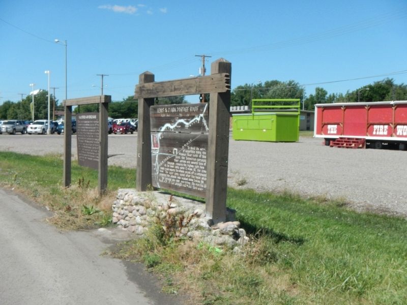
Lewis & Clark Portage Route Marker
301 ► Montana, Cascade County, Great Falls — Lewis & Clark Portage Route — June - July 1805 - July, 1806 —  |
| On 10th Avenue South (U.S. 87) near 50th Street South, on the right when traveling west. | |||
| 302 ► Montana, Cascade County, Great Falls — Lewis and Clark Passed Here — 1805 - 08 — |
| On Ryan Dam Road, in the median. | |||
| 303 ► Montana, Cascade County, Great Falls — Lewis's Grand Experiment — A Disappointment Disappears — |
| Near 40th Avenue South near 13th Street South, on the left when traveling west. | |||
| 304 ► Montana, Cascade County, Great Falls — Liberty Theatre — Great Falls Central Business Historic District — |
| On Central Avenue near 3rd Avenue South, on the right when traveling west. | |||
| 305 ► Montana, Cascade County, Great Falls — Malmstrom Air Force Base — |
| On 10th Avenue South (U.S. 87) near 50th Street South, on the right when traveling east. | |||
| 306 ► Montana, Cascade County, Great Falls — Masonic Temple — Great Falls West Bank Historic District — |
| On Central Avenue at 9th Street North, on the right when traveling west on Central Avenue. | |||
| 307 ► Montana, Cascade County, Great Falls — McCulloh Residence — Great Falls Northside Residential Historic District — |
| On 3rd Avenue North near 3rd Street North, on the left when traveling west. | |||
| 308 ► Montana, Cascade County, Great Falls — 444 — Methodist Parsonage — United Methodist Church Registered Historic Site No. 444 — |
| On 6th Street North near 2nd Avenue North, on the left when traveling south. | |||
| 309 ► Montana, Cascade County, Great Falls — Mobile Villages — |
| On Giant Springs Road near River Drive North. | |||
| 310 ► Montana, Cascade County, Great Falls — Murphy Maclay Hardware Store — Great Falls Central Business Historic District — |
| On Central Avenue near 2nd Street South, on the right when traveling north. | |||
| 311 ► Montana, Cascade County, Great Falls — New Park Hotel — Great Falls Central Business Historic District — |
| On Central Avenue at Park Drive North, on the left when traveling west on Central Avenue. | |||
| 312 ► Montana, Cascade County, Great Falls — Northside Residential Historic District — |
| On 4th Avenue North near Park Drive North, on the right when traveling west. | |||
| 313 ► Montana, Cascade County, Great Falls — Of Special Concern — Lewis and Clark Nature Trail — |
| Near Giant Springs Road near River Drive North, on the left when traveling east. | |||
| 314 ► Montana, Cascade County, Great Falls — One of Many Firsts — Lewis and Clark Nature Trail — |
| Near Giant Springs Road near River Drive North. | |||
| 315 ► Montana, Cascade County, Great Falls — Pure Springs Along the Missouri River — |
| Near Giant Springs Road 1.3 miles north of River Drive North, on the left when traveling north. | |||
| 316 ► Montana, Cascade County, Great Falls — Quigley House — Northside Residential Historic District — |
| On 4th Avenue North near 7th Avenue North, on the right when traveling west. | |||
| 317 ► Montana, Cascade County, Great Falls — Rocks of the Gorge and Falls — |
| Near Ryan Dam Road. | |||
| 318 ► Montana, Cascade County, Great Falls — S.H. Kress and Company — |
| On Central Avenue near 4th Street North, on the right when traveling west. | |||
| 319 ► Montana, Cascade County, Great Falls — Sacajawea Island — |
| On River Drive North near 6th Street North, on the right when traveling west. | |||
| 320 ► Montana, Cascade County, Great Falls — Seaman: Companion to the Corps — |
| Near Giant Springs Road near River Drive North, on the left when traveling east. | |||
| 321 ► Montana, Cascade County, Great Falls — St. Ann's Cathedral — |
| On 3rd Avenue North at 7th Street North on 3rd Avenue North. | |||
| 322 ► Montana, Cascade County, Great Falls — T.E. Collins Mansion — |
| On 2nd Avenue Northwest at 10th Street Northwest, on the right when traveling west on 2nd Avenue Northwest. | |||
| 323 ► Montana, Cascade County, Great Falls — Terrill Apartments — Northside Residential Historic District — |
| On 4th Avenue North at 3rd Street North, on the left when traveling west on 4th Avenue North. | |||
| 324 ► Montana, Cascade County, Great Falls — The Army's Navy — |
| Near Giant Springs Road near River Drive North. | |||
| 325 ► Montana, Cascade County, Great Falls — The Experiment — |
| Near Giant Springs Road near River Drive North, on the left when traveling east. | |||
| 326 ► Montana, Cascade County, Great Falls — The Falls Undergo a Change — |
| Near Ryan Dam Road. | |||
| 327 ► Montana, Cascade County, Great Falls — The Falls: Obstacle or Opportunity — |
| Near Overlook Drive south of 10th Avenue South (Business Interstate 15), on the right when traveling west. | |||
| 328 ► Montana, Cascade County, Great Falls — The Great Falls of the Missouri River — |
| On Morony Dam Road at U.S. 87, on the left when traveling west on Morony Dam Road. | |||
| 329 ► Montana, Cascade County, Great Falls — The Portage Around the Falls — |
| Near Overlook Drive south of 10th Avenue South (Business Interstate 15), on the right when traveling west. | |||
| 330 ► Montana, Cascade County, Great Falls — The Portage Route — Ancient Landscapes Ancient Obstacles — |
| Near 40th Avenue South near 13th Street South, on the left when traveling west. | |||
| 331 ► Montana, Cascade County, Great Falls — The Smallest River Runs Through It — |
| Near Giant Springs Road 1.3 miles north of River Drive North. | |||
| 332 ► Montana, Cascade County, Great Falls — The Ten Who Died In Service — |
| On 1st Avenue North near 14th Street North, on the right when traveling east. | |||
| 333 ► Montana, Cascade County, Great Falls — These Springs Have Witnessed... — |
| Near Giant Springs Road 1.3 miles north of River Drive North, on the left when traveling north. | |||
| 334 ► Montana, Cascade County, Great Falls — Toole Residence — Northside Residential Historic District — |
| On 4th Avenue North, on the left when traveling west. | |||
| 335 ► Montana, Cascade County, Great Falls — Twenty-eight Mile Station — |
| On Morony Dam Road near U.S. 87, on the left when traveling east. | |||
| 336 ► Montana, Cascade County, Great Falls — Union Bethel African Methodist Episcopal Church — |
| On 5th Avenue South near 9th Street South, on the right when traveling east. | |||
| 337 ► Montana, Cascade County, Great Falls — Upper Portage Camp — Preparation, Celebration, Frustration — |
| Near 40th Avenue South near 13th Street South, on the left when traveling west. | |||
| 338 ► Montana, Cascade County, Great Falls — Ursuline Academy — |
| On Central Avenue near 23rd Street North, on the right when traveling east. | |||
| 339 ► Montana, Cascade County, Great Falls — W.K. Floweree House — Northside Residential Historic District — |
| On 4th Avenue North near 9th Street North, on the right when traveling west. | |||
| 340 ► Montana, Cascade County, Great Falls — Welcome to the Upper Portage Overlook — Where the Only Only Constant is Change — |
| Near 40the Avenue South near 13th Street South, on the left when traveling west. | |||
| 341 ► Montana, Cascade County, Great Falls — Where Does the Water Come From? — |
| Near Giant Springs Road 1.3 miles north of River Drive North. | |||
| 342 ► Montana, Cascade County, Great Falls — White Bear Islands — Ever-changing Riverbanks — |
| Near 40th Avenue South near 13th Street South, on the left when traveling west. | |||
| 343 ► Montana, Cascade County, Great Falls — William & Isabel Shea House — Great Falls West Bank Historic District — |
| On 3rd Street Northwest near 3rd Avenue Northwest, on the right when traveling west. | |||
| 344 ► Montana, Cascade County, Great Falls, Salem — A Modern, Well-Armed Unit — |
| On Salem Road near Highwood Road, on the left when traveling north. | |||
| 345 ► Montana, Cascade County, Great Falls, Salem — Avenue to the Plains — |
| On Salem Roat near Highwood Road, on the left when traveling north. | |||
| 346 ► Montana, Cascade County, Great Falls, Salem — Deciding the Best Route — |
| On Salem Road near Highwood Road, on the left when traveling north. | |||
| 347 ► Montana, Cascade County, Great Falls, Salem — Keen Observers of Nature — |
| On Salem Road near Highwood Road, on the left when traveling north. | |||
| 348 ► Montana, Cascade County, Great Falls, Salem — Portaging the Great Falls — |
| On Salem Road near Highwood Road, on the left when traveling north. | |||
| 349 ► Montana, Cascade County, Great Falls, Salem — The Lewis and Clark Expedition — |
| On Salem Road near Highwood Road, on the left when traveling north. | |||
| 350 ► Montana, Cascade County, Great Falls, Salem — The Staging Area — |
| On Salem Road near Highwood Road, on the left when traveling north. | |||
| 351 ► Montana, Cascade County, Monarch — Steamboats, Bull Whackers, and Fish Trains — |
| On U.S. 89, on the left when traveling north. | |||
| 352 ► Montana, Cascade County, Monarch — The Ace in the Hole — |
| On U.S. 89 1.2 miles south of Missoula Avenue / Hughesville Road, on the right when traveling south. | |||
| 353 ► Montana, Cascade County, Neihart — Neihart Mining District's Heyday — |
| On Main Street (U.S. 89) at East Granite Street, on the right when traveling south on Main Street. | |||
| 354 ► Montana, Cascade County, Neihart — The Mining Legacy — |
| On Main Street (U.S. 89) at East Granite Street, on the right when traveling south on Main Street. | |||
| 355 ► Montana, Cascade County, Sand Coulee — Coal Mines and Railroads — |
| On Johnson Road at Stockett Road, on the left when traveling west on Johnson Road. | |||
| 356 ► Montana, Cascade County, Simms — Bird Tail Rock — |
| On State Highway 200 at milepost 114 near U.S. 287, on the right when traveling west. | |||
| 357 ► Montana, Cascade County, Sun River — Sun River Crossing — |
| On State Highway 200 at Choteau Street, on the right when traveling west on State Highway 200. | |||
| 358 ► Montana, Cascade County, Vaughn — Robert Vaughn Homestead/The Captain Couch Ranch — |
| Near 4th Street near 1st Avenue. | |||
| 359 ► Montana, Cascade County, Vaughn — The Sun River Leaving — |
| On U.S. 89 at milepost 2 at Medicine River Road, on the left when traveling west on U.S. 89. | |||
| 360 ► Montana, Chouteau County, Big Sandy — An Island on the Plains — The Bears Paw Mountains — |
| On Broadway (U.S. 87) at Johannas Avenue, on the left when traveling north on Broadway. | |||
| 361 ► Montana, Chouteau County, Big Sandy — Big Sandy — |
| On Broadway (U.S. 87) at McNamara Avenue, on the left when traveling north on Broadway. | |||
| 362 ► Montana, Chouteau County, Big Sandy — Camp Cooke — First Military Post In Montana — |
| On Judith Landing Road (State Highway 236), on the left when traveling south. | |||
| 363 ► Montana, Chouteau County, Big Sandy — Cow Island Trail — |
| On Broadway (U.S. 87) at McNamara Avenue, on the left when traveling north on Broadway. | |||
| 364 ► Montana, Chouteau County, Big Sandy — Fort Chardon — |
| On Judith Landing Road (State Highway 236), on the right when traveling south. | |||
| 365 ► Montana, Chouteau County, Big Sandy — Fort Walsh Trail — |
| On Broadway (U.S. 87) at McNamara Avenue, on the left when traveling north on Broadway. | |||
| 366 ► Montana, Chouteau County, Big Sandy — Judith Landing — |
| On Broadway (U.S. 87) at McNamara Avenue, on the left when traveling north on Broadway. | |||
| 367 ► Montana, Chouteau County, Big Sandy — Lewis and Clark National Historic Trail — 1804 • Commemorating 200 Years • 2004 — Lewis & Clark Campsite May 28, 1805 — |
| Near Judith Landing Road (State Highway 236), on the left when traveling south. | |||
| 368 ► Montana, Chouteau County, Big Sandy — Naturally Sustained Productivity — Past, Present & Future — |
| Near Judith Landing Road (State Highway 236). | |||
| 369 ► Montana, Chouteau County, Big Sandy — Tale of Two Treaties — Cultures Clash, Relationships Change — |
| Near Judith Landing Road (State Highway 236). | |||
| 370 ► Montana, Chouteau County, Big Sandy — The Anglos Are Coming — Immigration Brings Change — |
| Near Judith Landing Road (State Highway 236), on the left when traveling south. | |||
| 371 ► Montana, Chouteau County, Big Sandy — The Judith River Formation — |
| On Judith Landing Road (State Highway 236), on the right when traveling south. | |||
| 372 ► Montana, Chouteau County, Big Sandy — Welcome to the Mountain Ranges — Crossroads for Centuries — |
| Near Judith Landing Road (State Highway 236), on the right when traveling south. | |||
| 373 ► Montana, Chouteau County, Carter — Exploring to the South |
| On U.S. 87 at Buck Bridge Road, on the right when traveling west on U.S. 87. Reported damaged. | |||
| 374 ► Montana, Chouteau County, Carter — Great Falls of the Missouri |
| On U.S. Highway 87 at Carter Road (U.S. 87), on the right when traveling west on U.S. Highway 87. Reported damaged. | |||
| 375 ► Montana, Chouteau County, Fort Benton — "George Montgomery: Rider of the Purple Sage" — by Actor/Artist George Montgomery (1916-2000) and Artist Gary Schildt (1938- ) — |
| On Front Street at 15th Street, on the right when traveling east on Front Street. | |||
| 376 ► Montana, Chouteau County, Fort Benton — Bank of Northern Montana — |
| On Front Street near 13th Street, on the left when traveling north. | |||
| 377 ► Montana, Chouteau County, Fort Benton — Bloodiest Block in the West — |
| On Front Street near 15th Street, on the right when traveling north. | |||
| 378 ► Montana, Chouteau County, Fort Benton — Buffalo Robe Fur Press — |
| On Front Street near 18, on the left when traveling north. | |||
| 379 ► Montana, Chouteau County, Fort Benton — Choteau House — |
| On Front Street near 17th Street, on the left when traveling north. | |||
| 380 ► Montana, Chouteau County, Fort Benton — Chouteau County — |
| On U.S. 87 near County Road 386, on the right when traveling north. | |||
| 381 ► Montana, Chouteau County, Fort Benton — Chouteau County Courthouse — |
| On Franklin Street near 13th Street. | |||
| 382 ► Montana, Chouteau County, Fort Benton — Chouteau County Courthouse — |
| On Franklin Street near 13th Street, on the left when traveling east. | |||
| 383 ► Montana, Chouteau County, Fort Benton — Church of the Immaculate Conception — |
| On Chouteau Street at 16th Street, on the left when traveling east on Chouteau Street. | |||
| 384 ► Montana, Chouteau County, Fort Benton — Church of the Immaculate Conception — |
| On Chouteau Street near 16th Street, on the left when traveling east. | |||
| 385 ► Montana, Chouteau County, Fort Benton — Coulson's Steamboat Offices — Coulson Steamboat Lines Largest Company of the Upper River — |
| On River Street near 11th Street, on the right when traveling north. | |||
| 386 ► Montana, Chouteau County, Fort Benton — Cow Island Incident — |
| Near 8th Street near River Street. | |||
| 387 ► Montana, Chouteau County, Fort Benton — Culbertson House — |
| On Front Street near 15th Street, on the right when traveling north. | |||
| 388 ► Montana, Chouteau County, Fort Benton — Cummings Building — Fort Benton Historic District — |
| On Front Street near 15th Street, on the left when traveling north. | |||
| 389 ► Montana, Chouteau County, Fort Benton — Davidson and Moffitt Harness Shop — |
| On Front Street near 13th Street, on the left. | |||
| 390 ► Montana, Chouteau County, Fort Benton — Drowning of the Governor — |
| On Front Street near 17th Street, on the right when traveling north. | |||
| 391 ► Montana, Chouteau County, Fort Benton — Fire! Fire! — |
| On Front Street near 15th Street, on the left when traveling north. | |||
| 392 ► Montana, Chouteau County, Fort Benton — First Fire Engine House — |
| On Front Street near 15th Street, on the right when traveling east. | |||
| 393 ► Montana, Chouteau County, Fort Benton — Fort Benton — |
| On U.S. 87 near County Road 386, on the right when traveling north. | |||
| 394 ► Montana, Chouteau County, Fort Benton — Fort Benton — |
| On U.S. 87 near State Highway 233/80, on the right when traveling north. | |||
| 395 ► Montana, Chouteau County, Fort Benton — Fort Benton – Fort MacLeod Trail — |
| On Front Street at 18th Street, on the right on Front Street. | |||
| 396 ► Montana, Chouteau County, Fort Benton — Fort Benton and the Indian Wars — |
| On Front Street near 18th Street, on the left when traveling north. | |||
| 397 ► Montana, Chouteau County, Fort Benton — Fort Benton and the Mullan Road — |
| On U.S. 87 near State Road 233&80, on the right when traveling north. | |||
| 398 ► Montana, Chouteau County, Fort Benton — Fort Benton Bridge — |
| On Front Street at 15th Street, on the right when traveling east on Front Street. | |||
| 399 ► Montana, Chouteau County, Fort Benton — Fort Benton Engine House — |
| On Front Street near 15th Street, on the right when traveling east. | |||
| 400 ► Montana, Chouteau County, Fort Benton — Fort Benton Historic District — |
| On Front Street near 18th Street, on the left when traveling north. | |||
2388 entries matched your criteria. Entries 301 through 400 are listed above. ⊲ Previous 100 — Next 100 ⊳