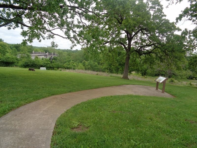
From the late 1830s and into the 1860s, thousands of traders, emigrants, and gold prospectors passed this way. After crossing the Big Blue River, covered wagons struggled up this hill due to the mud left behind from torrential spring downpours. Over . . . — — Map (db m199357) HM
Established at Wilmington in 1862, Drum Barracks became the United States military headquarters for Southern California, Arizona, and New Mexico. A garrison and base for supplies, it was a terminus for camel pack trains operated by the army until . . . — — Map (db m85152) HM
Balboa Park
Has Been Designated a
National Historic Landmark
This Site Possesses National Significance
in Commemorating the History of the
United States of America — — Map (db m280782) HM
It was over this building that the American flag was raised by Commodore John Drake Sloat, July 7, 1846, signalizing the passing of California from Mexican rule.
Restored through the efforts of the Native Sons of the Golden West with the . . . — — Map (db m95375) HM
This structure, erected in 1852-53, was occupied during the 1850’s by the B.F. Hastings Bank, Wells Fargo and Co., various state officials, Sacramento Valley Railroad, and the Alta Telegraph Co. during April 1860 - May 1861. The Alta Telegraph . . . — — Map (db m11388) HM
Trading post, emigrant stop, and mining camp of the 1850’s. This became one of the remount stations of the Central Overland Pony Express. Here at the Nevada House on April 13, 1860, pony rider William (Sam) Hamilton changed horses while carrying . . . — — Map (db m11571) HM
Born in Cumberland County, Pennsylvania, January 8, 1806, John Bigler was the eldest of what was said to be “a numerous family of children.” As a young man, he was apprenticed to the printing trade and became one of the youngest editors of the . . . — — Map (db m13069) HM
On Thursday, June 30, 1864 at about 10 PM two west-bound stage coaches of the Pioneer Stage Company were held up and the passengers robbed at gun-point at a location approximately 15 miles east of Placerville.
The bandits demanded and obtained . . . — — Map (db m13150) HM
Founded in 1776 by Padre Junipero Serra. The seventeenth in the chain of twenty-one missions established in Alta California to Christianize and civilize the Indians. Stone church destroyed in 1812 earthquake. Expropriated during Mexican rule. . . . — — Map (db m50226) HM
On this block, then on Yerba Buena's waterfront, stood the California headquarters of the Hudson's Bay Company. In 1841, their chief trader, William G. Rae, purchased the property and started operations. This venture caused wide speculation about . . . — — Map (db m143484) HM
Colonel Thomas Baker, Civil Engineer – Lawyer — Farmer – Soldier, 1810 – 1872.
In 1863 Colonel Baker came to this location. A friend to all travelers, his settlement became known at “Baker’s Field.” This civic center is his dream come true. . . . — — Map (db m134436) HM
Whichever direction your travels take you, you're going to have a similar experience to what the California-bound emigrants had. You're going to see the same country, except for the towns and the ranch meadows. The big difference, though, is that . . . — — Map (db m67507) HM
Keystone Lodge No. 161, F. & A. M, instituted in Copperopolis, Dec. 19, 1862, at the height of the copper mining boom. Moved 1881, to Milton, the terminal of the Stockton & Copperopolis Railroad, which, because of the collapse of copper mining, . . . — — Map (db m19758) HM
The Board of Trustees of the University of Southern California met for the first time on September 3, 1880, culminating years of efforts by leaders of the Methodist Episcopal Conference of Southern California. The Board accepted the gift of this . . . — — Map (db m129945) HM
Los Angeles was a rough and tumble frontier town in the 1870s, when a group of public-spirited citizens first dreamed of establishing a university
in the region. Led by Judge Robert Maclay Widney and members of the region’s
Methodist Episcopal . . . — — Map (db m130080) HM
The California Nursery property includes noteworthy landscape features, such as the many mature trees, in addition to historically and architecturally significant buildings like the garden store. Unfortunately, due to years of use and multiple . . . — — Map (db m208714) HM
These school grounds were the center of Villa de Branciforte founded in 1797 by Governor Diego de Borica of California on orders from Spain through Viceroy Branciforte in Mexico. The settlement existed as political entity until American occupancy of . . . — — Map (db m2347) HM
Across the valley you can see the canyon of the South Fork River, a major tributary to the Humboldt River. This portal is also the western end of the infamous Hastings Cutoff, which rejoined the main California Trail not far from the California . . . — — Map (db m67506) HM
"We arrived at the foot of the summit ridge, the top of which lay one mile distant ... Up we ascended, slowly but surely, by the toilsome climbing of the teams and by lifting of the members. ... at the wheels." - William Swain, Oct 11, 1849 — — Map (db m147406) HM
At this point in August 1849, a group of Odd Fellows nearing their goal, the California gold mines, paused in their struggle up these granite walls, to paint on this and adjacent boulders their names and the three links of the Great Order they so . . . — — Map (db m100569) HM
This boundary monument, a cast iron column erected in 1873, marks the southern terminus of the California – Nevada State Boundary established by A. W. Von Schmidt's 1872 – 73 survey. Von Schmidt's line, the first officially recognized oblique state . . . — — Map (db m29467) HM
In April, 1852, four brothers, Wesley, Samuel, James and Steven Hill, together with their families, 62 persons in all, left Paris, Monroe County, Missouri, for California.
Their were two deaths along the Platte River and here on the Hamsfork . . . — — Map (db m179619) HM
This building is a great example of the “Googie style” coffee shops and drive-in restaurants that once dotted the Southern California landscape. Googie Architecture called for buildings to read as signs to attract customers. Built in . . . — — Map (db m149050) HM
Southern California's first newspaper, The Los Angeles Star, was founded in this block on May 17, 1851 and for many years exerted a major influence upon this part of the state. Suspended temporarily from 1864 to 1868, it continued later as an . . . — — Map (db m125413) HM
Our Press House, the first stone winery building in America, was built in 1862 from volcanic stone cut out of the solid wall of the Mayacamas Mountains. Wine was made in this building the grapes were brought to the front door by horse-drawn . . . — — Map (db m315875) HM
You’re now standing at the western edge of the Great Basin. If you were an emigrant headed to California, you would have entered the Great Basin 450 miles back along the trail in southern Idaho, or 500 miles back in Salt Lake City if you had . . . — — Map (db m98142) HM
For many years the California Nursery was one of the state’s leading nurseries. Established in 1884 by John Rock, the nursery originally covered 463 acres. Through constant experimentation, including the introduction of new fruits, Rock made a . . . — — Map (db m208908) HM
This was the site of a change station of the Pioneer Stage Company in the 1850’s and 1860’s. During 1860-1861, the Central Overland Pony Express maintained here the first pony remount station east of Sportsman’s Hall. — — Map (db m57977) HM
This campus is named in honor of Mary D. Nichols for her dedication and service to CARB, Californians, and the world.
Mary D. Nichols devoted her life to protecting public health, reducing air pollution, and fighting against climate change. . . . — — Map (db m304026) HM
This marker commemorates the iron column erected in 1876 at the southernmost tip of the boundary survey line run by Allexey W. Von Schmidt, U. S. astronomer and surveyor. The line dividing Nevada and California was based on preliminary geodetic work . . . — — Map (db m29468) HM
Camp Young, named after Lt. Gen. S.B.M. Young, the 1st Army Chief of Staff, was established at this site in the Spring of 1942. It was one of twelve such camps built in the southwestern deserts to harden and train United States Troops for service to . . . — — Map (db m78581) HM
(front plaque)
South Road - Forks Of The Yreka Trail
“All in need of provisions were supplied by a government
agent at this camp. Near this point the road forks-one
leading to Jacksonville, in Oregon, and the other to
Yreka, . . . — — Map (db m151605) HM
... Decent [sic] to the lake ... Night brought us to the end of the lake ... We laid up on a mountain brook where the roads forked ... One branch going to Oregon, the other to California."
Alonzo Delano, August 28, 1849 — — Map (db m147424) HM
Carolands is California Historical Landmark No. 886, and listed on the
National Register of Historic Places.
The 98-room Château completed in 1916 is situated on over five and one
half acres
of land in Hillsborough.
Harriett Pullman . . . — — Map (db m253109) HM
“There is an immense abyss on either side, we could look down thousands of feet. The side of the ridge seeming almost perpendicular” —Charles Glass Gray, Sep 29, 1849
Guidebook available
Trails West Inc., P.O. Box 12045, Reno, NV 89510 . . . — — Map (db m87734) HM
The California Emigrant Trail extended approximately 2,000 miles from the Missouri River to California. Today you are standing on a segment of the trail that followed the Humboldt River for about 280 miles across northern Nevada. It was the only . . . — — Map (db m67508) HM
Camp Laguna operated from April 1942 to April 1944. It was one of twelve such camps built in the southwestern deserts to train United States troops during World War II.
The Desert Training Center, a simulated theater of operations, included . . . — — Map (db m29061) HM
USC’s international roots are broad and deep, reaching back to its founding in 1880. Two
of the three original donors of land to the university were foreign-born, and almost from the start, its stewards were casting their eyes overseas.
. . . — — Map (db m138118) HM
Visited the USC campus in 1982, 1985 and 1989.
“The end of all education should surely be service to others” • “El próposito de toda educacíon verdaderamente deberia servir a otros” — — Map (db m193883) HM
In the spring of 1852, over one hundred Mormon men donated a full thousand man-days of arduous labor, to construct a road up Waterman Canyon, past this spot, and into the prime timber, where some of their enterprising bethren established six . . . — — Map (db m154361) HM
side 1
The reports of this expedition directed the migration of the western settlement toward the Oregon Country which hitherto had been merely a rendezvous for trappers.
On December 16th 1843 the expedition, while enroute . . . — — Map (db m113809) HM
As an institution that has always been
inextricably linked to the region it calls home, the
University of Southern California has long been
a source of formal and informal community service. During its early years, much of that service took
the . . . — — Map (db m130194) HM
Ever since USC was founded, its students have sought ways to have their say. The earliest student publication, The College Review, dates back to 1884, only four years after USC was established. A slim monthly magazine, it lasted only the . . . — — Map (db m129532) HM
If USC’s earliest students could travel through time
to today’s university, they would probably find the
changes inside the classrooms even more astounding than the transformation of the campus. Confined to a rigid academic program that included . . . — — Map (db m128480) HM
General Andrés Pico, commander of Mexican forces that
were outnumbered and militarily overpowered, agreed to
put down arms. He signed the truce with Lt. Col. John C.
Frémont, a commander of American land forces. The
Articles of Capitulation . . . — — Map (db m250249) HM
His given name is the Trojan Shrine, but he is best-known by his nickname: Tommy Trojan. Probably the most popular and
recognizable member of the Trojan Family, he is a physical and symbolic rallying point for the entire university.
Tommy . . . — — Map (db m129746) HM
What Were the Water Wars?
The California Water Wars were a series of political conflicts that took place in the
late 19th and early 20th centuries in Owens Valley. These conflicts centered around
Los Angeles' expanding population . . . — — Map (db m285492) HM
Camp Bouse was established in Butler Valley 30 miles behind this monument in Sept. of 1943. It was one of twelve such camps built in the southwestern deserts to harden and train United States troops for service on the battlefields of World War II. . . . — — Map (db m78566) HM
Designed in 1889 by Walter J. Mathews, this solid masonry Romanesque church departed radically from California's traditional Gothic wood frame construction. Noted for its world famous stained glass windows produced by Goodhue of Boston, and for . . . — — Map (db m100561) HM
On the marsh near this point borax was discovered in 1881 by Aaron Winters who later sold his holdings to W. T. Coleman of San Francisco. In 1882 Coleman built the Harmony Borax Works and commissioned his superintendent J. W. S. Perry to design . . . — — Map (db m158971) HM
This restaurant was built in 1949 by locals Scott MacDonald and Ward Albert and is the oldest remaining Bob's Family Restaurant in America. It was designed by respected architect Wayne McAllister incorporating the 1940s Transitional design of . . . — — Map (db m144320) HM
Founded June 12, 1798 by Father Lasuen, then president of the California missions, and administered by Father Peyri. Notable for its impressive architecture — a composite of Spanish, Moorish, and Mexican. — — Map (db m401) HM
Ruel C. Gridley
Born Jan. 23, 1829
Died Nov. 24, 1870
Erected by Rawlins Post No. 23 Grand Army of the Republic and the Citizens of Stockton Sept. 19, 1887 in gratitude for services rendered Union Soldiers during the War of the . . . — — Map (db m15974) WM
A group of conservationists led by Andrew P. Hill camped at the base of Slippery Rock on May 15, 1900 and formed the Sempervirens Club to preserve the redwoods of Big Basin. Their efforts resulted in deeding 3,500 acres of primeval forest to the . . . — — Map (db m2350) HM
California Trail ruts and swales wind across Northern Nevada some touched only by the forces of nature since they were made by emigrant wagon trains on their way west in the mid 1800s.
Many of these irreplaceable historic trail segments lie on . . . — — Map (db m67505) HM
In August 1994, USC opened the doors to a revolutionary new facility destined to help redefine the nature and function of the modern university library. Conceived as a gateway to knowledge, the Thomas and Dorothy Leavey Library was designed . . . — — Map (db m130207) HM
The Camp Young Airstrip was established at this site in March 1942 by order of General George S. Patton. It was used to provide Camp Young with supplies and other essential material. It supported air transportation for the command staff of the . . . — — Map (db m78550) HM
The University of Southern California is
rich with story. Its buildings, its faculty, its eminent
benefactors and alumni — all are the subject of urban
legends that are passed along from student to student,
year after year.
You may have . . . — — Map (db m128413) HM
The Truckee River you can see on the other side of the Interstate highway provided the first drink of life-saving water California-bound emigrants had after
crossing the Forty-Mile Desert. Emigrants and animals staggered to the Truckee,
half dead . . . — — Map (db m143783) HM
Resting place of California Pioneers. The cemetery was established in 1850. Many of the victims of the Cholera Epidemic of that year are buried here. Included among the graves of illustrious Californians are those of Governors John Bigler, Newton . . . — — Map (db m11349) HM
Piece by piece through many years he acquired these acres, the site of the first Spanish settlement in California. He erected this building. He planted the trees and shrubs and nurtured their growth with tireless devotion, and when the barren . . . — — Map (db m84997) HM
The historic buildings on the property – the Vallejo Adobe, President’s House, Office Building and Packing Shed - make up the historic core of the site, and were the center of the nursery operation; the place where orders were placed, materials . . . — — Map (db m208904) HM
Located 3.49 miles southwest of this location on Sutter Creek Volcano Road several hundred feet above the river. This quarry produced high quality marble used in the construction of Stanford University as well as many of San Francisco’s civic . . . — — Map (db m27809) HM
Powered by water piped from a spring high in the Panamint Range, the Skidoo Mill extracted gold from ore and was one of Death Valley's most profitable operations. Skidoo had the only water-powered milling plant in Death Valley.
The Skidoo . . . — — Map (db m159375) HM
A sister ship of the X-1,
first aircraft to exceed the speed of sound.
This ship is the second of three
X-1 aircraft and was flight tested in 1946.
After extensive modification
of wings, canopy,
and fuel system, it was
redesignated . . . — — Map (db m294335) HM
Historic U.S. Army Balloon School at Ross Field was built on 184 acres donated
by Anita Baldwin on land she inherited from her father, Elias Jackson "Lucky"
Baldwin. It was named in honor of Lt. Cleo J. Ross who was the only soldier in . . . — — Map (db m268014) HM
Montrose merchants Bill Bailey and Vito Cannella dreamed of establishing a
"It all started in Montrose" National Week of Recognition to honor the American flag. Supported by the Rotary Club, the movement gained national appeal, and, in 1966, . . . — — Map (db m218223) HM
In June
15, 1885, the
eight men and women who
made up USC’s first two graduating classes gathered in
a two-story wooden structure called the University
Building to establish an alumni association. The group
adopted a temporary constitution and . . . — — Map (db m128326) HM
For many decades, the Trojan Spirit has been rooted in USC’s rich campus life. In each era, however, the environment that has fostered
that spirit has taken on a radically different character.
The university’s first students filled their . . . — — Map (db m130079) HM
The curtain first rose on USC’s distinguished contributions to cinema on February 6, 1929, when Douglas Fairbanks, Sr., ascended the stage in Bovard Auditorium and delivered the opening lecture for the nation’s first university course in film. The . . . — — Map (db m130658) HM
As long as USC has been in existence, there has been music in the air. Musical instruction was listed in the university’s first catalog in 1880, and the first USC band was started in 1881. A student served as band director, and although the group . . . — — Map (db m130533) HM
This library garden courtyard and fountain are dedicated to the memory of Carolyn Craig Franklin (1919–1993).
They were donated by Dr. Carl Franklin, Vice President Emeritus and Professor of Law at USC, and their four children: Craig, . . . — — Map (db m130210) HM
A singular example of functional public art by architects Charles and Henry Greene, this 1906 span was one of the country's first reinforced concrete bridges.
Recognized by Hampton Hotels Save-A-Landmark program as a site worth seeing. . . . — — Map (db m206059) HM
This structure replaces Bridge No. 27C0071, a contributing element to the Ross Historic Bridges District, eligible for inclusion in the National Register of Historic Places. The original bridge was completed on January 13, 1910 as part of a $12,500 . . . — — Map (db m63939) HM
"Traveled ... to Goose Lake. The descent ... is sidling and dangers. While we were nooning here 2 wagons of other trains were upset and mashed to atoms" - Simon Doyle, Sep 19 1849
Guidebook available
Trails West Inc., P.O. Box 12045, . . . — — Map (db m87849) HM
"Four miles to a beautiful little stream of pure cold water coming from the mountains to our left and emptying into Goose Lake ... Camped there ...Found plenty of ripe plums on the neighboring mountain sides." - Andrew Murphy, Sep 23, 1849 — — Map (db m147338) HM
"We leave the old Lawson Road for the new road to Shasta Valley (Yreka) to day It seems as if the road is one stone pile We have to goe a foot in such places for fear of getting our heads nocked off" Sophroni Helen Stone, Sep 13 1852 . . . — — Map (db m87850) HM
"Passing over the summit, which is a very narrow ridge, a broad,deep valley ... presented itself to our view, far below us ... We immediately descended the mountain, which on this side, is fearfully steep" - Amos Batchelder, Sep 25, 1849 — — Map (db m147407) HM
"Trees hundreds of feet high and 4-5-6 feet in diameter ... We can drive anywhere among the trees. Only the ground is covered with cobble stones" - E. W. Brooks, Sep 1, 1849 — — Map (db m147888) HM
"Camped at a magnificent spring of fresh cold water,
which we called Goff's Spring, in honor of the
newly elected lieutenant of the company."
-Levi Scott, South Road Exploring Party, 1846 — — Map (db m151903) HM
This beautiful Victorian was built by merchant J. J. Conner in 1897, and sold at the turn of the century to John Ernst and Olive Hamilton Steinbeck. On February 27,1902 John Steinbeck was born in what is now the reception room. He remained a . . . — — Map (db m25107) HM
This plaque commemorates the origins of the world’s first downhill snowshoe racing events which began in Plumas and Sierra Counties in the 1850’s. The Alturas Snowshoe Club was the world’s first organized ski club, having originated between . . . — — Map (db m56368) HM
Established in 1937, this family-owned restaurant has brought history and tradition to San Bernardino's west side for more than 60 years.
Recognized by Hampton Hotels Save-A-Landmark program as a site worth seeing — — Map (db m204523) HM
This Golden Gate Ferry Terminal is dedicated to Stephan C. Leonoudakis in recognition of his pivotal role in initiating the legislation that returned passenger ferry service to San Francisco Bay while a member of the board of directors of the Golden . . . — — Map (db m240255) HM
Lombard Street is known as the "Crookedest Street" in the World. You will climb 253 steps on the left side and 249 steps on the right side of the street. There are 8 switchbacks and 12 flowerbeds with over 2000 blue and purple hydrangeas. The . . . — — Map (db m132206) HM
Original Marker:
The early land surrounding Capitola first saw sea side lagoons and meadows of colorful wild flowers, eucalyptus trees and butterflies with Ohlone Indians fishing in Soquel Creek to glowing barely fields and a potato . . . — — Map (db m147263) HM
Beginning in 1854, John Bope's Ranch and Inn was a major stopping place on the Ridge Road. "3-1/2 miles to Tavern in Plum Valley, here we campt,...gold diggings all around here." - Loring S. Comstock, Aug 28, 1855 — — Map (db m99648) HM
"On again (along ridge), 2 miles to Gallaway's Rancho, then 4 miles to Forest City, to right of road and Orleans Flat (and Alleghany) to left of road. - Loring Samuel Comstock, Aug 28, 1855. — — Map (db m99646) HM
"Went to Downieville, called one of the smartest mining towns in the country, containing some 4, or 5,000 inhabitants, buildings in the business part of town are very well built a great deal of business is done" - Winslow Blake, Aug 25, 1852 — — Map (db m99645) HM
“Crossed on the natural bridge ... Composed of
solid rock ... Went 15 miles had some stony
road and came to Clamouth Lake & campt”
-Phoebe Hogeboom Terwilliger, Oct 8, 1854 — — Map (db m113111)
“Morn. Fine. Cook still sick no breakfast or dinner
for today. Get away in good time road runs
over the bluff quite rocky to lake”
-John Pratt Welsh, Aug 26, 1853 — — Map (db m113116)
“Here road leaves [Klamath] Lake and follows up the
side of a steep hill 1/2 mile but is not hard to climb”
-William Cochran Stoddard, Sep 16, 1852 — — Map (db m113109)
8928 entries matched your criteria. Entries 401 through 500 are listed above. ⊲ Previous 100 — Next 100 ⊳
Thin black lines indicate changes in relevance. Between each pair of lines entries are ordered geographically but all have the same relevance.
* Inflectional forms of words are their plurals, singulars, and possessives as well as gramatical tenses and similar variations.