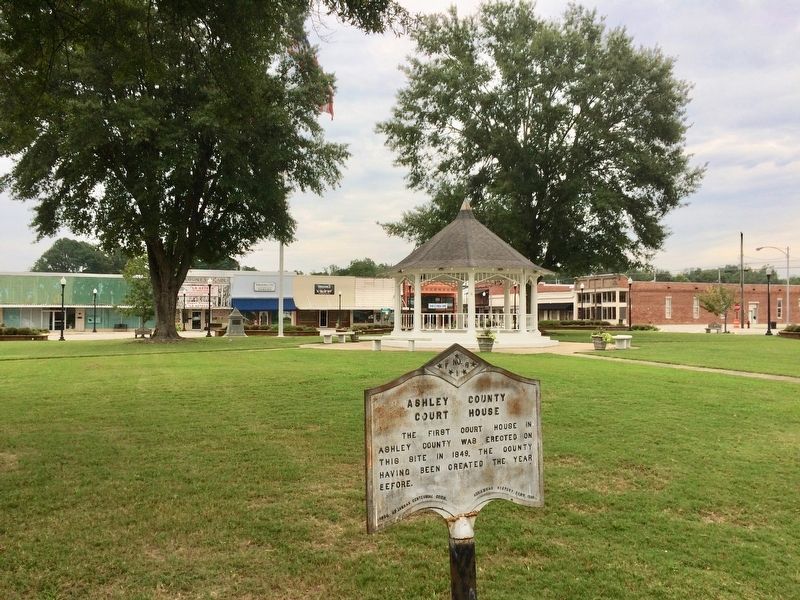
Ashley County in the Civil War
Thirteen companies were raised and organized in Ashley County for Confederate service during the Civil War: Co. F, 2nd Arkansas Cavalry; Cos. A, B, K and L, 3rd Arkansas Infantry; Co. F, 8th Arkansas Infantry . . . — — Map (db m107691) HM
World War I
Dedicated
to the sons of
Ashley County
Arkansas
Who Made The Supreme Sacrifice
For Humanities Defense
in the World War
1914 — 1918
_______
{List of the honored . . . — — Map (db m108565) WM
The first temporary court house in Bradley County was erected on this site in 1842, two years after the creation of the county, and continued in use until 1858, when a court house built of brick was erected. — — Map (db m121054) HM
Though sparsely populated, Calhoun County raised five companies of soldiers for service in the Confederate army: Company B, Sixth Arkansas Infantry, Companies E and G, Second Arkansas Cavalry, and Companies A and K, Fourth Arkansas Infantry . . . — — Map (db m200670) HM
This site
When the Clark County seat was
moved from Greenville to Arkadelphia
in 1842, until completion of a permanent
structure in 1844, a log building
which stood here served as court
house.
In 1860 a handsome two-story
brick . . . — — Map (db m234844) HM
Clark County was created by the legislature of Missouri Territory on Dec. 15, 1818 and named for the territorial governor, William Clark. It comprised, roughly, all of the present Clark, Hot Spring, Garland, Pike and Dallas counties. Early county . . . — — Map (db m121379) HM
East face
When the last trumpet
is sounded, may each one
answer the roll call
of the heavenly army.
South face
"The principles for
which they fought live
eternally." erected by
the Harris Flanagin Chapter, . . . — — Map (db m121961) WM
Indians in primeval times, DeSoto in 1541, and pioneers in the 1800s and Confederates during the Civil War obtained salt from the creek and old well here. John Hemphill in 1812 opened one of the first manufactories in Arkansas, a salt refinery. — — Map (db m200778) HM
John S.T. Callaway owned forty
acres, including this site, after
receiving a United States land patent
for it in 1836. Then, in 1842, Benjamin S.
Duncan purchased the land at a
sheriff's auction and platted
Duncan's Addition in 1858.
Today, . . . — — Map (db m234829) HM
At this site the first public or “free” school in Arkadelphia was opened in 1870. Early teachers included R.D. Hearn, Elizabeth Webb, Harriet Crow, John Gordon & Dutie Casey. — — Map (db m234848) HM
Here, during Reconstruction years, were the offices of the Freedmen's Bureau. The building was, at different times, used as a harness shop, grocery store, barber shop and saloon, and for many years was a residence. — — Map (db m234853) HM
As settlers began arriving in this area around 1812, the need for religious services became a top priority among the residents. Brush arbor meetings were held every summer. Soon a log structure was built along the creek that marked the beginning of . . . — — Map (db m184576) HM
PHS
Dedicated
This landmark is erected on the original site of Peake School built on land donated by Mr. Ed Peake in 1928, and is dedicated to the faculties and staffs who encouraged and prepared us to compete on an equal level with the best . . . — — Map (db m234859) HM
Used in the production of salt
from the water of the Saline
Bayou one mile east of Arkadelphia
by John Hemphill pioneer salt
maker of Arkansas territory, circa
1814. Given to the Henderson
State Teachers College museum
by the family of Capt. . . . — — Map (db m201033) HM
Near this site on April 1, 1864 Confederate General Joseph O. Shelby caught up with and attacked the rear guard of Union General Frederick Steeles army. Union General Samuel A. Rice, in charge of the supply, pontoon and brigade trains, rushed to . . . — — Map (db m121180) HM
Near this site was the original public school building for black students in the Arkadelphia public school system. Noted principals: Ms. P.A. Holmes 1872-1873, John Ed Peake 1877-1881, 1897-1898, 1904-1906 & Sam Hildreth 1907-1914, 1916-1939. The . . . — — Map (db m234864) HM
East & South of this point was
The Blakely Graveyard
in this first public burying
place of the community, the
early settlers were interred.
It remained in use until 1869
when it was closed to future
burials by the city council. . . . — — Map (db m200782) HM
Dr. W.D. and Ida Feaster were notable African American civic leaders and educators in Arkadelphia in the 20th century. Originally from South Carolina, they were educated at colleges and universities on the East Coast. In 1906 they moved to . . . — — Map (db m253950) HM
Confederate Manufacturing
Arkadelphia was a manufacturing center for Confederate Arkansas early in the Civil War. Gen. Thomas Hindman established a powder works and an arsenal in 1862, producing guns, cannon, bullets, shells, wagons and . . . — — Map (db m96557) HM
In the Hotel Hall which formerly stood on the site of this building was organized on January 21st 1892 the Concatenated Order of the Hoo-Hoo a society composed of lumbermen and those in allied industries and having for its object the promotion . . . — — Map (db m234904) HM
Skirmishes at Okolona
Gen. Frederick Steele’s Union army left Little Rock on March 23, 1864, for a planned invasion of Texas, but it was April 2 before they faced organized Confederate attacks. Gen. Joseph Shelby attacked the Union wagon train . . . — — Map (db m200735) HM
The man known to the world as Johnny Cash was
born near here, in the home of his grandparents,
John Lewis and Rosanna Hurst Rivers, on
February 26, 1932. The family doctor was not
able to arrive in time for his birth, so a midwife,
Mrs. Grace . . . — — Map (db m170307) HM
Johnny Cash moved with his parents and siblings
from Kingsland to Dyess, Arkansas in 1935 when he
was three years old. Johnny would often return to
the Kingsland area to visit or stay the night with
his Cash and Rivers relatives during his youth . . . — — Map (db m170310) HM
Paul William Bryant was born on September 11, 1913, and spent his early years here in a home in Moro Bottom. He was one of twelve children born to Monroe and Ida Bryant. As a young teenager, Paul earned the nickname “Bear” by entering a carnival . . . — — Map (db m257831) HM
Founded September 20, 1872
Dedicated this 9th day of May in this Bicentennial year of 1976 to the loving memory of the donors of this property: The John A. Seymore and Arthur L Wright Families.
Time capsule inclosed to be opened at . . . — — Map (db m305263) HM
Battle of Marks' Mills
On April 23, 1864, a Union force with 240 wagons left Camden to get supplies from Pine Bluff for Gen. Frederick Steele's army. Gen. James Fagan's Confederate cavalrymen ambushed them at Marks' Mills on April 25. . . . — — Map (db m121150) HM
The Battle of Mark's Mill, fought here on April 25, 1864, was a complete Confederate victory. General James F. Fagan's Confederate cavalry having surprised and captured a Union army of 2,000 men and 240 wagon loads of supplies. General Powell . . . — — Map (db m121283) HM
The New Edinburg Commercial Historic District,
located along the north and south sides of Highway 8,
was added to the National Register of Historic Places
on September 4, 2001 as a representative collection
of Craftsman style architecture . . . — — Map (db m170749) HM
Approaching Marks Mills from the south General Joe Shelby's Missouri Division was ordered to move to the right in order to block the Marks Mills to Mt Elba Road preventing The Union forces from escaping across the Saline River.
Guided by . . . — — Map (db m121660) HM
Early on the morning of April 25, the Confederates blocked the Pine Bluff Road near the Marks family home and mills. The first Union wagons arrived around 9:30 a.m. The Confederates shot the horses and driver of the lead Union wagon and launched . . . — — Map (db m121327) HM
Facts
After getting in the neighborhood of the supply train Gen. Shelby was ordered on the road leading to Mount Elba to intercept the train and attack the front. Cabell's Brigade moved up to the road leading direct to Marks' Mills. As they . . . — — Map (db m121658) HM
Front
Fought here on April 25, 1864
was a complete Confederate victory
General James F. Fagan's Division of Confederate
cavalry surprised and captured a Union supply
train of 2000 men and 240 wagonloads of supplies.
General . . . — — Map (db m121310) HM WM
In March of 1864, the Union Army began the Red River Campaign, a plan to subdue Arkansas and Louisiana and capture Texas cotton for northern mills. By mid-April, the Arkansas arm of the campaign was stalled in Camden. A Union foraging party and . . . — — Map (db m121311) HM
So many horses and soldiers were killed that Salty Branch ran red with blood.
In 1864, Camden was a large town on the Ouachita River, as was Pine Bluff on the Arkansas River. Moro Bay, to the south, was the largest cotton shipping point . . . — — Map (db m121330) HM
Cash Family Reunions
Johnny Cash often returned to Rison with his siblings
and father, Ray Cash, to attend annual family reunions
held at the old American Legion Hut, which formerly
stood across from the courthouse on Sycamore Street.
At . . . — — Map (db m185709) HM
Johnny Cash Day in Arkansas
On March 20, 1976, Johnny Cash Day in Arkansas
was declared by proclamation issued by then-
Governor David Pryor. The festivities started in
Kingsland where Johnny and his family boarded a
special train, the . . . — — Map (db m170305) HM
The county seat of Cleveland County "first called Dorsey County" was established at Toledo in 1878, where it remained until it was removed to Rison in 1889. — — Map (db m305265) HM
Madison Tate McGehee and his wife Lucy Cosby McGehee sold this 4 acres of land on June 13, 1854 for forty dollars to the trustees of Temperance Chapel Methodist Church South. The trustees were S. Treadwell, S. Mathew, C.A. Standfield, C. Varnell . . . — — Map (db m305668) HM
One of the very oldest settlements of this county. Here in 1840–1850 settled the Bakers, Barnetts, Booths, Couches, Deeses, Dixons, Garretts, McDonalds, McWilliams, and other pioneer families Near this point Harvey Crowley Couch, Arkansas . . . — — Map (db m121240) HM
This building was presented to School District No. 3 by Harvey C. Couch
1928
and dedicated to the education of the children of his friends, former schoolmates and neighbors of Calhoun.
(School Board names not transcribed) . . . — — Map (db m305139) HM
One of the oldest settlements in Columbia County. Here Colonel John Dockery had his plantation and home. Here T.P. Dockery, who became a general in the War Between the States, was born and reared. The Caddo Indian Trail from Camden on the Ouachita . . . — — Map (db m121136) HM
Third courthouse on this site. Bid for construction of a new courthouse was let in 1905 for $58,631. Designed by W.S. Hull and built of blond brick with stone detailing, it is considered an example of second renaissance revival architecture. . . . — — Map (db m121341) HM
John P. McCown was born Aug. 19, 1815, in Sevierville, Tenn. An 1840 graduate of West Point, he served in the Mexican and Seminole wars before resigning from the U.S. Army on May 17, 1861. McCown joined the Confederate army, rising to the rank of . . . — — Map (db m121139) HM
In honor of all who served and in memory of all who gave their lives to keep our country a land of freedom Army • USMC • Navy • USAF — — Map (db m287612) WM
Historical Marker
Knowing that all the land comprising the City of Carthage was once owned by Black Men and Women, we place this Historical Marker on the 31st day of May 1977, that you may know that our Black Forefathers had a hand in . . . — — Map (db m306034) HM
Before Fordyce was settled, when only a few houses stood in the woods around this section, Presbyterian minister E.M. Munroe of Princeton took this area under his care, for the first settlers were Presbyterians.
The first Presbyterian church . . . — — Map (db m305244) HM
Named for Samuel W. Fordyce, a leader in the building of the first
railroad through this area in 1882. Post office established June 25,
1883. Incorporated April 8, plat filed July 5, 1884. Second major
railroad reached town in 1905.
Became . . . — — Map (db m305250) HM
Road to Marks' Mills
Gen. Frederick Steele’s Union army set out from Little Rock on March 23, 1864, to join a second army in Louisiana and invade Texas. He made it as far as modern-day Prescott before turning toward Camden in hopes of . . . — — Map (db m121222) HM
Gen. Frederick Steele’s Union army left Camden on April 26, 1864, starting a retreat to Little Rock. Confederate pursuers caught up with them on April 29 on the Jenkins’ Ferry Road and began skirmishing. Union gunners of the 2nd Missouri . . . — — Map (db m121168) HM
Surveyed and town plat filed
March 5, 1914 following building of
the railroad through western Dallas
County 1911-13. School District 10
formed April 11,1914, consolidating
with Sparkman May 23, 1930. Post
office established May 16, 1914. — — Map (db m305049) HM
First town in Dallas County,
established
January 1, 1845, and known as Dallaston until November 1845
when name was
changed to
Princeton. Plat filed October 26, 1846,
incorporated March 4, 1849.
Site of first post
office in county established . . . — — Map (db m305046) HM
Constructed 1904
Dallas County
Ramsey, Arkansas has been placed on the National Register of Historic Places by the United States Department of the Interior 2003 — — Map (db m305172) HM
In 1849, several families settled in the Redbud Community, which
became known as the Ramsey Community in 1852, named after
Squire Ramsey, a successful businessman and community leader.
Most of the early settlers were from Alabama. The . . . — — Map (db m305173) HM
Arkansas Military Institute
The state legislature chartered the Arkansas Military Institute in 1850, and the school was built on Chapel Ridge in Tulip. Cadets had to be over 14 and at least 4 feet 9 inches tall. Classes included Latin, . . . — — Map (db m121218) HM
Tulip was settled in 1838 by Moses Overton. Making it the oldest community in Dallas County. Prominent settlers were Tyre H. Brown, Gen. Nathaniel G. Smith, Col. Maurice Smith and Judge Willis L. Somervell. Tulip missed being the capitol of Arkansas . . . — — Map (db m121307) HM
On February 19, 1942, Pres. Franklin
Roosevelt signed into law Executive
Order No. 9066, interning over 120,000
persons of Japanese ancestry, and
this act irrevocably changed their
lives. The majority of these people
were American citizens. As . . . — — Map (db m170318) HM
Drew County, named for Governor Thomas S. Drew, was organized in 1845 and Monticello was laid out in 1849 as the county seat. Many pioneer families whose sons and daughters became prominent in the affairs of State and Nation lived here. — — Map (db m85085) HM
(side 1)
Sixteen Confederate companies were raised in Drew County during the Civil War. Two, the "Confederate Stars" and "Selma Rifles," joined the 3rd Arkansas Infantry and fought with the Army of Northern Virginia. Three, the "Cut-off . . . — — Map (db m85087) HM
To the
Confederate
Soldiers
of Drew County.
1861—1865
Furl that banner! True,
'tis gory,
yet 'tis wreathed around
with glory,
and 'twill live in song
and story,
though its folds are
in the dust.
Father Ryan . . . — — Map (db m85093) WM
Erected by the citizens of Drew County in honor of all who served or who may serve and dedicated to those who gave their lives that we might be free. Veterans Day 1988.
World War I
B.C. Bast, George F. Cater, Chisley Garrison, Forrest . . . — — Map (db m85089) WM
"In this house I learned to walk and talk. I learned to pray I learned to read and I learned to count by number cards my grandparents tacked on the kitchen window."
— President Clinton, Dedication Speech at
the . . . — — Map (db m161922) HM
Created by the Randolph Rose Collection using the Lost Wax Cast Bronze method, these sculptures are titled "All Aboard." The Group Portrays a Train Conductor calling a woman and her daughter to catch a train in the 1920's.
First settled in . . . — — Map (db m246093) HM
Bill Clinton lived in this
house with his mother and
stepfather, Roger Clinton, from
1950 until 1953. During those
years, the future president
attended kindergarten and first
grade. Billy, as he was known
then, loved to play with . . . — — Map (db m159746) HM
This tree is believed to have been planted in 1912 when the railroad station was built. Local residents remember the days when its limbs were so long that they nearly touched the ground. A cannon sat next to this tree prior to World War II but this . . . — — Map (db m161918) HM
The last bag of mail hung on this pole was October 14, 1967 at Ward, Arkansas. This was also the final day of operation for the Railway Post Office in the state. — — Map (db m161919) HM
In 1909, the merchants of Hope paid to have the names of their business imprinted into a sidewalk which led from the old Garland School to Fair Park.
A portion of those squares were removed in 1995 for use in this new sidewalk at the train . . . — — Map (db m161920) HM
March 12, 1999. On this day two Hope natives
visited the Hope Visitor Center and museum.
President William Jefferson Clinton, in town to
dedicate his restored birthplace house, was
escorted through the center by life-long friend
Thomas Franklin . . . — — Map (db m161917) HM
This two man inspection car was built in 1948 by Fairmont Railway Motors. Signalmen especially, relied on this motor car for transportation as they inspected signals, automatic switches and crossing gates.
Known for its light weight and easy . . . — — Map (db m161915) HM
The culmination of the Camden, AR. and the Red River, LA. campaigns was to capture Texas. Two Union armies were to join at Shreveport and move West. Gen. Steele was defeated in AR. and Gen. Banks in LA. The wounded from the Battle of Prairie De Ann . . . — — Map (db m246084) HM
When Union troops occupied Little Rock on Sept. 10, 1863, Arkansas's Confederate government relocated to Washington, using the 1836 Hempstead County Courthouse as their Capitol building. The legislature met here Sept. 22 to Oct. 2, 1864, and the . . . — — Map (db m245665) HM
(Left Side)
True to their native soil. They gave their lives to a cause that was lost. Their survivors will never suffer their memory to perish.
(Right Side)
Erected by our citizens to the memory of the Confederate . . . — — Map (db m245989) WM
More than 19 companies formed in Hempstead County to fight for the Confederacy, starting with the "Hempstead Rifles," who mustered in on May 4, 1861. These local men served in the Confederate Congress - Grandison D. Royston and Rufus K. Charles . . . — — Map (db m245848) HM
Home-site of Dr. Isaac Newton Jones and Elizabeth Littlejohn Jones
Benefactors of James Black, maker of the Bowie knife. Parents of Daniel Webster Jones, Arkansas Governor 1897-1901. — — Map (db m244939) HM
In 1831 James Black, a silversmith, made for Col. James Bowie the original Bowie Knife. Black made the knife, but it was Bowie who made it famous. This shop was reconstructed in 1960 by the Pioneer Washington Restoration Foundation Inc. with funds . . . — — Map (db m245401) HM
"Let the broad mantle of Masonic charity be thrown over their errors, whatever the may have been, and may their virtues be cherished in the memory of those who survive."
Grand Master Elbert H. English 1859-1868
Erected by the most . . . — — Map (db m245567) WM
The Washington Post Office is the oldest continuous postal facility in Arkansas, having been established as Hempstead Courthouse Post Office, Arkansas Territory, February 23, 1820. This building provided by the Pioneer Washington Foundation -- . . . — — Map (db m244819) HM
The southern two-thirds of this building is one of the oldest, possibly the oldest structure in southern Lafayette County. The exact date it was built is not known, but it is known that the first children to study in it were born in the 1800s. . . . — — Map (db m109684) HM
The first court house in Lafayette County erected in 1828, was built of logs on Chickaninny Prairie. In 1840 a new town site for the county seat was laid off at the place to which was given the name of Lewisville. — — Map (db m178710) HM
Old jail, built circa 1830, at first
seat of LaFayette County at
Chickaninny Prairie. Moved by
Payne brothers to present
seat and restored by Lafayette
County historical society in
memory of Ralph M. Burton who
owned the building — — Map (db m286191) HM
Three African American men represented Lafayette County in the state legislature after the Civil War. Monroe Hawkins, born a slave in North Carolina around 1832, was a minister and laborer. He was a delegate in the 1868 Constitutional Convention and . . . — — Map (db m121211) HM
A founder of Lafayette County
First governor of Arkansas
In 1823 James Sevier Conway began a successful plantation in the rich soils near the Red River. In 1826 he married Mary Jane Bradley, a beautiful young women who had moved to the . . . — — Map (db m181517) HM
Anderson Ferry, on Little River 2 miles north of this point, was in operation during the early 1800's. It served the pioneers traveling to southwest Arkansas and Texas on the Old Southwest Trail. Anderson Ferry provided a passage from Old Paraclifta . . . — — Map (db m121276) HM
Little River County was formed 1867 out of lands taken from Hempstead and Sevier Counties by Act 104 of the Arkansas Legislature approved March 7, 1867. The Act fixed the temporary county seat at the home of William M. Freeman, which was ½ mile . . . — — Map (db m121273) HM
This property has been placed on the National Register of Historic places by the United States Department of the Interior.
Founders Odessa Smith, Newton Smith, Dan Smith, Thelma Skies, Shelba Clowdis
Alleene Birth Place of Chet Lauck The Lum . . . — — Map (db m172967) HM
Rocky Comfort, made the County Seat of Little River County in 1868, continued as such until 1880, when it was moved to Richmond and from there the Seat of Justice was moved to Ashdown. — — Map (db m121243) HM