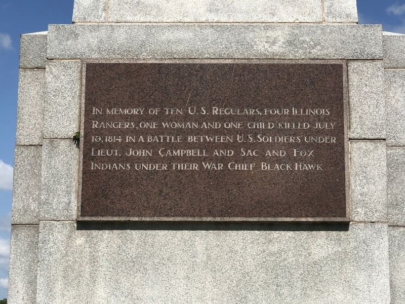
[East face] In memory of ten U.S. regulars, four Illinois rangers, one woman and one child killed July 19, 1814 in a battle between U.S. soldiers under Lieut. John Campbell and Sac and Fox Indians under their war chief Black Hawk.
. . . — — Map (db m230228) WM
This Peace Garden interprets the history of the Native American tribes, the Sauk and Mesquakie, who resided in this area from 1750 to 1831. The Mesquakie, called “Renards” (the Fox) by the French, and the Sauk were separate tribes with close . . . — — Map (db m230233) HM
In 1832 when Black Hawk and his Sauk and Fox followers returned to Illinois, 1500 mounted volunteers advanced along the banks of the Rock River to capture them. 505 men under Colonel Zachary Taylor followed in supply boats and late at night on May . . . — — Map (db m78266) HM
On May 8, 1832, while encamped approximately one mile west of this point, Abraham Lincoln was mustered into the military service of the United States. Captain Lincoln's company was mustered into state service at Beardstown April 28, the day before . . . — — Map (db m32972) HM
Black Hawk, famous Sauk warrior, was born in 1767 at the Sauk town of Saukenuk on the Rock River, located about one mile west of this spot. Black Hawk was not a chief. He was a warrior and leader of a political faction within the Sauk nation. Black . . . — — Map (db m202051) HM
Chippiannock Cemetery was placed on the National Register of Historic Places on May 6, 1994 for significance in Landscape Architecture, Architecture, and Art. Designed by noted Landscape Engineer Almerin Hotchkiss in 1855, Chippiannock Cemetery is . . . — — Map (db m202054) HM
[Left] The Figure Eight Roller Coaster was built in 1905. It was the first roller coaster west of Chicago and the only one with four loops. Cars were pulled up the track to a dizzying height of sixty feet and then raced another 1,000 feet . . . — — Map (db m201811) HM
Fort Armstrong was built in 1816-1817. Its riverside was protected by limestone bluffs and its other sides were formed in part by the rear walls of barracks and storehouses. Blockhouses, like the replica, stood at three corners. The pyramid of . . . — — Map (db m33225) HM
Upon this site on the fourteenth day of May in the year of our Lord one-thousand nine-hundred and sixty-six, members of the Rock Island Arsenal, tenant agencies and members of the surrounding communities did commemorate the one-hundred fiftieth . . . — — Map (db m230209) HM
The Sauk Indian village on the Rock River marks the site of the westernmost conflict of the Revolutionary War. In the summer of 1780, an American force under John Montgomery, with French and Spanish allies, destroyed the village of Saukenuk. Colonel . . . — — Map (db m202047) HM
[First plaque]
This property has been
placed on the
National Register
of Historic Places
by the United States
Department of the Interior
[Second plaque]
The Wagner Mansion
1904
Local . . . — — Map (db m202085) HM
The present Lodge is the fifth structure to stand on this location. Pictured below are the four buildings that preceded it.
Black Hawk Pavilion, 1882-1891
In 1882 the Black Hawk Pavilion was built on the crest of the bluff on this spot . . . — — Map (db m201837) HM
A true friend of the American cause during the Revolutionary War. His village occupied these and adjacent grounds and withstood a British war party on its way to attack General George Rogers Clark in 1779.
This also commemorates the burning of . . . — — Map (db m201880) HM
One of the successful projects at Rock Island Arsenal's Research and Development Division in 1961 and 1962 was the design and development of the XM37 cradle and recoil mechanism and the XM31 carriage for the XM102 howitzer. — — Map (db m93133) WM
This is the experimental model of the M65 atomic cannon. Adapted in 1956 the cannon could fire both nuclear and conventional shells over a range of 18 miles. — — Map (db m93137) WM
These boulders were removed from the Fort Armstrong Cemetery when the railroad embankment was made across the island to The Government Bridge of 1872. The Fort Armstrong Cemetery was located about seven hundred feet southeast of this site. . . . — — Map (db m229597) HM
John Gale
Surgeon United States Army, born in New Hampshire, 1790. Died at Fort Armstrong, Rock Island, Illinois, July 27, 1830.
Richard M. Coleman
Assistant Surgeon United States Army born in Kentucky, died at Fort Armstrong, Rock . . . — — Map (db m229235) HM
Hero Street, U.S.A. received its name in 1968 to honor the fifty-seven servicemen from thirty-three families on this block-and-a-half who served in defense of America between 1941 and 1968. Six men died in World War II and two in the Korean . . . — — Map (db m33236) HM
Four score and seven years ago our fathers brought forth on this continent, a new nation, conceived in Liberty, and dedicated to the proposition that all men are created equal. Now we are engaged in a great civil war, testing whether that nation, . . . — — Map (db m238504) WM
During a 10-day tour between Topeka court appearances, the temperance crusader stayed overnight and visited seven saloons including J.M. Wier’s at 221 E. 2nd St. She told a large audience in Muscatine’s Grand Opera House that she would not use her . . . — — Map (db m238746) HM
This property is listed in The National Register of Historic Places Division of Historic Preservation Iowa State Historical Department — — Map (db m238796) HM
Great River Road (marker north side) Charles H. Young of Muscatine devoted most of his life to the establishment of the Great River Road. In 1916, the idea of a scenic highway was conceived and an organization formed. Charles . . . — — Map (db m175878) HM
[north side] Dedicated Memorial Day, May 25, 1998 to honor all veterans of all wars and conflicts, of all branches of service, who fought bravely and gave their lives to preserve freedom and liberty in our land. For those . . . — — Map (db m238629) WM
In 1853 Orion Clemens became co-editor, co-owner of the Muscatine Journal. With his mother, Jane, and his youngest brother, Henry, he lived on the east side of Walnut Street, at the alley corner, across from this marker. His brother, Sam, then age . . . — — Map (db m238797) HM
The town’s first stream driven flour mill was here 1843-1850, beside a stream that meandered and often rampaged. A mother and three of her children drowned in an 1851 flood that carried away three bridges and two ancient Sycamore trees at the creek . . . — — Map (db m238748) HM
Dougherty drug store 1845-1910. The town’s first system-connected telephone installed June 1, 1881. Hardware store 1910-1999 — operated by Dethoff, then Coder, then Silberhorn — sold first Westinghouse refrigerator west of the Mississippi River. . . . — — Map (db m238762) HM
With the faith and courage of their forefathers who made possible the freedom of these United States The Boy Scouts of America dedicate this replica of the Statue of Liberty as a pledge of everlasting fidelity and loyalty 40th Anniversary . . . — — Map (db m177104) HM
Historic Davenport In 1829, William C. Redfield declared that Davenport lay opposite the future terminus of a “geographical trunk-line route” between the Atlantic and the Mississippi. Nine years later, in 1838, the Iowa Sun and Davenport . . . — — Map (db m286621) HM
Historic Davenport
In 1829, William C. Redfield declared that Davenport lay opposite the future terminus of a “geographical trunk-line route” between the Atlantic and the Mississippi. Nine years later, in 1838, the Iowa Sun and Davenport . . . — — Map (db m224581) HM
Claussen & Burrows
architects
Built 1900
This property is listed in the
National Register of Historic Places
The Scott County
Historic Preservation Society, Inc. — — Map (db m202163) HM
This property is listed in
the National Register of Historic Places
Iowa State Historical Department
Division of Historic Preservation — — Map (db m202179) HM
This property is listed in
the National Register of Historic Places
Iowa State Historical Department
Division of Historic Preservation — — Map (db m202212) HM
This property is listed in
the National Register of Historic Places
Iowa State Historical Department
Division of Historic Preservation — — Map (db m202214) HM
On September 21, 1832 General Winfield Scott & Governor Reynolds of Illinois negotiated the “Black Hawk Purchase” with the Sacs, Foxes, and the Winnebagos. The treaty deeded 6 million acres to the Americans. The price per acre was 9 cents. — — Map (db m230212) HM
This property is listed in
the National Register of Historic Places
Iowa State Historical Department
Division of Historic Preservation — — Map (db m202238) HM
In this house
Leon “Bix” Beiderbecke
(1903—1931)
was born and raised.
His short life's story left
us with the memory of his
legend as a jazz genius — — Map (db m202217) HM
Marion Crandell was the first American woman to die in the war zone during World War I. She was born in Cedar Rapids, but spent several years in France, where she attended the Sorbonne University. In 1916 she came to Davenport as a teacher at St. . . . — — Map (db m33120) HM
In 1882 Bishop John McMullen, born in Ballynahinch, County Down, wanted a place to begin a college. The pastor of St. Marguerites Parish, Fr. Henry Cosgrove, offered two rooms in his parish grade school. There, on September 4, 1882, St. Ambrose . . . — — Map (db m202265) HM
College Square Historic District
This property is listed in
the National Register of Historic Places
Iowa State Historical Department
Division of Historic Preservation — — Map (db m202211) HM
Built 1906 • Architects
Temple Burrows McLane
This property is listed in the
National Register of Historic Places
The Scott County
Historic Preservation Society, Inc. — — Map (db m202233) HM
In 1856 Antoine LeClaire offered a parcel of land for the construction of a new Catholic Church in Davenport, which he eventually funded in total. This new church was to be built at the top of “Cork Hill,” an area between 6th and 13th Streets named . . . — — Map (db m202256) HM
later Camp Kinsman
Became the Iowa Soldiers' Orphans' Home
in 1865
Renamed Iowa Annie Wittenmyer Home
in 1951
Dedicated by
Hannah Caldwell Chapter DAR 1996 — — Map (db m202223) HM
The Gannon home was the residence of prominent lawyer, politician, and publisher, M.V. Gannon. Mr. Gannon came to America in October 1866 after leading a group of young Irish patriots in liberating Fenian prisoners from Kilmain Hall, Castle Kilrain. . . . — — Map (db m202244) HM
Within these walls is carried the story of a family from simple beginnings. Through hard work and determination, they achieved success and prosperity, they developed the chiropractic profession and were broadcasting pioneers. This house was the . . . — — Map (db m202166) HM
B.J., Mabel and David moved into the Palmer Family Residence in 1912.
Bartlett Joshua (B.J.) Palmer, DC, E.P.A.C.
1882-1961
B.J. Palmer was the son of chiropractic's founder, D.D. Palmer. B.J. is known as The Developer of . . . — — Map (db m202177) HM
Fred B. Sharon and brother Thomas arrived in Davenport, Iowa in 1882. Together they published the Iowa Catholic Messenger which Thomas had established a few months prior to the move. Upon the death of Thomas, in 1888, Fred took over the management; . . . — — Map (db m202241) HM
This property is listed in
the National Register of Historic Places
Iowa State Historical Department
Division of Historic Preservation — — Map (db m202213) HM
Arts & Crafts bungalow
1910
This property is listed in
the National Register of Historic Places
Iowa State Historical Department
Division of Historic Preservation — — Map (db m202230) HM
To commemorate the Blackhawk Purchase Treaty signed by Maj. Gen. Winfield Scott and Hon. John Reynolds for the United States of America and by Chiefs Keokuk and Waupella for the Sac and Fox Indians at Davenport Iowa Sept. 21, 1832. — — Map (db m93118) HM WM
Born in Dundee, Scotland, James MacKintosh traveled to Canada in 1817 and became a bookbinder. In 1835 he journeyed to Iowa, explored the state's unpeopled prairies, and became one of the founding fathers of Davenport. In October, 1836, in a log . . . — — Map (db m202088) HM
Here at Brady and Second streets, in the former Ryan Building, is the site of the first chiropractic adjustment. On September 18, 1895, Daniel David Palmer, who was practicing as a magnetic healer at the time, repositioned a vertebra in the spine of . . . — — Map (db m202151) HM
[Left] This boulder marks the site of the western abutment of the first bridge across the Mississippi River, built in 1858 - 1886
[Center] This replica of a pier from first railroad bridge across Mississippi River is located near . . . — — Map (db m230213) HM
The Ancient Order of Hibernians is an Irish Catholic fraternal society that originated in Ireland sometime between the 16th and the 18th century. In 1836, a group of Irish immigrants in New York City formed the first chapter of the AOH in America. . . . — — Map (db m202157) HM
This property is listed in
The National Register of Historic Places
Iowa State Historical Department
Division of Historic Preservation — — Map (db m202154) HM
[Main plaque] The Bix Beiderbecke Memorial Society presents the annual Bix Beiderbecke Memorial Jazz Festival to honor the musical genius and preserve the world-wide regard for Davenport-born Bix. His life and accomplishments are still . . . — — Map (db m202143) HM
Since 1925, music has drifted along the Davenport levee from the Petersen Memorial Music Pavilion. One of several bandshells in Davenport at the time, the Music Pavilion was the final touch in Davenport's riverfront beautification project known as . . . — — Map (db m202109) HM
Davenport's civil rights movement is unique because of the significant support it received from the local Catholic community, including the Catholic Diocese of Davenport and St. Anthony's Parish, in front of you. A significant number of parish . . . — — Map (db m202160) HM
est. 1837
by Rev. Samuel Mazzuchelli, O.P.
Listed 05 Apr 89
This property is listed in the
National Register of Historic Places
State Historical Society of Iowa — — Map (db m202158) HM
Upon his death in 1914, Judge John F. Dillon bequeathed $10,000 to the city of Davenport to construct a fountain in the city that he called home. In 1921, the city dedicated the Dillon Fountain as part of its efforts to improve the riverfront. The . . . — — Map (db m202146) HM
Built in 1839 at the northeast corner of Second and Main Streets, the LeClaire House Hotel for 20 years prior to the Civil War was a northern resort spot for southerners. Known for providing first-class dining and proximity to hunting, fishing, and . . . — — Map (db m202149) HM
The Natatorium public swimming pool, pictured above, located here from 1922 - 1977, was one of Davenport's public facilities successfully integrated during the Civil Rights Movement. In the later 1950s, members of Davenport's African-American . . . — — Map (db m202147) HM
In 1924, the Davenport, Rock Island and North Western Railway Co. and its co-owners, the Chicago, Milwaukee, St. Paul and Pacific Railroad and the Chicago, Burlington and Quincy Railroad, constructed the Union Passenger Station to replace three . . . — — Map (db m202089) HM
Here was located a military camp during the Civil War, at which were trained more than half of the recruits from Iowa
In 1862 several hundred Sioux Indians were imprisoned here following the Minnesota Massacre.
Erected by Hannah Caldwell . . . — — Map (db m202229) HM
Here was located one of the earliest posts for trading with the Indians established west of the Mississippi River. The Battle of Credit Island was fought August 21, 1814 between the troops of the United States and Great Britain. — — Map (db m228856) HM
Dedicated on August 30 2014 by the city of Davenport and its citizens to commemorate the battle that took place on and around Credit Island on September 4 and 5, 1814.
This was the last battle for control of the upper Mississippi River during . . . — — Map (db m211242) HM WM
William Frederick Cody, "Buffalo Bill", son of Isaac and Mary Cody, was born near this site on February 26, 1846. His parents purchased land from the United States of America land patent on September 16, 1841. They built a log cabin in the NE ¼ of . . . — — Map (db m174978) HM
William F. Cody
(Buffalo Bill)
1846-1917
Born near LeClaire, Iowa, he was known as “Buffalo Bill”, a legend of the early west. Mention his name even today, and most everyone will immediately think of the Indian Scout, buffalo hunter, Pony . . . — — Map (db m230275) HM
Boy Scouts of America
Troop 9
First Christian Church
Davenport, Iowa
Erected in memory of the Green Tree that was used as a playground by Buffalo Bill
The Buffalo Bill Trail was established in 1964 the same year the Green Tree was . . . — — Map (db m230261) HM
All gave some – Some gave all
In honored tribute
to the
brave men and women
of the
city and township of LeClaire
who served this country
[On the sides of the monument are emblems of U.S. military branches and their founding . . . — — Map (db m230267) WM
During the 1800s, LeClaire was home to a special brand of riverman – the rapids pilot. Rapids pilots specialized in guiding steamboats and log rafts through the treacherous Rock Island Rapids between LeClaire and Davenport. Because the swift . . . — — Map (db m230271) HM
Walnut Grove was a Scott County crossroads
settlement and stagecoach stop of the 1860's. The
village includes several historic buildings, some
relocated from rural Scott County. Olde St. Ann's
church (e. 1852) was moved in 1985 and restored to . . . — — Map (db m230342) HM
Originated in 1852. The
original frame building
was erected in 1853 and is
now the vestry, moved to
Walnut Grove Pioneer
Village in 1985. — — Map (db m230351) HM
This home was built in 1847 by Issac Cody, father to Buffalo Bill. Constructed with native limestone. Boyhood home of Buffalo Bill. — — Map (db m230338) HM