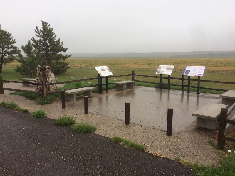
Guided to Hiddenwood Cliff by Sioux and Arikara scouts, General George Armstrong Custer and the 7th Cavalry camped on this famed buffalo hunting spot on July 8, 1874. The Custer Expedition was on its way to the Black Hills in South Dakota and . . . — — Map (db m113252) HM
Yellowstone Trail
The Yellowstone Trail was the first transcontinental automobile highway through he United States northern tier. The highway was created from a grassroots movement of local volunteers and originated near this . . . — — Map (db m113251) HM
In 1882 and 1883, the American buffalo made their last stand here in the valley of Hiddenwood and within a 30-mile range of this area. Hiddenwood Cliff, directly opposite across Hiddenwood Creek, was an ancient landmark for buffalo hunting tribes . . . — — Map (db m113254) HM
From the populated villages of Ukraine to the unsettled regions of North Dakota, the Ukrainian immigrants came here at the end of the 19th century. They emigrated from the “Bread Basket of Europe” to the virgin sodland yet untouched by man – from . . . — — Map (db m178102) HM
Water's a scarce commodity in the semi-arid Northern Plains-a resource worth fighting for when men and stock are running on empty. The Battle of the Badlands-the only significant engagement between the soldiers and the Sioux to occur along the . . . — — Map (db m254490) HM
Three prominent leaders among the Lakota and Dakota Sioux who called this region home and resisted encroachment by white Americans were Tatanka Iyotake (Sitting Bull), Pizi (Gall), and Inkpaduta (Red Point). Sitting Bull, born in 1831, became an . . . — — Map (db m87775) HM
The Bad Lands Cantonment, a temporary military base to protect railroad construction workers from Indian attacks, was established on November 10, 1879. At first consisting of only canvas tents, the cantonment soon grew to eight lumber buildings, . . . — — Map (db m87804) HM
In the era of the open range cattle industry of the late 1800’s, ranchers would work together to round up their free-ranging cattle in the spring and fall. During roundups the cattle would be driven to a wide river bottom like this one, where they . . . — — Map (db m88612) HM
Billings County was formed in 1879 and organized in 1886. Medora became the county seat in 1886, three years before North Dakota became a state in 1889. The first county offices were located in Roberts Hall. Two small homes built in the 1880s were . . . — — Map (db m88030) HM
The drought and depression of the 1930’s hit the badlands region hard. Small landowners, no longer able to eke out a living, sold their lands to the government with the hope of finding a new start elsewhere. Throughout the country, men were out of . . . — — Map (db m88610) HM
The Civilian Conservation Corps was a peacetime “army” of civilians between 1933 and 1941 which served to create jobs for unemployed men and to protect natural resources. Two CCC camps were located near Medora. In 1934 the CCC camp of . . . — — Map (db m87782) HM
The grey and red building that you see to the south is the Chateau built in 1883 by Marquis de Mores, a French nobleman, who founded the town of Medora. It was occupied as a part-time residence until the fall of 1886 and was frequently the scene . . . — — Map (db m87975) HM
One of the goals of early exploring parties in this area was to find local fuel, coal that fit the bill needed for railroad construction. One of the first area coal mines was located just west of Medora. The Northern Pacific Coal Company operated . . . — — Map (db m88007) HM
The American cowboy has become a mythical figure in the national consciousness. This would, no doubt, have surprised most of the common laborers who earned meager pay as cowboys. A number of them were indeed colorful characters. Some became outlaws . . . — — Map (db m88061) HM
The Yellowstone Expedition of 1876, organized to suppress the hostile Sioux, marched from Fort Abraham Lincoln May 17, 1876.
The Expedition camped at the junction of Davis Creek and the Little Missouri River, four miles south of Medora on May . . . — — Map (db m154256) HM
In memory of Antoine Manca de Vallombrosa Marquis de Mores Lieutenant French Cavalry Born in Paris 1858 Killed in North Africa 1896 and of his wife Medora who founded this town in 1883 — — Map (db m87539) HM
was built on this site by the Marquis De Mores in 1883 to furnish dressed beef directly from the western ranges. It was successfully operated for several years, destroyed by fire 1907.Exhibits on other side < Reverse Side : > Site of the . . . — — Map (db m87790) HM
Antoine Amédé Marie Vincent Amat Manca de Vallombrosa, more commonly known as the Marquis de Mores, was a French aristocrat with an entrepreneurial spirit typical of the late 1800s. The Marquis was one of many who sought to profit from the cattle . . . — — Map (db m87796) HM
The Little Missouri Badlands played a key strategic role in the conflict between American Indians and the expanding United States. General Alfred Sully in 1864 led the first military expedition to cross the badlands. The expedition of 2,200 men . . . — — Map (db m87805) HM
Between 1874 and 1893, seven million head of cattle and horses went up the Great Western Trail from Texas through nine U.S. states into Canada. This famous trail lasted more years, carried more cattle, and was longer than any other cattle . . . — — Map (db m87498) HM
Before you lies a scene not greatly changed since Theodore Roosevelt’s time here in the 1880s. Gone are the ambitious De Mores Packing Plant, the military cantonment and the early village of Little Missouri. But still present are the colorful . . . — — Map (db m154615) HM
The Marquis de Mores, a charismatic French nobleman, founded Medora in 1883. The Northern Pacific Railroad had reached the badlands only three years prior, opening the region to entrepreneurs and adventurers from the East.
For a few years the . . . — — Map (db m154951) HM
The Hotel de Mores was built by the Marquis de Mores in 1883 and served as a boarding house for up to 100 people. The 100-foot by 25-foot hotel was located north of the railroad depot and faced north. Manager George Fitzgerald advertised it as the . . . — — Map (db m88037) HM
The Little Missouri Badlands have always been ideal habitat for wildlife. American Indians hunted these lands for centuries. The first known white explorers, the La Verendrye brothers, ventured into the badlands in 1742. Trapper Jean Baptiste La . . . — — Map (db m87992) HM
Behind the visitor center is an old, rustic cabin. Architecturally insignificant, a person might wonder why it is here. To understand, step over the threshold and walk inside the building that housed a future president at a pivotal moment in . . . — — Map (db m87230) HM
Joe Ferris wore many hats in Medora. He was a hunting guide, a Medora postmaster and a successful merchant. Ferris opened his first general store in Little Missouri. In 1885 he began work in Medora on the current two-story, 25-foot by 75-foot . . . — — Map (db m88062) HM
From its formation in 1879 to its official organization on April 12, 1886, Billings County had no county offices or officials. All administrative duties were performed through the Morton County Courthouse at Mandan, some 130 miles to the east. The . . . — — Map (db m88025) HM
The Little Missouri River was a challenge for motorists. Motorists had to ford the river or wait for a railroad crew to carry their autos across on a flatcar. Construction of a transcontinental highway system began in 1912. The lack of proper . . . — — Map (db m87977) HM
The town of Little Missouri was founded in 1880 at the site of the Northern Pacific Railroad section house and depot, on the west bank of the river. In late 1880, Frank Moore, the Post Trader of the nearby military cantonment, opened the Pyramid . . . — — Map (db m87982) HM
A spur track connected the slaughterhouse with the main line of the Northern Pacific Railroad. Ice from the icehouses to your right were used to cool the refrigerator cars when the meat was loaded into them. The Marquis owned cold storage . . . — — Map (db m87799) HM
Margaret Barr was born in Ireland on September 15, 1853, and immigrated to Iowa with her family about 1864. In April 1871, she married John Lloyd Roberts from Wales, and soon became a pioneer wife to a cattle dealer and butcher. The couple arrived . . . — — Map (db m88018) HM
Medora’s business district originated north of 3rd Avenue. After Medora’s founding in 1883, carpenters, masons and other laborers filled the community, benefiting from a construction boom. Medora also became a supply hub for area ranchers and . . . — — Map (db m88066) HM
The Medora Cemetery consists of 1.93 acres located on a grassy plateau on the west bank of the Little Missouri River overlooking Medora. The Medora Cemetery Association was formed on October 15, 1919, by six pioneers of this area: Geo. R. . . . — — Map (db m87984) HM
The railroad reached the Little Missouri River in 1880. The Northern Pacific Railroad named the stop Pyramid Park. When the Marquis de Mores and Theodore Roosevelt arrived in 1883, the train depot was on the west side of the Little Missouri River. . . . — — Map (db m87986) HM
The need for educating local children was first publicly expressed in 1884 when St. Mary’s Catholic Church Pastor Rev. Martin Schmitt, O.S.B., appealed to Medora residents to establish a school. Classes were begun in a cantonment building west of . . . — — Map (db m88020) HM
Stables were important in early Medora, serving the primary means of local transportation: horseback and horse-drawn vehicles. Livery stables offered horses, teams and wagons for hire. These stables were built in conjunction with hotels so guests’ . . . — — Map (db m88063) HM
Marquis de Mores: A grand entrepreneur. In the fall of 1884 he inaugurated daily round-trip stage and freight service from Medora to the Black Hills of South Dakota. Four coaches were purchased. The Kittie, Medora, Dakota and . . . — — Map (db m88033) HM
The Town Hall was built in 1924 to serve as an activity center for Medora. The building featured electric lights, a hot water heating system, partial basement, a furnished balcony and a projection booth. Opera chairs were provided for ordinary . . . — — Map (db m88013) HM
The badlands you see from here were so named because they were "badlands" to travel over before modern roads were built. Rain, wind and running water have carved these hills. A thick series of shale and sandstone layers, all of these rocks are a . . . — — Map (db m4822)
One hunting trip in the badlands and Theodore Roosevelt was hooked-he invested in the flourishing cattle industry and returned to Dakota Territory often over the next few years.
Roosevelt thoroughly enjoyed "the glory of work and joy of living" . . . — — Map (db m154619) HM
Ralph “Doc” Hubbard was one of the most accomplished people to call Medora home. He was born on June 22, 1885, in New York to Elbert Hubbard, a prominent author and publisher, and Bertha Crawford Hubbard. Doc first visited Medora . . . — — Map (db m88047) HM
You are looking at a portion of the Little Missouri River bottomlands. Cottonwood trees line the river course, where their roots can reach abundant moisture. Dark green juniper trees dot the sheltered slopes of the steep bluffs. On dry open river . . . — — Map (db m154308) HM
Bob Roberts had operated The Senate Billiard and Pool Hall in Little Missouri. Later he joined many of his fellow business owners across the river in Medora. An April 1884 edition of The Bad Lands Cow Boy reported the contract for . . . — — Map (db m88016) HM
George Fitzgerald’s success operating the Hotel de Mores was such that in November 1884 he began work on his own 35-feet by 80 feet two-story hotel. Brick veneer was planned but was never added. The Bad Lands Cow Boy described its interior . . . — — Map (db m87499) HM
Medora de Vallombrosa, wife of the Marquis de Mores, financed the construction of this brick church late in the summer of 1884. This gift to her namesake community was paid for from an annual income of $90,000, earned from a stock portfolio she . . . — — Map (db m88001) HM
He laid the foundation of the National Park Service, defining and establishing the policies under which its areas shall be developed and conserved unimpaired for future generations. There will never come an end to the good that he has done. — — Map (db m87237) HM
In late 1908, Christ Pederson of Dickinson purchased the General Store from Joe Ferris and moved to Medora. On August 6, 1909, Pederson, Harve Robinson, and George Burgess filed a Certificate of Organization. The Stockmens State Bank was . . . — — Map (db m88040) HM
At the age of 22, Arthur T. Packard started Medora’s first newspaper, The Bad Lands Cow Boy. The first issue came off the press on February 7, 1884. Marquis de Mores was the major advertiser in the paper. Editor Packard produced a paper . . . — — Map (db m88045) HM
Theodore Roosevelt first came to the badlands in September 1883 to hunt buffalo. “Old Four Eyes” loved the life of the badlands’ cowboys and participated in roundups, brandings and social events, earning the respect of those he so . . . — — Map (db m88009) HM
William Riley Luffsey was born in Wayne County, Missouri, around 1859. He died in a gun battle along the Little Missouri River on June 26, 1883, about a mile west of the twin towns of Little Missouri and Medora. Riley Luffsey was a popular young . . . — — Map (db m87554) HM
The Soldiers and the Sioux
Cultural Conflicts Set the Stage
During the late 1800s, miners, traders and homesteaders rushed to the West, pushing Northern Plains tribes into ever smaller remnants of their homelands. Treaties between the . . . — — Map (db m254492) HM
(Two panels mounted back to back:)
The Soldiers and the Sioux
Cultural Conflicts Set the Stage
During the late 1800s, miners, traders and homesteaders rushed to the West, pushing Northern Plains tribes into . . . — — Map (db m254162) HM
“I propose to create a Civilian Conservation Corps . . . We can take a vast army of these unemployed out into healthful surroundings. We can eliminate to some extent at least the threat that enforced idleness brings to spiritual and moral . . . — — Map (db m87538) HM
In August 1884, Athenais von Hoffman, mother-in-law of the Marquis de Mores, commissioned Peter Book to erect a brick cottage for use by her and her husband, Louis. The new home was completed in 1884 but was probably not occupied until the . . . — — Map (db m88004) HM
The picturesque Little Missouri badlands are a unique landscape. The arrival of the railroad in 1880 opened the area to tourists who wanted to experience the western lifestyle. The first dude ranch in America opened in 1882, four miles south of . . . — — Map (db m87788) HM
These soft sandstone deposits, built up by wind and water and then carved into strange and fantastic shapes by the same forces, have fascinated man for at least 5,000 years. Note the absence of carvings in the sculptured walls seen in this . . . — — Map (db m154309) HM
Between 1874 and 1893, millions of head of cattle and horses went up the Great Western Trail from Texas through nine U.S. states into Canada. This famous trail lasted more years, carried more cattle, and was longer than any other cattle trail in . . . — — Map (db m299500) HM
The vast prairies of America have been described by many people as "an ocean of grass." This region of the country is considered either shortgrass or midgrass prairie, depending on the soil moisture, precipitation, and relative humidify in a . . . — — Map (db m113241) HM
Lewis and Clark and the Corps of Discovery passed north of this area in 1804-1806. The Homestead Act of 1862 brought white settlers from the eastern U.S. and emigrants from Europe to the American west and to this part of the Dakota Territory in . . . — — Map (db m298528) HM
On this site in September 1864 an immigrant train, under the command of Capt. James L. Fisk, bound for the gold fields of Montana, was besieged by hostile Sioux Indians, despite the fact that an armed escort of 50 U. S. Cavalrymen had been provided . . . — — Map (db m33923) HM
North Dakota Veterans Memorial 1989 In this year of North Dakots's centennial, this monument is dedicated to all North Dakotans who served in the armed forces since statehood.The names of the men and women listed on this memorial gave their . . . — — Map (db m44701) WM
The first scholarly archaeological study of a Mandan earthlodge village village site was made in 1905 by Harvard University students George Will and Herbert Spinden. They excavated portions of six midden mounds, two houses, six cache pits, and the . . . — — Map (db m154677) HM
This was the site of one of the largest river warehouses built during the 1870s when river transportation was of primary importance. The warehouse was served by a spur track of the Northern Pacific Railway and until the railroad was built west of . . . — — Map (db m154055) HM
Presented by the French National Railroads
to the State of
North Dakota
in gratitude for the help given to France
by the American people — — Map (db m44706) HM
Bullboats, round-bottomed watercrafts, were used by the Mandans, Hidatsas, and Arikaras to transport goods and people
along waterways. Bullboats were indispensable for river traffic and for hauling loads of driftwood for cooking and heating
fires. . . . — — Map (db m164368) HM
In honor of United States military personnel and veterans from Burleigh County for their service to our great Nation Dedication Date August 18th, 2022 Duty Honor Country — — Map (db m235002) WM
The State Historical Society of North Dakota acquired Camp Hancock in 1951 for preservation as a state historic site. Work began to repair fire damage on the lone remaining structure, the officers quarters from the 1870s, used later as the U.S. . . . — — Map (db m154548) HM
When plans for the Church of the Bread of Life were accepted in August, 1879, the Episcopal congregation's building committee contracted to spend $2,500 to build a place of worship. The funds, raised by benefit suppers and entertainments, proved . . . — — Map (db m154545) HM
Dedicated to all men and women wounded in all our wars.My stone is red for the blood they shed. The medal I bear is my country's way to show they care if I could be seen by all mankind maybe peace will come in my lifetime. — — Map (db m44704) HM
Fortification systems attest to the fierce warfare between villagers and surrounding nomadic tribes that is reported in early historic records. Ditch 2 that you seen in front of you at Double Ditch appears to have combined mounds and the ditch, with . . . — — Map (db m154250) HM
Ditch 3 is more recent than Ditch 4 and was constructed in the AD 1500s. Ditch 3, with only a few bastions, encompasses 15 acres and, like Ditch 4, is not visible on the surface. It reflects a fallback to a slightly smaller community and simpler . . . — — Map (db m154708) HM
Double Ditch Indian Village, overlooking the Missouri River, was a large earthlodge village inhabited by Mandan Indians between AD 1490 and 1785. The remains of earthlodges, midden mounds (trash heaps), and two fortification ditches are clearly . . . — — Map (db m154709) HM
Double Ditch Indian Village, overlooking the Missouri River, was a large earthlodge village inhabited by Mandan Indians between AD 1490 and 1785. The remains of earthlodges, midden mounds (trash heaps), and two fortification ditches are clearly . . . — — Map (db m154710) HM
The first non-Roman church service to be held in what is now Bismarck was the baptism of a son of Lt. Humbert of Camp Hancock by the Rev. J. Smith, and Episcopalian missionary This marked the beginning of Episcopalian services in the . . . — — Map (db m154650) HM
In front of you is a segment of the inner fortification ditch. Mandan villages usually were surrounded
by a ditch and wood palisade to keep out enemies. These villages also used natural features, such as
steep terrain and riverbanks, for added . . . — — Map (db m164478) HM
On this spot, July 31, 1863, occurred the first Masonic ceremony held in the present state of North Dakota. It was the Masonic funeral of Lieutenant Fred J. Holt Beaver, an Englishman and Oxonian, and a volunteer soldier, attached to the staff of . . . — — Map (db m234899) HM
From approximately this spot on July 5, 1876, Colonel Clement A. Lounsberry, the founder of the Bismarck Tribune in a feat of newspaper enterprise that overcame many obstacles, flashed - - by telegraph - - to the New York Herald the first account of . . . — — Map (db m85829) HM
Geophysics applies the methods of physics to remotely investigate and define objects or materials
in the earth's subsurface without direct contact. Geophysical investigations do not disturb the
soil and cultural features, as do traditional . . . — — Map (db m164367) HM
Glaciers altered river courses and molded the North Dakota landscape, creating the gently rolling, hilly terrain seen in most areas of the state today. Prior to about three million years ago, all the rivers in today's North Dakota flowed toward . . . — — Map (db m164376)
Camp Hancock was the location of an infantry post from 1872 to 1877 and a quartermaster depot and signal office until 1894. The post was originally named Camp Greeley in honor of Horace Greeley, an editor of the New York Times and candidate . . . — — Map (db m154971) HM
The Mandans, as well as the Hidatsa and the Arikaras, built dome-shaped houses of logs and earth, known as earthlodges. All that remains of the earthlodges on the surface are circular depressions. The men usually decided how large an earthlodge . . . — — Map (db m154544) HM
While the Mandans relied heavily on the cultivation of plants, they
were also skilled hunters. Bison hunting was as important as farming
and bison were vital to the Mandan diet. Before the arrival of horses,
bison were stalked individually, or . . . — — Map (db m164358) HM
By the time Lewis and Clark began their epic journey, the Ward Indian Village site (renamed Chief Looking's Village in 2003) had been abandoned. The Mandan and Hidatsa were displaced north, reduced in number by smallpox and warfare. The journals . . . — — Map (db m270046) HM
Going Upriver:
21st October Sunday 1804 (William Clark):
“…passed just by above our Camp a Small river on the L.S. Called by the Indians Chiss-Cho-tar (the Heart River) — this river is about 38 yards wide Containing a good Deel of water— . . . — — Map (db m269935) HM
This coal-fired steam locomotive was built by the Baldwin Locomotive works of Philadelphia, Pennsylvania for the Northern Pacific Railway in 1909. Numbered 2164 by the Northern Pacific, the locomotive and coal tender weigh 298,600 pounds, are 78 . . . — — Map (db m154970) HM
Mandan origins and history have been passed on orally. These origin stories are memorized and passed from generation to generation, telling the history of a
people. These traditions provide information regarding the origins of sacred bundles and . . . — — Map (db m164357) HM
Life for these agriculturalists centered on the cultivation and trade of native corn, beans, squash, and sunflowers along with hunting. Women watched the skies
carefully for the arrival of flocks of geese and ducks, which signified the arrival of . . . — — Map (db m164355) HM
The raised areas you see around the village are midden mounds or earthen mounds ranging from one to ten feet high. There are more than 30 mounds surrounding the village. The Mandans at Double Ditch disposed of their trash in heaps such as the one in . . . — — Map (db m154930) HM
Missouri River The Missouri River valley provided water, food, and shelter for the Mandans. Abundant timber and game could be found in the wooded bottomlands, and bison flourished on the surrounding prairie grasslands. The terrace edge . . . — — Map (db m154068) HM
Pó is the root for fish in the Mandan language-pótande is the catfish. The Missouri River system, along with its larger
tributaries such as the Heart River, supported fisheries that the Mandans drew upon as part of their subsistence . . . — — Map (db m164371) HM
Sakakawea Sakakawea has become a recognized name as part of the Lewis and Clark expedition. Although her name is famous, few facts remain to document her life and contributions to the voyage. When Lewis and Clark met Sakakawea in 1804 she was . . . — — Map (db m43838) HM
Square Buttes is a prominent and imposing landmark along this stretch of the Missouri River. The buttes take their name from their corresponding physical characteristics and robust form that is visible on the horizon eight miles to the north. . . . — — Map (db m154069) HM
The stone shelter your are now standing by was constructed in the 1930s as one of many projects completed throughout the state by the Civilian Conservation Corps (CCC) and the Works Progress Administration (WPA). The CCC and the WPA were programs . . . — — Map (db m154396) HM
Geophysical surveys and follow-up excavations have revealed that the village had four ditch fortification systems constructed over a period of 300 years. The fourth, or outermost, ditch had several well-defined bastions and was probably the oldest. . . . — — Map (db m154920) HM
Presented to the State of North Dakota by Harry Falconer McLean to honor the memory of the pioneers of the great Northwest. This plaque erected by the Bismarck Chapter Pioneer Daughters. < Back of Monument: > No trails too rugged, no . . . — — Map (db m85832) HM
As early as 1804, this village was noted by explorers Meriwether Lewis and William Clark during their expedition through this area.. Captain Clark wrote in his journal entry of October 22, 1804:
passed 2 old villages at the mouth of a . . . — — Map (db m284382) HM
288 entries matched your criteria. The first 100 are listed above. Next 100 ⊳