287 entries match your criteria. Entries 101 through 200 are listed.⊲ Previous 100 — The final 87 ⊳
Historical Markers and War Memorials in Leeds and Grenville United Counties, Ontario
By William Fischer, Jr., March 14, 2020
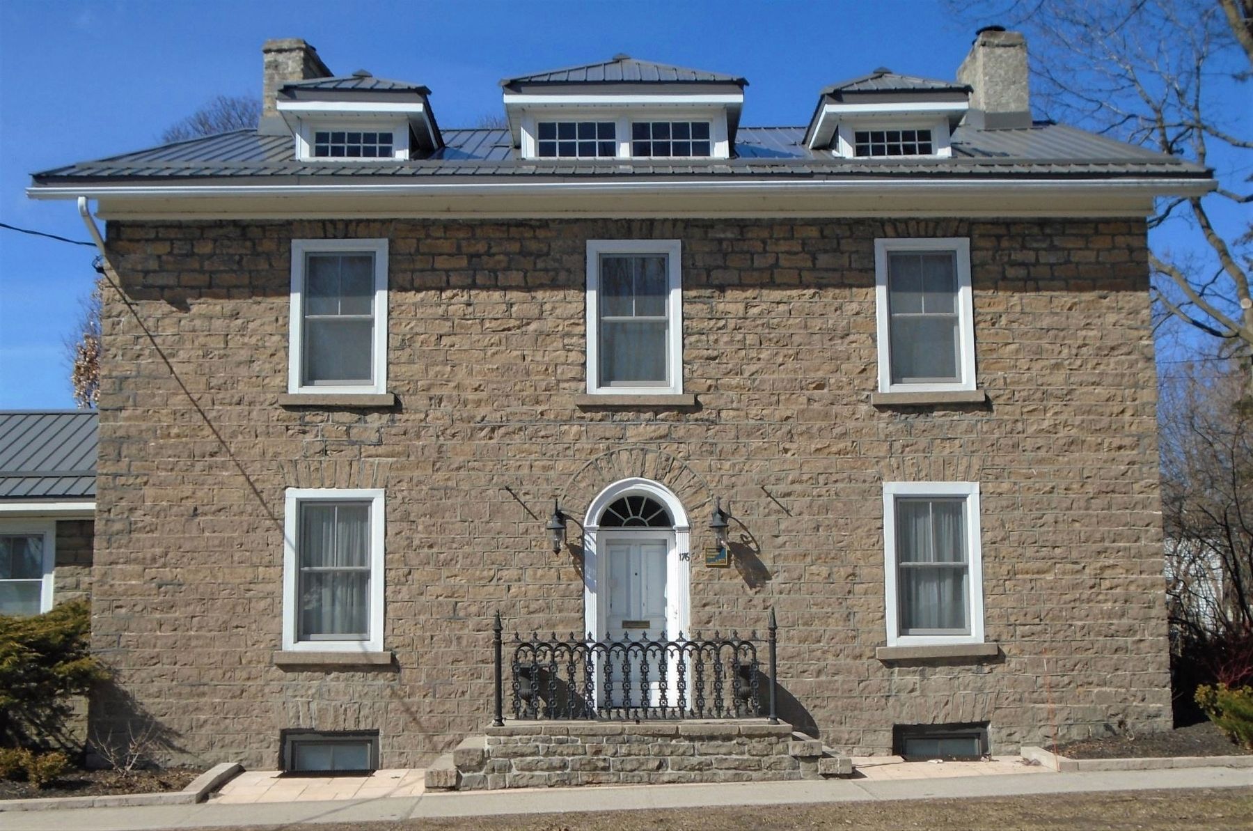
Samuel Reynolds House and Marker
| 101 ► Ontario, Leeds and Grenville United Counties, Brockville — Samuel Reynolds House — c. 1833 — |
| On King Street East (County Highway 2) just east of Bartholomew Street, on the left when traveling east. | |||
| 102 ► Ontario, Leeds and Grenville United Counties, Brockville — Senator George T. Fulford — 1852 - 1905 — |
| Near King Street East (County Highway 2). | |||
| 103 ► Ontario, Leeds and Grenville United Counties, Brockville — Senator John and Esmeralda Webster House — 1883 — |
| On James Street East just east of Garden Street, on the right when traveling east. | |||
| 104 ► Ontario, Leeds and Grenville United Counties, Brockville — Shop of George Houston — c. 1867 — |
| On King Street West (County Highway 2) just west of Market Street, on the right when traveling west. | |||
| 105 ► Ontario, Leeds and Grenville United Counties, Brockville — Shop of Thomas Cunningham — c. 1846 — |
| On Water Street West at Apple Street, on the left when traveling east on Water Street West. | |||
| 106 ► Ontario, Leeds and Grenville United Counties, Brockville — Sir William Buell Richards — 1815 - 1889 — |
| On Court House Square, on the left when traveling east. | |||
| 107 ► Ontario, Leeds and Grenville United Counties, Brockville — Smart's Foundry — |
| On Home Street just south of Ernie Fox Quay, on the right when traveling south. | |||
| 108 ► Ontario, Leeds and Grenville United Counties, Brockville — Smart's Foundry — Brockville Historic Area: The Brock Trail — |
| On Kincaid Street just south of Water Street West, on the left when traveling south. | |||
| 109 ► Ontario, Leeds and Grenville United Counties, Brockville — SS Kingston — Brockville Historic Area: The Brock Trail — |
| On Block House Island Road, 0.2 kilometers south of Water Street, on the right when traveling south. | |||
| 110 ► Ontario, Leeds and Grenville United Counties, Brockville — St. Lawrence Terrace — c. 1894 — |
| On King Street East (County Highway 2) at Ford Street, on the left when traveling east on King Street East. | |||
| 111 ► Ontario, Leeds and Grenville United Counties, Brockville — St. Peter's Church of England — original part opened 1831 — |
| On Pine Street at Park Street, on the left when traveling east on Pine Street. | |||
| 112 ► Ontario, Leeds and Grenville United Counties, Brockville — Steacy and Bowie Homes — ca. 1910 — Brockville Historic Area: Our Past — |
| On King Street (County Highway 2) at Park Street, on the left when traveling east on King Street. | |||
| 113 ► Ontario, Leeds and Grenville United Counties, Brockville — Steven Delbert Ring — March 3, 1962 - April 18, 1982 — Dedicated to the Memory of — |
| On Parkedale Avenue just east of Stewart Boulevard (County Highway 29), on the left when traveling east. | |||
| 114 ► Ontario, Leeds and Grenville United Counties, Brockville — Sylvester Skinner House — c. 1830 — |
| On Church Street just east of Perth Street, on the right when traveling east. | |||
| 115 ► Ontario, Leeds and Grenville United Counties, Brockville — T. Gilmore & Co. Building — c. 1870 — |
| On King Street West (County Highway 2) just west of John Street, on the right when traveling west. | |||
| 116 ► Ontario, Leeds and Grenville United Counties, Brockville — Tall Ships 1812 Tour — |
| On Broad Street just south of Flint Street, on the left when traveling south. | |||
| 117 ► Ontario, Leeds and Grenville United Counties, Brockville — The "Baby Bottle" House — part of the Brace Terrace — built 1895 — |
| On King Street East (County Highway 2) at Ford Street, on the right when traveling east on King Street East. | |||
| 118 ► Ontario, Leeds and Grenville United Counties, Brockville — The Bluenose Visit, 1933 / La visite du Bluenose, 1933 — Brockville Historic Area: The Brock Trail — |
| On Block House Island Road, on the right. | |||
| 119 ► Ontario, Leeds and Grenville United Counties, Brockville — The Brockville "Van" or Caboose — Built 1954 - Donated, restored and placed here, 1987 — |
| Near Water Street East at Ferry Street. | |||
| 120 ► Ontario, Leeds and Grenville United Counties, Brockville — The Brockville Public Library — Brockville Historic Area: Our Past — |
| On Buell Street just north of King Street West (Provincial Highway 2), on the right when traveling north. | |||
| 121 ► Ontario, Leeds and Grenville United Counties, Brockville — The Brockville Tunnel 1860 — |
| On Block House Island Road, 0.1 kilometers south of Water Street East, on the left when traveling south. | |||
| 122 ► Ontario, Leeds and Grenville United Counties, Brockville — The Brockville Waterworks and Pump House — was located here from 1884 to 1960 — Brockville Historic Area: The Brock Trail — |
| On Water Street East east of Park Street, on the right when traveling east. | |||
| 123 ► Ontario, Leeds and Grenville United Counties, Brockville — The Great War Memorial — 1914 - 1918 — |
| On Water Street at Ferry Street, on the right when traveling east on Water Street. | |||
| 124 ► Ontario, Leeds and Grenville United Counties, Brockville — The Strathcona Hotel / The Brock Theatre — Brockville Historic Area: Our Past — |
| On King Street West (County Highway 2) at Chase Street, on the right when traveling west on King Street West. | |||
| 125 ► Ontario, Leeds and Grenville United Counties, Brockville — The Wreck of the Robert Gaskin — GPS location co-ordinates: latitude N44 35.358 longitude W75 40.625 — Brockville Historic Area: The Brock Trail — |
| On Block House Island Road, on the right when traveling south. | |||
| 126 ► Ontario, Leeds and Grenville United Counties, Brockville — Thomas & Anna Webster House — built c. 1861 — |
| On Park Street just north of Pine Street, on the right when traveling north. | |||
| 127 ► Ontario, Leeds and Grenville United Counties, Brockville — Thomas Hume House — c. 1847 — |
| On Orchard Street just north of Pine Street, on the right when traveling north. | |||
| 128 ► Ontario, Leeds and Grenville United Counties, Brockville — Thomas R. Sheffield House — c.1863 — |
| On King Street East (County Highway 2) at Ormond Street, on the left when traveling east on King Street East. | |||
| 129 ► Ontario, Leeds and Grenville United Counties, Brockville — Timber Rafts on the River — |
| On Henry Street just south of Water Street West, on the left when traveling south. | |||
| 130 ► Ontario, Leeds and Grenville United Counties, Brockville — Tompkins Building and Grand Central Hotel — ca. 1899 — Brockville Historic Area: Our Past — |
| On King Street West (County Highway 2) at Buell Street, on the left when traveling west on King Street West. | |||
| 131 ► Ontario, Leeds and Grenville United Counties, Brockville — Victoria Hall and East Ward Market Building — 1863 — |
| On King Street (County Highway 2) at Victoria Avenue, on the left when traveling west on King Street. | |||
| 132 ► Ontario, Leeds and Grenville United Counties, Brockville — War Memorial — • Their Name Liveth Forever More • — |
| On King Street West (County Highway 2) at Court House Avenue (County Highway 29), on the right when traveling west on King Street West. | |||
| 133 ► Ontario, Leeds and Grenville United Counties, Brockville — Wesleyan Methodist Church — 1830 — |
| On Wall Street (Provincial Highway 29) at John Ross Matheson Way, on the right when traveling north on Wall Street. | |||
| 134 ► Ontario, Leeds and Grenville United Counties, Brockville — William and Augusta Swift House — c.1871 — |
| On King Street East (County Highway 2) at Orchard Street, on the left when traveling east on King Street East. | |||
| 135 ► Ontario, Leeds and Grenville United Counties, Brockville — William Buell House — Brockville Historic Area: The Brock Trail — |
| On Water Street West at Home Street, on the left when traveling west on Water Street West. | |||
| 136 ► Ontario, Leeds and Grenville United Counties, Brockville — William Buell, Sr. 1751 - 1832 — |
| On Home Street at Water Street West, on the right when traveling south on Home Street. | |||
| 137 ► Ontario, Leeds and Grenville United Counties, Brockville — William Buell’s 1816 Map of Brockville — |
| On Home Street close to Ernie Fox Quay. | |||
| 138 ► Ontario, Leeds and Grenville United Counties, Brockville — William Parkin House — built c.1843 — |
| On Water Street East at Orchard Street, on the left when traveling east on Water Street East. | |||
| 139 ► Ontario, Leeds and Grenville United Counties, Brockville — Women's Memorial — |
| 140 ► Ontario, Leeds and Grenville United Counties, Cardinal — St. Paul's Church — |
| On Leeds and Grenville 2 (Provincial Highway 2), on the right when traveling east. | |||
| 141 ► Ontario, Leeds and Grenville United Counties, Cardinal — The Founding of Cardinal — |
| On Leeds and Grenville 2 (Provincial Highway 2) at Bridge Street, on the right when traveling east on Leeds and Grenville 2. | |||
| 142 ► Ontario, Leeds and Grenville United Counties, Crosby — Blanche A. Thompson Leggett — 1893 - 1973 — |
| On County Highway 15 at Crosby Road, on the left when traveling north on County Highway 15. | |||
| 143 ► Ontario, Leeds and Grenville United Counties, Crosby — Crosby Methodist Church Bell — |
| On County Highway 15 at Crosby Road, on the left when traveling north on County Highway 15. | |||
| 144 ► Ontario, Leeds and Grenville United Counties, Crosby — The Methodist New Connection Church — 1830 - 1888 — |
| On County Highway 15 at Crosby Road, on the left when traveling north on County Highway 15. | |||
| 145 ► Ontario, Leeds and Grenville United Counties, Darlingside — Darlingside — |
| On Thousand Islands Parkway at Darlingside Drive, on the right when traveling east on Thousand Islands Parkway. | |||
| 146 ► Ontario, Leeds and Grenville United Counties, Darlingside — The Darling Store / Le magasin Darling — Canada's National Parks and National Historic Sites |
| On Thousand Islands Parkway at Darlingside Drive, on the right when traveling east on Thousand Islands Parkway. Reported permanently removed. | |||
| 147 ► Ontario, Leeds and Grenville United Counties, Darlingside — The Thousand Islands — Canada's National Parks and National Historic Sites — |
| On Thousand Islands Parkway at Darlingside Drive, on the right when traveling east on Thousand Islands Parkway. | |||
| 148 ► Ontario, Leeds and Grenville United Counties, Darlingside — Thousand Islands Bridge System — 1938 — |
| On Thousand Islands Parkway at Darlingside Drive, on the right when traveling east on Thousand Islands Parkway. | |||
| 149 ► Ontario, Leeds and Grenville United Counties, Elgin — Clifford Pennock & His Times — |
| On Main Street (County Highway 8) 0.2 kilometers east of Kingston Street, on the left when traveling east. | |||
| 150 ► Ontario, Leeds and Grenville United Counties, Elgin — The Artistry of Clifford Pennock — |
| On Main Street (County Highway 8) 0.2 kilometers east of Kingston Street, on the left when traveling east. | |||
| 151 ► Ontario, Leeds and Grenville United Counties, Elgin — Historic Elgin — |
| On Main Street (County Highway 8) 0.2 kilometers east of Kingston Street, on the left when traveling east. | |||
| 152 ► Ontario, Leeds and Grenville United Counties, Elgin — Remember The Fallen — North Leeds Regiment • 156th Leeds & Grenville • Overseas Battalion — 1914 - 1918 — |
| On Halladay Street at Church Street, on the right when traveling east on Halladay Street. | |||
| 153 ► Ontario, Leeds and Grenville United Counties, Elgin — The Red Brick School / L'École en Brique Rouge — |
| On Halladay Street at Church Street, on the right when traveling east on Halladay Street. | |||
| 154 ► Ontario, Leeds and Grenville United Counties, Gananoque — A Brief History of Half Moon Bay — Mural by Pierre Hardy — |
| On King Street East (County Highway 2) at Park Street, on the right when traveling west on King Street East. | |||
| 155 ► Ontario, Leeds and Grenville United Counties, Gananoque — A Bright and Prosperous Future / un Avenir Brillant et Prospère — The Garrison Settlement at Gananoque ca: 1815/16 — |
| On Water Street just west of Market Street, on the left when traveling west. | |||
| 156 ► Ontario, Leeds and Grenville United Counties, Gananoque — Band Stand — |
| On King Street East (County Highway 2) at Park Street, on the right when traveling west on King Street East. | |||
| 157 ► Ontario, Leeds and Grenville United Counties, Gananoque — Canadian Peacekeepers — Guardiens de la Paix — |
| On King Street West (County Highway 2) at Main Street, on the left when traveling east on King Street West. | |||
| 158 ► Ontario, Leeds and Grenville United Counties, Gananoque — Christ Church (Anglican) — c. 1857 — Heritage Landmark — |
| On Church Street, 0.1 kilometers south of King Street West (County Highway 2), on the left when traveling south. | |||
| 159 ► Ontario, Leeds and Grenville United Counties, Gananoque — Colonel Joel Stone — 1749-1833 — |
| On King Street East (Provincial Highway 2) 0.2 kilometers west of Stone Street, on the right when traveling west. | |||
| 160 ► Ontario, Leeds and Grenville United Counties, Gananoque — Engine 500 — |
| On King Street East (County Highway 2) just west of Park Street, on the right when traveling west. | |||
| 161 ► Ontario, Leeds and Grenville United Counties, Gananoque — Gananoque — |
| On Stone Street South close to Pine Street, on the right when traveling south. | |||
| 162 ► Ontario, Leeds and Grenville United Counties, Gananoque — Gananoque — Canadian Gateway to the Thousand Islands — |
| On King Street East (County Highway 2) 0.3 kilometers west of the Thousand Islands Parkway, on the right when traveling west. | |||
| 163 ► Ontario, Leeds and Grenville United Counties, Gananoque — Gananoque Horticultural Society Park — MacDonald Family — 1792 - 1924 — |
| On Main Street just south of King Street West (County Highway 2), on the left when traveling south. | |||
| 164 ► Ontario, Leeds and Grenville United Counties, Gananoque — Gananoque Town Hall — |
| On King Street East (Provincial Highway 2) 0.2 kilometers west of Stone Street, on the right when traveling west. | |||
| 165 ► Ontario, Leeds and Grenville United Counties, Gananoque — Grace Church Bell — 1873 — |
| On Stone Street South at Oak Alley, on the left when traveling south on Stone Street South. | |||
| 166 ► Ontario, Leeds and Grenville United Counties, Gananoque — Grace United Church Timeline — |
| On Stone Street South at Pine Street, on the right when traveling north on Stone Street South. | |||
| 167 ► Ontario, Leeds and Grenville United Counties, Gananoque — Honouring Our Past .. Celebrating Our Future — Downtown Gananoque — |
| On King Street East west of Charles Street, on the right when traveling west. | |||
| 168 ► Ontario, Leeds and Grenville United Counties, Gananoque — Infrastructure / Infrastructures — The Garrison Settlement at Gananoque ca: 1815/16 — |
| On Water Street just west of Market Street, on the left when traveling west. | |||
| 169 ► Ontario, Leeds and Grenville United Counties, Gananoque — Joel Stone Heritage Park — |
| On Water Street at Kate Street, on the left when traveling west on Water Street. | |||
| 170 ► Ontario, Leeds and Grenville United Counties, Gananoque — Jones Shovel Factory — 1852 – St. Lawrence Works – 1965 — A Shovel For Every Need — |
| 171 ► Ontario, Leeds and Grenville United Counties, Gananoque — Legion Riders Memorial Park — Lest We Forget — Support Our Troops — |
| On King Street West (County Highway 2) at Main Street, on the left when traveling east on King Street West. | |||
| 172 ► Ontario, Leeds and Grenville United Counties, Gananoque — Old Post Office — C. 1888 — |
| On Stone Street South at Pine Street, on the right when traveling south on Stone Street South. | |||
| 173 ► Ontario, Leeds and Grenville United Counties, Gananoque — Private John Henry (Harry) Brown — Victoria Cross — Born Gananoque 9 May 1898 Died of wounds 17 August 1917, age 19 — |
| On King Street East (Provincial Highway 2) 0.2 kilometers west of Stone Street, on the right when traveling west. | |||
| 174 ► Ontario, Leeds and Grenville United Counties, Gananoque — Pte. Harry Brown, V.C. — |
| On King Street East (County Highway 2) just west of Stone Street (County Highway 32), on the left when traveling west. | |||
| 175 ► Ontario, Leeds and Grenville United Counties, Gananoque — Pump House — c 1903 — Heritage Landmark — |
| On Kate Street just north of Water Street, on the left when traveling north. | |||
| 176 ► Ontario, Leeds and Grenville United Counties, Gananoque — Raid on Gananoque — 1812 — |
| On King Street East close to Park Street, on the right when traveling north. | |||
| 177 ► Ontario, Leeds and Grenville United Counties, Gananoque — River Traffic / Affluence sur la Rivière — The Garrison Settlement at Gananoque ca: 1815/16 — |
| On Water Street just west of Market Street, on the left when traveling west. | |||
| 178 ► Ontario, Leeds and Grenville United Counties, Gananoque — Site of Gananoque High School — |
| On Stone Street South at Sydenham Street, on the right when traveling south on Stone Street South. | |||
| 179 ► Ontario, Leeds and Grenville United Counties, Gananoque — Site of the D. F. Jones Shovel Co. — |
| 180 ► Ontario, Leeds and Grenville United Counties, Gananoque — Site of Thousand Islands Railroad Station — |
| On Water Street just west of Main Street, on the left when traveling west. | |||
| 181 ► Ontario, Leeds and Grenville United Counties, Gananoque — Taming the Wilderness / Domestiquer la Nature — The Garrison Settlement at Gananoque ca: 1815/16 — |
| On Water Street just west of Market Street, on the left when traveling west. | |||
| 182 ► Ontario, Leeds and Grenville United Counties, Gananoque — The Defence of Gananoque — La Défense de Gananoque — |
| On King Street West (County Highway 2) at Main Street, on the left when traveling west on King Street West. | |||
| 183 ► Ontario, Leeds and Grenville United Counties, Gananoque — The Garrison Settlement / l’Établissement de la Garnison — The Garrison Settlement at Gananoque ca: 1815/16 — |
| On Water Street just west of Market Street, on the left when traveling west. | |||
| 184 ► Ontario, Leeds and Grenville United Counties, Gananoque — The Raid on Gananoque / Le Raid sur la Gananoque — The Garrison Settlement at Gananoque ca: 1815/16 — |
| On Water Street just west of Market Street, on the left when traveling west. | |||
| 185 ► Ontario, Leeds and Grenville United Counties, Gananoque — The Umbrella — |
| On King Street East (County Highway 2) west of Park Street, on the right when traveling west. | |||
| 186 ► Ontario, Leeds and Grenville United Counties, Gananoque — The Way It Was — |
| On King Street East (County Highway 2) just west of Park Street, on the right when traveling west. | |||
| 187 ► Ontario, Leeds and Grenville United Counties, Gananoque — Town Jail — |
| On Stone Street South south of King Street East (County Highway 2), on the right when traveling south. | |||
| 188 ► Ontario, Leeds and Grenville United Counties, Gananoque — United Empire Loyalist Joel Stone 1749-1833 — Loyaliste de l'empire uni Joel Stone 1749-1833 — The Garrison Settlement at Gananoque ca: 1815/16 — |
| On Water Street just west of Market Street, on the left when traveling west. | |||
| 189 ► Ontario, Leeds and Grenville United Counties, Gananoque — War Memorial — |
| On King Street East (County Highway 2) at Park Street, on the right when traveling west on King Street East. | |||
| 190 ► Ontario, Leeds and Grenville United Counties, Gananoque — War Memorial — |
| On Water Street, on the left when traveling west. | |||
| 191 ► Ontario, Leeds and Grenville United Counties, Gananoque — War of 1812-1814 — |
| On Water Street west of Market Street, on the left when traveling west. | |||
| 192 ► Ontario, Leeds and Grenville United Counties, Johnstown — Eastern Ontario's First Court House and Gaol — |
| On Provincial Highway 2 at Provincial Highway 16, on the right when traveling west on Provincial Highway 2. | |||
| 193 ► Ontario, Leeds and Grenville United Counties, Johnstown — Fort de Levis — |
| On Leeds and Grenville 2 (County Highway 2), on the right when traveling east. | |||
| 194 ► Ontario, Leeds and Grenville United Counties, Johnstown — Johnstown 1789 — |
| On Provincial Highway 2 at Provincial Highway 16, on the right when traveling west on Provincial Highway 2. | |||
| 195 ► Ontario, Leeds and Grenville United Counties, Kemptville — Hon. G. Howard Ferguson — 1870 - 1946 — |
| On Prescott Street (County Highway 44) at Van Buren Street (County Highway 24), on the left when traveling south on Prescott Street. | |||
| 196 ► Ontario, Leeds and Grenville United Counties, Kemptville — North Grenville Rotary Millennium Park — |
| On Clothier Street East (County Highway 44) at Prescott Street (County Highway 44), on the right when traveling north on Clothier Street East. | |||
| 197 ► Ontario, Leeds and Grenville United Counties, Kemptville — Prescott Street Bridge — |
| On Clothier Street East (County Highway 44) at Prescott Street (County Highway 44), on the right when traveling east on Clothier Street East. | |||
| 198 ► Ontario, Leeds and Grenville United Counties, Kemptville — Resilience of North Grenville and its Residents — |
| On Clothier Street East (County Highway 44) at Prescott Street (County Highway 44), on the right on Clothier Street East. | |||
| 199 ► Ontario, Leeds and Grenville United Counties, Kemptville — St. James' Memorial Church — |
| On Clothier Street West (Provincial Highway 18) at Harriet Street, on the right when traveling west on Clothier Street West. | |||
| 200 ► Ontario, Leeds and Grenville United Counties, Kemptville — War Memorial — ·In·Flanders·Fields·Where·Poppies·Grow· — |
| On Prescott Street (County Highway 44) at Elizabeth Street, on the right when traveling south on Prescott Street. | |||
287 entries matched your criteria. Entries 101 through 200 are listed above. ⊲ Previous 100 — The final 87 ⊳