Laid out 1770 by a group of Connecticut settlers, on land claimed by that state. Seat of "County of Westmoreland," erected 1776. Near here took place the Wyoming Massacre, 1778, and the "Pennamite Wars" of 1769-72 and 1784. — — Map (db m19060) HM
Laid out 1770 by a group of Connecticut settlers, on land claimed by that state. Seat of "County of Westmoreland," erected 1776. Near here took place the Wyoming Massacre, 1778, and the "Pennamite Wars" of 1769-72 and 1784. — — Map (db m32163) HM
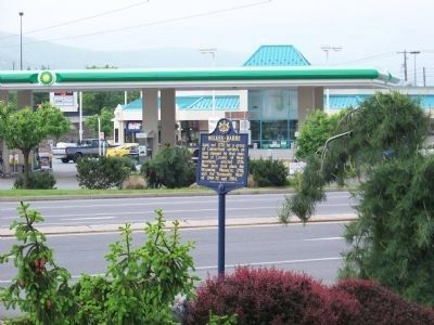
Laid out 1770 by a group of Connecticut settlers, on land claimed by that state. Seat of "County of Westmoreland," erected 1776. Near here took place the Wyoming Massacre, 1778, and the "Pennamite Wars" of 1769-72 and 1784. — — Map (db m90612) HM
Nearby on July 3, 1778, 300 patriots under Col. Zebulon Butler were defeated by 1100 British, Tories, and Indians with Maj. Gen. John Butler. Captives were massacred; survivors fled to Forty Fort. — — Map (db m18895) HM
Between 4 and 5 o'clock in the afternoon of July 3, 1778, an American force of about 300 men, led by Col. Zebulon Butler, Col. Nathan Denison, Lieut. Col. George Dorrance and Major Jonathan Garrett formed in line of battle east and west of this . . . — — Map (db m10515) HM
This encampment site was named by General Sullivan’s Expedition of the Revolutionary War, 1779, en route north to avenge the Wyoming Massacre. They called the adjacent swamp Hell’s Kitchen. Army engineers built this first road on the Pocono Plateau, . . . — — Map (db m84565) HM
The highway here follows closely the route of the Delaware Indian trail from Minisink Island to Wyoming. Refugees from the Massacre of Wyoming, 1778, camped by the “boiling” spring, which may be seen in the woods a few yards SW of here. — — Map (db m23643) HM
Formed March 2, 1855 out of Union County. The name honors Simon Snyder (Governor, 1808-17) who made his home in Selinsgrove. The county seat of Middleburg was laid out 1800, incorporated 1864. County was scene of the Penns Creek Massacre of 1755. — — Map (db m43849) HM
John Jacob LeRoy was killed by the Indians near this spot during the time of the Penns Creek Massacre, October 18, 1755. This was the first act of hostility by the Indians of this Province following the defeat of General Edward Braddock, July 9, . . . — — Map (db m87574) HM
On this site was the house of Col. Thomas Hartley, first congressman from York County. In 1777, he was prominent in the defense of Philadelphia; led an expedition to avenge the Wyoming Massacre in 1778. — — Map (db m4566) HM
The cemetery located about 1/2 mile SW, marks the original site of the church, founded Sept. 10, 1836. Buried here is William Blakely, Sr., survivor of Hayes Station Massacre, 1871, who with Samuel Blakely donated the land for the church and . . . — — Map (db m12030) HM
On this spot, where the eroded ruts of the Bismarck-Deadwood Trail are still plain to see took place on July 17, 1877 the massacre of the Wagnus family by Indians, who from Bear Butte watched with envy the passing of their lands to the whites. Two . . . — — Map (db m184171) HM
Established by James Houston in 1785, it stood about 300 yards east on Little Nine Mile Creek. From here, in 1786, John Sevier led 160 horsemen against the Cherokee towns. In 1788, the Kirk family was massacred about three miles south; shortly . . . — — Map (db m58500) HM
Here, near Mansker’s Lick, Casper Mansker established a station of the Cumberland Settlements in 1780. The road connecting with Nashboro was built in 1781. John Donelson and his family moved here after abandoning his Clover Bottom Station, following . . . — — Map (db m2375) HM
This pioneer finally settled on a farm about 4 1/2 mi. east. Following his last defeat for reelection to Congress, he went to Texas, where he died in the Alamo massacre. This cabin, restored partly from timbers of his original dwelling by . . . — — Map (db m81555) HM
Here stood the Crockett Tavern, established and operated by John and Rebecca Crockett. It was the boyhood home of David Crockett (1786-1836), pioneer and political leader in Tennessee, and a victim of the Alamo Massacre at San Antonio, Texas. — — Map (db m43711) HM
Many of the early settlers of Hawkins County are buried in this cemetery, 170 yards south, including Joseph Rogers, the founder of Rogersville, and his descendants. The grandparents of David Crockett who were massacred by the Indians are also . . . — — Map (db m91864) HM
About ½ mile north was this early fortified settlement. Here on Sept 25, 1793, Alexander Cavett and 12 other settlers were massacred by a Cherokee war party under Doublehead, one of the more savage chiefs of the tribe. — — Map (db m32688) HM
High priestess of the Cherokee and always loyal friend of white settlers, is buried on the ridge to the west. She repeatedly prevented massacres of white settlers and several times rescued captives from death at the hands of her people. She is also . . . — — Map (db m80167) HM
Revolutionary War veteran Major William Hall settled in this area in 1785 and built a station, 1 1/4 miles northeast. He and two sons were massacred a few years later. Born in North Carolina in 1775, General William Hall, his son, served in the . . . — — Map (db m68471) HM WM
Here are buried the nine victims of a massacre of Union sympathizers by a detachment of Confederate cavalry from the command of Col. V.A. Witcher, Jr. A marker at the grave site gives their names. — — Map (db m234257) HM
A flat limestone slab, said to be the doorstone of the original cabin, marks the birthplace of this pioneer. Before his death at the Alamo Massacre in 1836, he had been soldier, trapper, explorer, member of the State Legislature and Representative . . . — — Map (db m69615) HM
Here stood the early Court House, City Council Room, etc., and where occurred the Indian Massacre in 1840, and where the Court was captured in 1842. De Zavala Daughters of the Heroes of Texas. 1924. — — Map (db m142413) HM
New Yorker George Rounds served in Col. James W. Fannin's regiment in the Texas War for Independence but escaped the Goliad Massacre. He settled in Columbia, where he operated a tavern. Just before his death, he drew up a will devising his estate . . . — — Map (db m173039) HM
Started 1841 as two rooms of local pine wood. Acquired 1855 and enlarged by S.S. Munger. Owned 1866-1961 by estate of N. W. Faison (1817-70), who joined 1842 Dawson expedition resisting Mexican invaders. Captured near San Antonio when many Dawson . . . — — Map (db m215137) HM
Used by colonists of this vicinity as a protection against Indian attacks 1828-1842 fortified residence of Zadock Woods veteran of the War of 1812 One of the old "Three Hundred" of Austin's colonists Oldest man killed in the "Dawson Massacre" . . . — — Map (db m79696) HM
Known as Big Foot Wallace • Defender of Texas and Texans • As Soldier Ranger and Mail Rider, He Protected the Advancing Frontier • Died January 7, 1899 Erected by the State of Texas 1936 — — Map (db m162717) HM
The Texan victory at the Battle of San Jacinto led to the withdrawal of the Mexican army from Texas. At the end of May 1836, General Thomas Rusk reoccupied Victoria and Goliad. The Centralist soldiers had only partially burned the bodies of . . . — — Map (db m235075) HM
In fort built to halt Indian depredations in North Texas. One of buildings and units on inspection in May 1871 by Gen. Wm. Tecumseh Sherman, when news came of massacre of Warren Wagon Train, 24 miles northwest. Killers, later found at Fort Sill, . . . — — Map (db m137873) HM
Came to Texas from Alabama in January 1836 · A member of Captain Jack Shackelford's Red Rover Company under Colonel Fannin's Command · March 18-19, 1836 Miraculously escaped from the Goliad Massacre Erected by the State of Texas . . . — — Map (db m164193) HM
One of the first brick homes in Weatherford, this structure was begun in late 1860s and occupied by Joseph A. Woolfolk (1836-1918), one of two attorneys who defended Indian Chiefs Satanta and Big Tree, charged in 1871 wagon train massacre. In 1879 . . . — — Map (db m226540) HM
Here were buried King's Men massacred March 16th, 1836. Erected by the Refugio Chapter Texas Historical and Landmarks Association. A.D. 1934 — — Map (db m165546) HM
Initiated by the burial of 16 soldiers massacred during the Texas revolution of 1836. The bones of Capt. Amon King and his men - scattered on the Prairie - were buried by Refugio citizens. Later forgotten, the site was rediscovered in 1934. Grave . . . — — Map (db m165502) HM
Site of 1839 home and 1842 massacre of Gideon White. A daughter, Louisa, wed (1846) Edward Seiders, for whom oaks are named. Recorded Texas Historic Landmark - 1967 — — Map (db m100088) HM
Survivor of the famous Morgan Massacre; daughter of settler James Marlin. In Falls County, Jan., 1, 1839, Indians killed and scalped several members of the Morgan and Marlin families. Isaac Marlin, 10, ran 7 miles for help. His sister, Stacye Ann, . . . — — Map (db m145837) HM
Located 6.6 miles east of this site in the Sand Hills, Willow Springs was known to Comanche Indians and to West Texas pioneers as an important source of water. It was frequently used by gold seekers on their way to California after the 1849 gold . . . — — Map (db m73313) HM
In July 1853, a trade of fish for flour between an Indian and Mrs. James Ivie, ended in a skirmish; one Indian died, Chief Walker refused peace offer of ponies, beef, flour and blankets unless Mr. Ivie stood trial by Indians; raids began. Colonel . . . — — Map (db m75456) HM
"The man who robbed a thousand stagecoaches" was how actor Jack Elam was once described. Jack's familiar face appeared in hundreds of feature films and television series over his 50 year Hollywood career. He often came to Kanab for such films as . . . — — Map (db m130623) HM
Provo was settled by Mormon pioneers March 12, 1849. East of this monument a second fort was built in April, 1850. It was here that the settlers were threatened with massacre by Chief Walker and his Band of Indians, but were saved by Chief Sowiett's . . . — — Map (db m149444) HM
On September 16, 1859, 17-year-old James H. Berry witnessed an event that he would never forget. He saw 15 children return to relatives and friends in Carrollton, Arkansas. Those children were survivors of the Mountain Meadows Massacre. They were . . . — — Map (db m240465) HM
LDS convert of 1836 – Wounded in massacre at Haun's Mill, Missouri, 1838 – Moved to Illinois – Set apart as Bishop of Nauvoo 4th Ward and helped to build Nauvoo Temple – Captain of fifty in first Pioneer Company to enter Salt . . . — — Map (db m147481) HM
Half a mile north, stood the Warrascoyack Indian village. Captain John Smith obtained corn there for the starving colonists in 1608. The Warrascoyacks took part in the massacre of 1622 and their village was destroyed in 1623. In 1680, Old Town was . . . — — Map (db m18655) HM
The great Indian massacre of March 22, 1622, during which a quarter of the population of Virginia was slain came nearest to Jamestown here in a community known as Archer's Hope. At the house of Ensign William Spence five persons were killed-- John . . . — — Map (db m31085) HM
A small group of Spanish Jesuits attempted a settlement in Virginia in September, 1570. They are said to have entered James river and landed along this creek and crossed the peninsula to establish a mission near York River. Six months later all were . . . — — Map (db m30732) HM
"Laughing King of Accomacke Emperor of the Easterne Shoare King of the Great Nussawattocks" A gallant warrior and a loyal friend to the early settlers of the Eastern Shore. His timely warning to the colonists of an intended uprising in 1621, saved . . . — — Map (db m7591) HM
The village of the Nansemond Indians stood near here, 1608, when the region was first explored by the English settlers. These savages took part in the massacre of 1622, and in the war that followed their town was destroyed by Sir George Yeardley. — — Map (db m162964) HM
Charlie Newell’s knowledge of the Indian language and his wide acquaintance with the Yakama Indians enabled him to avert a crisis in which a massacre seemed imminent. The Indian Agency had forbidden the racing of horses and gambling at their meets. . . . — — Map (db m129700) HM
Named for Gen. William Darke, veteran of the Revolution and the Indian wars. He saved the remnants of St. Clair’s army from massacre in 1791 when badly defeated by the Miami Indians. His son, Capt. Joseph Darke, lost his life. — — Map (db m167181) HM
During the French and Indian War, Fort Neally was captured and its garrison massacred, Sept. 17, 1756. Many settlers in the vicinity also were killed. Among captives was Isabella Stockton, later wife of William McCleery, Morgantown. — — Map (db m12790) HM
William Stewart settled here in 1771. Northeast was Fort Dinwiddie. Forks of Cheat Baptist Church was organized here, 1775, by John Corbley, the pioneer minister, whose family was massacred later by the Indians. — — Map (db m74597) HM
John Statler built a fort here in 1770. In its vicinity a number of settlers were Indian victims in 1777 and 18 white men lost their lives the next year. Later Statler himself and companions were massacred. — — Map (db m196734) HM
Fort Seybert, strong frontier post with blockhouse, cabins, and stockade, surrendered to the Indians after three-day siege in 1758. Twenty of the prisoners were massacred and the others were carried into captivity. (Site 2 Mi. North) — — Map (db m34461) HM
Settled about 1753 by Robert Files and David Tygart. Files' family was massacred near by. Site of Westfall's Fort, 1774. In Mt. Iser Cemetery are the Union trenches and graves of Confederate soldiers killed in Battle of Rich Mountain. — — Map (db m24579) HM
In honor of John (Portugee) Phillips who Dec. 22-24, 1866, rode 236 miles in sub-zero weather through Indian infested country to Fort Laramie to summon aid for the garrison of Fort Phil Kearny beleaguered by Indians following the Fetterman . . . — — Map (db m86069) HM
Between recruitment in New Orleans on October 13, 1835, and the Palm Sunday massacre at Goliad during 157 days of the Texas Revolution the 120 men of the two companies of New Orleans Greys fought at Bexar; and units of the Greys fought at the . . . — — Map (db m221154) HM
Captain Silas S. Soule and Lieutenant Joseph A. Cramer of the 1st Colorado (U.S.) Volunteer Cavalry put their military
careers - and lives - at risk by refusing to fire during the attack against a peaceful Cheyenne and Arapaho village at
Sand . . . — — Map (db m180846) HM
Chief Pocatello - Born in a Time of Change
It is hard to imagine the change Pocatello saw during his lifetime, and the challenges to his people's way of life to which he was forced to respond.
Early Life
Pocatello was . . . — — Map (db m108331) HM
The people of the Cherokee Nation left a lasting legacy to this corner of the State.
The 1836 Treaty of New Echota forced the removal of the Cherokee Nation from lands east of the Mississippi to the new Indian Territory. In addition to the . . . — — Map (db m81141) HM
"They made us many promises, more than I can remember, but they never kept but one: they promised to take our land and they took it." - Chief Red Cloud, Oglala Sioux
Major Conflicts of the Plains Indian War
August 19, 1854 Gratten . . . — — Map (db m189765) HM
Auditorio Elba y Celina Ramos Dignas y ejemplares mujeres, representantes de la sencillez, generosidad y laboriosidad del pueblo salvadoreños. En recuerdo agradecido a su cercanía y servicio a la Compañía de Jesús, que las llevó a . . . — — Map (db m142787) HM WM
National Liberation Front (FMLN) a coalition of five left-wing guerrilla groups. However this conflict evolved into a proxy war between the United States and the Communist elements of Nicaragua and Cuba. The United States was able to prevail by . . . — — Map (db m194165) HM WM
The Bataan Battle ended with the capitulation of 80,000 sick injured and starving men. The largest surrender in U.S, military history. They were forced marched by Japan’s . . . — — Map (db m193932) HM WM
Floods of emigrants, gold seekers, and Mormon settlers entering the homeland of the Shoshone and Bannock people from the mid-1840s to early 1860s gave rise to conflict and often violent encounters. Despite Mormon effort to supply them with food, . . . — — Map (db m106723) HM
The Tchefuncte tribe found
this shell mound about 400 B.C.
In 1720 the Chouachas then
living on this mound were massacred
by slaves on the order of Governor
Perrier for looting of warehouses
and crops.
Authority of F.S. Martin, . . . — — Map (db m177531) HM
1520 - 1711
In 1520 the Spaniard, Francisco Gordillo, sailing from Hispaniola, stopped near Port Royal Sound long enough to call the place Santa Elena. Fourty-two years later, in 1562, Jean Ribaut and his French Huguenots named the . . . — — Map (db m5886) HM
Zadock Woods (d. 1842), veteran of the War of 1812 and one of Stephen F. Austin's old three hundred colonists, brought his family to settle in this area in 1828. He built a fortified home on land deeded to his son, Montraville, and established a . . . — — Map (db m195933) HM
The Common an Historic Overview In 1634, only four years after John Winthrop and the Puritans of the Massachusetts Bay Colony settled the Shawmut Peninsula and created the town of Boston, these colonists bought a 48-acre tract of land on the . . . — — Map (db m191834) HM
To the east, on Dogue Neck, "Certain Unknown Indians" attacked the house of Thomas Barton about 3:00 P.M. on Sunday, 16 June 1700, killing eight persons with "arrowes & Wooden Tommahawkes." The neighboring Piscataway Indians denied making the attack . . . — — Map (db m203) HM
27 July 1813 – Battle of Burnt Corn
30 August 1813 – Fort Mims Massacre
31 August 1813 – Kimbell – James Massacre
2 September 1813 – Attack at Fort Sinquefield
13 September 1813 – Wood's Bluff . . . — — Map (db m122631) HM WM
This was in the square at intersection of these streets.
Dimensions fifty-six feet north and
south, and forty-six east and west.
Built in 1688, of wood.
Burned during Massacre of 1690.
Rebuilt of stone in 1703.
Used as guard house and . . . — — Map (db m223655) HM
In 1869, Canada bought Rupert's Land but failed to provide the area with any government presence. The illegal whiskey trade, the need to build a national railway, fear of American settlers laying claim to the land and the massacre of several . . . — — Map (db m221775) HM
In 1812, the Earl of Selkirk settled dispossessed Scottish highlanders on Red River valley lands granted by the Hudson's Bay Company. The HBC's rival in the fur trade, the North West Company, feared the new colony would block its trade and . . . — — Map (db m106761) HM
Restos del helicóptero UH-1H, de fabricación Norte Americana. Derribado por las fuerzas guerrilleras a las 16.00 horas, del día 23 octubre de 1984, en las alturas cercanas al municipio de Joateca. En que murió el Teniente coronel Domingo . . . — — Map (db m83658) HM WM
En esta casa nacio el 15 de Agosto de 1917,
Monseñor Oscar Arnulfo Romero Segundo Obispo de Santiago de Maria
(1974-1977) y IV Arzobispo de San Salvador de 1977 a 1980.
En Memoria
El Obispado de Santiago de Maria
24 de Marzo . . . — — Map (db m83250) HM
Casimiro Chowell J. ilustre patriota mexicano fue sacrificado en esta plazuela el día 28 de noviembre de 1810. English translation: Casimiro Chowell Jurado illustrious Mexican patriot, was assassinated in this plaza on November . . . — — Map (db m100725) WM
En este lugar estaba una tienda, de donde el 28 de septiembre de 1810, el Pípila y la muchedumbre tomaron lo necesario para incendiar la puerta principal de la Alhóndiga de Granaditas. Ayuntamiento de Guanajuato 1989-91 . . . — — Map (db m100744) HM WM
Spanish soldiers may have fired from this very site during the infamous “massacre” of 1805. Their Navajo targets were huddled in the alcove below and to the left. Spanish accounts describe a day-long battle against Indians . . . — — Map (db m170547) HM
Buried here are the remains of Tom McLaury, Frank McLaury, Billy Clanton - killed in Earp Clanton battle Oct 26, 1881.
Dan Dowd, Red Sample, Bill DeLancy, Dan Kelly: Tex Howard hanged legally by Sheriff Ward for Bisbee massacre Mar 1884, John . . . — — Map (db m100173) HM
Ancestral Puebloans
Beginning around A.D. 600, Ancestral Puebloans built Colorado's first permanent towns in the canyon country south of here. Hundreds of these settlements sprawled across the desert, with an overall population possibly . . . — — Map (db m160128) HM
Following the Meeker Massacre, Gen. Wesley Merritt established at this site his “Camp on White River,” 1879. After withdrawal of the garrison in August, 1883, the town of Meeker was founded by the following pioneers: George S. Allsebrook, Charles . . . — — Map (db m163871) HM
Erected By The
State of Delaware
To Commemorate The Settlement
On This Spot, Of The First
Dutch Colony, Under De Vries,
A.D. 1631.
Here was the cradling of a state.
"That Delaware exists as a separate
Commonwealth is due to . . . — — Map (db m37400) HM
The Old Military Road connecting Ft. Brooke (Tampa) and Ft. King (Ocala) ran through this vicinity. On Dec. 23, 1835, Maj. Francis L. Dade set out over the Trail with a detachment of 109 soldiers to reinforce the small garrison of Ft. King.
On . . . — — Map (db m126035) HM
On January 15,1838, during the Second Seminole War.The Seminoles met and defeated U.S. forces in the first battle of the Loxahatchee River.Trying to end the war,Maj. Gen. Thomas Jesup brought several columns of troops to south Florida, including . . . — — Map (db m99906) HM
Large Indian town home of the Chehaws. A friendly agricultural people of the Creek Tribe who aided our early settlers. They contributed men, food and horses to subdue the hostile Seminoles. Here Andrew Jackson rested with his starving army and was . . . — — Map (db m197060) HM
Located Sept. 15, 1846 by William Craig mountain man and his Indian wife Isabel.
First permanent white settler in Idaho, 1840, first Nez Perce Indian Agent, 1848; interpreter at Walla Walla Flathead and Blackfoot Councils, 1855 Lieutenant . . . — — Map (db m121603) HM
(There are five historical panels in this kiosk:)
Idaho's Emigrant Trail
Westward-bound emigrants entered Idaho after crossing Thomas Fork Valley. They soon encountered the climb and descent of Big Hill, witnessed nature's . . . — — Map (db m124029) HM
Defense
Fort Dearborn stood almost on this spot. After an heroic defense in eighteen hundred and twelve, the garrison together with women and children was forced to evacuate the fort. Led by Captain Wells, they were brutally massacred by the . . . — — Map (db m47670) HM
Josette Beaubien, a survivor of the Fort Dearborn Massacre, was buried here in 1845. She was married to Jean Baptiste Beaubien, one of Chicago's first settlers. Her brother was Claude LaFramboise, a chief of the Potawatomi Indians. Chief Alexander . . . — — Map (db m55452) HM
Around 11 p.m. on July 2, rioters set fire to the neighborhood here in an attempt to spread the violence to the north. Major military reinforcements did not arrive until after midnight. — — Map (db m142464) HM
Over 100 African Americans barricaded in two homes here. They provided armed resistance to the white attackers. Soldiers brokered a cease fire and escorted them to St. Louis. — — Map (db m142285) HM
As early as 1818, settlers were drawn to the Fall Creek area near the Falls that were utilized as a source of power and water. On November 10, 1823, Thomas Pendleton platted the Town of Pendleton on land that he owned. It was on this day the . . . — — Map (db m164180) HM
Isaac N. Blackford (1786-1859) was one of Indiana's first Supreme Court Justices. He moved to Salem, Indiana in 1812 and served as county clerk. Five years later he moved to Indianapolis when he was appointed to the Indiana Supreme Court. In 1824, . . . — — Map (db m132722) HM
These iron sculptures by Todie Zweygardt are in memory of the Cheyenne and other Indians, survivors of the 29 Nov. 1864 Massacre at Sand Creek, Colo., who fled to this Cherry Creek Valley, remaining until joined by forces of there Plains tribes for . . . — — Map (db m78887) HM
Two miles northeast of here Abraham Lincoln, grandfather of the president, was massacred by Indians in May 1786. Long Run Baptist Church, standing on the Lincoln land grant, marks the traditional site of the pioneer's grave.
The original . . . — — Map (db m161772) HM
In the field nearby was situated the garrison house of the Rev. Joseph Rowlandson first ordained minister of Lancaster. During his absence on February 10, 1675-76 this garrison house was attacked and destroyed by the Indians. The inhabitants were . . . — — Map (db m32253) HM
In 1782 marauding American militia massacred nearly one hundred Christian Delaware Indians at their village in eastern Ohio. Seeking refuge, the Delaware settled on the Clinton River two and one-half miles north of here, on land granted by the . . . — — Map (db m85632) HM
War of 1812: A Private in the Dragoons, 1st. Regiment Michigan Volunteers. Taken prisoner with Hull's Army at surrender of American troops at Detroit on August 16, 1812. Released, he returned across the ice on skates to help bury the River Raisin . . . — — Map (db m242776) HM WM
In the Spring of 1780, several families of the Great Pee Dee River area near Charleston, S.C., loaded their possessions on pack-horses and set out for the far off "Natchez Country". Richard Curtis, Sr., was their leader. At the Holston River in . . . — — Map (db m105400) HM
Amache Ochinee Prowers (ca. 1846-1905) was born near Bent's Fort, the daughter of a Cheyenne chief named Ochinee. In 1861, as a teenage girl, she married John Prowers, a trader with Bent, St. Vrain & Co. For a time, Amache and her husband lived in . . . — — Map (db m199381) HM
984 entries matched your criteria. Entries 401 through 500 are listed above. ⊲ Previous 100 — Next 100 ⊳
* Inflectional forms of words are their plurals, singulars, and possessives as well as gramatical tenses and similar variations.