By William Fischer, Jr., August 20, 2011
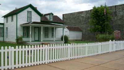
Boyhood Home of General Funston and Marker
| On Washington Street near Madison Avenue (U.S. 54), on the left when traveling north. |
| On Skyway Highway (U.S. 59) 0.2 miles west of Rawlins Road, on the right when traveling west. |
| On U.S. 73 at Osage Road, on the right when traveling east on U.S. 73. |
| On Amelia Earhart Road (U.S. 73) at Kansas Highway 74, on the left when traveling north on Amelia Earhart Road. |
| On U.S. 160 at the entrance to Memorial Peace Park, on the right when traveling east on U.S. 160. |
| On U.S. 56, on the left when traveling east. |
| On U.S. 56 at SW 70th Road / County Line Road, on the left when traveling west on U.S. 56. |
| On National Avenue at Stanton Street, on the right when traveling north on National Avenue. |
| On 15th Street (U.S. 73) near 5th Avenue East, on the right when traveling east. |
| On Interstate 35 at milepost 65. |
| On Pearl Street at Broadway, on the right when traveling east on Pearl Street. |
| On U.S. 50, on the right when traveling east. |
| On U.S. 69/400, 0.2 miles south of SE Varck Road, on the right when traveling south. |
| On U.S. 160 at milepost 138, on the left when traveling south. |
| On 620th Avenue (State Highway 47) 0.5 miles east of 60th Street, on the right when traveling east. |
| On East Frontier Parkway (U.S. 36) east of Martin Avenue, on the right when traveling east. |
| On U.S. 36 near Ottumwa Road, on the left when traveling west. |
| On U.S. 56, 0.1 miles east of North 250th Road, on the right. |
| On U.S. 56, 0.1 miles east of East 2000 Road. |
| On U.S. 40 at E 600 Road (County Route 1029), on the right when traveling west on U.S. 40. |
| On 6th Street, on the right when traveling west. |
| On U.S. 50 near 120th ave. |
| On U.S. 160 at Osage Street, on the right when traveling east on U.S. 160. |
| On Bypass U.S. 183, 0.1 miles south of Golf Course Road, on the left when traveling south. |
| On Old Highway 40 at Ball Park Road, on the right when traveling east on Old Highway 40. |
| On Douglas Avenue (State Highway 14) at Main Street, on the right when traveling south on Douglas Avenue. |
| Near Interstate 70 at milepost 224,, 1.3 miles west of State Highway 156. |
| Near Interstate 70 at milepost 224. |
| Near East Fulton Street (Business U.S. 50) just east of Campus Drive, on the right when traveling east. |
| On Kansas Route 156 at Kansas Route 23, on the right when traveling west on State Route 156. |
| On U.S. 54 at Bloom Road, on the right when traveling west on U.S. 54. |
| On Wyatt Earp Boulevard (Business U.S. 50) 0.1 miles east of Matt Down Road, on the right when traveling east. |
| On U.S. 400, 0.2 miles west of Sheridan Street, on the left when traveling west. |
| Near U.S. 56 at U.S. 283. |
| On Huebner Road east of 10th Street, on the right when traveling east. |
| On Huebner Road east of 10th Street, on the right when traveling east. |
| On Huebner Road at Seitz Road, on the right when traveling west on Huebner Road. |
| On Interstate 70 at milepost 294, on the right when traveling east. Reported missing. |
| Near Interstate 70, 4.5 miles west of Pillsbury Drive (State Highway 177), on the right when traveling west. |
| On Interstate 70 at milepost 310, on the right when traveling west. |
| Near Interstate 70 at milepost 310. |
| On U.S. 24. Reported permanently removed. |
| On State Highway 25, 14.4 miles north of U.S. 56, on the left when traveling north. |
| Near South Main Street (State Highway 23) 0.1 miles south of West Avenue E, on the right when traveling south. |
| On U.S. 54, 0.5 miles west of County Route 33, on the left when traveling west. |
| On State Highway 2 at NE 140th Road, on the right when traveling north on State Highway 2. |
| On U.S. 50, on the left when traveling east. |
| On U.S. 75 at 286th Road, on the left when traveling south on U.S. 75. |
| On U.S. 59 at 142nd Street, on the left when traveling north on U.S. 59. |
| On U.S. 24, 0.8 miles west of U.S. 59, on the right when traveling west. |
| On Main Street, 0.1 miles North Oak Street, on the right when traveling west. |
| On 63rd Terrace, 0.1 miles west of Carter Avenue, on the right when traveling west. |
| On U.S. 50/400, 0.1 miles west of Country Heights Road, on the left when traveling west. |
| On U.S. 50/400 east of Road W2, on the left when traveling east. |
| On U.S. 54/400 west of Ohio Avenue, on the left when traveling east. |
| On Reynolds Avenue east of Gibbons Avenue, on the left when traveling east. |
| On Metropolitian Street (State Highway 92) 0.2 miles north of State Highway 7, on the right. |
| On U.S. 69, on the right when traveling south. Reported missing. |
| On U.S. 69 near Kansas Highway 52. |
| On Bison Road (State Highway 15) at 130th Street on Bison Road. |
| On Valley Road (State Highway 9) 0.1 miles east of U.S. 77, on the right when traveling east. |
| On State Highway 148 near U.S. 36. |
| On Pony Express Highway (U.S. 36) near 11th Road, on the left when traveling east. Reported permanently removed. |
| On Pony Express Highway (U.S. 36) 0.2 miles west of 11th Road, on the right when traveling west. |
| On Old U.S. 81, 0.3 miles south of Comanche Road, on the right when traveling south. |
| On U.S. 54 at milepost 42.5, on the right when traveling east. |
| On 6th Street at Lincoln Avenue, on the left when traveling north on 6th Street. |
| On U.S. 24, 2 miles east of Cawker City, on the right when traveling east. Reported missing. |
| On Wisconsin Street (U.S. 24) 2.3 miles east of Ash Street, on the right when traveling east. |
| On Main Street (U.S. 160) at 4410th Street, on the left when traveling east on Main Street. |
| On U.S. 56 west of Trim Avenue, on the right when traveling west. |
| On Acorn Road (U.S. 75) 0.8 miles 280th Road (State Highway 246), on the right when traveling south. |
| On Pratt Road (U.S. 59) at 160th Road (Kansas Highway 146), on the right when traveling north on Pratt Road. |
| On Pratt Road (U.S. 59) at 160th Road (State Highway 146), on the right when traveling north on Pratt Road. |
| On Washington Street (State Highway 47) near Udall Road, on the right when traveling east. |
| On State Highway 96, 0.1 miles east of C Rd, on the right when traveling east. |
| On 80th Drive, on the right when traveling east. |
| On U.S. 56 at 3rd Street, on the left when traveling east on U.S. 56. |
| On U.S. 56 at milepost 181, on the left when traveling east. |
| On East Bertrand Street (U.S. 24) at Grand Avenue, on the right when traveling east on East Bertrand Street. |
| On Oregon Trail Road, 0.8 miles west of Onaga Road, on the right when traveling west. |
| On The Road to Oz Highway (State Highway 99), on the right when traveling south. |
| On Lake Road at North 2nd Street, on the left when traveling east on Lake Road. |
| On U.S. 36 near Cloud Street, on the left when traveling west. |
| On Avenue M (U.S. 56) at 12th Road, on the left when traveling west on Avenue M. |
| On State Highway 96 at Whippet Avenue, on the right when traveling east on State Highway 96. |
| On U.S. 83, 0.5 miles north of Kansas Highway 95, on the left when traveling north. |
| On West Scott Lake Drive, on the right when traveling north. |
| On Broadway south of 63rd Street, on the left when traveling north. |
| On Broadway, 0.3 miles north of I-235 Exit 15, on the right when traveling north. |
| Near U.S. 54 at Panhandle Road. Reported missing. |
| On U.S. 160 at U.S. 83, on the right when traveling west on U.S. 160. |
| On Yellow Brick Road at East Pancake Boulevard, on the right when traveling north on Yellow Brick Road. |
| Near Interstate 70, 10 miles west of S Lawrence Trafficway (State Highway 10). |
| On 37th Street at Topeka Boulevard, on the right when traveling west on 37th Street. Reported permanently removed. |
| On U.S. 36, on the right when traveling west. |
| Near U.S. 36, 0.4 miles west of Kansas Highway 181, on the right when traveling east. |
113 entries matched your criteria. The first 100 are listed above.
The final 13 ⊳