The "Southern Route" to Oregon, the Applegate Trail left the Oregon Trail at Fort Hall, passed through northern Nevada and California before heading north to the Willamette Valley.
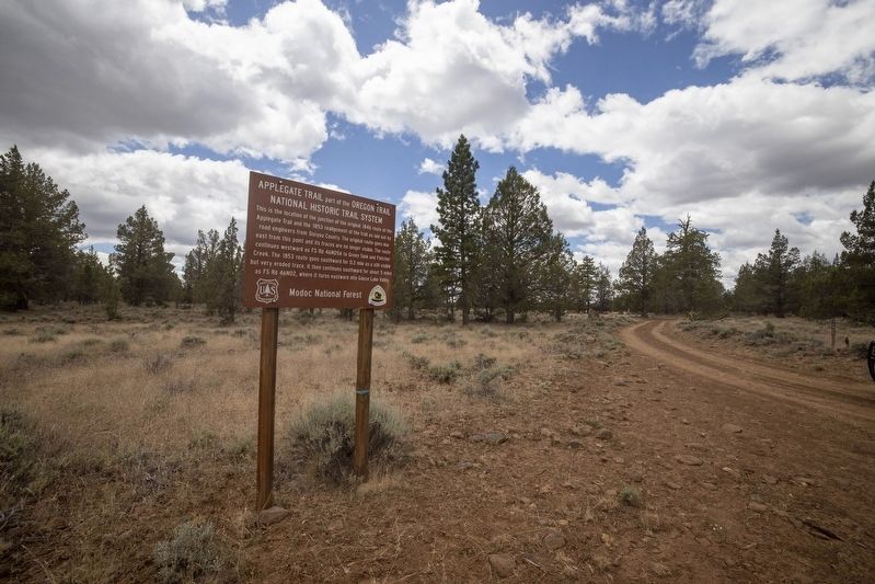
This is the location of the junction of the original 1846 route of the Applegate Trail and the 1853 realignment of the trail as laid out by road engineers from Siskiyou County. The original route goes due east from this point and its traces are no . . . — — Map (db m152261) HM
The 1846 Applegate Trail, also known as the South Road to Oregon, lies behind this sign and heads westward along the banks of Fletcher Creek. It leaves Fletcher Creek after about two miles and then swings around the southern flank of Blue Mountain. . . . — — Map (db m152283) HM
... Decent [sic] to the lake ... Night brought us to the end of the lake ... We laid up on a mountain brook where the roads forked ... One branch going to Oregon, the other to California."
Alonzo Delano, August 28, 1849 — — Map (db m147424) HM
"Traveled ... to Goose Lake. The descent ... is sidling and dangers. While we were nooning here 2 wagons of other trains were upset and mashed to atoms" - Simon Doyle, Sep 19 1849
Guidebook available
Trails West Inc., P.O. Box 12045, . . . — — Map (db m87849) HM
"Four miles to a beautiful little stream of pure cold water coming from the mountains to our left and emptying into Goose Lake ... Camped there ...Found plenty of ripe plums on the neighboring mountain sides." - Andrew Murphy, Sep 23, 1849 — — Map (db m147338) HM
"We leave the old Lawson Road for the new road to Shasta Valley (Yreka) to day It seems as if the road is one stone pile We have to goe a foot in such places for fear of getting our heads nocked off" Sophroni Helen Stone, Sep 13 1852 . . . — — Map (db m87850) HM
This spot marks the convergence of two pioneer trails widely used by emigrants during the years 1846-1850. The Applegate Trail, established in 1846, led from the Humbolt River in Nevada to the Willamette Valley in Oregon. The Lassen Cut-Off, . . . — — Map (db m10174) HM
"We arrived at the foot of the summit ridge, the top of which lay one mile distant ... Up we ascended, slowly but surely, by the toilsome climbing of the teams and by lifting of the members. ... at the wheels." - William Swain, Oct 11, 1849 — — Map (db m147406) HM
"Passing over the summit, which is a very narrow ridge, a broad,deep valley ... presented itself to our view, far below us ... We immediately descended the mountain, which on this side, is fearfully steep" - Amos Batchelder, Sep 25, 1849 — — Map (db m147407) HM
"Trees hundreds of feet high and 4-5-6 feet in diameter ... We can drive anywhere among the trees. Only the ground is covered with cobble stones" - E. W. Brooks, Sep 1, 1849 — — Map (db m147888) HM
Southern Route to Oregon
In 1846, Jesse Applegate and fourteen others from near Dallas, Oregon, established a trail south from the Willamette Valley and east to Fort Hall. This route offered emigrants an alternative to the perilous . . . — — Map (db m87845) HM
"Over divide to Tule Lake, on Lost River, passed in sight of Bloody Point where a train of emigrants were cut off last year. This afternoon Geo. W. Ebey killed a brant on the lake. Oh, so good to eat." - James Henry Bascomb Royal, Oct 19, 1853. — — Map (db m147563) HM
"Camped at a magnificent spring of fresh cold water,
which we called Goff's Spring, in honor of the
newly elected lieutenant of the company."
-Levi Scott, South Road Exploring Party, 1846 — — Map (db m151903) HM
(front plaque)
South Road - Forks Of The Yreka Trail
“All in need of provisions were supplied by a government
agent at this camp. Near this point the road forks-one
leading to Jacksonville, in Oregon, and the other to . . . — — Map (db m151605) HM
"Road good ... Still crooking round the inlets of lake, make 8 miles and camp at a fine bold spring but not cold."
Virgil Pringle, Oct 2, 1846 — — Map (db m151579) HM
“Crossed on the natural bridge ... Composed of
solid rock ... Went 15 miles had some stony
road and came to Clamouth Lake & campt”
-Phoebe Hogeboom Terwilliger, Oct 8, 1854 — — Map (db m113111)
“Morn. Fine. Cook still sick no breakfast or dinner
for today. Get away in good time road runs
over the bluff quite rocky to lake”
-John Pratt Welsh, Aug 26, 1853 — — Map (db m113116)
“Here road leaves [Klamath] Lake and follows up the
side of a steep hill 1/2 mile but is not hard to climb”
-William Cochran Stoddard, Sep 16, 1852 — — Map (db m113109)
“Crossed the Sacremento [Lost River], over the hill
or divide to a large swamp down this to a lake
(Clammett) about 3 ms, down the lake and camped”
-Lester Hulin, Oct 8, 1847 — — Map (db m113117)
Jesse and Lindsay Applegate headed south from Williamette Valley, Oregon, June 29, 1846, seeking a less hazardous route to that region from the east. On July 21, they came to a large meadow on the Humboldt River, what is now the nearby Rye Patch . . . — — Map (db m67379) HM
(Seven panels dealing with topics related to the Applegate Trail are found at this kiosk.)
Applegate Trail
Southern Route to Oregon
In 1846, Jesse Applegate and fourteen others from near Dallas, Oregon, established a . . . — — Map (db m116846) HM
In June 1846 Jesse Applegate, Levi Smith and 11 other men left their homes near Dallas Oregon to develop a southern route from Fort Hall (Idaho) to the Willamette Valley. Their route passed through the gap west of Pigeon Butte, then proceeded . . . — — Map (db m119068) HM
(Two interpretive displays are located here next to the South Benton Community Museum):
(First Display)
In 1846, Jesse Applegate and fourteen others from near Dallas, Oregon, established a trail south from the Willamette Valley and . . . — — Map (db m116837) HM
(Seven panels dealing with topics related to the Applegate Trail are found at this kiosk.)
Applegate Trail
Southern Route to Oregon
In 1846, Jesse Applegate and fourteen others from near Dallas, Oregon, established . . . — — Map (db m112862) HM
In 1846, Jesse Applegate and fourteen others from near Dallas, Oregon, established a trail south from the Willamette Valley and east to Fort Hall. This route offered emigrants an alternative to the perilous “last leg” of the Oregon Trail . . . — — Map (db m116842) HM
"The valley opens and we pass some very pretty
locations. Timber in a great many varieties, some
entirely new to me." Virgil K. Pringle, Oct 11, 1846 — — Map (db m152440) HM
"Make 10 miles and camp at a considerable sized creek
[Ashland Creek], the best camp we have had for several
[days.] Road very good. High mountains around."
- Virgil K. Pringle, Oct 11, 1846 — — Map (db m152442) HM
Named for its hundreds of fresh water springs, lush glades and meadows, the Greensprings has for millenia been a seasonal gathering place for Native Americans and later provided refuge for travelers. In 1846, Levi Scott and the Applegate brothers, . . . — — Map (db m113544) HM
In the spring of 1846 pioneers settling in the western valleys of Oregon encouraged the opening of an alternate wagon route from the states to their settlements—one that avoided the perils of the Columbia River, and one free of control by . . . — — Map (db m128076) HM
(Seven panels dealing with topics related to the Applegate Trail are found at this kiosk.)
The Applegate Trail
Southern Route to Oregon
In 1846, Jesse Applegate and fourteen others from near Dallas, Oregon, . . . — — Map (db m112656) HM
"Father and I rode down to Jacksonville about 10 miles
from Wagner's Fort. The country is very fine. The town is
wedged up into the mountain but the mines are all stopped
Business is very dull" - Welborn Beeson, Sep 4, 1853 — — Map (db m149048) HM
"The roads today were excellent and the face of nature
appeared full as interesting as yesterday Followed
down Rogue River [Bear Creek] about 12 mi[le]s & camp"
-Lester Hulin, Oct 15, 1847 — — Map (db m152444) HM
We continued our journey towards Jacksonville this morning,
designing to find a suitable place to graze our cattle until we
can find a shelter for our families...we then proceeded across
a prairie...where we encamped" - William Hoffman, Oct . . . — — Map (db m152446) HM
In Honor of the Following Pioneers who in the Year
1846 Blazed the First Trail Through the Wilderness
of Southern Oregon and the Rogue River Valley
Lindsay Applegate — Robert Smith — John Jones
Jesse Applegate — Moses . . . — — Map (db m122982) HM
Applegate Trail emigrants required up to four days to travel from the Klamath River over the Cascades and Siskiyous to the Rouge River valley. The journey may have challenged those with healthy oxen, but it was a devastating trail for those whose . . . — — Map (db m88403) HM
In July 1846 Jesse Applegate, Levi Scott and thirteen others known as "The South Road Party" located this pioneer trail. It was used by the emigrants traveling from Fort Hall on the Oregon Trail to the Rogue River and Willamette Valleys between . . . — — Map (db m88005) HM
Southern Route to Oregon
In 1846, Jesse Applegate and fourteen others from near Dallas, Oregon, established a trail south from the Willamette Valley and east to Fort Hall. This route offered emigrants an alternative to the perilous . . . — — Map (db m88017) HM
"The valley is about 3 miles wide here. It is not the main Rogue
River Valley, but a branch of it called Bear Creek...The first
tomatoes and melon patch I found I helped myself to as many as
I could eat being very hungary" - Wellborn Beeson, . . . — — Map (db m152443) HM
The perilous last leg of the Oregon Trail down the Columbia River rapids took lives, including the sons of Jesse and Lindsay Applegate in 1843. The Applegate brothers and others vowed to look for an all-land route into Oregon from Fort Hall (in . . . — — Map (db m167270) HM
In 1846 the Crowley Family arrived in the valley with the first wagon train over the Applegate Trail.
Martha Leland Crowley, a daughter, succumbed to typhoid fever at the age of 16. She was buried here in a casket made of timber boards from some . . . — — Map (db m114481) HM
"Move one mile to camp (on Grave Creek), having none last night, and spent the day burying Mr. Cowley's daughter (Martha), who died yesterday evening, age about 14 years." - Virgil K. Pringle, Oct. 19, 1846 — — Map (db m112854) HM
The narrow gorge of Canyon Creek has long served as a travel corridor. Native Americans likely trekked this canyon for thousands of years. Alexander McLeod of the Hudson's Bay Company provided the first written account of the route in 1829, while . . . — — Map (db m112856) HM
Between 1846 and 1856 the Applegate Trail through Josephine County became a major travel corridor for settles, miners, freighters and those trekking between Oregon and California. Where the well-traveled route crossed the valley of Wolf Creek, a . . . — — Map (db m114479) HM
Generations of Oregon school children learned the lyrics of a song: "Hurry up oh pioneers, your faithful little band must never fail." Applegate Trail emigrants struggled to follow this advice, but the mountainous terrain of northern . . . — — Map (db m153823) HM
In 1846, Jesse Applegate and fourteen others from near Dallas, Oregon, established a trail south from the Williamette Valley and east to Fort Hall. This route offered emigrants an alternative to the perilous “last leg” of the Oregon . . . — — Map (db m63155) HM
Jesse and Lindsay Applegate, members of the first wave of Oregon Trail emigrants, watched their ten-year old sons drown in the Columbia River when a boat overturned in the rapids near The Dalles in 1843. Once their families were settled, the . . . — — Map (db m114483) HM
In 1846, Jesse Applegate and fourteen others from near Dallas, Oregon, established a trail south from the Willamette Valley and east to Fort Hall. This route offered emigrants an alternative to the perilous "last leg" of the Oregon Trail down the . . . — — Map (db m114488) HM
The first emigrant train over the "Southern Route," including more than fifty wagons under the leadership of Captain Levi Scott and David Goff, left the Oregon Trail at Fall Creek or Raft River, on the Snake River, August 10, 1846. The Klamath River . . . — — Map (db m88002) HM
Large lakes, lush marshes, and verdant meadows of the Klamath Basin foretold the richness of the Oregon country. Watchful against cattle being stampeded by Indians, emigrants encountered mud, rain, a lack of grazing, and other unforeseen hardships. . . . — — Map (db m112865) HM
In 1846, Jesse Applegate and fourteen others from near Dallas, Oregon, established a trail south from the Willamette Valley and east to Fort Hall. This route offered emigrants an alternative to the perilous "last leg" of the Oregon Trail down the . . . — — Map (db m112867) HM
The Applegate Trail crossed the present boundary of Oregon approximately three miles southeast of here and went around the northern end of the lake which covered much of the basin, passing close to where you are now standing. The route was opened in . . . — — Map (db m112699) HM
Honorable Lindsay Applegate, son of a Revolutionary soldier with Colonial ancestry, born in Kentucky, September 18, 1808. Explorer, soldier, Trailblazer. Came to the Oregon country 1843. An Oregon Patriot, served in provisional, territorial and . . . — — Map (db m112625) HM
Capt. Jack’s winter camp was located approximately 1/4
mile east of here and was the site of the opening battle
of the Modoc War - Nov. 1872 — — Map (db m112936) HM
In 1846, Jesse Applegate and fourteen others from near Dallas, Oregon, established a trail south from the Willamette Valley and east to Fort Hall. This route offered emigrants an alternative to the perilous “last leg” of the Oregon . . . — — Map (db m112707) HM
On July Sixth 1846 fifteen pioneers who located the South Road from Fort Hale to the Willamette Valley crossed Lost River on the ledge underlying this dam.
In their memory this marker is placed by Eulalona Chapter Daughters of the American . . . — — Map (db m241971) HM
Southern Route to Oregon
In 1846, Jesse Applegate and fourteen others from near Dallas, Oregon, established a trail south from the Willamette Valley and east to Fort Hall. This route offered emigrants an alternative to the perilous . . . — — Map (db m87946) HM
A party of 15 men, styled the South Road Expedition, as led by Capt. Levi Scott, Jesse Applegate, and David Goff, crossed the 42nd parallel on late July 4, 1846. It was blazing a road on which to lead Americans from harm, free of the impending war . . . — — Map (db m87945) HM
Marker on Left:
In 1846, Jesse Applegate and fourteen others from near Dallas, Oregon, established a trail south from the Willamette Valley and east to Fort Hall. This route offered emigrants an alternative to the perilous . . . — — Map (db m147032) HM
In 1846 Levi Scott, together with Jesse and Lindsay Applegate, led an expedition that established the southern route to Oregon from Ft. Hall, Idaho. He was also elected to guide the first emigrants over the new route. Scott's significant role in the . . . — — Map (db m112910) HM
Slowed by rugged trail conditions, weather, and weary teams, emigrants in 1846 entered the southern Willamette Valley in dire circumstances. Transit of the mountains between the Rogue River and the Willamette watershed took a terrible toll - . . . — — Map (db m112911) HM
Roads and rights-of-way were serious public considerations on the Oregon frontier. Market roads, territorial roads and county roads were the lifelines of commerce and communication. River Road - the road upon which you are standing - was once a . . . — — Map (db m112909) HM
In 1846, Jesse Applegate and fourteen others from near Dallas, Oregon, established a trail south from the Willamette Valley and east to Fort Hall. This route offered emigrants an alternative to the perilous "last leg" of the Oregon Trail down the . . . — — Map (db m112908) HM
The trail to Oregon was never a single set of wagon ruts etched from Missouri to the Willamette Valley. Wagons often traveled abreast through valleys and plains sometimes widening the trail several miles. In the mountains they constantly attempted . . . — — Map (db m112912) HM
(The following two of four interpretive displays located in this park highlight the Applegate Trail):
(First Display)
In 1846, Jesse Applegate and fourteen others from near Dallas, Oregon, established a trail south from the Willamette . . . — — Map (db m116803) HM
(Seven panels dealing with topics related to the Applegate Trail are found at this kiosk:)
In 1846, Jesse Applegate and fourteen others from near Dallas, Oregon, established a trail south from the Willamette Valley and east to Fort . . . — — Map (db m114352) HM