84 entries match your criteria.
Applegate Trail Historical Markers
The "Southern Route" to Oregon, the Applegate Trail left the Oregon Trail at Fort Hall, passed through northern Nevada and California before heading north to the Willamette Valley.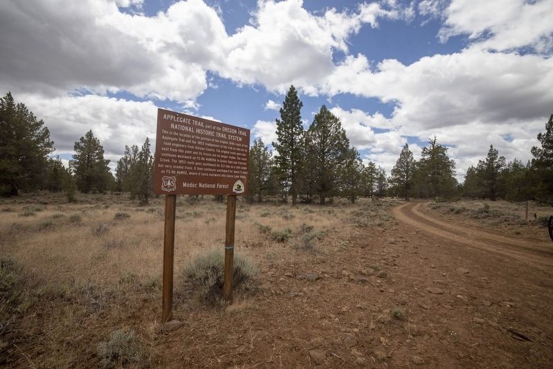
By Douglass Halvorsen, June 29, 2020
Applegate Trail Marker
| 1 ► California, Modoc County, Davis Creek — Applegate Trail — Part of the Oregon Trail National Historic Trail System — |
| On FS 46N05A, on the right when traveling west. | |||
| 2 ► California, Modoc County, Davis Creek — Applegate Trail — A portion of the Oregon Trail National Historic Trail System — |
| On Crowder Flat Rd (Forest Road 73), on the right when traveling south. | |||
| 3 ► California, Modoc County, Davis Creek — A-33 — Applegate Trail - Davis Creek — |
| On Westside Road (County Route 11) at U.S. 395, on the right when traveling east on Westside Road. | |||
| 4 ► California, Modoc County, Davis Creek — A-32 — Applegate Trail - Descent to Goose Lake — |
| On U.S. 395 at milepost 50.6, on the right when traveling south. | |||
| 5 ► California, Modoc County, Davis Creek — A-31 — Applegate Trail - Descent to Lassen Creek — |
| On County Route 133C, 0.3 miles south of South Willow Ranch Road (County Route 47), on the left when traveling south. | |||
| 6 ► California, Modoc County, Davis Creek — A-33 — Applegate Trail - New Road to Yreka — |
| On Westside Road (County Route 48) near U.S. 395, on the left when traveling west. | |||
| 7 ► California, Modoc County, Davis Creek — A-37 — South Road - Applegate Trail — |
| On Crowder Flat Rd (Forest Road 73), on the right when traveling south. | |||
| 8 ► California, Modoc County, Davis Creek — A-35 — South Road - Devil's Garden — |
| On FS 46N02 at FS 46N05A, on the right when traveling south on FS 46N02. | |||
| 9 ► California, Modoc County, Davis Creek — A-36 — South Road - Fletcher Creek — |
| 10 ► California, Modoc County, Davis Creek — A-34 — South Road - McGinty Creek — |
| 11 ► California, Modoc County, Fandango Pass — 546 — The Applegate-Lassen Trail — |
| On Fandango Pass Road (County Road 9) 4 miles west of Surprise Valley Road (County Road 1), on the right when traveling east. | |||
| 12 ► California, Modoc County, Fort Bidwell — A-28A — Applegate Trail - Fandango Pass Ascent — |
| On Fandango Pass Road (County Route 9) 2.5 miles north of Surprise Valley Road, on the right when traveling north. | |||
| 13 ► California, Modoc County, Fort Bidwell — A-28B — Applegate Trail - Fandango Pass Descent — |
| On Fandango Pass Road, 3.8 miles north of Surprise Valley Road, on the left when traveling north. | |||
| 14 ► California, Modoc County, Fort Bidwell — A-30 — Applegate Trail - Through the Forest — |
| On Forest Road 30, 2 miles south of County Route 133C, on the left when traveling south. | |||
| 15 ► California, Modoc County, Fort Bidwell — The Applegate Trail — Fandango Pass — |
| On Fandango Pass Road, on the left when traveling west. | |||
| 16 ► California, Modoc County, Newell — A-44 — Applegate Trail - Bloody Point — California Historical Landmark No. 8 — |
| On Old Alturas Highway (County Route 114) 1.1 miles north of County Route 101, on the left when traveling north. | |||
| 17 ► California, Modoc County, Newell — A-40 — Applegate Trail - Pothole Spring — |
| On 46N19. | |||
| 18 ► California, Siskiyou County, Dorris — A-50, Y-1 — South Road - Forks Of The Yreka Trail / Yreka Trail - The Trail Forks — |
| On Dorris Brownell Road, on the left when traveling west. | |||
| 19 ► California, Siskiyou County, Dorris — A-52 — South Road - Hot Creek — |
| On Dorris Brownell Road, 2 miles west of Sheepy Creek Road, on the left when traveling west. | |||
| 20 ► California, Siskiyou County, Tulelake — A-48 — Applegate Trail - Campt — |
| On Dorris Brownell Rd, on the left when traveling west. | |||
| 21 ► California, Siskiyou County, Tulelake — A-49 — Applegate Trail - Quite Rocky — |
| On Dorris Brownell Rd, on the left when traveling south. | |||
| 22 ► California, Siskiyou County, Tulelake — A-47 — Applegate Trail - Up a Steep Hill — |
| On Dorris Brownell Rd, on the left when traveling west. | |||
| 23 ► California, Siskiyou County, Weed — A-46 — Applegate Trail - Clammett Lake — |
| On Dorris Brownell Rd (U.S. 97), on the left when traveling south. | |||
| 24 ► Nevada, Pershing County, Imlay — 49 — Applegate - Lassen Emigrant Trail Cutoff — |
| On Frontage Road at Lake Road, on the right when traveling west on Frontage Road. | |||
| 25 ► Oregon, Benton County, Corvallis — Avery Park Applegate Trail Kiosk — Southern Route to Oregon — |
| On SW Avery Park Drive, on the left when traveling east. | |||
| 26 ► Oregon, Benton County, Monroe — Applegate Trail — |
| On Dawson Rd, on the right when traveling east. | |||
| 27 ► Oregon, Benton County, Monroe — The Applegate Trail — Southern Route to Oregon — |
| On Pacific Hwy (U.S. 99) at Main Street, on the right when traveling south on Pacific Hwy. | |||
| 28 ► Oregon, Douglas County, Canyonville — Canyonville Applegate Trail Kiosk — |
| On Southwest 5th Street at South East Canyon Street, on the right when traveling east on Southwest 5th Street. | |||
| 29 ► Oregon, Douglas County, Oakland — Applegate Trail - Oakland — Southern Route to Oregon — |
| On NE 1st Street at SE Maple Street, on the left when traveling north on NE 1st Street. | |||
| 30 ► Oregon, Jackson County, Ashland — A-74 — Applegate Trail - A Pretty Location — |
| On East Main Street, on the right when traveling west. | |||
| 31 ► Oregon, Jackson County, Ashland — A-75 — Applegate Trail - Ashland Creek — |
| On E Hersey Street, on the right when traveling west. | |||
| 32 ► Oregon, Jackson County, Ashland — Greensprings — |
| On Greensprings Hwy (U.S. 66). | |||
| 33 ► Oregon, Jackson County, Ashland — Historic Applegate Trail 1846 - 1869 — |
| On Green Springs Highway (U.S. 66), on the right when traveling south. | |||
| 34 ► Oregon, Jackson County, Ashland — A-68 — Keene Creek Wagon Slide — |
| On Green Springs Highway (U.S. 66), on the right when traveling south. | |||
| 35 ► Oregon, Jackson County, Ashland — Route of — |
| On Green Springs Highway (U.S. 66). | |||
| 36 ► Oregon, Jackson County, Ashland — A-71 — Route of Historic Applegate Trail — 1846-1869 — |
| On Greensprings Hwy (U.S. 66) at Buckhorn Springs Rd on Greensprings Hwy. | |||
| 37 ► Oregon, Jackson County, Ashland — A-73 — Route of Historical Applegate Trail — 1846 - 1869 — |
| On Emigrant Lake Rd at Greensprings Hwy (U.S. 66) on Emigrant Lake Rd. | |||
| 38 ► Oregon, Jackson County, Ashland — The Applegate Trail — |
| 39 ► Oregon, Jackson County, Central Point — A-81 — Applegate Trail - We Took Breakfast — |
| On Old Stage Road at Taylor Road, on the right when traveling north on Old Stage Road. | |||
| 40 ► Oregon, Jackson County, Central Point — The Old Stage Road — |
| On Old Stage Road, on the right when traveling north. | |||
| 41 ► Oregon, Jackson County, Gold Hill — A-83 — Applegate Trail - Fort Birdseye — |
| On Rogue River Highway (U.S. 99), on the left when traveling west. | |||
| 42 ► Oregon, Jackson County, Gold Hill — Valley of the Rogue Applegate Trail Kiosk — |
| Near Interstate 5 at milepost 458, on the right when traveling north. | |||
| 43 ► Oregon, Jackson County, Jacksonville — A-80 — Applegate Trail - Jacksonville — |
| On Old Stage Road, on the right when traveling north. | |||
| 44 ► Oregon, Jackson County, Medford — A-78 — Applegate Trail - A Fine Prairie — |
| On Mace Road. | |||
| 45 ► Oregon, Jackson County, Medford — A-77 — Applegate Trail - Down Bear Creek — |
| On South Pacific Hwy (U.S. 99), on the right when traveling north. | |||
| 46 ► Oregon, Jackson County, Medford — A-79 — Applegate Trail - Towards Jacksonville — |
| On South Stage Road, on the left. | |||
| 47 ► Oregon, Jackson County, Phoenix — Applegate Trail Pioneers — |
| On Pacific Highway (U.S. 99) at Oak Street, on the right when traveling south on Pacific Highway. | |||
| 48 ► Oregon, Jackson County, Pinehurst — Crossing the Siskiyous — |
| Near Green Springs Highway (Oregon Route 66), on the right when traveling west. | |||
| 49 ► Oregon, Jackson County, Pinehurst — Historic Applegate Trail — Tub Springs — |
| On Green Springs Highway (Oregon Route 66), on the right when traveling west. | |||
| 50 ► Oregon, Jackson County, Pinehurst — The Applegate Trail — Tub Springs — |
| Near Green Springs Highway (Oregon Route 66), on the right when traveling west. | |||
| 51 ► Oregon, Jackson County, Talent — A-76 — Applegate Trail - Bear Creek — |
| On Talent Avenue, on the left when traveling west. | |||
| 52 ► Oregon, Josephine County, Grants Pass — The 1846 Applegate Trail — Southern Route to Oregon — |
| Near Interstate 5 at milepost 62 near Merlin Road, on the right when traveling north. | |||
| 53 ► Oregon, Josephine County, Wolf Creek — "Grave Creek" — How it got its name — |
| Near Sunny Valley Loop near Placer Road (Route 34-5-10), on the right when traveling north. | |||
| 54 ► Oregon, Josephine County, Wolf Creek — A-90 — Applegate Trail - Grave Creek — |
| On Sunny Valley Loop, on the left when traveling north. | |||
| 55 ► Oregon, Josephine County, Wolf Creek — Canyon Creek — Oregon History — |
| On I-5 Frontage Road at Ritchie Road, on the right when traveling north on I-5 Frontage Road. | |||
| 56 ► Oregon, Josephine County, Wolf Creek — Early Traveler Accommodations — |
| On Old State Highway 99 South near Front Street, on the left when traveling north. | |||
| 57 ► Oregon, Josephine County, Wolf Creek — Feeble, Hungry, and Haggard — |
| On Old State Highway 99 South at Front Street, on the left when traveling north on Old State Highway 99 South. | |||
| 58 ► Oregon, Josephine County, Wolf Creek — The Applegate Trail — Southern Route to Oregon — |
| On Sunny Valley Loop north of Interstate 5, on the left when traveling north. | |||
| 59 ► Oregon, Josephine County, Wolf Creek — The Applegate Trail — |
| Near Sunny Valley Loop near Placer Road (Route 34-5-10), on the right when traveling north. | |||
| 60 ► Oregon, Josephine County, Wolf Creek — The Applegate Trail — Southern Route to Oregon — |
| On Old State Highway 99 South at Front Street, on the left when traveling north on Old State Highway 99 South. | |||
| 61 ► Oregon, Klamath County, Keno — Applegate Trail — |
| On Green Springs Highway (Oregon Route 66 at milepost 44) at Toby Grade Road, on the right when traveling west on Green Springs Highway. | |||
| 62 ► Oregon, Klamath County, Keno — A-55 — Bear Valley — Applegate Trail 1847 — |
| On Hamaker Mountain Rd, on the left when traveling south. | |||
| 63 ► Oregon, Klamath County, Keno — A-56 — Cooper Stage - Station Site — |
| On Freight Road Lane. | |||
| 64 ► Oregon, Klamath County, Keno — Klamath River Crossing — |
| On Green Springs Highway (Oregon Route 66), on the left when traveling west. | |||
| 65 ► Oregon, Klamath County, Keno — A-58 — Second Klamath River Ford — |
| On Unnamed Road, 0.3 miles Keno Access Road. | |||
| 66 ► Oregon, Klamath County, Keno — A-57 — Spencer Creek Crossing / Camp Day — |
| On Unnamed Road, 0.3 miles Keno Access Road. | |||
| 67 ► Oregon, Klamath County, Keno — The Applegate Trail — Southern Route to Oregon — |
| 68 ► Oregon, Klamath County, Keno — A-54 — Whittle's Ferry Site — |
| On Green Springs Highway (Highway 66) at River Street, on the right when traveling south on Green Springs Highway. | |||
| 69 ► Oregon, Klamath County, Klamath Falls — A-53 — Applegate Trail — |
| On Volcanic Legacy Scenic Byway (U.S. 97), on the right when traveling north. | |||
| 70 ► Oregon, Klamath County, Malin — Applegate Trail — |
| Near 4th Street. | |||
| 71 ► Oregon, Klamath County, Malin — Lindsey Applegate — |
| 72 ► Oregon, Klamath County, Merrill — A-45 — Stone Bridge — |
| On Malone Road, on the right when traveling south. | |||
| 73 ► Oregon, Klamath County, Merrill — The Applegate Trail — Southern Route to Oregon — |
| On Malone Rd, on the right when traveling south. | |||
| 74 ► Oregon, Klamath County, Merrill — The Stone Bridge — |
| On Malone Rd, on the right when traveling south. | |||
| 75 ► Oregon, Klamath County, Worden — Applegate Trail — Klamath County — |
| Near U.S. 97, on the right when traveling south. | |||
| 76 ► Oregon, Klamath County, Worden — Western International History — Applegate Trail — |
| On U.S. 97. | |||
| 77 ► Oregon, Lake County, New Pine Creek — The Applegate Trail — Southern Route to Oregon — Goose Lake Recreation Site — |
| On State Line Road, on the right when traveling west. | |||
| 78 ► Oregon, Lane County, Cottage Grove — A Trail by Any Other Name — |
| On North River Road near West Main Street, on the right when traveling north. | |||
| 79 ► Oregon, Lane County, Cottage Grove — Crossing the Calapooya Mountains — |
| On North River Road near West Main Street, on the right when traveling north. | |||
| 80 ► Oregon, Lane County, Cottage Grove — River Road — Historic Trail to Modern Highway — |
| On North River Road near West Main Street, on the right when traveling north. | |||
| 81 ► Oregon, Lane County, Cottage Grove — The Applegate Trail - Southern Route to Oregon — Cottage Grove — |
| On North River Road near West Main Street, on the right when traveling north. | |||
| 82 ► Oregon, Lane County, Cottage Grove — The Changing Trail to Oregon — |
| On North River Road near West Main Street, on the right when traveling north. | |||
| 83 ► Oregon, Lane County, Eugene — The Applegate Trail — Southern Route to Oregon — |
| On Cheshire Ave at N Lincoln St, on the right when traveling west on Cheshire Ave. | |||
| 84 ► Oregon, Polk County, Rickreall — Polk County Fairgrounds Applegate Trail Kiosk — Southern Route to Oregon — |
| On South Pacific Highway West (Oregon Route 99W) near Bursh Grove Lane, on the right when traveling north. | |||