705 entries match your criteria. Entries 101 through 200 are listed.⊲ Previous 100 — Next 100 ⊳
Lewis & Clark Expedition Historical Markers
Sent by Jefferson to explore the far west, the Corps of Discovery left Pittsburgh August 31st, 1803 and reached the mouth of the Columbia River in the Pacific Northwest on November 15th, 1805.
In the fall of 1803, Captain Meriwether Lewis and William Clark passed this place with about twenty men on their way westward. At the confluence of the Wabash and Ohio Rivers, they first reached territory that is now the State of Illinois. They then . . . — — Map (db m60311) HM
Meriwether Lewis, William Clark, and about twenty men passed this place in the fall of 1803 on their famous journey westward. Cave-In-Rock, a natural landmark near here, was well known and noted on some early maps of this area. The party continued . . . — — Map (db m154573) HM
This natural cave located nearby was known to European explorers as early as 1729. Its location was noted in diaries and journals of travelers. It was noted on maps used by Lewis and Clark.
Late in the 18th century, The Cave was the habitat for . . . — — Map (db m155030) HM
Captain William Boone, the nephew of the famous Daniel Boone, is thought to have been the first white settler in Jackson county, having arrived shortly after Lewis and Clark discovered Tower Rock. William Boone's son, Benningen, was the first white . . . — — Map (db m180340) HM
In November 1803, Meriwether Lewis, William Clark, and their party passed by here on their way west. They camped across the river. Clark sketched the area, the local landmarks of Tower Rock and the Sugar Loaf, and their keelboat anchored near the . . . — — Map (db m161439) HM
The exact location of Lewis & Clark's Camp River Dubois winter campsite is not known - all physical evidence is gone. Guided by journal entries, Clark's rough sketches, and maps, historians have deduced the look and general location of this historic . . . — — Map (db m163849) HM
Near here at Camp Dubois, the Lewis and Clark Detachment spent the winter of 1803. They left on May 14, 1804, ascending the Missouri River to its source. Crossed the Great Divide reaching the Pacific on November 7, 1805. They returned to Illinois on . . . — — Map (db m141833) HM
Meriwether Lewis and William Clark of the Corps of Discovery stayed at Camp River Dubois during the winter of 1803–1804, on their journey to find an all-water-route to the Pacific Ocean. For five months, the Corps stayed near the confluence of . . . — — Map (db m2400) HM
In 1804-1806, Captains Meriwether Lewis and William Clark led the Corps of Discovery on an epic journey. Charged by President Thomas Jefferson to find a water route to the Pacific Ocean through the newly acquired Louisiana territory, they mapped the . . . — — Map (db m163844) HM
Near this site along the river Dubois, in the vicinity of the confluence of the Mississippi and Missouri Rivers, the Corps of Discovery established its 1803-1804 winter camp and prepared for the historic expedition, which departed on May 14, 1804. — — Map (db m163841) HM
The exact number of participants on the expedition is uncertain. Journals of participants indicate that it may have been as few as 26 and as many as 45. The following names were mentioned in accounts of the expedition:
Meriwether Lewis . . . — — Map (db m142937) HM
Meriwether Lewis and William Clark originally planned to camp west of the Mississippi River during the winter of 1803-04. Carlos Dehault Delassus, the Spanish commandant at St. Louis, however, had not received formal notification from his government . . . — — Map (db m141787) HM
Named in honor of George Drouillard ((Drewyer)) who lived at Fort Massac before becoming one of the most valuable members on the Lewis and Clark Expedition 1803 - 1806. — — Map (db m154849) HM
On November 11, 1803, Meriwether Lewis and William Clark arrived at Fort Massac. They spent three days here, recruiting men to join their westward expedition. They also hired George Drouillard to act as an interpreter on the journey. Known for his . . . — — Map (db m154569) HM
In 1796 Major James Vance Lusk, Revolutionary War veteran, and his wife Sarah, daughter of Gen. James McElwaine, led a party of 35 - half of them children - from Washaw, South Carolina to a site in Kentucky, opposite the mouth of Lusk Creek.
Lusk . . . — — Map (db m155008) HM
In the fall of 1803, Captain Meriwether Lewis and William Clark passed this place with about twenty men on their way westward. At that time, there were a few residents and Lusk's ferry located nearby. Most likely, the Expedition party visited with . . . — — Map (db m154572) HM
The town of Chester, Illinois, sprawls on the eastern bluffs overlooking the November 27, 1803, Horse Island campsite of Captain Lewis and William Clark on the west bank of the Mississippi River near its confluence with the Kaskaskia River. The . . . — — Map (db m144872) HM
On November 27, 1803, Meriwether Lewis, William Clark and their party camped on Horse Island, just opposite this place at the confluence of the Kaskaskia and Mississippi Rivers. The next morning, Lewis left them to travel by land. Clark and the men . . . — — Map (db m144873) HM
On November 28, 1803, Meriwether Lewis and William Clark arrived in Kaskaskia with about twenty-four men. Here they recruited twelve more soldiers from the local fort, including Patrick Gass, and John Ordway. They obtained a second pirogue and hired . . . — — Map (db m161438) HM
In 1803, President Thomas Jefferson sent Meriwether Lewis and William Clark to lead a "Corps of Discovery" up the Missouri River in search of a water route to the Pacific. They arrived at Kaskaskia on November 29, looking for new recruits. . . . — — Map (db m163783) HM
Meriwether Lewis and William Clark arrived in Kaskaskia with twenty-four men on November 29, 1803. Here they acquired the expedition's third boat, a pirogue. After recruiting twelve more soldiers, the Captains hired expert boatman and interpreter . . . — — Map (db m143581) HM
On December 4, 1803, William Clark and several recruits passed by this place on their expedition west. In his journal, Clark noted the stone ruins of Fort De Chartres. The party continued on to pick up supplies and then meet Meriwether Lewis in . . . — — Map (db m161441) HM
Cahokia was Lewis and Clark's host community for much of their six month stay in Illinois. Meriwether Lewis was often found in Cahokia on expedition business through the winter of 1803-04. During this important period of preparation, Lewis spent . . . — — Map (db m140559) HM
On December 7, 1803, William Clark and several recruits landed at Cahokia, a town of about 700 residents. Meriwether Lewis was on the road to St. Louis to meet with the Spanish Governor. Two local men, Nicholas Jarrot and John Hay, went with him as . . . — — Map (db m142124) HM
On December 10, 1803 Meriwether Lewis, William Clark and their party camped at this place opposite St. Louis. The next morning, Clark left Lewis in St. Louis before heading upstream towards a winter campsite. They would spend five months in Illinois . . . — — Map (db m132646) HM
York, as Clark's Body Slave, was an active voting member of the expedition. Described as big, very dark, strong, agile, athletic, and playful. York was known as "Big Medison" to Native Americans. From near this site he often paddled Lewis and Clark . . . — — Map (db m132875) HM
Meriwether Lewis, William Clark, and their party passed this place on their way west. Here they crossed the river to visit Cape Girardeau. The next day they were relieved to find Nathaniel Pryor, a recruit who had gone hunting two days earlier but . . . — — Map (db m161186) HM
The Lewis and Clark Expedition had a scientific mission as well as others. President Jefferson urged them to study the flora and fauna along their route. When passing through this area, they noted the abundant pines and cedars, unique limestone . . . — — Map (db m161204) HM
History’s Great Explorers
Lewis & Clark
Acclaimed National Heroes
The Eastern Legacy
October 14, 1803
Meriwether Lewis came from Washington, D.C. and
met William Clark at the Falls of the Ohio
“When they shook hands, the Lewis . . . — — Map (db m103856) HM
Jeffersonville is named for President Thomas Jefferson, who had a profound influence on the city. As a Virginia legislator, Jefferson was a strong supporter of General George Rogers Clark's Illinois campaign from 1778 to 1779, which resulted in the . . . — — Map (db m241638) HM
Shields, born 1769 in Virginia, served as a private for the entire Lewis and Clark Expedition from October 19, 1803 until October 10, 1806; one of its "Nine Young Men from Kentucky," he was a skilled gunsmith and blacksmith.
The Corps of . . . — — Map (db m9642) HM
Harrison became Governor of Indiana Territory 1800; he administered government of District of Louisiana 1804-1805. In Vincennes, he served as a contact during the expedition; surviving records document his support and his involvement in decisions . . . — — Map (db m23251) HM
(Front Side - in Stone):
Montgomery County's
Tribute to her Heroic Dead
Mexican War 1846 - 1948
Men Enrolled 98
War for the Union 1861 - 1865
Men Enrolled 2,971
Spanish American War 1898
Men Enrolled 264
(Under . . . — — Map (db m9394) WM
Bratton (1779 - 1841) is buried in this cemetery. With U.S. Army rank of private, he joined Lewis and Clark Expedition's Corps of Discovery near Clarksville, Indiana 1803. Corps explored lands of Louisiana Purchase and Pacific Northwest. . . . — — Map (db m3868) HM
Loess Light-weight grains of feldspar, quartz, and mica are the material of loess. It is homogenous, clayless, and porous. The Hills are strengthened with a dry climate and endangered by erosion when excessive moisture occurs. The . . . — — Map (db m162417) HM
French, Spanish, and British traders already controlled trade empires west of the Mississippi river when Lewis and Clark began the Expedition in 1804. but President Thomas Jefferson wanted the United States to control trade in the newly acquired . . . — — Map (db m45162) HM
After traveling 68 days and 600 miles, it was time for the Corps of discovery to stop for a rest. On July 22, 1804, William Clark wrote, they camped on the east side of the Missouri River, about 10 miles above the mouth of the Platte River, on land . . . — — Map (db m45164) HM
One of President Jefferson’s goals for this expedition was to seek out the native peoples and council with them. On July 28, 2804, the expedition passed this overlook area early in the morning and noted of this area “a bluff on the S.S. . . . — — Map (db m45111) HM
During late July and early August of 1804, the Lewis and Clark Expedition traveled the length of the Missouri River that today is the boarder between Iowa and Nebraska. Meriwether Lewis and William Clark studied the river, forests, and prairies. . . . — — Map (db m45117) HM
In 1804-06, Captains Meriwether Lewis and William Clark led about 40 soldiers and boatmen on an epic journey. President Thomas Jefferson commissioned this “Corps of discovery” to find a route to the Pacific Ocean through the newly . . . — — Map (db m45116) HM
The Council Bluffs area was the scene of such important events in Iowa history as the explorations of Lewis and Clark, the Mormon Trail, the Missouri River steamboat traffic and the railroad industry. Francois Guittar established the first white . . . — — Map (db m224579) HM
The Council Bluffs area was the scene of such important events in Iowa history as the explorations of Lewis and Clark, the Mormon Trail, the Missouri River steamboat traffic and the railroad industry. Francois Guittar established the first white . . . — — Map (db m224580) HM
Ray "Bubba" Sorensen painted this rock in June 2017.
The west face includes images of Sgt. Charles Floyd and the Floyd Monument in Sioux City, Iowa.
Sgt. Floyd was a United States explorer, a non-commissioned officer in the U.S. Army . . . — — Map (db m126927) WM
"Corps of Discovery” is a site-specific public-artwork based on the Louis
and Clark Expedition. Concepts and images were developed with
respect to the rich history of Woodbury County. The components
integrated throughout the building and site . . . — — Map (db m196861) HM
Capt Lewis took 12 men & went to
the Pond & Crek between Camp and
the old Village and Caught upwards
of 800 fine fish, 79 Pike,….8 fish
resembg Salmon Trout, 8 Salmon, 1
Rock, 1 flat Back, 127 Buffalow F
red horse, 4 Bass Y 490 Catt. . . . — — Map (db m196863) HM
after Breakfast we Collected those
Indians under an awning of our Main
Sail, in presence of
and Delivered a long Speech to them
expressive of our journey the wirkes of
our Government, Some advice to them
and Directions how They were to
our . . . — — Map (db m161626) HM
We had seen but a few aquatic fouls of any
kind on the river since we commenced our
journey up the Missouri. this day I saw a
great number of feathers floating down the
river those feathers had a very extraordinary
appearance as the appeared in . . . — — Map (db m161627) HM
On August 21, Tuesday, 1804, Lewis & Clark wrote: "…We set out verry early this morning and proceeded on under a Gentle Breeze from the S.E. … Passed Willow Creek (Perry Creek) Small on the S.S. (Starboard Side) below a bluff of . . . — — Map (db m160796) HM
West Side of Monument
Floyd
This Shaft
Marks the Burial Place of
Sergeant Charles Floyd
A Member of the
Lewis and Clark Expedition
He Died in his Country's service
and was buried near this spot
August 20 1804
Graves of . . . — — Map (db m177305) HM
When Lewis & Clark saw western Iowa in 1804, the land was almost completely covered with prairie grasses and wildflowers. Now, very little of this vegetation remains. The largest tracts of undisturbed prairie found in Iowa are here in the Loess . . . — — Map (db m162542) HM
Has Been Designated a
Registered National Historic Landmark
Under the Provisions of the
Historic Sites Act of August 21, 1935
This Site Possesses Exceptional Value in Commemorating
and Illustrating the History of the United States of . . . — — Map (db m177303) HM
Sergeant Charles Floyd
Sergeant Charles Floyd was one of the outstanding members of the Lewis & Clark Expedition. Born in Jefferson County, Kentucky sometime between the years 1780 and 1785, his father and uncles served with George Rogers . . . — — Map (db m177298) HM
Sgt. Floyd's Burial
On Monday, August 20, 1804 this was written in the journal of Lewis and Clark: "...I am Dull & heavy been up the greater Part of last night with Serjt. Floyd, who is as bad as he can be to live...We set out under a . . . — — Map (db m92782) HM
In 1804-1806, Captains Meriwether Lewis and William Clark led the Corps of Discovery on an epic journey. Charged by President Thomas Jefferson to find a water route to the Pacific Ocean through the newly acquired Louisiana territory, they mapped . . . — — Map (db m112825) HM
In 1804-1806, Captains Meriwether Lewis and William Clark led the Corps of Discovery on an epic journey. Charged by President Thomas Jefferson to find a water route to the Pacific Ocean through the newly acquired Louisiana territory, they mapped the . . . — — Map (db m177412) HM
In 1804-06, Captains Meriwether Lewis and William Clark led about 40 soldiers and boatmen on an epic journey. President Thomas Jefferson commissioned this "Corps of Discovery" to find a route to the Pacific Ocean through the newly acquired Louisiana . . . — — Map (db m177302) HM
"The water we drink or the Common water of the missourie at this time, contains a half a Comm Wine Glass of ooze or mud to every pint-"
William Clark
June 21, 1804
The Missouri River of Lewis and Clark's era was wild and unpredictable. It . . . — — Map (db m44801) HM
The U.S. Army expedition led by Captains Meriwether Lewis and William Clark camped in this vicinity on July 4, 1804. In honor of the nation's 28th birthday, expedition members fired the swivel cannon on the bow of their keelboat once in the morning . . . — — Map (db m52994) HM
"…Capt. Lewis walked on Shore above this Creek and discovered a high moun from the top of which he had an extensive view, 3 paths Concentering at the moun..."
William Clark
July 4, 1804
The U.S. Army expedition led . . . — — Map (db m44812) HM
July 4, 1804
William Clark recorded in his
journal that on this date,
the Corps of Discovery
"Passed a Creek 12 yrs. wide...comeing
out of an extensive Prarie reching
within 200 yeards of the river, as this
Creek has no name, and . . . — — Map (db m44786) HM
This stream was named by Meriwether Lewis and William Clark when they stopped at the present site of Atchison, Kansas on July 4, 1804. The following is an excerpt from Clark's logbook:
"...as this creek has no name, and this being the 4th of . . . — — Map (db m44784) HM
In 1804-06, Captains Meriwether Lewis and William Clark led about 40 soldiers and boatmen on an epic journey. President Thomas Jefferson commissioned this "Corps of Discovery" to find a route to the Pacific Ocean through the newly acquired . . . — — Map (db m44807) HM
The U.S. Army expedition led by Captains Meriwether Lewis and William Clark journeyed up the Missouri River and passed through this area on July 9, 1804.
That evening, Clark wrote in his journal: “…passed the mouth of Creek on the L. S. . . . — — Map (db m55936) HM
"…towards the Evening a many Espyd. a wolf lying a Sleep with the Noise of the Oars Racing he awoke Stood to know what was a comeing…"
Sergeant Joseph Whitehouse
July 7, 1804
The Corps of Discovery, a United States Army expedition lead by . . . — — Map (db m55965) HM
"The water we drink or the Common water of the missourie at this time, contains a half a Comm Wine Glass of ooze or mud to every pint-"
William Clark
June 21, 1804
The Missouri River of Lewis and Clark's era was wild and unpredictable. It . . . — — Map (db m55929) HM
William Clark recorded in his journal that on this date:
“opposite. is a butifull bottom Plain of about 2000 acres…Covered with wild rye & Potatoes…intermix’d with the grass, we camped…opposite a yellow Clay Cliff.” — — Map (db m55926) HM
In 1804-06, Captains Meriwether Lewis and William Clark led about 40 soldiers and boatmen on an epic journey. President Thomas Jefferson commissioned this "Corps of Discovery" to find a route to the Pacific Ocean through the newly acquired . . . — — Map (db m55928) HM
Soldier, scholar, diplomat, explorer, the career of Meriwether Lewis epitomizes the range of duties and responsibilities inherent in the role of United States Army officer. Lewis was born 18 August, 1774 in Virginia and was commissioned as ensign . . . — — Map (db m66670) HM
Captain William Clark epitomized the best qualities of the American citizen-soldier and their seminal contributions to the development of the United States. Clark was born 1 August, 1770 to a modest, but accomplished and fiercely patriotic Virginia . . . — — Map (db m66682) HM
"The water we drink or the Common water of the missourie at this time, contains a half a Comm Wine Glass of ooze or mud to every pint-"
William Clark
June 21, 1804
The Missouri River of Lewis and Clark's era was wild and unpredictable. It . . . — — Map (db m53941) HM
"…we determin to delay at this Place three or four Days to make observations & recruit the party…"
Captain William Clark
June 27, 1804
On June 26, 1804, the U.S. Army expedition led by Captains Meriwether Lewis and William . . . — — Map (db m53964) HM
She was not at Kaw's Mouth
in June 1804, but joined the expedition later in April of 1805 at the Mandan villages in what is now North Dakota. — — Map (db m54007) HM
June 26, Tuesday 1804. "passed a bad Sand bar, where our tow rope broke twice, & with great exertions we rowed round it and Came to & Camped in the Point above the Kansas River."
William Clark
This Kansas artist's interpretation of the . . . — — Map (db m53962) HM
As early as the 1600s, the Kanza (or Kaw) Indians migrated from their home east of the Mississippi River and up the Missouri River into what is now northeastern Kansas. In the 1700s, the Kanza occupied two villages on the west bank of the Missouri: . . . — — Map (db m53945) HM
Lewis and Clark at Kaw Point
The Lewis and Clark expedition arrived here at Kaw Point on June 26, 1804, concluding another daily struggle against the powerful current of the Missouri River. Captain William Clark wrote in his journal that . . . — — Map (db m53939) HM
In 1804-06, Captains Meriwether Lewis and William Clark led about 40 soldiers and boatmen on an epic journey. President Thomas Jefferson commissioned this "Corps of Discovery" to find a route to the Pacific Ocean through the newly acquired . . . — — Map (db m53963) HM
Long before Lewis and Clark stopped near Wickliffe in western Kentucky on their outbound trip to the west, Fort Jefferson had been built in 1780-81 by George Rogers Clark during the Revolutionary War as an outpost against British-led Indian attacks. . . . — — Map (db m18548) HM
(North Side):Lewis and Clark in Kentucky Fort Jefferson Lewis and Clark and a party of eight men visited the site of Fort Jefferson on Nov. 18, 1803, while on their epic 1803-1806 journey to the Pacific. Fort est. in 1780 by Clark's . . . — — Map (db m18545) HM
Meriwether Lewis, coleader of the Lewis & Clark Expedition, with a party of Expedition veterans and a Mandan Indian delegation, went through Cumberland Gap in Nov. 1806 en route to Washington to report on the expedition. Over.
Cumberland . . . — — Map (db m33299) HM
In December 1806, William Clark, coleader of the Lewis and Clark Expedition to the Pacific Ocean, visited his nephews in school in Danville. Clark was en route to Washington to report to President Jefferson and other government officials about the . . . — — Map (db m49744) HM
Lewis and Clark in Kentucky
George Shannon
George Shannon, youngest member of the 1803-06 Lewis & Clark Expedition, studied at Transylvania Univ. and practiced law in Lexington. His office was in Jordan’s Row on Upper Street. He married . . . — — Map (db m136937) HM
(marker side 1)
Ky. newspapers were a major means of reporting news regarding the 1803-06 Lewis & Clark Expedition to the Pacific Ocean. Of special importance were the Frankfort papers The Palladium and The Western . . . — — Map (db m123855) HM
(side 1)
Lewis and Clark in Kentucky
Lewis & Sheheke
Meriwether Lewis, coleader of the 1803-1806 Lewis and Clark Expedition, was in Frankfort from Nov. 13-15, 1806. Party included Mandan Chief Sheheke and family and delegation . . . — — Map (db m62259) HM
Lewis and Clark in Kentucky
One of the "Nine Young Men From Ky." that accompanied Lewis and Clark on 1803-6 expedition to the Pacific Ocean. Shields was born in Va. and moved to Ky. in the 1790s. By 1803 he was married and living in West . . . — — Map (db m122112) HM
In the fall of 1809, William Clark was summoned to Washington from St. Louis by President Madison to discuss the governance of the Louisiana Purchase Territories, which he had explored with Meriwether Lewis during the Jefferson administration. . . . — — Map (db m39981) HM
Joseph and Reuben Field were two of the most important members of the 1803-1806 Lewis and Clark Expedition to the Pacific Ocean. Born in Virginia, they were raised in the present Okolona, Fairdale, and Valley Station areas. Over. Reverse . . . — — Map (db m204268) HM
Born in Dublin he arrived in America c. 1768. Present at 1776 Delaware crossing and battles of Trenton, Princeton, Brandywine, Germantown & Monmouth; wintered 1777-78 at Valley Forge: captured at Charleston 1780 with Lt. Col. Jon. Clark: witnessed . . . — — Map (db m127917) HM
Lewis and Clark in Kentucky. Charles Floyd (ca. 1782-1804).
Born at or near Floyd's Station in present St. Matthews. In August 1803 Floyd joined the Lewis and Clark Expedition. He was appointed a sergeant in Corps of Discovery . . . — — Map (db m161998) HM
Soldier, Patriot. Founder Of Louisville. Founder Of Kentucky. Conqueror of our first great west from the Alleghany Mountains to the Mississippi River. A son of Virginia. A gallant gentleman and a great American. — — Map (db m104489) HM
Lewis and Clark in Kentucky
York
This enslaved African American who lived most of his life in Louisville, went on Lewis and Clark Expedition to the Pacific, 1803-6. York was the first African American to cross the U.S. coast to coast and . . . — — Map (db m70385) HM
William Clark (1770-1838). Born in Va.; bro. of Geo. Rogers Clark; came here in 1785, in Ky. Militia & US Army, where he met Meriwether Lewis. Together they led 1803-1806 mission to Pacific. Stayed in govt. service; moved to St. Louis in 1808. . . . — — Map (db m104252) HM
York
(ca. 1772 - before 1832)
Member of the Lewis and Clark Expedition (1803-1806) to the Pacific Ocean
York was the first African American to cross the United States from coast to coast. Born a slave belonging to the Clark family, York was . . . — — Map (db m104251) HM
Lewis and Clark in Kentucky
William Clark's 1809 Visit
William Clark, coleader of the famous Lewis & Clark Expedition, visited Russellville with his family October 3-7, 1809, while traveling to Louisville and farther east. Benjamin & . . . — — Map (db m123376) HM
Lewis and Clark in McCracken County
Lewis and Clark, with the nucleus of the Corps of Discovery, stayed in present McCracken Co. in Nov. 1803 while traveling down the Ohio River on their journey to the Pacific. Clark returned 1827 to . . . — — Map (db m47208) HM
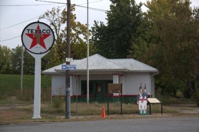
As Meriwether Lewis and William Clark wound their way westward, they encountered many indigenous people. The Native Americans portrayed here represent those who helped Lewis and Clark during their travels to the Pacific Ocean. The flag that the . . . — — Map (db m47210) HM
Lewis and Clark in Kentucky 1806 Return of Expedition
Meriwether Lewis & William Clark, leaders of the 1803-06 journey to the Pacific, visited Shelbyville several times. In Nov. 1806, on the Expedition's return, Lewis arrived with . . . — — Map (db m136887) HM
Lewis and Clark in Kentucky
William Clark, coleader of the famous Lewis and Clark Expedition to the Pacific, spent the night of October 28, 1809, at John Shannon's Tavern near present Graefenburg. That day he read that Lewis, his . . . — — Map (db m136897) HM
President Thomas Jefferson negotiated the Louisiana Purchase with French Emperor Napoleon Bonaparte in 1803. The Louisiana Purchase was the largest peacetime land acquisition in U.S. history, containing territory that eventually comprised 15 states. . . . — — Map (db m106110) HM
705 entries matched your criteria. Entries 101 through 200 are listed above. ⊲ Previous 100 — Next 100 ⊳