705 entries match your criteria. Entries 201 through 300 are listed.⊲ Previous 100 — Next 100 ⊳
Lewis & Clark Expedition Historical Markers
Sent by Jefferson to explore the far west, the Corps of Discovery left Pittsburgh August 31st, 1803 and reached the mouth of the Columbia River in the Pacific Northwest on November 15th, 1805.
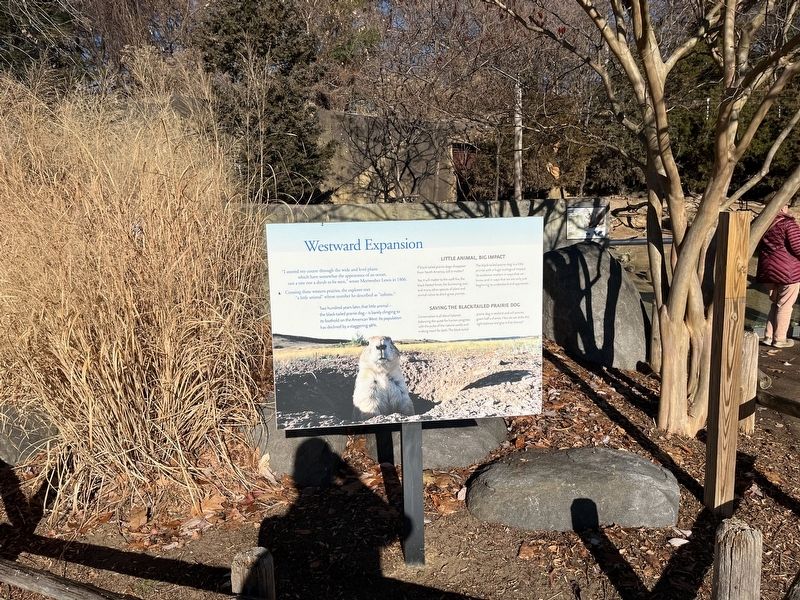
"I steered my course through the wide and level plains which have somewhat the appearance of an ocean, not a tree nor a shrub to be seen," wrote Meriwether Lewis in 1806.
Crossing these westward prairies, the explorer met "a little animal" . . . — — Map (db m189030) HM
The Lewis & Clark Expedition
In the Spring of America's 28th year, Captains Meriwether Lewis and William Clark began a vital mission, having been charged by President Thomas Jefferson to do three things: chart an all-water route from the . . . — — Map (db m145919) HM
Native of Frederick County, skilled hunter and a superintendent of provisions with the Lewis and Clark expedition, John Collins was the first Marylander to cross the North American continent. Meriwether Lewis and William Clark were charged by Thomas . . . — — Map (db m1904) HM
July 4th Wednesday (1804)
…proceeded on, passed the mouth of a Bayeau lading from a large Lake on the S.S. which has the appearance of being once the bed of the river & reaches parrelel for several Miles…
William Clark
Traveling up the . . . — — Map (db m44569) HM
Missouri was a beginning and end for the Lewis and Clark Expedition. Planned by President Thomas Jefferson and carried out by the two captains and a large crew, the expedition is a keystone American event. When the United States took ownership of . . . — — Map (db m44590) HM
The land that would become Missouri and 14 other western states was acquired by the United States in the greatest land acquisition in American history: the Louisiana Purchase. By the stroke of a pen, President Thomas Jefferson ensured the country . . . — — Map (db m44615) HM
"Groops of Shrubs covered with the most delicious froot is to be seen in every direction, and nature appears to have exerted herself to butify the Senery by the variety of flours [flowers] Delicately and highly flavered raised above the Grass, . . . — — Map (db m44624) HM
Joseph Robidoux, founder of St. Joseph, was the leader of a French-Canadian fur trading family which sent men out to trade with the Indians along the Missouri River and as far west as today's Wyoming, Colorado, and New Mexico. From his first trip . . . — — Map (db m91000) HM
St. Michael's Prairie
St. Michael’s Prairie, the site where St. Joseph would be established, was identified on maps at least as early as 1792. French explorers and trappers had been traveling up and down the Missouri River since the early . . . — — Map (db m47472) HM
In 1804-06, Captains Meriwether Lewis and William Clark led about 40 soldiers and boatmen on an epic journey. President Thomas Jefferson commissioned this "Corps of Discovery" to find a route to the Pacific Ocean through the newly acquired . . . — — Map (db m89212) HM
The Men of the Corps of Discovery
During the winter of 1803, Lewis and Clark set up camp opposite the mouth of the Missouri River. Here they drilled and trained their men to prepare them for the task ahead. All of the men had been selected . . . — — Map (db m79291) HM
Missouri was a beginning and end for the Lewis and Clark Expedition. Planned by President Thomas Jefferson and carried out by the two captains and a large crew, the expedition is a keystone American event. When the United States took ownership of . . . — — Map (db m169398) HM
The historic Osage River, impounded here by Bagnell Dam, flows east and north some 82 miles to join the Missouri. At the river's mouth, the 1804 Lewis and Clark Expedition camped several days and in 1806 Zebulon M. Pike's Southwest Expedition . . . — — Map (db m78759) HM
Between 1803 and 1806, Meriwether Lewis and William Clark led President Jefferson's Corps of Discovery to the great American West. On November 23, 1803, they stopped at Cape Girardeau to deliver letters of introduction to Louis Lorimier. Captain . . . — — Map (db m107721) HM
On Nov. 23, 1803, Meriwether Lewis and William Clark arrived at Cape Girardeau, a trading post established in 1795 by Louis Lorimier, the Spanish-appointed Commandant of the Cape Girardeau District. Here, Lewis, co-commander of the expedition, left . . . — — Map (db m58675) HM
In 1803, President Thomas Jefferson buys the Louisiana Purchase from France for $15 million. It remains one of the greatest acquisitions in American history. In 1804, Jefferson sent Meriwether Lewis and William Clark to explore and map the . . . — — Map (db m68373) HM
The Clay County Fine Arts Council commissioned this mural in commemoration of the 200th anniversary of the Lewis and Clark Corps of Discovery expedition.
The artist's version shows the expedition stopping at sundown to set camp along a bend in . . . — — Map (db m68309) HM
“The Deer in the Morning & evening are feeding in great numbers on the banks of the River, they feed on young willow, and amuse themselves running on the open beeches or points.” William Clark, June 25, 1804.
The Lewis and . . . — — Map (db m46694) HM
…the high lands which is on the Northe Side [just above the Blue Water river] does not exceed 80 feet high, at this Place the river appears to be Confined in a very narrow channel, and the Current Still more So by Couenter [counter] . . . — — Map (db m67770) HM
Meriwether Lewis • William Clark
York • Seaman • George Drouillard
———————
Sculptor: Sabra Tull Meyer
Columbia, Missouri
Project Designer: Austin Tao
St. Louis, Missouri . . . — — Map (db m62317) HM
The Jefferson City Greenway is a linear park that serves as a conduit for non-motorized travelers to gain access to recreation areas, natural and cultural features, schools and businesses. The greenway is a multi-use trail designed to provide a . . . — — Map (db m62318) HM
Commemorating the
Lewis and Clark Expedition
which explored these hills
June 3 and 4, 1804
Cedar Island and Cedar Creek on the north shore of the Missouri River are especially mentioned in the Original Journals Of The . . . — — Map (db m62388) HM
On June 4, 1804, a keelboat and two pirogues containing the members of the Corps of Discovery passed this spot as they headed upstream to the headwaters of the Missouri River and across the Rocky Mountains to the Pacific Ocean. The Lewis and . . . — — Map (db m62379) HM
Lewis and Clark, 1804
"The object of your mission is to explore the Missouri river, & such principal stream of it, as, by its course & communication with the water of the Pacific ocean may offer the most direct & practicable water . . . — — Map (db m62349) HM
The Lewis and Clark Expedition faced many obstacles and challenges on their journey to the west and the Missouri River was among the mightiest. The Corps of Discovery rowed and pulled with a heavy rope (cordelle) up the uncharted Missouri River's . . . — — Map (db m169286) HM
While trapping for beaver along the Jefferson's Fork River in the fall of 1808, John Colter and his companion, John Potts, were surprised by a war party of Blackfeet braves. With no chance to escape Colter came ashore while Potts retreated and was . . . — — Map (db m121297) HM
John Colter's nearly three years with the Lewis & Clark Expedition had hardened him for a life in the mountains. He had survived cold, hunger, grizzly bears, and Indians. It was the lure of wealth from beaver pelts that kept him in the West from . . . — — Map (db m121298) HM
John Colter, a Virginia native was recruited in Kentucky by Meriwether Lewis, to serve in the Lewis & Clark Expedition, October 1803. Colter became a valued member of the Corps of Discovery, serving as a hunter and scout. When Colter asked to leave . . . — — Map (db m121294) HM
Born about the time of the American Revolution John Colter was enlisted as a private in the Lewis and Clark Expedition at Maysville, Kentucky in October, 1803. He began the expedition as an oarsman but because of his skills as a woodsman was . . . — — Map (db m121295) HM
Private John Colter was among the first members to be recruited by Captain Meriwether Lewis for the Lewis and Clark Expedition. Colter was a skillful hunter, scout, and translator and he quickly became a valuable member of the party.
After almost . . . — — Map (db m121296) HM
His (John Colter's) veracity was never questioned among us and his character was that of a true American backwoodsman. He was about thirty-five years of age, five feet ten inches in height and wore an open, ingenious, and pleasing . . . — — Map (db m169282) HM
In 1804-06, Captains Meriwether Lewis and William Clark led about 40 soldiers and boatmen on an epic journey. President Thomas Jefferson commissioned this "Corps of Discovery" to find a route to the Pacific Ocean through the newly acquired Louisiana . . . — — Map (db m121299) HM
”Set out a 7 O’Clock after a hard rain & Wind, & proceed on verry well under Sale… The wind favourable today… we made 18 mile… wind & rain Closed the Day…”
William Clark, May 26, 1804
The Lewis and Clark Expedition passed by . . . — — Map (db m121300) HM
This marker commemorates Robert Frazer, a member of the Corps of Discovery, on the occasion of the bicentennial of the Lewis and Clark Expedition.
Listed as a witness in the trial of United States vs. Robert Westcott, Frazer wrote to President . . . — — Map (db m61608) HM
"Set out early…passed wood river [today's Dubois Creek near Washington, Missouri] on the Lbd [larboard or south] Side… Camped at the mouth of a Creek called River a Chauritte [La Charrette] above a Small french village of 7 houses and . . . — — Map (db m61610) HM
"as we were pushing off this Morning two Canoes Loaded with fur &c. Came to from the Mahars nation [Omahas]...., at about 10 oClock 4 Cajaux or rafts loaded with furs and peltres came too one from the Paunees (Pawnees) the other from . . . — — Map (db m63210) HM
[A series of deteriorating tiles inlaid in the sidewalk tell the Lewis and Clark Corps of Discovery Story]
[Tile 2 reads] The "Corps of Discovery began its way up the Missouri aboard a 56' keelboat with two smaller pirogues. Most of Clark's . . . — — Map (db m63245) HM
You're standing on a refuge that is 7,440 acres of diverse habitat along the eastern edge of the Missouri River floodplain. With a distance of more than 2,341 miles, the Missouri River is America's Longest River and flows from the Rocky Mountains . . . — — Map (db m216822) HM
Louisiana Purchase 1803Numerous states emerged including Missouri in 1821, doubling the size of the United States. Acquisition of the Platte Purchase Indian Territory in 1836 extended the State boundary westward to the Missouri . . . — — Map (db m179439) HM
"... Set out this morning verry early passed Some bad placies in the river Saw a number of Goslings... pass[ed] near a Bank which was falling in...passed the two River of Charletons [Charitons] ...above Some high land which has a great quantity . . . — — Map (db m216999) HM
More than two centuries ago, Meriwether Lewis, William T. Clark and their Corps of Discovery passed by this place. They traveled the pristine Missouri River for the majority of their 1804-1806 epic search for a waterway to the West Coast. Their . . . — — Map (db m200143) HM
On September 15, 1806, Meriwether Lewis and William Clark returning from the Pacific, stood on this point and recorded in their journal that this was a commanding situation for a fort and that from the top of the hill you have a perfect command of . . . — — Map (db m86117) HM
“we Set out early… Passed the mouth of … Blue water river…[and later]… a bad Sand bar, where our two rope twice…. Came to and Camped in the Point above the Kansas River. I observed a great number of Parrot queets this evening…” . . . — — Map (db m86206) HM
Marker Front:
The French-speaking community made a significant contribution to the ultimate success of the epochal Lewis & Clark expedition. The St. Louis Chouteau brothers, fur traders Auguste and Pierre, lodged the two captains in their . . . — — Map (db m86207) HM
[Front]
Events at Fort Osage
1803 The Louisiana Purchase
1804 Lewis and Clark Explore
1808 They build Fort Osage - Osages cede lands to the east
1809 Troops to the Mandans
1811 Astorians to the Pacific - Sibley visits Kaws and . . . — — Map (db m86562) HM
On June 23-24, 1804 the Corps of Volunteers for Northwestern Discovery spent Saturday afternoon, the night and early Sunday morning across the river from the bluffs which would, in four years time, become the site of Fort Osage. On . . . — — Map (db m86560) HM
On June 21, 1804, a few miles above the future site of Lexington, the Lewis and Clark Expedition faced rapids that "rored like an immence falls." Navigator Pierre Cruzatte selected their route, which was hardly an easy one. The men had to tow the . . . — — Map (db m90457) HM
Waverly, noted for fine apples & rich farmlands was settled in 1818, chartered in 1850 with William Smith Thomas as Mayor. In 1804 Lewis & Clark Expedition made oars near Port of Waverly which served Missouri River steamboats and now barge lines for . . . — — Map (db m90359) HM
Sent out by Thomas Jefferson to explore the Great North West, spent three days near here making new oars for their boats June 17-18-19 • 1804 — — Map (db m131994) HM
On June 17 and 18, 1804, Lewis and Clark camped a few miles downstream to make oars from timber in the area. Near the camp was a river crossing for Sacs, Ayauways (Iowas), and Sioux in their excursions against the Osage. On June 19, the explorers . . . — — Map (db m90360) HM
On June 16, the Lewis and Clark Expedition passed present-day Waverly in a flotilla consisting of a keelboat and two pirogues. The men were keeping and eye out for good timber with which to replace their oars that had worn out from use in the nearly . . . — — Map (db m90420) HM
This marker commemorates George Shannon, the youngest member of the Corps of Discovery, on the occasion of the bicentennial of the Lewis and Clark Expedition.
He died in Palmyra, Missouri while on legal business, August 30, 1836, and is . . . — — Map (db m150082) HM
Meriwether Lewis left Pittsburgh Aug. 30, 1803, in the 55-foot keelboat built for him there. As he headed down the Ohio River, slowed by low water levels, he recruited men for the expedition and acquired two other smaller vessels (canoes or . . . — — Map (db m163264) HM
The McKittrick-Portland segment is 15.10 miles long.
After leaving McKittrick, the trail goes under Highway 19 and crosses the Loutre River. Hermann is visible across the river valley from around milepost 102. Deutschheim State Historic Site . . . — — Map (db m162215) HM
On Nov. 27, 1803, Lewis and Clark camped near this point, which at that time was the lower portion of Horse Island. Horse Island was located just below the mouth of the Kaskaskia River at the beginning of a sharp bend in the Mississippi River. As a . . . — — Map (db m208663) HM
Tower Rock is a grand vision. As Lewis and Clark passed through this area 200 years ago, Lewis found the rock so commanding that he wrote about it at length in his journal. Climbing to the top of a nearby summit, Lewis was impressed with the bold . . . — — Map (db m208669) HM
"Set out verry early this morning and proceeded on under a gentle Breeze from the S. passed two Islands one a Small Willow Island on the L.S. the other large Called by the french Isle de Vache or Cow Island, opposit the head of the S.S. is a large . . . — — Map (db m44567) HM
In 1804-06, Captains Meriwether Lewis and William Clark led about 40 soldiers and boatmen on an epic journey. President Thomas Jefferson commissioned this "Corps of Discovery" to find a route to the Pacific Ocean through the newly acquired . . . — — Map (db m44565) HM
In 1803, only a handful of states existed in America – the rest of the land was uncharted wilderness. That wilderness included the Louisiana Territory, which was purchased that year by the United States government.
At the same time, . . . — — Map (db m43233) HM
In 1804-06, Captains Meriwether Lewis and William Clark led about 40 soldiers and boatmen on an epic journey. President Thomas Jefferson commissioned this "Corps of Discovery" to find a route to the Pacific Ocean through the newly acquired . . . — — Map (db m44517) HM
Katy Trail State Park runs for 5.70 miles from Augusta to Matson. The first four miles are away from roads, and trail users can enjoy the farm landscape and bottomland forest of the Missouri River floodplain, lined by increasingly taller . . . — — Map (db m133202) HM
Katy Trail State Park runs for 5.70 miles from Matson to Augusta, Tavern Bluffs, seen across the river, were the scene of a dramatic episode from the Lewis and Clark Expedition: on May 23, 1804, Capt. Meriwether Lewis fell 20 feet before . . . — — Map (db m133210) HM
Founder and guiding spirit of the Discovery Expedition of St. Charles. Glen's vision and commitment built a replica keelboat and a great organization which subsequently built 3 replica boats and reenacted the Lewis & Clark Bicentennial Expedition, . . . — — Map (db m162712) HM
Corn (Zea mays), Pole Beans (Phaseolus vulgaris), Squash (Cucurbita maxima)
These three vegetables store very well during winter months and were important food sources for the Native Americans of the northern plains. . . . — — Map (db m169189) HM
North 2nd Street Shops
North Second Street was a bustling thriving commercial district. Butchers, bakers, tinsmiths and saddle makers all had shops on the street; many lived above them on the second floor. Farmers brought their grain to the . . . — — Map (db m150983) HM
Saint Charles has welcomed travelers for well over 200 years. Captain William Clark and the men of the Corps of Discovery experienced this hospitality with a ball held in their honor on the evening of May 16, 1804 as they awaited the arrival of . . . — — Map (db m163854) HM
With the advent of the Louisiana Purchase, St. Charles became part of the Missouri territory. Meriwether Lewis and William Clark started out from St. Charles in 1804 to explore the rest of the Louisiana Purchase. St. Charles County was one of the . . . — — Map (db m163859) HM
Meriwether Lewis designed a lightweight, collapsible iron boat frame that could be transported easily and then assembled and covered when needed. The iron frame consisted of eight sections that, when connected, reached a length of 36 feet 4 1/2 . . . — — Map (db m169569) HM
The Corps of Discovery left Camp Dubois on May 14, 1804, and headed up the Missouri River to St. Charles. The corps arrived on May 16 and was greeted by a number of local residents. Co-commander William Clark was in command for this leg of the . . . — — Map (db m163257) HM
On May 21, 1804, the Corps of Discovery departed from St. Charles near this spot. The day before, Meriwether Lewis had finally arrived from St. Louis. That same day, William Clark had given 20 of the men permission to attend the local Roman Catholic . . . — — Map (db m163262) HM
President Thomas Jefferson to Meriwether Lewis
"The object of your mission is to explore the Missouri river, & such principal stream of it, as, by it's course and communication with the waters of the Pacific ocean, whether the Columbia, . . . — — Map (db m169209) HM
Replica boats and canoes constructed by the Discovery Expedition of St. Charles were used to retrace the river portions of the Lewis & Clark trail from Elizabeth, Pennsylvania to the mouth of the Columbia and back to St. Louis during the 2003-2006 . . . — — Map (db m169167) HM
From Weldon Spring to Matson is 4.60 miles, one of the shortest distances between trailheads in Katy Trail State Park. At milepost 56.7, less than a mile from the Weldon Spring trailhead is a junction with the Hamburg Trail, a converted haul . . . — — Map (db m169484) HM
Preparation for Departure
The crew of the Lewis and Clark Expedition spent five months (Dec. 12, 1803 to May 14, 1804) in winter camp at the mouth of Wood River. The five months gave the captains time to ready the boats, purchase supplies . . . — — Map (db m201340) HM
Born in Virginia August 1, 1770, Entered into Life Eternal September 1, 1838
Soldier, Explorer, Statesman and Patriot. His life is written in the history of this country. — — Map (db m61810) HM
The Return of the Lewis and Clark Expedition
Michael Haynes "We Arrived in Sight of St. Louis"
At about noon on September 23, 1806, five dugout canoes and a larger boat called the "White Pirogue" rounded the bend of the Mississippi River to . . . — — Map (db m151406) HM
At noon on September 23, 1806, the Lewis and Clark expedition ended on the St. Louis riverfront after a journey along the Missouri River to its headwaters, a passage of the Rocky Mountains, and a descent to the Pacific Coast via the Columbia River. . . . — — Map (db m124962) HM
William Clark died in 1838 at his son's home on this site.
Clark became a national hero more than 30 years earlier when he and Meriwether Lewis explored the newly acquired Louisiana Territory for President Jefferson. Lewis and Clark led 31 . . . — — Map (db m147625) HM
Jefferson National Expansion Memorial
Gateway Arch
• The Gateway Arch is a 630 feet tall stainless steel structure designed by famous architect Eero Saarinen. It symbolizes St. Louis's role as the gateway to the west.
• A tram takes . . . — — Map (db m144261) HM
"a Verry rainey morning the wind from the N, E, crossed the river to St. Louis, Capt. Lewis detain for to acquire information of the Countrey and to prepare Despatches to the government by the next Mail. At 11oClock I proceeded on..."
William . . . — — Map (db m140473) HM
Charbonier Bluff is the highest point on the lowest Missouri River and boasts a distinct appearance because of the exposed layer of coal at its base. As such, it was noted by the French explorers in the early 18th century who called it "La . . . — — Map (db m238812) HM
William Clark, in command of the boats and men of the future Lewis and Clark Expedition, passed this place on Dec. 7, 1803, on his way to Cahokia, Ill., where he would meet his co-commander, Capt. Meriwether Lewis. On the previous evening, the . . . — — Map (db m151550) HM
Fort Belle Fontaine was built in 1805 on a low plain near the confluence of the Missouri and Mississippi Rivers. Belle Fontaine was the first U.S. military post located in the newly acquired Louisiana Territory and was originally called Cantonment . . . — — Map (db m142606) HM
June 20, 1803
President Thomas Jefferson’s instructions to Meriwether Lewis
on river exploration:
“The object of your mission is to explore the Missouri river, & such
principle stream of it, as, by its course & communication with . . . — — Map (db m124994) HM
Members of the Lewis and Clark Expedition spent the last night of their 7,500 mile jouney at Fort Belle Fontaine. Located on the south bank of the Missouri River near Coldwater Creek, it had been built in 1805 while they were crossing the continent . . . — — Map (db m142613) HM
Why is this Park Important?
•St. Louis was a center of military activity for the trans-Mississippi West for 181 years (1765-1946)
•Cantonment Belle Fontaine - First Indian factory (trading post) built west of the Mississippi (1805) . . . — — Map (db m142539) HM
After the Louisiana purchase in 1803, Thomas Jefferson asked William Clark and Meriwether Lewis to explore the newly-acquired but uncharted northwest. An Army Captain, Clark set off with Lewis from St. Charles on May 14, 1804, and vividly chronicled . . . — — Map (db m124513) HM
On Dec. 4, 1803, this site was passed early in the morning by a flotilla commanded by William Clark, co-leader of the upcoming Lewis and Clark Expedition. Traveling in a 55-foot long keelboat, two pirogues and other smaller boats, were Clark, his . . . — — Map (db m191751) HM
1799
The Village of La Charrette
Long before Europeans settled in this area, Native American tribes including the Missouria, Osage, Sac and Fox used this land as their home or hunting grounds. The French, followed by the Spanish, were . . . — — Map (db m169262) HM
This small house was built by the men of the Marthasvile Lewis and Clark Bicentennial Committee to commemorate the stops of the Lewis and Clark Expedition at Charrette village May 25, 1804 and September 20, 1806. This French style house is on the . . . — — Map (db m61521) HM
Missouri was a beginning and end for the Lewis and Clark Expedition. Planned by President Thomas Jefferson and carried out by the two captains and a large crew, the expedition is a keystone American event. When the United States took ownership of . . . — — Map (db m61691) HM
"the party being extreemly anxious to get down ply their ores very well, we Saw Some cows on the bank which was a joyfull Sight to the party and Caused a Shout to be raised for joy at [blank] P M we Came in Sight of the little french Village . . . — — Map (db m61650) HM
"Camped at the mouth of a Creek called river a Chauritte, above a Small french Village of 7 houses and as many families... The people at this Village is pore, houses Small, they Sent us milk & eggs to eat."
William Clark, May 25, 1804 . . . — — Map (db m61681) HM
The distance along Katy Trail State Park from Treloar to Marthasville is seven miles. Peers, about halfway to Marthasville, was founded in 1893 when the railroad arrived. It was named for MKT attorney Charles Peers. The gap between the trail . . . — — Map (db m169247) HM
Few points along the route of the Lewis and Clark Expedition have the significance of this site, now beneath the waters of Clark Canyon Reservoir. Noted on their maps as "Fortunate Camp", the Lewis and Clark Expedition journeyed here hoping to . . . — — Map (db m124302) HM
Lewis and Clark Trail 1806
First important gold camp 1862
Scene of vigilante activities 1863
First capital Territory of Montana 1864-1865
First county seat of Beaverhead County 1864-1881
In grateful memory of the early pioneers who . . . — — Map (db m49535) HM
Lewis and Clark Trail 1806. First Important Gold Camp 1862. Scene of Vigilante Activities 1863. First Capital Territory of Montana 1864-1865. First County Seat of Beaverhead County 1864-1881. In grateful memory of the early pioneers who founded our . . . — — Map (db m145711) HM
705 entries matched your criteria. Entries 201 through 300 are listed above. ⊲ Previous 100 — Next 100 ⊳