298 entries match your criteria. Entries 101 through 200 are listed.⊲ Previous 100 — The final 98 ⊳
Historic Trees Historical Markers
An historic tree is one that was witness to an historic event, or maybe it was planted by, or otherwise directly associated with a famous historic figure. These have been marked with a historical marker.
On Independence Avenue Southwest east of West Basin Drive Southwest, on the right when traveling east.
The first Japanese Cherry Trees, presented to the City of Washington as a gesture of friendship and good will by the City of Tokyo, were planted on this site, March 27, 1912. — — Map (db m54912) HM
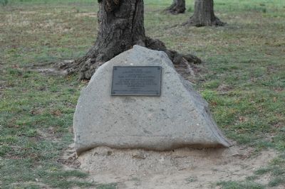
Near West 10th Street (State Road 30) at Beck Avenue (Alternate U.S. 98), on the left when traveling west.
This Heritage Oak Tree
is estimated to be over
250 years old
It was standing during
The War Between the
States as if a Sentry
standing guard over
Old St Andrews Bay — — Map (db m87324) HM
William Dutcher was the first president of the National Association of Audubon Societies, appointed in 1905. He helped shape the organization and worked tirelessly for bird protection. He was instrumental in establishing the Audubon warden program . . . — — Map (db m164918) HM
The Baker-Curry tree is named for two individuals whose unlikely partnership saved Corkscrew and established it as an Audubon Sanctuary. It started with passionate citizens who came together to stop the logging of the last remaining old-growth bald . . . — — Map (db m164919) HM
Aldo Leopold is considered the father of the modern conservation ethic. He lamented the toll wrought on the landscape in the name of material progress, and the ever widening disconnect between society and land. Where John Muir was inspired by . . . — — Map (db m164909) HM
Theodore Roosevelt, the 26th president of the United States (1901-1909) is known as the "conservationist president" for creating the Division of Forestry and protecting 230 million acres of federal land. He was a member of Florida Audubon during . . . — — Map (db m164912) HM
Guy Bradley is one of the heroes of Audubon and one of the most colorful characters of its history. He was the first warden to be deputized by Audubon, a strange fact due to his passion for hunting birds for their valuable, fashionable plumes. When . . . — — Map (db m164913) HM
The Rhett Green tree is an iconic, massive individual, rugged like its namesake. It has withstood the test of time. In 1912, Rhett Green was hired as an Audubon warden to protect plume bearing birds such as egrets, herons and roseate spoonbills . . . — — Map (db m164914) HM
In the early 1800s, the Seminole tribe sought and found refuge deep in the bald cypress forests of Southwest Florida during the Seminole Wars. This tree bears the Seminole name for big cypress, Asteenahoofa. It is straight, solid and free of . . . — — Map (db m164916) HM
Descendant of the Original Tree at Mount Vernon Dedicated to the Men and Women of the United States Marine Corps Past, Present and Future — — Map (db m239849) HM WM
Near World Drive north of Seven Seas Drive, on the left when traveling north.
The original Liberty Tree, a stately elm, was a rallying point for pre-revolutionary activities. The open space under its branches was called "Liberty Hall" and a flag pole was erected through its branches with a hoisted flag the symbol for . . . — — Map (db m242969) HM
On Oakstand Lane at Windy Wood Drive on Oakstand Lane.
In 1548 when I sprouted, Florida belonged to Spain. When I was 17 the oldest city in Florida, St. Augustine, was established. I was 215 years old when Spain traded Florida to Britain. When Florida became a U.S. Territory, I had lived 274 years. In . . . — — Map (db m129719) HM
On MacArthur Boulevard just north of Northlake Boulevard, on the right when traveling north.
These two Banyan trees (Ficus benghalensis), with a combined limb spread encompassing one-half acre, form the entrance to the City of Palm Beach Gardens. Palm Beach Gardens was developed by insurance magnate and philanthropist John D. . . . — — Map (db m97049) HM
On South Elm Avenue just south of West 6th Street, on the left when traveling south.
1 • Helen Keller Southern Magnolia Planted on July 9, 2000 by family in honor of Venus Guess a devoted mother and grandmother. The towering Helen Keller Southern Magnolia may have been one of the trees Helen Keller climbed in the yard . . . — — Map (db m214868) HM
On Myrtle Avenue just south of West 6th Street, on the left when traveling north.
1 • Martin Luther King, Jr. Sycamore Planted on March 4, 2000 by family in memory of Ethel Mae Monroe. The Martin Luther King, Jr. Sycamore stands in front of Brown Chapel AME, a church in Selma, Alabama, where the dedicated young . . . — — Map (db m214872) HM
Near West 7th Street just west of Myrtle Avenue, on the right when traveling west.
1 • Mount Vernon Red Maple Planted in honor of the Founders of the City of Sanford, Florida on February 10, 1992. This red maple has been grown from seeds collected at Mount Vernon, President George Washington's beloved home on the . . . — — Map (db m214875) HM
Near Myrtle Avenue just north of West 7th Street, on the left when traveling north.
1 • Ponce de León Live Oak Planted on November 27, 2001 in memory of Eunice R. Rabette. The Ponce de León Live Oaks grow near the spot at Port Charlotte, Florida, where the explorer first came ashore in April 1513. 2 • Treaty Live . . . — — Map (db m214873) HM
On East Weed Street, 0 miles east of Ready Street, on the right when traveling east.
Grown from pecan nuts found floating at sea by Capt. Samuel F. Flood and planted by his wife, nee Rebecca Grovenstine, on Block 47.
The remainder of these nuts were planted by St. Joseph Sebastian Arnow in the north half of Block 26.
These . . . — — Map (db m14398) HM
On the Atlanta Waterworks pumping station access road, 0.3 miles west of Ridgewood Road NW, on the right when traveling west.
A Creek Indian village on both sides of the river at mouth of Peachtree Cr. Whether it was named for a "pitch tree" or a peach tree, it occurs, officially, as Standing Peach Tree in Gov. John Martin's letter of May 27, 1782, to Gen. Andrew Pickens . . . — — Map (db m22090) HM
On Ocean Highway (U.S. 17) 0.4 miles south of St Simons Island Causeway, in the median.
'neath this gracious tree
stood Sidney Lanier and
under inspiration of the
oak and the marsh wrote
The Marshes Of Glynn
" I will heartily lay me a-hold on the greatness of God :
Oh, like to the greatness of God is the greatness . . . — — Map (db m12554) HM
During his visits to Brunswick in the 1870`s Sidney Lanier, Georgia's greatest poet, frequently sat beneath this live oak tree and looked out over "a world of marsh that borders a world of sea." Here he received the inspiration which resulted in . . . — — Map (db m12300) HM
On Riverside Drive, 0.2 miles north of Plantation Road when traveling north.
McEvers Bayard Brown Oak
Centenarian Tree recognized by the Live Oak Society of the Louisiana Garden Club Federation, Inc.
This tree consists of a cluster of five trunks growing from the stump of a single live oak harvested between . . . — — Map (db m155960) HM
On U.S. 17 at Adams Street (U.S. 17), on the right when traveling north on U.S. 17.
Traditional site of Oglethorpe's shelter in 1736 upon occasion of his visit to Darien, a town founded that year by Scotchmen under his direction. — — Map (db m8254) HM
On Fairhope Road (Cooke Avenue), on the right when traveling south.
In this plot under the “Great Oak at Mallow Plantation,” Captain William McIntosh, father of the Indian chief, General William McIntosh, was buried in 1794. Captain McIntosh, an officer in the British army, when stationed in the Creek country, . . . — — Map (db m16172) HM
On West Lamar Street (Georgia Route 27) 0.1 miles west of South Dudley Street, on the right when traveling east.
The tree was grown from a branch of the original “Washington Elm” under which George Washington was sworn in as Commander of the Continental Army at Cambridge, Mass. in 1775. Donated to the people of Americus and Sumter County by John H. Gray, . . . — — Map (db m155680) HM
On Northwest 6th Street at Northwest 6th Avenue, on the right when traveling west on Northwest 6th Street.
This oak tree was planted on the grounds of the Roosevelt Military Academy during Homecoming festivities on November 5, 1938 as a memorial to former President Theodore Roosevelt. The tree was sent from Roosevelt's Sagamore Hills Estate at Oyster . . . — — Map (db m171086) HM
On West High Street south of Main Street, on the left when traveling south.
Circa 1499 - This bur oak takes root.
c. mid/late 1600's - French explorers tour this region inhabited by Peoria Native Americans.
c. 1750's - Early surveys by European setters include reference to this tree.
c. 1850's - Dr. & . . . — — Map (db m220260) HM
On West High Street, on the right when traveling west.
Constitution Elm
On this spot, beneath the shade of the elm
the Constitution of Indiana
was framed in
June, 1816 This tree lived until 1925, attaining a height
of fifty feet. A trunk diameter of five feet
and a spread of one hundred . . . — — Map (db m137509) HM
This American Liberty Elm was named after "The Liberty Tree: Our Country's first symbol of freedom." On the morning of August 14, 1765, the people of Boston awakened to discover two effigies suspended from the elm tree in protest of the hated Stamp . . . — — Map (db m246165) HM
Near West Grissom Avenue west of South 7th Street, on the right when traveling west.
STS-41D — Mercury Program This tree was grown from a seed which orbited the Earth with astronaut Charles Walker, native of Bedford, Indiana aboard Space Shuttle Discovery from 30 Aug. to 5 Sept. 1984. It was presented to the Grissom family by . . . — — Map (db m195329) HM
On Wisconsin Street east of Front Street, on the right when traveling east.
Boy Scouts of America
Troop 9
First Christian Church
Davenport, Iowa
Erected in memory of the Green Tree that was used as a playground by Buffalo Bill
The Buffalo Bill Trail was established in 1964 the same year the Green Tree was . . . — — Map (db m230261) HM
On Main Street (U.S. 56) at 2nd Street, on the right when traveling east on Main Street.
This hardwood tree was part of the original grove that provided shelter, and wood for wagon repairs for travelers on the Santa Fe Trail.
The grove was a continuous strip of timber near one mile in width with a rich variety of trees. The town of . . . — — Map (db m44964) HM
On Main Street (U.S. 56) near Union Street, on the right when traveling east.
This hardwood tree was part of the original grove that provided shelter, and wood for wagon repairs for travelers on the Santa Fe Trail.
The grove was a continuous strip of timber near one mile in width with a rich variety of trees. The town of . . . — — Map (db m44966) HM
On Main Street (U.S. 56) near 2nd Street, on the left when traveling east.
has been designated a
Registered National
Historic Landmark
under the provisions of the
Historic Sites Act of August 21, 1935.
This site possesses exceptional value
in commemorating and illustrating
the history of the United . . . — — Map (db m44979) HM
On Main Street (U.S. 56) near Union Street, on the left when traveling east.
Under this tree
the treaty between
the U.S. Commissioners and
the Osage Indians was signed
giving the right of way
forever through their land
establishing the Santa Fe Trail — — Map (db m44971) HM
On Main Street (U.S. 56) near 2nd Street, on the left when traveling east.
The hunting grounds of the Kaw (Kansa) and Osage Indians were located here when Americans and Mexicans began hauling trade goods over the Santa Fe Trail in 1821.
In 1825, in response to traders and merchants who eagerly sought trade with . . . — — Map (db m44981) HM
On Main Street (U.S. 56) near Union Street, on the left when traveling east.
The stump before you is all that is left of a grand old oak tree that was about 270 years old when it died in 1990. The tree, which once stood 80 feet high, was located in the campground used by Santa Fe Trail travelers. It is said to have been . . . — — Map (db m44960) HM
On Main Street (U.S. 56) near 2nd Street, on the left when traveling east.
Santa Fe Trail
Marked by the
Daughters of the
American Revolution
and the State of Kansas
Council Grove
On this spot August 10, 1825
the treaty was made with the
Osage Indians
for the right of way of the
Santa Fe . . . — — Map (db m44967) HM
On Frederica Street (State Road 2831) at Maple Avenue, on the right when traveling south on Frederica Street.
This giant tree, first mentioned for its size in 1883, has been an historic landmark in Daviess County for several centuries. Believed to be 250 or 300 years old, it measures over 100 feet tall, with a circumference of 16 feet. It is probably the . . . — — Map (db m159324) HM
Originally thought to be approximately 400 years old prior to its death in 1976, the park cut the remains of this magnificent oak in 1986. However, a study of the growth rings after its removal showed the tree to be approximately 195 years of age. . . . — — Map (db m13262) HM
Near this site, close to the walls of the fort, stood the "Divine Elm," a majestic tree, under whose boughs 100 persons could be seated. The old tree served as both council chamber and church in the development of this state. On May 23, 1775, it . . . — — Map (db m165362) HM
On Lone Oak Road (U.S. 45) at Lovelaceville Road (Kentucky Highway 1322), on the right when traveling south on Lone Oak Road.
On this site stood the massive tree for which the town of Lone Oak was named in 1900. The town, first known as Pepper's Mill, was renamed to obtain a local post office. The tree was cut down in 1903 and was used for a bonfire on Christmas night . . . — — Map (db m158867) HM
On Henderson Street at Golf Course Road, on the left when traveling east on Henderson Street.
In 1989 a surface-mining company in Tennessee unearthed this stump buried 30 feet underground. The two-ton stump measures 15 feet in circumference and almost 6 feet in diameter. Geologists from the University of Kentucky indicate this is not a . . . — — Map (db m233172) HM
Near Kentucky Route 235, 0.1 miles south of Kentucky Route 761, on the left when traveling south. Reported permanently removed.
Forgotten Men
In the years after the Battle of Mill Springs, the white oak tree that General Felix Zollicoffer's body had been placed under became known as the Zollie Tree. While the tree became a local gathering spot, no effort was made . . . — — Map (db m70008) HM
Near Kentucky Route 235, 0.1 miles south of Kentucky Route 761, on the left when traveling south.
After Confederate General Felix Zollicoffer was fatally wounded at the Battle of Mill Springs on January 19, 1862, his men placed his body under a white oak tree. In the years that followed, the tree became known as the "Zollie Tree."
Forty . . . — — Map (db m137096) HM
On Port Hickey Road at Port Hudson Cemetery Road (State Highway 3113), on the right when traveling west on Port Hickey Road.
This Tree Dedicated by the Veterans Administration in 1976 to America's Medal of Honor Recipients who helped Make this Bicentennial Observance possible by Gallantry Above and Beyond the Call of Duty. — — Map (db m129212) WM
On Jungle Garden Road near Avery Island Road/Main Road.
The Cleveland Oak was named for Grover Cleveland
(1837-1908), the two-term U.S. President (1885-1889 and
1893-1897). Cleveland was a close friend of Joe Jefferson
(1829-1905), the actor of Rip Van Winkle fame who owned
nearby Jefferson Island. . . . — — Map (db m118534) HM
Near East Pinhook Road at SW Evangeline Thruway (U.S. 90).
These centurion live oak trees shaded Ile Copal, the plantation home of Alexandre Mouton. Mouton was governor of Louisiana from 1843-46 and son of the founder of Vermilionville. Here marks the beginning of a shady lane of oaks planted by Emma K. . . . — — Map (db m125837) HM
Near St John Street north of West Main Street, on the left when traveling north.
The tree, one of the largest live oak trees in the United States, is estimated to be almost 500 years old. It was a large tree in 1800 when the property was donated to the Catholic Church. The age of the tree is based on the average sizes of known . . . — — Map (db m86194) HM
On False River Road (State Highway 1) south of Cochran Lane (Route 0.1), on the left when traveling south.
Near this tree, within the walls
of Poydras College were written
the immortal lines of
"Maryland, My Maryland"
by James Ryder Randall
Born in Baltimore, Maryland
January 1st, 1839
Died in Augusta, Georgia January 14th 1908
Poem . . . — — Map (db m85522) HM
On Turnage Road south of Twin Bridges Road (State Highway 488), on the right when traveling south.
This "Moon Tree” is a Loblolly Pine grown from a seed that, in
January 1971 was carried to the Moon and brought back to
Earth by Major Stuart Roosa, command module pilot for
Apollo XIV and a former U.S. Forest Service smoke . . . — — Map (db m135981) HM
On West St. Bernard Highway (Highway 46) west of Montesquieu Street, on the right when traveling east.
These Versailles Oaks Were planted in 1783 by Pierre Denis De La Ronde Born New Orleans, April 20, 1762 Died December 2, 1824 Here he also built a French Colonial residence He was Lieut. at conquest of W. Florida. Military Commandant . . . — — Map (db m99230) HM
On West Landry Street (U.S. 190) east of South Court Street, on the left when traveling west.
This giant live oak tree is over 350 years old and
is named in honor of legendary adventurer and
hero of the Battle of the Alamo, Colonel
James "Jim” Bowie, who lived in Opelousas
for part of his life.
The Jim Bowie Oak is a charter . . . — — Map (db m145660) HM
On East Landry Street (U.S. 190) east of Court Street, on the right when traveling west.
On April 4, 1809, Louisiana cotton planter Jean Henri Lastrapes became the proud father of a new baby boy. Because this was his seventh son, he immediately sent workers out to gather seven small live oak trees, intending to surround his home with . . . — — Map (db m107480) HM
On Catahoula Highway (State Highway 96) at Pine Alley Drive, on the right when traveling north on Catahoula Highway.
Charles Durand, Pre-Civil War sugar planter, credited with planting this alley.
In legend a family wedding party rode down the alley canopied by giant spider webs dusted gold and silver. Ca 1795-99 Spanish Grant to Jacques Fontenette. — — Map (db m101673) HM
Longfellow's poem "Evangeline" immortalized the tragedy of the Acadian exile from Nova Scotia in 1755. This oak marks the legendary meeting place of Emmeline Labiche and Louis Arceneaux, the counterparts of Evangeline and Gabriel. . . . — — Map (db m66354) HM
On Northwest Railroad Avenue at West Charlest Street, on the left when traveling north on Northwest Railroad Avenue.
This tree grew from a seed of a walnut tree at Geo. Washington's home at Mt. Vernon.
Planted February 22, 1932 by the American Legion Auxiliary and Boy Scouts of Hammond in celebration of Washington's bicentennial. Was transplanted in this . . . — — Map (db m49776) HM
On North LaBauve Avenue at West Main Street, on the left when traveling north on North LaBauve Avenue.
Member Louisiana Live Oak Society. Estimated to be over 330 years old in the Bicentennial Year of 1976. Community gathering place for many years.
(plaque)
Back Brusly Oak preservation project
2004
made possible by a cooperative . . . — — Map (db m86589) HM
Near College Avenue (Maryland Route 450) at King George Street (Maryland Route 450).
This tablet is placed upon the Liberty Tree by the Peggy Stewart Tea Party Chapter Daughters of the American Revolution of Annapolis, Maryland, October 19, 1907 to commemorate the first treaty made here with the . . . — — Map (db m241906) HM
On North Charles Street at East Mulberry Street, on the left when traveling north on North Charles Street.
This elm has watched the growth of "Baltimore Towne" for over 100 years, on former estate of John Eager Howard, Revolutionary and 1812 Officer and fifth governor of Maryland. Here, in "Howard's Woods", Count De Rochambeau's troops camped, 1782, . . . — — Map (db m209470) HM
On Conowingo Road (U.S. 1) east of Arbor Lane, on the right when traveling west.
General Lafayette and his army camped around this tree April 12, 1781. A Civil War cavalry unit later occupied the site. The oak, over 500 years old, was owned by the Thomas Richards family for over a century. A huge limb fell August, 1964, . . . — — Map (db m145616) HM
Near Rockville Pike (Maryland Route 355) 0.1 miles south of Center Drive, on the right when traveling south.
From the Greek Island of Cos, Hippocrates is said to have held classes under the parent tree. The gift Tree was presented by the town of Cos to the National Library of Medicine at the dedication
of its new building on December 14, 1961.
This . . . — — Map (db m73312) HM
Near Center Drive, 0.3 miles east of Convent Drive, on the right when traveling east.
From the Greek Island of Cos, Hippocrates is said to have held classes under the parent tree. The gift Tree was presented by the town of Cos to the National Library of Medicine at the dedication
of its new building on December 14, 1961.
This . . . — — Map (db m74964) HM
Near Excalibur Road north of Elder Oaks Boulevard, on the right when traveling north.
The majestic pin oak (quercus palustris) has graced this spot for over 150 years. It is almost 17 feet in circumference, over 100 feet tall and has a crow of over 90 feet. In the late 1800's this tree as well as others were part of the landscape of . . . — — Map (db m207083) HM
Near Bladensburg Road (Alternate U.S. 1) east of Eastern Avenue, on the right when traveling north.
1680 • Original land granted from Lord Baltimore to George Conn
1683 • Old Spring House erected - One of the oldest buildings in the State of Maryland
1800 - 1859 • The Dueling Grounds - Site of the 1820 duel between Steven Decatur and . . . — — Map (db m206605) HM
On Watson Road at Water Way, on the left when traveling north on Watson Road.
This American Liberty Elm was named after "The Liberty Tree: Our Country's first Symbol of Freedom." On the morning of August 14, 1765, the people of Boston awakened to discover two effigies suspended from an elm tree in protest of the hated Stamp . . . — — Map (db m243001) HM
For well over 450 years, a quiet giant stood marking the passage of time for many generations. The Wye Oak survived through the birth of a nation, the Civil War, and two World Wars. Located alongside what was once a Native American Trail and later . . . — — Map (db m113580) HM
On South Water Street south of Main Street, on the left when traveling south.
(A Chinese Huai tree - Sophora japonica) Brought from China in a flower pot in 1837 by Captain Thomas Milton to grace his new home then being built. This is believed to be the largest of its kind on the continent. — — Map (db m177815) HM
Near Water Street at Endecott Street. Reported missing.
One-eighth of a mile distant.
On a part of the 300 acres
granted to Governor John
Endecott, is the pear tree
planted by the Governor in
1632. This tree still bears
fruit. — — Map (db m46192) HM
On North Main Street (Massachusetts Route 27) just south of Coolidge Street, on the right when traveling south.
It is believed that four trees, two ash and two sycamore, were set out in 1780 by Joseph Dowse at the end of the Revolutionary War. Several generations later, one ash and one sycamore, were blown down in the hurricane of 1938. Charles Arthur Dowse . . . — — Map (db m219198) HM
This amazing oak tree is
approximately 250 years old.
It has stood as the Sentinel
on these grounds since the
American Revolution.
Courthouse Square Association
honors and celebrates its
life and history.
Eaton County's Museum
at . . . — — Map (db m216506) HM
On State Highway 119, 0.2 miles north of Division Road, on the left when traveling north.
This was the name given by the French to the region from Cross Village to Harbor Springs because of a large crooked tree that stood on the crest of the bluff. Visible for many miles, it marked the center of a large Odawa Indian settlement. — — Map (db m97815) HM
On State Highway 119, 0.4 miles north of Pike Road, on the left when traveling north.
In this area, beneath a large tree, tribal chief of the Menominee, Ojibwe, and Odawak held many councils in the late 1700's. The tree was also used as a navigational tool during seasonal migrations. — — Map (db m97840) HM
On Newport Road at Telegraph Road (U.S. 24), on the right when traveling east on Newport Road.
The International
Society of Arboriculture and the National
Arborist Association jointly recognize this significant tree in this bicentennial year as having lived here during the American
Revolutionary Period
1776 · 1976 — — Map (db m227458) HM
On Willow Street at W. 14th Street, on the right when traveling south on Willow Street.
To commemorate
the Battle of Fort Griswold
fought September 6, 1781,
this tree
was planted in historic earth
from the thirteen original colonies.
by Minneapolis Chapter,
Daughters of the American Revolution.
Tablet placed . . . — — Map (db m229542) HM
White pines once dominated northern Minnesota. Even in Lindbergh's time these scattered reminders of earlier eras dotted the pasture.
The trunk in front of you is the remains of one of these forest giants. This white pine stood 100-feet . . . — — Map (db m78229) HM
On W. Kellogg Boulevard at Washington Street, on the right when traveling east on W. Kellogg Boulevard.
In the moist, rich soils of river bottoms, cottonwoods can grow to enormous sizes.
Look at the circle on the ground in front of you. It represents the girth of the largest tree in Minnesota—a cottonwood in Nicollet County. It's 344 inches . . . — — Map (db m240444) HM
Near North Pine Street just north of West 4th Street, on the left when traveling north.
Apollo XIV was launched on January 31, 1971, from Kennedy Space Center and was the third lunar landing. The entire mission lasted for 9 hours, 1 minute and 57 seconds, carrying three Americans: Captain Alan Shepard, USN; Major Stuart Roosa, USAF; . . . — — Map (db m237059) HM
On Maple Avenue near Delaware Street, on the right when traveling east.
During his daily walks in his later years, Harry Truman would stop and pat this old Gingko tree, speak a few words, then continue his walk. — — Map (db m34740) HM
On Cave Hollow Road (County Highway 453) 0.2 miles south of State Highway 79, on the left when traveling south.
As part of our Nation[']s Bicentennial,
the Missouri Department of Conservation
recognized certain trees throughout Missouri
as Liberty Trees. This Burr Oak started as a
seedling in 1731 and is included in Famous
and Historic Trees of . . . — — Map (db m156649) HM
On South Fisher Street just south of East Jasper Street, on the left when traveling south.
Johnny Appleseed Tree is unquestionably the most famous tree in American History. John Chapman was born in Leominster, Massachusetts in 1774. In the late 1780’s he set out in a canoe to plant orchards of apple trees. He traveled to the new . . . — — Map (db m216975) HM
On Main Street (U.S. 136) east of South 17th Street, on the right when traveling east.
The Basking Ridge Oak stands in the churchyard of the Presbyterian Church in the center of Basking Ridge, New Jersey which was settled in 1720. The tree is associated with the stirring events of the American Revolution. In 1776 General Charles Lee . . . — — Map (db m188196) HM
Near Grant Street just east of South 17th Street, on the left when traveling east.
George Rodgers Clark (1752-1818) was an American frontiersman and Revolutionary War leader. One of his other ventures was to try to make “coffee” from the seeds of this tree — making seeds available to Thomas Jefferson and other contemporaries. . . . — — Map (db m188197) HM
Near South 17th Street just north of Grant Street, on the left when traveling south.
This American sycamore is grown from one of the small number of seeds carried to the moon and back by Astronaut Stuart Roosa on the February 1971 Apollo 14 flight. The seeds were germinated by a US Forest Service scientist at NASA's manned space . . . — — Map (db m188195) HM
Near South 17th Street just south of Main Street (U.S. 136), on the left when traveling south.
Many believe that Johnny Appleseed is a fictional character, but he was real — John Chapman (1775-1845). He belonged to a mystical Swedish Religion and when his wife died at an early age he took that as a sign from God that he should spend the rest . . . — — Map (db m216956) HM
This is to certify that the
American Elm
described below is the largest
known tree of its species in the
state of Missouri recorded by
Forestry Division,
Missouri Department of Conservation
Species: Ulmus americana
Owner: . . . — — Map (db m62186) HM
On State Highway 25 at East Shawnee Street (State Highway E), on the right when traveling north on State Highway 25.
(Front): An article in the Missouri Democrat, a Cape Girardeau newspaper, dated July 3, 1862, described the war-weary community of Bloomfield. It also told of a certain tree used for sad occasions. Two or three of us went down and . . . — — Map (db m60710) HM
On Old U.S. 20, 0.6 miles west of Whitney Lake Road, on the left when traveling west.
In September 1875 a lone cottonwood provided a landmark where the Allison Commission met with thousands of Lakota Sioux in a futile effort to buy the Black Hills. Based on the recollections of elderly Lakotas, Captain Christopher Robinson Chapter, . . . — — Map (db m235900) HM
On U.S. 30 at 15th Road, on the left when traveling west on U.S. 30.
Lone Tree, a giant, solitary cottonwood, was a noted Platte River landmark as early as 1833. Standing on the north side of the river some three miles southwest of present Central City, the tree was visible at great distance. Several travelers . . . — — Map (db m53229) HM
Near East Musser Street at North Fall Street when traveling south.
— Washington — first took command of the American Army under the grandparent of this elm at Cambridge, Mass, July 3, 1775. Raised an given by Maryland D.A.R. Marked by Nevada D.A.R. This tree is planted as part of the two hundredth . . . — — Map (db m160564) HM