The Nez Perce War of 1877 saw the Niimíipuu leave their home near Enterprise, Oregon and flee through Idaho and Wyoming in order to avoid being put on a new reservation, before their defeat in northwestern Montana and exile. Nez Perce National Historic Park has 38 separate sites dedicated to the Nez Perce flight, to which are added numerous state and local monuments.
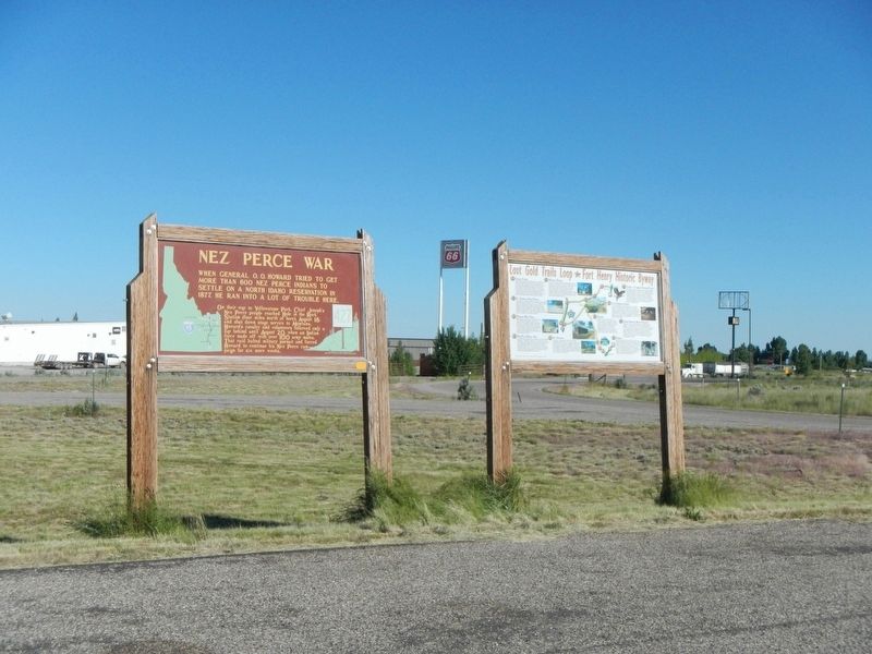
When General O.O. Howard tried to get more than 600 Nez Perce Indians to settle on a North Idaho reservation in 1877, he ran into a lot of trouble here.
On their way to Yellowstone Park, Chief Joseph's Nez Perce people reached Hole in the . . . — — Map (db m124339) HM
Following the Battle at White Bird Canyon on July 4, 1877, U.S. cavalrymen, entrenched nearby at Cottonwood, resisted attacks by Nez Perce warriors.
East of here on July 5, 1877, Nez Perce warriors created a strategic diversion by surrounding . . . — — Map (db m121140) HM
“I will not hide anything. That part of the fight was not long.” Yellow Wolf, Nez Perce warrior.
On July 3, 1877, 2nd Lt. Sevier M. Rains, civilian scout William Foster, and ten 1st cavalrymen rode from Norton’s ranch . . . — — Map (db m121142) HM
Erected in memory of the seventeen volunteers who engaged in battle with the Indians 2000 feet East from this point with two killed and three wounded the 5th day of July 1877 during the Nez Perce Indian War. Captain D.B. Randall, C.M. Day, James . . . — — Map (db m121144) HM
The Lewis and Clark Expedition passed through the valley of Hungery Creek in late September 1805, and on their return journey in late June, 1806. Five of the party's campsites are located in this valley to the south. Here you can see the extent of . . . — — Map (db m140826) HM
Named for the blue flowering camas -- an important root food for all interior Northwestern Indians -- Camas Prairie is a traditional Nez Perce cultural center. Tolo Lake -- visible below -- provided a campground for Joseph’s Wallowa band and . . . — — Map (db m121138) HM
(Three panels outline the history of Tolo Lake)
The Nez Perce name for this lake is Tipahxlee’whum (Tepahlewam or Split Rocks). In early June 1877, five bands of Nimiipuu gathered here for their last taste of freedom before . . . — — Map (db m121267) HM
Near the base of this hill, over 100 cavalrymen and volunteers met disaster in the opening battle of The Nez Perce War.
Rushing from Grangeville on the evening of June 16, 1877, Captain David Perry planned to stop the Indians from . . . — — Map (db m4643) HM
(Four historical panels are located at the kiosk:)
The Lewis and Clark Expedition
The Lewis and Clark expedition known as the Corps of Discovery, passed through this area in September and October of 1805, on its way to find . . . — — Map (db m121344) HM
Looking Glass told army authorities: “Leave us alone. We are living here peacefully and want no trouble.”
But after a military attack, July 1, that destroyed his village, ruined his gardens and captured 750 Nez Perce horses, Looking . . . — — Map (db m109790) HM
On July 23, 1877, approximately 750 members of the Nez Perce Nation, with over 2,000 horses, crossed Lolo Pass to escape the pursuing U.S. Army. Leaving their homeland behind, they followed this trail across the Bitterroot Mountains in an attempt to . . . — — Map (db m123218) HM
In July of 1877, nearly 800 Nimiipuu (Nez Perce) people traveled with heavy hearts across the Lolo Trail above you. They did not know if they would ever return to their homes. The women sang songs of sorrow and longing.
The journey began in the . . . — — Map (db m123163) HM
(This marker is composed of two panels and is presented here as if the panels were joined.)
The land today looks much the same as it did to Lewis and Clark. Today, as stewards of this beautiful land, we have an opportunity to leave a . . . — — Map (db m123213) HM
After the Clearwater Battle on the heights above here, July 11-12, 1877, the Indians crossed the Lolo Trail to Montana.
Advancing northward along the high ground with 600 troops and artillery, General Howard found the Indians camped on the . . . — — Map (db m121319) HM
"Our American horses were not used to the fodder of the native cayuse. We carried no forage. If we should chance upon one of the little mountain valleys where there should be grass, we found it either trampled down by Joseph's ponies or destroyed . . . — — Map (db m140784) HM
On the more distant of the ridges Lieutenant Theller halted and deployed his advance guard, at the same time sending word that the Indians were in sight. I immediately formed my company 'left front into line’ at a trot, gave the order to drop . . . — — Map (db m119505) HM
Five warriors, led by wet’itwe’tit hawalis . . . had been sent out . . . as a peace party to meet the soldiers. Of course they carried a white flag.
Peace might be made without fighting. -- himi'n maqsmaqs (Yellow . . . — — Map (db m119506) HM
(Three panels are located at this kiosk overlooking the White Bird Battlefield.)
We were marched into a deep canyon and to a country strange to us, and familiar to the enemy. If there was any plan of attack, I never heard of it. -- Sgt. . . . — — Map (db m121137) HM
Following high ridges, buffalo hunters cut an old Indian trail along a direct route from Lewiston past here to Lemhi Valley.
This trail was not available to Lewis and Clark in 1805, but an early missionary -- Samuel Parker -- crossed it with . . . — — Map (db m109621) HM
This park links a series of widely separated sites of deep significance to the Nez Perce – historic villages, battlefields, and legend sites.
The park experience involves a journey across both time and territory.
Although firmly . . . — — Map (db m109994) HM
A short walk leads to
ilcwe-wcixnim timine the Heart of the Monster, the Place of Beginning for the
nimi-pu, the Nez Perce people.
Like other sites in the valley that are significant to the Nez Perce, the Heart is a distinctive . . . — — Map (db m109995) HM
Household and family groups were the heart of Nimiipuu, or Nez Perce society.
Families lived and worked together, forming social alliances with others.
Each Nez Perce – man, woman, child – uniquely contributed to the common . . . — — Map (db m110701) HM
Two styles of houses were used. Some were fairly square with interior benches dug out for use by a family or two.
Others were round – 20 to 30 feet wide and two to three feet deep – but lacked benches.
This village reached its height . . . — — Map (db m109725) HM
This scenic route commemorates the Lewis and Clark expedition’s quest for a watercourse through the Rocky Mountains connecting the Missouri and Columbia rivers.
The byway parallels the explorers' journey through the ancestral Nez Perce homeland in . . . — — Map (db m109726) HM
This marker commemorates the Cuddy Mill.
Built by John Cuddy in 1869. Originally six miles north of here, at the foot of Cuddy Mountain. The General Howard Expedition against the Indians on the warpath under Chief Joseph had grain ground . . . — — Map (db m119371) HM
The Nez Perce camped near here on Horse Prairie Creek, Aug. 12 1877 following the Battle of the Big Hole Aug. 9-10. General Howard was summoned when beating drums arroused [sic] the citizens of Bannack. Women and children were quartered in the Meade . . . — — Map (db m49537) HM
From this vantage point you can visualize the general progress of the Battle of the Big Hole, but at a distance from the fear and chaos of its hand-to-hand combat. The landscape has changed little since the morning of August 9, 1877. This lush . . . — — Map (db m123741) HM
(Inscriptions are found on three sides of this monument.)
On This Field
17 officers and 133 enlisted men of
the 7th U.S. Infantry
under its Colonel
Bvt. Major General John Gibbon with 8 other
soldiers and 36 citizens . . . — — Map (db m123812) WM
To the
everlasting
Memory of the
Brave Warriors of
Chief Joseph's Band
who fought on
these grounds
in the
Nez Perce War
of 1877
In Memory of
the Indians, Infants,
Children, Women
and Old Men
who . . . — — Map (db m123755) HM
(Three panels make up this informational marker:)
Natural Travel Corridor
Clark's 1806 Route
Captain Clark and his party found great quantities of camas just beginning to bloom when they passed here on Sunday July 6, 1806. . . . — — Map (db m123738) HM
In front of you on the morning of August 9, 1877, you would have seen soldiers and Montana volunteers pass by as they began to deploy for the coming attack on the Nez Perce encampment just through the trees.
Following the army's surprise attack, . . . — — Map (db m123745) HM
For the exhausted Nez Perce, this site, known to them as ćáynim?a•lika?spe (Place of Manure Fire), appeared to be a good place to rest before continuing to Canada. Then a large force of U.S. soldiers surprised them from the east. After . . . — — Map (db m142832) HM
Striking on the run, the U.S. Army planned to surprise and overwhelm the Nez Perce camp. Along this ridge Nez Perce warriors fought back fiercely and stopped the cavalry charge. The surprise attack was blunted, but the Nez Perce were pinned down, . . . — — Map (db m142866) HM
C'Aynnim 'Alikinwaaspa is the Nez Perce name for this site. It means "Place of the Manure Fire" because the Nez Perce used buffalo chips as fuel here.
On September 29, 1877, about 700 Nez Perce men, women and children camped in the basin . . . — — Map (db m142830) HM
Two panels are affixed to a common boulder.
Commemorating the surrender of Chief Joseph and the remnants of his tribe of Nez Perce to General Nelson A. Miles, October 5, 1877.
Here Chiefs Looking Glass, Ollicut, Too-hul-sote and . . . — — Map (db m142802) HM WM
To the
everlasting
memory
of the
Brave Warriors
Chief Joseph's Band
who fought on
these grounds
in the
Nez Perce War
of 1877
Erected by
Nez Perce Indians
and the
Chief Joseph Memorial
Association . . . — — Map (db m142865) WM
With the fighting at a standoff, Hinmatóowyalahtq̓it (Chief Joseph) met with Colonel Miles near this site. Surrender was a survival strategy, to keep the Nez Perce people alive and together. One witness reported that Chief Joseph spoke . . . — — Map (db m142869) HM
These rolling hills and coulees are the site of the last battle of the 1877 Nez Perce War. For the Nez Perce this was the end of a 1,170-mile journey, after many successful skirmishes along the way. Canada was only 40 miles farther, its mountains . . . — — Map (db m142833) HM
About noon the families made camp. The scouts killed several buffalo. This place is ćáynim?a•lika?spe (Place of Manure Fire) .... Some warriors were on the buttes watching for enemies. We expected none. -- himi・n maqsmáqs . . . — — Map (db m142838) HM
This park links a series of widely separated sites of deep significance to the Nez Perce – historic villages, battlefields, and legend sites. The park experience involves a journey across both time and territory. Although firmly connected to . . . — — Map (db m142831) HM
The large depression is the site of a mass grave. Here the U.S. Army buried its casualties from the battle. This ridge is also the site of a hastily erected field hospital -- just a tent were surgeons tended and operated on the wounded. In 1912 the . . . — — Map (db m142868) HM
From where the sun now stands I will fight no more forever.
October 5 1877
Surrender of Chief Joseph to Colonel Nelson A Miles
To the valor and devotion of those both red and white who struggled here
Erected by the Congress of . . . — — Map (db m142801) HM
This battle was fought September 30 to October 5, 1877, on Snake Creek, about 20 miles south of here near the Bears Paw Mountains, where after five days days' siege Chief Joseph, one of five remaining Nez Perce leaders, surrendered to Col. Nelson A. . . . — — Map (db m142800) HM
In September 1877 the Nez Perce traveled across the Judith Basin headed for Canada. In anticipation of trouble, Major Ilges (commandant at Fort Benton) organized a party of fifty volunteers, mostly Fort Benton's Irish Fenians. They loaded the . . . — — Map (db m142215) HM
The Nez Perce people, under the leadership of their Great Chief Joseph crossed the Musselshell River near here on September 17, 1877. They had left their Idaho homeland in a valiant but futile effort to reach Canada. Their march marked by several . . . — — Map (db m188961) HM
(Three panels, presented left to right, form this marker.)
The Flight of the Nez Perce
In Search of Peace
In the mid-1870s the United States government attempted to force the Nez Perce (Nee-Mee-Poo or Nimiipu) people . . . — — Map (db m123125) HM
One-half mile west of here, a steep, narrow ravine runs north from Lolo Creek, In the early morning of the fourth day of standoff, the Nez Perce ascended the ridge next to this ravine. Using skills acquired by life in the mountains and plateaus of . . . — — Map (db m123241) HM
About twenty miles west of here at Lolo Hot Springs, the Nez Perce heard that soldiers were coming, so they moved cautiously and set up camp four miles from here.
Three parleys (meetings) between Nez Perce, soldiers, and citizens were held over . . . — — Map (db m123240) HM
During the Civil War, soldiers often fought out in the open causing thousands of casualties. Because of this, the military decided to formally instruct and equip soldiers to entrench themselves. Soldiers and citizens here fully embraced this new . . . — — Map (db m123239) HM
You're standing in a replica of an entrenchment and breastworks similar to those built north of this point in July 1877. Notice the gap between the bottom and top logs. Rifle barrels could be slid through this opening while the logs provided . . . — — Map (db m123238) HM
In June 1877, several bands of the Nez Perce, resisting relocation from their native lands in northeast Oregon to a reservation in North-Central Idaho, attempted to escape to the east through Idaho, Montana, and Wyoming over the Rocky Mountains into . . . — — Map (db m190773) HM
"Hear me my Chiefs, I am tired. My heart is sick and sad. From where the sun now stands, I will fight no more forever."
With these words, Chief Joseph of the Nez Perce surrendered to Colonel Nelson A. Miles of the United States Army and thus . . . — — Map (db m60427) HM
In May, 1877, Chief Joseph gathered his band of Nez Perce Indians from their winter villages along the Imnaha. Instead of heading for their customary summering country in the Wallowa Valley, they began their famous fighting retreat from General O.O. . . . — — Map (db m71743) HM
In 1877, the wal'wáama were driven out of the Wallowa Valley, which had been their homeland since time immemorial. Leaving was full of heartbreak and hardship. Over the next 1170 miles they would join with other Nez Perce bands, cross extremely . . . — — Map (db m111341) HM
Iwetemlaykin is Nez Perce for "at the edge of the lake." It is pronounced ee-weh-TEMM-lye-kinn and the Nez Perce spelling is 'Iweté•mlaykin. This site is part of the ancestral homeland of the Nimigpuu (Nez Perce) and is considered sacred land. As . . . — — Map (db m111348) HM
Born between 1785 and 1790, tiwi∙teqis came to be the principal leader of the walwá∙ma (Wallowa Band), In 1839 he was baptized and christened "Joseph," a name he carried of the rest of his life, despite later renouncing . . . — — Map (db m111364) HM
During their fighting retreat toward freedom in Canada, the non-treaty Nez Perce passed directly through Yellowstone National Park in August, 1877. Their route followed this creek. When outriders encountered a party of sightseers camped nearby, the . . . — — Map (db m39455) HM
Across the meadow, a fire burned in the campsite of nine tourists on the night of August 23, 1877. The Cowan party had unknowingly camped near hundreds of Nez Perce men, women, and children who were under violent pursuit by the United States Army. . . . — — Map (db m86788) HM
Journey through Yellowstone
On August 23, 1887, more than 600 men, women, and children camped in the woods near here. Sustained by courage, social structure, and knowledge of the land, they were midway from their homeland in . . . — — Map (db m45256) HM