Union troops under Brigadier General T.A. Morris, advanced from Philippi on July 7, 1861 and established a fortified camp near this site. Battle of Belington took place July 7-11. Confederates were two miles to east at Laurel Hill. — — Map (db m34424) HM
Fortified camp occupied by Confederates under Brig. Gen. Robert S. Garnett. June 16 - July 12, 1861. The scene of sharp skirmishes July 7-11. Garnett retreated early in the morning of July 12 after the Rich Mountain defeat. — — Map (db m34425) HM
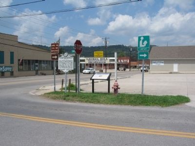
Battle of Laurel Hill, July 8, 1861, between Confederates and McClellan's army, followed by actions at Rich Mountain and Corrick's Ford, gave Federals control of State and established communication lines to the West. Fine view from peak. — — Map (db m34426) HM
Meadowville, on the site of an Indian fort built in 1784, is a few miles north. New Jersey colonists settled there before 1800, and tavern, mills, and stores made it a trading center of the Tygarts Valley for a hundred years. — — Map (db m34448) HM
Barbour County. Formed from Harrison, Lewis, and Randolph in 1843. It is named for a distinguished Virginia jurist, Philip Pendleton Barbour. Scene of opening hostilities on land between the armies of the North and South in 1861.
Randolph . . . — — Map (db m33928) HM
Born in New Hampshire in 1807, he moved to Wheeling and worked as a merchant and as a freight agent for the B&O. He was appointed colonel of the 1st WV (90-day regiment) in
1861 and led the unit at Philippi, where he was seriously wounded. He . . . — — Map (db m211566) HM
One mile east is Woodbine Farm, birthplace of W.D. Zinn, noted farmer, writer and lecturer. He contributed much to scientific farming in this and adjoining states. "The Story of Woodbine Farm" is an autobiography of his work. — — Map (db m33776) HM
First land battle between the North and South here, June 3, 1861. Confederates under Col. Porterfield were dislodged by Federal troops from Gen. McClellan's army under Col. Kelley. The old covered bridge here was used by both armies. — — Map (db m211563) HM
Confederate J. E. Hanger's leg was mangled by a cannonball during the Battle of Philippi on June 3, 1861. Hanger survived a surgery that made him the first amputee of the war. After serving time in a Union prison, he returned to his home in . . . — — Map (db m211591) HM
After the Civil War, Barbour County residents built this one-room school house near Volga, 8 miles SW. As one of the county's first free schools, it was the center of education for hundreds of children, providing instruction for primary through . . . — — Map (db m155092) HM
Originally called Anglin's Ford for William Anglin but later named Booth's Ferry for Daniel Booth. Near by in 1780, Richard, Cottrill, and Charity Talbott settled. Philippi was named for Judge Philip Pendleton Barbour. — — Map (db m33702) HM
The Philippi Covered Bridge across Tygart Valley River was built in 1852 by Lemuel Chenoweth of Beverly. Made of wood, with the exception of the iron bolts used to hold the segments together, it is an example of the best in covered bridge . . . — — Map (db m33665) HM
Iron ore was discovered here, 1835, by John Johnson. The Old Iron Furnace, built, 1848, was operated for six years by C.W. Bryant and Isaac Marsh. In 1850, a steam engine replaced the water power used to run fan air blast. Charcoal was fuel used. . . . — — Map (db m33929) HM
Established as the Newton D. Baker General Hospital, U.S. Army. Named for Newton D. Baker, native of Martinsburg and Secretary of War, World War I. Opened for patients in 1944. It became Veterans Administration Center in 1946. — — Map (db m12784) HM
Named for the property owners this stone bridge built in 1832 across Opequon Creek was major improvement for travellers on Warm Springs Road connecting Alexandria and Bath, Va., site of famous mineral waters. The Berkeley County Court established a . . . — — Map (db m12849) HM
Two miles west is the site of the first house in present West Virginia. It was built by Col. Morgan Morgan who came from Delaware in 1726. It was destroyed and the one now there was built in 1800 by another Morgan. — — Map (db m57717) HM
Originally built 1731-34 as second home of Morgan Morgan-first white settler in West Virginia. Rebuilt with some of original logs in 1976 as a State and County Bicentennial project. It was here during the Revolution that James Morgan, the grandson . . . — — Map (db m12798) HM
Morgan Morgan, a native of Wales, established his home at Bunker Hill before 1732, and was leader in Eastern Panhandle’s early development. His sons gave name to Morgantown, and fought in Indian and Revolutionary Wars. — — Map (db m1176) HM
Named for Gen. William Darke, veteran of the Revolution and the Indian wars. He saved the remnants of St. Clair’s army from massacre in 1791 when badly defeated by the Miami Indians. His son, Capt. Joseph Darke, lost his life. — — Map (db m167181) HM
West Virginia
(Berkeley County)
"The Mountain State"—western part of the Commonwealth of Virginia until June 20, 1863. Settled by the Germans and Scotch-Irish. It became a line of defense between the English and French during . . . — — Map (db m131797) HM
Built by John Hays, 1743. Became home of Reverend David Gerard, who founded Gerrardstown in 1787. His father was Reverend John Gerard, the first Baptist Minister west of the Blue Ridge Mountains. — — Map (db m12793) HM
Established as a town, 1787. Named for John Gerrard, first pastor of Mill Creek Baptist Church, which was organized by early settlers about 1743. The congregation reorganized after Indian hostilities during the French and Indian War. — — Map (db m12791) HM
Site of stockade fort built during the early Indian wars. Mt. Zion Episcopal Church was built soon after. A mile west is the tavern, built, 1740–1750, by Robert Snodgrass on land patented in 1732 by William Snodgrass, pioneer settler. — — Map (db m990) HM
Morgan County. Formed, 1820, from Berkeley and Hampshire. Named for Gen. Daniel Morgan of the Revolutionary Army. Many of his renowned “Riflemen” were from the Eastern Panhandle, where he once lived. Famed Berkeley Springs here.
Berkeley . . . — — Map (db m1112) HM
One of the most noted female spies for the Confederacy, Boyd was born in Martinsburg in 1844. After she killed a Union soldier in 1861 who was threatening her mother, Belle began spying on local Union troops. Her efforts at the Battle of Front . . . — — Map (db m206099) HM
Built, 1812, by Elisha Boyd, general in the War of 1812, on land bought from Gen. Adam Stephen. Mansion noted for its fine workmanship. Home of his son-in-law, Charles J. Faulkner, Minister to France, and his grandson, U.S. Senator Faulkner. — — Map (db m983) HM
Born in Martinsburg, July 6. 1806. Member of Virginia legislature and served in Congress, 1851-1859. In 1860 he was appointed Minister to France but was arrested in 1861 on charges of negotiating sales of arms for the Confederacy. Enlisted in . . . — — Map (db m203911) HM
During the French and Indian War, Fort Neally was captured and its garrison massacred, Sept. 17, 1756. Many settlers in the vicinity also were killed. Among captives was Isabella Stockton, later wife of William McCleery, Morgantown. — — Map (db m12790) HM
Here was home of General Adam Stephen, founder of Martinsburg and county's first sheriff. Was famous as fighter in French and Indian Wars, and as major general in the American Revolutionary War. — — Map (db m12786) HM
Born 1848 in Hardy Co. A Civil War vet., Storer College graduate, teacher and principal at local Sumner School. Published Pioneer Press (1882), first African American paper in state. First of race to pass state bar exam (1887); argued two . . . — — Map (db m1210) HM
Founded, 1778, by Gen. Adam Stephen. Named for Thomas Martin, nephew of Lord Fairfax. Home of Admirals Charles Boarman and C.K. Stribling. Locomotives seized here, 1861, in Jackson’s raid were drawn by horses to Winchester, Va. — — Map (db m1973) HM
Martinsburg. Established, 1778, by Gen. Adam Stephen. Named for Col. Thomas Martin, nephew of Lord Fairfax. Home of Admiral C.K. Stribling and Admiral Charles Boarman. In Jackson’s raid, 1861, captured B&O locomotives were drawn by horses to . . . — — Map (db m1976) HM
Roundhouses and Shops. The B&O Railroad reached Martinsburg in 1842,
and by 1849, a roundhouse and shops were
built. These first buildings were burned by
Confederate troops in 1862. The present west
roundhouse and the two shops were built . . . — — Map (db m1197) HM
In the early hours of February 19, 1886, a mob of White men removed Joe Burns from the cellar of the local jailer. Mr. Burns, a Black man, was accused but never tried for assaulting a White woman. The vigilantes taunted, mutilated, and hanged Mr. . . . — — Map (db m269314) HM
Tuscarora Presbyterian Church, which was built before 1745 by Scotch-Irish Presbyterians. Rev. Hugh Vance, first pastor, is buried here. During Indian days, worshipers hung their guns on pegs in the walls while they sang and prayed. — — Map (db m92578) HM
Fort Evans, built here, 1755, was attacked by Indians, 1756. The men were absent but Polly Evans, whose husband, John, had built the fort, led the women in its defense. The Big Spring here was noted camping ground of both armies, 1861-1865. — — Map (db m134041) HM
West Virginia (Berkeley County). "The Mountain State—western part of the Commonwealth of Virginia until June 20, 1863. Settled by the Germans and Scotch-Irish. It became a line of defense between the English and French during . . . — — Map (db m167182) HM
1.5 miles north is Swan Pond Manor, a 2,000 acre retreat set aside in 1745 for use by Thomas, Lord Fairfax, once the proprietor of the Northern Neck of Virginia who established an estate at Greenway Court, Frederick County in 1738. So named because . . . — — Map (db m92579) HM
Designed by architect H. Russ Warne in Neo-Classical Revival style. Opened in 1921; replaced first brick courthouse. Features Indiana limestone, Beaux-Arts Classicism in small open-domed belvedere, tetra-style 2-story porticos with Corinthian . . . — — Map (db m138450) HM
County seat, incorporated in 1906 and
named for William Madison Peyton, a leader
in movement for the formation of Boone
County, 1847. Peyton, pioneer in the development of the Coal River Valley, locked and
dammed Coal River in the 1840’s and . . . — — Map (db m138449) HM
Born in 1810 in present-day Boone County, Methodist minister Robert Hager was a delegate to the state’s first constitutional convention in Wheeling. 1861-1863. He supported including a provision for gradual emancipation in WV and also a free school . . . — — Map (db m138447) HM
Founded in 1917 by T. E. B. Siler and
M. Slush; named for newspaper editor
Frank Nellis. Purchased by ARMCO
in 1920. Noted as model coal mining
town. Homes were built by Minter of
Huntington. ARMCO Assoc. Building, in
center of town, housed . . . — — Map (db m137428) HM
John Peter Salley (Salling) and companions discovered
coal near here in 1742 on their exploring trip from the Greenbrier River. They followed the Coal River to its junction with The Great Kanawha River at St. Albans. — — Map (db m137510) HM
Under rock overhang across highway was an Indian camp site. Here were found several burials. One occupation, Fort Ancient, dates from A.D. 1400; another, Buck Garden, from A.D. 1000. Pottery and other artifacts were found. — — Map (db m252534) HM
To the north, birthplace and home
of John Edward Kenna, U. S. Senator
and prominent figure in the early
life of this State. His statue
stands among the notables of other
States in the Hall of Columns in
the national capitol in Washington. — — Map (db m137454) HM
Named for William Madison Peyton,
father of navigation on Coal River,
who promoted and actively engaged in
coal mining. As chief engineer for the
Coal River Navigation Company, he
locked and dammed Coal River in the
1840’s and made it . . . — — Map (db m137511) HM
Completed as Sherman District Jr.
High in 1931. Whitesville School
replaced a building that burned
down in 1929. Wysong and Bengston
designed the rare example of high-style Art Deco architecture in the
southern West Virginia coalfields.
Since . . . — — Map (db m137755) HM
Bulltown. Important point in plan of Washington to establish water transportation to West. Salt was made here as early as 1792. Attack of whites in 1772 upon Captain Bull's Indian village here was among the causes of Dunmore's War. . . . — — Map (db m37050) HM
Braxton County Formed in 1836 from Lewis, Kanawha, and Nicholas. Named for Carter Braxton, signer of the Declaration of Independence. Washington planned to establish important point in project for western communication in this county. Gilmer . . . — — Map (db m73419) HM
Area first settled in 1798; Payton Byrnes came in 1830. First known as Lumberport in 1866, when Capt. John Burns established first saw mill in area. Incorporated by county in 1902 and named for Burns. — — Map (db m50025) HM
Near here stood Beech Bottom Fort, which was with Fort Pitt and Fort Henry in the group of posts guarding the western borders during the Revolution and its attendant Indian wars. Troops from Fort Pitt helped garrison this important fort. — — Map (db m54915) HM
On land near here was state's first military airfield, home to the West Virginia Flying Corps. Founded in April 1917 by Louis Bennett Jr. and backed by state and private funds, the corps was modeled after the French Lafayette Escadrille with the . . . — — Map (db m176858) HM
Here lived the leading influence in America's largest indigenous religious movement, Christian Church (Disciples of Christ), and founder of Bethany College. Built in four periods: the John Brown Mansion, completed in 1793; Buffalo Seminary, in 1819; . . . — — Map (db m20826) HM
Bethany
Here Scots-Irish Alexander Campbell founded a religious movement which he called the Disciples of Christ. In this place Amos Dolbear perfected parts of the telephone, and longtime Speaker of the House "Champ" Clark, Supreme Court . . . — — Map (db m79899) HM
Bethany
Bethany College, established here in 1840, oldest school of college rank in State. The home and the study of Alexander Campbell, founder, are here. Prof. A. E. Dolbear here perfected parts of the telephone, which Bell used.
. . . — — Map (db m79900) HM
Bethany Church of Christ, the oldest church building in Bethany, was built in 1852 according to plans drawn by Alexander Campbell, founder of Bethany College and leader in the Disciples Movement. Its foundation is built of stone from the original . . . — — Map (db m20830) HM
Here are buried the Campbell family; the first missionaries, other prominent leaders in the Disciples Movement, presidents and distinguished teachers of Bethany College. The seven foot hand hewed stonewall is a unique feature of Cemetery. — — Map (db m20963) HM
In this house, 8 Bethany College Students - William Cunningham, John Johnson, Alexander Earle, Richard Alfred, Eugene Tarr, Henry Bell, John Hunt and Jacob Lowe - Met in 1858 and founded Delta Tau Delta. This social fraternity soon spread across the . . . — — Map (db m20849) HM
Founded in 1793 by Joseph Doddridge. It is the first Episcopal Church west of the Alleghenies and the oldest continuous worshipping congregation within this religious body in West Virginia. The first church, made of logs, was burned by Indians. . . . — — Map (db m79897) HM
John Decker built a fort of logs and stone on a site just north of State St. near Ohio River, 1774. Leaden bullets and arrowheads found here on the river bank signify Native American attack on the fort from Mingo Island. — — Map (db m21605) HM
Village of Power. Built to house employees of the Windsor Power Plant, the village of Power consisted of 100 homes along tree-lined streets, a post office, and a company-owned store. There also was a fulltime doctor. Residents gathered at the . . . — — Map (db m285130) HM
First highway tunnels constructed west of Alleghenies. They were built in 1831 by Richard Waugh at personal expense to ease transportation to his flour mills. The tunnels, a mile apart, were removed by the State in 1957. — — Map (db m21614) HM
Born in Wellsburg. January 8. 1819, Tarr opposed Virginia secession in 1861. A staunch Unionist. he was a delegate to the first and second Wheeling conventions, raised Union Troops, and was treasurer for the Restored Government of Virginia. He . . . — — Map (db m189408) HM
Constructed by John Fowler, 1848-51 with bricks fired on the property. First known as Fowler's Inn, the house provided food and lodging for drovers herding livestock over the Wellsburg-Washington Turnpike to eastern markets. Other services provided . . . — — Map (db m42167) HM
George Washington began a journey on October 5, 1770 to the Ohio Country to see lands he had fought to win and now hoped to own. After a trip, on November 3, up the Kanawha River, the party headed back up the Ohio River. On November 17, they reached . . . — — Map (db m33913) HM
Watering trough marks location of first Grimes Golden Apple tree, discovered by owner of land, Thomas Grimes, in 1802. Memorial Trough sponsored by the Franklin Country Women's Club in 1922. — — Map (db m70931) HM
The first glass house in Western Virginia was built at Charlestown, now Wellsburg, in 1813, by Isaac Taylor Duvall and Company. It was located on the southeast corner of Fifth and Yankee Streets. Cobalt blue, green and clear flint glass wares were . . . — — Map (db m285126) HM
Built by John Henderson prior to 1798 in Federal style, the building was leased by William Miller and operated as a tavern for 50 years. Since 1974 building has housed the Brooke County Museum. — — Map (db m21628) HM
Born 12 June 1771, Gass served as carpenter for Lewis and Clark. The expedition explored and studied the land, waterways, animal life, natural features and resources of the West. Gass's journal of trip was published in 1807. Soldier in the War of . . . — — Map (db m39731) HM
Four flour mills were constructed near Wellsburg in the early 1800s. The first of these mills was built by John Moore in 1800. Moore's son-in-law, Richard Waugh, built the old stone mill in 1824, and the upper mill in 1835. A. M. Buchanan built the . . . — — Map (db m79898) HM
Established in 1791. Brooke Academy, started, 1778, incorporated in 1799. Here lived Joseph Doddridge, the author of "Frontier Notes," and Patrick Gass, member of the Lewis and Clark Expedition and author of its "Journal." — — Map (db m39699) HM
In the 1790's, flatboats left here with their cargoes for southern markets. To accommodate and store products, warehouses and wharfs were built along our river banks. This wharf, which was established in the 1800's, extended twenty feet out in the . . . — — Map (db m21637) HM
One of two tollgate houses erected by the Wellsburg and Washington Turnpike Company in 1834. Served taking tolls on the Pike until 1910. The other tollgate house was located one-half mile east of Wellsburg and was torn down when the Pike was rebuilt . . . — — Map (db m258086) HM
Established, 1813. County seat moved here from Guyandotte and remained until taken to Huntington in 1887. Before the Guyandotte courthouse was chosen,court met at the home of William Merritt, 1809-1810, on Mud River near here. — — Map (db m227463) HM
Site of early Civil War battle fought July 13, 1861. Border Rangers and local citizens met on “Fortification Hill” to repel an advance by five companies of the 2nd Kentucky Inf. After firing several volleys, Union troops made a bayonet charge up . . . — — Map (db m239111) HM
This old toll house, built in 1837, stood below town of Barboursville on Guyan River bank; tolls collected on James River - Kanawha Turnpike from those using the ferry. Restored in 1950 by the D.A.R., Barboursville — — Map (db m64095) HM
Bridge named for Hershel "Woody" Williams, who as a corporal in 3rd Marine Div. during World War II won Congressional Medal of Honor for heroism against the Japanese at Iwo Jima, 23 February 1945. — — Map (db m73686) WM
Born January 1809 in Massachusetts, he was a lawyer who came to Cabell County shortly before the Civil War. A Unionist, he fled when A. G. Jenkins called for his arrest. From 1861 to 1863, he was a delegate to the constitutional convention for the . . . — — Map (db m178192) HM
First located in Gallipolis, Ohio,
the house, owned by James Gallaher.
was floated down the Ohio River to
Guyandotte in 1810. Obtained by the
Carroll family, it was used as an
inn and site for Catholic Mass.
On November l1, 1861, Mary . . . — — Map (db m178157) HM
B&O Railroad Depot. Passenger station completed 1887, freighthouses 1890 with additions 1898, 1911 & 1916. B&O, oldest U.S. line, acquired in 1901. Superior location in business district gave B&O edge over C&O in city.
Heritage Village. . . . — — Map (db m213392) HM
Historian, author, educator. Founder of the Assoc. for the Study of Negro Life & History, 1915. Began Journal of Negro History, 1916. In 1926 began Negro History Week, later Black History Month. A graduate and later principal, Douglass H.S., . . . — — Map (db m213391) HM
The 1308, built in 1949, was one of the last working steam locomotives built by Baldwin Locomotive Works for a Class 1 railroad in the USA. It primarily hauled coal from Logan Co. Retired from C&O Railway service in 1956. Moved in September 1962 to . . . — — Map (db m60349) HM
Built by American Locomotive Company in 1924, the #10 was used to haul mine waste from Rich Run Mine in Widen, WV. Retired from Elk River Coal and Lumber in 1959 and moved to its present location on May 27, 1977. Placed on National Register of . . . — — Map (db m62334) HM
Indian name. Founded in 1810. Site chosen as county seat, 1809, and court first met here, October, 1810. Important point in river traffic, connecting with the James River and Kanawha Turnpike. Burned during the War between the States. — — Map (db m73705) HM
Originally called Holderby’s Landing. Laid out as a town, 1869, by Collis P. Huntington of the C&O Railroad, and named for him when incorporated in 1871. Western end of C&O when the first trains came from Richmond in 1873. — — Map (db m126030) HM
One of the original 7 US Bureau of
Mines train cars was headquartered
near C&O tracks, 1911–1933. The
wooden car, with crew & supplies,
traveled the WV region to give
mine safety & rescue training and
to aid in mine disaster rescue
efforts. . . . — — Map (db m126017) HM
George Washington was made
president in 1785 of the
James River Company. His
plan of communication to
the West eventually resulted
in the construction of the
Midland Trail, U.S. 60, and the
Chesapeake and Ohio Railroad. — — Map (db m126041) HM
Born 1830 in Utica, NY, Oley was
in that state's National Guard and
came to western Virginia in 1861
to drill Union troops. He rose to
rank of brevet brigadier general
by war's end. In 1871 Oley settled
in Huntington and worked as land
agent . . . — — Map (db m178145) HM
Born 1839 in Cabell County, Witcher
was clerk of the court, and in
1862 he began distinguished service
with the 3rd West Virginia Cavalry
and was appointed brevet brigadier
general by end of war. Served as
state delegate, secretary of . . . — — Map (db m125938) HM
Born on December 14, 1882, in
Montgomery, WV. Lavinia Norman
later attended Howard University
in Washington, DC. In 1908, with
eight other students, she founded
Alpha Kappa Alpha, the oldest
Greek-lettered organization for
African American . . . — — Map (db m125986) HM
On November 14, 1970, a chartered jet crashed on approach to Tri-State Airport near Huntington, claiming the lives of seventy-five members of the Marshall University football team, coaches, fans, pilots & crew. This boulevard, named in honor of . . . — — Map (db m73729) HM
On November 14, 1970, a chartered jet crashed on approach to Tri-State Airport near Huntington, claiming the lives of seventy-five members of the Marshall University football team, coaches, fans, pilots & crew. This boulevard, named in honor of . . . — — Map (db m208449) HM
Named for John Marshall, Chief Justice U.S. Supreme Court, 1801–1835. Founded as Marshall Academy, 1837, and chartered as Marshall College, 1858. Established as a state-supported institution, 1867. Granted university status, 1961. — — Map (db m125985) HM
Named for John Marshall, Chief Justice U.S. Supreme Court, 1801–1835. Founded as Marshall Academy, 1837, and chartered as Marshall College, 1858. Established as a state-supported institution, 1867. Granted university status, 1961. — — Map (db m178150) HM
Union School, nicknamed "Punkin Center School," was located on Guyan Creek Road near Glenwood, Cabell County. Served grades 1 thru 8 from 1899 to 1955. Schoolhouse donated by Mrs. Bill (Tina) Bryan; relocation and renovation funded by Phil Cline. On . . . — — Map (db m23026) HM
Raid on Guyandotte. On the night of November 10, 1861, Confederate cavalry led by Colonels John Clarkson and Albert Jenkins raided the town of Guyandotte and surprised Union recruits of the 9th WV Infantry. Following a heated battle, . . . — — Map (db m125979) HM
War Between the States Generals Two of seven War Between the States generals buried in W. Va. interred here: Albert Gallatin Jenkins, C.S.A., in Confederate plot; John Hunt Oley, Union, and over 200 soldiers. Confederate Monument dedicated in . . . — — Map (db m73730) HM
Rev. Charles McGee chartered WV Normal Industrial School for Colored Orphans, 1899. Opened, Central City, 1900, moved to 190-acre farm near Huntington & Guyandotte R. Served African-American orphans and indigent. Bought, 1911, operated until 1956 . . . — — Map (db m73742) HM
Survey of Milton began here in 1872 and post office was established in 1873. Founder, David Harshbarger, later lived on this lot. Named for Milton Reece, first postmaster and large landholder in vicinity. Town incorporated in 1876 with Captain J.R. . . . — — Map (db m73674) HM
1009 entries matched your criteria. The first 100 are listed above. Next 100 ⊳