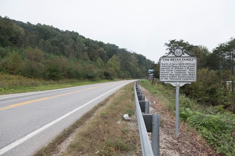
North of here (1826-28) lived
John and Nancy Bryan, grandparents of William Jennings Bryan,
the Great Commoner. They
moved to Gallipolis Ferry
where they died; John, 1834;
Nancy in 1832. Buried nearby
in the Yatesmont Cemetery. — — Map (db m125870) HM
First White settlers came here from Giles County, Virginia, in pursuit of an Indian raiding party that had taken their horses. Permanent settlement established by 1800. McComas and Hatfield families were among first settlers. Thomas Ward produced . . . — — Map (db m178251) HM
Site of Camp McDonald, set up, 1862, occupied by the 11th W. Va. Inf., U.S.V. Scene of engagement, May 6, 1862, when Federals under Maj. George C. Trimble beat off an attack by Confederate Moccasin Rangers under Capt. Geo. Downs. — — Map (db m14153) HM
Gilmer CountyFormed, 1845, from Kanawha and Lewis. Named for Thomas Walker Gilmer, Secretary of the Navy in President Tyler's Cabinet, who was killed by the explosion of a gun on board the United States battleship, Princeton, February 28, 1844. . . . — — Map (db m73437) HM
One of several partisan groups in
western VA during the Civil War,
the Moccasin Rangers were Southern
sympathizers who operated in the
central counties of present-day West Virginia,
conducting raids and terrorizing
local Unionists. After they . . . — — Map (db m137948) HM
Perry Hays & George Silcott
Peregrine Hays and George Silcott were prominent businessmen before the Civil War. Hays was sheriff of Calhoun County and Silcott county clerk. In 1861, they helped form the Moccasin Rangers. After truce they helped . . . — — Map (db m137949) HM
Site of first Calhoun Co. Court which met at home of Joseph Burson, April 14, 1856. Justices were Wm. Brannon, Dan. Duskey, H.R. Ferrell, Geo. Lynch, Joshua Knight, Absalom Knotts and Hiram Ferrell. — — Map (db m73462) HM
One mile west in the low gap are the graves of Mike Fink and an Indian, slain in 1780, and buried where they fell. While hunting, Fink and Adam O’Brien were fired on by two Indians; Fink shot one and was killed by the other. — — Map (db m137950) HM
Solomon Osborne was born circa 1814 on a Cherokee reservation in North Carolina. Served as guard on the “Trail of Tears,” and fell in love with Seaberry (Martha Arms), daughter of Chief Running Bear (Robert Arms). They escaped and were married in . . . — — Map (db m137986) HM
Born on December 10, 1826, he was
one of the first school teachers
in Nicholas County. He moved to
Clay County before the Civil War
and was a delegate to the first
constitutional convention for West Virginia,
1861-1863. In 1863, he organized . . . — — Map (db m137965) HM
Both county and county seat are named for Henry Clay. The Golden Delicious apple, once called "Mullins' Yellow Seedling," was developed on Porters Creek. The State also produced the Grimes Golden, the other great yellow apple. — — Map (db m64096) HM
During the Civil War, civilians in West Virginia formed Union militias to combat Confederate guerrillas and to protect the local citizenry. Often called Home Guards, these units were sometimes incorporated into the regular army. There were . . . — — Map (db m179592) HM
Named in honor of Ozro, Johnie,
Burman, Eugene and Lawson Jones,
brothers who grew up in Hartland
in Clay County and served in the
Army during World War II. Burman,
Ozro, and Johnie were killed in
action during the war. After the
war, Eugene . . . — — Map (db m137964) HM
To east was Claude Markle (1882-1962) home, noted road builder in Clay, Webster, Boone, & Kanawha in early 20th century. Projects include Maysel intersection of US 119/36/ & 4, Clay Jct. Route 16, & Widen ridge; bridges; tunnels; & culverts. He . . . — — Map (db m137966) HM
Clay County. Formed in 1858 from Braxton and Nicholas. Named for the great Kentuckian, Henry Clay, who was so popular in western Virginia that in 1820 a monument was erected to him for his part in bringing the National Road to Wheeling.
. . . — — Map (db m137951) HM
This privately owned covered bridge was completed in 1890 as ordered by the county court. Stone masons T. C. Ancell and E. Underwood prepared all abutments at a cost of $976.54, and carpenters John Ash and S. H. Smith built frame superstructure for . . . — — Map (db m142404) HM
In 1915, a two-span reinforced concrete arch bridge was built over Arnold Creek near Central Station by the Clarksburg-based Concrete Steel Bridge Company. Constructed during the Good Roads Movement and the state's first major effort to address poor . . . — — Map (db m142409) HM
Here lived Joseph H. Diss Debar, artist, designer of the State seal and coat of arms. He lived here many years and helped establish Saint Clara Colony nearby, about 1845. Author of first "Handbook of West Virginia". — — Map (db m142421) HM
21st governor of W. Va. (1941-1945), born at Grove, 1874, spent boyhood here in former town of Market. He served in Spanish American War and graduated from W. Va. Univ. before opening law practice in Fairmont. His public career included terms as . . . — — Map (db m142423) HM
Site of Greenbrier Seventh Day Baptist Church, organized Aug. 1870 by members of New Salem church, est. 1792 in Salem. Met in log building; new church dedicated, 1880; razed, 1975. Rev. Peter Davis (1783-1885), original settler & Rev. Jacob Davis . . . — — Map (db m142418) HM
Born January 8, 1820, Stuart was prosecuting attorney of Doddridge County, 1852-1861. After voting against secession at the Richmond Convention, he was elected senator of the Restored Government of VA. He also served as a delegate to the . . . — — Map (db m142415) HM
Skirmish at West Union
Early on May 5, 1863, six companies of the 2nd WV Infantry under Col. George Latham arrived in West Union to protect area railroad bridges during the Jones-Imboden raid. Two regiments of Confederate cavalry advanced to . . . — — Map (db m142412) HM
West Union, incorporated in 1881, was formerly called Lewisport in honor of Lewis Maxwell. It is the county seat of Doddridge, named for Philip Doddridge. In it lived J. H. Diss Debar and Sen. and Gov. M. M. Neely. — — Map (db m42429) HM
Built, 1830, on the old James River and Kanawha Turnpike. Restored antebellum home of Colonel George W. Imboden, on General Lee's staff, C.S.A. Property and headquarters of the Fayette County Historical Society, organized in 1926. — — Map (db m50392) HM
Regular stop on the James River and Kanawha Turnpike. The original building, dating from before the Revolution, was rebuilt by William Tyree, 1810. During the winter of 1861-62, it was headquarters for Chicago Gray Dragoons. — — Map (db m67013) HM
Once called Marshall’s Pillar for Chief Justice John Marshall, who came here, 1812. U.S. engineers declare the New River Canyon, 585 feet deep, surpasses the famed Royal Gorge. Tunnel for river makes vast water power here. — — Map (db m20675) HM
Mouth of the great Hawk's Nest Tunnel, three miles long, which diverts water of New River from its five-mile long gorge. The tunnel, a mile of which is through solid rock, and a 50-foot dam give waterfall of 160 feet for electric power. — — Map (db m34421) HM
Construction of nearby tunnel, diverting waters of New R. through Gauley Mt. for hydroelectric power, resulted in state’s worst industrial disaster. Silica rock dust caused 109 admitted deaths in mostly black, migrant underground work force of . . . — — Map (db m34417) HM
In Westlake Cemetery is the grave of the mother of General Thomas J. "Stonewall" Jackson. The monument at the grave was placed by Captain Thomas Ranson, who had fought in Jackson's old brigade in the War between the States. — — Map (db m34376) HM
The sheer cliffs of Nuttall sandstones forming the walls of the New River Gorge are the "Salt Sands" of the driller. These sands produce oil and natural gas in West Virginia and commercial brines on the Kanawha and Ohio Rivers.
Sponsored . . . — — Map (db m34420) HM
Nearby is grave of Seaberry Osborne
(circa, 1815-66), daughter of Chief
Running Bear. She married Solomon
Osborne in Cherokee, N.C. and in
1838 fled to escape “Trail of Tears.”
The Native American pioneers found
sanctuary in the mountains and . . . — — Map (db m138009) HM
On a ridge between Armstrong and Loop creeks across the river are extensive prehistoric stone ruins whose walls are several miles long, and enclose a large area. Many of these stones are from the valley below the old wall. — — Map (db m20820) HM
Camp named for Booker T. Washington (1856-1915) and George Washington Carver (1864-1943). Land deeded for sum of $5.00 by Charles and Kathryn Midelburg. Constructed 1939-1942 by local WPA labor with materials found on site including stone and native . . . — — Map (db m138103) HM
Battle of Fayetteville (1862)
On September 10, 1862, soldiers under the command of Confederate Gen. W.W. Loring attacked Union forces in Fayetteville under Col. Edward Siber, driving them out of the town towards Charleston, where fighting . . . — — Map (db m120516) HM
In the attack on Federal forces here, 1863. Milton W. Humphreys, the educator and soldier, gunner of Bryan's Battery, 13th Virginia Light Artillery, C.S.A., first used “indirect firing,” now in universal military use. — — Map (db m55815) HM
Memorial Park was presented to citizens of Fayetteville to honor all veterans who served to defend their country. LaFayette Post No. 149, The American Legion, obtained lease for this property on August 4, 1958 from the New River Pocahontas Coal Co. . . . — — Map (db m76724) HM WM
Nearby on May 19-20, 1863, Corp. Milton W. Humphreys, gunner in Bryan's Battery, 13th Virginia Light Artillery, C.S.A., made first use of indirect artillery fire in warfare. Target was Union fort in Fayetteville. — — Map (db m217549) HM
John Townsend bought a large tract of land here in 1841, an area that became Lansing, Ames Heights and Canyon Rim Park. Operated a ferry that provided commercial transport across the river at site of present bridge until the civil war. Grandson . . . — — Map (db m78288) HM
Masonic group owned property in 1854. Baptists worshipped here prior to Civil War, but building destroyed during the conflict. Contains 29 marked graves, including town's early settlers and soldiers of the Civil War. A number of graves are marked . . . — — Map (db m76708) HM
Christopher Q. Tompkins
Born 1813 in Matthews County, VA.
Tompkins was an 1836 graduate of
West Point. A prominent industrial
businessman in the Kanawha Valley
before the Civil War, from May to
November 1861 he was colonel of
the . . . — — Map (db m138027) HM
Here New and Gauley rivers unite to form Great Kanawha River. Piers still stand of old bridge destroyed by the Confederate troops in 1861. Here Thomas Dunn English, author of the ballad, "Ben Bolt," wrote "Gauley River". — — Map (db m20818) HM
Located across Kanawha River from this point was Civil War camp for Union Army, 1862-64. Site had 56 cabins and parade grounds for 23rd Ohio Vol. Inf. commanded by Col. Rutherford B. Hayes and Lt. William McKinley, future United States presidents. — — Map (db m50397) HM
The nearby highway is part of route traversing W.Va. from Lewisburg to Point Pleasant memorialized by the state to commemorate the march of the American Colonial army of 1,200 men led by Andrew & Charles Lewis. After a month's march this army . . . — — Map (db m33809) HM
Site of largest mine disaster in Fayette County history. On 2 March 1915, coal dust in Layland #3 ignited, killing 112 men; 42 of 53 survivors were rescued 6 March, one mile inside 10th left section behind barricade they built. — — Map (db m140484) HM
Sandstone formation at 2510 feet is landmark known for view of Sewell Mt. range to SE. Known as "Rock of Eyes" by Native Americans and dubbed "Spy Rock" by Civil War soldiers. Sept. 1861, Gen. J.D. Cox and 5,000 Union soldiers camped here to oppose . . . — — Map (db m34430) HM
Born in slavery in Monroe Co., Sept. 7, 1848, he worked as servant in the Confederate army. Served as teacher and ordained Baptist minister; estab. West Virginia Enterprise, Pioneer, & Mountain Eagle papers; later a lawyer. First . . . — — Map (db m34413) HM
Fayette County
Formed in 1831 from Nicholas, Greenbrier, Kanawha, Logan. Named for General Lafayette. On New River, 1671, Batts and Fallam officially claimed Mississippi Valley for Great Britain in opposition to the claim of France. . . . — — Map (db m76931) HM
Settled before the Revolution by Levi Morris, whose father, William Morris, made the first permanent settlement in the Great Kanawha Valley. Named Coal Valley in 1879. Renamed when incorporated in 1891 for James C. Montgomery. — — Map (db m138010) HM
Settled before the Revolution by Levi Morris, whose father, William Morris, made the first permanent settlement in the Great Kanawha Valley. Named Coal Valley in 1879. Renamed when incorporated in 1891 for James C. Montgomery. — — Map (db m138013) HM
State institution established in 1895 as Preparatory Branch of West Virginia University. In 1931, name was changed to New River State College. Became a multipurpose college in 1941, known as West Virginia Institute of Technology. — — Map (db m76933) HM
An African American high school
formed in 1917, it educated black
Fayette County children until 1956.
Students were taught in community
buildings and churches, 1950-1954,
after the school was destroyed by
fire. The second DuBois High . . . — — Map (db m140445) HM
Fayette County. Formed, 1831, from Nicholas, Greenbrier, Kanawha, Logan. Named for General Lafayette. On New River, 1671, Batts and Fallam officially claimed Mississippi Valley for Great Britain in opposition to the claim of France. . . . — — Map (db m228751) HM
Nallen. Wilderness Lumber Co. camp, named for John I. Nallen, manager, circa 1916. John Bayes family settled in 1825, later by James Miller, who had ferry across Meadow R. Served by Sewell Valley, later NF&G connection to C&O RR. . . . — — Map (db m238234) HM
Built in 1903 by the White Oak Railway Company, the depot is one of the oldest surviving structures in the community. It was leased by the Virginian Railway Company in 1912, then purchased in 1922, and is the only extant Virginian depot in West . . . — — Map (db m143111) HM
White Oak Fuel Company built the Oakwood Mine Complex in 1902. In 1915, 21 miners died when gas in the mine exploded. A year later, the original wooden tipple was upgraded to a multi-story steel structure. New River Company ran the mine after . . . — — Map (db m76691) HM
Fayette County. Formed in 1831 from Nicholas,
Greenbrier, Kanawha, Logan.
Named for General Lafayette.
On New River, 1671, Batts
and Fallam officially claimed
Mississippi Valley for Great
Britain in opposition to the
claim of France.
. . . — — Map (db m140483) HM
Near here, at highest point on
the Midland Trail, Gen. Robert
E. Lee had headquarters during
his campaign in West Virginia
in 1861. His famous war horse
“Traveler,” was brought to him
here from the Andrew Johnston
farm in . . . — — Map (db m164702) HM
From August to October 1861, about
17,000 Union and Confederate troops
operated near the Sewell Mountain
area. Waiting for a major battle
that never came, many soldiers died
of disease caused by foul weather.
Excessive rainfall hampered . . . — — Map (db m138110) HM
Southwest is the Old Stone
House, built, 1824, by Richard
Tyree on the James River and
Kanawha Turnpike. It was visited by Jackson, Clay, Webster,
Benton, and other notables.
Here Matthew Fontaine Maury
wrote his book on navigation. — — Map (db m138108) HM
At the top of the hill is the site of a log fort 30x30 feet in size, built in spring, 1864, for Capt. W.T. Wiant's Gilmer County Home Guards. Occupied until December, 1864. Burned days later by Confederates under Capt. Sida Campbell. — — Map (db m73428) HM
Here was written “The West Virginia Hills,” State song. This was the home of William Perry Brown, author of three score books for children, and for many years one of the most popular writer for the old “Youth’s Companion.” — — Map (db m189578) HM
Here was written "The West Virginia Hills," State song. This was the home of William
Perry Brown, author of three score books for children, and for many years one of the most popular writers for the old "Youth's Companion." — — Map (db m190020) HM
A college that offers both professional and general education with emphasis on teacher education was established by the Legislature in 1872 as the Glenville Branch of the West Virginia Normal School. Became Glenville State Normal School in 1898. . . . — — Map (db m73429) HM
A central West Virginia college maintained for the training of grade and high school teachers. Established as a normal school in 1872 by the Legislature. Given college status in 1930. — — Map (db m73430) HM
Built this home in 1837 on a 1000-acre tract, and laid out the town of Glenville in 1845. As a member of the Virginia Assembly, he urged the building of the Parkersburg-Staunton Turnpike. As a Congressman, in 1842, Hays appointed Thomas Jonathan . . . — — Map (db m17557) HM
Nearby was located cabin of Vincent Williams, an early settler and noted Indian fighter of the South Branch, who lived on Patterson’s Creek near Fort Pleasant. During a July 16, 1756 attack on his home, Williams killed five Native Americans before . . . — — Map (db m94034) HM
Grant County. Formed in 1866 from Hardy. Named for General Grant, later President. At the northwestern corner is the Fairfax Stone, which established the limits of the lands of Lord Fairfax. The county has many mountain peaks and beautiful . . . — — Map (db m156427) HM
Cliffs 800 feet high lining great cleft in the New Creek and Knobley mountains, which rival the famed Franconia Notch of New England. Scene of skirmish in 1863 between General Jones' cavalry and Federal troops from New Creek. — — Map (db m36835) HM
The proclamation of George III, King of England, in 1763 ordered settlement west of these mountains to stop. The early treaties between the English and the Six Nations accepted this range as the dividing line between them. — — Map (db m75184) HM
Frontier defense, including blockhouse, stockade, and cabins. Part of the chain of forts established by George Washington about 1755. Point of refuge for the Bowmans, Lees, Logsdons and many pioneer families. — — Map (db m75185) HM
Here was the southwestern boundary of the six million acre estate of Lord Fairfax. This vast tract, lying south of the Potomac and known as the Northern Neck, included the Eastern Panhandle and most of the South Branch. — — Map (db m155451) HM
Near this fort, established as defense against Indians, stood Samuel Bingamon's cabin. His home attacked and his wife wounded, Bingamon single-handed shot and clubbed to death all but one of a party of seven Indians. — — Map (db m50399) HM
Grant County. Formed in 1866 from Hardy. Named for General Grant, later President. At the northwestern corner is the Fairfax Stone, which established the limits of the lands of Lord Fairfax. The county has many mountain peaks and beautiful . . . — — Map (db m162737) HM
Settled about 1745. Near by was Fort George, Indian fort. Federal trenches overlooked the town in 1863 and 1864. Here is grave of Rev. W. N. Scott, pioneer preacher, who built churches at Old Fields, Moorefield, and Petersburg. — — Map (db m162730) HM
Settled in 1777 by “Elder” John Alderson, the frontier missionary. He organized the first Baptist church in the Greenbrier Valley. In 1763, the Muddy Creek settlements were destroyed by Shawnee Indians under Cornstalk. — — Map (db m76515) HM
Alderson Academy opened September 18, 1901, a coeducational secondary school founded mainly through the efforts of Miss Emma C. Alderson. Closely associated with Greenbrier Baptist Church, after 1910 control was assumed by W. Va. Baptist . . . — — Map (db m76519) HM
Marker Front: Formed, 1778, from Botetourt and Montgomery. Named for the river which drains it. This county had many pioneer forts and saw many bloody Indian battles. Here are the world-famed White Sulphur and other mineral springs. . . . — — Map (db m76636) HM
The nearby highway is part of route traversing W.Va. from Lewisburg to Point Pleasant memorialized by the state to commemorate the march of the American Colonial army of 1,200 men led by Andrew & Charles Lewis. After a month's march this army . . . — — Map (db m238227) HM
Fort Donnally Built by Andrew Donnally a few miles north about 1771. Attack on this fort by 200 Indians in 1778 was second most important frontier engagement in the State. The fort was relieved by force under Colonel John Stuart.
Border . . . — — Map (db m55818) HM
Fort Donnally. Built by Andrew Donnally a few miles north about 1771. Attack on this fort by 200 Indians in 1778 was second most important frontier engagement in the State. The fort was relieved by force under Col. John Stuart.
Border . . . — — Map (db m238233) HM
The resistant Droop Sandstone
in this quarry is the “Maxon Sand”
of the driller, and shows southerly
dipping cross laminations. This
Sand yields oil and natural gas
at depths of over 1000 feet in
southern and central West Virginia. — — Map (db m140575) HM
Unknown Soldiers
Six miles west, a Confederate regt. from Georgia camped at Blue Sulphur Springs in improvised shelters, during the winter of 1863. Many died of exposure and disease, and are buried on the hill 400 yards north of the . . . — — Map (db m100004) HM WM
The massive pebbly sandstone exposed in the cliff is the Berea of the driller and geologist. This sand produces large quantities of oil and natural gas in West Virginia. — — Map (db m76501) HM
In November 1863, David S. Creigh, a well-known southern sympathizer, found a Union soldier ransacking his home and harassing his wife. In the ensuing fight, Creigh killed the man, then hid the body. Later arrested, Creigh was tried and, on June 10, . . . — — Map (db m110028) HM
Col. John Stuart, who came here in 1769 with McClanahan, the Renicks, and companions, bought out earlier claims of William Hamilton. "The Cliffs" to the east offer one of the celebrated beauty spots of Greenbrier Valley. — — Map (db m50389) HM
On the evening of May 1, 1863, Lt. Col. George Edgar moved to block Union troops marching to Lewisburg. Establishing lines at Tuckwiller's hill, Edgar caught the enemy by surprise under cover of darkness early on the 2nd, and reportedly feigned . . . — — Map (db m116378) HM
The Greenbrier Limestone in the quarry represent the "Big Lime" of the driller. Fish-egg like oölitic zones in the "Big Lime" produce oil and natural gas in West Virginia. — — Map (db m97799) HM
Carnegie Hall, built in 1902, by Lewisburg Female Institute and citizens of the Greenbrier Valley area. It is one of only three Halls in the U.S. named for Andrew Carnegie who gave $26,750. Local citizens gave $10,000 to complete the Hall. . . . — — Map (db m61464) HM
Col. John Stuart Col. John Stuart built Stuart Manor, 1789, near Fort Stuart. He was a military and civil leader and led a company in the Battle of Point Pleasant. As clerk of Greenbrier County, he left many historic records. His first office is . . . — — Map (db m50394) HM
Side A On the hill, 400 yards west, in a common grave shaped like a cross, lie unclaimed bodies of ninety-five Confederate soldiers, casualties of the area, including those of the Battle of Droop Mountain and the Battle of Lewisburg. . . . — — Map (db m21748) HM
Enslaved African, noted for bravery in defense of Fort Donnally during Shawnee attack May 29, 1778. He was granted his freedom by James Rodgers in 1801. Land granted to other defenders; his 1795 pension petition, supported locally, denied. . . . — — Map (db m21737) HM
Site of the campus of Greenbrier College. In 1812, the Rev. John McElhenney established a co-ed school, the Lewisburg Academy. In 1875, the academy transferred all properties to the Lewisburg Female Institute. Briefly named Lewisburg Seminary prior . . . — — Map (db m140673) HM
Constructed 1837 by John W. Dunn, well known local brickmason. All brick was made locally. Building has been in constant use since its completion and is unchanged except for wings added in 1937 and 1963. — — Map (db m50471) HM
First established at Lewisburg 1808-09 by Dr. John McElhenney and chartered as an academy in 1812. Used as barracks and hospital during War between the States. Present buildings on north side of town built 1921. — — Map (db m19378) HM
First school was established 1808-09 by Dr. John McElhenney and chartered as an academy in 1812. Used as barracks and hospital during War between the States. The present buildings were erected in 1921. — — Map (db m19382) HM
Side A Site of Fort Savannah, built in 1755. Here at Camp Union Gen. Andrew Lewis mustered troops which participated in the Battle of Point Pleasant 1774. Lewisburg was incorporated in October, 1782, by the Virginia Assembly. Side B . . . — — Map (db m21747) HM
Confederate troops under Gen. Henry Heth here, May 23, 1862, were repulsed in attach upon division of Col. Geo. Crook's brigade. The Old Stone Church was used as a hospital. In his retreat, Heth burned bridge over Greenbrier at Caldwell. — — Map (db m19380) HM
Pontiac's WarMassacre of white families of Muddy Creek and of the Clendenins near here by a band of Shawnee Indians led by Chief Cornstalk, in 1763, completed the destruction of the early settlements in the Greenbrier Valley.
Welsh . . . — — Map (db m50395) HM
Born July 28, 1805, Samuel Price served in the Virginia legislature, 1850-1841 Constitutional Convention, and 1861 Richmond Convention. From 1863 to 1865, he was Lt. Governor of Confederate Virginia. As president of West Virginia’s Constitutional . . . — — Map (db m140698) HM
980 entries matched your criteria. Entries 101 through 200 are listed above. ⊲ Previous 100 — Next 100 ⊳