By Craig Swain
Markers in Belington
GEOGRAPHIC SORT Title Sort Marker Number Sort Marker Number Sort N Marker Number Sort T Publication Order Sort Publication Order Sort A Erected Year Sort Most Viewed Sort Most Recent-Interest Sort Most Recently Changed Sort SEE FAQ #33 FOR DESCRIPTIONS
On Philippi Pike (U.S. 250) at Watkins Street (County Route 15), on the right when traveling north on Philippi Pike.
On Laurel Mountain Road (County Route 15), on the right when traveling east.
On Laurel Mountain Road (County Route 15), on the right when traveling east.
On Morgantown Pike (State Highway 92) at Slate Road, on the right when traveling east on Morgantown Pike.
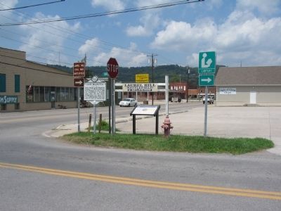
On Junior-Philippi-Grafton Road (U.S. 250), on the right when traveling south.
On Mansfield Drive (U.S. 250) at North Main Street, on the right when traveling north on Mansfield Drive.
On Beverly-Fairmont Pike (U.S. 250), on the right when traveling south.
On Beverly-Fairmont Pike (U.S. 250), on the right when traveling south. Reported permanently removed.
On Church Street south of North Walnut Street, on the left when traveling south.
On Graystone Drive, on the right when traveling south.
On North Main Street (U.S. 250) at Court Street, on the right when traveling north on North Main Street.
On Main Street (U.S. 250), on the right when traveling east.
On State Highway 38, on the right when traveling west.
On Baker Road at Charles Town Road (West Virginia Route 9), in the median on Baker Road.
On Flaggs Crossing Road at Blairton Road on Flaggs Crossing Road.
Paid Advertisement
On Winchester Pike (U.S. 11) north of Old Mill Road, on the right when traveling north. Reported missing.
On Runneymead Road, 0.5 miles west of Goldmiller Road, on the right when traveling east.
On Winchester Pike (U.S. 11) north of Old Mill Road, on the right when traveling north. Reported missing.
On Winchester Pike (U.S. 11) south of Hatchery Road (County Route 11/8).
On Williamsport Pike (U.S. 11) east of Temple Drive, on the right when traveling west.
On Dominion Road, 0.1 miles south of Gerrardstown Road, on the left when traveling south.
On Gerrardstown Road (West Virginia Route 51) 0.1 miles east of Reunion Corner Road, on the left when traveling west.
On Hedgesville Road (West Virginia Route 9) near Mt. Zion Street, on the right.
On Martinsburg Road or Hedgesville Road (West Virginia Route 9) west of Rustic Tavern Road, on the right when traveling west.
On North Queen Street (U.S. 11) at East Commerce Street, on the right when traveling north on North Queen Street.
On South Queen Street (West Virginia Route 45) north of Buxton Street, on the left when traveling north.
On South Queen Street (West Virginia Route 9/45) south of East Addition Street, on the right when traveling south.
On Williamsport Pike (U.S. 11) 0.4 miles north of Warm Springs Ave., on the right when traveling north.
On East John Street, on the right.
On West Martin Street west of Raleigh Street, on the left when traveling west.
On Edwin Miller Boulevard (West Virginia Route 9) east of Interstate 81, on the left when traveling west.
Paid Advertisement
On King Street (U.S. 11) near North Maple Avenue, on the left when traveling east.
On East Martin Street near White Avenue.
On Tuscarora Pike (County Route 15) west of Lost Road (County Route 13/1), on the left when traveling west.
On Winchester Avenue (U.S. 11) 0.1 miles north of Evans Run Road, on the left when traveling north.
On Winchester Avenue (U.S. 11) 0.2 miles south of Specks Run Road, on the right when traveling north.
On Shepherdstown Road (West Virginia Route 45) at Files Cross Road (Local Route 45/2), on the left when traveling east on Shepherdstown Road.
On State Street (West Virginia Route 85) at Avenue C, on the left when traveling south on State Street.
On State Street (West Virginia Route 85) at Avenue C, on the left when traveling south on State Street.
On West Virginia Route 85, 0.1 miles north of Country Estates Road, on the left when traveling south.
On Memorial Drive north of Ridgeview-Nellis Road (County Route 1), on the right when traveling west.
On Daniel Boone Parkway (West Virginia Route 3) 0.1 miles west of Roundbottom Road (Local Route 119/21), on the right when traveling west.
On Daniel Boone Parkway (West Virginia Route 3) 0.5 miles west of the Peytona Post Office on Roundbottom Road (Local Route 119/21), on the left when traveling west.
On Daniel Boone Parkway (West Virginia Route 3) 0.5 miles west of the Peytona Post Office on Roundbottom Road (Local Route 119/21).
On Daniel Boone Parkway (West Virginia Route 3) at Roundbottom Road (Local Route 119/21) when traveling west on Daniel Boone Parkway.
On Coal River Road (West Virginia Route 3), on the right when traveling west.
Near Burnsville Lake Road.
Paid Advertisement
On Burnsville Road (SR 5).
On Bridge Street (West Virginia Route 5) at S. Wabash Avenue, on the left when traveling west on Bridge Street.
On West Virginia Route 2 at Park Avenue, on the right when traveling south on State Route 2.
On River Road (West Virginia Route 2) 0.2 miles north of Caroline Avenue, on the left when traveling north.
On Main Street (West Virginia Route 67), on the right when traveling west. Reported missing.
On Main Street (West Virginia Route 67) 0.2 miles east of West Virginia Route 88, on the right when traveling east.
On Main Street (Route 67) at Fairway Street, on the right when traveling east on Main Street.
On Main Street at Church Street, on the right when traveling east on Main Street.
On Main Street (West Virginia Route 67), on the right when traveling east. Reported missing.
On Main Street (West Virginia Route 67), on the right when traveling east.
Near Eldersville Road (West Virginia Route 27) at St. John's Road, on the right when traveling west.
On Main Street (West Virginia Route 2), on the right when traveling north.
On Archer Hill Road at West Virginia Route 2, on the right when traveling west on Archer Hill Road.
On Bethany Pike (West Virginia Route 67) 0.1 miles north of McCord Hill Road (County Route 67/2), on the right when traveling north.
On Commerce Street (West Virginia Route 2) north of 12th Street, on the right when traveling south.
On West Virginia Route 27 at Northview Road, on the left when traveling east on State Route 27.
Paid Advertisement
On West Virginia Route 2, 0.1 miles north of Cross Creek Road, on the right when traveling north.
On Washington Pike (West Virginia Route 27) at Bradys Ridge Road, on the right when traveling east on Washington Pike.
On Commerce Street (West Virginia Route 2) at 3rd Street, on the right when traveling north on Commerce Street.
On 6th Street at Main Street, on the right when traveling west on 6th Street.
On Commerce Street (West Virginia Route 2) north of 22nd Street, on the right when traveling south.
On Bethany Pike (West Virginia Route 67) 0.1 miles north of McCord Hill Road, on the right when traveling south.
On Commerce Street (West Virginia Route 2) south of 3rd Street, on the right when traveling north.
On Main Street at 6th Street, on the right when traveling south on Main Street.
On Main Street at Water Street on Main Street.
On Water Street at Midland Trail (U.S. 60), on the left when traveling north on Water Street.
On Midland Trail (US 60).
On Ohio River Road (West Virginia Route 2) at Homestead Road, on the right when traveling south on Ohio River Road.
On Guyan St north of 5th Avenue, on the right when traveling north.
On Guyan Street north of 5th Avenue, on the right when traveling north.
On 11th Street south of Veterans Memorial Boulevard (U.S. 60), on the left when traveling south.
Paid Advertisement
On Hal Greer Blvd at 9th Avenue on Hal Greer Blvd.
On West 14th Street at Memorial Boulevard on West 14th Street.
On 11th Street near Veterans Memorial Boulevard (U.S. 60), on the left when traveling south.
On Bridge Street (West Virginia Route 2) at Richmond Street, on the left when traveling west on Bridge Street.
On 5th Avenue (U.S. 60) east of 7th Avenue, on the left when traveling east.
On 7th Avenue west of 10th Street, on the left when traveling west.
On 5th Avenue (U.S. 60) at 6th Street, on the left when traveling east on 5th Avenue.
On 11th Street at Veterans Memorial Boulevard (U.S. 60), on the left when traveling south on 11th Street.
On Bridge Street (West Virginia Route 2) at Richmond Street on Bridge Street.
On 10th Avenue at Douglass Street / A D Lewis Avenue, on the right when traveling west on 10th Avenue.
On Marshall Memorial Boulevard / Charleston Avenue east of 20th Street.
On 3rd Avenue (U.S. 60) at 20th Street, on the right when traveling west on 3rd Avenue.
On 3rd Avenue (U.S. 60) at 18th Street, on the left when traveling west on 3rd Avenue.
On Hal Greer Boulevard (West Virginia Route 10) near 4th Avenue, on the right when traveling south.
On 5th Avenue at 17th Street, on the left when traveling east on 5th Avenue.
On Main Street north of Hagan Street, on the left when traveling south.
Paid Advertisement
On Norway Avenue at Huntington State Hospital Road, on the right when traveling south on Norway Avenue.
On Midland Trail (US 60).
On James River Turnpike Road (County Route 25) 1.6 miles Midland Trail (U.S. 60), on the right when traveling east.
980 entries matched your criteria. The first 100 are listed above.
Next 100 ⊳