1283 entries match your criteria. Entries 201 through 300 are listed.⊲ Previous 100 — Next 100 ⊳
National Historic Landmarks Historical Markers
Nationally significant historic places designated by the Secretary of the Interior because they possess exceptional value or quality in illustrating or interpreting the heritage of the United States. Today, fewer than 2,500 historic places bear this national distinction.
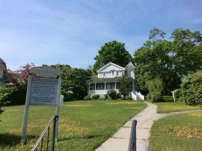
Boyhood home of Eugene O’Neill, America’s most renowned playwright and setting for his masterpieces ‘Ah, Wilderness’ and ‘Long Day’s Journey Into Night”. O’Neill won the Nobel Prize in literature in 1936.
This site possesses exceptional . . . — — Map (db m66446) HM
Near Greenmanville Avenue (Connecticut Route 27) south of Bruggeman Place, on the left when traveling north.
Built: 1925, John F. James & Son, Essex, MA
Length: 137'
Beam: 25'
After a century of service, the Grand Banks fishing schooner Roseway is here at Mystic Seaport Museum for a major preservation . . . — — Map (db m226931) HM
Near Greenmanville Avenue (Connecticut Route 27) south of Hinckley Street, on the left when traveling north.
Built and launched in New Bedford in 1841, the Charles W. Morgan is the last of an American whaling fleet that numbered more than 2,700 vessels over 150 years. During an 80-year whaling career, the Morgan embarked on 37 voyages. . . . — — Map (db m227038) HM
New Castle Historic District
has been designated a
Registered National
Historic Landmark
under the provisions of the
Historic Sites Act of August 21, 1935
This site possesses exception value
in commemorating or illustrating
the . . . — — Map (db m64763) HM
[1st plaque]
Eleutherian Mills
This is Eleutherian Mills, where E.I. du Pont built his home in 1803. Here also is the restoration of E.I. du Pont's garden, as well as a workshop, vehicle and weather vane exhibits in the Barn,
and the . . . — — Map (db m213322) HM
Near Concord Pike, on the right when traveling north.
In 1682, William Penn granted 986 acres of land at this location to Valentine Hollingsworth. A portion of the tract was subsequently conveyed to the Robinson family in 1726. The present stone dwelling was erected here circa 1750. In 1785, Gunning . . . — — Map (db m92148) HM
Near North Church Street (Route 13) at East 7th Street, on the right when traveling north.
Upon arrival from Sweden in 1697, Pastor Eric Björk began his quest to build a stone church to replace the decaying log structure on the south bank of the Christina River that had served the Swedish Lutheran congregation. Helga Trefaldighet . . . — — Map (db m174436) HM
Near East 7th Street just east of Swedes Landing Road, on the right when traveling east.
The park was created by the State of Delaware for the tercentenary in 1938. It was designated a National Historic Landmark by the U.S. Department of the Interior March 29, 1963 in the presence of Prince Bertil of Sweden, Vice President Lyndon B. . . . — — Map (db m174432) HM
Near Shipcarpenter Street north of PIlottown Road, on the right when traveling north.
Lightship LV-118
Overfalls
has been designated a
National Historic Landmark
This vessel possesses national significance in commemorating the history of the United States of America
Used from 1820 to 1983, lightships . . . — — Map (db m232749) HM
Near 1st Street Northeast south of Constitution Avenue Northeast (Alternate U.S. 1), on the right when traveling south.
Front:
One of the icons of world architecture, the U.S. Capitol has been the meeting place of Congress since 1800. President George Washington laid the cornerstone on September 18, 1793. While under construction, the the building was . . . — — Map (db m111467) HM
On Lincoln Circle Northeast north of Tapscott Street Northeast, on the right when traveling south.
Panel 1
“Ole Jim” Fondly known by Gallaudet alumni as “Ole Jim,” this building was the first Gallaudet College gymnasium. Designed by Frederick Withers and built in 1881, it was the nation’s second gymnasium . . . — — Map (db m40440) HM
On Lincoln Circle Northeast north of Florida Avenue Northeast.
Chapel Hall
Gallaudet College has been designated a
Registered National Historic Landmark
under the provisions of the Historic Sites Act of August 21, 1935, this site possesses exceptional value in commemorating or illustrating the . . . — — Map (db m40459) HM
Near 16th Street Northwest at W Street Northwest, on the right when traveling north.
Since Meridian Hill Park opened in 1936, Washingtonians from the diverse neighborhoods surrounding the park have gathered here for performances, community events, and political protest.
When tens of thousands of people flocked to Washington, . . . — — Map (db m156670) HM
Near 16th Street Northwest north of Crescent Place Northwest, on the right when traveling north.
Congress ordered sculptures installed at Meridian Hill Park long before the park's completion. So many sculptures were authorized that Horace Peaslee, the park's architect, called for a moratorium on installations. He told the Commission of the . . . — — Map (db m63658) HM
Near 15th Street Northwest south of Euclid Street Northwest, on the left when traveling north.
President Monroe singed a charter in 1821 that established Columbian College on a site north of Florida Avenue between 14th and 15th Streets, Columbian College moved to Foggy Bottom in 1912 and became George Washington University, but the original . . . — — Map (db m63771) HM
Near 15th Street Northwest north of Chapin Street Northwest, on the left when traveling north.
At the beginning of its second century, the nation's capital was changing dramatically. In 1902, the United States Senate adopted a number of recommendations from the Senate Park Commission, popularly known as the McMillan Commission. By 1910, a . . . — — Map (db m63940) HM
Near 16th Street Northwest north of W Street Northwest, on the right when traveling north.
Buchanan was our only bachelor president and relied upon his orphaned niece, Harriet Lane, to act as his First Lady during his years in the White House (1857 to 1861). In her estate, Harriet Lane Johnson made a bequest to fund a memorial to her . . . — — Map (db m156671) HM
On 16th Street Northwest north of W Street Northwest, on the right when traveling north.
Meridian Hill Park
has been designated a
National Historic Landmark
This site possesses national significance
in commemorating the history of the
United States of America
with its formal symmetry and grand central cascade, . . . — — Map (db m212706) HM
Near Pennsylvania Avenue Northwest west of 15th Street Northwest, on the left when traveling west.
Declared a National Historic Landmark in 1972, the US Treasury Building is the oldest departmental building in Washington. The building serves as the headquarters of the Treasury Department. Treasury's responsibilities encompass revenue collection, . . . — — Map (db m100443) HM
On H Street Northwest west of Vermont Avenue Northwest, on the right when traveling west.
Ashburton House
has been designated a
National
Historic Landmark
This site possesses national significance
in commemorating the history of the
United States of America
1974
National Park Service
United States . . . — — Map (db m4082) HM
On M Street Northwest west of 9th Street Northwest, on the left when traveling east.
Blanche K. Bruce House has been designated a National Historic Landmark This site possesses national significance in commemorating the history of the United States of America 1977 National Park Service United States Department of the . . . — — Map (db m99178) HM
On Jackson Place Northwest at Pennsylvania Avenue Northwest, on the right when traveling north on Jackson Place Northwest.
700 Jackson Place has been designated a National Historic Landmark This site possesses national significance in commemorating the history of the United States of America National Park Service 1974
From 1910 to 1948 it served as the first . . . — — Map (db m32879) HM
On H Street Northwest at Jackson Place Northwest, on the right when traveling east on H Street Northwest.
Decatur House Has been designated a
Registered National
Historic Landmark
Under the provisions of the
Historic Sites Act of August 21, 1935
This site possesses exceptional value
in commemorating and illustrating
the history of . . . — — Map (db m31101) HM
On Pennsylvania Avenue Northwest at 17th Street Northwest, on the right when traveling east on Pennsylvania Avenue Northwest.
Originally State, War, and Navy Departments Constructed 1871-1888 South Wing Ground broken June 1871 Completed December 1875 East Wing Ground broken July 1872 Completed April 1879 North Wing Ground broken July 1879 Completed December 1882 West . . . — — Map (db m71253) HM
On Pennsylvania Avenue Northwest at Madison Place Northwest, on the right when traveling west on Pennsylvania Avenue Northwest.
[north face:]
To General Lafayette and his Compatriots
1777 - 1783
[south face:] By the
Congress in commemoration of the services rendered by General Lafayette and his Compatriots during the struggle . . . — — Map (db m32245) HM
On Pennsylvania Avenue Northwest east of 16th Street Northwest, on the left when traveling east.
Renwick Gallery
has been designated a
Registered National
Historic Landmark
under the provisions of the
Historic Sites Act of August 21, 1935,
This site possesses exceptional value
in commemorating or illustrating
the . . . — — Map (db m73812) HM
On 16th Street Northwest / Black Lives Matter Plaza north of H Street Northwest, on the right when traveling north.
Every President of the United States since President James Madison has attended occasional services here. Many of them were communicants of the parish.
This building was completed in 1816 from plans of Benjamin Henry Latrobe.
an adjacent . . . — — Map (db m39126) HM
On Pennsylvania Avenue Northwest east of 17th Street Northwest, on the right when traveling east.
State, War, and Navy Building
has been designated a Registered National Historic Landmark under the provisions of the Historic Sites Act of August 21, 1935 this site possesses exceptional value in commemorating or illustrating the . . . — — Map (db m71233) HM
On Pennsylvania Avenue Northwest at Jackson Place Northwest, on the right when traveling west on Pennsylvania Avenue Northwest.
National Historical Marker The Blair House Purchased in 1836 by Francis P. Blair, Sr., friend of Andrew Jackson, publisher of the Washington "Globe" and the "Congressional Globe." Inherited by his son, Montgomery Blair, Attorney for Dred Scott, . . . — — Map (db m23493) HM
On Massachusetts Avenue Northwest west of 12th Street Northwest, on the left when traveling west.
The Church of the Ascension and St. Agnes
has been designated A National Landmark listed in The National Register of Historic Places under the provisions of the Historic Act of August 1, 1935. This site possesses historic architectural . . . — — Map (db m99179) HM
On Pennsylvania Avenue Northwest east of 17th Street Northwest, on the right when traveling east. Reported permanently removed.
The White House is the oldest public building in the District of Columbia, and 1600 Pennsylvania Avenue is the most famous address in the United States. Here, every President except George Washington, has conducted the government of the Nation. . . . — — Map (db m10127) HM
On 15th Street Northwest at I Street Northwest, on the right when traveling south on 15th Street Northwest.
United Mine Workers
of America Building
has been designated a
National Historic Landmark
This site possesses national significance
in commemorating the history of the
United States of America
Associated with the . . . — — Map (db m19990) HM
On Pennsylvania Avenue Northwest at 15th Street Northwest, on the left when traveling west on Pennsylvania Avenue Northwest.
United States Department
of the Treasury
has been designated a
Registered National
Historic Landmark
under the provisions of the
Historic Sites Act of August 21, 1935
This site possesses exceptional value
in . . . — — Map (db m2122) HM
On 16th Street Northwest east of P Street Northwest, on the right when traveling east.
Administration Building
Carnegie Institution
of Washington
has been designated a
Registered National
Historic Landmark
under the provisions of the
Historic Sites Act of August 21, 1935
This site possesses exceptional . . . — — Map (db m129560) HM
On 18th Street Northwest at Massachusetts Avenue Northwest, on the right when traveling north on 18th Street Northwest.
Andrew Mellon Building has been designated a National Historical Landmark This site possesses national significance in commemorating the history of the United States of America.
1977
National Park Service United States Department . . . — — Map (db m40505) HM
On R Street Northwest west of 16th Street Northwest, on the left when traveling west.
Charlotte Forten Grimke House
has been designated a National Historic Landmark
This site possesses national significance in commemorating the history of the United States of America. — — Map (db m7125) HM
On N Street Northwest east of 18th Street Northwest.
The General Federation of Women’s Clubs is an international women’s organization dedicated to community improvement by enhancing the lives of other through volunteer service. Founded in 1890, it is one of the world’s largest and oldest . . . — — Map (db m32128) HM
On 15th Street Northwest south of Church Street Northwest, on the left when traveling north.
This was the first independent black Episcopal parish church in the city. It was established in 1879 by a breakaway group from a Foggy Bottom mission church, St. Mary's Chapel for Colored People, led by former St. Mary's pastor, Alexander Crummell . . . — — Map (db m110910) HM
On Massachusetts Avenue Northwest east of Q Street Northwest, on the right when traveling east.
The Society of the Cincinnati was founded in 1783 by the officers of the Continental Army to perpetuate their fellowship, preserve the memory of the Revolutionary War and promote the principles for which they had fought. The Society is named . . . — — Map (db m89464) HM
On 18th Street Northwest south of D Street Northwest, on the right when traveling north.
Constitution Hall
has been designated a
National
Historic Landmark
This site possesses national significance
In commemorating the history of the
United States of America
1985
National Park Service
United States . . . — — Map (db m242229) HM
On 17th Street Northwest south of D Street Northwest, on the right when traveling south.
Memorial Continental Hall
has been designated a
Registered National
Historic Landmark
under the provisions of the
Historic Sites Act of August 21, 1935
This site possesses exceptional value
in commemorating or . . . — — Map (db m242228) HM
Near 17th Street Northwest south of E Street Northwest, on the right when traveling south.
National Headquarters
American Red Cross
has been designated a
Registered National
Historic Landmark
under the provisions of the
Historic Sites Act of August 23, 1935
This site possesses exceptional value
in . . . — — Map (db m38864) HM
On New York Avenue Northwest at 18th Street Northwest when traveling west on New York Avenue Northwest.
The Octagon once was the city residence of wealthy Virginia landowner Colonel John Tayloe III. After the British burned the White House and other government buildings, President James Madison accepted Tayloe's invitation to use the Octagon as . . . — — Map (db m87563) HM
On New York Avenue Northwest east of 18th Street Northwest, on the right when traveling west.
Built between 1799 and 1802 by Colonel John Tayloe III (1771-1828) and his wife Ann Ogle Tayloe (1772-1855)
Dr. William Thornton (1759-1828)
Architect
Occupied by President and Mrs. Madison from August 1814 to March 1815 after the burning . . . — — Map (db m40225) HM
On Main Drive Northwest, 0.1 miles west of 12th Street Northwest, on the right when traveling east.
While the hospital continued to emphasize clinical microscopy and bacteriology, achievements in other fields set the standards for military and civilian care in fields such as dentistry and X-ray use. The circumstances of World War I and the high . . . — — Map (db m143699) HM
On Main Drive Northwest, 0.1 miles west of 12th Street Northwest, on the right when traveling west.
Walter Reed
Army Medical Center
Named in honor of
Major Walter Reed, pioneer in military medicine
Dedicated September 26, 1977 A.D.
Dedicated to Major Walter Reed, who proved the mosquito transmission of . . . — — Map (db m143697) HM
Near 31st Street Northwest north of Avon Lane Northwest, on the right when traveling south.
In the early 20th century, cold frames were used in the Tudor Place garden to grow vegetables and herbs. These structures, with origins in the 18th century, extend the growing season by creating a raised and enclosed bed in which seeds can be . . . — — Map (db m241128) HM
Near 30th Street Northwest near C&O Canal Towpath Northwest, on the right when traveling south.
Georgetown
Historic District
has been designated a
Registered National
Historic Landmark
under the provisions of the
Historic Sites Act of August 21, 1935
This site possesses exceptional value
in commemorating and . . . — — Map (db m130) HM
Near Carroll Walk south of Old N Way, on the right when traveling south.
[Panel 1:]
Healy Hall bears the name of
the Reverend Patrick F. Healy, S.J. 1834-1910 the University's twenty-ninth president 1873-1882
The first Black American to hold a doctorate and the first to serve as president of a major university in . . . — — Map (db m127948) HM
Near 31st Street Northwest south of Avon Lane Northwest, on the right when traveling south. Reported permanently removed.
In 1816, your view from this sweeping lawn included the bustling tobacco port of Georgetown, the Potomac River, and, to the east, the growing city of Washington DC. Then a hay field, sheep and cows grazed on the law. By the beginning of the 1900s . . . — — Map (db m95956) HM
On 35th Street Northwest at Volta Place Northwest, on the left when traveling south on 35th Street Northwest.
Volta Bureau
has been designated a
Registered National
Historical Landmark
under the provisions of the
Historic Sites Act of August 21, 1935
This site possesses exceptional value
in commemorating or illustrating
the . . . — — Map (db m112142) HM
On Indiana Avenue Northwest east of 5th Street Northwest, on the right when traveling west.
witness
to the end of slavery
in the nation’s capital.
This imposing Greek Revival building was Washington’s first city hall, designed by George Hadfield and built between 1820 and 1850. It house the city court and an elected mayor . . . — — Map (db m29655) HM
On F Street Northwest east of 5th Street Northwest, on the right when traveling east. Reported permanently removed.
“It’s too bad
the damn thing
is fire proof.”
General William Tecumseh Sherman, 1887
The nation’s only museum dedicated to American achievements in architecture, urban planning, construction, . . . — — Map (db m48661) HM
On Logan Circle Northwest west of 13th Street Northwest, on the right when traveling west.
9 Logan Circle has been designated a
National Historic Landmark
———
The Preservation of the Pratt house conforms to
National Park Service, U.S. Department of Interior standards
and is consistent with the historic . . . — — Map (db m79589) HM
On Corcoran Street Northwest at 13th Street Northwest, on the left when traveling east on Corcoran Street Northwest.
Zalmon Richards House
has been designated a
National
Historic Landmark
This site possesses national significance
in commemorating the history of the
United States of America
1975
National Park Service
United . . . — — Map (db m148587) HM
Near Lincoln Drive Northwest north of Upshur Street Northwest, on the right when traveling north.
President Lincoln and his family lived in this country home for over a quarter of his presidency. Escorted by his cavalry guard, Lincoln rode to the White House every morning either on horseback or by carriage, and returned here each evening to . . . — — Map (db m52838) HM
Near Grant Drive Northwest north of York Road Northwest, on the left when traveling south.
U.S. Soldiers' Home has been designated a National Historic Landmark This site possesses national significance in commemorating the history of the United States of America
1974 National Park Service United States Department of the . . . — — Map (db m52839) HM
On F Street Northwest east of 8th Street Northwest, on the right when traveling east.
General Post Office has been designated a Registered National Historic Landmark under the provisions of the Historic Sites Act of August 21, 1935. This site possesses exceptional value in commemorating or illustrating the history of the . . . — — Map (db m28536) HM
Near Georgia Avenue Northwest (U.S. 29) north of Howard Place Northwest, on the right when traveling north.
Howard Hall was completed in 1869 as the home of white Civil War General Oliver Otis Howard (1830-1909), for whom Howard University was named. As commissioner of the Bureau of Refuges, Freedman and Abandoned Lands (Freedman's Bureau), General Howard . . . — — Map (db m65707) HM
On 6th Street Northwest at Howard Place Northwest on 6th Street Northwest.
Howard University, one of the oldest Black colleges in the United States, was established by Congress in 1866 to educate formerly enslaved individuals. Its name honors Freedman's Bureau Commissioner General Oliver Otis Howard, a member of the white . . . — — Map (db m66401) HM
On 9th Street Northwest south of Q Street Northwest, on the right when traveling south.
Carter G. Woodson House
has been designated a
National Historic Landmark
This site possesses national significance
in commemorating the history of the
United States of America. — — Map (db m7121) HM
On S Street Northwest east of 24th Street Northwest, on the right when traveling east.
Woodrow Wilson House
has been designated a
Registered National
Historic Landmark
under the provisions of the
Historic Sites Act of August 21, 1935
This site possesses exceptional value
in commemorating and . . . — — Map (db m112613) HM
Near Lincoln Memorial Circle Northwest south of Constitution Avenue Northwest (U.S. 50), on the left when traveling north.
[Dedication by Royal Cortissoz, above the statue by sculptor Daniel Chester French:]
"In this temple as in the hearts of the people for whom he saved the Union the memory of Abraham Lincoln is enshrined forever."
[Inscription . . . — — Map (db m28607) HM
On 12th Street Northwest north of T Street Northwest, on the right when traveling south.
The Thurgood Marshall Center for Service and Heritage occupies the historic Italian Renaissance-style building of the 12th Street YMCA, known after 1972 as the Anthony Bowen YMCA.
The 12th Street YMCA was the first African American YMCA . . . — — Map (db m130788) HM
On W Street Northwest west of 14th Street Northwest, on the left when traveling east.
When the lists of African American “firsts” are read, Mary Ann Shadd Cary’s name is everywhere. Born in Delaware to a free Black abolitionist family, Cary (1823-1893) moved to Canada in 1850 and ran a racially integrated school. Her anti-slavery . . . — — Map (db m61813) HM
On New Hampshire Avenue Northwest south of Florida Avenue Northwest, on the right when traveling north.
Just ahead of you at the corner of 15th Street and Florida Avenue is the entrance to Meridian Hill Park, a dramatic urban oasis established in 1912 and completed in 1936. Its stunning, 12-acre landscape features the longest cascading waterfall . . . — — Map (db m130792) HM
Near W Street Southeast at 14th Street Southeast, on the left when traveling west.
Also known as Cedar Hill, this site encompasses the estate owned by Frederick Douglass from 1877 until his death in 1895. In honor of Douglass’ work as an author, orator, abolitionist, statesman, and civil rights leader, this site is designated a . . . — — Map (db m40846) HM
On E Street Southeast just east of Potomac Avenue Southeast, on the right when traveling east.
Welcome to Congressional Cemetery, a place where American heritage comes to life every day.
There are about 65,000 people buried on these 35 acres, and about half of them are children. Historic Congressional Cemetery predates Arlington . . . — — Map (db m141882) HM
On 7th Street Southeast just south of Virginia Avenue Southeast, on the right when traveling south.
The oldest active post in the Marine Corps, Marine Barracks Washington, D.C., was founded in 1801 by President Thomas Jefferson and the second commandant of the Marine Corps, Lt. Col. William Ward Burrows. Better known as "8th & I," the Barracks . . . — — Map (db m210266) HM
On Ely Place Southeast, 0.1 miles west of 37th Street Southeast, on the right when traveling west.
A key event in the landmark 1954 school desegregation case Brown v. Board of Education occurred here at Sousa Junior High (now Middle) School. In 1950 Sousa was one of several new DC schools for white children. When Spottswood T. Bolling, . . . — — Map (db m187431) HM
On Dahlgren Avenue Southeast at Warrington Avenue Southeast, on the right when traveling north on Dahlgren Avenue Southeast.
Authorized by the first Secretary of the Navy, Benjamin Stoddard, is the U.S. Navy's oldest shore establishment. It occupies land set aside by George Washington for use by the federal government. The Navy Yard expanded rapidly as a shipbuilding . . . — — Map (db m90434) HM
On Martin Luther King Jr. Avenue Southeast south of Pomeroy Road Southeast, on the left when traveling north.
St. Elizabeths
Hospital
has been designated a National Historic Landmark This site possesses national significance in commemorating the history of the United States of America. — — Map (db m58305) HM
On Jefferson Drive Southwest east of 12th Street Southwest, on the right when traveling east. Reported permanently removed.
The Arts and Industries Building, the second oldest Smithsonian building, was the first building designed for the National Museum, as the Smithsonian's first museum was known. It was constructed between 1879 and 1881 to meet the need for more . . . — — Map (db m108904) HM
On Jefferson Drive Southwest east of 12th Street Southwest, on the right when traveling east.
Erected 1847-57. Designed by James Renwick, Jr. in twelfth century Romanesque style for the first offices, research laboratories, exhibits, collections, and lectures of the Smithsonian Institution. Dedicated to the increase and diffusion of . . . — — Map (db m46413) HM
Near County Road 325 north of Southeast 190th Place, on the left when traveling north.
Marjorie Kinnan Rawlings House and Farmyard has been designated a National Historic Landmark This site possesses national significance in commemorating the history of the United States of America 2006 National Park Service . . . — — Map (db m185040) HM
Near Museum Circle, 0.2 miles south of Lighthouse Road, on the left when traveling south.
Established by the United States Air Force in 1950 as the Joint Long Range Proving Ground, this area supported the initial development of America’s space program. The era of the Space Age for the U.S. began on this site with the launch of America’s . . . — — Map (db m154077) HM
On Windover Way at Windover Trail on Windover Way.
Discovered by accident in 1982, the Windover site is a burial place of Early Native Americans who inhabited this region 7,000 to 8,000 years ago. The burials were placed underwater in the peat of the shallow pond. This peat helped to preserve . . . — — Map (db m60342) HM
On Arlington Road at Westdale Drive, on the right when traveling west on Arlington Road.
While Jacksonville bustled with the activity of motion picture filming during the years 1908 through 1916, by the early 1920s little of the industry remained in town. However, over on Laura Street in the Springfield section of Jacksonville, brothers . . . — — Map (db m93419) HM
On Southern Teminus of S Hogan Street, in the median.
Approximately 15 miles up river from this point, the Union transport Maple Leaf was destroyed by a Confederate mine during the early morning hours of April 1, 1864. The Maple Leaf sank to the bottom of the St. Johns River after . . . — — Map (db m58347) HM
On East 7th Avenue/Broadway Avenue (State Road 45/574) at North16th Street on East 7th Avenue/Broadway Avenue.
Chartered on September 7, 1891, El Centro Español was the first Latin club organized in Ybor City. As a mutual aid society, it provided early Spanish immigrants with a framework by which they maintained their identity and culture while . . . — — Map (db m31711) HM
On June 14, 1898, Lt. Col. Theodore Roosevelt
and the First United States Volunteer Cavalry,
known as the Rough Riders, embarked from Port
Tampa for victory in the Spanish-American War.
The Tampa Bay Hotel was used as headquarters
for . . . — — Map (db m20160) HM
On West Kennedy Boulevard near University Drive, on the right when traveling west.
Henry B. Plant built this ornate Moorish structure at a cost of $3 million. Opened in 1891, it became the social and cultural center of early Tampa. During the Spanish American War it was headquarters for troops going to Cuba and housed such . . . — — Map (db m20020) HM
This former grand old resort hotel, a seat of
culture and education, has been the proud
symbol of Tampa since 1891. Erected by The
University of Tampa Class of 1991, on the
occasion of the centennial of the building,
this marker is a . . . — — Map (db m20063) HM
On East 7th Avenue (a.k.a. La Séptima) just east of Nuccio Parkway.
Vincente Martinez-Ybor, a wealthy Spanish
cigar manufacturer from New York and
Key West, began development of Ybor City
in 1885. On April 12,1886, 500 Cuban cigarmakers
boarded the sidewheeler Hutchinson in
Key West and sailed for Tampa. . . . — — Map (db m31712) HM
Mission San Luis de Talimali was among the largest and most important missions in Spanish Florida. Its parishioners were Apalachee Indians who were descendents of those people whose village Hernando de Soto appropriated during the winter of . . . — — Map (db m79564) HM
On North Krome Avenue (State Road 997) north of East Mowry Drive, on the right when traveling north.
Historic Town Hall has been designated a National Historic Landmark.
This building was designed by Miami architect H. Hastings Mundy and built in 1917. As the Homestead Town Hall, it housed the City Fire Department, the Police Station and the . . . — — Map (db m73367) HM
Near SW 124th Avenue, 1 mile south of SW 152nd Street, on the right when traveling south.
U.S. Car No. 1,
Ferdinand Magellan
has been designated
National
Historic Landmark
Presidential railroad car built for the
exclusive use of the President of the
United States of America
1942
Restored and exhibited by
The . . . — — Map (db m73445) HM
Near Brickell Avenue (U.S. 1/41) north of Southeast 5th Street, on the right when traveling north.
The Miami Circle site would not exist today if it were not for the support of the community. Public outcry over the impending destruction of the Miami Circle led to additional archaeological research and preservation of the 2.2 acre parcel of . . . — — Map (db m65471) HM
Near Brickell Avenue (U.S. 1/41) north of Southeast 5th Street, on the right when traveling north.
On this spot of land at the mouth of the Miami River, a historic discovery shed new light on one of Florida's early peoples - the Tequesta. During the demolition of the Brickell Point apartments in 1998, archaeologists uncovered preshistoric . . . — — Map (db m65644) HM
Near Brickell Avenue (U.S. 1/41) north of Southeast 5th Street, on the right when traveling north.
The Miami Circle at Brickell Point has been designated a National Historic Landmark This site possesses national significance in commemorating the history of the United States of America. The Miami Circle is a 38-foot diameter ring of post . . . — — Map (db m65646) HM