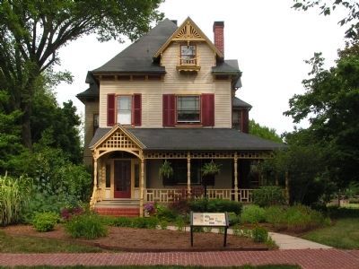
The land on which Hall House stands was originally part of the Woodburn property. In 1885, Thomas Wilson, Jr. purchased an acre from his uncle living in Woodburn and built this house, which was completed in 1887. In 1983, during the . . . — — Map (db m43736) HM
The land on which Hall House stands was originally part of the Woodburn property. In 1885, Thomas Wilson, Jr. purchased an acre from his uncle living in Woodburn and built this house, which was completed in 1887. In 1983, during the . . . — — Map (db m198999) HM
Legislative Hall was dedicated as the state's new capitol building in 1933, replacing The Old State House on The Green. The Senate and the House of Representatives of Delaware's General Assembly meets here. The building also houses the offices of . . . — — Map (db m194645) HM
This house was built for Charles Hillyard III ca. 1798. At the time, it was considered one of the grandest in Kent County. When Hillyard died in 1814, his son-in-law, Dr. Martin W. Bates purchased the house. Bates lived here with his wife Mary . . . — — Map (db m42796) HM
This house was built for Charles Hillyard III ca. 1798. At the time it was considered one of the grandest in Kent County. When Hillyard died in 1814, his son-in-law, Dr. Martin W. Bates purchased the house. Bates lived here with his wife Mary and . . . — — Map (db m232941) HM
This house was built for Charles Hillyard III ca. 1798. At the time it was considered one of the grandest in Kent County. When Hillyard died in 1814, his son-in-law, Dr. Martin W. Bates purchased the house. Bates lived here with his wife Mary . . . — — Map (db m198998) HM
Lums Pond State Park
The pond has existed since 1735 when St. Georges Creek was dammed to power a sawmill. when the Lum family acquired the mill after 1809, they lent their name to the pond. Some twenty years later, Lums Pond provided water . . . — — Map (db m238407) HM
Once the summer home of a prosperous Wilmington businessman and his family, the Cauffiel House has changed little since it was built in the late 1920s. The colonial style brick house still looks down to the Delaware River over land that was . . . — — Map (db m227941) HM
Charles A. "Chazz" Salkin's 35-year career with Delaware State Parks began as Director of the Young Adult Conservation Corps at Bellevue State Park in 1978 and culminated in an unprecedented 21-year tenure as Director of the Delaware Division of . . . — — Map (db m240845) HM
Fort DuPont State Park
Tucked beneath the northern foot of Reedy Point Bridge, Fort DuPont is one of the last open riverfront areas left in northern New Castle County. Once farmland, the site has been dedicated to defending the Delaware . . . — — Map (db m174456) HM
Fort Delaware is located on Pea Patch Island in the Delaware River. The island is sometimes said to have gotten its name from a boat loaded with peas that ran aground on a mud shoal in the 1770s. The spilled peas sprouted, mud caught in the . . . — — Map (db m21589) HM
1640
Native people welcomed the early explorers
Before the arrival of the first Europeans, this area was occupied by Lenape Indians, who depended on the forests, river valleys and waterways for their survival. When the early Dutch . . . — — Map (db m191668) HM
The White Clay Creek Valley
The White Clay Creek Valley is a stream and floodplain habitat surrounded by rolling, forested hills. An important natural resource, the valley is home to more than 250 plant species, 30 species of mammals, and . . . — — Map (db m154633) HM
White Clay Creek State Park
Sloping hills and rocky outcrops mark the White Clay Creek State Park as part of the Piedmont, which comprises just six percent of Delaware's land mass. Its forested hills are blessed with a rich variety of . . . — — Map (db m244064) HM
Newark was once the home of several factories producing paper, wood laminates and a variety of textiles. Some were located on the White Clay Creek. Harnessing its water flow to generate power. The Pomeroy and Newark Railroad service these . . . — — Map (db m174922) HM
Built in the 1790s, this 2½ story gray fieldstone house is the former home of Judge Hugh M. Morris. Morris was a Delaware native, respected attorney and distinguished federal judge. He purchased the house and a large parcel of land here in 1933. . . . — — Map (db m161924) HM
The Original Structure
The original structure was a 22-story gray fieldstone house built in the 1790s by John Barclay. The home was purchased by Andrew Gray in the 1820s. Gray made additions to the structure and named it "Chestnut Hill." . . . — — Map (db m161929) HM
Built in 1914 to process milk for Alfred I. duPont's Nemours Estate, this small building was a fine match for the expensive barn nearby. In addition to an office, it had a coal stove, sink for washing bottles and equipment, and an ice box room. . . . — — Map (db m185413) HM
Not Just Workers, But Family
For as long as this was a family business, workers at Bancroft Mills were treated as members of the family. Long before workers had any rights, Joseph Bancroft and his sons provided decent wages and benefits not . . . — — Map (db m240816) HM
An oasis within the city
Welcome to Alapocas Run Park, a part of Wilmington State Parks. The park began in 1910 when William Poole Bancroft donated 123 acres along the banks of Brandywine River to the city of Wilmington. In the years since, . . . — — Map (db m240818) HM
What you see before you is Bancroft Mills. At one time, this was one of the most important local businesses and a textile center of national and global significance. Founded by Joseph Bancroft in 1831, Bancroft Mills flourished for more than a . . . — — Map (db m240812) HM
Bancroft Mills became a leading manufacturer through one family's business sense and Quaker values.
The Founder
Joseph Bancroft was both a devout Quaker and a wise businessman. By keeping his company up-to-date on new trends and . . . — — Map (db m240759) HM
A geological oddity
Many people call the huge rocks you see along this trail "blue granite" or "blue rock." This is because when they are broken, the fresh exposed rock is a brilliant blue color. Continued exposure to air soon gives them . . . — — Map (db m240819) HM
This property, now known as the Cauffiel Estate, was purchased in 1910 by Daniel Cauffiel, the chief real estate advisor to T. Coleman DuPont and the DuPont Company. Cauffiel bought this 44-acre estate as a summer home for his wife Elizabeth and . . . — — Map (db m226404) HM
Bald and Beautiful
Ever wonder why vultures have bald heads? This is a feeding adaptation revolving around their diet of carrion — dead and decaying carcasses. Having a feather-free head allows them to put their whole head into rotting . . . — — Map (db m191217) HM
• Breed dates back to at least 3,500 years ago.
• Produces up to 5 pounds of wool per shearing.
🏠 Origin: Turkey
💡 Known for wool used for mohair fabrics. — — Map (db m191245) HM
Ruffed lemurs plant trees! Undigested fruit seeds fall to the ground in their feces, which is good fertilizer. The future of forests depends on them.
World's Largest Pollinator!
Pollen gets stuck to the "ruffs" on fur around this . . . — — Map (db m191236) HM
Demand for fur coats pushed many wild cats to the brink of extinction. Thanks to protective legislation, species like bobcats are rebounding.
Brandywine Zoo animal keepers train this bobcat and other zoo animals to voluntarily get in . . . — — Map (db m191218) HM
This owl lives in underground colonies called "prairie-god towns" made by burrowing mammals. They share tunnels with prairie dogs, armadillos, foxes, skunks, and more. Do you see the tunnels our keepers made in this exhibit?
Cowboys . . . — — Map (db m191238) HM
• Became the Delaware state bird in 1939.
• Accompanied Delaware soldiers in the Revolutionary War.
🏠 Origin: United States.
💡Known for steel-blue feathers and lightly tinted white eggs. — — Map (db m191243) HM
Goats were domesticated more than 10,000 years ago in the Middle East and Western Asia. Known for their easily digestible milk, there are more than 900 million goats spanning 200 breeds in the world.
Chickens were first domesticated . . . — — Map (db m191244) HM
Golden Lion Tamarin
Leontophithecus rosalia
Golden lion tamarins were once critically endangered, with few as 200 in the wild. With intensive conservation efforts of AZA zoos and field partners, there are now . . . — — Map (db m191648) HM
The Sugar Bowl, used as a band shell and observatory, stood at the original entrance to the Brandywine Zoo in the early 1900's. The pavilion was demolished in two stages--its dome was taken down in 1949 and the railings were removed in 1959. . . . — — Map (db m65718) HM
The Sugar Bowl, built in 1902, was so named because of its lid-like domed roof. It was used as a concert site and venue for community programs.
The Sugar Bowl eventually fell into disrepair and was reduced to a plaza and chain link fence. . . . — — Map (db m131165) HM
The Josephine Fountain has been drawing visitors to Brandywine Park since the 1930s. The fountain was built in honor of Mrs. Josephine Tatnall Smith who enjoyed walking through the park. Here families and couples enjoy a cool spring day in the . . . — — Map (db m131170) HM
Created during the Great Depression, this garden's first plants were 670 roses donated by Mr. Jasper Crane. In 2001, the Friends of Wilmington Parks began restoration to return the garden to its original state. — — Map (db m173699) HM
Brandywine Park was created to give urban residents relief from city living and working conditions. A young woman is pictured sitting atop an outcropping of Brandywine Blue Rock in 1897. — — Map (db m173700) HM
On a mild winter day, two young boys run along the bank of the Brandywine River. Above them, a train rattles across the B & O Railroad Bridge. — — Map (db m216045) HM
An iron bridge once stood where the wooden bridge stands now. Deep in the winter, a mother and her daughters pause for this photograph taken in the early 20th century. — — Map (db m240820) HM
Brandywine Park was created more than a century ago and has remained a quiet refuge in the heart of Wilmington ever since.
In 1881, local businessman William Poole Bancroft recognized that the growing city of Wilmington had no public open . . . — — Map (db m130510) HM
Radiated tortoises are one of more than 150,000 species found only in Madagascar. Like all tortoises, they serve as very important habitat role as "lawnmowers" and seed spreaders.
Over 50% of radiated tortoises have disappeared since . . . — — Map (db m191233) HM
Though they look bear-like, red pandas are more closely related to racoons. The name panda likely comes from the Nepali word ponya, which means bamboo eater.
Red pandas were first classified by a French . . . — — Map (db m191228) HM
Numbers in Decline
Red panda populations have dropped by as much as 40% in the last 50 years, with fewer than 10,000 of this vulnerable species thought to remain in the wild.
Habitat Loss
The red panda habitat has been fragmented . . . — — Map (db m191219) HM
Brandywine Park was created more than a century ago and has remained a quiet refuge in the heart of Wilmington ever since.
In 1881, local businessman William Poole Bancroft recognized that the growing city of Wilmington had no public open . . . — — Map (db m216046) HM
The Delaware estuary is the second largest freshwater port in the United States. It hosts the country's second largest concentration of petrochemical facilities. Shipping of petrochemicals and other products has revitalized ports along the . . . — — Map (db m191845) HM
The history of Fox Point has been rich and varied with each generation leaving its indelible influence on the area. Gertrude Dunlap, historian of the Fox Point Association, fondly recorded the memories of long time residents of the Fox Point . . . — — Map (db m191846) HM
Fox Point State Park is unique in Delaware's system of state parks. The park and its surroundings have a colorful history. As home to the Lenape Indians, the Swedes, Dutch, and English, it has been a hunting ground, farmland, a resort, and an . . . — — Map (db m191848) HM
This former dairy barn has been transformed. Today it is a visitor and conference center available for meetings, weddings and other special events.
The Blue Ball Barn is home to the Delaware Folk Art Collection, as well as an historical . . . — — Map (db m173286) HM
Rockford Tower, opened in 1901, was designed to be an observation tower and water tank by architects Elijah Dallett, Jr. and Louis C. Banker, Jr., and by engineer Theodore A. Leisen. The tank, still a part of the city water system, holds 500,000 . . . — — Map (db m191282) HM
True to its original design, Rockford Tower is an observation tower and still provides water to the surrounding neighborhoods. Here, two men are perched on the unfinished tower in the fall of 1900. — — Map (db m191289) HM
In 1938 the Wilmington Board of Education proudly dedicated a new vocational high school on the northwest corner of Market and 14th Streets. State and city dignitaries attended the ceremony that officially opened a school that for the next three . . . — — Map (db m131160) HM
In this photo from about 1913, park visitors enjoy the ice along with their dogs. A series of cold winters made ice skating on the Brandywine River a popular pastime. The dam pictured is the remnant of an early mill in Wilmington. — — Map (db m131163) HM
Skating on West Street Dam
Though it is not done today, ice skating on the Brandywine River used to be quite popular. In this photo from about 1913, park visitors enjoy the ice with their dogs! — — Map (db m173698) HM
Early in the 1890s, Civil War Union veterans claimed a small corner of Brandywine Park as a place to congregate in good weather. The familiar sight of the old soldiers sitting regularly in that area led people to call the spot "Old Soldiers' . . . — — Map (db m169002) HM
Our generation has the moral obligation to make sure that future generations have open spaces to enjoy where they can refresh their spirit. — Lorraine Fleming
As a student, Lorraine Fleming and her classmates took . . . — — Map (db m180668) HM
As a child, Lynn Williams spent her summers among the rural landscapes of her native New York. There she discovered what would become a lifelong appreciation and love of nature. Lynn brought that love of nature with her to Delaware, where she has . . . — — Map (db m180667) HM
Surf fishing is a Delaware tradition older than the beach parks themselves.
Decades of cooperation between surf anglers, DNREC Division of Parks and Recreation, elected officials, and other concerned citizens have created perfect conditions . . . — — Map (db m206352) HM
The Indian River Inlet has not always existed in its current location. This barrier beach environment is dynamic, and the opening to the inlet has opened and closed at different locations.
When the inlet closed, navigation, water quality, . . . — — Map (db m206345) HM
There is an ocean current that moves sand parallel to the coast known as the "littoral drift" or "longshore current." Along most of coastal Delaware, this current moves in a northward direction. As it moves north, it moves sand. There is so much . . . — — Map (db m206344) HM
The Indian River Inlet has not always existed in its current location. This barrier beach environment is dynamic, and the opening to the inlet has opened and closed at different locations.
When the inlet closed, navigation, water quality, . . . — — Map (db m150130) HM
There is an ocean current that moves sand parallel to the coast known as the "littoral drift" or "longshore current." Along most of coastal Delaware, this current moves in a northward direction. As it moves north, it moves sand. There is so much . . . — — Map (db m150128) HM
Built from 1939 to 1942, the 11 concrete observation towers along Delaware's coast were built to protect the shores during World War II - and to last about 20 years. They are still standing after 60 years. The towers were the eyes for the guns of . . . — — Map (db m68875) HM
In the 1870s, the United States Life-Saving Service (USLSS) was established to aid the victims of shipwrecks on American shores. The service featured a network of stations, with seven or eight men — called surfmen — who . . . — — Map (db m150127) HM
Trussum Pond
Tranquil waters trapped by a grist mill dam in the early nineteenth century made Trussum Pond a haven for the bald cypress. However, the trees now seen dotting the pond's surface are all that remain of a once extensive . . . — — Map (db m4540) HM
From Ironworks to Gristmills
Many of the ponds in this area, including Trap Pond, were created in the late 1700s. The earliest dams were built to produce waterpower for ironworks. The waterpower ran bellows for furnaces that created iron . . . — — Map (db m198864) HM
For more than a quarter century, Senator Venables was an admired and influential legislator, serving 26 years in the Delaware General Assembly. During his many years as the co-chair of the state's Bond Bill Committee, he was able to garner . . . — — Map (db m198862) HM
Saving an Historic Landmark
The Bethesda Methodist Episcopal Church was built in 1879 to replace an older chapel. This rural country church is an excellent example of the Greek Revival style of architecture. Although it was . . . — — Map (db m198870) HM
Once Common, Now Rare
The Bethesda Methodist Episcopal Church is a quiet reminder of the past. It may be hard to imagine now, but this was a central religious and community gathering site for 150 years. By the late 1800s, the church . . . — — Map (db m198868) HM
Trap Pond was created in the late 1700s to power a small water mill.
Today the pond is a prime feature of this park—Delaware's first state park. Spanning about 3,800 acres, the park protects part of the ancient Great Cypress Swamp and . . . — — Map (db m198860) HM
Guns such as these were used as field artillery. There were four 155mm guns placed at Fort Miles and four more placed across the Delaware Bay at Cape May, NJ to limit access to the bay. The concrete pads the were placed on were called "Panama . . . — — Map (db m150111) HM
When Fort Miles was completed, its two 16-inch guns were some of the largest artillery ever engineered by the United States and were placed here to defend the coastline from enemy battleships.
This particular gun barrel is Barrel 371, . . . — — Map (db m150114) HM
This gun is known as a 3"/50, which specifies diameter of the gun's bore and it's caliber. The 3-inch guns that were placed at Fort Miles were mounted on a pedestal to allow them to be easily aimed and follow the target. Throughout their use, . . . — — Map (db m150104) HM
The gun before you is a 6-inch pedestal-mounted deck gun. This gun could fire two types of rounds, a 105-lb. armor-piercing round and a 90 lb. high-explosive round.
The model 1903-A2 guns that were at Fort Miles would have been mounted on . . . — — Map (db m150115) HM
The 8-inch guns placed at Fort Miles were each mounted on a railcar, making the large guns very mobile and easy to position for firing. The gun was able to turn in a 360° circle at an elevation of 45°. This made them difficult targets for enemy . . . — — Map (db m150112) HM
Many of the European immigrants who came to this country at the end of the nineteenth century brought with them a variety of epidemic diseases including cholera, typhus, smallpox and bubonic plague. This posed a serious threat to urban areas such as . . . — — Map (db m39387) HM
Long ago, this area was a freshwater marsh. It lay protected from ocean storms by the Great Dune and barrier beaches. As sea levels rose, saltwater marshes replaced freshwater marshes.
Starting in the 1800s, locals extracted salt from . . . — — Map (db m232983) HM
The guns in this park serve as representations of the artillery that was here throughout Fort Miles' World War II years; these are not the actual guns and not the same models as the guns that were placed here.
Fort Miles was part of the . . . — — Map (db m150109) HM
This small group of buildings, or cantonment, provided living space and necessary services for the troops assigned to operate the guns of Fort Miles. Concrete barracks were more comfortable than the canvas and wood structures that were . . . — — Map (db m150102) HM
The troops stationed here during World War II were part of the nation's coastal defense system that protected the mouth of the Delaware Bay and industries located up the Delaware River. Later the U.S. Army used the area as a recreation center . . . — — Map (db m150103) HM
Just before World War II, the U.S. War Department began upgrades of the harbor defenses that protect the Delaware Bay. They built new fortifications here at Cape Henlopen that became known as Fort Miles. The fort grew as the members of the . . . — — Map (db m150101) HM
Built from 1939 to 1942, the 11 concrete observation towers along Delaware's coast were built to protect the shores during World War II - and to last about 20 years. They are still standing after 60 years. The towers were the eyes for the guns of . . . — — Map (db m39595) HM
Built from 1939 to 1942, the 11 concrete observation towers along Delaware's coast were built to protect the shores during World War II - and to last about 20 years. They are still standing after 60 years. The towers were the eyes for the guns of . . . — — Map (db m232986) HM
Cape: a piece of land jutting into a body of water beyond the rest of the coast line; a headland; a promontory. Delaware's coastline is constantly changing. The daily effects of wind, tidal currents, and wave action are reshaping and redesigning the . . . — — Map (db m39388) HM
The United States Navy's ties to Cape Henlopen spanned nearly 100 years. The Navy first came to the Cape in 1898 to build a signal tower during the Spanish American War. In the 20th century, the Navy kept a communications station he, beginning with . . . — — Map (db m79201) HM
When Bill Hopkins came to Delaware in 1964 as the first superintendent for Cape Henlopen State Park, he brought with him a vision that would shape preservation in the state for years to come. For more than forty years he has been a driving force . . . — — Map (db m150116) HM
When the Dutch first arrived in 1631 to build a whaling station near Lewes, they met a band of Lenape Indians known as the Sicconese. For at least 2,500 years, the Indians had been coming to Wolfe Neck in the spring to harvest clams, oysters and . . . — — Map (db m245056) HM
In 1879, Delaware illustrator an other Howard Pyle visited the shingles to watch them at work. The result was these drawings and a report of what he saw.
The workmen had just excavated a log, the butt or root . . . — — Map (db m198867) HM